
Home » Traffic Management (Page 2)
Category Archives: Traffic Management
A new bottleneck along Marcos Highway in Antipolo City?
I’ve been wondering why there seems to be much congestion along the westbound side of Marcos Highway in the morning just before we reach SM Cherry. It is usually flowing there but the past weeks when we used the route instead of Sumulong Highway, traffic was really bad. As I am quite observant about the traffic and always looking for reasons or causes, I found that this was due to the alternative route Antipolo ‘opened’ that many motorists now take when traveling between Marikina and the side of Antipolo heading in the general direction of Cogeo.
The alternate route connects Marcos Highway and Sumulong Highway via TOCS Avenue (which intersects Marcos Highway near SM Cherry) and Sampaguita Street (which intersects Sumulong Highway past Masinag Junction and near the Hillside Centre Plaza before Soliven Avenue). If you’re coming from Marikina and heading in the direction of Cogeo or even Antipolo Simbahan then this route may provide shorter travel time as you won’t have to go around Masinag Junction to make an effective left turn to Marcos Highway (direct left turns at Masinag are not allowed).
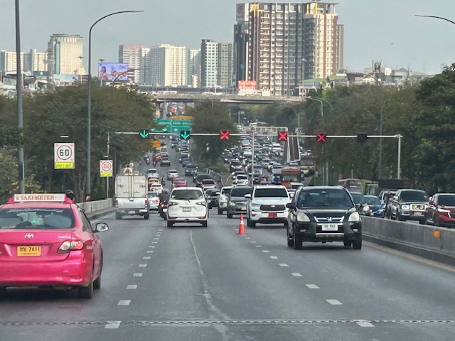
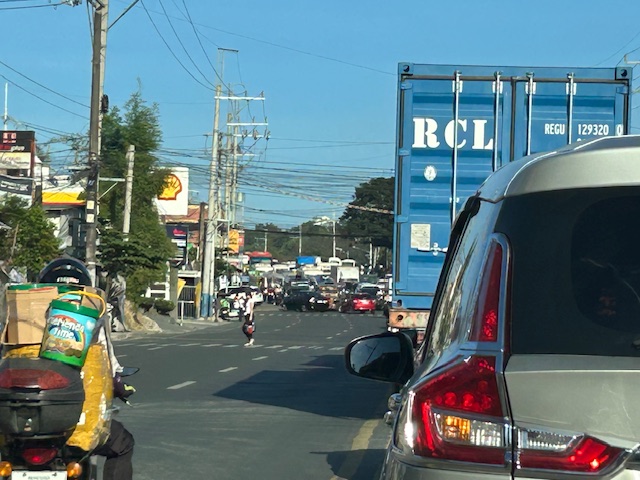 This is the view from the queue approaching the intersection of TOCS Avenue with Marcos Highway from the eastbound side of the highway. Note that traffic is not flowing from the junction along the eastbound (Metro Manila bound) side of the highway.
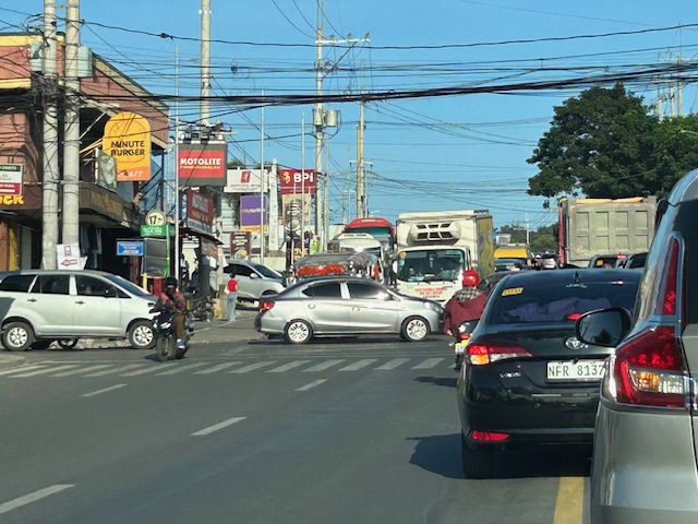 A closer look with vehicles turning left to Marcos Highway from TOCS Avenue. There are usually Antipolo traffic enforcers facilitation (read: favoring) traffic from and to TOCS Avenue. This results to build-up along Marcos Highway where most traffic is through traffic.
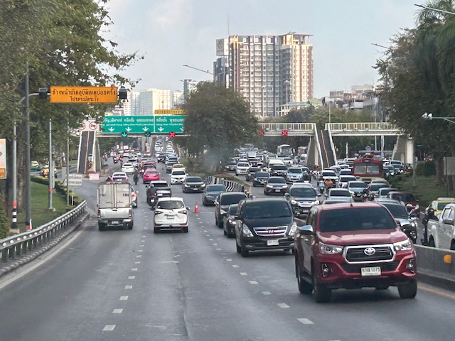
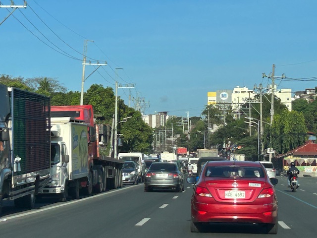 The resulting congestion affects many travelers including freight along the westbound (Metro Manila-bound) direction of Marcos Highway.
While the alternate route likely provides shorter travel times for those coming from Marikina to Antipolo/Cogeo and vice versa, this is at the expense of more people and goods who and that travel along Marcos Highway. Antipolo should realize this even with basic observations on the traffic build-up in the area. Traffic for that alternate route should not be prioritized to the detriment of travelers along Marcos Highway.
–
Counterflow lanes in Bangkok, Thailand
I almost forgot again about this set of photos showing the implementation of a counterflow scheme along a long stretch of road in Bangkok. Heading out of Bangkok, I was able to take photos of the counterflow lanes and variable traffic signs used for this purpose. We were northbound meaning we were traveling outbound of the metropolis and opposed to the peak direction (southbound was inbound to Bangkok).
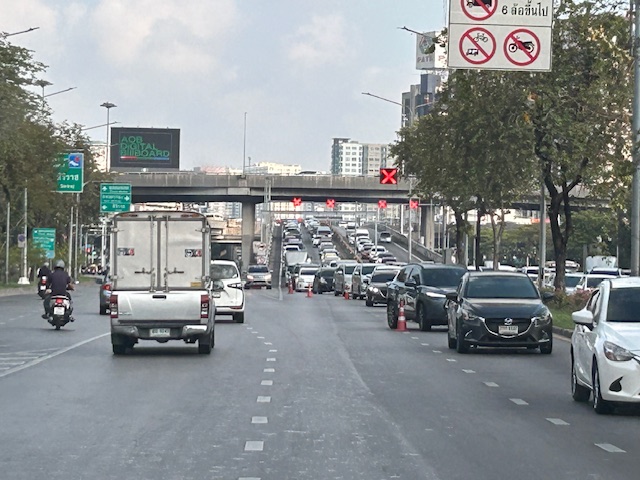
 Approaching an overpass where variable traffic signs are installed overhead (i.e., on a gantry).
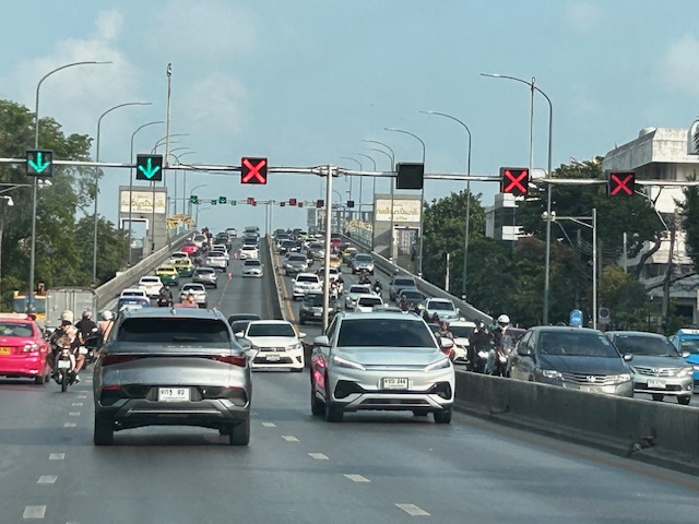 It is easy to see which lanes are assigned for our direction and which ones for the opposite flow.
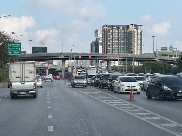
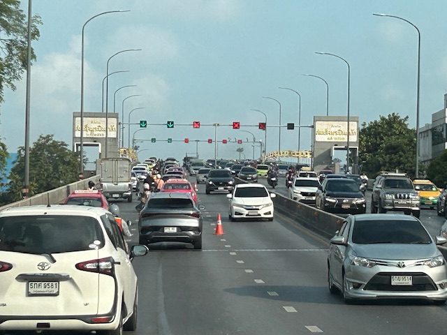 On the overpass, you can see that the variable signs are installed at regular intervals. There are a few cones that act as physical separators (not really barriers) between opposing flows.
 Sort of a close up of the variable signs and a cone. I assume the cones are placed there by traffic authorities. They might be transferred to the other side of the overpass if the counterflow was in favor of our direction.
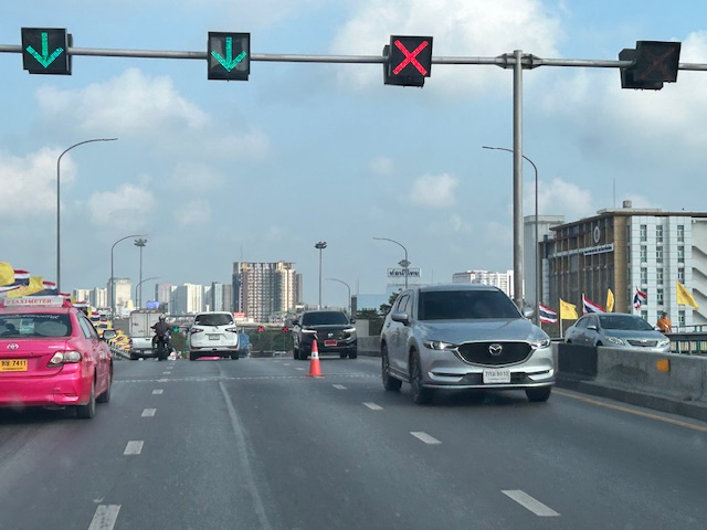
 Another photo showing the installed variable signs towards the other end of the overpass.
 Four lanes are assigned to inbound traffic while only two are for outbound traffic.
 At the foot of the overpass is a pedestrian overpass. The stairs appear to be quite steep based on the photo. I’m not aware of criticisms of the pedestrian footbridges in Bangkok. I would have to ask my Thai friends about their designs.
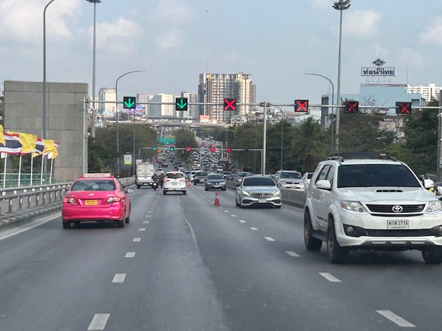
 Another overpass where all lanes are assigned to the southbound direction
 The parked vehicle on the chevron is with the traffic authority of Bangkok.
I actually started writing this in April last year. I will try to finish some drafts I started last year this month while also posting about my recent travel to Bicol.
–
To B(RT) or not to B(RT)?
I kind of expected questions or comments from my ‘students’ after my lecture last Wednesday about “Traffic Congestion.” Among my slides were those featuring solutions to transport and traffic problems. I presented both soft and hard approaches including travel demand management schemes and infrastructure that we should have built decades ago. The uniformed officers who were there had a very simple take on congestion – it’s basically because of a lack of discipline. While theirs may also be valid observations based on their experiences, ‘discipline’ is not the most critical problem that we have especially considering the ever increasing demand for travel. One government official present was very direct in his question about what I thought about the MMDA’s pronouncement that they plan to remove the EDSA Bus Carousel. I thought my reply and the following explanation was clear – it was a wrong move.
The EDSA Bus Carousel is simple. Bus lang sa bus lane (Only buses along the bus lane). Pag may private or pa-VIP, bawal at huli dapat (If there are private vehicles or those who regard themselves as VIPs using the lane, then they should be apprehended. An HOV (high occupancy vehicle) lane is more difficult to implement. Mas pahirapan ang pag monitor and enforce (It is very difficult to monitor and enforce). So this proposal to phase out the EDSA bus lanes don’t make sense from this perspective. In fact, I don’t agree with a couple of more senior transport experts who say that the MRT Line 3 is sufficient and that it hadn’t reached capacity yet. It has but in the time that the carousel has been operational, the carousel had absorbed much of the demand along the corridor. There is also the fact that it will take much time before Line 3 is upgraded. Are the new train sets here? Are the stations designed for these trains and more passengers? If the answers are no, then MRT3 will not have its capacity increased in such a short time. That also means the carousel is very much relevant not just to supplement MRT3 capacity but as a needed alternative mode for commuters.
–
On civil works for transferring cables and wires underground
I got messages this week about the civil works to be implemented in relation to transferring overhead cables and wires underground at the Ortigas Center in Pasig City. This is a screenshot of what’s been circulating the past days:
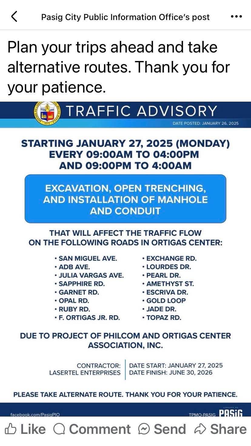
I think this follows the examples of cities like Iloilo and Davao already transferring or placing power and communications cables and wires underground. Prior to these, Bonifacio Global City (BGC) in Taguig City already did so but that was from the start considering BGC is a masterplanned development. Other masterplanned developments are already consciously doing this so there will be no overhead cables and wires that are often criticized as unsightly or ugly. Such works will require traffic management as excavations will surely reduce road capacities and lead to more congestion. The timeline or schedule can also be affected once they do the excavations as conflicts among utilities are expected. Note that water lines and drainage are already underground and there will be the need to resolve the intersections of these with the power and communications lines to be transferred.
Perhaps we can learn from this experience that Ortigas Center will undergo until 2026 as other Metro Manila LGUs also consider transferring their overhead cables and wires underground. Quezon City, for one, is already at the early stage of identifying an area or corridor to serve as a pilot for the city. That can be a road like Commonwealth Avenue or Visayas Avenue or perhaps the Araneta Center in Cubao.
–
Davao 8th, Manila 14th worst in Tomtom Traffic Index
I just want to share this news report here:
Source: Davao 8th, Manila 14th worst in Tomtom Traffic Index
I have to admit that I still have to figure out in detail how exactly their data were collected and evaluated. However, knowing and experiencing traffic in these cities, I would like to opine that traffic is still worse in Metro Manila cities compared to Davao and perhaps others across the country.
From 9-to-5 to Anytime: How Telecommuting Changes the Traffic Game
Here’s a quick share of an article on telecommuting:
Source: From 9-to-5 to Anytime: How Telecommuting Changes the Traffic Game
To quote from the article:
“As we look across these 83 cities, it’s clear that remote work has brought relief to some areas while leaving others just as crowded as before. The cities seeing the most benefit from WFH were those with a flexible, remote-friendly workforce and a supportive economic structure. For fast-growing cities, or those with heavy industry or logistics, WFH alone wasn’t enough to solve congestion.
Telecommuting has no doubt reshaped our roadways, but it’s clear that tackling urban congestion will require more than just a remote work policy. As cities continue to grow and evolve, the future of urban mobility will rely on creative solutions, from smarter infrastructure to updated transit options, to keep America’s cities moving in this new, work-from-anywhere world.”
There are lessons to be learned here for us in the Philippines. Telecommuting is not a new thing here especially considering we have many BPOs operating across the country. Indeed, it is not to be considered as the only solution but one of many we can use to reduce congestion and improve commutes in our towns and cities.
–
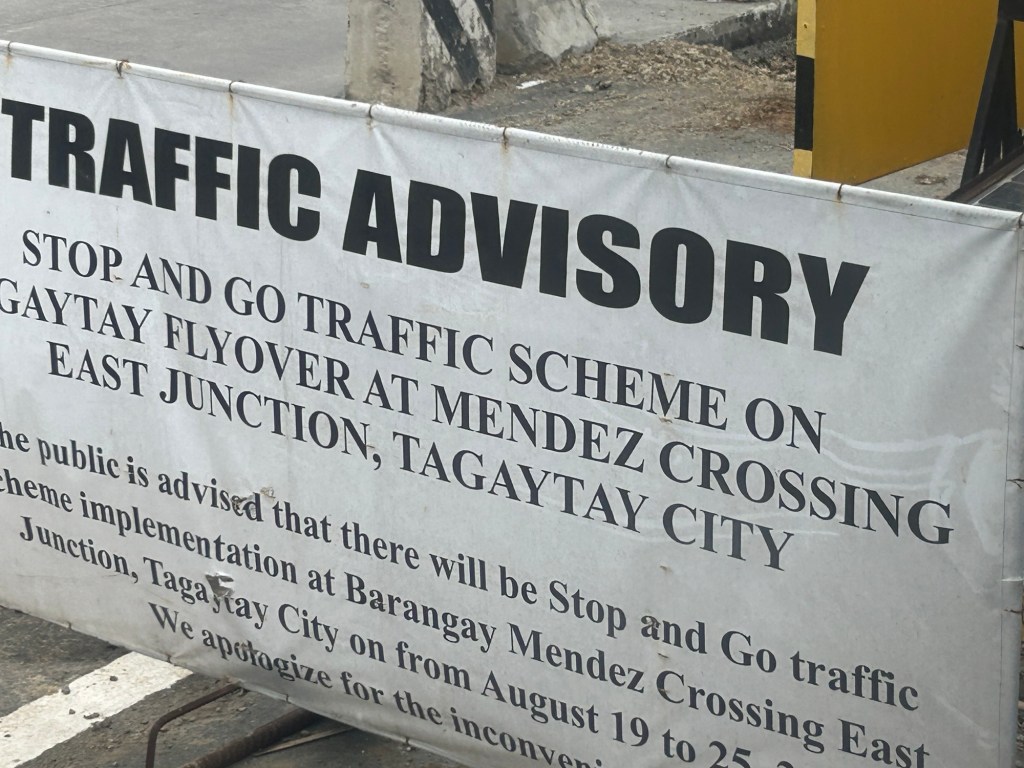
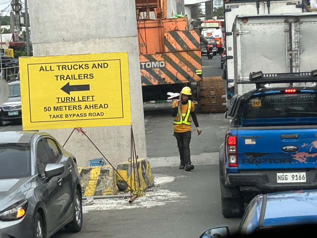
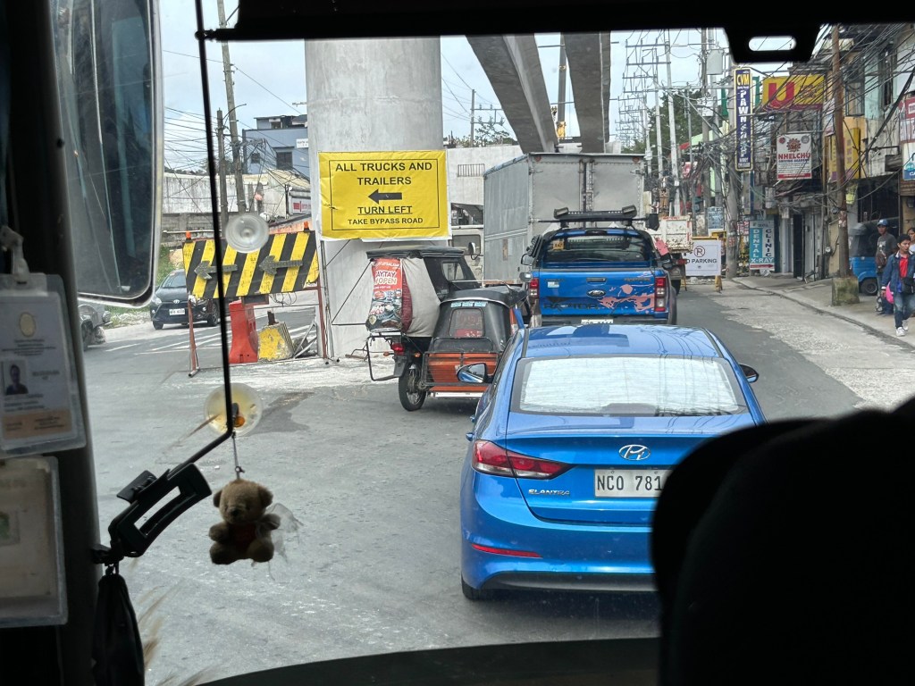
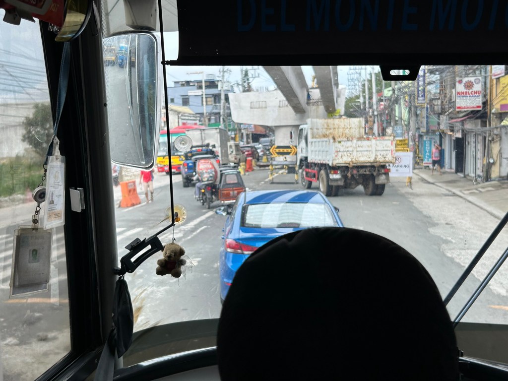
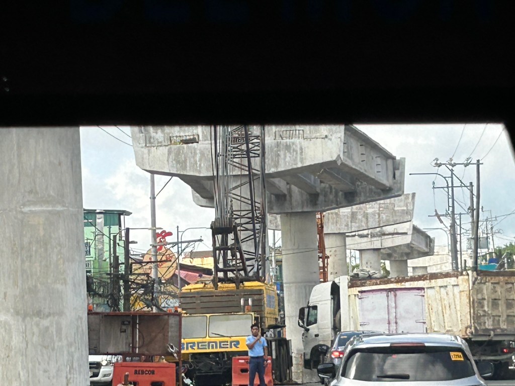
Congestion due to flyover construction: Tagaytay-Nasugbu Road – Part 2
I showed photos of the construction of an overpass along the Tagaytay-Nasugbu Highway coming from Tagaytay in the previous post. This time, here are some photos taken along the opposite direction.


–
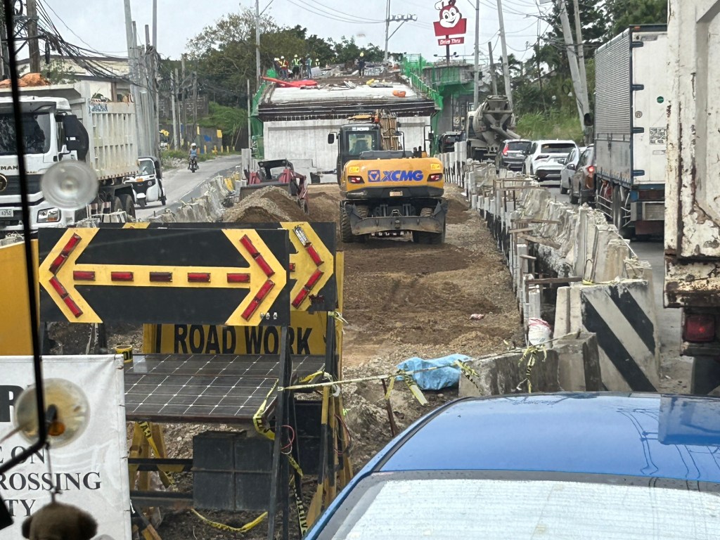
Congestion due to flyover construction: Tagaytay-Nasugbu Road – Part 1
There is significant traffic congestion along the Tagaytay – Nasugbu Highway due to the construction of an overpass along the highway at its junction with the Tagaytay – Mendez Highway.
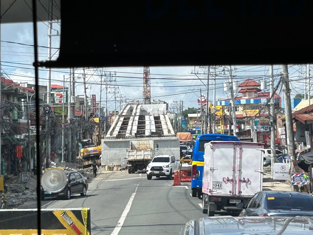


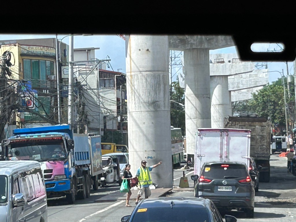
Was there a need for a flyover here? Otherwise I would suggest instead a set of good old-fashioned traffic signals and geometric improvements to the intersection.
–
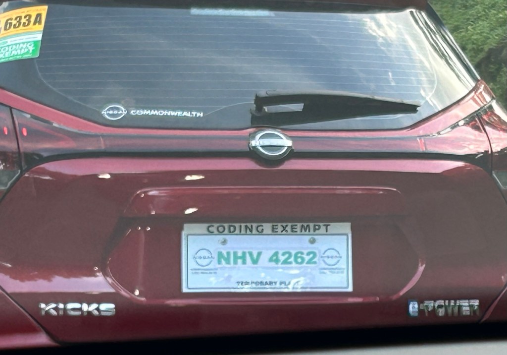
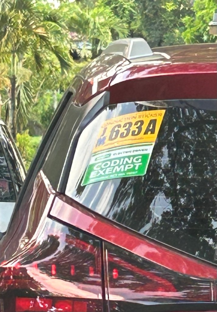
Is the MMDA’s coding scheme still effective?
That’s actually a title of a paper or article I co-wrote before. At the time, which was over a decade ago, we were revisiting certain travel demand management (TDM) measures being implemented in Metro Manila. We already concluded that the effectiveness of the number coding scheme has been reduced mainly as people bought a second, third or more vehicles to be able to use any vehicle on coding days.
Since then, coding’s effectiveness continued to be eroded by a combination of increasing vehicle ownership (including more vehicles operating as ride hails) and the rapid increase of motorcycles.
More recently, government decided to give push for electric and hybrid vehicles. The MMDA made these coding exempt, which perhaps is an example of instituting a policy with unintended consequences. I say unintended here because the agency seems oblivious to the fact that people will likely get that second, third or more vehicle. And that will be an EV or hybrid. Manufacturers are already marketing these as ‘coding exempt’ and they are making a good sales pitch here.
Maybe it’s time to revisit coding and re formulate it? But then coding wasn’t supposed to be sustained as long as it has. Government should be more aggressive and decisive for public transport in order to retain and increase mode shares that have also been reduced by more private vehicle and motorcycle use.
–
Technical sessions at the TSSP 2024 Conference
I am sharing here the latest draft of the technical sessions for the 30th Annual Conference of the Transportation Science Society of the Philippines (TSSP). The conference will be held in Iloilo City this coming September 13, 2024.
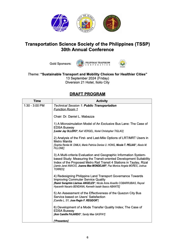
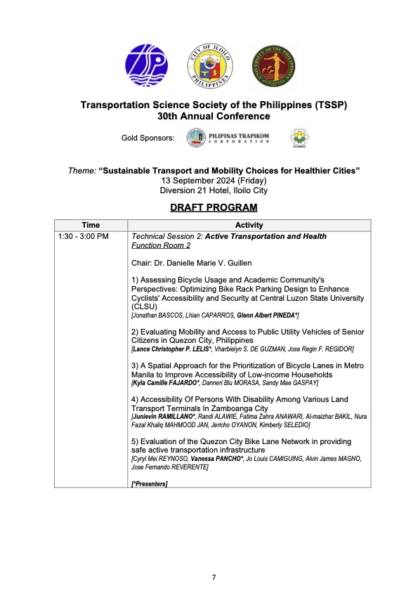
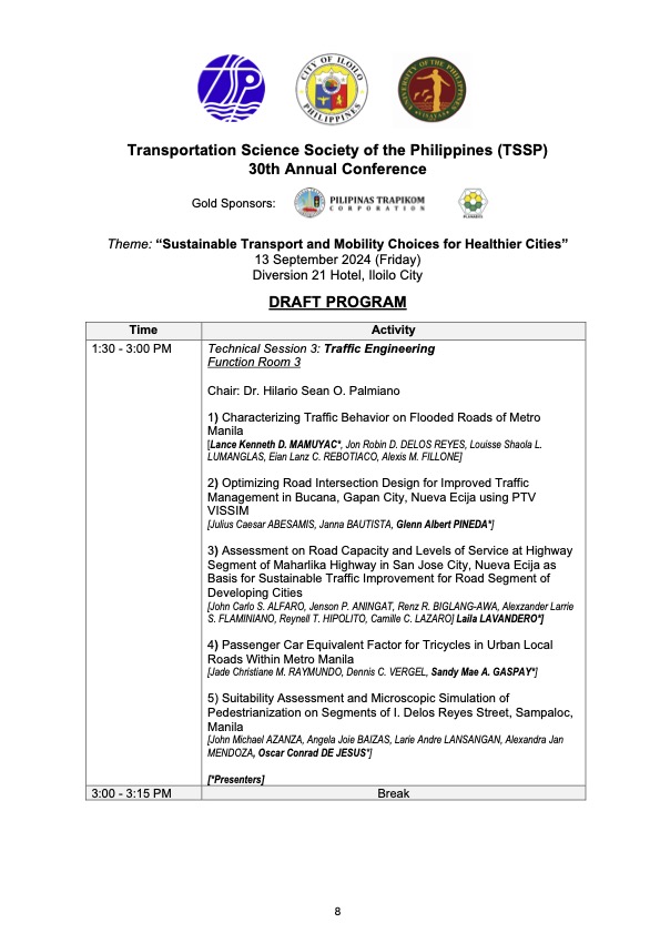
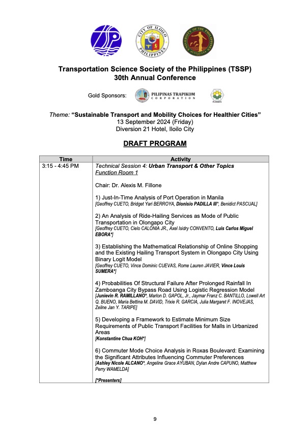
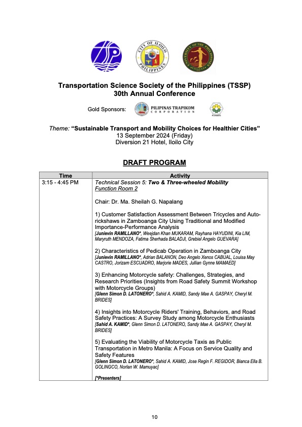
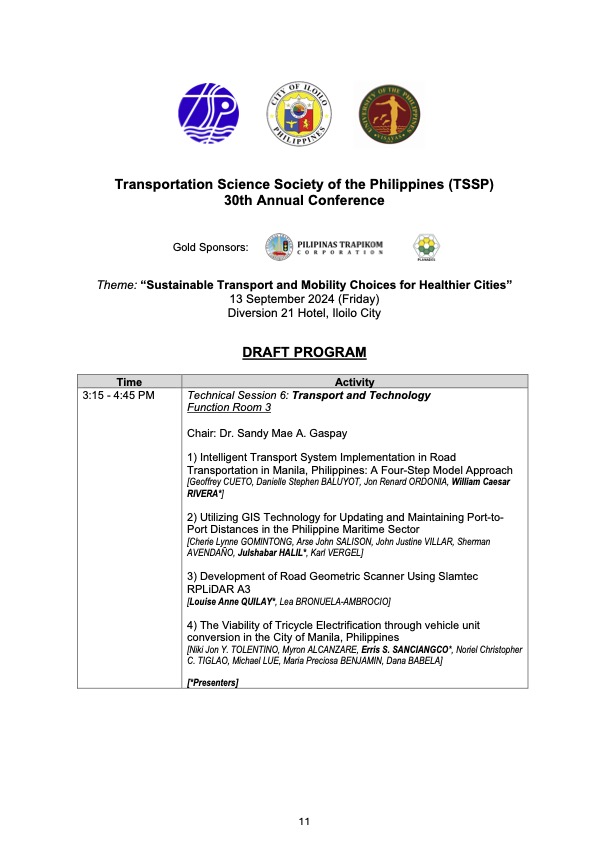
I will share the draft program for the morning plenary session in the next post.
–
