
Home » Traffic Management (Page 3)
Category Archives: Traffic Management
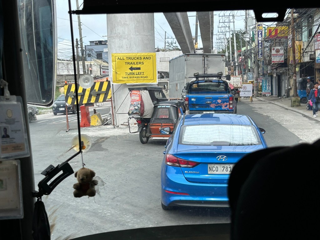
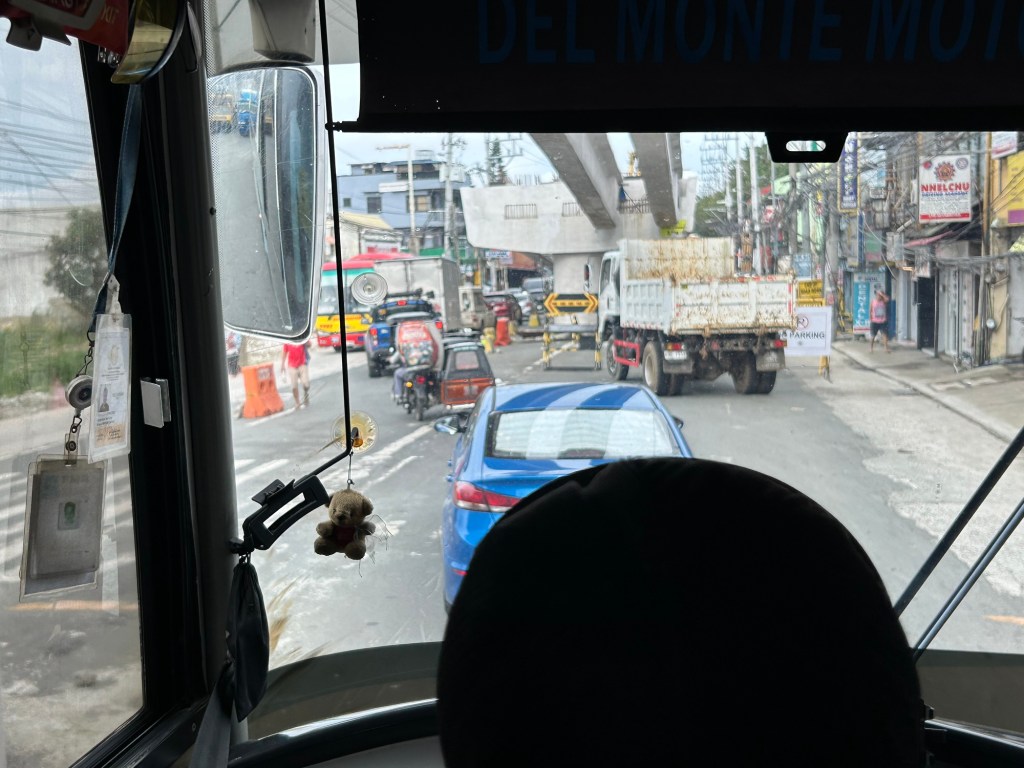
Congestion due to flyover construction: Tagaytay-Nasugbu Road – Part 2
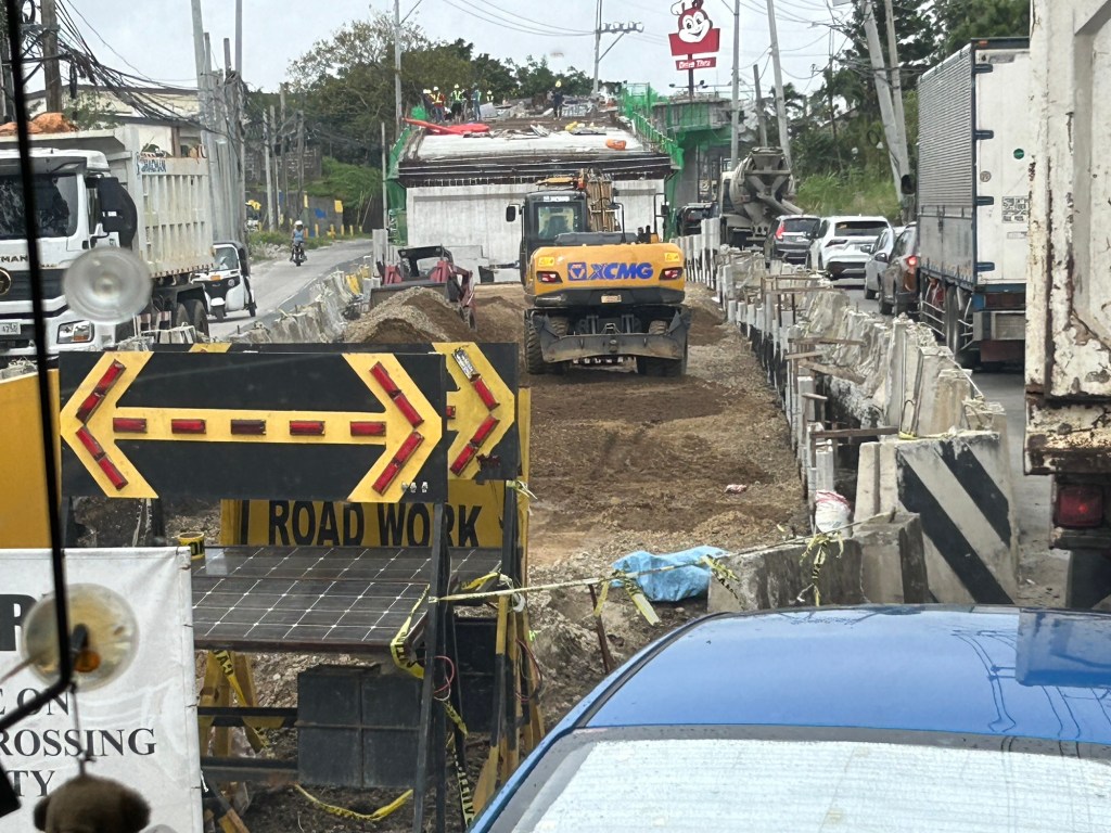
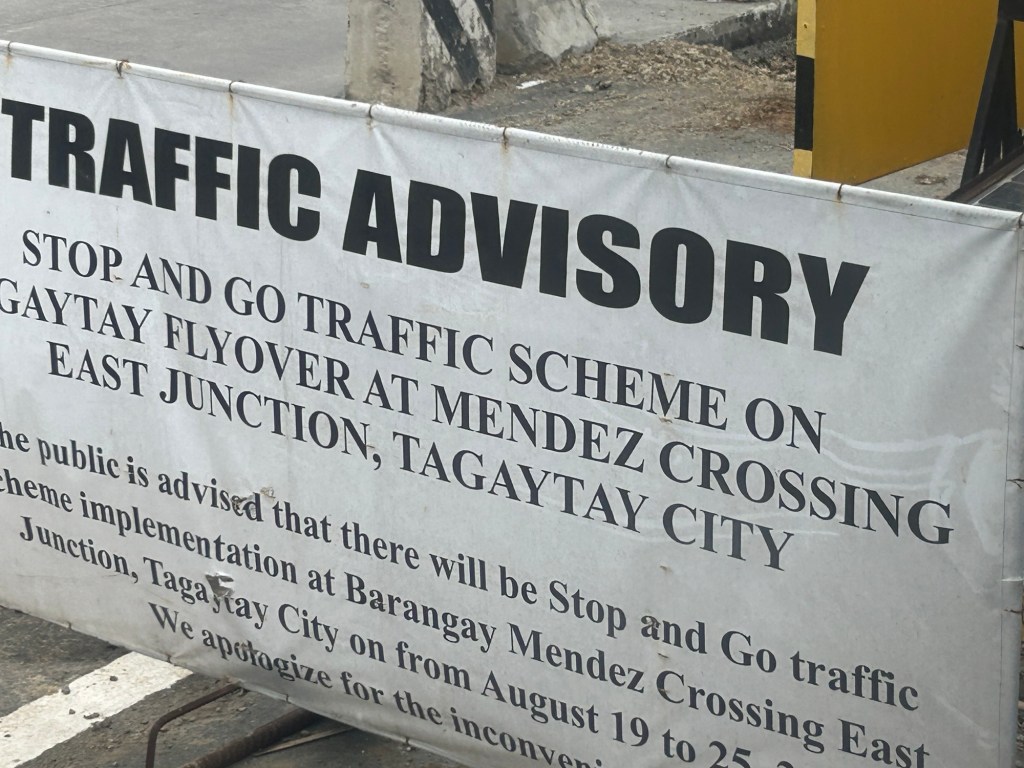
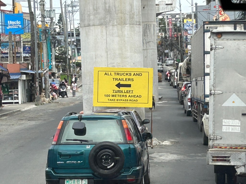
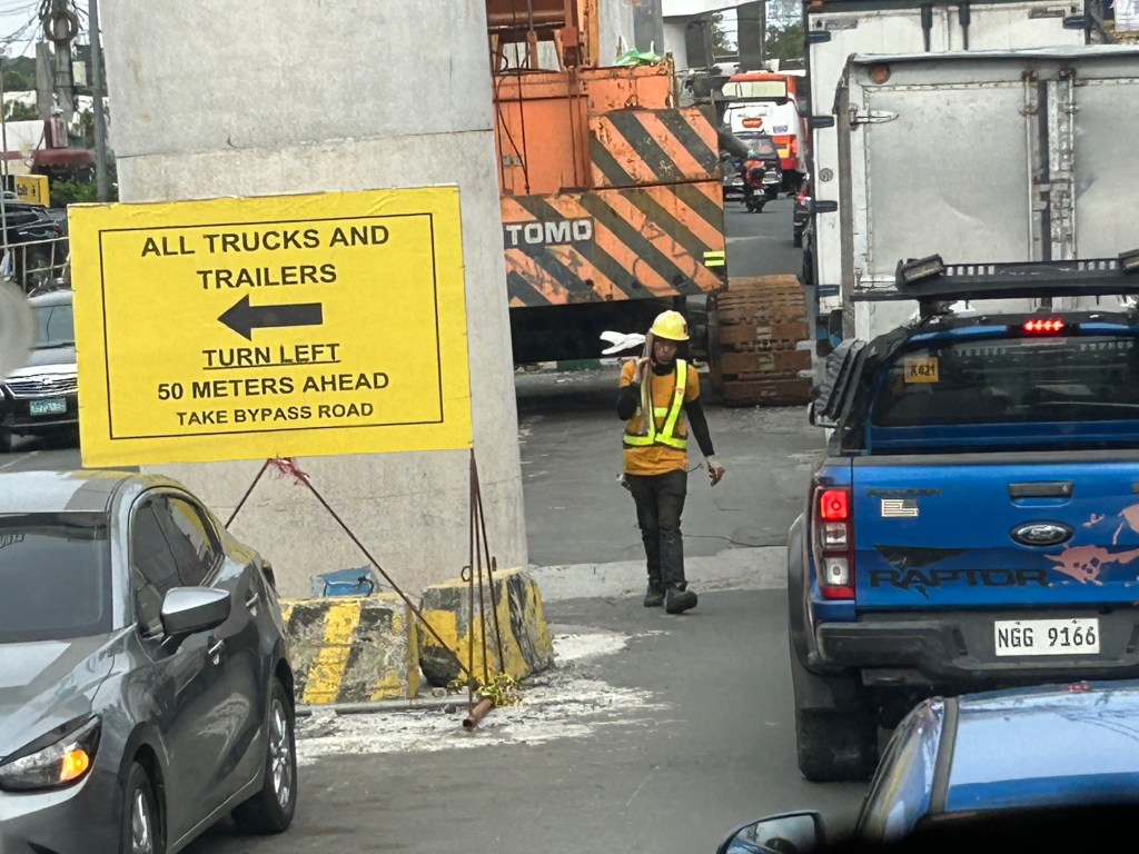
I showed photos of the construction of an overpass along the Tagaytay-Nasugbu Highway coming from Tagaytay in the previous post. This time, here are some photos taken along the opposite direction.





–
Congestion due to flyover construction: Tagaytay-Nasugbu Road – Part 1
There is significant traffic congestion along the Tagaytay – Nasugbu Highway due to the construction of an overpass along the highway at its junction with the Tagaytay – Mendez Highway.
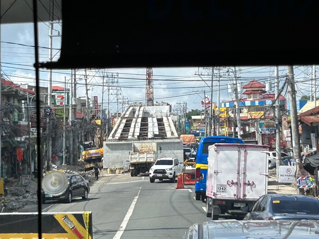


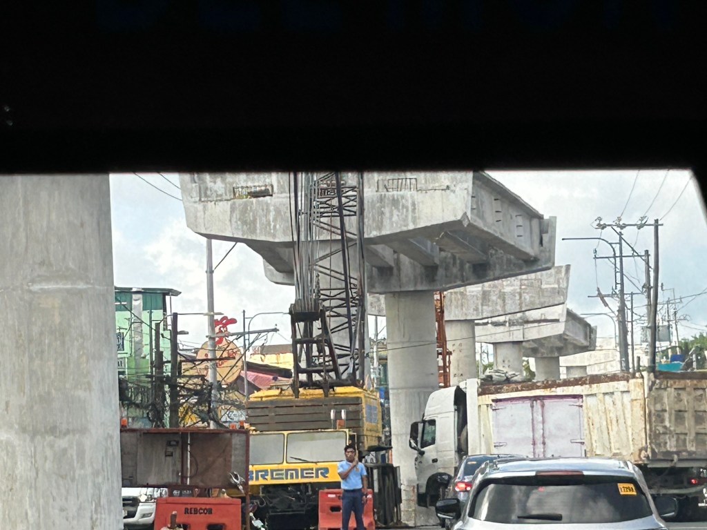

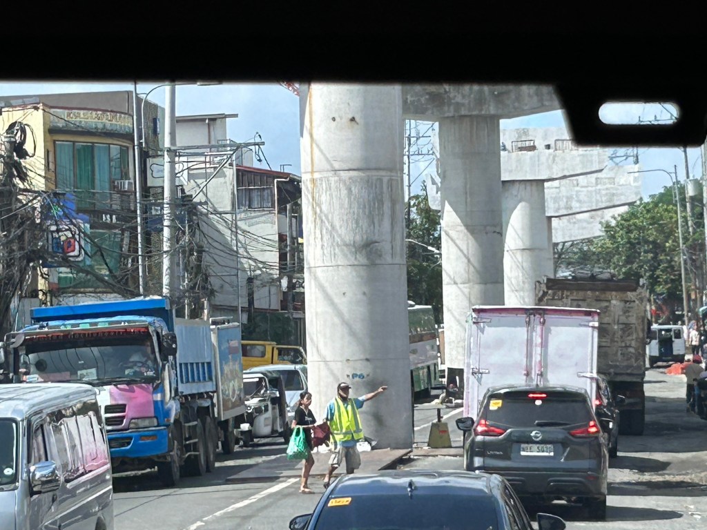
Was there a need for a flyover here? Otherwise I would suggest instead a set of good old-fashioned traffic signals and geometric improvements to the intersection.
–
Is the MMDA’s coding scheme still effective?
That’s actually a title of a paper or article I co-wrote before. At the time, which was over a decade ago, we were revisiting certain travel demand management (TDM) measures being implemented in Metro Manila. We already concluded that the effectiveness of the number coding scheme has been reduced mainly as people bought a second, third or more vehicles to be able to use any vehicle on coding days.
Since then, coding’s effectiveness continued to be eroded by a combination of increasing vehicle ownership (including more vehicles operating as ride hails) and the rapid increase of motorcycles.
More recently, government decided to give push for electric and hybrid vehicles. The MMDA made these coding exempt, which perhaps is an example of instituting a policy with unintended consequences. I say unintended here because the agency seems oblivious to the fact that people will likely get that second, third or more vehicle. And that will be an EV or hybrid. Manufacturers are already marketing these as ‘coding exempt’ and they are making a good sales pitch here.
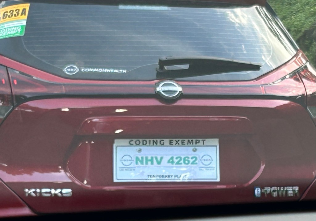

Maybe it’s time to revisit coding and re formulate it? But then coding wasn’t supposed to be sustained as long as it has. Government should be more aggressive and decisive for public transport in order to retain and increase mode shares that have also been reduced by more private vehicle and motorcycle use.
–
Technical sessions at the TSSP 2024 Conference
I am sharing here the latest draft of the technical sessions for the 30th Annual Conference of the Transportation Science Society of the Philippines (TSSP). The conference will be held in Iloilo City this coming September 13, 2024.
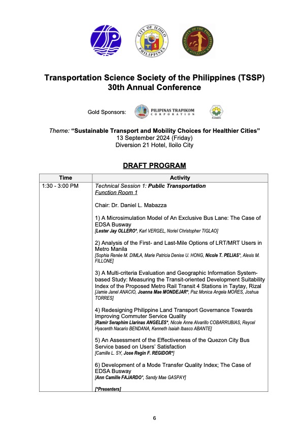
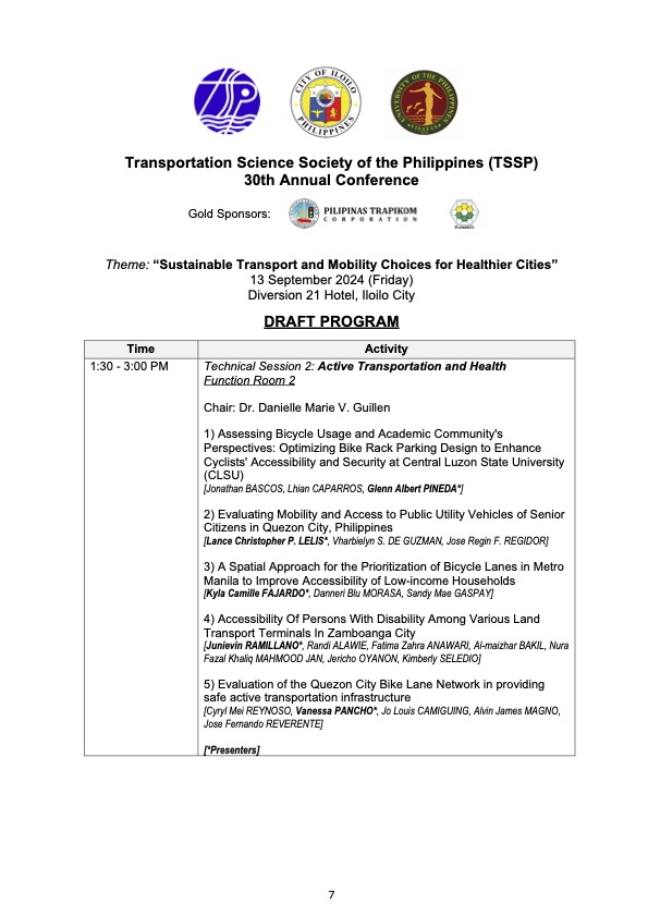
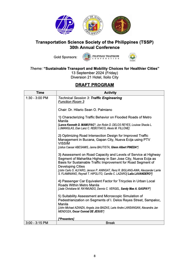
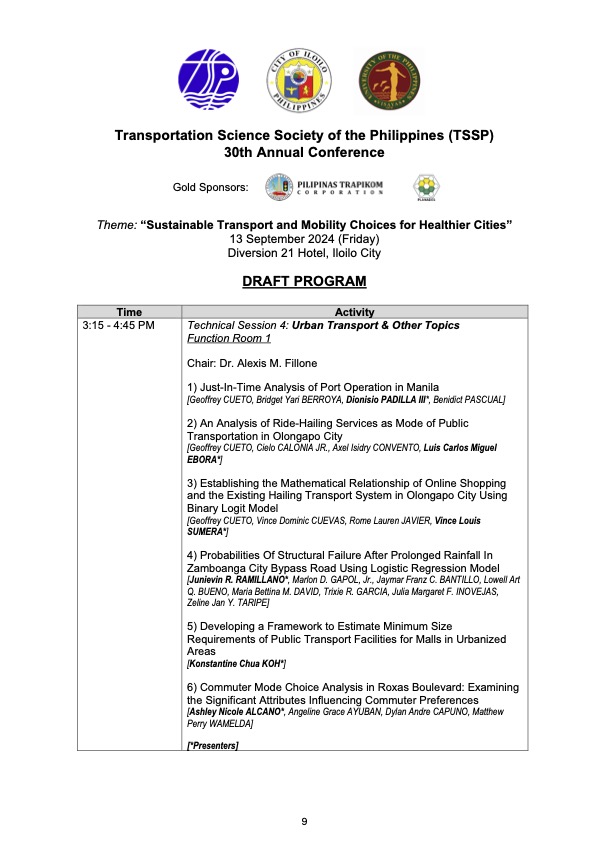
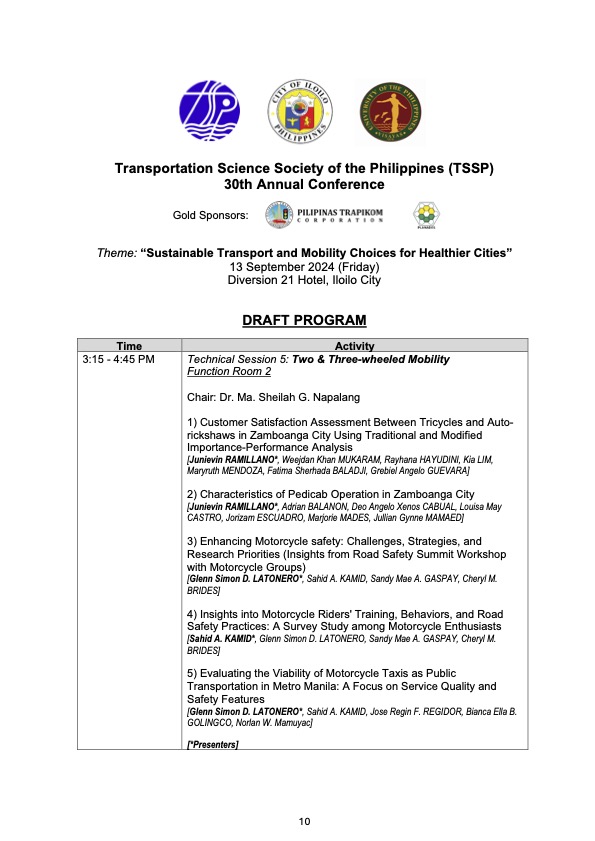
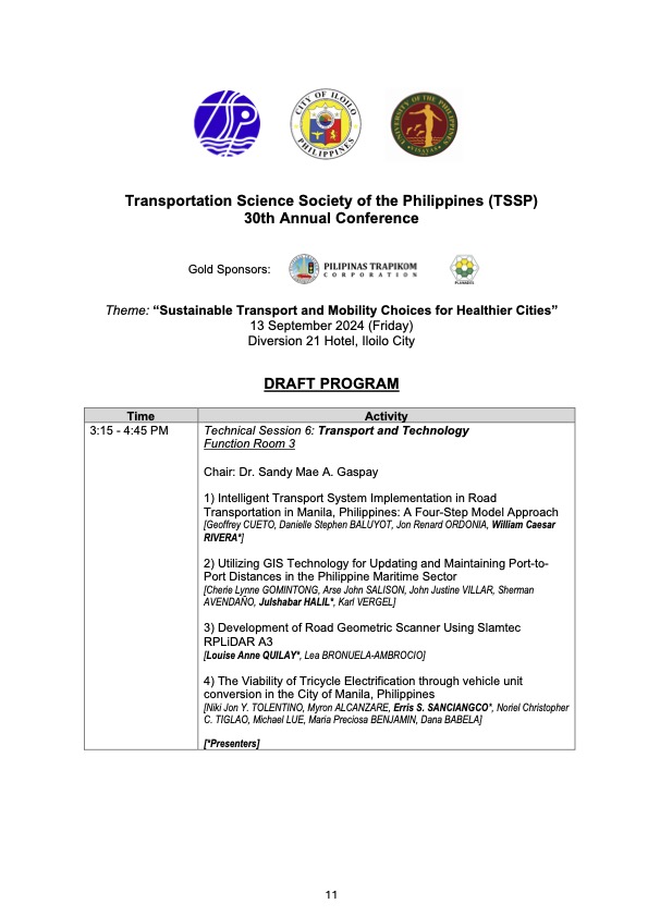
I will share the draft program for the morning plenary session in the next post.
–
Safety or speed?
We start June by sharing a video on why safety and vehicle speed are incompatible:
I saw this video while browsing an article on “Dangerous by Design”. The article discusses a new publication where road designs are evaluated from the perspective of safety. Most of our roads have been designed with speed in mind. That is, how to facilitate the movement of motor vehicles to ensure they travel faster. Forgotten or, even worse, disregarded is the most important element of safety. Why do we widen roads or insist on higher speeds in populated areas or school zones? Such questions are not addressed directly or not answered at all by agencies in charge of planning, designing, constructing and maintaining roads and bridges. The same is true for agencies or units in charge of traffic regulations or management. The result not surprisingly is an increase in the number of road crashes, fatalities and injuries due to our roads being ‘dangerous by design’.
–
Another roadblock for active transport?
The Metro Manila Development Authority (MMDA) recently released what they claim to be their counts of bicycle traffic along major roads in Metro Manila from 2020 to 2023.
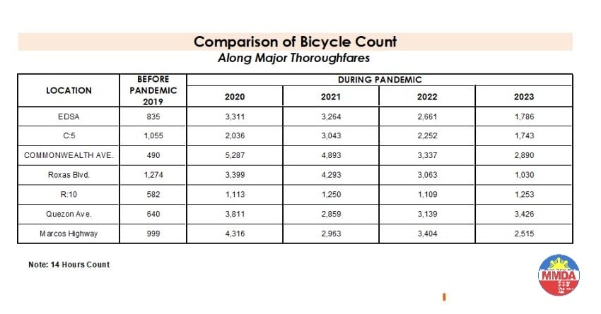
These are supposed to be official data as it is issued by the government agency in-charge of traffic management for Metro Manila roads (aside from its other functions and roles). What are not stated, and are actually very important details, are the locations of the counts and when the counts were conducted. The Traffic Engineering Center (TEC) that was under the DPWH and currently with the MMDA used to publish traffic volume maps for major roads in Metro Manila. So along EDSA, for example, the volume per section are shown on the map. The same for other major roads like Commonwealth, Quezon Avenue and SLEX. The thicker lines mean higher volumes along those sections, and vice versa. However, they did not consciously count bicycles (only motor vehicles) and perhaps MMDA only started counting during the pandemic (i.e., 2020). So there is no one value to represent a road. And counts vary over time of day, day of the week and even throughout the year (i.e., monthly variations).
There were many reactions to the MMDA’s posting of the data and most were critical and even derided the agency for what to them appeared to be inaccurate data. The problem is that it seems there are no other counts that can validate and perhaps refute the MMDA data. Previous bike counts were not conducted according to how the MMDA and DPWH count vehicles. That is, counts are typically done over a 14 or 16-hour period and ideally on several days in a year. Expansion and conversion factors are applied based on established stations along major roads that are supposed to have more frequent if not continuous counts. This methodology is how Annual Average Daily Traffic (AADT) is computed. Call it car-centric if you like but the methodology is very much applicable to bicycles as well. Peak hour counts for bikes are not enough and the peak hour factor for motor vehicles does not apply to bicycles (if this is to be used to expand/convert peak volumes to daily values). In fact, if you go into the math, there should be a peak hour factor for each type of vehicle considering each vehicle’s volume will vary differently over time. So yes, the solution here is to conduct bicycle counts according to how MMDA or DPWH counts vehicles and these should be done along several stations along major roads (e.g., those in the table above) to validate the MMDA counts.
More on this topic in the next post!
–
Counterflow irony along Ortigas Avenue Extension, Pasig City
One Friday, I traveled to Ortigas Center from Antipolo via the most direct route using Ortigas Avenue Extension. I was not surprised by the counterflow scheme being implemented starting from De Castro all the way to Rosario Bridge. I was also not surprised that the more congested lane was the counterflow lane. I thought everyone expected the main traffic lanes to be congested as PUVs like jeepneys, buses and vans usually create bottlenecks as they block traffic while passengers board/alight along that section of Ortigas Avenue Extension. Here is what you might encounter in terms of traffic if you opt to stay along the westbound traffic lanes:
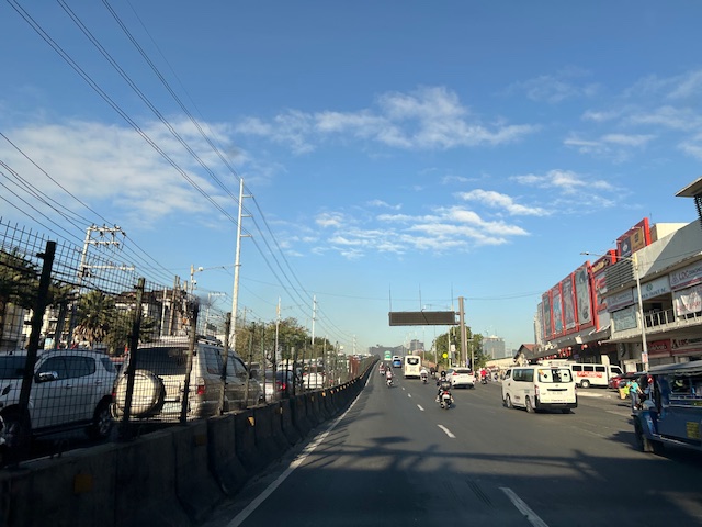 Traffic before the Manggahan floodway bridge at what was generally called Mariwasa. The Filinvest residential development on the left used to be the Mariwasa tiles plant.
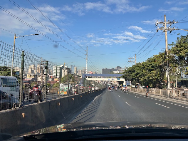 Traffic after the crossing the bridge. Note the pedestrian overpass in the photo.
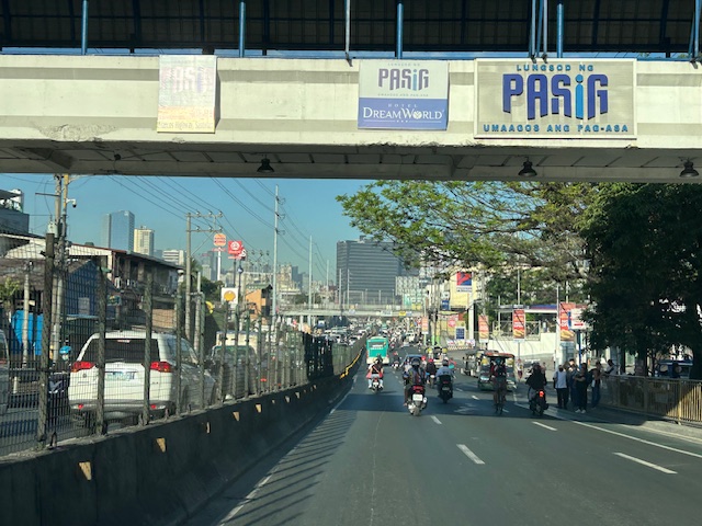 Meters after and near the overpass, you can already see the build-up in the Rosario area
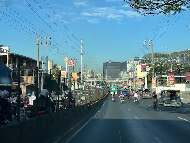 The Rosario bridge area is usually congested not just because of the PUV operations but also because there is the junction of Ortigas Avenue Extension and Amang Rodriguez Avenue, which is another major thoroughfare connecting this area to other parts of Pasig, Quezon City and Marikina City.
I will post about the counterflow scheme in Bangkok in the next post.
–
International Shrine of Our Lady of Peace and Good Voyage
It’s Maundy Thursday today and there will be the Alay Lakad later this afternoon. Here are photos I took yesterday morning at the shrine including the road closures sign or tarp posted at the intersection of P. Oliveros Street, Ortigas Avenue Extension and L. Sumulong Circle near the provincial capitol site.
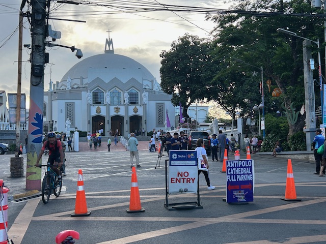 Access was already being limited as of yesterday morning. On regular days, there will be a queue of vehicles mostly new and to be blessed at the shrine. There’s limited parking at the shrine itself so visitors or pilgrims would have to find parking around the church including the nearby mall.
 View of the shrine from the entrance to the complex
 The main altar of the shrine
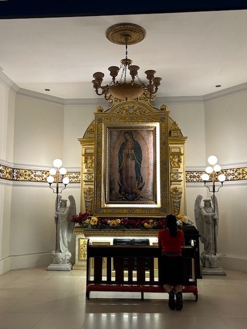 Retablo to Our Lady of Guadalupe
 The main road to the shrine, P. Oliveros Street, is an extension of Ortigas Avenue Extension from the Provincial Capitol site. This will be the main route to the shrine and will be filled with people later this afternoon and overnight.
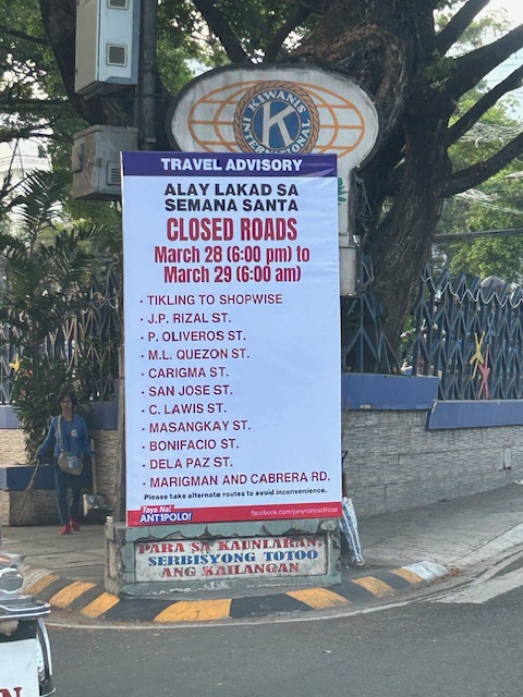 Road closures from 6:00 PM today until 6:00 AM tomorrow (Good Friday)
The Alay Lakad is a spectacle by itself and probably rivals if not exceeds the Traslacion of the Black Nazarene in Quiapo, Manila in terms of the number of participants.
–
Alay Lakad 2024
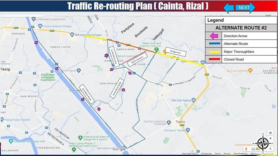
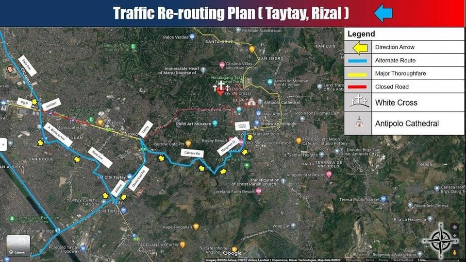
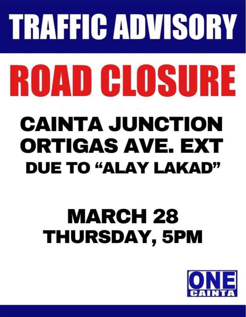
I’m sharing here the announcements and maps shared by Antipolo, Cainta and Taytay regarding road closures and alternative routes during the Alay Lakad this Holy Week. The roads leading to the Antipolo Shrine will be closed from 5pm of March 28 (Maundy Thursday) to 6am of March 29 (Good Friday). Expected are hundreds of thousands of people making the trek to the Shrine of Our Lady of Peace and Good Voyage, which is among the most popular pilgrimage sites in the country.
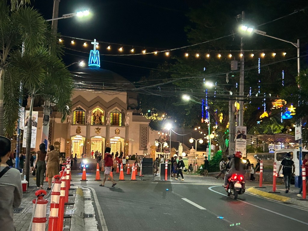
Many are probably walking as part of their panata or commitment in exchange for a favor they have prayed for. This may be healing for an illness or finding work or passing a licensure exam. Of course there are those who also pray for wants rather than needs like a new car, a big house or winning the lottery. And then there are those who are in it for the adventure, treating this as an excursion or a gig with the barkada.
Here are the maps and announcements posted in the official pages of the LGUs:
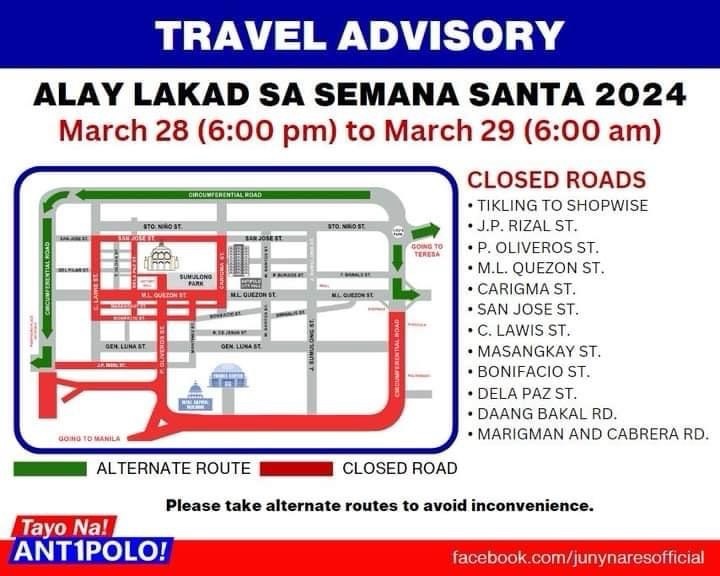
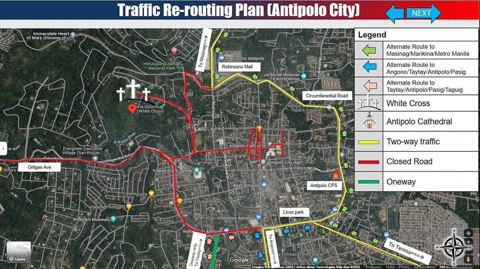
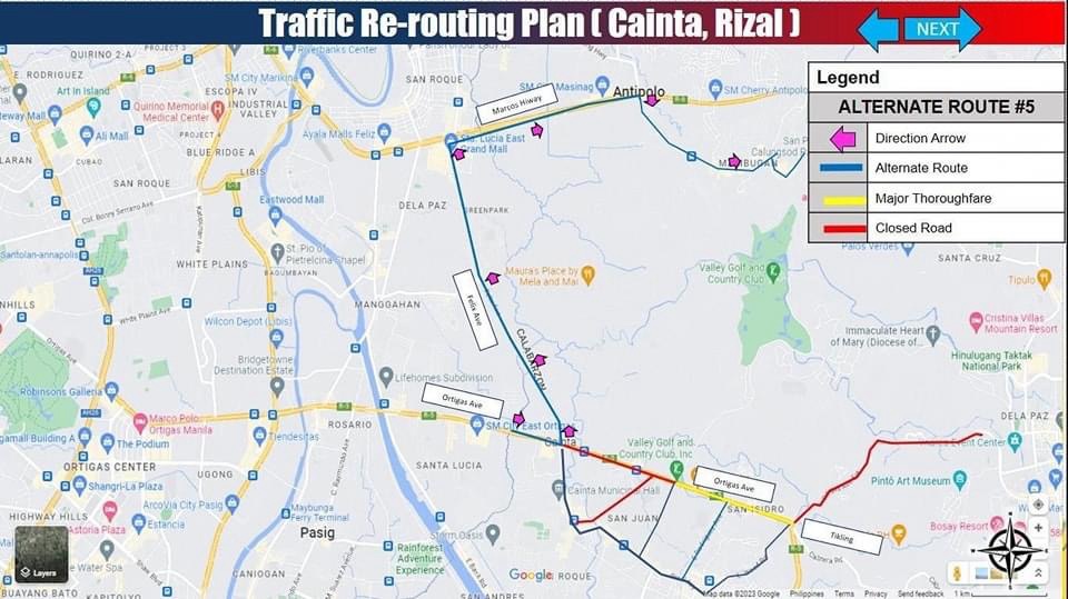
–
Zamboanga’s first flyover
We passed by the construction site of Zamboanga City’s first flyover at the intersection of the Pan Philippine Highway (AH 26) and Veteran’s Avenue. I recall there was a lot of pressure from DPWH for the city to approve its construction. The previous mayor didn’t want to approve the project because the perception was that it was not required and there were other options to consider before a flyover was to be constructed. However, many people including the then congressman and now mayor probably thought the flyover would be the solution to the congestion experienced at the intersection. Add to that the perception that the flyover is also somewhat a symbol of progress.


We won’t know until its completion and the ‘normalization’ of traffic in the area to determine whether the flyover has ‘solved’ traffic congestion in the area. The problem with this approach to ‘solving traffic’ is that it is usually a short-lived alleviation of a symptom of the real problem, which is transportation. Zamboanga City has deferred rationalization of public transport routed despite analysis and plans pointing to a streamlined and optimized transportation system if this was pursued. The City commissioned a Transportation and Traffic Management Plan Study in the previous administration but the plan and its recommendations have been shelved, another example of such being casualties of a change in administration of an LGU.
–

