
Home » Traffic Management (Page 4)
Category Archives: Traffic Management
Counterflow lane to Cainta Junction along Felix Avenue
Counterflow traffic schemes seem to be in these days. Cainta used the scheme temporarily while one lane of Felix Avenue was blocked due to the maintenance work being conducted by Manila Water. Following are photos showing the traffic advisory and photos during the counterflow.
 Traffic advisory showing the period when the counterflow traffic scheme was implemented.
 There was a median opening across from a factory’s main gate that allowed vehicles to counterflow.
 The counterflow lane allowed vehicles to bypass the utilities maintenance works being performed by Manila Water’s contractor that blocked the median side lane of Felix Avenue.
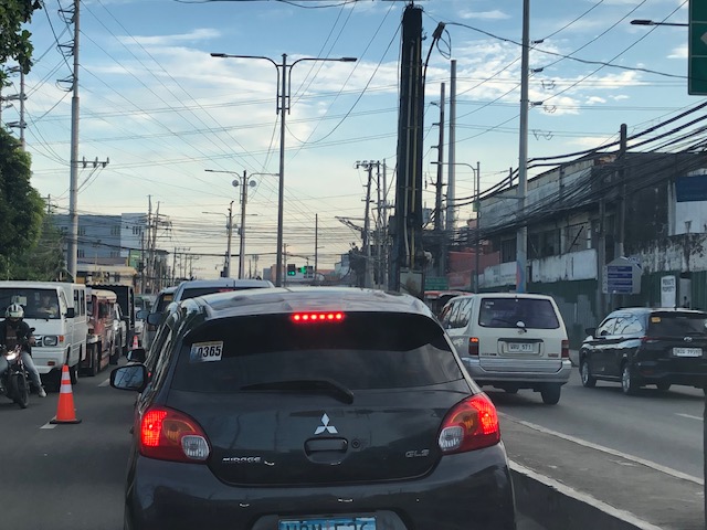 Approach to Cainta Junction
 The counterflow ends at Cainta Junction where left turning vehicles are positioned correctly for the movement. Through traffic were expected to occupy the other/normal approach lanes.
As the Manila Water concluded its maintenance work, the counterflow scheme was already lifted and traffic is back to normal.
–
On Undas traffic 2023
The past two years, I have not written about the traffic situation or conditions during Undas or the holidays corresponding to All Saints and All Souls Days (November 1 and 2). There wasn’t much to write about really. The usual traffic congestion would be along roads near cemeteries and memorial parks. Marikina City’s Barangka area and Bonifacio Avenue near Loyola Memorial are usually congested due to the city’s public cemetery and the memorial park combining for significant traffic generation during Undas. The days leading to Undas find people traveling, usually back to their hometowns but these days many go out for vacations instead. And so the roads near the airports, seaports and bus terminals are also congested. Tollways and national roads (especially the main corridors) can also be congested with the exodus of people from Metro Manila to the provinces in Luzon Island. I assume something similar occurs for other major cities as well.
Many people I know seem to be vacationing this week as they took advantage of the October 30 Barangay elections and the declaration of November 2 as a holiday to take the week off. Many probably took leaves for the two days that were not declared as holidays – October 31 (Tuesday) and November 3 (Friday). Many if not most schools I know declared a break for the week. It is, after all, an opportunity for students, teachers and school staff to take a breather. At UP though, this week came shortly after its Reading Break so its likely people were not able to gain momentum despite the opportunity to catch up on matters like assignments and correcting exams or papers.
I saw some social media posts early this week about expressways being congested. A few even opined that tollways were a scam because of the toll fees being collected despite congestion. I found those quite amusing as the alternative would have been national and local roads that would also be congested. Tollways have been proven to provide shorter travel times (and therefore higher level and quality of service) compared to the free roads. Also, its a free country so those who have their own vehicles may choose to take free roads. We also have apps like Waze to help us find alternative routes other than those that involve tollways. But for long distance travel (e.g., Manila to Baguio, Manila to Legazpi, etc.), tollways will always have the advantage over free roads. Of course, the timing of the travel also matters and the long Undas week should allow for some flexibility in travel especially those taking the road trips.
Here’s to a meaningful and reenergizing Undas!
–
Still on the Katipunan zipper lane
I’ve occasionally arrived at Katipunan with the experimental zipper lane still in use. I usually take Major Dizon from Marcos Highway in order to have a chance of using the zipper lane. That is, I take the left-most lane of C5 so I am in a good position in case the lane was available when I get to the Ateneo area. Perhaps it is already assumed that the right most lanes are already dedicated to vehicles bound for Ateneo or Miriam (mostly Ateneo I suppose).
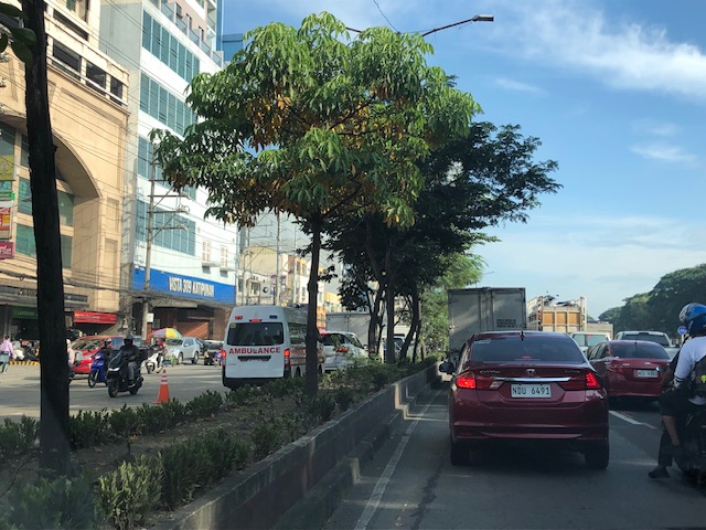
So far, I’ve been able to use the zipper lane only once. On the other times, I stay on the left-most lane (beside the island) of Katipunan/C5. The zipper is relatively short as vehicles return to the correct side of the road at Ateneo Gate 3. The merging there means slower movement of both the zipper lane and the median lane traffic. So is the zipper lane a success? I would say the experiment is just above “marginal success” (or pasang awa) given its limited application. It doesn’t hurt to implement the scheme as traffic along the southbound side of Katipunan is generally light anyway.
–
Tikling junction traffic
Easily a pet peeve along my commute is Tikling or Kaytikling Junction in Taytay, Rizal. I think traffic here is worse than two other major junctions in Rizal Province – Cainta Junction and Masinag Junction in Antipolo City. And that is because of the combination of traffic management (or mismanagement) by elements of the Taytay Municipal Government and motorists lack of understanding of how vehicles should position (or travel) at roundabouts. Of course, the volume of motor vehicle traffic converging at this junction would probably merit traffic signals over a roundabout but for most times when there are no enforcers here, traffic is somewhat more efficiently flowing as drivers and riders are forced to give way in order to not constrict traffic.
 Enforcers often employ the “buhos” system of prioritizing traffic for one leg at a time. However, instead of a quick transition from one leg to another, they tend to give more time to vehicles coming out of the Manila East Road and turning left and (west)bound for Ortigas Avenue Extension. The long time allocated to the latter means long queues for traffic coming down from Antipolo and those from Cainta.
 Enforcers are partial to outbound traffic from Taytay rather than make an effort to have more equitable ‘go’ time for all legs at the junction.
One wonders who is in charge of traffic for Taytay considering they mismanage traffic everyday. [Though I also wonder why the rest of Rizal including Antipolo and Cainta can’t seem to be bothered by the congestion emanating from Tikling.] As if to prove the point of incompetence, another problematic intersection is the Highway 2000 – Barkadahan Bridge – East bank road intersection, which is signalized and yet somehow always congested (or saturated). But that’s another story.
–
A real battle of Katipunan – the search for a transportation solution
Is it obvious that I was alluding to the classic match-ups of the two major universities – Ateneo De Manila University and the University of the Philippines Diliman – that are located along Katipunan Avenue for the title of this article? That is deliberate on my part as there is a ‘real’ battle along Katipunan Avenue, and it does not involve sports.
Following is a recent article from the Philippine Collegian that reports on the current state of traffic along the corridor:
https://phkule.org/article/971/private-cars-mainly-to-blame-for-katipunan-traffic-transport-experts
I have written before and many times about transport and traffic along Katipunan Avenue. This road has been part of my daily commute since 1988 when I was admitted to UP Diliman as a B.S. Civil Engineering major. Back then Katipunan was not as wide as it is now, especially along the section between UP Diliman and the MWSS complex. That section only had 2 lanes then. What is not a wide center island with large, old acacia trees used to be the frontage of MWSS. So now you can probably imagine how much land was ceded by MWSS for road widening.
I also wanted to write about Katipunan in part as a sort of farewell to the former MMDA Chair and Marikina Mayor Bayani Fernando (BF), who recently passed away. Much of how Katipunan looks like and the traffic situation today can be traced to what transpired during his time at MMDA. I will refrain from writing about this and him for now. I am actually thinking of writing a series about BF and his time as Mayor in Marikina, as MMDA Chair, and his brief stint as DPWH Secretary. This short article will do for now.
A zipper lane along Katipunan?
Yesterday, the Metro Manila Development Authority (MMDA) started another experiment along Katipunan Avenue in Quezon City. They introduced a zipper lane along the stretch fronting Ateneo’s Gate 2 and Miriam College’s main gate (about 740m – less than a kilometer). This single lane was supposed to ease traffic congestion along the northbound direction of Katipunan (aka Circumferential Road 5 or C5 or Pres. C.P. Garcia Avenue), which is saturated with vehicles especially during the morning peak.
While we wait for the official pronouncements regarding this experiment, the impacts are likely to be marginal as the original northbound lanes are jammed with vehicles. Thus, there is a tendency for the entry to the zipper lane to be blocked. MMDA staff will also have to stop vehicles at the exit if they will allow the movement of left-turning and U-turning vehicles at the junction with B. Gonzales and Miriam’s main gate. While it may seem an exercise in futility, we have to appreciate the continuing effort of MMDA for such schemes. The bottomline though is the MMDA has limited options to address the hellish traffic along Katipunan. The schools and other establishments would need to put their heads together to formulate a more sustainable solution for this corridor.

Traffic congestion at the UP Diliman campus
The University of the Philippines returned to face-to-face classes last week. That meant many students who have been admitted to the various programs of the university finally set foot on campus. Many, unsurprisingly, drove their own cars or were driven by their parents who themselves may probably were first-timers on campus, too. And given that many students come from middle to upper class families (they are the ones coming from the better schools and more likely to be admitted to UP), it is not surprising that many if not most have cars. The result is vehicles going around the campus even for short trips that could have been made by walking or cycling. Public transportation in the form of jeepneys were also affected as their routes were clogged by private cars. Jeepney users ended up similarly caught in traffic.
The same week, the UP Fair was also held. This was the first UP Fair in 2 years after the lockdowns. The trips generated by activities associated with the Fair contributed to the congestion along the main roads in the campus core. Note that much of the Academic Oval remained closed to traffic and these roads are the widest on campus. Still, portions were open to general traffic including sections to access the parking lot across from Palma Hall.
Will this congestion persist or will it go away eventually? Are a significant part of this actually through traffic? We’ll know very soon for sure once students settle down and realize going around on their cars are not the way to travel around the campus.
–
[Updates on this later]
Why do we keep widening roads?
I’m just going to share this article here. The article from The NY Times asks a question that has been bugging planners and engineers, particularly those who are in government and perhaps under the agencies like the DPWH, DOTr and NEDA. This also applies to planners, engineers and those from other disciplines involved in transportation infrastructure development and particularly roads or highways.
–
The return of carmaggedon and the illusion of low vehicle ownership
Traffic seems to be back to pre-pandemic levels in the Metro Manila and its adjacent provinces. You can experience this along major roads like Commonwealth Avenue, C-5 and yes, EDSA. The number of vehicles on the roads including motorcycles defy what is supposed to be low motor vehicle ownership in Metro Manila (as claimed by DOTr and JICA in the MUCEP report and echoed by groups who cite the report as if it is flawless).
 Intense traffic congestion along C5/Katipunan Avenue. The photo shows traffic on the C5/Katipunan flyover’s northbound side and towards the direction of Ateneo, Miriam and UP Diliman.
The reality appears to be that more households actually own motor vehicles and the inefficiencies and unattractiveness of public transport continues to convince people to take private transportation, including motorcycles, over public transport options. The inconvenient truth according to one senior transport expert is that while cycling has gained ground, the numbers are minuscule compared with those taking either private or public motorized transport. Yes, carmaggedon is back and looks here to stay for a while longer until the so-called game changers like the MM subway and Line 7 are operational. Will they change the commuting behavior or are these too late in as far as solutions are concerned?
–
On reducing driving and its inherent risks
Ever since the automobile was invented and eventually mass-produced, there has been an increasing risk associated with motor vehicle traffic. Laws, policies and regulations have also been influenced to favor the car rather than people. And so we now have what is termed as a car-oriented and dependent transportation system that seems so difficult to undo as most people appear to be enamored by the car. Owning a car (or even a motorcycle if you want to extend this idea of individual ownership) remains an aspiration to a lot of people.
Here is a link to the compact version of a comprehensive report by Todd Litman that presents and argues for a new paradigm where driving is considered a risk factor. There are data and a table comparing old and new traffic paradigms to help us understand the situation and what needs to be redefined or re-framed in order to achieve our safety targets or vision.
Litman, T. (October 20, 2022) “Driving as a Risk Factor: A New Paradigm,” Planetizen, https://www.planetizen.com/blogs/119287-driving-risk-factor-new-paradigm?utm_source=newswire&utm_medium=email&utm_campaign=news-10202022&mc_cid=beacdc2a04&mc_eid=9ccfe464b1 [Last accessed: 10/28/2022]
To quote from the article:
“Safer vehicles, roads, and driving may reduce crashes but achieve few other goals, and sometimes contradict them. Transportation demand management and smart growth policies increase safety in addition to helping to achieve other planning goals, and so can be considered win-win solutions.
More comprehensive safety analysis tends to support social equity goals. Many conventional safety strategies, such as larger vehicles with more passenger protection, and wider roads with fewer intersections, tend to increase walking and bicycling risks. In contrast, lower traffic speeds, TDM, and Smart Growth tend to improve safety, mobility, and accessibility for people who cannot, should not, or prefer not to drive.”
The key takeaway here should be that people should have the option of not driving at all in order to reduce the risks associated with driving as well as reduce congestion. A more comprehensive
–
 Caught (up) in traffic