
Home » Posts tagged 'Antipolo'
Tag Archives: Antipolo
Road crash along Ortigas Avenue Extension leads to Carmaggedon – impacts on traffic
The crash involving a truck, a car and a jeepney last Saturday led to severe traffic jams. Taytay traffic management decided to apply a one way alternating scheme while they were conducting emergency and clearing operations at the site. The result was very long queues along Ortigas Avenue Extension/ Corazon Aquino Avenue.
Travelers were forced to use alternate routes going down from Antipolo. That led to these alternate routes becoming congested as well as streets were generally narrow and were not meant for heavy traffic.
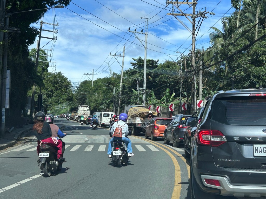
While the crash was severe and probably led to a fatality if not more, there was actually space for two way traffic. There would still be congestion but at least traffic would have been moving instead of at a standstill for long periods of time. While this may appear to be insensitive to those involved in the crash, this is the practical thing to do for traffic management. This is also to lessen the impacts of such crashes on the network and transport operations (i.e., movement of people and goods).
–
Road crash along Ortigas Avenue Extension leads to carmaggedon in Antipolo – The crash
A terrible crash across Fibertex along Ortigas Avenue Extension. The outcome most likely led to fatalities given the severity of the crash and the conditions of the vehicles involved. Here are photos my daughter took as we passed the scene of the crash as we headed towards Tikling Junction.
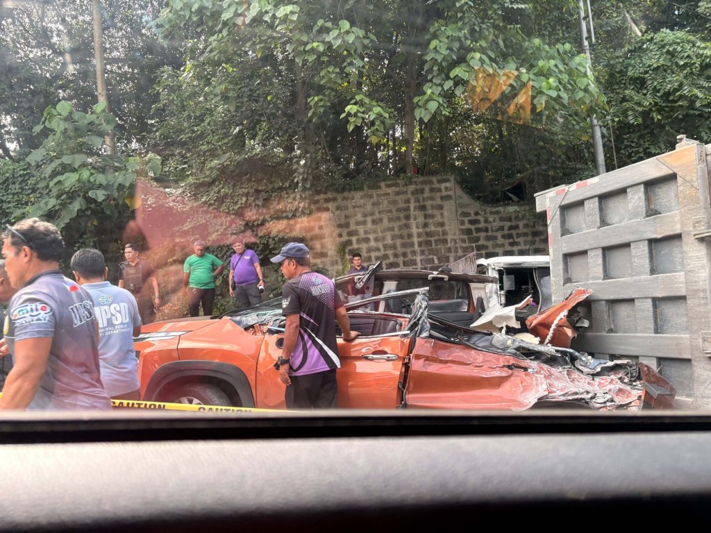


I will write about the aftermath of the crash in the next post.
–
Bakit ma-traffic sa Ortigas Avenue? [Why is Ortigas Avenue congested?]
Bakit ma-traffic sa _______? I usually pose this question to my audience (e.g., students, trainees, etc.). In this post, I attempt to answer the question in the title using data we collected for Antipolo City’s Sustainable Urban Mobility Plan (SUMP). In one of the workshops, I asked the participants from the local government unit (i.e., from the various transport-related offices of Antipolo City) to try to determine the traffic mix for Ortigas Avenue Extension (also named Corazon Aquino Avenue from the Antipolo side) based on the traffic counts conducted at a station along the section that connected Antipolo with Taytay (at Tikling Junction). They also had performed vehicle occupancy counts along the same location so
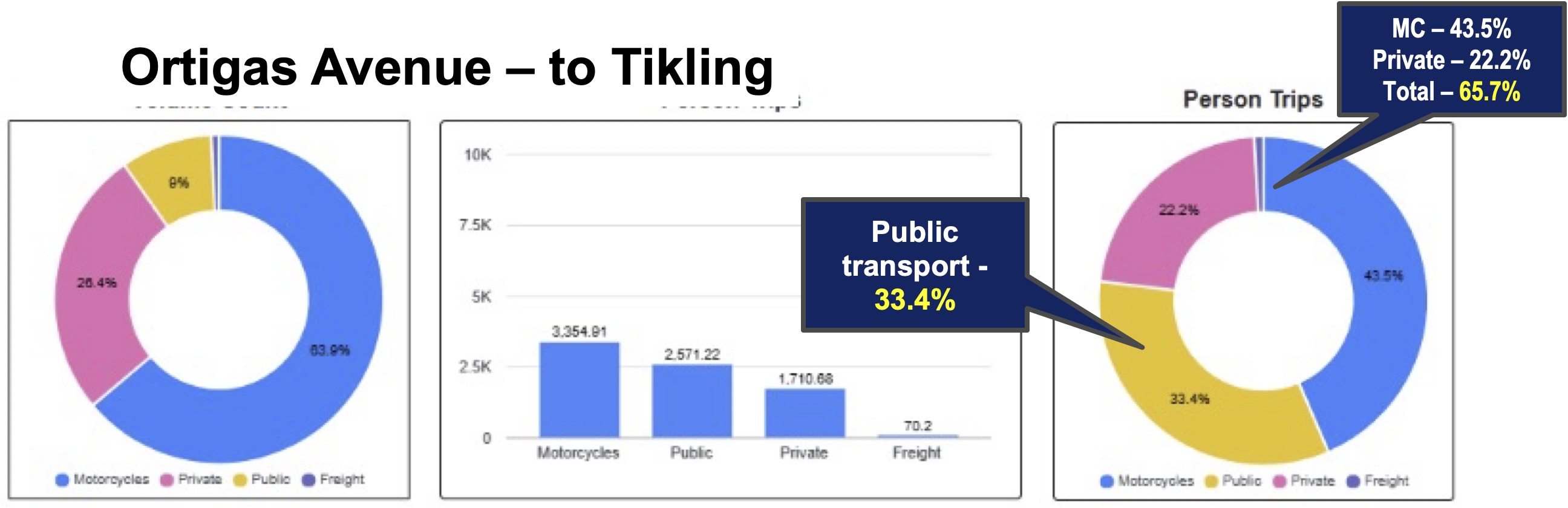
These are just the numbers from the Antipolo surveys. Note that Ortigas Avenue Extension serves as a collector for the Rizal towns including Taytay and Cainta as well as for Pasig City. If we have similar numbers for the traffic mix and occupancies, then we can conclude that most people are actually using private vehicles with a surprising share being carried by motorcycles! That seems to go against the narrative that private vehicle ownership is low and that most people take public transportation. At least for the case presented here, that is not true, and we seem to be underestimating private vehicle use or preference.
Next: Bakit ma-traffic sa Marcos Highway?
–
Traffic congestion due to flood control project – another interceptor for Cainta and Marikina
This week, another flood control project commenced that is expected to bring more congestion along Marcos Highway. The construction involves constriction along the corridor. That is, the capacity of Marcos Highway will be reduced due to the space required by the project. This meant the closure of U-turn slots and the reopening of the Marcos Highway-Felix Avenue-Gil Fernando Avenue intersection. There is significant traffic from Felix that turns left to Marcos Highway towards Quezon City. Instead of continuous, uninterrupted flow towards the former U-turn slot across Burger King, vehicles now need to queue for their turn to make a left turn. And this has led to long queues along Feliz Avenue that reaches Karangalan Village, even Vista Verde on a bad day.
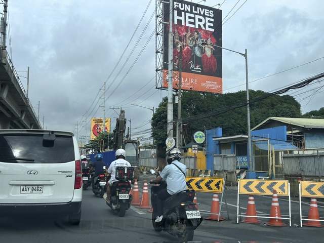 Two lanes have been closed to give way to excavations and the installation of large pipes that will connect with the existing drainage in the area. This interceptor will eventually drain to the Marikina River and is expected to reduce flooding particularly in Cainta and Antipolo where residential subdivisions have endured floods during the wet season for many years.
The project will run for a year. That, of course, assumes that there will be no delays for whatever reasons might come up. The LGUs concerned including Antipolo, Cainta, Marikina and Pasig are cooperating with the MMDA to address traffic management issues.
–
Trip purpose, Antipolo City
In the same workshop with Antipolo LGU staff, the following graph was presented showing the purposes of trips made by residents of the city. The data was gathered with the assistance of barangays, which deployed personnel to do a version of the household information surveys (HIS) usually conducted to collect data on transportation and trip making among residents.
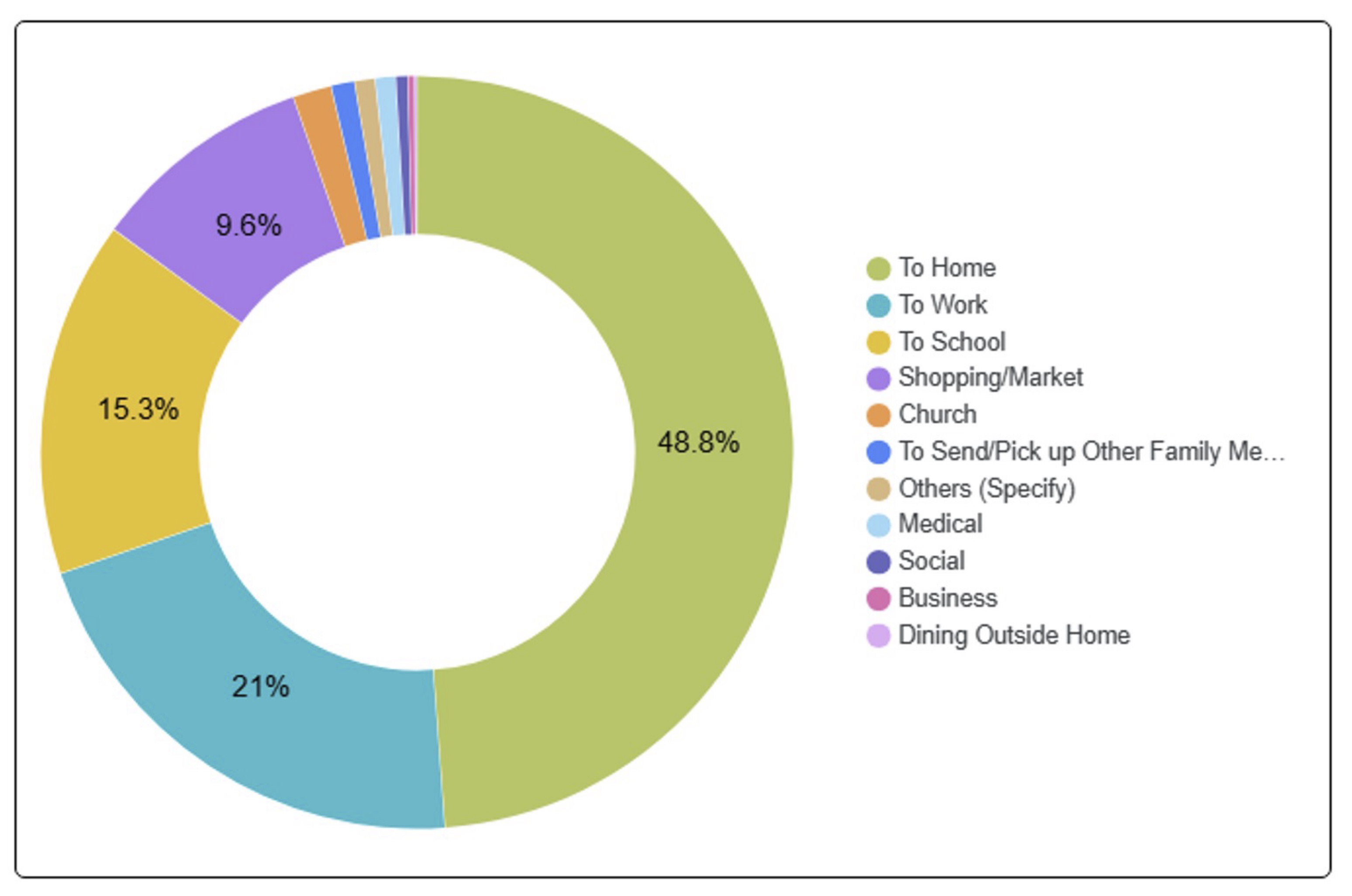
It is important to note that most if not all trips eventually end up at home (i.e., coming home from the workplace, school, market, etc.). Thus we can interpret the graph in a way where we can derive the trip purpose other than “to home”. For example, perhaps the real % of work trips is not 21% but 41.0% of trips made other than “going home.” School trips come in second with 29.9% of trips. Third would be shopping trips at 18.8%. These three combine for 89.7% of all trips made by Antipolo City residents. Work and school trips are most likely the most regular or frequent trips. These are the purposes associated with daily commutes whether by public or private transportation. In the next post, I will share data on mode share and try to relate the latter to the trip purpose.
–
Travel time maps for Antipolo City
Yesterday, we facilitated a workshop for Antipolo City where technical staff of the city presented on the outcomes of various activities related to the formulation of a Sustainable Urban Mobility Plan (SUMP) for the city. One interesting output from one of the groups is this map showing the travel times within selected driving times with the destination being the Antipolo Shrine (“Antipolo Simbahan” if you will refer to the PUV signboards of those plying routes to Antipolo). The maps are the equivalent of travel time contour maps that can be generated with travel speed or travel time data.
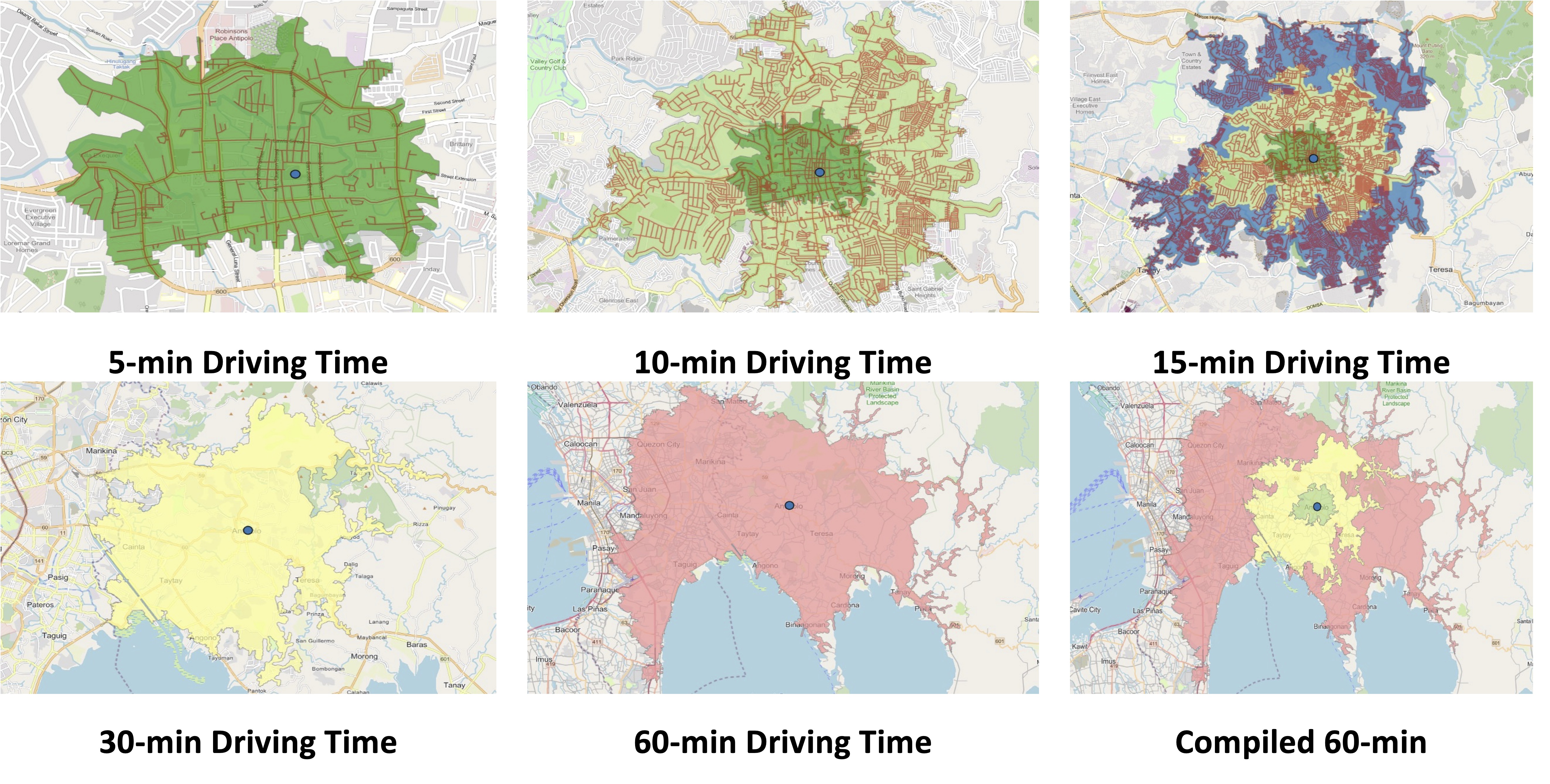
While shown are driving times and assuming car use, similar maps can be produced for public transportation, motorcycles, bicycles and even walking. It is just a matter of collecting the data and plotting them. Alternatively, the data can probably be obtained or derived from sources like Google Traffic or Waze. Some effort, of course, is required in order to have more accurate maps especially considering the road network and traffic circulation. Note that the travel times indicated are also centered on the Antipolo Shrine, which for presentation purposes was used to represent the center of the city. Other maps can be produced in aid of planning travel and transportation for the purposes of the city (e.g., how long it takes between Antipolo and Cubao for a regular commute, etc.).
–
May-time pilgrimage
Last April 30-May 1, there was another ‘Alay Lakad’ to the shrine in Antipolo. The pilgrimage walk started in Quiapo Church (Black Nazarene) and ended at the Antipolo church (Our Lady of Peace and Good Voyage). Dubbed the “Walk for Peace,” there usually was a lot of people considering the number of devotees as well as May 1 being perhaps a holiday. Antipolo and Taytay LGUs at least put up stations for assistance to pilgrims.
We started hearing Mass again at the shrine last Sunday as our daughter prefers going there instead of at the chapel at our village. She’s gone to two Lenten Alay Lakads the past two years so maybe she felt this was a kind of pilgrimage for her, too.
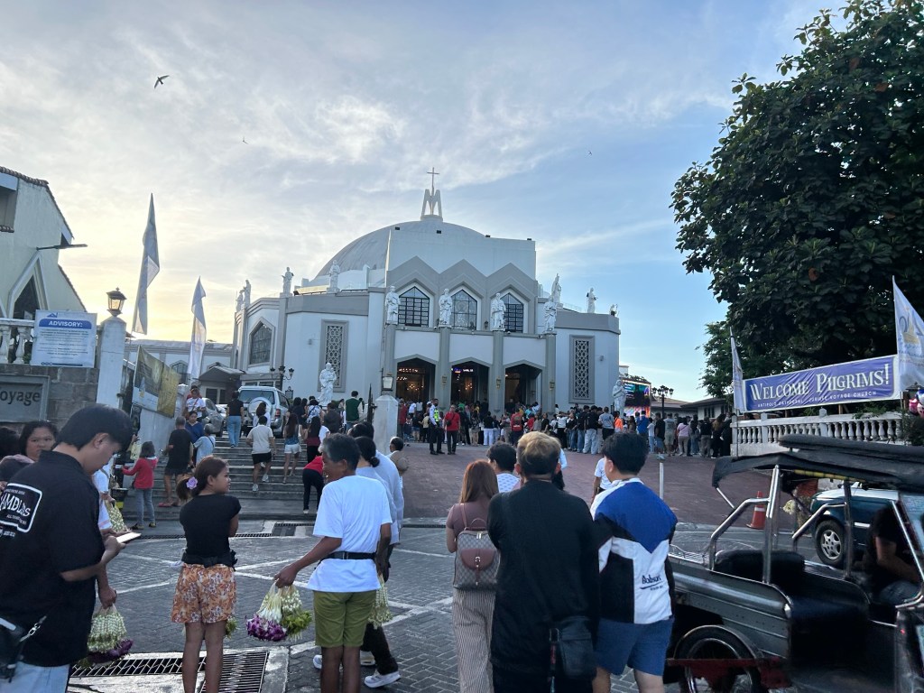

For those walking from Metro Manila, there are two general routes to Antipolo. One is via Ortigas Avenue Extension and Tikling junction and the other is via Sumulong Highway and Masinag junction. You can take public transportation from Cubao or Crossing where there are jeepneys and buses. Many terminate at the Robinsons Antipolo mall terminal. But there are many other smaller terminals around the city including some near the Simbahan itself. There are also many tricycles that can take you to the shrine from various points in Antipolo including the Line 2 station at Masinag. Line 2, of course, is a convenient and fast way to get to Antipolo from Manila and Quezon City.
–
Safety roller barriers along Sumulong Highway
Last week, I observed that the DPWH is currently installing road safety barriers along a section of Sumulong Highway in Antipolo City. Previously, I posted about the same along the Antipolo-Teresa Road, which has treacherous zigzag sections. Here are photos of the ongoing installation work along Sumulong between Padi’s Point and the Oscar Lopez Center.
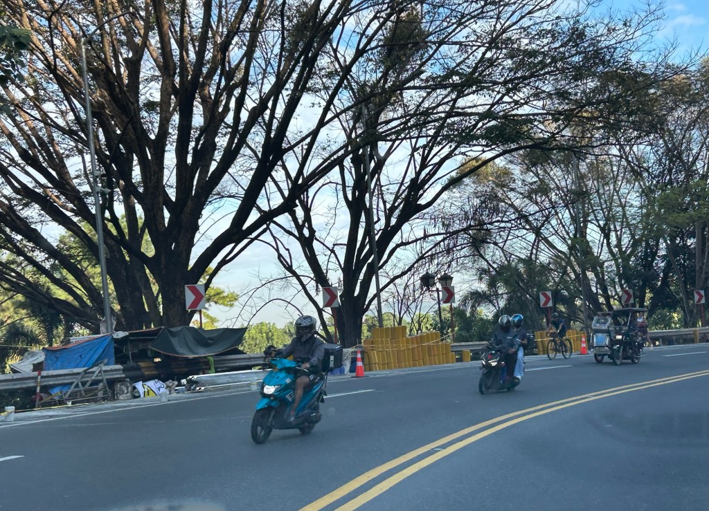
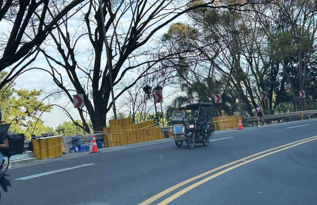
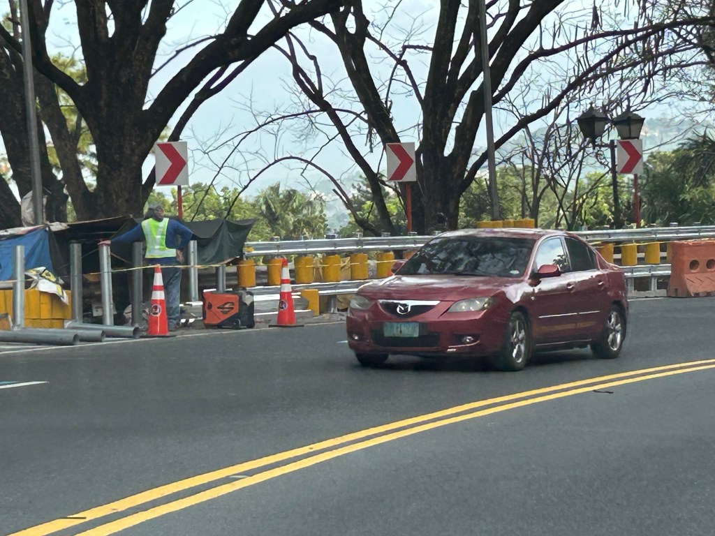
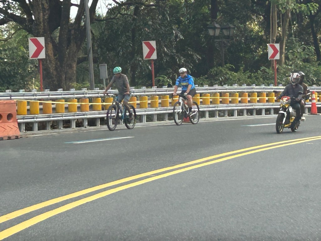
Here is a link to what these barriers are and how they help make roads safer for all users:
https://roadskyguardrail.com/what-is-a-safety-roller-barrier-a-comprehensive-guide
–
Ortigas Avenue Extension counterflow
One traffic scheme that has been constant along Ortigas Avenue Extension is the counterflow scheme. The scheme is applied in the mornings for westbound (outbound from Rizal) traffic. It has been implemented for as long as I can remember; perhaps since the early 1980s. One variant before was a form of “Buhos” where eastbound traffic is stopped for several minutes at certain intervals (6:30am, 7:00am, 7:30am and so on), and westbound traffic is allowed to take all the available lanes during the periods.
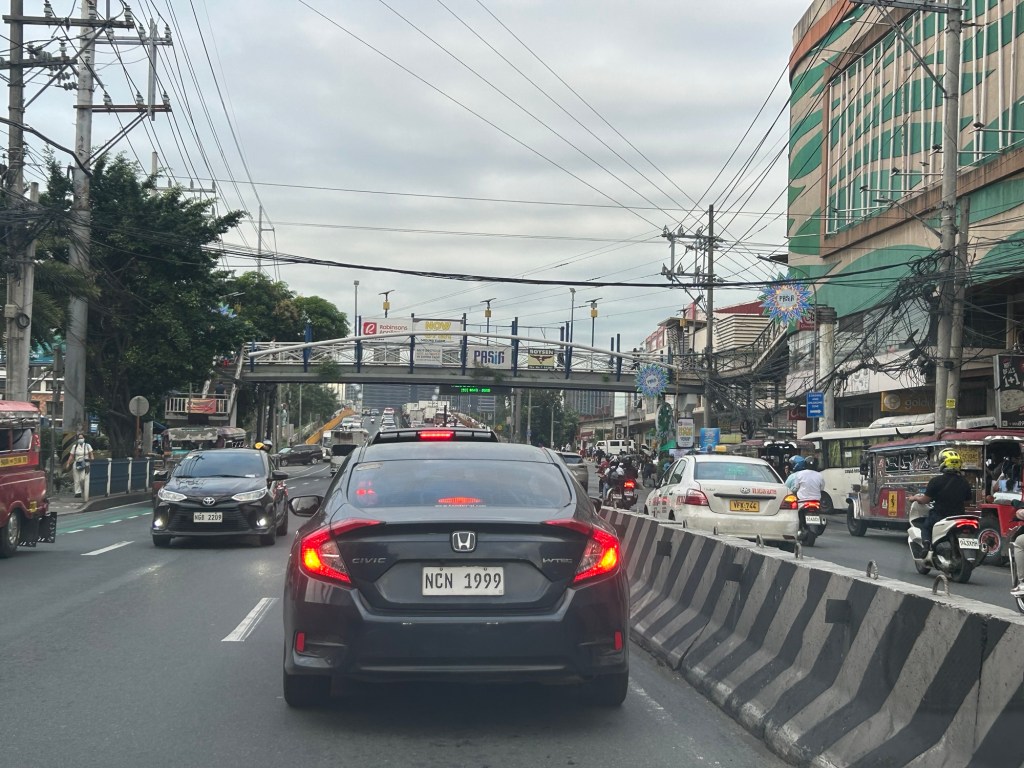
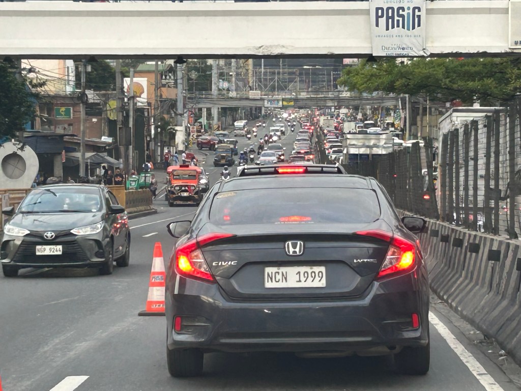
Considering this scheme has been implemented for more than 4 decades now, there must be some measure of effectiveness there. It is an example where the directional distribution during the peak hours allow for such scheme to be implemented. Note that the scheme pre dates number coding and similar counterflow schemes elsewhere in other major roads in Metro Manila (correct me if I’m wrong).
The scheme though only shows that there should have been a better transport system put in place along the corridor, which has had a steady growth in travel demand. There should have already been a transit line along this corridor a long time ago. What happened? Was it not in the government’s radar? There was a line proposed and shown in various master plans before.
–
Just keep on walking
After an eventful end to 2025 and start of 2026, I finally was able to get back to walking. I passed on January 1 as there was a haze that blanketed our area. That was due to the fireworks. With more residents in our village and surrounding areas, there has been an increase in fireworks users the past few years. Last weekend, it was nice to have better air quality for my morning walks.

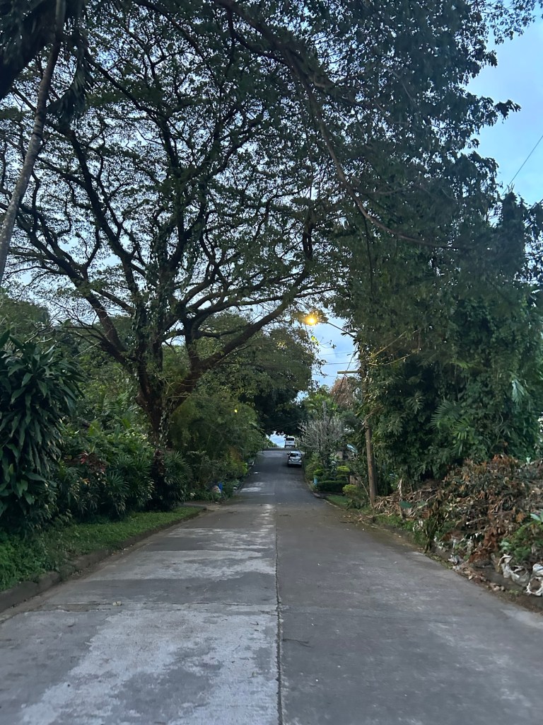
My average step count decreased last year due to a variety of factors including weather. I intend to start strong again this January and hopefully be able to sustain this for the year. It’s really a good thing for my health and wellbeing. And it’s something I would strongly recommend for others- be more active. Set some time for walking whether it’s in the morning, noon or evening.
–

