
Home » Posts tagged 'Antipolo' (Page 2)
Tag Archives: Antipolo
International Shrine of Our Lady of Peace and Good Voyage
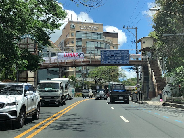
It’s Maundy Thursday today and there will be the Alay Lakad later this afternoon. Here are photos I took yesterday morning at the shrine including the road closures sign or tarp posted at the intersection of P. Oliveros Street, Ortigas Avenue Extension and L. Sumulong Circle near the provincial capitol site.
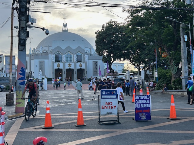 Access was already being limited as of yesterday morning. On regular days, there will be a queue of vehicles mostly new and to be blessed at the shrine. There’s limited parking at the shrine itself so visitors or pilgrims would have to find parking around the church including the nearby mall.
 View of the shrine from the entrance to the complex
 The main altar of the shrine
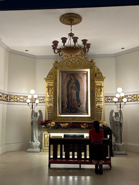 Retablo to Our Lady of Guadalupe
 The main road to the shrine, P. Oliveros Street, is an extension of Ortigas Avenue Extension from the Provincial Capitol site. This will be the main route to the shrine and will be filled with people later this afternoon and overnight.
 Road closures from 6:00 PM today until 6:00 AM tomorrow (Good Friday)
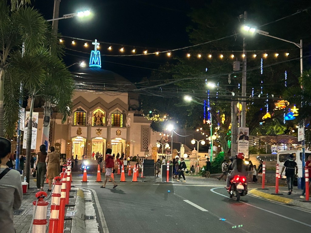
The Alay Lakad is a spectacle by itself and probably rivals if not exceeds the Traslacion of the Black Nazarene in Quiapo, Manila in terms of the number of participants.
–
Alay Lakad 2024
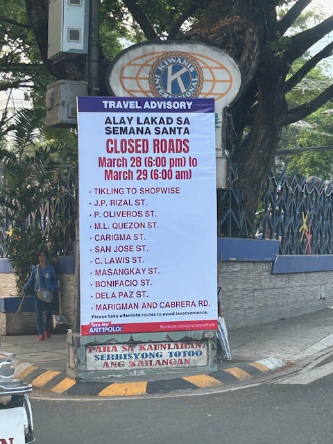
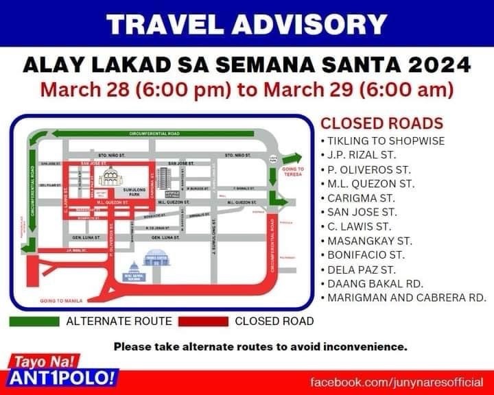
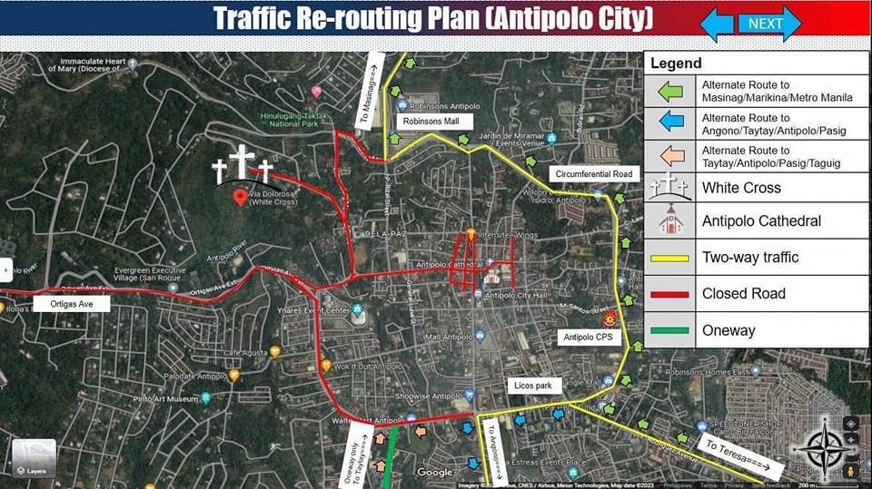
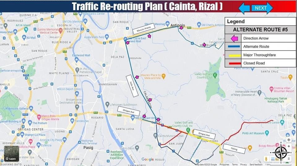
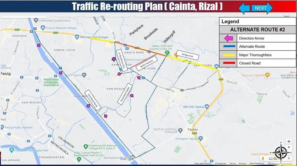
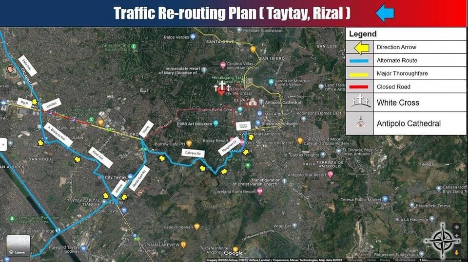
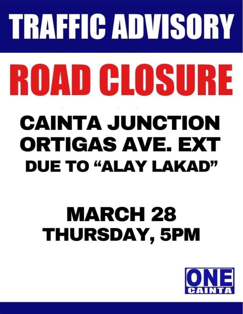
I’m sharing here the announcements and maps shared by Antipolo, Cainta and Taytay regarding road closures and alternative routes during the Alay Lakad this Holy Week. The roads leading to the Antipolo Shrine will be closed from 5pm of March 28 (Maundy Thursday) to 6am of March 29 (Good Friday). Expected are hundreds of thousands of people making the trek to the Shrine of Our Lady of Peace and Good Voyage, which is among the most popular pilgrimage sites in the country.
Many are probably walking as part of their panata or commitment in exchange for a favor they have prayed for. This may be healing for an illness or finding work or passing a licensure exam. Of course there are those who also pray for wants rather than needs like a new car, a big house or winning the lottery. And then there are those who are in it for the adventure, treating this as an excursion or a gig with the barkada.
Here are the maps and announcements posted in the official pages of the LGUs:
–
On road crashes involving trucks
In the week leading to the Christmas break, there was a major crash in Antipolo City along Ortigas Avenue Extension. The crash caused a standstill for both inbound and outbound traffic as the road was impassable to traffic and later, only one lane was available and vehicles had to take turns to use the lane. Here is a photo taken by a passer-by and shared multiple times on social media:

The crash damaged electric and phone poles causing power outage and phone and internet lines to be disconnected. Obviously, the crash not only inconveniences travelers but a lot of residents of the area affected by the blackout and phone and internet disruptions. Crashes like this are preventable if only operators and drivers are extra diligent with vehicle inspection and maintenance. Apparently, the occurrence of such crashes are not enough a lesson that people could learn from. So there needs to be stronger initiatives including inspections of vehicles that can cause major damage and murder. While we expect a lot from national government, local government units must also pitch in along with the private sector in order to improve safety conditions.
We hope that 2024 will be better and that we will have safer roads for all users.
–
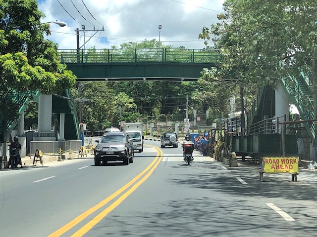
Footbridges along Sumulong Highway – Part 1
There are several new pedestrian footbridges along Sumulong Highway. The intent is simple – provide a safe crossing for people considering the high volume of traffic along the highway and the high risk of being hit by vehicles. Speed is an issue here considering the highway’s slopes and curves. Footbridges present a quick solution. However, it is not necessarily the most appropriate given the objective of improving safety. Perhaps slowing down or ‘calming’ traffic is a better approach?
 A new pedestrian footbridge near the San Pedro Calungsod Church. The intention is for people to use this footbridge to cross to or from the church. Considering the relatively narrow carriageway, crossing on road level is actually the shortest and most efficient way. However, the volume and speed of traffic is a major consideration here and elsewhere along Sumulong Highway.
 This pedestrian overpass or footbridge near Fatima University Hospital is intended for students and staff of the university and hospital. While many, even most, use the overpass, there are a significant number of people who prefer crossing directly on the highway. Before, there were school personnel, usually a guard, who helps people cross. I don’t see them anymore. Even Antipolo does not have traffic enforcers or aides in the area.
More on these pedestrian footbridges.
–
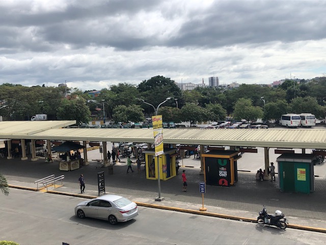
On the Robinsons Antipolo Transport Terminal – again
I took the following photos of the transport terminal at Robinsons Antipolo last December 24. I have shared photos at the ground level and mostly close-ups of the buses, vans and tricycles that operate to and from the terminal. I was at the toy shop last Saturday for a last minute purchase and saw a nice vantage point to show the expanse of the terminal.
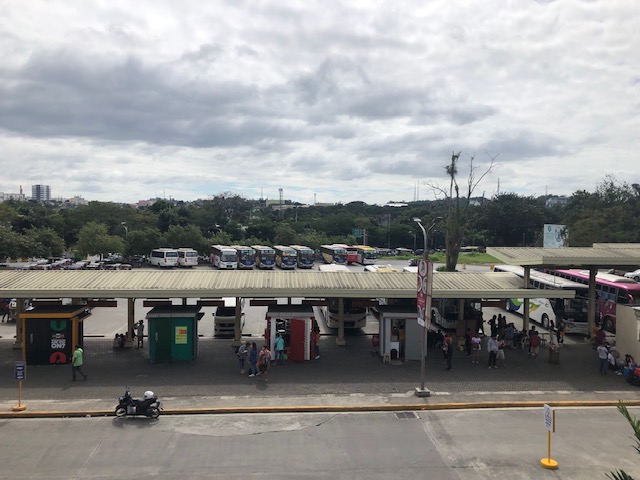 Bus ports and garage (in the distance)
 There are regular trips here between Antipolo and Cubao (aircon buses), Antipolo and Ortigas Center (P2P buses), and Antipolo and other provinces (Quezon, Bicol, Samar, Leyte and Bohol).
 People can transfer to modern Jeepneys (actually mini buses) that ply the Antipolo-Marikina route or perhaps take a tricycle (conventional or electric) to their final destinations.
–
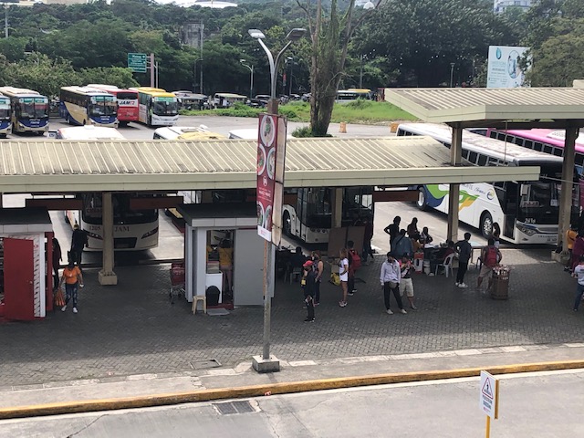
Commuting from/to Antipolo via the public transport terminal at Robinsons Antipolo
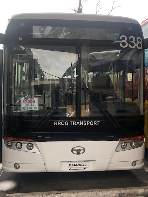
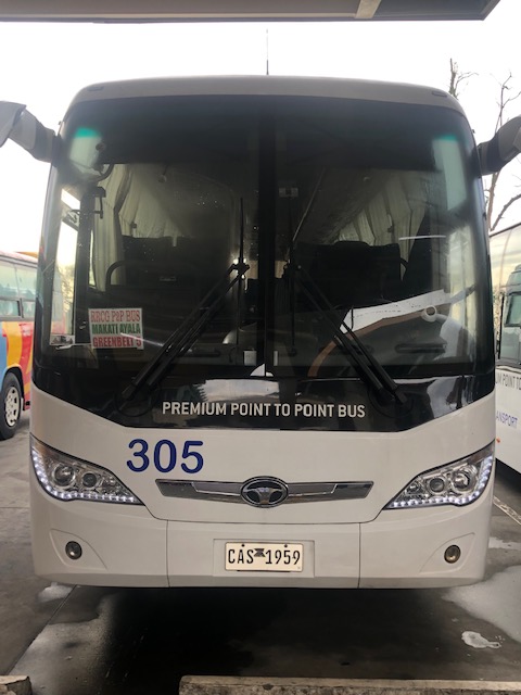
I was at the Robinsons Antipolo public transport terminal to take a P2P bus to Ortigas. I took a few photos before boarding the bus. The bus no longer terminates at Robinsons Galleria but instead goes to Greenhills. This is very convenient for people who need to go to Virra Mall or somewhere in its vicinity (e.g., Cardinal Santos Medical Center, LSGH, etc.).
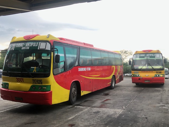
Then there are the buses plying the Antipolo-Cubao route via Sumulong Highway-Marcos Highway-Aurora Boulevard. These are regular aircon buses (not P2P) operated by various companies including G-Liner, RRCG, Jayross, etc. Below are photos of Diamond Star buses loading passengers bound for Cubao.
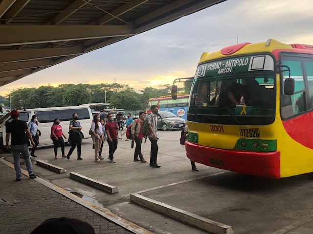
The lines can be very long depending on the time in the morning but I guess the assurance of a seat makes it worthwhile to go to the terminal rather than wait for the bus along its route. Passengers loads are practically back to pre-pandemic levels and with some jeepneys back, that means competition for the buses.
–
Old rail timetable to Antipolo
I found this on the internet – a timetable or schedule for trains bound for what are now destinations in Rizal (e.g., Antipolo, Taytay, San Mateo and Montalban). Pasig and Marikina used to be part of Rizal province with the capital at Pasig (thus, Kapitolyo).
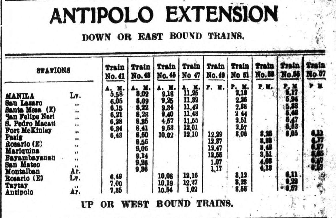
From the schedule, one can see that the main line was between Manila and Pasig (Rosario). From Rosarion, the line branched out towards either Antipolo or Montalban (now Rodriguez). Certain trains like Nos. 41, 45, 47, 51 and 56 terminated in Antipolo while others at Montalban. Again, one cannot help but wonder what if these lines were sustained and still operational (of course, upgraded) today. Commuting would have been different for many of us residing in Rizal and along these lines.
–
Provincial bus services via the transport terminal at Robinsons Antipolo
Robinsons Antipolo recently announced the daily trip schedule for provincial destinations for the transport terminal at the mall. These are for destinations in the Bicol region and the Visayan Islands of Samar, Leyte and Bohol. These will likely travel via Rizal’s “backdoor” through Teresa, Morong, Tanay and Pililla and proceed through the Laguna towns of Pangil, Pakil, Paete, Lumban and Pagsanjan, before going through Quezon province via Luisiana, Lucban towards Lucena, where there is a major bus. From Lucena, the trip will then take the usual routes through Bicol. Here is the posting from the Robinsons Antipolo Facebook page:

There are three bus companies serving the routes mentioned above and as shown at the bottom of the poster. While I am familiar with the routes in Bicol (I have experienced traveling by bus all the way to Gubat, Sorsogon, which is my mother’s hometown and where we have many close relatives.), I have not experienced crossing to Samar via Matnog. I have been to both Samar and Leyte and have crossed the San Juanico Bridge many times so I know how long those trips can be. The highways now are better and I assume the buses offer more comfortable rides so its the ferry (RORO) crossing between Matnog and Allen that will be the slowest and perhaps most uncertain part of the trip. I say uncertain because if the weather is not good, the coast guard will halt the ferry services. I was surprised there was a connection to Bohol. That is not a short trip from Leyte to Bohol. And I was expecting a service to Cebu instead, which was closer and had regular ferry services between Leyte and Cebu islands.
I don’t know about the demand for these services or routes. I hope these are sustainable and sustained as it offers an alternative for people residing in Rizal and nearby areas who want to go to Bicol, Samar, Leyte or Bohol via these routes.
–
Requiem for the Antipolo-Cubao jeepneys?
From the time Metro Manila and Rizal transitioned to General Community Quarantine (GCQ), there have been limited public transport services connecting the two considering most Rizal towns are like bed towns to Metro Manila. The term “bed town” refers to towns, or municipalities, even cities, that are basically the place of residence of persons who during the day time usually travel out to workplaces or schools outside their areas of residence. Many who reside in Rizal province actually work or study in Metro Manila. Similar cases may also be found in the other provinces surrounding Metro Manila like Bulacan, Laguna and Cavite. These connections are made mainly by public transport, which for the National Capital Region (NCR) and adjoining areas currently comprise about 70% of total trips. The rest is by private transport. [Note: Not counted are trips mainly by walking and cycling. While everyone walks, walking is usually at the ends of the commutes.]
Current public transport services now comprise of buses plying the Antipolo-Cubao and Taytay-Gilmore routes that were among the first operationalized under the rationalization program of the Department of Transportation (DOTr). For the Antipolo-Cubao route, several companies have shared the load with mostly aircon buses running between Quezon City and Antipolo City. I wrote recently that there are now non-aircon (referred to as ordinary) buses serving this route and that in addition to the main line (Aurora Blvd.-Marcos Highway-Masinag Junction-Sumulong Highway via) there was now a branch going through Cogeo and via Olalia Road.
 Aircon bus approaching the Robinsons Antipolo terminal
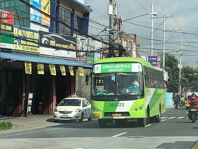 Non-aircon (ordinary) bus plying the Antipolo-Cubao route along Sumulong Highway past the Masinag Junction
We got a comment about how perhaps DOTr and LTFRB plans to introduce variations to main routes including adding to the route number to distinguish one variation from another. While the original route signs look like the one on top of the windshield in the Aircon bus in the first photo with the white box on the left displaying the route number, the bus in the second photo shows two boxes. The second box to the right of the route name is blank. So perhaps there can be an ‘A’ to refer to the original Route 9 and ‘B’ can refer to the one via Cogeo. Does this mean there can also be a ‘C’ and that can be via the even older route via Felix Avenue, Cainta Junction and Ortigas Avenue. If this becomes a reality, then that probably puts the proverbial last nail on the coffin of the Antipolo-Cubao jeepneys. Jeepneys would have been phased out for the route in favor of the higher capacity buses.
–
Other buses operating the Antipolo-Cubao route
I had mentioned in previous posts that more buses have been deployed to serve the Antipolo-Cubao route. The route had already evolved to have two alternatives: the original route via Aurora Boulevard, Marcos Highway and Sumulong Highway, and the variant that goes through Cogeo and passes through Olalia Road to/from Sumulong Highway. Here are a couple of photos showing a couple more bus companies that used to ply other routes via EDSA.
 Jayross Lucky Seven Tours bus – these used to ply the Fairview-Baclaran route via Commonwealth Avenue and EDSA with all aircon buses.
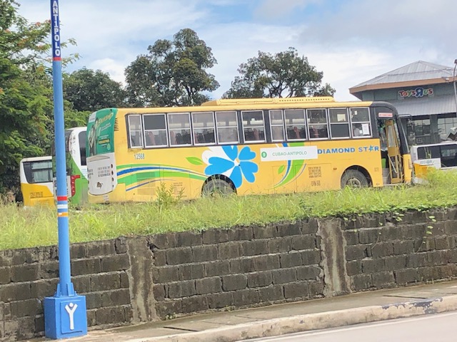 Diamond Star bus – these used to ply the Malanday-NAIA route via EDSA with both ordinary and aircon buses
More photos of other buses now serving the Antipolo-Cubao route.
–
