
Home » Posts tagged 'bridges'
Tag Archives: bridges
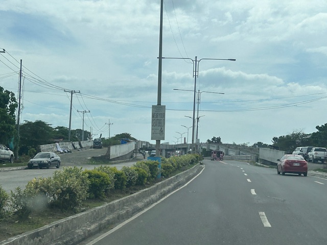
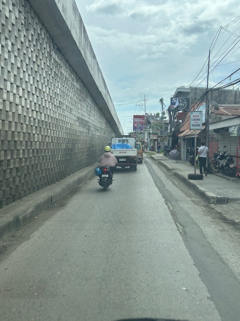
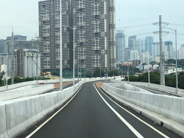
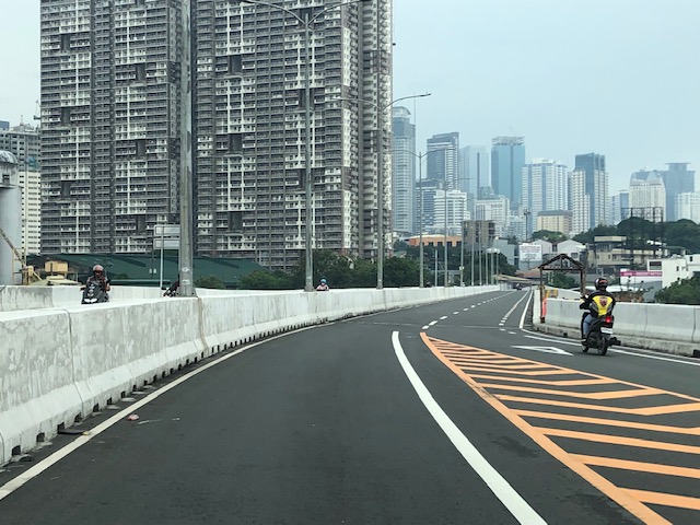
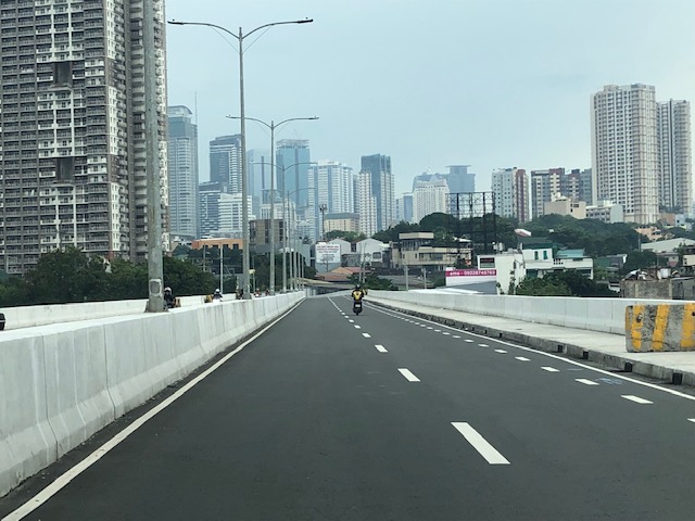
The unfinished Ungka flyover in Iloilo City
The Ungka flyover generated much controversy in Iloilo not just because it remain unfinished but the reasons why it is not completed. I assume that since this is a government project, budget is not really an issue. Projects like this can always have allocations as long as it sticks to the budget or any reasonable and justifiable adjustments (read: additional funds) for its completion. However, there are technical rather than budget issues that need to be addressed and which have major implications on the budget if retrofitting is required and undertaken. Otherwise, the capacity of the overpass is compromised and it will not function as originally planned. Following are photos I took last year coming from the airport to the city.
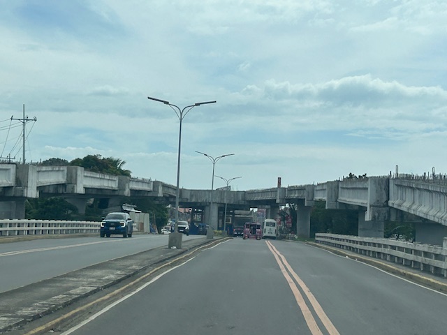
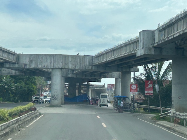
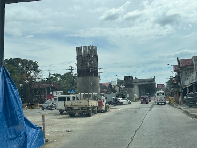
I decided to finish and publish this now as there is news that construction recently resumed. Hopefully, the issues have been addressed and this long delayed project can be completed to help alleviate congestion in the area.
–
On the collapse of a bridge in Isabela
A hot topic these days is the collapse of a span of a newly built bridge in Isabela. The alleged causes of the collapse included truck overloading, design flaws and inferior construction. Initial news reports and statements put the blame on the trucker and the designer with only a few suspicions thrown at the contractor. And then the current President of the country together with his DPWH Secretary inspected the site together. BBM was later quoted as saying the cause was a design flaw.
The bridge’s designer came out to state that it is not his fault. That could have been perceived as a self-serving statement until you delve into his explanation and check his credentials. The designer happens to be one if not the most experienced bridge engineer in the country. He obtained his Bachelor’s and Master’s degrees in reputable institutions (UP and Virginia Tech in the US, respectively). He taught bridge engineering in universities and is perhaps instrumental in civil engineers choosing to specialize in bridges. And he was a past president of the Association of Structural Engineers in the Philippines (ASEP). He knew what he was doing and the process requires for his design to be reviewed and approved by the DPWH prior to having the bridge constructed. If it passed the DPWH review and approval process, then it should be determined if the contractor was faithful to the execution of the design. Photos spreading over social media shows problems where the structure failed. And the quick assessment of many who are knowledgeable about structural engineering and construction is that apparently, the failure is due to the construction.
What happened? Wasn’t construction progress monitored? Were there inspections to determined whether the design was followed? One result of the suspicions being thrown at the people responsible for the bridge is the proliferation of ‘corruption’ as the root cause of the collapse. There are already clever memes of the bridge employing ‘steal design’ and ‘steal reinforcement’ obviously replacing ‘steel’ in the terms. While we inject humor into the situation, we cannot deny how serious the matter is and the implications of design specifications as well as the emergence of new truck types with higher payloads is to pavement engineering in general and bridge engineering in particular.
–
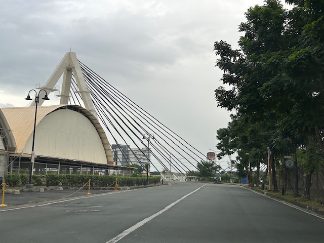
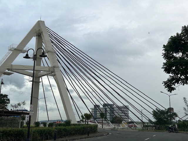
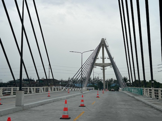
Bridges between Cebu and Mactan
Our route to the airport was via the Marcelo Fernan Bridge (the second bridge connecting Cebu and Mactan Islands). While on the bridge, I saw this opportunity to take a photo. That photo shows all three bridges currently connecting the two largest islands of Cebu Province.
 In the distance is the CCLEX Bridge (Cebu – Cordova Bridge) that connects Cebu City’s South Reclamation Project (SRP) and the town of Cordova in Mactan Island. CCLEX is a cable stayed bridge and the third to connect Cebu and Mactan. Closer is the first Mactan-Mandaue Bridge or simply First Bridge is a steel truss bridge. The bridge we were on, the Marcelo Fernan Bridge, is also a cable stayed bridge.
A fourth bridge is planned and should soon be constructed to the north of the second bridge.
–
Article share: on the collapse of a bridge in Baltimore
The recent incident of a container ship colliding with the bridge in Baltimore in the US has been trending and gone viral. There are also many articles now putting out their assessments of what happened, how the bridge collapsed, what troubled the ship, etc. There are also now articles discussing the implications or the impacts of this incident on logistics considering the collapsed bridge lies along a busy maritime route in the US. Here is an article that focuses on the former, providing analysis on how the ship caused the collapse of a major bridge.
Laris, M. Hassan, J. and Achenbach, J. (March 26, 2024) “How a cargo ship took down Baltimore’s Key Bridge,” The Washington Post, https://www.washingtonpost.com/dc-md-va/2024/03/26/how-key-bridge-collapsed-baltimore/ [Last accessed: 3/27/2024]
What also came to mind as I read reports about this incident is something similar that could happen to the CCLEX bridge connecting Cebu and Mactan Islands. Apparently, something similar already happened decades ago when a bulk carrier, Sanko Elegance, collided with the pier of the first Mactan Bridge. While the bridge did not collapse, it sustained damage that required it to be repaired and severely affected traffic between the two islands considering it was the only bridge at the time. It is important to note that the airport was on Mactan Island so it affected both passenger and freight flow for the province and others that connect and trade with it. While a former student who was much involved in the construction of the CCLEX bridge assured us in a briefing before that the bridge pier can withstand the collision of large vessels (perhaps the largest currently calling on Cebu ports), there may be larger and heavier ships in the future. The Key Bridge, after all, was hit by a container carrier that was larger than the ships transiting in the area when the bridge was designed and constructed.
–
Circulo Verde Bridge
Many roads are quite congested these days during this Christmas season. I wouldn’t get into the causes of congestion but suffice it to say here that the seasonality of traffic would basically explain most of the congestion this time of the year. For a couple of times, I have been advised by Waze to take this alternate route going home via Eastwood City and Circulo Verde. This leads me to the East Bank Road of the Manggahan Floodway and the old De Castro Subdivision before eventually taking me to Ortigas Avenue Extension. Along this route is one of three new bridges crossing the Marikina River near where it connects to the Manggahan Floodway. You can see the floodgates as you cross the bridge. Here are photos of the Circulo Verde Bridge:
The bridge ends in an intersection with Amang Rodriguez Avenue. Going left eventually leads to Ligaya and Marcos Highway. Turning left immediately leads you to the intersection of Amang Rodriguez and the East Bank Road. Taking Among Rodriguez will lead to Rosario and eventually C5 while the East Bank Road takes you to Pasig and the Rizal towns of Cainta and Taytay. Further on leads to Angono and Binangonan. Not so many vehicles currently use this alternate route and Circulo Verde does not seem to be fully developed and occupied yet. Its a nice detour from the usually congested routes.
–
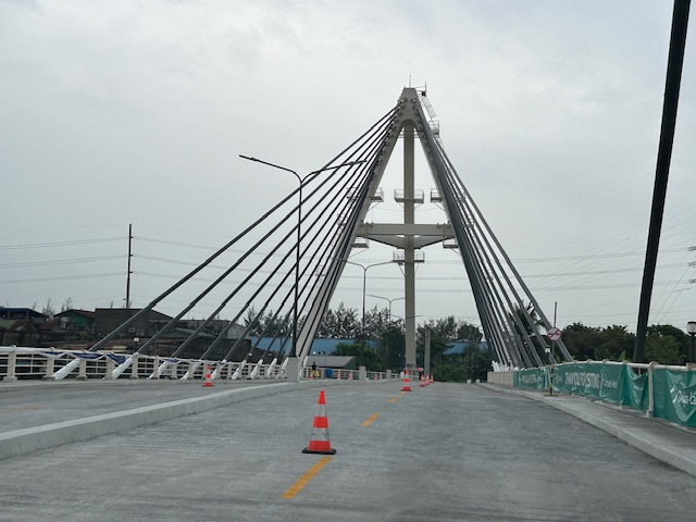
Kalayaan Bridge (BGC – Ortigas Center Link)
The Kalayaan Bridge, also known as the Bonifacio Global City (BGC) – Ortigas Center Link opened about a year ago and was supposed to ease traffic along the usual routes along EDSA and C5 that crossed the Pasig River. The new bridge is located between the EDSA and C5 bridges and is a more direct route to and from BGC if you reside in Pasig and choose the route to/from BGC via Pasig/Shaw Boulevard.
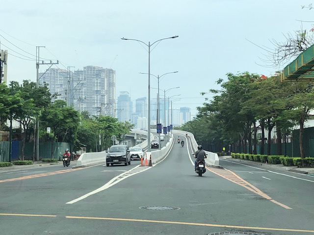 The approach ramp to the bridge from the BGC side is in the vicinity of the Uptown part of BGC. The bridge goes over Kalayaan Avenue, which is one of the major access roads to BGC from C5 or EDSA, and J.P. Rizal Avenue Extension but there is access and egress to Kalayaan Avenue.
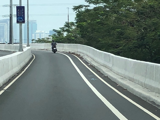 The ramp is practically a single lane with painted bike lanes on either side of the bridge. There is noticeably no space for pedestrians on this bridge. That is only a curb on the right side. This lack of pedestrian provisions is a major flaw of this bridge.
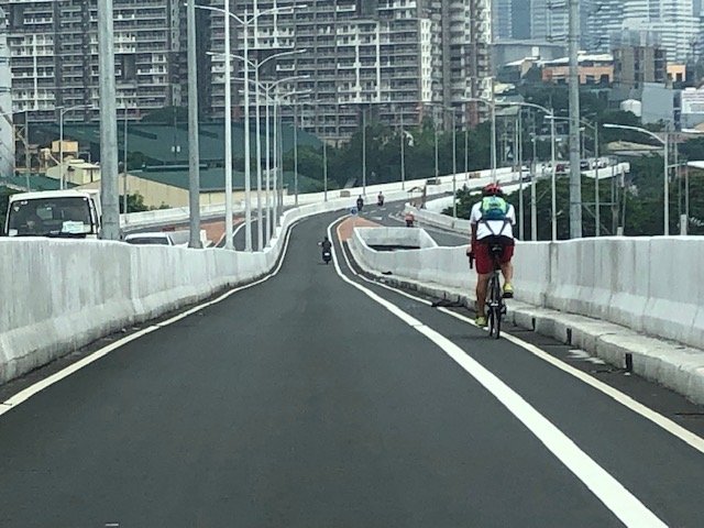 A lone cyclist traversing the bridge – the merge for traffic from BGC and vehicles from Kalayaan Avenue is seen downstream.
 Approaching the merging section (from this perspective; its diverging on the other side) of the bridge.
 A motorcycle merges with the traffic from BGC. Notice the chevron markings separating merging flows as well as the yield marking for vehicles coming from Kalayaan (i.e., priority is for vehicles coming from BGC). The bridge from this section becomes two lanes per direction. There is, however, a risky part for cyclists who will cross paths with vehicles coming from Kalayaan. Cyclists from BGC will have to cross a lane to get to the bike lane on the outer side of the bridge. There is no space for pedestrians along this bridge.
 There is only this part of the bridge where there appears to be a sidewalk. Was this really the design for this bridge? It is very obvious that many people failed in both design and implementation of this project.
 The view towards the Pasig side of the bridge. There are two lanes per direction and narrow bike lanes along the curbsides.
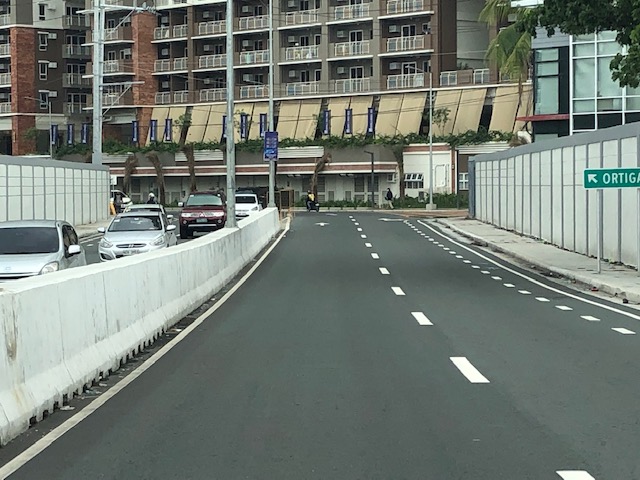 There is an intersection at the end of the bridge but the road immediately at the right is closed to incoming traffic so right turns are currently prohibited despite the pavement markings that indicate they were allowed at one time.
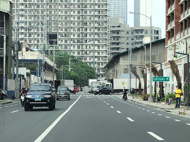 The road leads to this intersection which is in area generally referred to before as ‘Pioneer’. The area hosts many warehouses or storage buildings and I remember going here many years ago to check out the imported wood furniture and office surplus items. Turning right leads one to the area generally known as ‘Unilab’ because that was where United Laboratories had their plant and offices. It retained the property where now stands an events venue. Further on leads you to Kapitolyo and the Estancia Mall.
–
Inter-island bridges in the Philippines – Nice to have but not necessary at this time?
A news article came out yesterday, reporting on the shelving of several inter-island bridge projects as well as the progress of only 3 projects include the Panguil Bay Bridge. Many of these projects have been conceptualized a long time ago but were being fleshed out through various feasibility studies.
I’ve written before about these bridges, and had a healthy discussion among friends about the merits and demerits of such infrastructure when there are other, more urgent projects that would probably have higher impacts. One friend was involved in studying the connection between Panay and Negros islands, and had concluded that the cost can be justified by the economic benefits brought about by the bridge. I disagreed, stating the costs could cover modern urban transit systems at least in the major cities of Iloilo and Bacolod.
With limited resources and the likelihood of these projects being funded from various foreign loans make them unpalatable since these will mean more debt for the country. Also, these projects will benefit fewer people compared to other transport projects including modernizing public transportation and building bike lane networks. The latter kinds of projects are for daily commuters whereas the bridges are more for occasional travelers. What do you think?
–
How many bike lanes can you make with…?
Someone in a social media group subscribe to posted about the future Bataan – Cavite interlink bridge that will cost 175.7 Billion Pesos for 32.15 kilometers (~5.465B PHP per km). That’s a lot of money but is understandable for a major infrastructure project that will required much state of the art engineering and construction for its implementation. I casually mentioned that it was a nice project but belongs to those I’d classify as “nice to have but not really necessary or urgent at this time.” Others were more direct in saying it was another “car-oriented” project. The price tag is quite hefty and a similar amount could have been used for other, more urgent projects around the country that could benefit more people than this bridge. So for the sake of discussion, let’s try to estimate how much of another project can we make out of the estimated cost for such a bridge.
Perhaps among the more popular items due to the pandemic are infrastructure and facilities for active transportation (i.e., walking and cycling). Many cities have initiated projects that encourage more walking and cycling in order to promote healthier lifestyles as well as to reduce car dependence. The Federal Highway Administration (FHWA) of the US estimates that bike lanes can be developed for $5,000 to $50,000 per mile depending on various factors and conditions. That’s 150,000PHP to 1.5M PHP per kilometer at 48PHP : 1 USD. [Ref: https://safety.fhwa.dot.gov/saferjourney1/library/countermeasures/10.htm] Using these numbers we can easily estimate how many kilometers of bike lanes we can produce for 175.7 B pesos. That simple division exercise will give us from 117 thousand (at 1.5M/km) to 1.171 million (at 150k/km) kilometers of bike lanes. For comparison, the Philippine national highway network is 32,932 kilometers. The numbers could mean bike lanes could laid out for the entire national road network with much to spare for provincial, city and municipal roads for connectivity. Funds can even be allocated to improve pedestrian facilities! This begs the question then of how such resources can be used in a more comprehensive manner to benefit a lot more people. From the bragging point of view, won’t such a bike lane network be more impressive than one bridge?
What else can you think about that can be funded by amounts similar to the Bataan – Cavite Bridge or other projects you can tag as “nice to have but not really necessary or urgent”?
–
The FVR Road and Bridge after Typhoon Ulysses
This is a continuation of the feature on the aftermath of Typhoon Ulysses (Vamco). I am posting this here as part of my archives on the floods in the Marikina Valley.
There’s a road branching off from Marcos Highway that links to a bridge crossing the Marikina River and connects with the FVR Road along the Marikina Riverbanks. The following photos speak for themselves in as far as the mud and garbage that was left after the floods subsided.
 Descending from Marcos Highway, only one of two lanes are passable after heavy equipment moved tons of mud and garbage to the roadsides. The fences trapped a lot of garbage, too, as seen in the photo.
 Piles of mud and garbage at the service road leading to the east bank of the Marikina River and the SM Marikina access road.
 Under the Marcos Highway Bridge, garbage, mostly plastics, remain on the wire fences. This area was totally submerged during the height of the floods with water reaching the underside of the bridge. Fortunately, the bridge seems undamaged.
 Even lamp posts and electric poles caught a lot of garbage.
 The Olandes housing development was surely affected by the swelling of the river.
 The FVR Road leading to C-5 is already clear for 2-lane traffic but you can see the mud and garbage all around. The dried mud has turned into dust (alikabok) that blows away as vehicles pass through the road. There is also mud on the plants in the median planters as this area was also submerged during the height of the typhoon.
–
Traffic congestion due to Barkadahan Bridge rehab
Here are more photos of the situation in the vicinity of Barkadahan Bridge. Photos were taken on a late Sunday morning (around 11 AM). Photos show the traffic congestion particularly along the eastbound side of Ejercito Avenue and Barkadahan Bridge.
 Even before completely crossing the bridge, one can see how long the queue from C-6 is. This is a photo of the queue just past the West Bank Road. The road here is names Ejercito Avenue after former Pres. Joseph Estrada whose real family name is Ejercito.
 Truck occupying an entire lane and encroaching on one of the lanes to C-6. This is due to the bottleneck caused by the wall of a residential subdivision across from the Greenwoods gate. The wall actually only contains the subdivision name and yet DPWH has been unable to expropriate the land that includes part of that subdivision’s driveway.
 Long queue extending towards Tapayan Bridge along Ejercito Avenue
 Queue along Tapayan Bridge or bridges considering there are two – one for each direction of traffic.
 Queue crossing the bridge and the bend towards C-6 and Lupang Arenda, which is a major relocation site for Metro Manila squatters during the time of then Pres. Joseph Estrada. Vehicles turn left towards C-6 while those going straight continue along Ejercito Avenue towards Pinagbuhatan, Pasig City.
 The queue reaches C-6 on a Sunday morning. It is likely worse on weekdays.
–
