
Home » Posts tagged 'DPWH' (Page 2)
Tag Archives: DPWH
Our clear and present problem with DPWH and certain contractors
I was going to write about the new taxi service and TNVS I used recently during this long weekend. Unfortunately, I lost focus and “gana” after reading about the collusion among DPWH officials and certain contractors about flood control projects. Here are my sentiments today that I shared on my social media account:
“Bakit walang pasok bukas? Kasi may nagbabadyang masamang panahon. Baka bumaha? Bakit babaha? Alam na siguro natin ang sagot sa tanong na ito? Damay-damay na yan. Resilience na lang ba ng mga taong nagbabayad ng buwis ang kasagutan? Di ba dapat may managot sa kung bakit patuloy tayong binabaha samantalang bilyones o trilyones ng kaban ng bayan ang ginagastos? Naiisip ba natin na yung pinagpaguran, pinagpapaguran at pagpapaguran natin ay napupunta sa mga nanlalamang? Wala nga siguro silang nararamdaman at napapansin habang nakasakay sa kabilang magagarang sasakyan. Tayo naman, hanggang tiis sa paglusong sa baha at mag ‘abangers’ sa anunsyo ng walang pasok.”
With the recent revelations of these contractors having the propensity to purchase luxury items like expensive vehicles, do we still wonder why these people cannot feel what ordinary people experience during these times of inclement weather? Hindi nga siguro maramdaman ang baha o ang mga lubak sa daan pag naka SUV ka. To be quite direct about this, I would like to personally drag them to experience the floods and maybe submerge their homes for a few days so we’re even. I am probably not alone with my sentiments.
Flood control is probably just the tip of the proverbial iceberg. There are just so many other projects including roads and bridges that also need to be investigated for anomalies. Will the current administration act on this? Or are we just being taken for a ride with all these lip service and grandstanding by politicians and government officials?
–
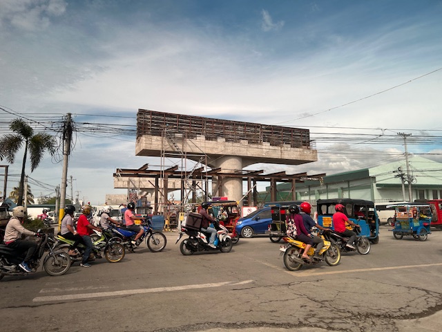
Pothole season
The heavy rains the past days have taken a toll on many roads. Special mention here would be city roads such as main arterials where traffic flow is affected by the pavement conditions. Here are a couple of photos of potholes along Katipunan Avenue.


The photos also reveal that cement concrete slabs are actually under the asphalt concrete. This means asphalt concrete was used more as an overlay to protect the cement concrete slab rather than as the main structural component that will carry the traffic loads. The pavement slabs may not necessarily be compromised but the hammering action of tires/wheels as they hit the potholes will definitely lead to more damage. The water, of course, is worrisome because once they seep or penetrate the cracks and interfaces between the slabs, they may compromise the layers beneath the slab. This will weaken the foundation of the pavement and lead to more critical damage. The challenge is how to repair these potholes when we are still experiencing heavy rains. Now that’s something the DPWH needs to figure out, learn and apply rather than the usual patch up work that results in mounds of asphalt replacing the potholes.
–
On the collapse of a bridge in Isabela
A hot topic these days is the collapse of a span of a newly built bridge in Isabela. The alleged causes of the collapse included truck overloading, design flaws and inferior construction. Initial news reports and statements put the blame on the trucker and the designer with only a few suspicions thrown at the contractor. And then the current President of the country together with his DPWH Secretary inspected the site together. BBM was later quoted as saying the cause was a design flaw.
The bridge’s designer came out to state that it is not his fault. That could have been perceived as a self-serving statement until you delve into his explanation and check his credentials. The designer happens to be one if not the most experienced bridge engineer in the country. He obtained his Bachelor’s and Master’s degrees in reputable institutions (UP and Virginia Tech in the US, respectively). He taught bridge engineering in universities and is perhaps instrumental in civil engineers choosing to specialize in bridges. And he was a past president of the Association of Structural Engineers in the Philippines (ASEP). He knew what he was doing and the process requires for his design to be reviewed and approved by the DPWH prior to having the bridge constructed. If it passed the DPWH review and approval process, then it should be determined if the contractor was faithful to the execution of the design. Photos spreading over social media shows problems where the structure failed. And the quick assessment of many who are knowledgeable about structural engineering and construction is that apparently, the failure is due to the construction.
What happened? Wasn’t construction progress monitored? Were there inspections to determined whether the design was followed? One result of the suspicions being thrown at the people responsible for the bridge is the proliferation of ‘corruption’ as the root cause of the collapse. There are already clever memes of the bridge employing ‘steal design’ and ‘steal reinforcement’ obviously replacing ‘steel’ in the terms. While we inject humor into the situation, we cannot deny how serious the matter is and the implications of design specifications as well as the emergence of new truck types with higher payloads is to pavement engineering in general and bridge engineering in particular.
–
On the pushback vs. bike lanes
I saw this short article at Planetizen that linked to another article that was the original one about cities dismantling or removing bike lanes. This is a very concerning trend in the US but something that’s also happening here. The Department of Public Works and Highways (DPWH) has always been lukewarm to bike lanes (parang napipilitan lang), the Metro Manila Development Authority (MMDA) seemed never to understand it (even during BF’s time as Chair), and many local government units that jumped on the bike lane bandwagon during the COVID-19 pandemic have reneged on their declared commitments. Currently, it seems that only cities like Quezon City and Iloilo City have sustained bike lanes development. Others have removed protected bike lanes or have not enforced vs. motor vehicles encroaching on the bike lanes.
Johnson, R. (February 18, 2025) “Cities Start to Backpedal on Bike Lanes: A Growing Crisis for Cyclists,” Momentum Mag, https://momentummag.com/cities-start-to-backpedal-on-bike-lanes-a-growing-crisis-for-cyclists/ [Last accessed: 3/2/2025]
To quote from the article:
“Bike lanes have become a culture war where those in favor are seen as “woke” or some other terrible conservative slur. But, most who use bike lanes are just regular people who want to save some money, and get the mental and health benefits to cycling to work.
Urban cyclists, bike commuters, and advocates for safer streets, have all noticed a troubling trend. What was once a symbol of progress toward sustainable transportation and safer roads for all is being reversed in multiple cities across North America.”
Will bike lanes and cyclists suffer similar setbacks here? Will the Department of Transportation (DOTr) continue to champion bike lanes? Will the agency be more aggressive and assertive of bike lanes development? Your guess is as good as mine!
–
Pedestrian-Friendly Cities: The Impact of Walkability Grants
Here is a quick share of an article on how to encourage cities to be more pedestrian-friendly:
Source: Pedestrian-Friendly Cities: The Impact of Walkability Grants
Many of our cities, particularly the highly urbanized ones, are not as walkable as we want them to be. Lacking are the most basic facilities such as sidewalks and safe crossings. Walkability Grants such as those in the US can encourage cities to build and/or enhance pedestrian infrastructure. Many designs such as those footbridges along EDSA and Commonwealth Avenue, for example, are anti-walking. Grants may be used to come up with better designs for walkways and footbridges.
To quote from the article:
“Walkability grants are awards for programs and projects creating innovative pedestrian infrastructure, such as new sidewalks, crosswalks, plazas, street lights and green spaces. For example, in February 2023, the Biden-Harris Administration announced the Safe Streets and Roads for All Grant Program, delivering $800 million in monetary awards for 511 projects addressing public safety and road improvements…
Reshaping the built environment into a walkable haven helps boost the local economy and sustainability. By changing the urban landscape, citizens are more inclined to walk instead of drive, allowing cities to reduce emissions, improve air quality and create healthier neighborhoods. This is critical, considering air pollution is responsible for 7 million early deaths yearly.”
Perhaps we can have similar grants coming from national government via the Department of Interior and Local Government (DILG) in cooperation with the Department of Transportation (DOTr) and the Department of Public Works and Highways (DPWH)? There was some funding for bikeways during the pandemic but this new one should put more emphasis on walkability.
–
Another roadblock for active transport?
The Metro Manila Development Authority (MMDA) recently released what they claim to be their counts of bicycle traffic along major roads in Metro Manila from 2020 to 2023.
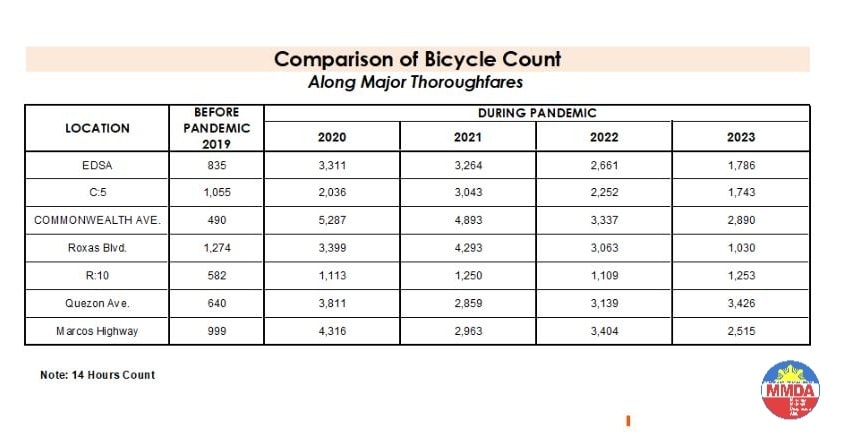
These are supposed to be official data as it is issued by the government agency in-charge of traffic management for Metro Manila roads (aside from its other functions and roles). What are not stated, and are actually very important details, are the locations of the counts and when the counts were conducted. The Traffic Engineering Center (TEC) that was under the DPWH and currently with the MMDA used to publish traffic volume maps for major roads in Metro Manila. So along EDSA, for example, the volume per section are shown on the map. The same for other major roads like Commonwealth, Quezon Avenue and SLEX. The thicker lines mean higher volumes along those sections, and vice versa. However, they did not consciously count bicycles (only motor vehicles) and perhaps MMDA only started counting during the pandemic (i.e., 2020). So there is no one value to represent a road. And counts vary over time of day, day of the week and even throughout the year (i.e., monthly variations).
There were many reactions to the MMDA’s posting of the data and most were critical and even derided the agency for what to them appeared to be inaccurate data. The problem is that it seems there are no other counts that can validate and perhaps refute the MMDA data. Previous bike counts were not conducted according to how the MMDA and DPWH count vehicles. That is, counts are typically done over a 14 or 16-hour period and ideally on several days in a year. Expansion and conversion factors are applied based on established stations along major roads that are supposed to have more frequent if not continuous counts. This methodology is how Annual Average Daily Traffic (AADT) is computed. Call it car-centric if you like but the methodology is very much applicable to bicycles as well. Peak hour counts for bikes are not enough and the peak hour factor for motor vehicles does not apply to bicycles (if this is to be used to expand/convert peak volumes to daily values). In fact, if you go into the math, there should be a peak hour factor for each type of vehicle considering each vehicle’s volume will vary differently over time. So yes, the solution here is to conduct bicycle counts according to how MMDA or DPWH counts vehicles and these should be done along several stations along major roads (e.g., those in the table above) to validate the MMDA counts.
More on this topic in the next post!
–
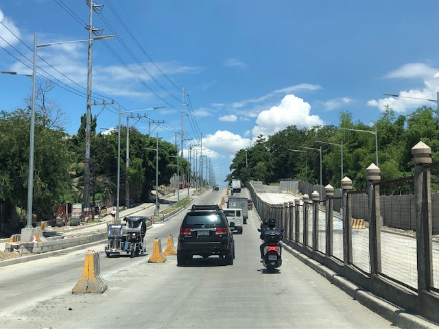
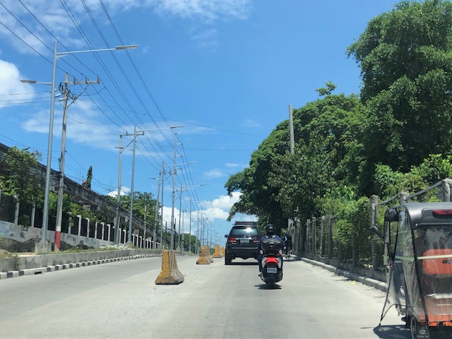
Widening of Gen. Santos Avenue, Taguig City
This is a very late post. I saw this draft that I made more than 7 months ago when I passed by General Santos Avenue in Taguig en route to Laguna where I was to attend a nephew’s wedding. General Santos Avenue is the road connecting C6 with the South Luzon Expressway (SLEX).
 Fence dividing traffic along either side of the road
 The fence stretches along a significant length of the avenue, effectively preventing people from crossing the street anywhere.
 Unfinished section (should be done by now) showing the original carriageway on the left. The new lanes due to the road widening project is on land acquired from the DOST lot on the right.
 It becomes clear in this photo that the median of the widened road is actually where the walls of the DOST compound used to be. Note the dead end where DOST land has not been expropriated yet for the road widening project.
 Either side of the road are DOST lands. The main compound is at right while the left is the MIRDC compound.
 The experimental Automated Guideway Transit (AGT) is found at the MIRDC compound.
More on similar cases in future posts. Road widening projects are very popular with the DPWH, and the agency has been criticized for being somewhat lazy or applying a non-imaginative approach to solve traffic problems. The project is a good example of DPWH fulfilling its mandate. Never-mind that this is not a sustainable approach to addressing transport problems.
–
Zamboanga’s first flyover
We passed by the construction site of Zamboanga City’s first flyover at the intersection of the Pan Philippine Highway (AH 26) and Veteran’s Avenue. I recall there was a lot of pressure from DPWH for the city to approve its construction. The previous mayor didn’t want to approve the project because the perception was that it was not required and there were other options to consider before a flyover was to be constructed. However, many people including the then congressman and now mayor probably thought the flyover would be the solution to the congestion experienced at the intersection. Add to that the perception that the flyover is also somewhat a symbol of progress.
We won’t know until its completion and the ‘normalization’ of traffic in the area to determine whether the flyover has ‘solved’ traffic congestion in the area. The problem with this approach to ‘solving traffic’ is that it is usually a short-lived alleviation of a symptom of the real problem, which is transportation. Zamboanga City has deferred rationalization of public transport routed despite analysis and plans pointing to a streamlined and optimized transportation system if this was pursued. The City commissioned a Transportation and Traffic Management Plan Study in the previous administration but the plan and its recommendations have been shelved, another example of such being casualties of a change in administration of an LGU.
–
Westbound bike lane along Ortigas Avenue Extension, Cainta, Rizal
I was not able to post these photos of the westbound bike lane along Ortigas Avenue Extension immediately after I shared photos of the eastbound bike lane. The bike lanes, as can be seen from the photos, are painted green.
 Bike lane past Valley Golf and STI
 Bike lane approaching Brookside (Sunset Drive) with the CK Square as a landmark
 Still a big issue for bike lanes is the presence of electric and communication poles/posts that have not been relocated after so many years since Ortigas Avenue had been widened.
 Bike lane across from Tapsi ni Vivian
 These photos were taken before the solar studs were installed to delineate the bike lanes and make them more visible at night or when its dark.
 Also, challenges and concerns for cyclists are parked vehicles and those maneuvering from the various establishments along the road. This photo pretty much captures those two concerns – a parked UV Express van and a truck maneuvering out of a store occupying the bike lane.
 Cyclist pedaling along the bike lane approaching the Shell Gas Station (where there is also a McDonald’s)
 Bike lane in front of the Ortigas Hospital just outside the Brookside Gate 1 and near Cainta Junction
More photos of the bike lanes soon!
–
Incorporating bike lanes along local roads – an example in Taguig City
I have not used an old route that we usually take to go to BGC from our place in Antipolo. This is via the Manila East Road, Highway 2000, Barkadahan Bridge and C6. From C6, we usually take Ruhale instead of Seagull Avenue as the former provided a shorter route towards Levi Mariano Avenue and C5. So it was only last weekend that I was able to see the improvements along Ruhale Street and how bike lanes were incorporated along this road. I am sharing the following photos showing a two lane road and Class 2 bike lanes.
 The green pavement markings indicate an intersection or driveway.
 Noticeable are the electric posts that remain along the bike lanes. These need to be transferred so they will not pose danger to all road users.
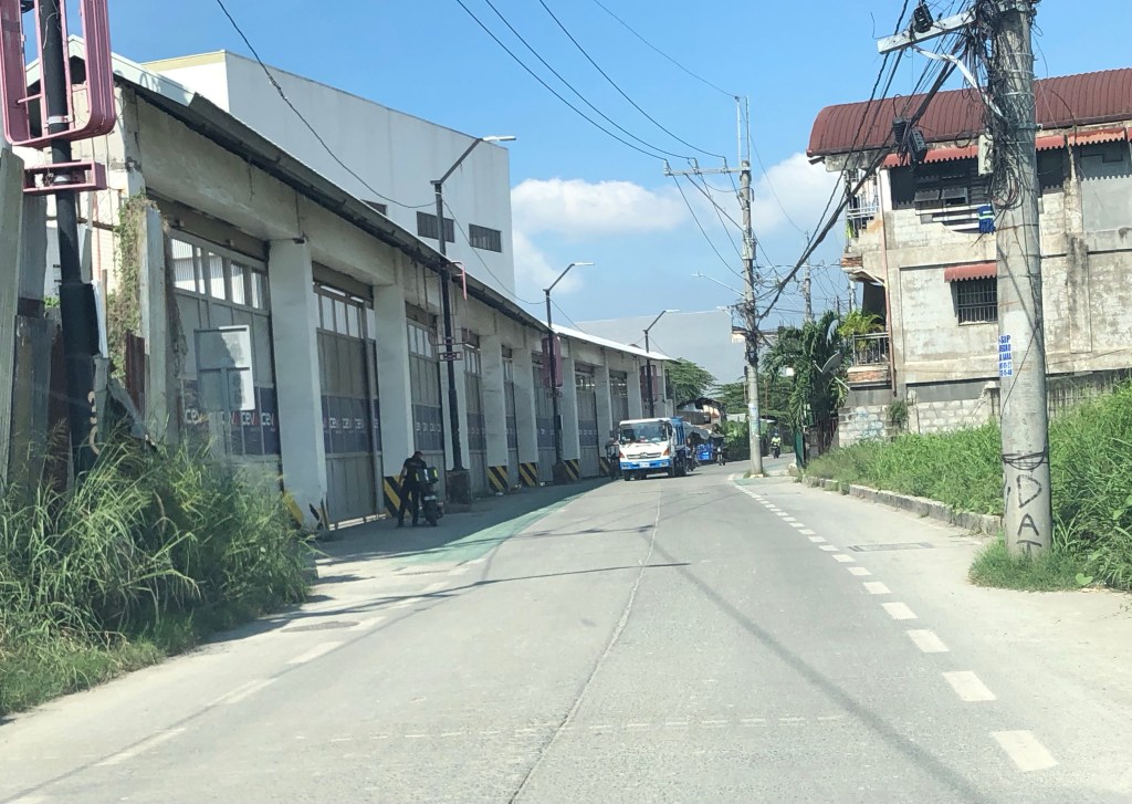 More electric posts along the bike lanes
 Bike lanes in front of an industrial establishment
 Close-up of a post in the middle of the bike lane.
 Bike lane across another industrial establishment. Again, note the green pavement marking across the driveway of the establishment.
 Bike lanes along a predominantly residential area along Ruhale.
I would consider this as a good practice example that can be replicated elsewhere. Of course, it is not perfect and as shown in the photos, there is much room for improvement including the transfer of electric posts that pose as hazards to all road users. The bike lanes are wide enough that installing bollards for the perception of physical protection vs. motor vehicles can be considered. Ruhale is generally a low speed, low volume road so perhaps the current state with no barriers would be enough for now. Also, we need to appreciate that these are already gains or wins in as far as active transport is concerned. A few years ago, this would not have been implemented by national or local governments.
–
