
Home » Posts tagged 'floods' (Page 2)
Tag Archives: floods
Flooded roads and some thoughts on flooding
I’ve always said that transport and traffic problems will always take a back seat to flooding. Traffic also takes a back seat to floods in this post. Issues like congestion and terrible public transport services are experienced by many everyday but basically do not stop people from their routines. Floods on the other hand are a major inconvenience that makes things like congestion or getting a ride during the rush hours much worse. Floods also have a way of making things stop as people cannot go to work and students cannot go to school. It seems that whenever there are floods, everything grinds to a halt and productivity takes a dive. Such losses, of course, are in addition to the cost of damages directly brought about by the floods.
The following photo was taken by a staff of our office who was going around near his home. Fortunately, their place was not flooded so that afforded him time to go around and take some photos of the swollen Marikina River along Marcos Highway in the Pasig-Marikina border.
 Marcos Highway Bridge over a swollen Marikina River – not visible in the photo is the road leading to FVR Road and C-5, which is usually subject to flooding. The tall building in the background is SMDC’s Blue condominium along Katipunan Avenue. [Photo credit: Roy Velasco, NCTS, September 2014]
These extreme floods have been happening more frequently lately. I think these extreme rain events brought about by typhoons or monsoons are the norm now and we should be more prepared than ever in dealing with such heavy rainfall. Flooding can be alleviated if not eliminated and the experiences of some flood-prone LGUs can help us in determining suitable approaches to alleviate the problem and mitigate its impacts.
The philosophy applied by previous administrations of Marikina City did not have the objective of eliminating flooding. That was too expensive for a growing city that needed to put resources to other aspects or areas of development. The main objective was to alleviate flooding; mainly to reduce the depth as well as the duration of flooding. That is, instead of having waste-deep waters, perhaps knee-deep would be more tolerable. And instead of having to deal with flooded homes or streets over a day or more, half a day would make life better for people affected. The key was to address issues that led to severe flooding. Such issues include poor drainage stemming from inadequate maintenance of facilities and the still tremendous amounts of garbage irresponsibly disposed off by people, especially those living near waterways.
Marikina, Antipolo and Cainta at least should consider building retention basins in order to mitigate serious flooding. A lot of waterways were lost as residential subdivisions were developed and developers responsible for these should bear part of the burden by doing their part (e.g., identifying and turning over or donating lands than can serve as sites for the basins) in helping alleviate flooding. One friend pointed out that the critical time for flooding would be when rains are heaviest (e.g., last Thursday to Friday for Mario or the 6 hours of extreme rains by Ondoy in 2009). Basins should be designed so they can accommodate waters from the rains during the critical period so that instead of neck-deep floods, perhaps there will only be knee-deep or waist-deep waters. Yes, there will still be floods but they will be more tolerable and perhaps faster to dissipate than when you don’t have the basins to mitigate such events. There will be significant costs for such facilities but then the costs surely don’t compare to the annual losses that can be attributed to flooding and relocating whole communities definitely is much more costly and is not an option for those in the Marikina Valley and other food prone areas. Floods have been issues for many LGUs during elections and whoever can come up with a good plan to alleviate flooding will surely win a lot of votes.
–
All weather transport
The flooding brought about by heavy rains around the country rendered many roads impassable to motor vehicles. This meant traffic congestion in many areas and so many commuters being stranded due to the lack of public transport vehicles available to them. In these times, the only modes for traveling are reduced and limited to walking and non-motorized tranport (NMT). While cycling is an option for some people, a more popular mode in many areas and local roads are pedicabs. Known by various names in the vernacular such as padyak, trisikad, sikad, etc., these three wheelers are found providing transport services particularly in residential areas. These tend to use national roads and busy streets in cities, and such often causes conflicts with motor vehicles as the NMTs slow down traffic. During times of heavy rains due to typhoons or the monsoon, pedicabs become the mode of choice for many who need to get to their workplaces, schools or home despite flooded streets.
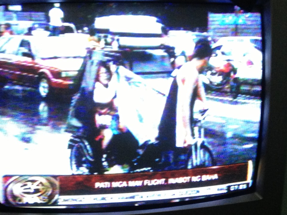 Photo of TV news report (GMA News’ 24 Oras) on air passengers taking pedicabs in order to get to the airport and catch their flights. Traffic was terrible due to floods along airport roads and only the non-motorized transport could navigate the flood waters. Interviews of passengers including tourists and foreigners showed their appreciation of the alternative mode of transport they had to take to catch their flights.
 Pedicab service along a flooded residential road – special rates are often charged by pedicab drivers during the rainy season and when go into flooded streets. Regulated fares are charged in areas like residential subdivisions where homeowners associations have a say in fare rates. In other places, fares can be arbitrary or according to the willingness to pay of prospective passengers.
 Bicycles are becoming popular for commuting not especially due to floods but more because of increasing fuel prices and fares. There is also an influx of second-hand or used bicycles from Japan (Note: Jitensha is bicycle in Japanese). These have become collectibles but are in actual use by their owners like the bikes shown in the photo that were exhibited at a mall recently.
–
Floods and traffic
Transport and traffic problems take a backseat to the flooding problem during this time of the year in the Philippines. Since there are practically only two seasons (dry and wet) in the country, floods become a genuine concern once monsoon rains arrive and these are usually complicated by a high frequency of typhoons between August and November. Many major roads in Metro Manila are prone to flooding including Espana Avenue, Araneta Avenue, Gil Fernando Avenue, Ortigas Avenue, and EDSA. Flash floods often lead to traffic congestion and commuters and motorists alike would have a hell of a time traveling yet it seems very little has been done to address a situation that’s been here since the Spanish period. This is a perception by many people and a reasonable one given the historical evidence of flooding in the area and elsewhere in the country.
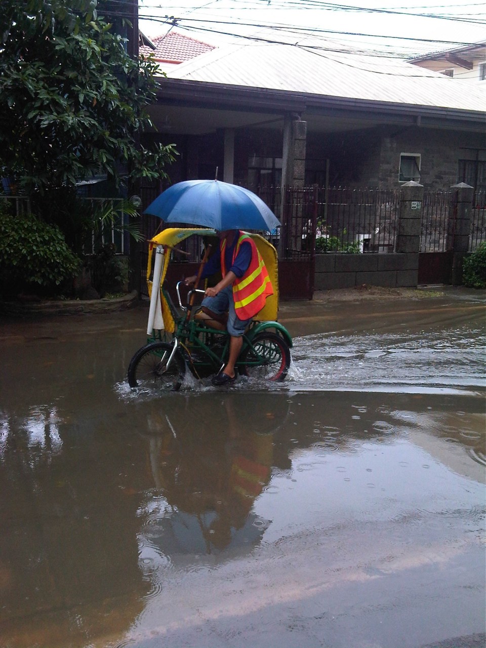
 Pedicab ferrying passengers in a flooded residential area
There are many images on the current floods in Mega Manila that one can find in various reports online and on TV. The Telegraph provides good photos for describing the situation around Metro Manila and the surrounding areas, and especially in the low-lying areas like Marikina, Malabon, Rodriguez and Cainta. These images could have been taken in any other year in the past and the images would probably be the same with slight changes in some buildings that could have been improved (e.g., additional floor?) in response to the flood experience.
Floods and possible solutions have been the topics of discussions every year and usually during this rainy season. While there have been efforts to address this problem, these are usually and obviously not enough and a more comprehensive approach is needed. Quite obviously, too, solutions that tend to dig up faults in urban planning throughout Metro Manila have led nowhere as legitimate residents and other locators in these areas are not in a position to give up their properties just like that. Relocating informal settlers and others who have encroached from waterways and other critical areas is a start but will have limited impacts in part because Mega Manila does not have a good drainage system in the first place.
Expensive as they are, engineering solutions like perhaps what Tokyo has done in this underground wonder. Of course, this example is a kind of ultimate solution and would require tremendous resources to realize. But then this is also like the transport and traffic problems we are experiencing where years (or decades) of inaction and hesitation due to resource and technical questions have led to the despicable transportation we have now The reality is that solutions will not get cheaper as we continue to balk at the cost of the required solutions. Floods and traffic will not be solved overnight. It will take years to improve the lives of many people in flood prone areas and implementing solutions should have started yesterday.
