
Home » Posts tagged 'infrastructure' (Page 2)
Tag Archives: infrastructure
Roads, railways support needed for airport upgrades — analysts
Here’s a quick share on an article on the infrastructure needed to support airport development:
Source: Roads, railways support needed for airport upgrades — analysts
Unlike many capital airports including Malaysia’s Kuala Lumpur International Airport and Bangkok’s Suvarnabhumi International Airport, Ninoy Aquino International Airport does not have rail or mass transit access. It will eventually have rail access via the currently under construction Metro Manila Subway. The airport construction in Bulacan should also have transit access in order to make it more accessible to passengers and other airport users. Railways will provide an alternative to road-based transport that would probably require much road space and likely lead to congestion just like what we experience around NAIA at present.
–
The journey to PHL’s railway renaissance
Here is a quick share of an article on railway development in the Philippines. It certainly took a while for railway development to get underway with considering rail transit would probably had a major impact on commuting particularly in Metro Manila and highly urbanized cities like Cebu and Davao that require mass transit systems to alleviate congestion.
Source: The journey to PHL’s railway renaissance
The article though doesn’t contain a narrative on the journey but rather only a summary of the rail projects that are currently being implemented as well as those in the pipeline. It would be a nice to have a more historical approach to this so-called journey so we can have an objective look at what happened to our railways from the 1970s when its decline began until the last few years when a so-called renaissance came to be.
–
Planning for True Transportation Affordability: Beyond Common Misconceptions
How much do we spend on transportation as part of our budgets? Is it 5% of your monthly budget? Is it 10%? Or is it eating up a substantial part of what you’re earning?
Source: Planning for True Transportation Affordability: Beyond Common Misconceptions
To quote from the article:
“This research indicates that many common policies favor expensive transportation and housing over lower-cost alternatives, which drives the cost of living beyond what is affordable, leaving too little money to purchase other necessities. The result is immiseration: growing stress, unhappiness, and discontent.
The solution is simple: planning should favor affordable over expensive modes and compact development over sprawl. This is not to suggest that automobile travel is bad and should be eliminated. Many people are justifiably proud of being able to afford a nice car, and automobiles are the most efficient option for some trips. However, automobile travel requires far more resources and is far more expensive than other modes, typically by an order of magnitude, so true affordability requires an efficient, multimodal transportation system that allows travelers to choose the options that truly reflect their needs and preferences.
Affordability requires a new economic paradigm; rather than trying to increase incomes or subsidies we need to increase affordability and efficiency so households can satisfy their basic needs consuming fewer resources and spending less money. Our planning should be guided by a new goal: how can we help families be poor but happy.”
I share this article because it provides a more complete narrative and assessment than those just focusing on transport. Home choice locations and affordable housing are part of the equation. Looking at transport alone can be myopic and leads us to think it is the only problem to solve.
–
On the future of transportation – some history lessons
I found this interesting article that basically is a history lesson on transportation systems and infrastructure:
Dillard, G. (October 21, 2024) “Our infrastructure is Not Our Destiny,” Medium.com, https://medium.com/the-new-climate/our-infrastructure-is-not-our-destiny-6d7f8355144a [Last accessed: 11/17/2024]
To quote from the article:
“We’ll never build out a network of electric-car charging stations, they say, or How could we possibly replace all of these highways with mass transit? But the infrastructure that dominates our world today once seemed impossible, until it didn’t…
As we begin to imagine a new way of organizing our economy, let’s remember that infrastructure isn’t destiny, nor is it forever. Today, our fossil-fuel present may feel like the only “practical” way to do things — just as the canals, and then the railroads, once felt like the only possibility.
So the next time a transition away from cars, fossil fuels, and the other technologies that dominate our world seems impossible, think about Hermon Bronson and Robert Fulton, who surely thought that canals were the infrastructure of the future. They were wrong, and so are the people who tell us that it’s impossible or impractical to build a greener world.”
Perhaps we can take a look at our transportation infrastructure development history and the way it’s going now. It would be good to contextualize all those planned tollways and inter-island bridges against what is really most urgent these days (i.e., mass transit, active transport for our rapidly growing cities). I’ve always stated here about how some infra are nice to have but aren’t as urgent as others that need more push and support and will be utilized by and benefit more than fewer people.
–
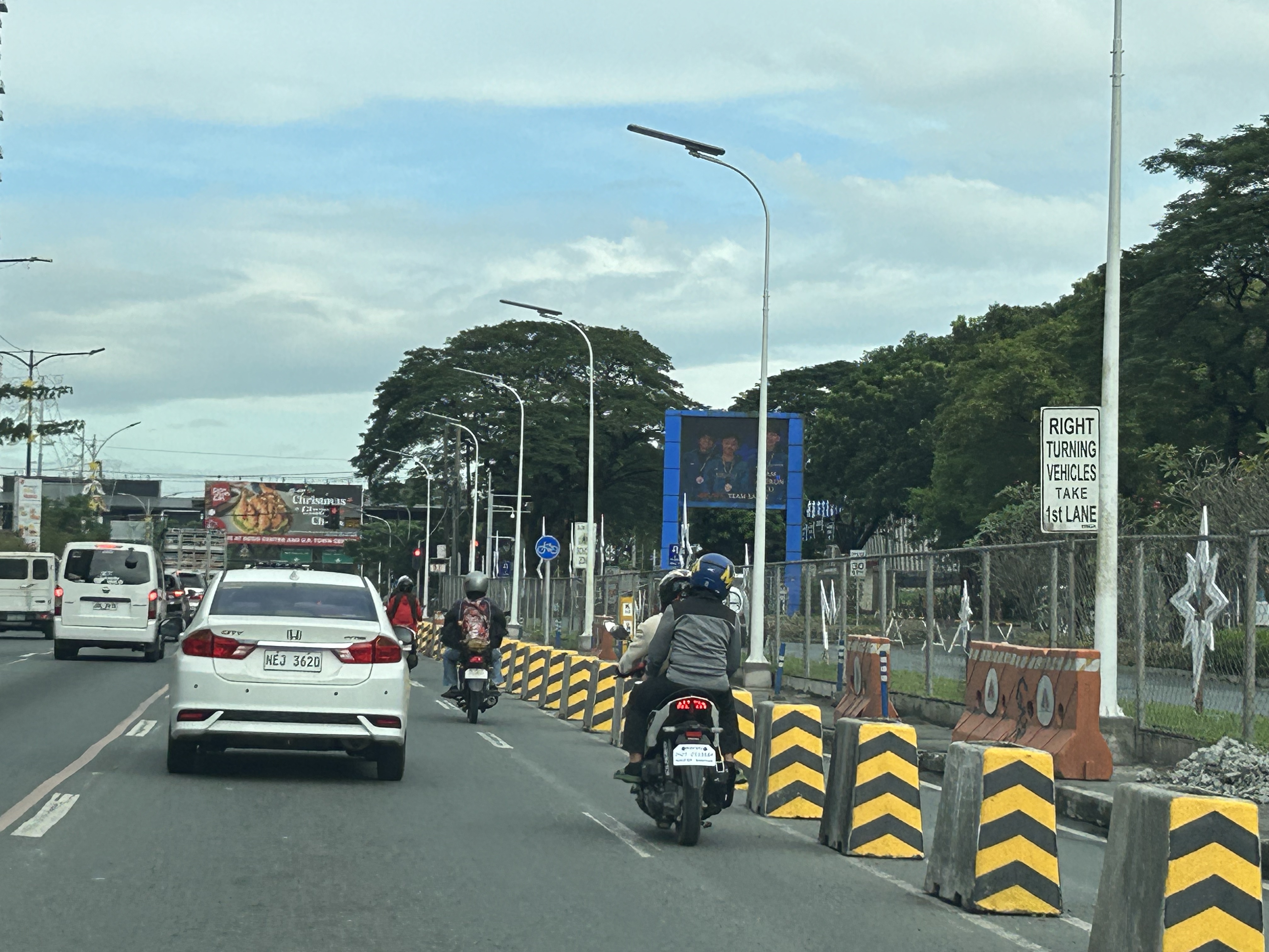
Skyway to the south
Instead of going via C5 and then SLEX en route to Tagaytay last week, we opted to take the Skyway via Quezon Avenue. The travel was smooth between 6:30 AM and 7:30 AM maybe because it was a Thursday and regular classes have not yet resumed (i.e., less trips). Note the counter flow lane adjacent to the median? This is implemented likely due to the experience of heavier traffic along the northbound (Metro Manila-bound) direction during the mornings. I wonder if the reverse is implemented in the afternoons/evenings.

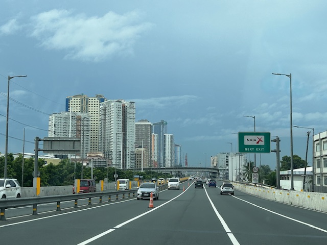
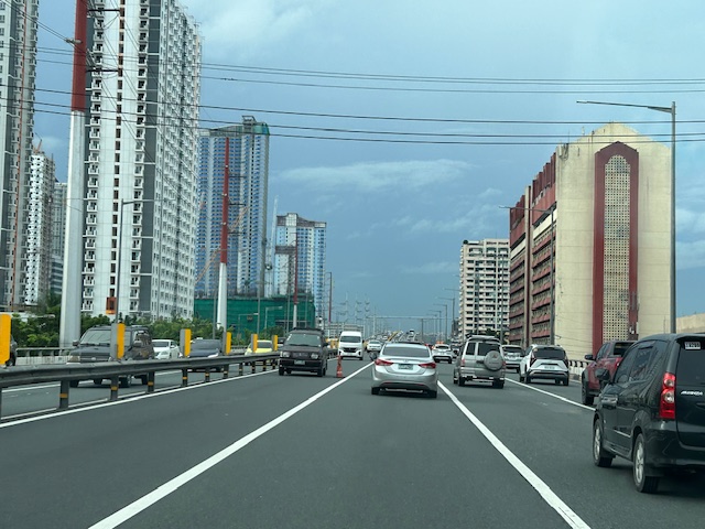
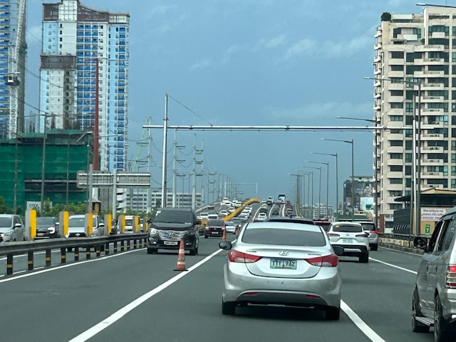
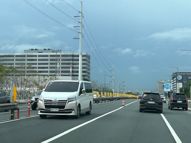
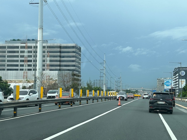


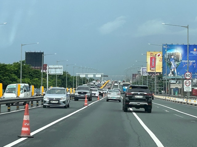
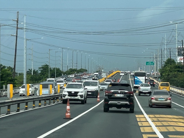
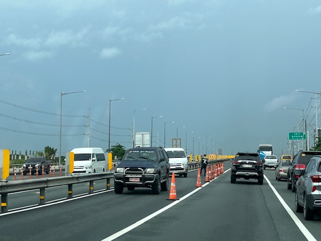
Note that there was more traffic as we traveled between Makati and Muntinlupa. The traffic represented commuters residing in the south and traveling to Metro Manila for work purposes.
Bridges between Cebu and Mactan
Our route to the airport was via the Marcelo Fernan Bridge (the second bridge connecting Cebu and Mactan Islands). While on the bridge, I saw this opportunity to take a photo. That photo shows all three bridges currently connecting the two largest islands of Cebu Province.
 In the distance is the CCLEX Bridge (Cebu – Cordova Bridge) that connects Cebu City’s South Reclamation Project (SRP) and the town of Cordova in Mactan Island. CCLEX is a cable stayed bridge and the third to connect Cebu and Mactan. Closer is the first Mactan-Mandaue Bridge or simply First Bridge is a steel truss bridge. The bridge we were on, the Marcelo Fernan Bridge, is also a cable stayed bridge.
A fourth bridge is planned and should soon be constructed to the north of the second bridge.
–
On bike lanes network development – examples in the US
I am sharing this article on the best new bike lanes in the United States:
Haggerty, M. (January 12, 2024) “The Best New U.S. Bike Lanes of 2023,” People for Bikes, https://www.peopleforbikes.org/news/the-best-new-u.s.-bike-lanes-of-2023 [Last accessed: 1/23/2024]
Quoting from the article:
“Even for the most ardent naysayers, it’s difficult to deny that the landscape of bicycling in America is transforming (although not as quickly as many of us would like to see). While we have yet to see any U.S. cities emerge with truly bold citywide plans for bike networks as we’ve seen in places like London, Paris, and Bogota, many are (slowly) beginning to envision a future where cycling takes center stage. Although there remains a substantial amount of work ahead of us to cultivate a safe and comfortable environment for people of all ages and abilities to ride bikes in the U.S., it’s well worth pausing to commemorate the significant infrastructure victories U.S. cities achieved in 2023.”
The quote above also applies to us in the Philippines where there are still few examples of safe and comfortable bike lanes. I shared the same article on my social media page asking aloud if there’s something like this in the Philippines. I am aware of the Mobility Awards but that’s supposed to cover everything on mobility and particularly walking and cycling. The list is about bike lanes and touches on the various designs (note that in the US, while there are federal guidelines, most if not all states and cities would have their own that they use for planning and design of bicycle facilities). It would be nice to have our cities develop guidelines while also referring to the minimum standards in the DPWH Guidelines. Of course, the challenge is to come up with good if not the best designs and not just comply with the minimum.
 If there was an award for best new bike lanes in 2023, I think Quezon City will have several nominees and even win the award with one. Picture above is the bike lane along Katipunan Avenue/C5.
–
Article share: Drought and the Panama Canal
Here’s a quick share of an article on how a drought is affecting operations of the Panama Canal:
Eavis, P. (November 1, 2023) “Drought Saps the Panama Canal, Disrupting Global Trade,” Wired, https://www.nytimes.com/2023/11/01/business/economy/panama-canal-drought-shipping.html?unlocked_article_code=1.7kw.9CNJ.NKhQS8RCMh9h&smid=url-share [Last accessed: 11/3/2023]
From the article:
“But a drought has left the canal without enough water, which is used to raise and lower ships, forcing officials to slash the number of vessels they allow through. That has created expensive headaches for shipping companies and raised difficult questions about water use in Panama. The passage of one ship is estimated to consume as much water as half a million Panamanians use in one day…
Without a new water source, the canal could lose significant amounts of business. Other ocean routes are, of course, longer and more expensive, but they are less likely to have unpredictable delays. One alternative is to transport goods between Asia and United States through the Suez Canal to the East Coast and Gulf Coast. Another is to ship goods from Asia to the West Coast ports — and then transport them overland by train or truck…”
I suddenly remembered the current work along the Marikina River. The government is supposed to be working towards making the river navigable for the Pasig River Ferry to extend operations there. However, the depth of the river prevents regular, reliable operations. I wonder if the current project that includes flood control, riverside roads and erosion control components also will lead to a navigable depth for the river for most if not the whole year.
–
Article share: On the benefits of sidewalk networks
Here is another quick share of an article by Todd Litman on Planetizen. The article contains a lot of information or data about why we should be investing in sidewalks or pedestrian facilities (i.e., for walking).
Litman, T. (August 6, 2023) “Completing Sidewalk Networks: Benefits and Costs,” Planetizen, https://www.planetizen.com/blogs/124999-completing-sidewalk-networks-benefits-and-costs?utm_source=newswire&utm_medium=email&utm_campaign=news-08142023&mc_cid=cd3b2e2ba5&mc_eid=9ccfe464b1 [Last accessed: 9/23/2023]
To quote from the article:
“Walking is the most basic and universal travel mode, and sidewalks are the most basic walking infrastructure, but they are often overlooked and undervalued in transportation planning. Completing and improving sidewalk networks can help achieve many economic, social and environmental goals.
Recent case studies indicate that typical North American communities spend $30 to $60 annually per capita on sidewalks, and would need to double or triple these spending levels to complete their networks. This is a large increase compared with current pedestrian spending but small compared with what governments and businesses spend on roads and parking facilities, and what motorists spend on their vehicles. Sidewalk funding increases are justified to satisfy ethical and legal requirements, and to achieve various economic, social and environmental goals. There are several possible ways to finance sidewalk improvements. These usually repay their costs thorough savings and benefits.”
–
On using advanced tools for infrastructure assessments
I came upon this article on how transportation departments in the US are using tools such as drones to assess critical infrastructure including roads and bridges. This is very relevant to us especially as many similar infra are aging and would need to be assessed to determine how to reinforce, retrofit or even rehabilitate certain infrastructure vs. naturally occurring phenomena like earthquakes and typhoons.
Reed, J. (August 2, 2022) “How Transportation Departments Are Using Advanced Drone Technology for Infrastructure Assessments,” Aviation Today, https://www.aviationtoday.com/2022/08/02/transportation-departments-using-advanced-drone-technology-infrastructure-inspections/ [Last accessed: 8/4/2022]
To quote from the article:
“The WVDOT may expand its drone programs to perform road safety assessments and to assist in designing new road routes by providing topographical maps.”
I recall that there have been road-based surveys involving Lidar to map the road and adjacent land surfaces about a decade ago (maybe less). This was a nationwide project funded by the Department of Science and Technology (DOST) and implemented by the University of the Philippines Diliman’s Department of Geodetic Engineering. I’m not sure where that data is stored or hosted but the DGE should have a back-up somewhere that can be used or further processed for road safety assessment applications. This could be an interesting and fruitful research area that can involve people from various disciplines.
–
