
Home » Posts tagged 'infrastructure' (Page 3)
Tag Archives: infrastructure
On the benefits of developing and investing in active and public transportation
Here is another quick share of an article with a very relevant and timely topic – the business case for multimodal transport planning:
Litman, T. (July 2022) “The Business Case for Multimodal Transportation Planning,” Planetizen, https://www.planetizen.com/blogs/117697-business-case-multimodal-transportation-planning?utm_source=newswire&utm_medium=email&utm_campaign=news-07142022&mc_cid=03c159ebcf&mc_eid=9ccfe464b1 [Last accessed: 7/15/2022]
To quote from the article:
“Conventional planning tends to undervalue non-auto mode improvements by assuming that each additional mile of their travel can reduce, at best, one vehicle mile traveled. In fact, in many situations they can leverage much larger reductions in vehicle travel, meaning that each additional mile of walking, bicycling, or public transit can reduce more than one vehicle mile … As a result, walking, bicycling and public transit improvements can provide much larger vehicle travel reductions and benefits than is commonly recognized.”
There is a box referred to in the preceding quote. I will not reproduce it here so I leave it up to the reader to go to the original article by Litman to find out how active and public transport can leverage additional travel reductions. Understanding these and the extend by which we can be independent of car-use (referring to non-car travel demand) will allow for a better appreciation, travel-wise and economics or business-wise, of the advantages of developing and investing in active and public transportation infrastructure and services.
–
Flashback: Transport Infrastructure Framework Plan for the Philippines
I was reading an article yesterday about the outgoing NEDA Director General stating that Philippines needing a long term strategy for infrastructure development that will address the shortcomings or gaps due to unsolicited proposals. There was already something like this drafted almost a decade ago and under the auspices of the returning NEDA DG. Unfortunately, while NEDA accepted the Final Report of the study, they never adopted it as a policy that could also be imposed on agencies like the DOTr (still DOTC back then) and the DPWH. So for a sort of Throwback Thursday and on the last day of the Duterte Administration, I am sharing the promotional video produced for the framework plan that was supported by The World Bank.
The study was conducted by Cambridge Systematics (not related to Cambridge Analytics as far as I know) and was implemented at the same time as the JICA Dream Plan study for Mega Manila. I recall there is also a video on the latter and it listed all the infrastructure projects needed to address the transport problems of the Greater Capital Region. The Infra Framework Plan for the country mentions the various infrastructure projects ongoing and proposed for the Philippines but focuses on the soft side (i.e., strategies) including the reforms and institutional set-up that need to be in place for everything to come together and produce the desired outcomes in the long term. Sadly, strategies and plans are not well appreciated despite their being essential as foundations. While the Build, Build, Build mantra of the outgoing administration is worth praising for attempting to do the catch-up needed in as far as certain transport infrastructure is concerned, it falls short of what are necessary and to be prioritized. Instead, it ended up accommodating projects that are “nice to have” but should not be prioritized considering our limited resources and the undesirable foreign debt racked up by government. Hopefully, the returning NEDA DG and other officials will be able to steer the country clear of the current and future crises that may end up bringing more hardships on Filipinos.
–
Tagbilaran – Panglao Airport Departure
With the recent popularity of my post on the Tagbilaran-Panglao Airport, I was encouraged to write this second part about the airport. Following are photos taken during our departure from Panglao. I took photos from the driveway, the check-in area and the pre-departure area and lounges. I hope this helps my readers including and especially travelers and tourists.
 Curbside at the new airport – the area is very spacious and should be able to handle the steadily increasing number of passengers and well-wishers at the airport.
 Passengers alight from their vehicles near the Philippine Airlines office at the terminal.
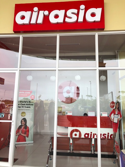 Air Asia ticket office near the terminal curbside
 Spacious check-in area – I was just discussing the requirements and standards for check-in counters and frontage to my students this last semester.
 Check-in counters for PAL
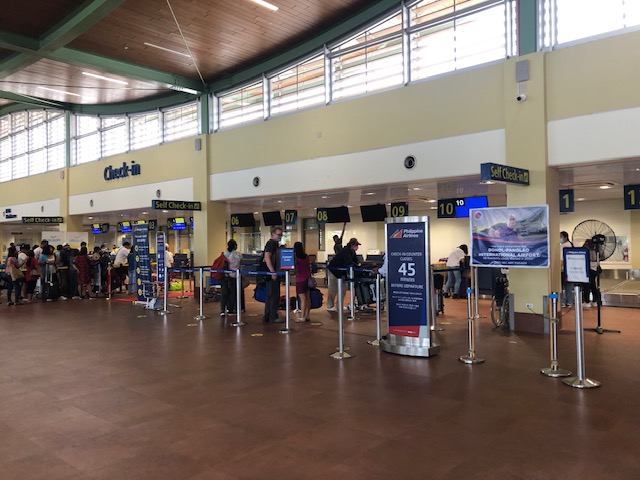
 The check-in counters for Cebu Pacific were crowded when we arrived at the terminal.
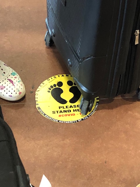 Stickers on the floor mark where passengers are supposed to position themselves to comply with health protocols (i.e., social distance).
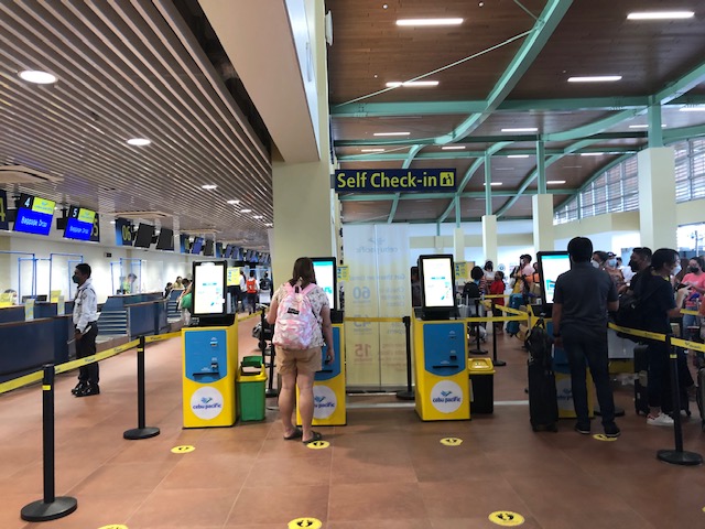 CebPac has their self check-out portals at the airport for those who have not done their online check-in and to facilitate and expedite check-in procedures.
 There’s a separate section for international departures. The airport used to service international flight (before the pandemic). I assume this is where immigration (i.e., passport and visa control) and customs would have been located for International travel.
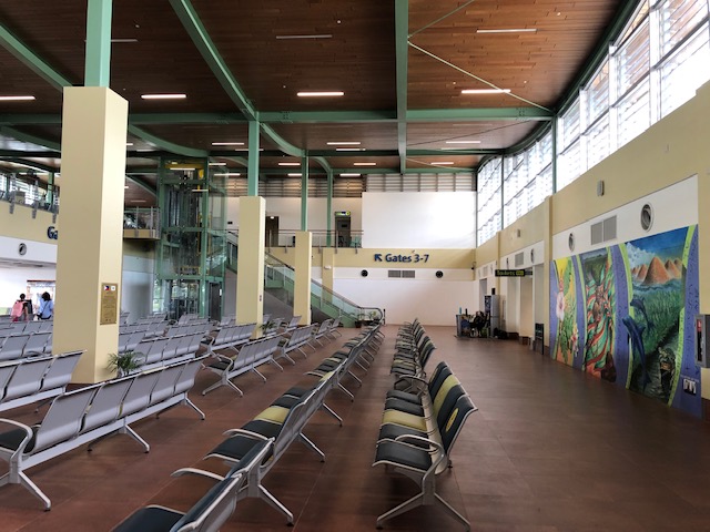 After checking-in, travelers are greeted by very spacious lounges
 This is the ground floor. Visible is the elevator and escalators to the second level pre-departure area for domestic flights. I assume this is a mirror image of the international departures wing.
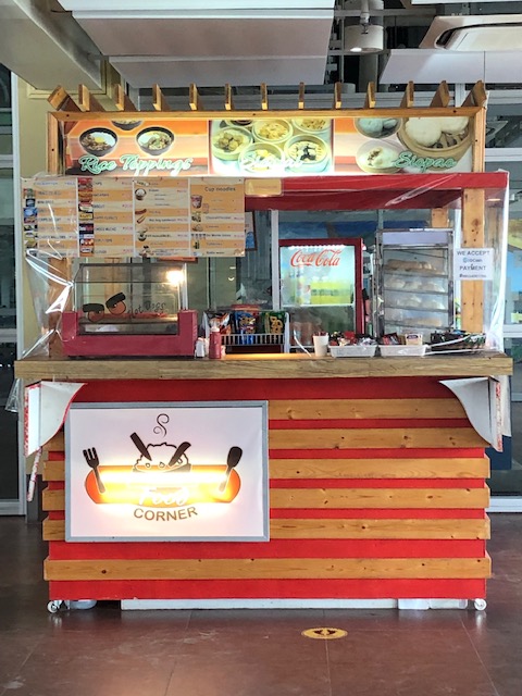
 Unfortunately, there are only two kiosks at the terminal when we were there. One is this stall that sells snacks, sandwiches, instant noodles, and soft drinks and water. There are no souvenir shops or stores for last minute pasalubong shopping.
 A view of the tarmac from the lounge
 The elevator to the second level lounges and boarding gates.
 Stairs and escalators to the second level
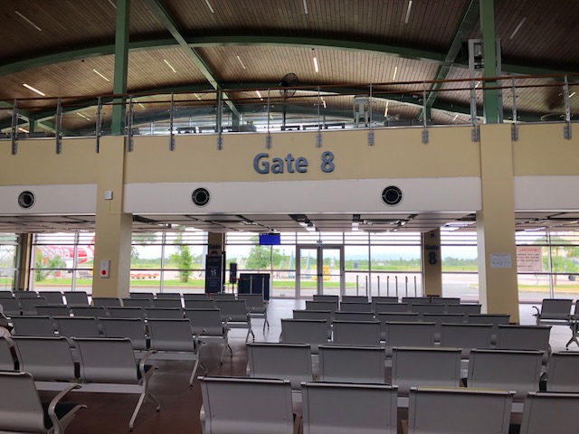
 One of the boarding gates at the second level
 The second level pre-departure area
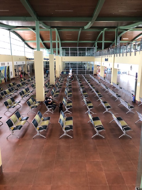 A look at the ground floor
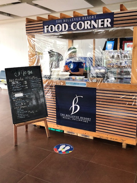 The other kiosk is by The Bellevue Resort. Their coffee is good but they ran out of food at the time we were there. We thought this was not good considering there were other flights scheduled for the rest of the day and passengers will end up with very limited or no options for meals before their flights.
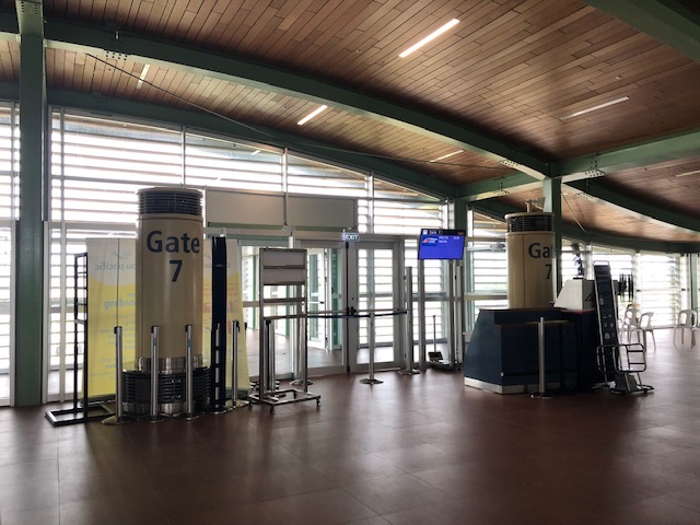
 Another look at the boarding gate and kiosk at the ground level
 Another look at the other kiosk at the pre-departure area that sells snacks, light meals and drinks.
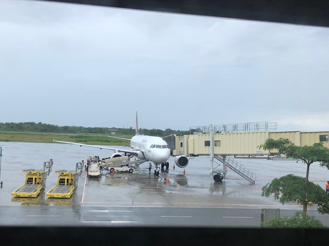
 Passengers walk towards the tube connecting to aircraft
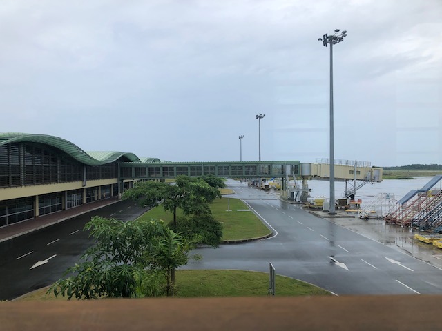
 Bridge connecting the terminal to the aircraft
 A PAL plan taking off
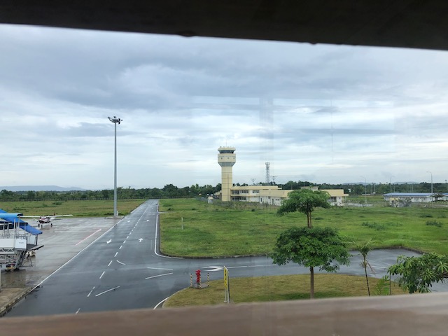
 The airport control tower
 Baggage being transport for loading unto the aircraft
 A family walks to board the awaiting aircraft bound for Manila.
 A view of an Air Asia plane that had just arrived and with its passengers just starting to deplane.
This airport is probably one of the better airports in the country now. There is a new airport in Bicol (replacing the old Legazpi Airport) that just started operations recently, which I have yet to visit but is likely better than Panglao in terms of shops and stores. Facilities-wise, this is a modern gateway that should serve the projected number of passengers for Bohol for the next so many years including the expected international operations for the terminal. We are still in the midst of the pandemic but the number of travelers is steadily increasing. And so I wonder how the airport will be once the ‘old normal’ number of visitors return.
They definitely need more shops and stores than the current two kiosks at the airport. They also would need to improve on the ventilation and air-conditioning (it was quite humid inside the airport when we were there – the aircon was not functioning). As a tourist, I am already looking forward to the next trip to Panglao. Hopefully, the airport will be even better on that next trip.
–
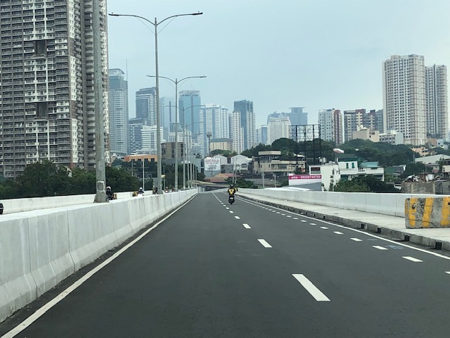
Kalayaan Bridge (BGC – Ortigas Center Link)
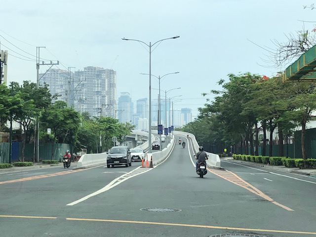
The Kalayaan Bridge, also known as the Bonifacio Global City (BGC) – Ortigas Center Link opened about a year ago and was supposed to ease traffic along the usual routes along EDSA and C5 that crossed the Pasig River. The new bridge is located between the EDSA and C5 bridges and is a more direct route to and from BGC if you reside in Pasig and choose the route to/from BGC via Pasig/Shaw Boulevard.
 The approach ramp to the bridge from the BGC side is in the vicinity of the Uptown part of BGC. The bridge goes over Kalayaan Avenue, which is one of the major access roads to BGC from C5 or EDSA, and J.P. Rizal Avenue Extension but there is access and egress to Kalayaan Avenue.
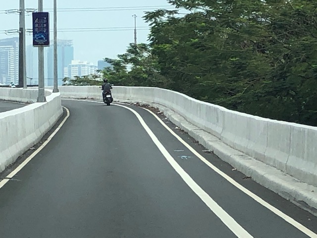 The ramp is practically a single lane with painted bike lanes on either side of the bridge. There is noticeably no space for pedestrians on this bridge. That is only a curb on the right side. This lack of pedestrian provisions is a major flaw of this bridge.
 A lone cyclist traversing the bridge – the merge for traffic from BGC and vehicles from Kalayaan Avenue is seen downstream.
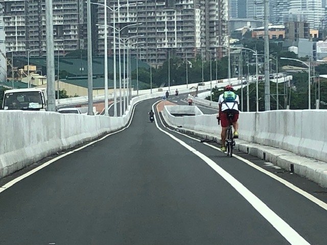
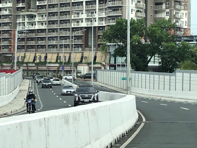
 Approaching the merging section (from this perspective; its diverging on the other side) of the bridge.
 A motorcycle merges with the traffic from BGC. Notice the chevron markings separating merging flows as well as the yield marking for vehicles coming from Kalayaan (i.e., priority is for vehicles coming from BGC). The bridge from this section becomes two lanes per direction. There is, however, a risky part for cyclists who will cross paths with vehicles coming from Kalayaan. Cyclists from BGC will have to cross a lane to get to the bike lane on the outer side of the bridge. There is no space for pedestrians along this bridge.
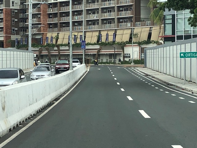
 There is only this part of the bridge where there appears to be a sidewalk. Was this really the design for this bridge? It is very obvious that many people failed in both design and implementation of this project.
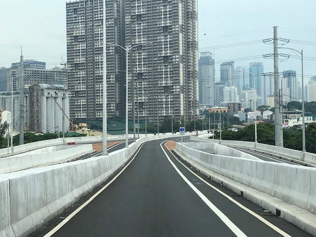
 The view towards the Pasig side of the bridge. There are two lanes per direction and narrow bike lanes along the curbsides.
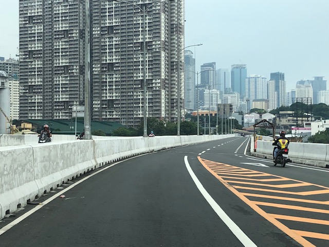
 There is an intersection at the end of the bridge but the road immediately at the right is closed to incoming traffic so right turns are currently prohibited despite the pavement markings that indicate they were allowed at one time.
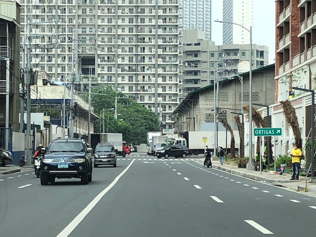 The road leads to this intersection which is in area generally referred to before as ‘Pioneer’. The area hosts many warehouses or storage buildings and I remember going here many years ago to check out the imported wood furniture and office surplus items. Turning right leads one to the area generally known as ‘Unilab’ because that was where United Laboratories had their plant and offices. It retained the property where now stands an events venue. Further on leads you to Kapitolyo and the Estancia Mall.
–
Tagbilaran – Panglao Airport Arrival
The last time we were in Bohol, the airport was still in Tagbilaran City. One had to travel about 45+ minutes if you were staying at a resort in nearby Panglao Island that is part of the province. The old airport was closed (the runway though served as a venue for ) and replaced by a new airport. This one is located in Panglao Island and close to the resorts that are the main attraction of the province.
 We deplaned via tube/bridge at the new airport terminal
 A photo of the control tower from the bridge
 Did the airport terminal architecture take inspiration from Bohol’s famous Chocolate Hills?
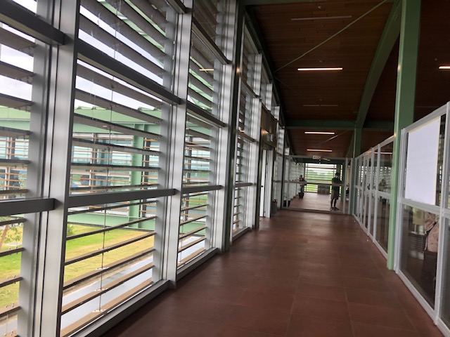 The corridors were well lighted, again thanks to the building design.
 Our plane at the tarmac or apron unloading luggage and cargo
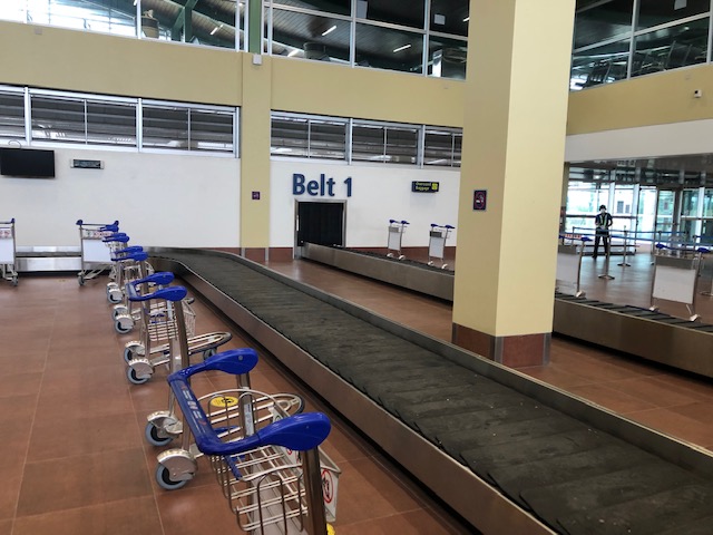 We arrived at the baggage claim area ahead of most people. The carts were already placed across the conveyor belt by airport staff.
 Belt 2 on the other side is for international arrivals. The airport already served international flights before the pandemic. These have yet to resume.
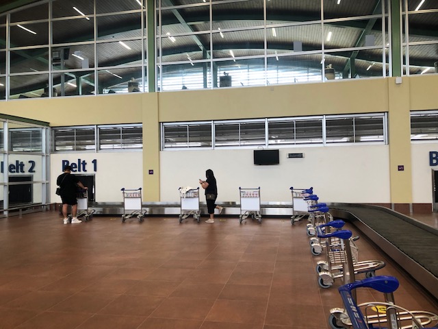
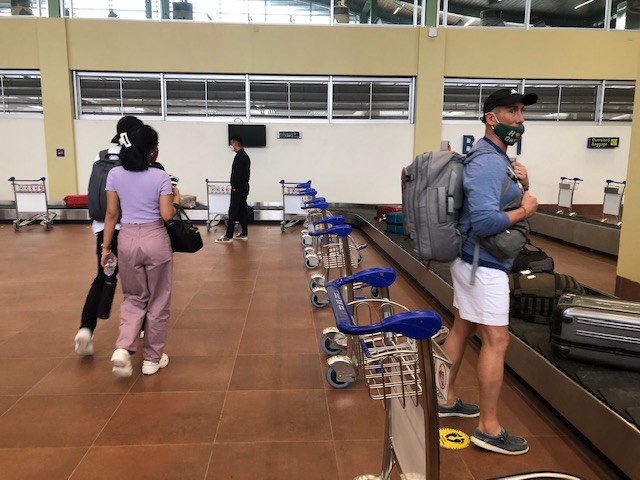 Passengers file unto the baggage claim area to pick up their luggage.
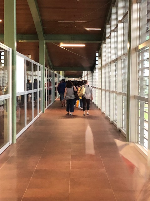
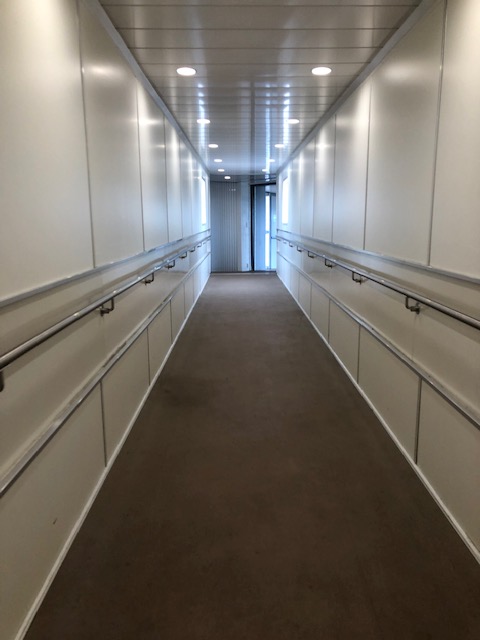
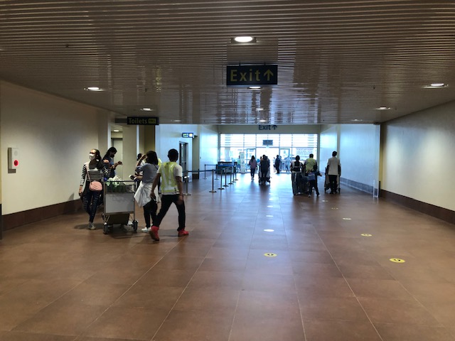 The hallway towards the terminal exit. The toilets are on the left side of the hallway.
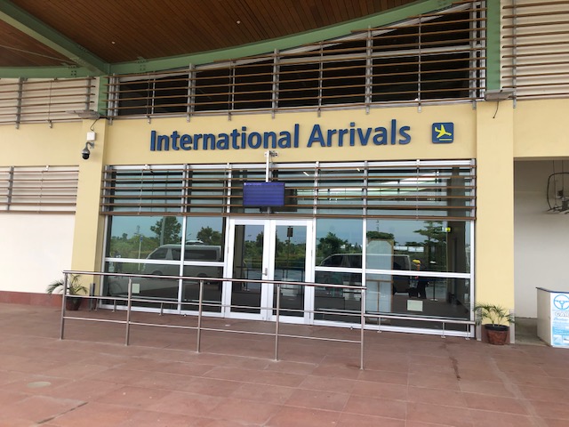
 The sign indicates international arrivals. The airport currently does not serve international flights but these will likely resume once the pandemic threat is clearly contained. Other airports like Iloilo and Bacolod have also suspended international flights.
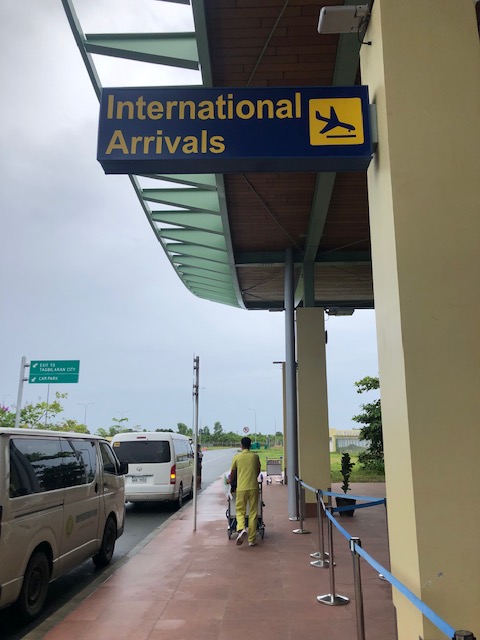
 The international arrival area at Tagbilaran-Panglao Airport
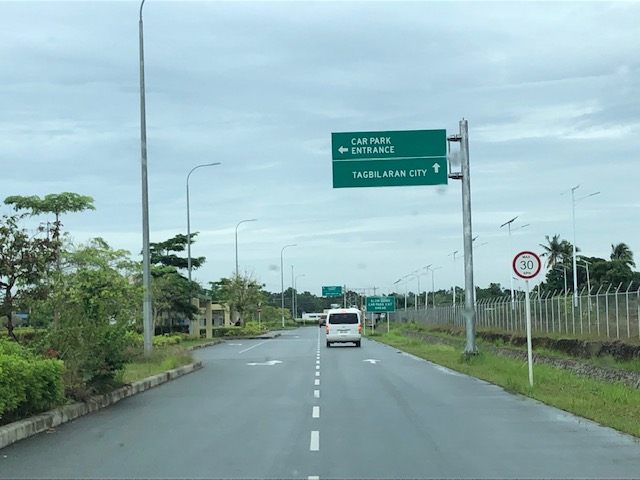
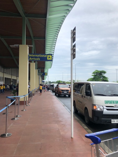 Airport driveway
 Exit towards our destination
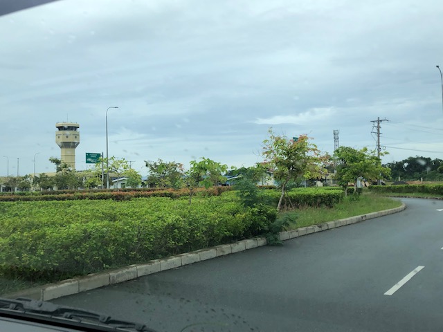 A view of the control tower as we headed towards the airport exit gate
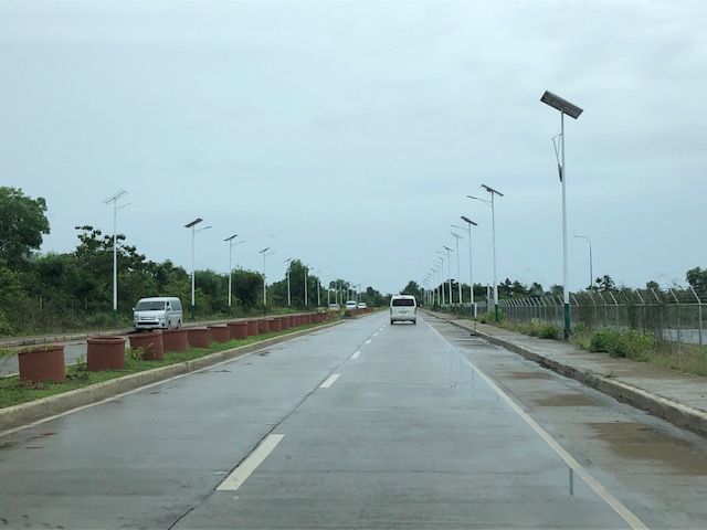 The new road connecting to the national road circling Panglao Island, which connects to the local roads leading to the resorts and towns in the island.
It now only takes something like 10 to 15 minutes to many of the resorts in Panglao Island. This is a convenience to tourists. However, the distance from the main island of Bohol (the rest and most of the province) means a longer travel time for Boholanons or Bol-anons to/from their hometowns from/to the airport. This looks to be a non-issue considering the pros of the new airport outweighs its cons.
More on this airport soon!
–
Is the concept of induced demand a hard sell?
Here’s a quick share of an article on ‘induced demand’ particularly why it appears to be a hard sell:
Blumgart, J. (February 28, 2022) “Why the concept of induced demand is a hard sell,” Governing, https://www.governing.com/now/why-the-concept-of-induced-demand-is-a-hard-sell [Last accessed: 3/8/2022]
To quote from the article:
“Transportation experts say that the way to defeat induced demand, and actually ease traffic, would be to price roadways through tolls and congestion fees. But such alternatives are not popular. It’s hard to imagine running a political campaign on such a promise, as opposed to pledging an answer that looks free and easy… “Highway expansion is an attractive project regardless of your political orientation or what the state of the economy is,” says Thigpen. “There’s always a good argument for why we should be expanding highways. We need more jobs, or we need to unlock economic opportunity. There’s always a good political argument in favor of that.”
That last statement there relating highway or road expansion to politics is relevant everywhere. In our case in the Philippines, politicians are perceived to be very conservative and the type to use road projects as accomplishments. They are not as progressive as politicians abroad who may have the backgrounds and/or advocacies relating to sustainable transport to pursue the more difficult programs and projects needed improve the transport system. Instead, most are content with projects that they can put their name on and claim as hard accomplishments. Many of their constituents appear to agree. And agencies like the DPWH are only too happy to support this never-ending road construction and widening projects with the length of roads and the number of lanes added being their metrics for success. Of course, these (e.g., understanding and how to address induced demand, performance metrics, etc.) need to change if we really want to transform our transportation system towards something more efficient for everyone’s benefit.


–
Article on how cities can rapidly expand bike networks
With the increasing popularity of bicycles for utilitarian use (e.g., bike to work, bike to school, etc.), the need for strategies, programs and projects to support cycling has become more urgent. This is mainly to sustain the increase of bicycle use and partly to enhance the safety of cyclists. Here is an article that discusses how cities can rapidly expand bike networks:
https://www.urban.org/urban-wire/how-can-cities-rapidly-expand-access-cycling-infrastructure
To quote from the article:
“Our research points to several key recommendations for other cities hoping to expand their cycling infrastructure and encourage a more rapid shift toward biking and away from cars.
– Local governments can lead the implementation of a large-scale expansion of cycling infrastructure if local leaders can commit to ambitious, quantified mileage goals that will help structure how capital dollars are spent.
– Local implementation goals should include metrics related to increasing equity, particularly for people of color and those with low incomes. Although the Final Mile program increased the number of miles of cycling infrastructure, it did not directly prioritize the people who could benefit most from improvements.
– Philanthropic funders interested in supporting climate-friendly infrastructure should ensure their funds help hold local policymakers accountable to achieving their commitments instead of funding infrastructure projects directly. They can also encourage collaboration between cities and nonprofit advocates while working to fill local capacity gaps, such as through engineering consultants.”

Article on evaluating transport equity
Here is another quick share of an article on transportation equity:
Litman, T. (February 2, 2022) “Evaluating Transportation Equity: ITE Quickbite,” Planetizen, https://www.planetizen.com/news/2022/02/116058-evaluating-transportation-equity-ite-quickbite [Last accessed: 2/4/2022]
Transportation equity is a very relevant, very timely topic as people in the Philippines are just beginning to understand and weigh the advantages of having more efficient transport in the forms of active and public transport over private vehicles.
–
UPSE Discussion Paper on Martial Law and the Philippine Economy
To those who were looking for references on the Philippine economy during the Martial Law years, look no further than a recent discussion paper from the UP School of Economics (UPSE). To quote from their social media post:
UPSE Discussion Paper No. 2021-07 (November 2021)
📌Title: Martial law and the Philippine economy
🖊Authors: Emmanuel S. de Dios, Maria Socorro Gochoco-Bautista, Jan Carlo Punongbayan
📄Abstract: Part of a proposed anthology, this article provides a concise review of the economic performance during the period of the Marcos dictatorship (1972-1985) from a comparative historical perspective. We examine the external events and internal policy responses that made possible the high growth in the early years of martial law and show that these are integral to explaining the decline and ultimate collapse of the economy in 1984-1985. The macroeconomic, trade, and debt policies pursued by the Marcos regime—particularly its failure to shift the country onto a sustainable growth path—are explained in the context of the regime’s larger political-economic programme of holding on to power and seeking rents.
📖 Read the full paper here: https://econ.upd.edu.ph/dp/index.php/dp/article/view/1543/1027
https://econ.upd.edu.ph/dp/index.php/dp/article/view/1543/1027
Why is this relevant to transportation in the country? Economic performance and policies during that period strongly influenced if not practically dictated infrastructure development during the period. Add politics to the mix and you get what ultimately affected future administrations in terms of debt servicing and other financial or fiscal issues that needed to be addressed due to the debt incurred during that period.
We should learn from this and hopefully not repeat it. Unfortunately, the fiscal discipline and reforms during the previous administration appear to have been abandoned and the current spending and borrowing spree will likely handicap future administrations. Are there bad debts around? Probably! And so there will likely be a need to do some due diligence during the transition to a new administration after the elections this year.
–
On transport equity
To start the year 2022, I’m sharing another article by Todd Litman. I thought this was a timely one as this is basically about transport equity and the results despite competent planners and perhaps good intentions.
Litman, T. (December 21, 2022) “Good Planners: Bad Outcomes. How Structural Biases Can Lead to Unfair and Inefficient Results,” Planetizen, https://www.planetizen.com/blogs/115621-good-planners-bad-outcomes-how-structural-biases-can-lead-unfair-and-inefficient?utm_source=newswire&utm_medium=email&utm_campaign=news-12232021&mc_cid=35d4ce69aa&mc_eid=9ccfe464b1 [Last accessed: 12/27/2021]
There should be similar studies for the Philippine case. We need to understand and correct bad practices including those related to an over-reliance to what is referred to as “old school” practices (i.e., “nakasanayan na”, “ginagawa na noon pa”, and so on), which is what young engineers and planners are taught by the “old boys” in certain agencies as an initiation of sorts if not part of their ‘continuous orientation’ at these offices.
–
