
Home » Posts tagged 'Pampanga'
Tag Archives: Pampanga
Mt. Arayat – the Lonely Mountain
A trip north will usually bring travelers to see a lonely mountain, actually a volcano, that is Mt. Arayat. Located in Pampanga province, you can see Mt. Arayat clearly as you traverse the North Luzon Expressway (NLEX). The volcano is actually visible even from afar on a clear day. I have shared photos of it from our village in Antipolo, Rizal.
 Mt. Arayat as viewed from the NLEX viaduct. On the foreground is the Candaba Swamps
 Another view of the ‘extinct’ volcano dominating the Pampanga landscape. Is it really extinct or perhaps just waiting to be awakened by a force of nature? That was how Mt. Pinatubo became active after a powerful earthquake a year before its big eruption.
I have seen the Mt. Arayat up close on a few occasions. One such time and perhaps the closest I’ve seen it was when we traveled along its foot to get to a wake in a far off Nueva Ecija town. There are actually many plantations or farms around it and along its slopes.
–
Dau, Mabalacat Bus Terminal – Part 2
The first part of this feature on the Dau Bus Terminal in Mabalacat, Pampanga showed the city’s PUV Common Terminal, the bus berths from the entrance of the terminal and the many stalls lined along the terminal. This second part features more photos including some showing a tricycle terminal and an airport shuttle lounge inside the huge bus terminal.
 The interior shows an even more expansive bus terminal with more berths, a tricycle terminal and the Clark Airport shuttle station.
 Victory Liner buses berthed just after the tricycle terminal within the bus terminal
 Clark Airport Lounge in the middle of the bus terminal
 An add for a popular cracker brand states “the journey is long”
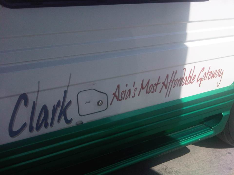 Sign on the Clark shuttle jitney
 The Clark Airport shuttle jitney is an extended or stretched Asian Utility Vehicle (AUV) that typically seats 27 people including the driver.
 The tricycle terminal at the bus terminal allows for a more direct transfer between modes (i.e., long distance, inter-provincial or inter-city transport to local transport).
 Passengers from the lounge board the airport shuttle. Luggage are also taken inside the vehicle so it can only accommodate a limited number of people rather than the 27 I mentioned earlier.
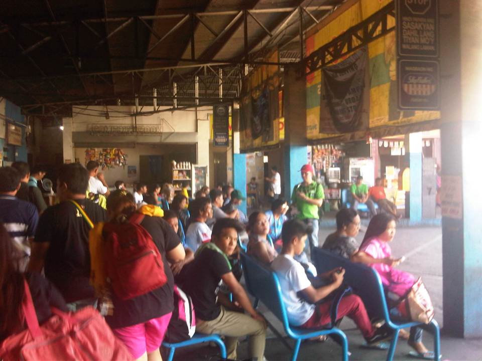
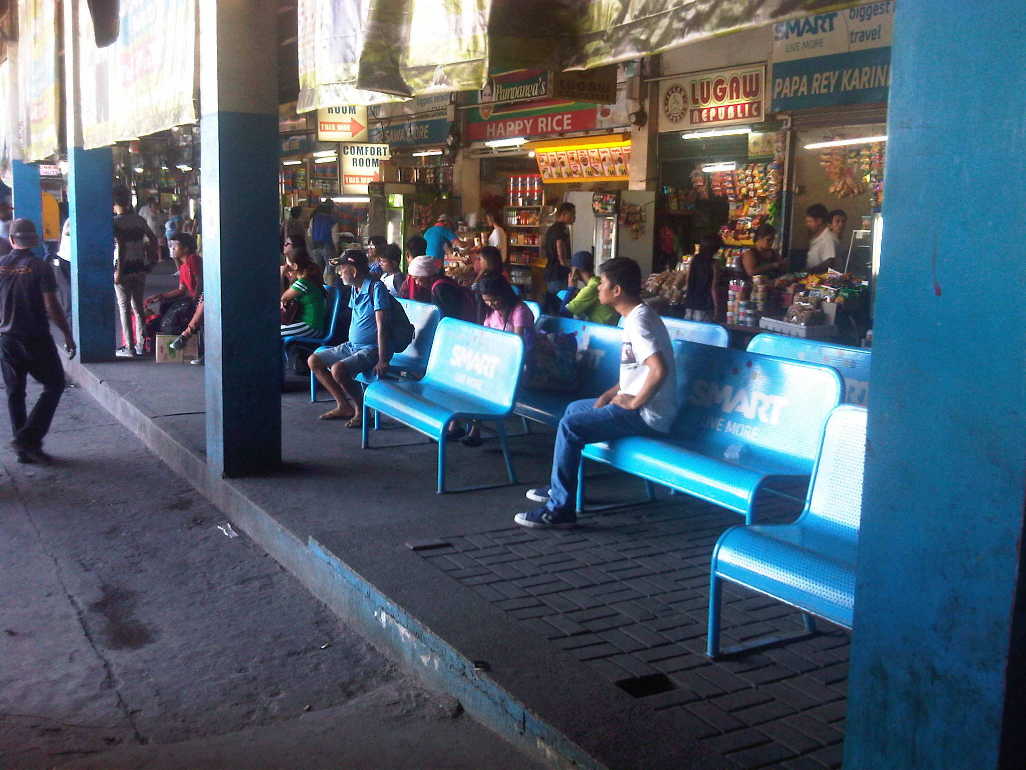 Another look at passengers waiting for their buses at the available (and limited) benches at the terminal. The benches shown seem to be ‘sponsored’ by a leading Telecom company.
 Beverage dispenser at the terminal
 Low batt? Cellular phone chargers are quite popular with passengers needing a quick battery charge while waiting for their buses to arrive at the terminal.
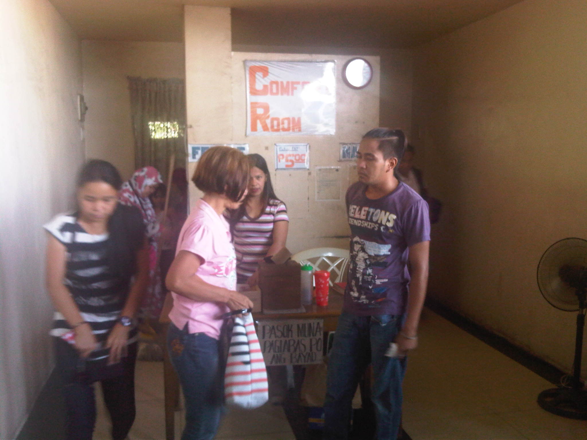 Public comfort rooms or toilets at the terminal charge 5 pesos (about 12 US cents) for each use. There’s a sign that says payments are made after use. The fees are supposed to cover maintenance of the toilets but don’t expect much in terms of cleanliness or smell.
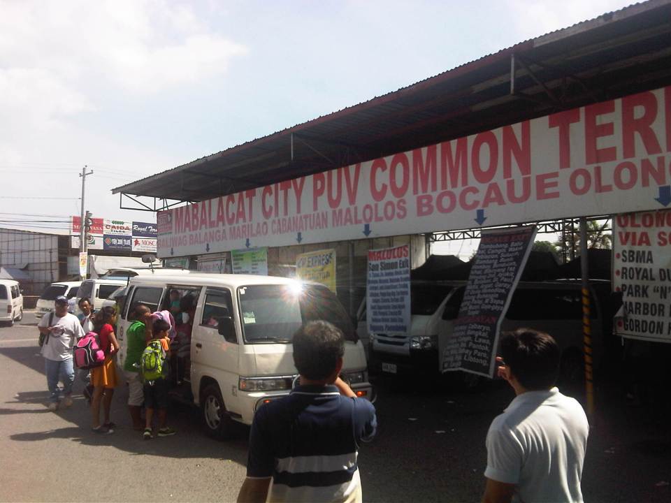 Passengers board a van at the Mabalacat City PUV Common Terminal. PUV stands for Public Utility Vehicle and basically stands for the vans running long distance express routes that are supposed to be non-stop or limited stop.
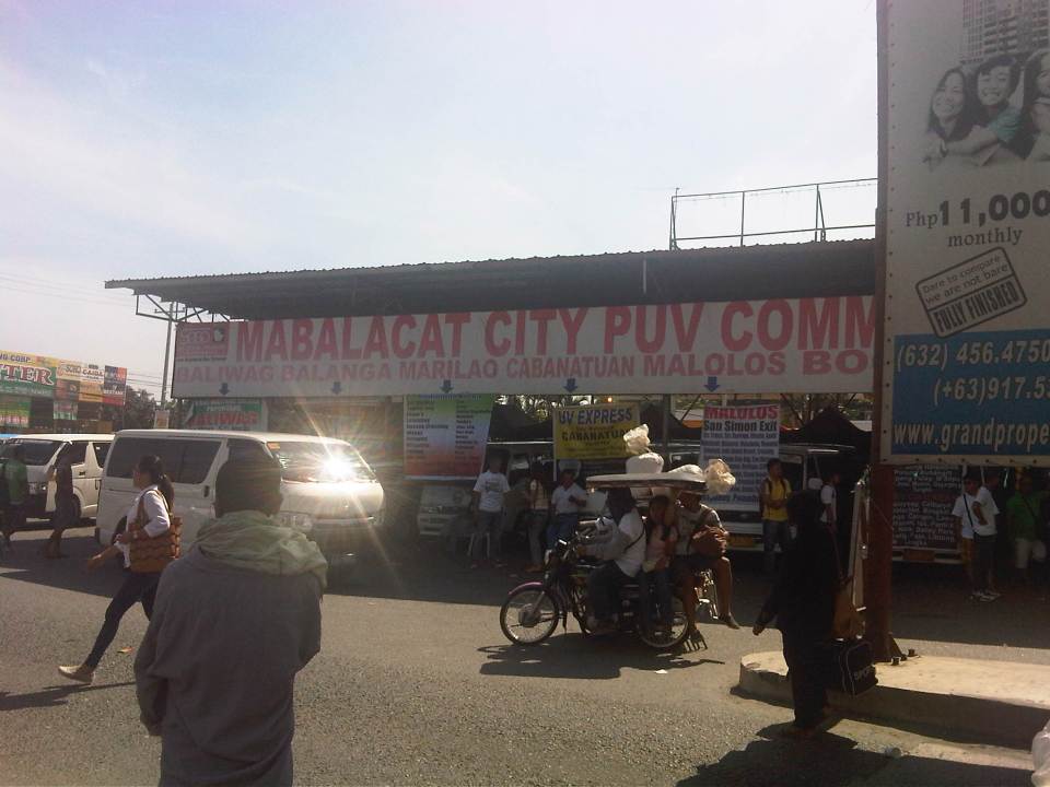
 Huge signboard at the entrance to the terminal
The huge bus terminal is a good example of a regional bus terminal in the Philippines and one that is also a multi-modal facility at least for road transport. It is relatively well-run and is a major transfer point for people traveling between much of Luzon Island including Metro Manila. There is definitely room for improvement including amenities for passengers and perhaps a more modern airport shuttle lounge. Perhaps there should be more investments to further improve this terminal used by so many passengers traveling mainly on the provincial buses calling on the terminal.
–
Dau, Mabalacat Bus Terminal – Part 1
We recently went to Mabalacat, Pampanga, which is north of Metro Manila and at the end of the North Luzon Expressway. The objectives of my colleagues were to inspect the Dau Bus Terminal and to look at the airport shuttle whose terminal is co-located and within the large bus terminal. Following is a first batch of photos I took at what is the largest bus (and intermodal) terminal in Central Luzon. There are others like it around the country like the one in Lucena City in Quezon Province (Southern Luzon) but few are as large and serve as many buses.
 The city’s PUV terminal is adjacent to the bus terminal
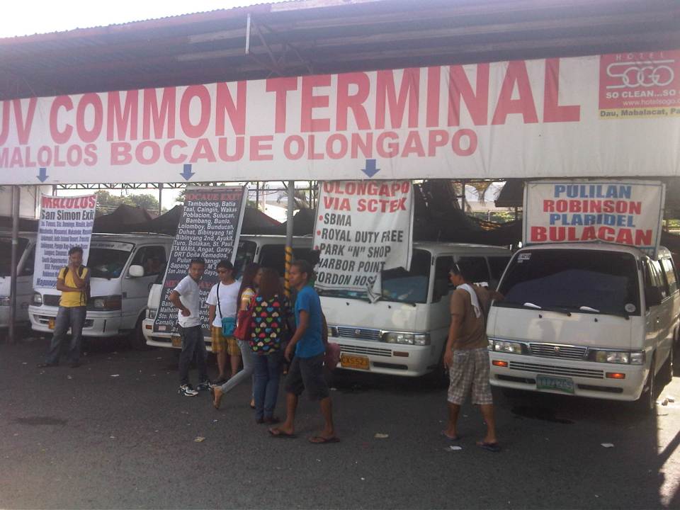 Vans bound for various provincial destinations await their passengers at the PUV terminal. These usually seat 10 passengers and directly compete with buses for the destinations indicated in the signs.
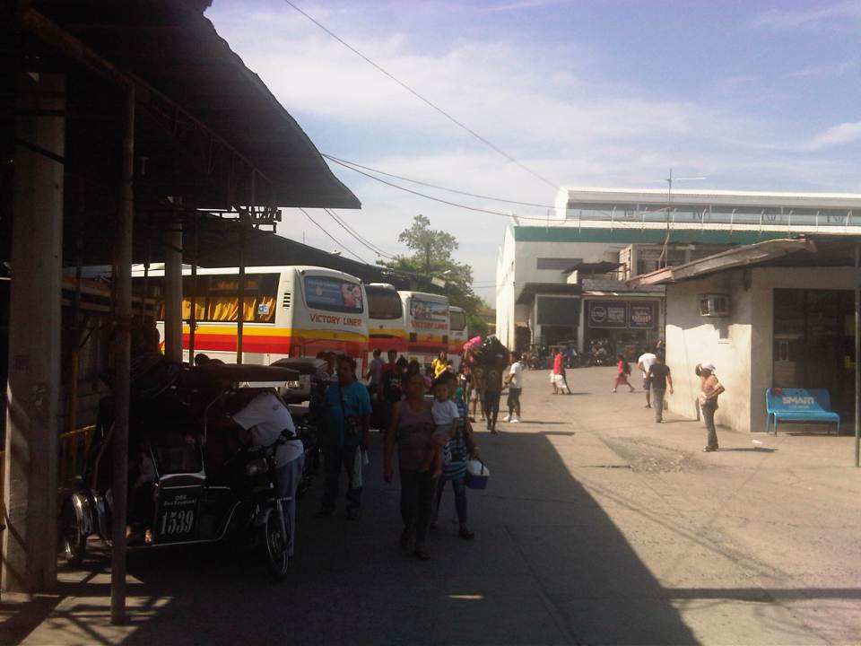
 Passengers walk towards the terminal and the berth assigned to their buses.
 People line up to congregate at the berth assigned to specific bus companies and according to their destinations
 Passengers, well-wishers, hawkers and shopkeepers mingle in what is probably the busiest terminal in Central Luzon. I am not aware of any similar terminals in other provinces in Region 3 including Bulacan, Tarlac and Nueva Ecija.
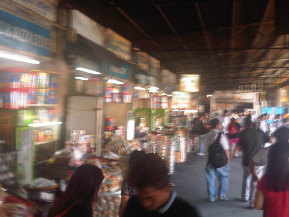 Stalls at the terminal sell mostly food and drinks including large containers of biscuits that are still popular pasalubong.
 Some areas of the terminal can be quite crowded as some bus companies are more popular than others.
 Not all bus companies provide benches for their passengers. Some seats are actually provided by stores and eateries but only for their customers.
 Empty berths at the bus terminal
 Passengers wait for their buses on the benches or while standing and having a quick snack or smoke at one of the stores at the terminal. The guy in the photo is actually violating a national law and local ordinance banning smoking in public areas.
 A Five Star bus arrives at the terminal. Bus companies have their assigned berths at the terminal and drivers and conductors presumably have their suki eateries or stores.
More on the Dau bus terminal in a future post.
–
Gapan-San Fernando-Olongapo Road: Lubao bypass road
The Gapan-San Fernando-Olongapo Road was often congested along sections passing through populated areas of towns along the highway. Among the busiest (and most congested) was the section in Lubao. This necessitated the eventual construction of a bypass road for travelers to be able to reduce delays caused by various elements including local traffic (e.g., tricycles and pedicabs). The following photos describe the bypass road and the traffic using it.
 The bypass road is easily identified with the conspicuous signage and lane markings. The junction is right after this bridge.
 The pavement markings along the bypass road is inadequate and appears to be inappropriate given the carriageway width. There are also many people crossing the highway at various points.
 The bypass road should have been a two-lane, two-way highway with shoulders at either side of the road. The yellow line in the middle of the road may be appropriate to advise against overtaking or passing but the white broken lines should be replaced by solid lines to delineate the shoulders from the traveled way. Yup, that’s a tricycle along a national road.
 The highway is elevated probably to prevent flooding (of which the area has lots of experience including the times when lahar was a severe problem in the area). As such, travelers can see the rooftops of a lot of most houses along the highway.
 The bypass road narrows to 3 lanes at certain sections.
 Scene along the highway sections along which is a river. Quarrying for construction materials like sand is quite common and a major source of revenue for many Pampanga towns. Such activities have also been controversial due to the fees charged by the local governments, particularly how these are divided among towns and where these are used.
 The space provided along the single lane direction is obviously inadequate considering that trucks tend to encroach upon the opposing traffic lane.
 The 3-lane section approaching a junction. There were no signs or rumble strips to warn drivers about the presence of a junction.
 There are no signs to inform motorists of the presence of this junction at a curved section where the 3-lane road transitions into 4 lanes. This is actually an unsafe location for a junction and requires both geometric and traffic engineering interventions to prevent crashes from occurring.
 The chevron signs indicating the curvature of the road section are quite few. Perhaps the highway engineers became too conscious of the controversies elsewhere where there seems to be an abundance and propensity for such signs. The embankment for the highway is visible from the photo.
 Lower section of the bypass road with concrete barriers apparently designed for waters to flow through. Notice that the section is not as elevated as the previous ones judging from the rice plantations on either side of the road.
 Rumble strips along the highway to warn the driver of a hazardous section
 13Curved section with signs that seem to be too small considering the speed limits (40 kph). Meanwhile, there is a single chevron sign on the other side of the road.
 Straight, level section is quite tempting for speeding. Such designs actually encourage speeding, and many vehicles we observed (including ours) exceeded the 40 kph speed limit.
 Traffic along the highway is quite light even during the peak periods – further proof that 2 lanes are enough for the bypass.
 The concrete barriers do not seem sufficient or able to stop large trucks should these be involved in crashes where vehicles are run off the road.
 Aside from tricycles, there is a significant motorcycle traffic along the bypass road.
 I think sharp curves like this section requires more chevron than what was installed along the highway.
 Straight, level section approaching the west junction with the Gapan-San Fernando-Olongapo highway. The tall electric pole marks the junction.
 Closer to the junction, the electric pole looms and become more conspicuous to travelers.
 Power line pole in the middle of an island that’s part of the channelization for the bypass road’s intersection with the GSO Highway.
It is clear that the Lubao bypass road has benefited many motorists often hindered by congestion along the GSO road. However, given the opportunity to design a safe highway, it seems that many elements were not satisfied in terms of safety. As such, the bypass road presents us with a high potential for road crashes at present and when traffic eventually increases over time. There are, of course, options that can be implemented to improve the situation along the bypass road and its junctions with the GSO Highway.
–
