
Home » Posts tagged 'Pasig'
Tag Archives: Pasig
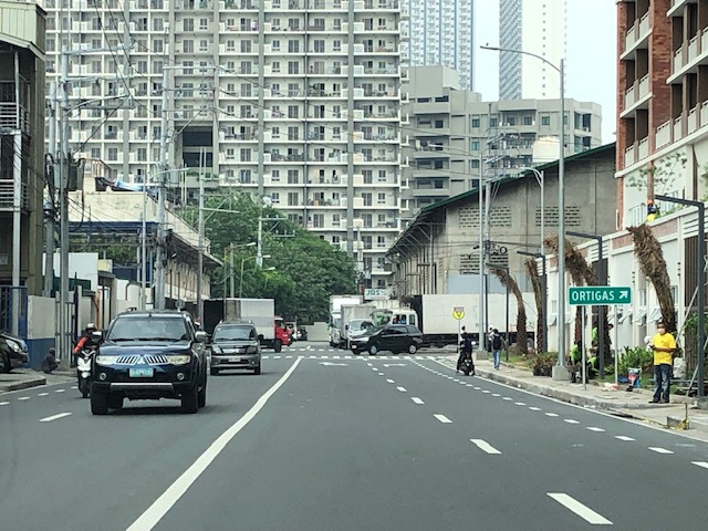
Ortigas Avenue Extension counterflow
One traffic scheme that has been constant along Ortigas Avenue Extension is the counterflow scheme. The scheme is applied in the mornings for westbound (outbound from Rizal) traffic. It has been implemented for as long as I can remember; perhaps since the early 1980s. One variant before was a form of “Buhos” where eastbound traffic is stopped for several minutes at certain intervals (6:30am, 7:00am, 7:30am and so on), and westbound traffic is allowed to take all the available lanes during the periods.
Considering this scheme has been implemented for more than 4 decades now, there must be some measure of effectiveness there. It is an example where the directional distribution during the peak hours allow for such scheme to be implemented. Note that the scheme pre dates number coding and similar counterflow schemes elsewhere in other major roads in Metro Manila (correct me if I’m wrong).
The scheme though only shows that there should have been a better transport system put in place along the corridor, which has had a steady growth in travel demand. There should have already been a transit line along this corridor a long time ago. What happened? Was it not in the government’s radar? There was a line proposed and shown in various master plans before.
–
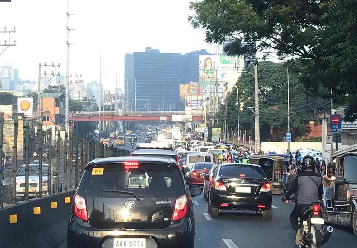
On the chronic congestion along Ortigas Avenue Extension
I previously wrote about the counterflow scheme along Ortigas Avenue Extension. While this is usually implemented during the mornings. A similar scheme is not applied in the afternoons or evenings. Apparently, the directional distribution in the afternoons and evenings is not suitable for a counterflow scheme. The photos below show the typical eastbound traffic as seen from the Manggahan Floodway bridge.
 Typical weekday evening traffic along Ortigas Avenue Extension
 The photos show that the traffic along the opposing direction (westbound) is as heavy as the eastbound traffic. This means a counterflow scheme similar to that in the mornings cannot be implemented during this period.
I have mentioned in the previous article that the corridor already required a mass transit system since the 1980s. Despite the operations of several bus companies over the past decades, these have not been enough (together with jeepneys and vans) to serve the demand along the corridor. It is not uncommon to find so many people stranded along the corridor and waiting to get a ride even during the early mornings. While Lines 2, 3 and 7 were being constructed, people in Rizal who have long endured the traffic along Ortigas Avenue Extension could only wonder why a transit system has not been provided for them. Will the proposed Line 4 be finally constructed? When will it be completed? What could be the traffic impacts of construction considering the limited space available for the construction? Should commuters prepare for more miserable travel once construction is underway?
–
After getting engrossed with EDSA, is Marcos Highway next?
If you monitored the news articles and social media post over the past two decades, there seems to be an obsession for EDSA. Circumferential Road 4 is the busiest corridor in Metro Manila, stretching across several jurisdictions including Caloocan, Quezon City, Mandaluyong, Makati and Pasay City. Aside from the MMDA, national agencies like the DPWH and DOTr have been heavily involved in traffic schemes and transportation infrastructure development along the corridor. These include variants of the travel demand management (TDM) scheme commonly called number coding. Since the 1990s, there’s the Line 3 and several overpasses/flyovers and underpass that have been constructed along major intersections (e.g., EDSA-Shaw, EDSA-Ortigas, EDSA-Kamuning, EDSA-Quezon Avenue, etc.). Nowadays, people are more into the EDSA carousel and most recently the pavement rehabilitation for EDSA. It seems we failed to realize that EDSA is just one corridor. There are others that also demand attention including those in other parts of the country.
Recently, a “carmaggedon” along Marcos Highway was in the headlines or shall I say was trending in social media. There was a lot of excitement for what has been a recurring nightmare to those residing along the corridor. I recall something worse occurred more than 15 years ago (pre-Ondoy), before social media and influencers and digital creators. At the time, Line 2 terminated at Santolan Station. And even back then, the MMDA insisted on playing with their U-turn scheme. I don’t recall a more in-depth study that could have involved micro-simulation modeling being done for the corridor. And since then, populations and traffic have grown steadily and as I’ve written about previously, the extension of Line 2 to Masinag seems to have had little impact on traffic. And so here we are with the MMDA still insisting on tweaking their U-turn schemes and relying mainly on gut-feel instead of a more scientific approach that may actually lead to more sound solutions for the corridor.
 Approach to Marcos Highway from Felix Avenue – that’s the elevated Line 2 superstructure behind the Cainta arch.
 Intersection of Marcos Highway, Felix Avenue and Gil Fernando Avenue – there’s a major foot bridge installed here so people can cross at the intersection, which used to be a signalized junction before the MMDA opted for U-turns for Marcos Highway sections under its jurisdiction.
 Marcos Highway section fronting the Ayala Feliz Mall – the MMDA has played with the location of the U-turn slots in the vicinity of the Marcos Highway-Amang Rodriguez-J.P. Rizal intersection as they tried to determine the “optimum” locations of these slots.
Of course, there is also the case of Commonwealth Avenue. How many carmaggedons have occurred along that corridor? Isn’t it an everyday thing there? And there’s also Ortigas Avenue Extension and many other roads and streets where congestion seems to have been accepted as the norm. How do we make travel easier for most people? How do we improve commutes given the constraints and realities concerning behavior and choices?
–
Vehicle refuge during floods
Passing Felix Avenue one early morning this week, I saw familiar scene. There were lots of vehicles parked along Felix Avenue (formerly Imelda Avenue) including the service roads along either side of this major road connecting Marcos Highway and Ortigas Avenue Extension.
These vehicles are owned by residents of subdivisions along the avenue whose areas are prone to flooding. These include Vista Verde, Metroville, Kasibulan, Karangalan and the two Green Parks. I didn’t see this along the stretch so the other flood prone villages like Village East and Country Homes. Perhaps they have been able to adapt better?
Car-centric discussions aside, when you go the ‘east’ you will notice a lot of people using SUVs. One reason probably is because many Rizal towns including Antipolo City, and Pasig and Marikina Cities are prone to flooding. Can you imagine over 50 years of flooding in these areas? And then with the current investigations concerning flood control projects, have you wondered if the ‘east’ really got their taxpayers’ money’s worth in terms of interventions?
–
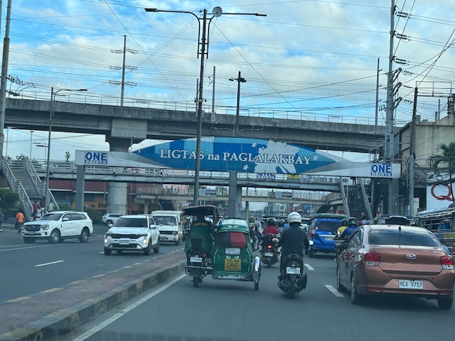
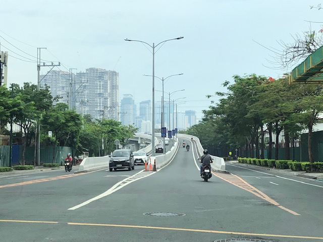
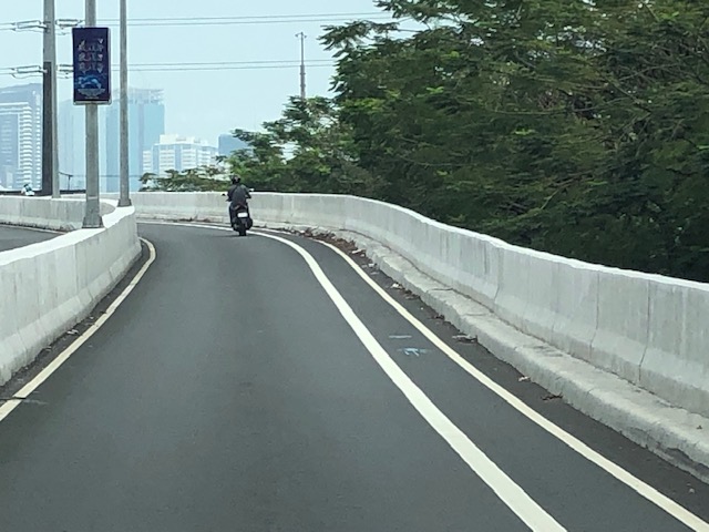
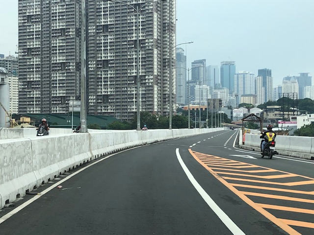
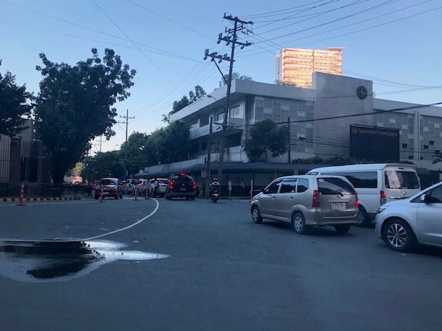
Counterflow irony along Ortigas Avenue Extension, Pasig City
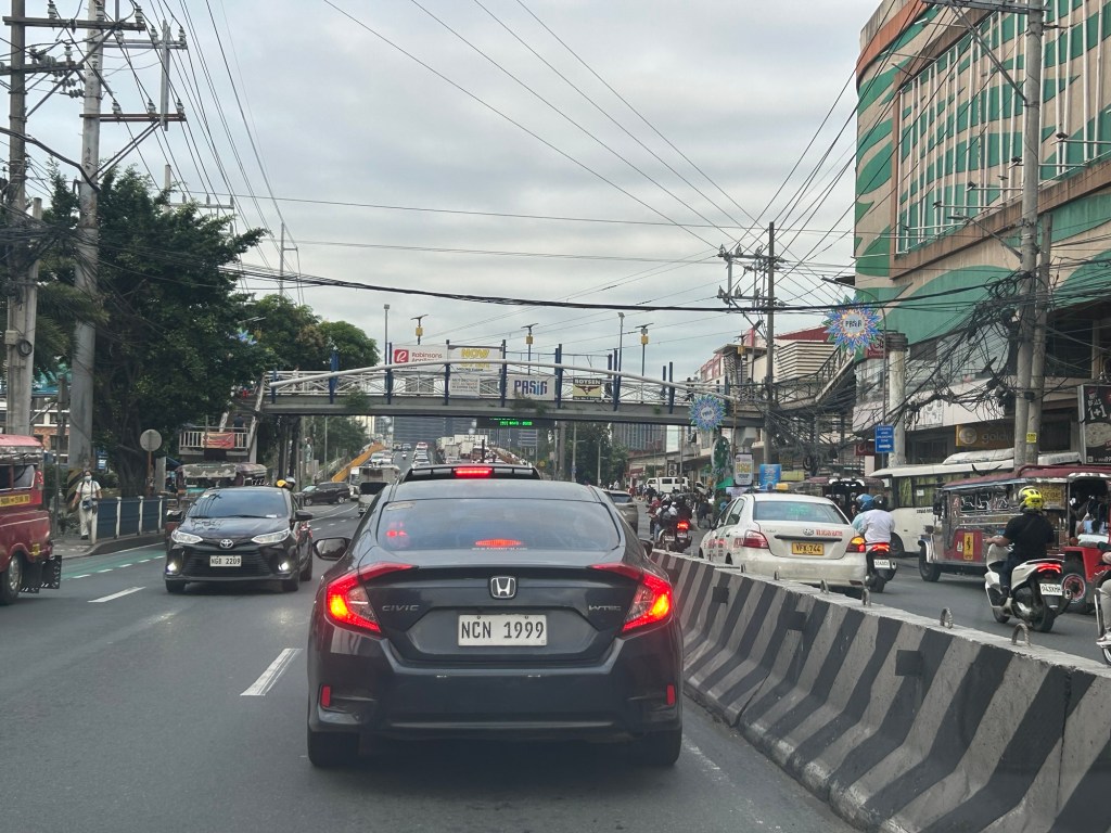
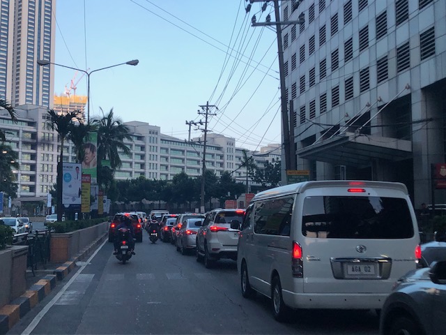
One Friday, I traveled to Ortigas Center from Antipolo via the most direct route using Ortigas Avenue Extension. I was not surprised by the counterflow scheme being implemented starting from De Castro all the way to Rosario Bridge. I was also not surprised that the more congested lane was the counterflow lane. I thought everyone expected the main traffic lanes to be congested as PUVs like jeepneys, buses and vans usually create bottlenecks as they block traffic while passengers board/alight along that section of Ortigas Avenue Extension. Here is what you might encounter in terms of traffic if you opt to stay along the westbound traffic lanes:
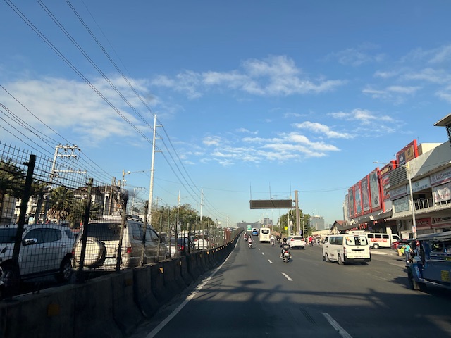 Traffic before the Manggahan floodway bridge at what was generally called Mariwasa. The Filinvest residential development on the left used to be the Mariwasa tiles plant.
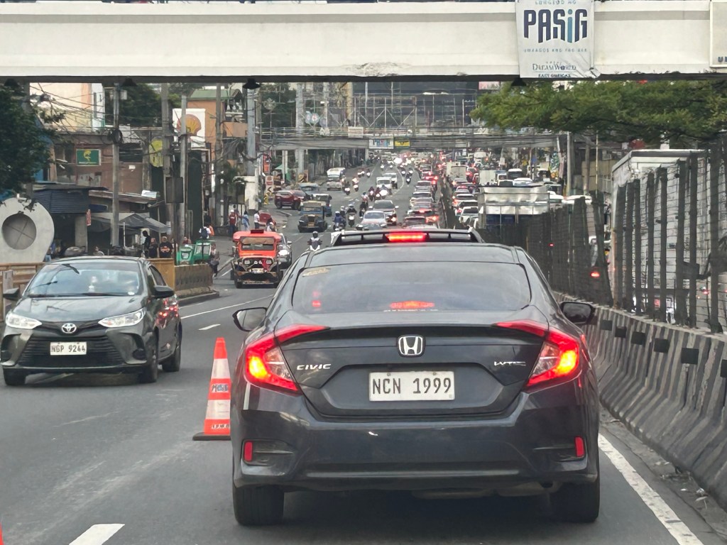
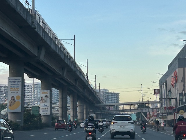
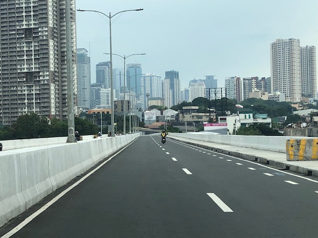
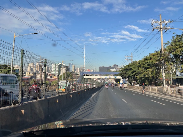 Traffic after the crossing the bridge. Note the pedestrian overpass in the photo.
 Meters after and near the overpass, you can already see the build-up in the Rosario area
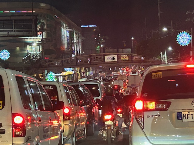
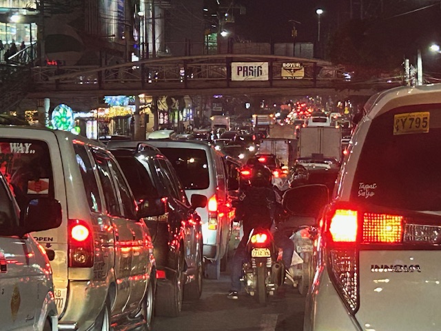
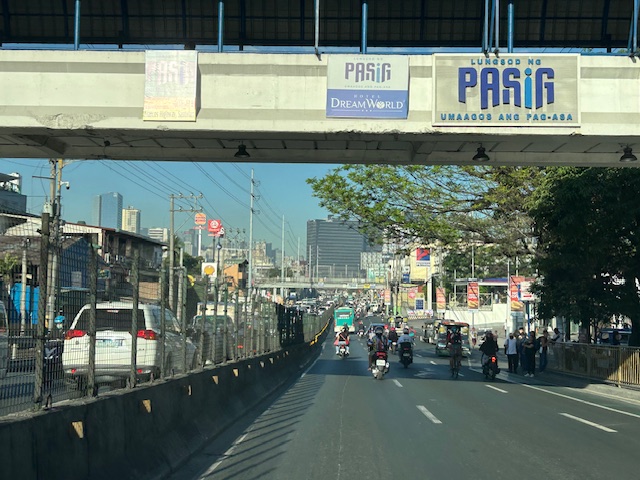
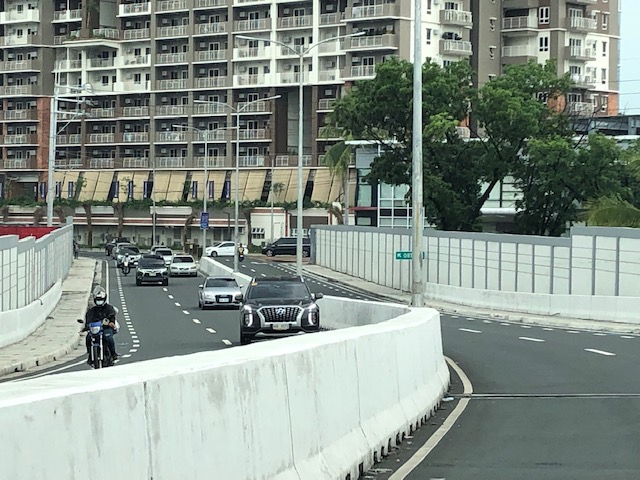
 The Rosario bridge area is usually congested not just because of the PUV operations but also because there is the junction of Ortigas Avenue Extension and Amang Rodriguez Avenue, which is another major thoroughfare connecting this area to other parts of Pasig, Quezon City and Marikina City.
I will post about the counterflow scheme in Bangkok in the next post.
–
Kalayaan Bridge (BGC – Ortigas Center Link)
The Kalayaan Bridge, also known as the Bonifacio Global City (BGC) – Ortigas Center Link opened about a year ago and was supposed to ease traffic along the usual routes along EDSA and C5 that crossed the Pasig River. The new bridge is located between the EDSA and C5 bridges and is a more direct route to and from BGC if you reside in Pasig and choose the route to/from BGC via Pasig/Shaw Boulevard.
 The approach ramp to the bridge from the BGC side is in the vicinity of the Uptown part of BGC. The bridge goes over Kalayaan Avenue, which is one of the major access roads to BGC from C5 or EDSA, and J.P. Rizal Avenue Extension but there is access and egress to Kalayaan Avenue.
 The ramp is practically a single lane with painted bike lanes on either side of the bridge. There is noticeably no space for pedestrians on this bridge. That is only a curb on the right side. This lack of pedestrian provisions is a major flaw of this bridge.
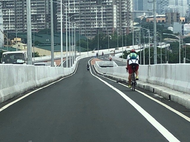 A lone cyclist traversing the bridge – the merge for traffic from BGC and vehicles from Kalayaan Avenue is seen downstream.
 Approaching the merging section (from this perspective; its diverging on the other side) of the bridge.
 A motorcycle merges with the traffic from BGC. Notice the chevron markings separating merging flows as well as the yield marking for vehicles coming from Kalayaan (i.e., priority is for vehicles coming from BGC). The bridge from this section becomes two lanes per direction. There is, however, a risky part for cyclists who will cross paths with vehicles coming from Kalayaan. Cyclists from BGC will have to cross a lane to get to the bike lane on the outer side of the bridge. There is no space for pedestrians along this bridge.
 There is only this part of the bridge where there appears to be a sidewalk. Was this really the design for this bridge? It is very obvious that many people failed in both design and implementation of this project.
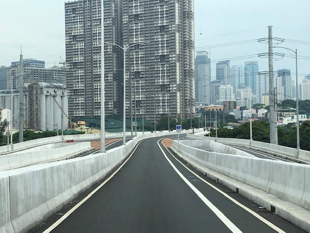
 The view towards the Pasig side of the bridge. There are two lanes per direction and narrow bike lanes along the curbsides.
 There is an intersection at the end of the bridge but the road immediately at the right is closed to incoming traffic so right turns are currently prohibited despite the pavement markings that indicate they were allowed at one time.
 The road leads to this intersection which is in area generally referred to before as ‘Pioneer’. The area hosts many warehouses or storage buildings and I remember going here many years ago to check out the imported wood furniture and office surplus items. Turning right leads one to the area generally known as ‘Unilab’ because that was where United Laboratories had their plant and offices. It retained the property where now stands an events venue. Further on leads you to Kapitolyo and the Estancia Mall.
–
Pasig to Lucena vans
I was surprised to see a sign at the transport terminal of SM East Ortigas announcing van services between the mall and Lucena City (SM City Lucena terminal). This seems to be a very convenient service and it is via a route I consider to be quite scenic. This is the one via the “backdoor” of Rizal through the towns of Teresa, Morong, Tanay, Pililla in Rizal, Laguna province (Famy, Paete, Lumban, Pagsanjan, etc.) and Quezon province (Luisiana, Lucban, Tayabas).
 Modern jitneys (actually more like mini-buses)
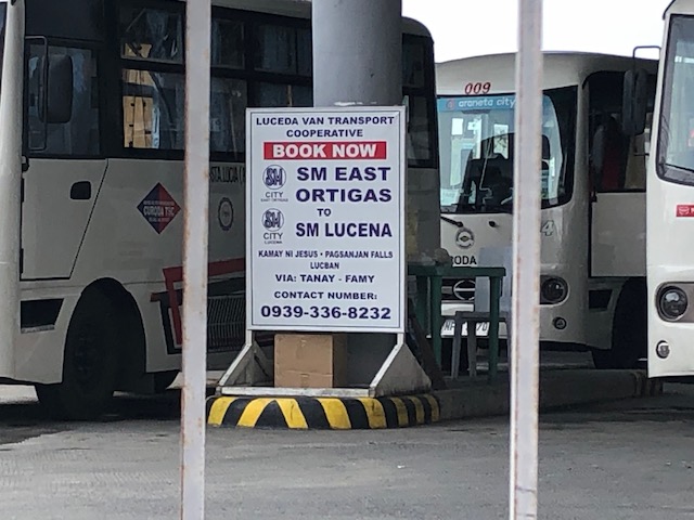 Close-up of sign showing the transport service between SM East Ortigas and SM Lucena in Quezon Province.
–
On Pasig’s ordinance promoting and supporting the use of bicycles
I am posting a couple of LGU issuances that would be good references to other LGUs as we all tread along through these quarantines, curfews and lockdowns (or whatever it is they call it these days). First off is the Ordinance from Pasig City. The city has been in the news quite frequently for the very progressive, responsible and active handling of the situation led by its popular mayor Vico Sotto. His policies and programs are claimed to be based on data or information on his constituents that his team is using with much efficiency. This shows us how data analytics can prove useful in times of crisis such as the Covid-19 pandemic. The ordinance also shows a grasp of realities for transport and the so-called “new normal” that people have been talking about once we transition out of the quarantines and lockdowns.


I guess it begs the question if Pasig is also coming out with a formal policy or statement regarding other modes of transport such as tricycles, jeepneys and buses. They did allow tricycles for a while until national government told them to cease tricycle operations citing health issues while not really delving into details to find a way to improve people’s mobility during these times. Meanwhile, other LGUs specifically one that is close to the President’s heart has defied the very same orders from national agencies to restrict tricycle operations as public transport. I will post that issuance next…
–
Cooperative work among LGUs to address transport problems along Ortigas Avenue Extension?
I saw a recent post about a meeting hosted by Pasig City. The Mayor of Pasig City recently held a meeting where he invited the mayors or Antipolo, Cainta and Taytay to discuss, among other things perhaps, transportation along Ortigas Avenue. Ortigas Avenue is a corridor shared by several LGUs most notably the Rizal towns of Antipolo (which is the provincial capital and a highly urbanized city), Cainta and Taytay. The latter two are among the richest municipalities in the country; a fact I underline here since that also should translate to them having the resources or means to help come up with transport and traffic solutions.
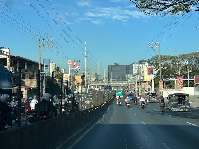
 Morning rush traffic starts very early these days. This photo was taken around 6AM on a Thursday along the westbound direction just after the Manggahan Bridge. The pedestrian overpass at C. Raymundo junction is shown and the dark colored buildings are at Robinsons’ Bridgetown development. Note the commuters along the right waiting for a ride.
Photos paint a thousand words. The Taytay Mayor attended the meeting. He has been under fire for the horrendous traffic caused by the mismanagement of Tikling Junction as well as the Barkadahan Bridge area that was and is supposed to be a major alternative route for Rizalenos heading to their workplaces in Makati and BGC. More recently, there were posts about the traffic signals installed at Tikling Junction that basically invalidates the roundabout concept for the junction. The result last Thursday, the first day of operations for the signals, was hellish traffic that backed up a couple of kilometers along the Manila East Road and Ortigas Ave. Extension (some reports say until Cainta Junction). This, even as the signal settings were supposedly done with help from the MMDA.
Antipolo was represented by its former Mayor and husband to the current one. He also happens to be a former Governor of the Rizal Province and likely to run again as his mother, the current governor, is on her 3rd term. It seems to me that the province is not so interested in solutions for Ortigas Avenue despite most of its constituents traveling through the corridor to get to their workplaces and schools. Marcos Highway is not the main corridor for Rizal towns as it basically carries only Antipolo and maybe some of Tanay (via Sampaloc) traffic. Ortigas Avenue Extension branches into two major roads from Tikling – Ortigas Ave Extension, which ends at the capitol, and the Manila East Road, which connects to practically all of Rizal towns with San Mateo and Rodriguez (Montalban) being the exceptions. It is time for the province to pay attention to this commuting problem experienced daily by her constituents.
The Mayor of Cainta seems not as interested as the others, sending a representative who appears to be not one of the top officials (the traffic chief with a rank of SPO1=Master Sergeant is lower ranked than a councilor) of the Municipality to such an important meeting. In fact, he is currently now embroiled in a controversial faux pas involving himself by not wearing a helmet while riding a motorcycle. What’s more is his downplaying this and appearing to be even justifying the act. He eventually apologized but not before stating his moves. He is not new to publicity (stunts?) and knows how bad publicity still translates to good publicity especially in this days of fake news and trolls (he apparently has many on social media). He seems to forget that transport and traffic solutions for Ortigas Ave will likely benefit anyone seeking reelection or higher office in Rizal. He is on his last term as mayor and the break-up with some of his allies including his former Vice Mayor who ran against him in the last elections shows the limits of his political career. What was rumored as plans to run for Rizal governor might just be downgraded to perhaps Vice Mayor? In any case, he should show more interest and effort in finding solutions beyond traffic management and not by himself but in cooperation with others with whom his jurisdiction shares the problems with. Perhaps the initiative of the Pasig Mayor presents an opportunity for such cooperative work? Many people are very interested in this and will be watching – and hoping.
–
Ortigas Center congestion
A couple of Thursdays ago, I was in the Ortigas CBD area to attend a conference on statistics. I hitched a ride with an old friend who was also going there and so we had some time to catch up on life and other topics we usually talked about since our college days. Being on the passenger seat also meant I had some opportunities to take photos of the traffic situation in the vicinity of the venue of our conference. Here are some photos I took of traffic in the Galleria – ADB area as we drove along ADB Avenue.
 Congestion along ADB Avenue across from Robinsons. The ADB building is shown ahead of the vehicles.
 Most of the vehicles turned out to be turning towards Guadix and headed for Poveda. These are traffic generated by the exclusive school where most if not all students’ mode of transport is by car. This causes much of the congestion in the area at this time of day as well as during dismissals in the noontime and afternoon.
 Vehicles bound for Poveda (building is in the background) and EDSA.
 View of Ortigas bound vehicles filed along Sapphire Road – this photo was taken at the bridgeway connecting Crowne Plaza and Holiday Inn. The relatively uncontested road is the Robinsons’ driveway.
The photos show how dependent to cars many people working in the Ortigas CBD are. Many of them live outside of the CBD including those residing in the Rizal towns to the east of Metro Manila. The number of people using their own cars put so much strain on the major thoroughfares including and perhaps especially Ortigas Avenue, which serves as a main arterial connecting the CBD to many parts of Pasig, Quezon City (via C5) and the very progressive towns of Rizal Province such as Cainta, Taytay and Antipolo City.
It is a wonder why up to now, there is no mass transit system along Ortigas Avenue when the demand is very high and continuous to increase with the development of lands along it. SM, Robinsons and Megawide are among the major players now developing their plots of land to become high density commercial/office/residential areas. And these will surely translate into more trips generated and worse traffic congestion. Perhaps the mayors of Pasig, Cainta, Taytay and Antipolo plus the governor of Rizal can get together to discuss and agree about solutions where each LGU can contribute for the betterment of their constituents’ commutes?
–
