
Home » Posts tagged 'pedestrian'
Tag Archives: pedestrian
Article share: On the benefits of sidewalk networks
Here is another quick share of an article by Todd Litman on Planetizen. The article contains a lot of information or data about why we should be investing in sidewalks or pedestrian facilities (i.e., for walking).
Litman, T. (August 6, 2023) “Completing Sidewalk Networks: Benefits and Costs,” Planetizen, https://www.planetizen.com/blogs/124999-completing-sidewalk-networks-benefits-and-costs?utm_source=newswire&utm_medium=email&utm_campaign=news-08142023&mc_cid=cd3b2e2ba5&mc_eid=9ccfe464b1 [Last accessed: 9/23/2023]
To quote from the article:
“Walking is the most basic and universal travel mode, and sidewalks are the most basic walking infrastructure, but they are often overlooked and undervalued in transportation planning. Completing and improving sidewalk networks can help achieve many economic, social and environmental goals.
Recent case studies indicate that typical North American communities spend $30 to $60 annually per capita on sidewalks, and would need to double or triple these spending levels to complete their networks. This is a large increase compared with current pedestrian spending but small compared with what governments and businesses spend on roads and parking facilities, and what motorists spend on their vehicles. Sidewalk funding increases are justified to satisfy ethical and legal requirements, and to achieve various economic, social and environmental goals. There are several possible ways to finance sidewalk improvements. These usually repay their costs thorough savings and benefits.”
–
Article share: on pedestrian facilities and climate change
Here is an article that articulates the importance of walking and pedestrian facilities in sustainability and ultimately fighting climate change. It argues that if we had the infrastructure and facilities to make it easier for people to walk, they will and are likely to walk rather than use their cars. This is not limited to short trips as walking can be in combination with public transportation, making it an integral part of trips where public transportation covers the main commute and walking is the proverbial last mile travel.
To quote from the article:
“Walking, biking, and transit need to be prioritized, and treated as legitimate forms of transportation. This means stepping up efforts to collect data on sidewalks the way we do for roads, investing in complete walking networks before engaging in expensive new road projects and making sidewalk construction and maintenance a municipal responsibility rather than an individual one.”
Bike lanes at the UP Diliman campus – Part 1
I had first read about the enhanced bike lanes at the UP Diliman Academic Oval last month from a social media post of a friend. She was present as the delineations of the jogging and cycling lanes were being painted along with the baybayin marks distinguishing UP’s bike lanes from others like it. UP’s bike lanes predate the current ones around Metro Manila that mostly popped-up during the pandemic.
 The Academic Oval road original had two-way traffic along its wide carriageway, that could easily fit 4 lanes. Since it became a one-way, counterclockwise road, the lanes had been divided into 3 wide lanes with one lane initially committed to bicycles.
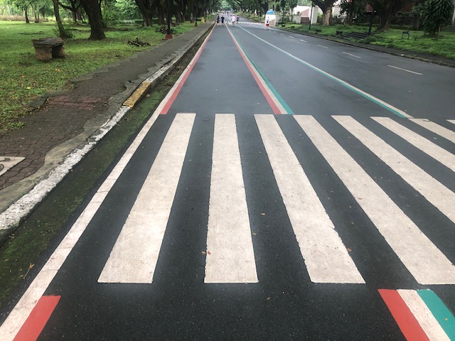 Here are the two lanes designated for joggers/walkers (curbside) and cyclists (median). The pedestrian sidewalk was originally planned to be widened in time for UP’s Centennial celebration back in 2008. That did not materialize. The Academic Oval could have had wider sidewalks for those who are not walking for exercise.
 The section in front of Melchor Hall features the words bicycles or bike lane and pedestrian in baybayin. Its certainly a novelty for now and something probably apt for the campus roads but not necessarily for others.
 A closer look at the baybayin script along the jogging/walking and bike lanes.
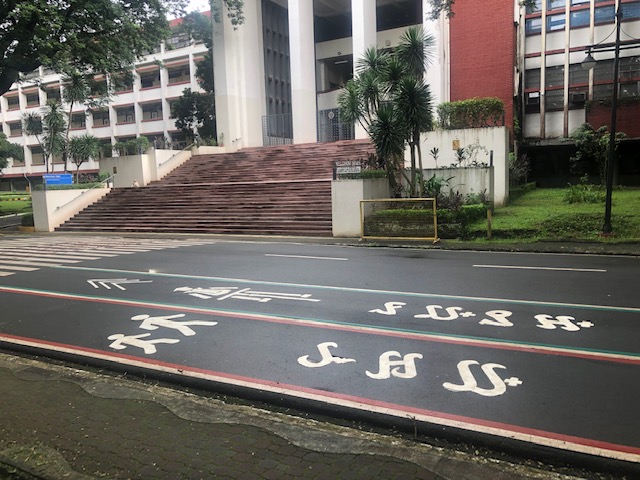 Here’s the bigger picture on the pavement markings.
 Approach to an intersection
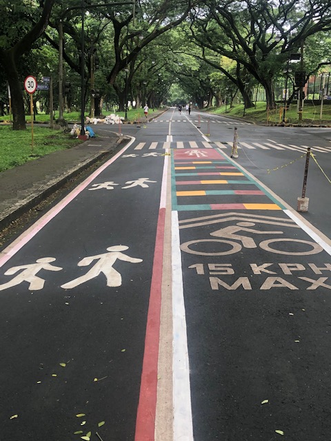 The UP colors inform riders about the intersection ahead. These are more visual as they are flat and not rumble strips. The older pavement markings advising riders of the speed limit should be seen in the context of utilitarian cycling (e.g., bike to work, bike to school) rather than cycling for fitness or recreation, which obviously may involve higher speeds and is frowned upon along the oval.
 The intersection approach from another angle.
The Academic Oval bike lane is one of the original recommendations of a transport study conducted for the campus about 17 years ago. The study was the basis for the campus being declared as a road safety zone, which among others included a provision for its roads to have a 30-kph speed limit. The one-way counter-clockwise traffic circulation and the jogging and bike lanes, however, are officially a part of what has become a long-term experiment on campus. There are many who oppose the one-way scheme and are vehement against the ultimate plan to have the Academic Oval car-free or car-less (it is mostly car-less during Sundays – part of the “experiment”).
The other new bike lanes on campus in Part 2 of this series.
–
On step counts
Here’s a nice read about whether we need to reach 10,000 steps/day. We often hear or read about people asking how many steps you’re taking on average each day or lamenting or bragging about how many they’re taking each day. Perhaps we don’t really have to take so many? And maybe the key is really about our diets.
Apparently, there is really no need to reach that so-called magic number that is 10,000 steps.
Here is another article:
Landsverk, G. (July 9, 2021) “Forget 10,000 steps — here’s how much you should actually walk per day, according to science,” Insider, https://medium.com/insider/forget-10-000-steps-heres-how-much-you-should-actually-walk-every-day-db6699848f9c [Last accessed: 7/14/2021]
–
Walking in Singapore
The recent trip to Singapore was like a sentimental journey for us. We had lived in the Lion City for almost 2 years and consider this a second home (actually a close third for me because I consider Yokohama as a second home having lived there for 3 years). Among the things we truly missed about Singapore aside from friends (many of whom have already moved to other countries) and food were the public transport and the walking. Singapore is a walkable city and the excellent public transport along with the land use planning has allowed healthier commutes for people.
 The environment along Orchard Road is inviting and conducive for walks.
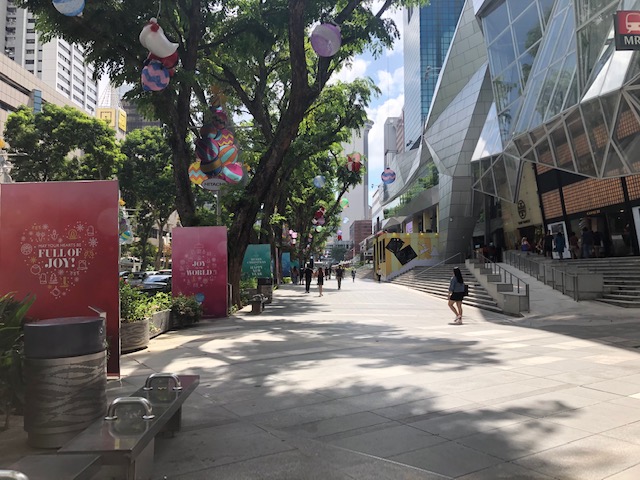 Wide sidewalks can accommodate more people and don’t make it feel so crowded even during the peak hours.
It was easy to log more than 10,000 steps per day in Singapore. In fact, I was happy to have walked an average of 11,000+ steps per day for the 3 days were there. One could only hope we can have similar infrastructure in the Philippines.
More on walking and public transport in Singapore soon.
–
Walking in downtown Cebu City
Last month when we were in Cebu to coordinate with our counterparts at the University of San Jose-Recoletos (USJR), I took some quick photos of the sidewalk scenes near the university. We stayed at a nearby hotel so that meant we only needed to walk to/from USJR for our meetings. Here are some of those photos.
 Many buildings in the downtown area have designs where sidewalks are practically covered, protecting pedestrians vs. the elements. This alludes to arcade design architecture you find in many old cities’ downtowns including Manila, Iloilo and Bacolod.
 There are many shops and stores at ground level. Depending on the area, there will be hardware stores, electronic stores, school supplies and others.
 Along some streets, one will find makeshift stalls occupying the road itself. I assume these are allowed by the city along certain streets.
 Typical street vendor with his mobile store. Fruits, local delicacies and snacks, and refreshments are popular.
I believe these scenes reflect on the character of the city and gives the visitor a view of life in the downtown area of the city, which in this case is Cebu, the oldest city in the country. I will be back in Cebu soon and will be taking more photos around downtown. I’ll be posting these, too.
–
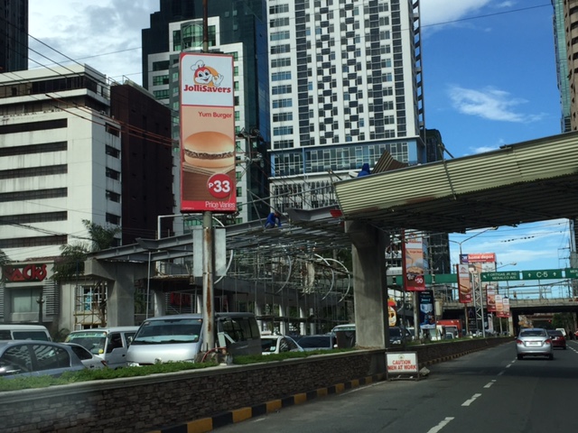
Marcos Highway-Felix Avenue-Gil Fernando Avenue pedestrian overpass
Here’s are some photos of the pedestrian overpass structure at the intersection of Marcos Highway, F. Felix Avenue (formerly Imelda Avenue) and Gil Fernando Avenue (formerly A. Tuazon Avenue).
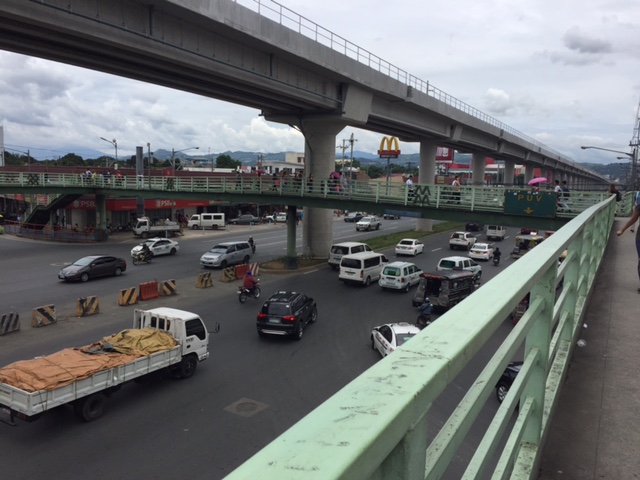 Here’s a view of Marcos Highway and the elevated Line 2 Extension from the structure crossing Felix Avenue between Soliven/Tropical and Sta. Lucia. Also shown is the overpass crossing Marcos Highway.
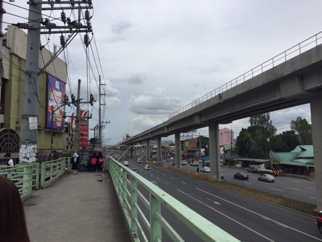 View towards Sta. Lucia and Robinsons Metro East
 Stairs to Sta. Lucia – notice the gap in the railings along the elevated Line 2 superstructure? That is where the Emerald Station will be constructed.
–
Ortigas Center walkways under construction
Currently under construction at the Ortigas Center are elevated walkways that are part of the Ortigas Greenways Project. Following are some photos I took a few weeks back (they’re old!), and so the current state should show significant progress from what is in the photos.
 Elevated walkways are currently under construction at the Ortigas Center. This part can be seen along Julia Vargas Ave. at the intersection with Garnet St.
 Structure at F. Ortigas, Jr.
 Close-up of the F. Ortigas part of the elevated walkways
 Walkway section under construction along the approach of ADB Ave./San Miguel Ave.
 Crossing under construction at the intersection of Julia Vargas with San Miguel Ave. (to the left) and ADB Ave. (to the right).
 View of the F. Ortigas crossing walkway along the eastbound direction of Julia Vargas Ave.
This project is perhaps one of the most hyped pedestrian facilities in Metro Manila and if I recall right, the concept for this can be traced to workshops conducted during one of the Transport Forums organized by the Asian Development Bank (ADB), whose headquarters are located in Ortigas Center. It took a while to be realized but should be completed soon. This won’t be the first of its kind in Metro Manila as Makati already has one connecting office and residential buildings to Greenbelt and Glorietta. I really do hope it is able to reduce congestion in the area but this would require studies after the facilities are opened for public use. We need more of these around Metro Manila as well as other major cities. We direly need facilities to encourage walking as a preferred mode over motorized transport.
–
Challenges for students commuting to/from schools
Its our first day of school for our daughter today. But unlike her, I recall that I had to wake up early when I was in grade school and high school because the ‘service’ providing transport to and from school had to pick me up and then others. That usually meant a 5:30 AM wake up, a quick shower, dress-up (we wore uniforms) and breakfast before the ‘service’, an AUV, picked me up at home. School started at 7:30 AM and it took something like 45 minutes (depending on traffic) from our last pick-up to get to school at exactly 7:30. If our vehicle is able to finish pick-ups earlier, that meant we were assured of not being late for homeroom period. If the other kids (and there are many) are running late and we end up waiting longer for each, then we would likely be late. In many cases, our driver would have to resort to being reckless in order to make the time.
Nowadays, I think its much more difficult for kids due to the worsening traffic congestion. What was a 30 to 45-minute travel time between our home in Cainta to Pasig/Mandaluyong is now easily twice or longer that. And I am only referring to a direct trip. Even with Waze available, one can only have few options for routes between home and school.
While there are still many school ‘service’ vehicles (and not so many actually buses), many parents seem to have opted to Ateneo, for example, used to have a fleet of buses transporting students. These were replaced by AUVs and vans accredited by the school, and the many (too many?) private vehicles ferrying mostly individual students to and from their Quezon City campus.
 School children have to wake up early to go to school. Some probably take their breakfasts as baon in order to save time for traveling. Some take their breakfasts at nearby eateries or fast-food restaurants.
 Many children may be at risk as they are ferried to school via motorcycles and usually without helmets. In other cases, there are tricycles acting as school service vehicles. Often these are overloaded with children and their school bags.
Pedestrian facilities are also lacking in many cases and particularly in rural areas where public schools are located along highways that have no sidewalks or cities where pedestrian walkways are not built to standards for one reason or another. These are issues that need to be addressed and would be nice topics for research, especially those with practical and safety applications.
–
On walking and the old pedestrian overpass at UPIS
I decided to go for a long walk one day last April. I walked from our office to the UP Town Center, which was just under 2 kilometers away, to purchase something. I could have taken my car or perhaps rode a jeepney but I wanted to see for myself how easy or difficult it was to walk that distance. It turned out that it wasn’t a difficult walk at all. From Melchor Hall, I crossed the street so that I could walk along the inner part of the Academic Oval. I then took a short cut through the trail in front of Malcolm Hall at the edges of the Sunken Garden, emerging just near the grandstand. From there, I crossed towards Vinzons Hall and then walked towards and along Shuster Street near UP Integrated School. I exited the campus at the portal at the end of Shuster and crossed Katipunan using the old pedestrian overpass that connected the main campus with what used to be UPIS on the other side of C-5.
 The pedestrian overpass is an old structure compared to many of its kind around Metro Manila. The design is quite massive considering it is a concrete structure. The photo above was taken towards the direction of UP Town Center.
 The steps are quite steep on either side of the overpass
 Here’s a photo of a person carefully walking down the steps of the overpass.
 The photo above was taken towards the direction of the UP campus.
The overpass used to be dirty, unkempt, and to many was revolting enough that it was rare to find people using it to cross Katipunan. Most people crossed the busy thoroughfare on the ground, often braving the traffic and taking on the risk of getting hit by a vehicle. Since the overpass was integrated with the UP Town Center (i.e., it is physically connected to the mall and there security personnel posted there), more people now use it. MMDA also fenced much of the median of Katipunan in the area and so the only way to cross the stretch of UP Town Center from Shuster to C.P. Garcia is via either of the two pedestrian overpasses (there’s a second, newer steel structure near C.P. Garcia).
As for the walk to Town Center and back, I thought it was safe, convenient and invigorating (nothing like some walking to help in blood circulation). I took a leisurely pace (not brisk) for my walk so I could enjoy the environment. You tend to see a lot of things when you take such walks and the campus is full of activities, sights and sounds, to help make the walk enjoyable such that you won’t even notice the time and perhaps, won’t even mind the exercise.
–
