
Home » Posts tagged 'pedestrian' (Page 3)
Tag Archives: pedestrian
Caught up in trAPEC
It’s a corny title to this post and perhaps is practically what people would call ‘click bait’. But then it is a very appropriate one considering it describes what happened last Monday and is still happening today and for the rest of the week affected by the Asia Pacific Economic Cooperation (APEC) forum hosted by the Philippines and held in Metro Manila. Yes, Metro Manila. And many people have been asking loudly or in their mind why the capital city when the government was supposed to be promoting and bragging about growth in other cities (inclusive growth anyone?). I would have thought and preferred to have APEC in either Subic or Clark, which have been touted as rapidly growing areas and as international gateways. In fact, Clark is being pitched as the location of a potential new city in the Clark Green City project as well as the aerotropolis currently being developed (slowly) near the airport and the SCTEX Clark South interchange.
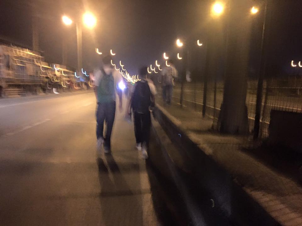
Instead, we have the APEC forum and all its attendant activities in Metro Manila. And it seems that the forum has maximized its detrimental impacts on the economy as it practically shut (some people even say shat) down the capital because of severe traffic congestion and a lack of public transport infrastructure and services to carry commuters safely and efficiently between their homes and work places. The Manila Bulletin posted the following photo last Monday:
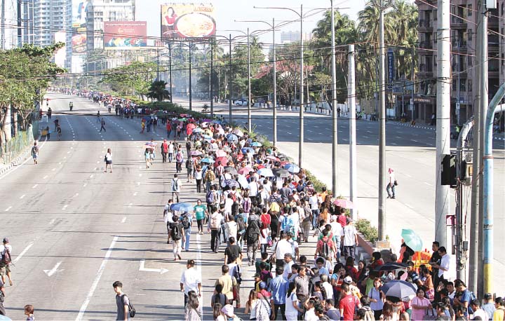 Commuters were forced to walk along Roxas Boulevard just to get to work.
Here are a few more photos courtesy of an old friend from high school:
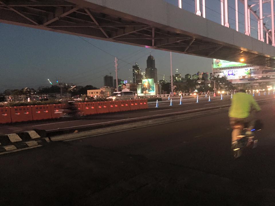 A lone cyclist pedaling along a practically empty section of EDSA (photo credit: Bong Isaac)
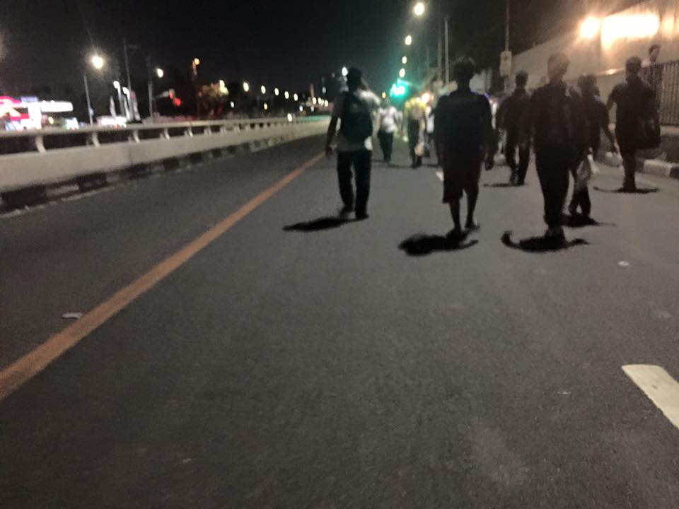 Walkers? – commuters took to walking along EDSA, one of the country’s busiest and most congested thoroughfares. I was amused of the memes about the ‘Walking Deadsa’ referring to people seemingly walking like zombies after a hard day’s work just to get home. (photo credit: Bong Isaac)
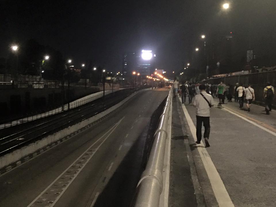 Commuters walking along a vehicle-less EDSA. The MRT 3 line at the left in the photo also seems to be ‘lifeless’ at the time (evening I was told) the photo was taken. (photo credit: Bong Isaac)
 People walking along the service road along the SLEX – most affected of the road closures were people from the southern parts of Metro Manila including those from Laguna and Cavite. (photo credit: Bong Isaac)
I remember being asked once during an interview if it was possible to determine the cost of congestion due to a single event such as a road crash or perhaps a rally. I replied that it is possible given the available tools and expertise in making such assessments. What could be the cost of such a week-long event? Would the holidays for Metro Manila have lessened the economic impacts on traffic of the APEC? Or was it assumed that agreements and the media mileage we got from APEC more than enough to cover economic losses?
Could this disastrous traffic mess have been averted or at least mitigated despite APEC in Manila? Yes, perhaps, if the transport infrastructure particularly the LRT Line 1 Extension to Cavite, the upgrading of the MRT Line 3 and an airport access transit system were completed prior to APEC. These along with other major projects for Metro Manila were promised years ago and yet have not been realized. Add to this the apparent lack of contingencies (BRT-like express buses? bicycles?) that could have eased the pain of hundreds of thousands of commuters affected by APEC traffic schemes. Government has no right to tell people “I told you so” when government efforts for the benefit of its own commuting citizens have been deficient these past years.
–
Antipolo public market pedestrian overpass
I took some photos atop the pedestrian overpass connecting the New Antipolo Public Market and the Robinson’s Place mall. The overpass is across Sumulong Highway, which terminates nearby at the intersection with Antipolo Circumferential Road (Daang Bakal), which is currently being widened.
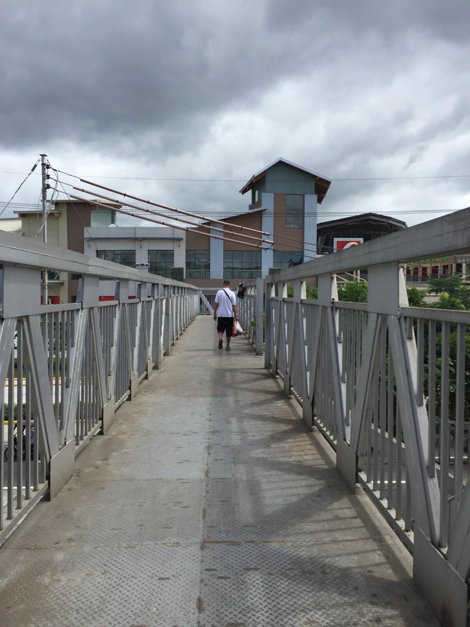 The overpass is a steel structure, including the flooring, which reminded me of factories. This industrial look is not new as there are other overpasses that have been constructed in Metro Manila similar to this.
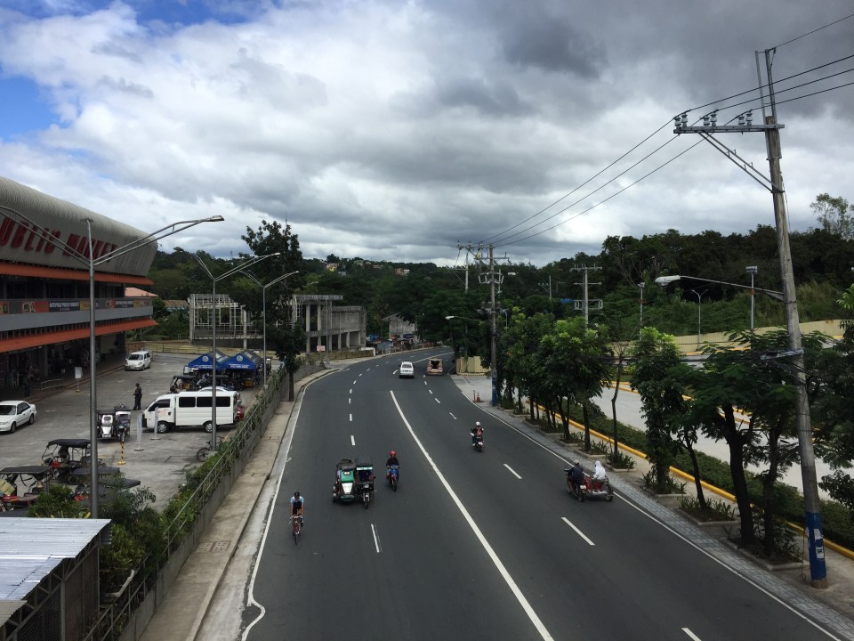 A look at Sumulong Highway towards Masinag. The highway has 4 lanes and at this section has sidewalks on either side of the road. There is no median island to separate opposing flows of traffic. The Antipolo Public Market is on the left side.
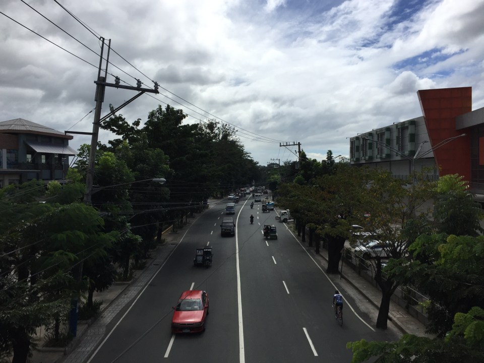 A view of Sumulong Highway towards the Antipolo Shrine of Our Lady of Peace and Good Voyage. The Public Market is at the right and the mall is at the left.
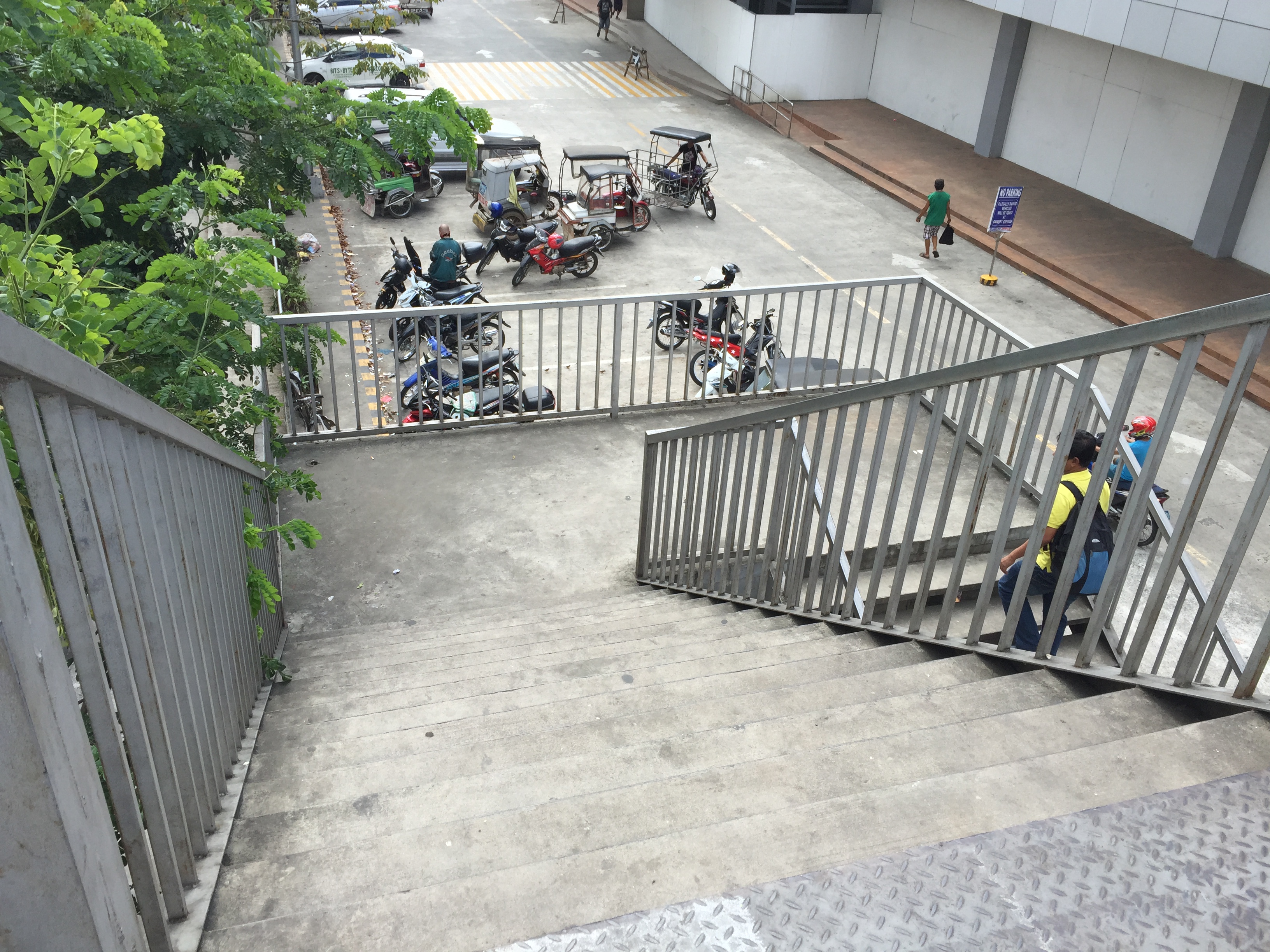 The overpass’ stairs are a bit steep and perhaps not so friendly to senior citizens. There should probably be a ramp for persons with disabilities or for cyclists to use as they carry their bicycles to cross using the overpass.
Despite calls from some advocacy groups for pedestrians to be prioritised and for them to cross at-grade, the reality is that we are still far from achieving safe roads for pedestrians given the way motorists run their vehicles. In the case of Antipolo, many jeepneys, UV Express and tricycles (freely roaming the city) are operated by reckless drivers. Private vehicle drivers are not so different and I have seen scenes of road crashes along Marcos Highway and Sumulong Highway where those involved are private vehicles including motorcycles. Clearly, many of these people should not have driver’s licenses in the first place given their mindset when driving. So until this improves, pedestrians are safer when they do use these overpasses. Of course, that goes without saying that the location and design of overpasses need to be thought over carefully so that these facilities will be used and not just become white elephants.
–
Construction of pedestrian overpass at Masinag
What’s been causing a lot of traffic jams the past week emanating from the Masinag area is the installation of the pedestrian overpasses (or footbridges, if you prefer the term) at the junction. Components of the overpasses were constructed and installed intermittently over several months already. Last Sunday, major works were undertaken including the raising of the main girders that are also to be the walkways for pedestrians. The work entailed closing sections or parts of the intersection and resulted in monstrous traffic jams along both Marcos Highway and Sumulong Highway. The congestion spread to local roads that were used to divert traffic as work was underway during the daytime. Yes, daytime! I found it unusual that such works would be undertaken when traffic was already significant for the two major roads here even if it were a Sunday. Most people had little or no information about this including residents of Antipolo and Marikina who were the most affected by partial closures.
 The still unfinished pedestrian facility at Masinag Junction
The pedestrian facility at Masinag junction has four spans that are supposed to cover crossings across all four legs of the intersection. Thus, theoretically, pedestrians may cross any time despite the busy traffic at ground level. I haven’t seen the stairs yet but if they are much like other footbridges including recent ones of similar design, then I would say that they are not that friendly to senior citizens, persons with disabilities and those who want to cross with their bicycles. Then there are those who are just too lazy to use the overpass and instead would just risk it by braving traffic as they cross at ground level. Already, many pedestrians choose to cross the roads a few meters from the intersection (it used to be that they crossed at the intersection) and it will take a lot of education and enforcement to make most people use the footbridges. Meanwhile, Antipolo should ensure that vendors do not set up shop at the overpasses. This facility is for walking and not shopping.
Among the implications of the four overpasses is the need to re-install traffic signals at the intersection as the current set-up is already obscured by the pedestrian structure. Incidentally, that it also why Antipolo City had to assign personnel to manage traffic at the intersection for much of the day. It is expected that the signals will be installed where motorists can easily see them. The pedestrian facility is also expected to enhance safety at the intersection especially for pedestrians as well as ease congestion for vehicular traffic. Call it car-oriented but it is a necessity given the steadily increasing volume of traffic at the junction. Until there is a good public transport system to help reduce the number of motor vehicles on roads such as Sumulong and Marcos Highways, cars and the like will continue to rule our road space. Ultimately, the provision of pedestrian facilities (hopefully, appropriately designed) is a people-oriented endeavor that should be promoted.
–
Some setbacks for sustainable transport
There have been a few setbacks for sustainable transport in the news recently and not so recently. One is the burning of an electric vehicle, a COMET to be precise, that saw one unit burn to the ground near the UP Town Center along Katipunan Avenue. I am not aware of any official or formal findings being released as to what really happened to the vehicle but that is basically a big PR problem now as detractors of e-vehicles will point to the incident as proof that e-vehicles still have a long way to becoming a viable and safe option as public utility vehicles. E-vehicles have a lot to prove especially as an option for public transport and such setbacks only strengthen the argument against them and leaves us with the current conventional options.
Another is the discontinuance of service inside the Bonifacio Global City (BGC) of hybrid buses operated by Green Frog Transport. This one is due to what Green Frog described as exorbitant fees being charged by Bonifacio Estates Services Corp (BESC) for their buses to enter BGC. This is making the rounds of social media but there seems to be no response from BESC nor from the Bases Conversion and Development Authority (BCDA), which is supposed to also have a say with policies in BGC. Perhaps BESC thought it best to just give Green Frog the silent treatment for what appears as a trial by publicity approach by Green Frog. One commuter commented that maybe BGC authorities should push for their Fort Buses to be hybrid and phase out the jeepneys in favour of higher capacity transit inside BGC.
There have also been issue on road safety including many incidents of pedestrians getting run over by vehicles. Many of these have been captured on video particularly by the Metropolitan Manila Development Authority (MMDA), which has set-up a network of cameras in many intersections along major roads. Many show vehicles Given that many cases feature jaywalking, it is still the responsibility of any motorist to exercise caution when manoeuvring, especially when turning at intersections. Drivers will always have blind sides or weak sides when they manoeuvre so they should be very careful when in doubt and not immediately proceed when it is not clear that they have a clear path. At BGC (again) one will notice that many motorists do not give way to pedestrians even when the latter are crossing at the right locations and according to the sign clearing them to cross the street. In one case involving two speeding SUVs, one lost control and hit a pregnant woman crossing the street. While a significant number of vehicles in BGC are through traffic, it is still the responsibility of BGC’s traffic enforcers to ensure motorists follow traffic rules and regulations including prioritising safety over haste. Simply attributing such safety issues to through traffic is no excuse for traffic enforcement being as lax as or par with the rest of Metro Manila, especially for a CBD that packages itself as better than the rest of Metro Manila.
Candidates for pedestrianisation?
I friend recently posted on the pedestrianisation of Intramuros and I commented that the walled city that used be equated to Manila should be a prime candidate for initiatives on pedestrianisation. Among the challenges, however, for any project that seeks to encourage walking by reclaiming roads and other spaces for pedestrians in the walled city would be the pedicabs. These are non-motorised three-wheelers that proliferate in Intramuros. There are just too many of these vehicles going around the area. I have mentioned these vehicles in past articles on some streets in the walled city including Calle Real del Palacio, Muralla Street, and Solana Street.
A city that can be used as a ‘good practice’ reference is Vigan City in the province of Ilocos Sur. Many parts of Vigan City are already pedestrian-friendly. In fact, Crisologo Street, which famously represents this city recognised as a UN Heritage Site is off-limits to motorised transport. However, the issue with Vigan is the proliferation of motorized tricycles. There also seems to be an oversupply of these tricycles that many continuously go around the city looking for passengers. The noise and emissions from these roaming tricycles alone contribute to negate part of the attraction of this Heritage City.
Baguio City can be transformed into a walkable city and focus should be on the iconic Session Road where small businesses including restaurants and shops once thrived. I say ‘once’ because the establishments along Session Road have experienced a decline during the past years since a major retail company constructed and started operating a huge mall near one end of Session Road. So much for the small city feel of Baguio and the local shops and restaurants that have suffered from the big business concept brought in by the mall.
In Makati City, the Ayala CBD has been pedestrian-friendly for quite some time now. People-centered facilities include underpasses for crossing major roads like Ayala Avenue and an elevated walkway connecting office buildings all the way to the Greenbelt mall. Unfortunately, these pedestrian-friendly features are limited to the CBD and
In Taguig City, the Bonifacio Global City is a good example where sidewalks are wide enough and there are pedestrian friendly malls like the High Street where people are prioritized over cars. Crossing the streets, however, can be very dangerous at BGC and traffic enforcers need to do more serious enforcing in order to manage speeds and aggressive driving by motorists in BGC. There are already incidences being shared on social media of pedestrians being hit by speeding vehicles or those whose drivers simply don’t give way especially when turning at corners.
In Quezon City, there are few areas that can be regarded as pedestrian-friendly. Among these are the University of the Philippines campus in Diliman, whose core is closed to motorised traffic during Sundays. There are initiatives for making Katipunan Avenue more pedestrian-friendly. However, these initiatives seem to be still far from being implemented on the southbound side of Katipunan where plenty of establishments do not have adequate parking and there are practically no sidewalks for people to walk on. This is the side where there used to be a service road that had to be sacrificed more than a decade ago when the MMDA got engrossed with a flawed traffic scheme.
What cities or streets would be your candidates for pedestrianisation?
All roads lead to Antipolo: rerouting for the Alay Lakad
The Rizal Provincial Government and the Antipolo City Government recently posted traffic rerouting schemes on their Facebook pages. Lalawigan ng Rizal was the first to post schemes that affect traffic in at least 3 major local government jurisdictions – Antipolo, Cainta and Taytay. The schemes affect the two major corridors that basically lead to Antipolo’s National Shrine of Our Lady of Peace and Good Voyage (or Antipolo Cathedral to many) – the Ortigas Avenue corridor and the Marcos Highway-Sumulong Highway corridor. There are many major and minor routes connecting to these corridors and are clearly seen in the maps.
Within Antipolo, there are also re-routing schemes, which the Antipolo City Government posted along with a “clearer” re-posting of the maps from the Rizal FB page. The Antipolo FB page includes information/maps on the rerouting within the city center. These schemes will affect traffic circulation including public transport routes. Critical would be the permanent and temporary terminals and parking areas set-up around the city that should be able to accommodate the thousands of vehicles that are also expected to be used by people who won’t be walking or cycling.
What the maps basically say is that from 4:00 PM today, Maundy Thursday, to 6:00 AM tomorrow, Good Friday, the stretch from Cainta Junction to the Shrine will be closed to traffic. This is to allow the hundreds of thousands expected to make the trek to Antipolo to have the road for themselves. What the maps don’t say is that motorcycles and tricycles would likely be allowed, too. I can understand that motorcycles could easily squeeze into the throngs of people but then allowing tricycles to operate among the walkers and bikers would be risky given their drivers’ behavior. Add to this that they would be making a killing out of charging opportunistic fares.
Technically, the rerouting schemes don’t appear to be as well thought of as can be expected from the LGUs. Baka ito lang nakayanan ng staff o ng consultants nila, and surrender na agad ang Rizal and Antipolo with regards to the coming up with more options for people to travel to the Antipolo Shrine? Not all people can walk or cycle but are willing to an could take public transport for their pilgrimage. The maps themselves are a bit crude and the Province of Rizal and City of Antipolo could have done much better maps given the resources of these LGUs. There are open source tools now available as well as your basic software like PowerPoint or Photoshop (even Word!) that can be used to render good quality images to guide people making the Alay Lakad. This is a regular event and though it happens once a year then perhaps the LGUs could have better plans especially to transport people who cannot make the walk to Antipolo. The objective after all is to convey the masses to and from the shrine safely and efficiently – something a mass transport system can do whether via Marcos/Sumulong or Ortigas corridors.
One reminder to all doing the Alay Lakad: keep your garbage to yourselves if you cannot find a proper waste bin. Do not dispose of your waste along the route and make a dumpsite out of Ortigas Avenue, Marcos Highway, Sumulong Highway or whatever roads you are taking! Kasalanan din po ang irresponsableng pagtatapon ng basura. While you might be forgiven for these “sins” through the Sacrament of Reconciliation (which many will likely take at the Cathedral), nature will have a way of getting back at you for your environmental travesty. –
Swapang drivers
Intersections, especially those with traffic signals, typically have road markings indicating the stop line for vehicles as well as the designated pedestrian right of way for crossing at the intersection. Most intersections also have a typical “yellow box” that is supposed to mark the area that is to be clear of any obstructions (including vehicles and pedestrians) in order for traffic to flow efficiently at the intersection. Despite these and the clear policy on where to stop at intersections based on traffic rules and regulations, many motorists choose to violate these rules and encroach or occupy space that is for pedestrians and cyclists. In the process, these motorists endanger the lives or limbs of people that they might hit as they attempt to get ahead of others. This propensity to “get ahead” or panggugulang in street lingo is widespread and indicative of how the poor discipline among motorists.
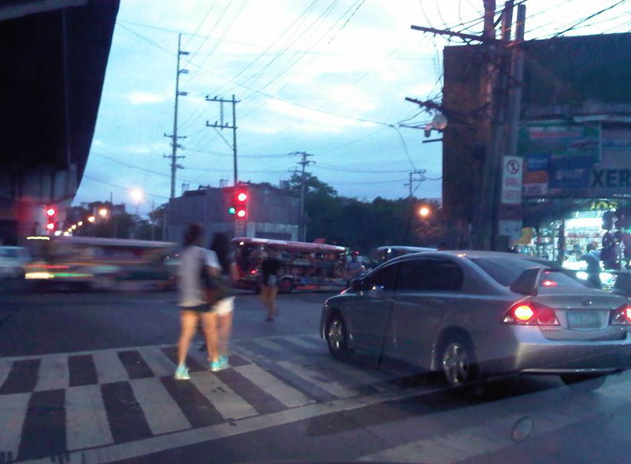 The driver of this car seems to think he could get ahead of everyone else by stopping on top of the pedestrian crossing, which in this case is clearly marked.
There are many cases like this and in some there are traffic enforcers that quickly approach the vehicle to accost the driver. In Makati, erring drivers immediately get a ticket or are fined for such transgressions. The photo taken above was in Quezon City at the intersection of Aurora Boulevard and Katipunan Avenue. There were a lot of enforcers there and very visible but they were only watching traffic and did not mind such cases. I think that if an enforcer was not deputised (i.e., not authorised to give a traffic ticket) then the least he/she could do was to approach the driver, inform him/her of the transgression and then direct the driver to clear the area (basically back up behind the crosswalk).
If and where the enforcer is deputised, then I think they should issue tickets or fine violators to send a clear message that such actions will be penalised immediately and firmly. Word of such actions and their outcomes usually travel fast among motorists especially with social media these days expediting such information dissemination regarding transport and traffic in various areas in the metro. This would be a good way to influence people to improve their behaviour on the roads.
–
If you build it, will they come?
There seems to be a belief among the more zealous advocates of sustainable transport that if “you build it, they will come.” It seems cliche but this saying is not necessarily applicable to many things especially when referring to transport infrastructure. There are examples of roads, terminals and other transport facilities that have been built but sadly are underutilized mainly due to the demand just not being there and taking much time to attain. The last is usually due to the fact that certain conditions or prerequisites have not been satisfied. One such example of this is the case of the Subic-Clark-Tarlac Expressway (SCTEX), whose payment for the loan that covered the construction costs was premised on a very high traffic demand forecast. It took some time for more people to use the expressway as the traffic from the major developments (Clark, Subic, Tarlac and Bataan industrial and commercial developments) just didn’t happen as immediately as assumed in the forecast. Still, there is a strategic value to such major infrastructure considering it as an investment and something that will cost a lot more in the future if not built today.
In Metro Manila, the MMDA has allocated or designated lanes for cycling along several major roads. These included the lanes they created out of painting existing pedestrian sidewalks and marking these as bikeways. One section is between Magallanes and Ayala while another is from Ortigas to White Plains. These are poorly designed, “pwede na yan” types of bikeways that people on bicycles would find very difficult to use because the course is full of obstacles. And how about the plight of pedestrians who would have to share these narrow paths with cyclists? Such mixed signals on providing for the needs of pedestrians and cyclists are not necessary unless of course the main objective of this exercise is just to get the attention of a wider audience that is the general public, which I would strongly agree is needed to advocate for sustainable transport. Focus on the ultimate goal, however, should not be lost for what appears as small victories. Perhaps an even stronger initiative should be towards having the DPWH revise road design guidelines to incorporate walking and cycling requirement especially for national roads.
 Bicycle lane along Julia Vargas Ave. in Pasig City
Cebu City enacted an ordinance essentially promoting cycling through the planning and implementation of bikeways, bike lanes or shared lanes. However, initial efforts seem to be following the MMDA’s “pwede na yan” approach. I think Cebu could do better and come up with a better plan for integrating and mainstreaming bikeways into the transport network. But of course, a lot still needs to be done for pedestrian facilities.
In conclusion, building transport infrastructure is not an assurance that it will generate its intended benefits at once. However, some infrastructure are more strategic than others as perhaps they form part of a network. Expressways in Luzon are among these strategic investments. High standard highways in Mindanao are also essential. Rail rehab and building in Luzon is strategic. The same in Mindanao perhaps is not. Mass transit systems in highly urbanized cities are required but perhaps many should start with buses rather than rail. Bridges across islands are not urgent. International-standard airports in major cities are necessary but not all provinces require such airports. Its not a simple task to determine what will work and what wouldn’t. While it is easy to attribute so many benefits in order to justify a project, such practice would usually result in white elephants that few people benefit from.
–
On jaywalking, overpasses and informal terminals
I had some errands last December and decided to take public transport instead of taking our car and wasting time parking the vehicle. There was significantly less traffic at that time of the year because schools already on Christmas break and everyone else seemed to be on the slow side of the holiday mode (read: not in shopping mode). I needed to cross the wide road that is Quezon Avenue and there was a sign where I usually crossed that it was now prohibited to cross there. I had to take the overpass to get to the other side and to the jeepney stop to board one to get back to the university.
The overpass at the Quezon Ave.-Araneta Ave. intersection is under-utilized. I base this on the several times I’ve used the overpass. Most people prefer to cross at road level, taking advantage of the traffic signal cycle that allows for gaps in the traffic for pedestrians to cross safely. Of course, there are those who cross any time and seem to tempt fate by their behaviour. They seem to tempt also the MMDA traffic enforcers assigned in the area but from what I have observed, enforcement of the “no jaywalking” policy is usually lax or non-existent. People regularly cross at ground level in plain view of traffic enforcers.
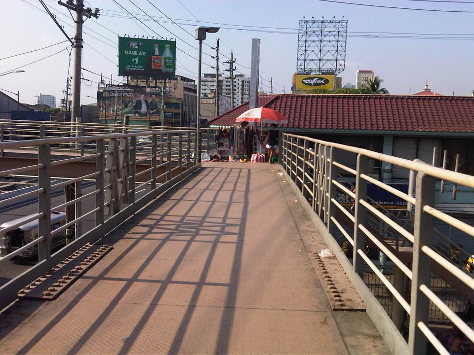 A vendor set-up at the corner of the pedestrian overpass at the Quezon Ave.-Araneta Ave. intersection. Obviously, there are few pedestrians using this overpass as most prefer to cross at ground level.
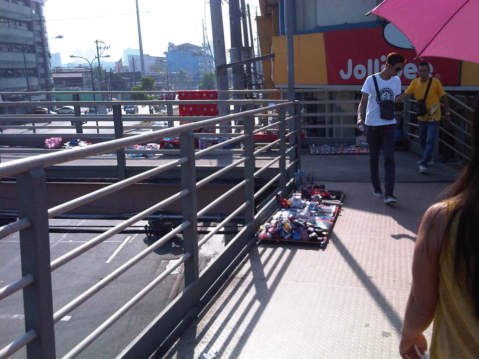 More vendors on the overpass – fortunately, there were few pedestrians using the overpass at the time. Its not the same for other overpasses that are crowded due in part to vendors occupying much of the facility.
 The stairs for many overpasses around Metro Manila are a bit on the steep side. That’s generally not okay with senior citizens, children or persons with disabilities.
There is an informal, on-street jeepney terminal right at the foot of the overpass. If you are in a hurry, its best to try to board a jeepney on the second lane as they are more likely to proceed when the approach is given a green light. From my experience, it takes about 2-3 cycles before the “queued” jeepneys finally cross the intersection. It takes that time to at least have several passengers for the jeepneys before it proceeds to cross the intersection. Most passengers here are transferring from jeepneys plying routes along Araneta Ave. There shouldn’t be an informal terminal here and jeepneys occupy 1-2 lanes of the road at a critical point – the intersection approach. This means intersection capacity is significantly affected and many vehicles could not proceed as they are blocked by the jeepneys. Special mention is made of vehicles wanting to make a right turn but have to go through this “gauntlet” of public utility vehicles. Again, there are MMDA enforcers in the area but it seems the jeepneys and the barkers hold sway and likely with the blessing of enforcers. Such situations are commonplace in Metro Manila and many other cities, and contribute to traffic congestion and other problems commuters regularly encounter.
–
Challenges concerning pedestrian overpasses
A photo went viral over social media last year about power lines jutting out of a pedestrian overpass in Metro Manila that also happened to be a steel structure. There are others like it that were constructed with the implementors not paying attention to the details, that is referring to the power and communication lines or cables that are practically everywhere in Metro Manila and other cities. I give the designers the benefit of the doubt as they likely did the designs assuming there were no constraints such as the overhead cables and wires.
Over the holidays, we observed some very crowded overpasses along Commonwealth Avenue particularly those at the Fairview and Litex market areas. Here’s a photo of one very crowded overpass where pedestrians seem to be walking single file in two directions:

It is clear in the photo that the main reason for the very crowded overpass is the presence of vendors on the overpass itself. This seems to be the case in many other overpasses in other commercial areas (e.g., Quiapo, Ortigas, Cubao, etc.) where vendors practically occupy half of the area along the overpass thereby constricting the space people can use to cross the road beneath it.
Who is in-charge of these overpasses? Do local governments or the MMDA tolerate such practices by vendors? I already answered the first question – the MMDA and local government units are in-charge and are responsible for keeping these facilities clear of other activities other than pedestrians using the overpass to cross the road. I recall that there are actually ordinances with the MMDA and the respective LGUs pertaining to the proper use of overpasses and there are actually penalties for vendors and others setting up shop on these facilities. Judging from the scenes atop the overpasses that we see every day (e.g., the photo above), it is clear that the people in-charge are neglecting their work (surrender na?) and this is clearly an inconvenience to pedestrians, many of whom can also be seen crossing the wide Commonwealth Avenue and risking their lives and limbs as they evade motor vehicles including zooming buses along the highway.
These are examples of challenges that pedestrians face everyday and something authorities should be urged to act on and immediately and decisively. Such action should not only be for the case of overpasses but to sidewalks and other pedestrian facilities as well. These have significant implications to road safety as well as the efficient use of transport facilities and improvements will surely enhance quality of life as well. We cannot claim to promote walkable communities if we fail to deliver on the spaces that are supposed to be for walking. And we cannot promote healthy cities without having such spaces for people to be encouraged to walk.
–
