
Home » Posts tagged 'pedestrians'
Tag Archives: pedestrians
“Nobody Walks Here. It’s Too Hot or Cold or Wet or Dry.”
I’m sharing this article as it provides a clear response to the question about walking under different circumstances. Those circumstances include weather conditions. How many times have we heard people saying “people won’t walk because it’s too hot or rainy” ? Maulan (rainy)! Mainit (too hot)! And yet we find a lot of people walking, even when its extremely hot or the rains are pouring.
Source: “Nobody Walks Here. It’s Too Hot or Cold or Wet or Dry.”
Quoting from the article:
“The human ability to adapt is the key to our spectacular success on this planet. Our problem is that the people who lead our public conversations, our elites of wealth and opinion, are often some of the least adaptable people on earth. And when societies assume that we should listen to those people, we all end up internalizing the message that there’s something wrong with us if we even try to walk…
…Sometimes walking a few blocks is the key to liberty and prosperity in someone’s life. Most people do what makes sense in the place where they live. Only if we recognize that will we make the investments in urban design to make walking more bearable in extreme weather. And only then will our cities include everyone.”
Here’s another quote and a take on what certain people say that often influences our choice for walking:
“The functionality of a city, and of its transport system, arises from the sum of everyone’s choices about how to travel, not just the preferences of elites. When elites make pronouncements about what “people” will tolerate, while really speaking only of themselves, they mislead us about how cities actually succeed. They also demean the contributions of the vast majority of people who are in fact tolerating extreme weather to do whatever will give their lives meaning and value.”
–
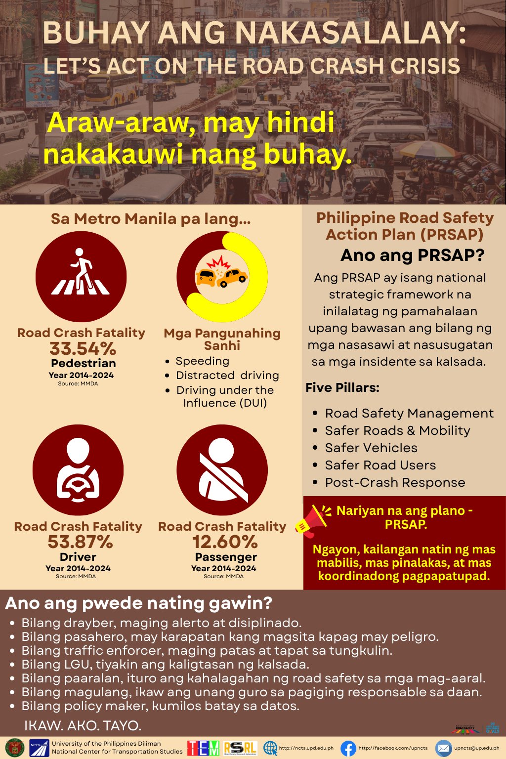
Let’s act on road safety crisis!
May is Road Safety Month. It’s quite ironic that we started the month with some of the most gruesome crashes including one at SCTEX and another at NAIA. There is indeed a crisis on road safety but many are in denial or perhaps insensitive to the impacts of these crashes. We need to act and only together can we be most effective in reducing the risks for all road users.
So what can one do? How can one contribute to making roads safer? Sharing this poster from the Road Safety Research Laboratory (RSRL) of the National Center for Transportation Studies (NCTS) of the University of the Philippines:
–
Technical sessions at the TSSP 2024 Conference
I am sharing here the latest draft of the technical sessions for the 30th Annual Conference of the Transportation Science Society of the Philippines (TSSP). The conference will be held in Iloilo City this coming September 13, 2024.
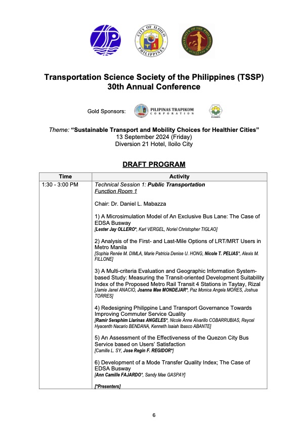
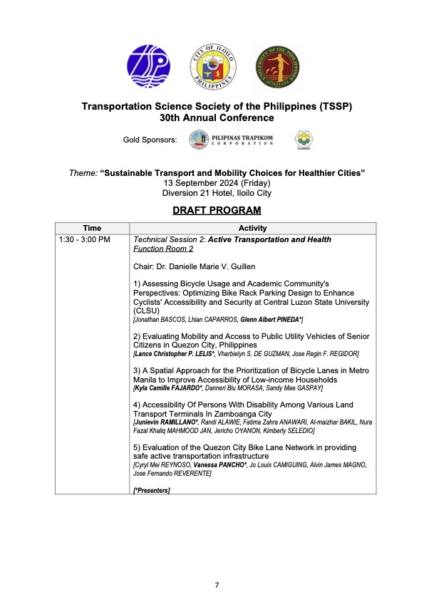
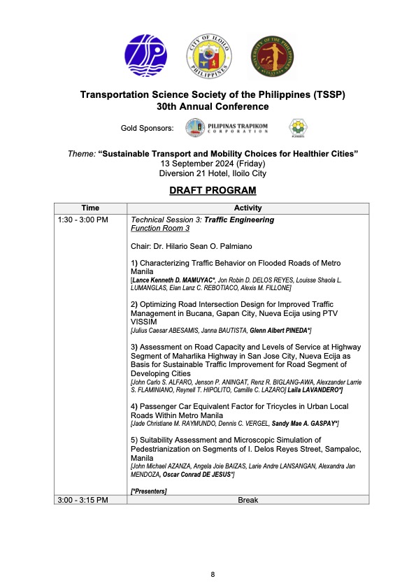
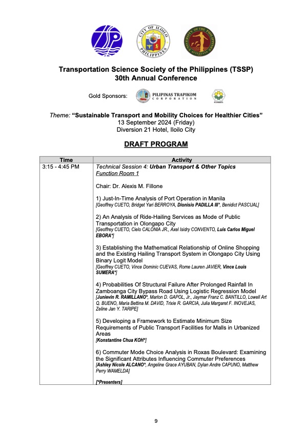
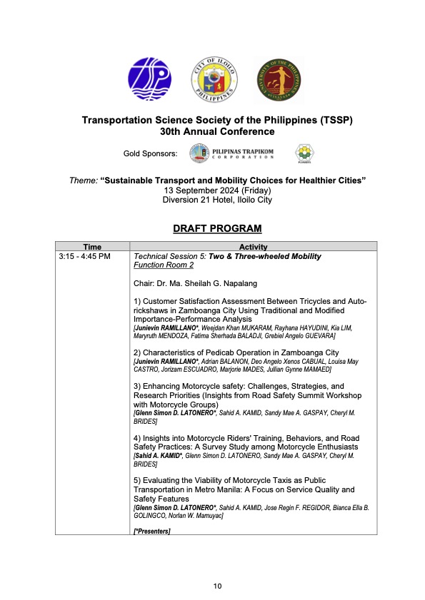
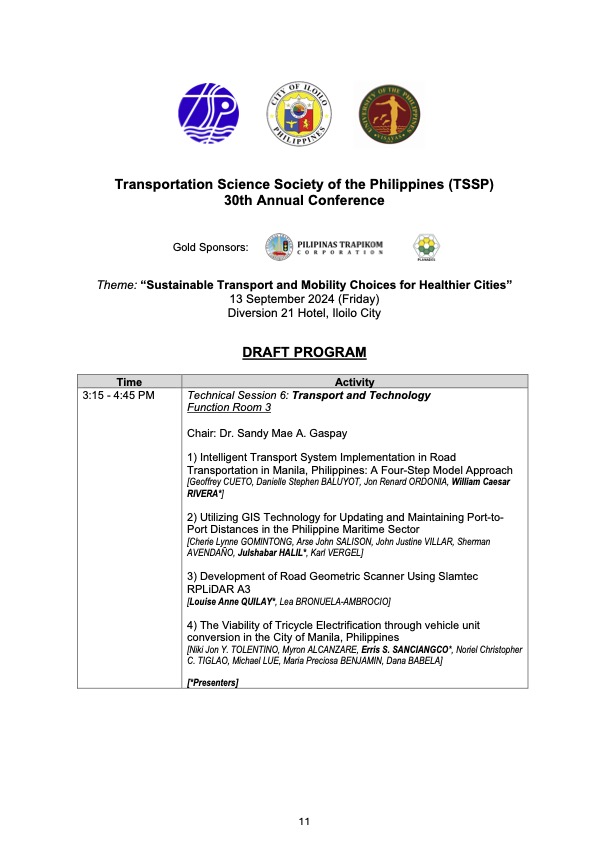
I will share the draft program for the morning plenary session in the next post.
–
Pedestrian-Friendly Cities: The Impact of Walkability Grants
Here is a quick share of an article on how to encourage cities to be more pedestrian-friendly:
Source: Pedestrian-Friendly Cities: The Impact of Walkability Grants
Many of our cities, particularly the highly urbanized ones, are not as walkable as we want them to be. Lacking are the most basic facilities such as sidewalks and safe crossings. Walkability Grants such as those in the US can encourage cities to build and/or enhance pedestrian infrastructure. Many designs such as those footbridges along EDSA and Commonwealth Avenue, for example, are anti-walking. Grants may be used to come up with better designs for walkways and footbridges.
To quote from the article:
“Walkability grants are awards for programs and projects creating innovative pedestrian infrastructure, such as new sidewalks, crosswalks, plazas, street lights and green spaces. For example, in February 2023, the Biden-Harris Administration announced the Safe Streets and Roads for All Grant Program, delivering $800 million in monetary awards for 511 projects addressing public safety and road improvements…
Reshaping the built environment into a walkable haven helps boost the local economy and sustainability. By changing the urban landscape, citizens are more inclined to walk instead of drive, allowing cities to reduce emissions, improve air quality and create healthier neighborhoods. This is critical, considering air pollution is responsible for 7 million early deaths yearly.”
Perhaps we can have similar grants coming from national government via the Department of Interior and Local Government (DILG) in cooperation with the Department of Transportation (DOTr) and the Department of Public Works and Highways (DPWH)? There was some funding for bikeways during the pandemic but this new one should put more emphasis on walkability.
–
Another misplaced pedestrian footbridge?
There are soil tests currently being performed along L. Sumulong Memorial Circle across from Dela Paz National High School. This would probably be for the foundations of a pedestrian footbridge in the area that will, in theory, reduce if not eliminate pedestrian crossings in the area. On most days when there’s school, there are a lot of people, mostly students, crossing here. The result is traffic slowing down along both sides of the road that happens to be near the junction with Pinagmisahan Road. Is this enough reason to build a footbridge here? Probably and tempting enough for those who look for ‘easy’ solutions rather than come up with something that is less car-centric than a footbridge where the crossing is short and quick if done on the ground rather than via an overpass.
 Soil tests across from Dela Paz National High School.
There should be a solution here along the lines of complete streets rather than the usual pedestrian footbridge that’s a favorite of local and national government officials, planners and engineers who appear to be too lazy to come up with a more suitable treatment to improve safety in a high pedestrian and vehicle traffic area.
–
International Shrine of Our Lady of Peace and Good Voyage
It’s Maundy Thursday today and there will be the Alay Lakad later this afternoon. Here are photos I took yesterday morning at the shrine including the road closures sign or tarp posted at the intersection of P. Oliveros Street, Ortigas Avenue Extension and L. Sumulong Circle near the provincial capitol site.
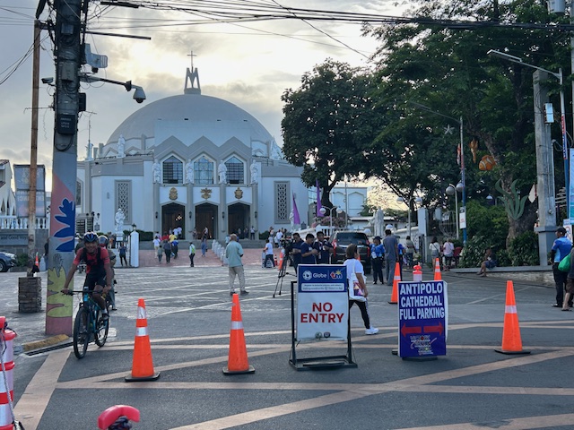 Access was already being limited as of yesterday morning. On regular days, there will be a queue of vehicles mostly new and to be blessed at the shrine. There’s limited parking at the shrine itself so visitors or pilgrims would have to find parking around the church including the nearby mall.
 View of the shrine from the entrance to the complex
 The main altar of the shrine
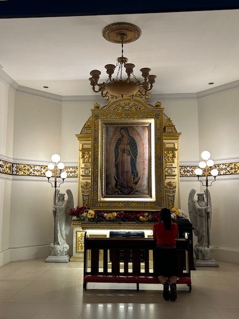 Retablo to Our Lady of Guadalupe
 The main road to the shrine, P. Oliveros Street, is an extension of Ortigas Avenue Extension from the Provincial Capitol site. This will be the main route to the shrine and will be filled with people later this afternoon and overnight.
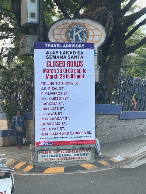 Road closures from 6:00 PM today until 6:00 AM tomorrow (Good Friday)
The Alay Lakad is a spectacle by itself and probably rivals if not exceeds the Traslacion of the Black Nazarene in Quiapo, Manila in terms of the number of participants.
–
On the Pasig River esplanade project
My news feed was full of articles on the Pasig River esplanade, or at least the recently completed section at the Manila Central Post Office building. This is a proof of concept type of project that hopes to be expanded or extended to cover both sides of the river much like the Iloilo River Esplanade project. If you are wondering what the section looked like before the project, here are two posts I wrote in 2012 that features a lot of photos of the Muelle del Rio:
These were way before the fire that damaged the Post Office building. However, even at that time, there were already calls for the renovation, even repurposing of the Post Office building. Such projects or proposal draw inspiration from Singapore where old buildings have been preserved and many repurposed (e.g., how about the Post Office building transformed into a hotel?). Perhaps such will breathe life and lead to a revival of this part of Manila?
–
Article share: What’s Incomplete About Complete Streets?
The concept of road diets circulated in Metro Manila more than a decade ago. I recall the Metro Manila Development Authority (MMDA) picked up the concept and attempted to apply it in some parts of Metro Manila. Since there are no evidence of that endeavor surviving now, then we can assume that it was a failure. There is no wonder there as I also recall the effort to be half-hearted and more to get media mileage (cheap talk or lip service) out of it. Road diets eventually evolved into the complete streets (though the literature now will state road diets as part of complete streets). That experience and similar initiatives of varying success (or failure) rates are not unique to the Metro Manila but is actually happening elsewhere including cities in countries where the complete streets have been applied more comprehensively and yet somehow found to be lacking or not as effective a solution as expected. I am sharing an article here that discusses what seems to be lacking or ‘incomplete’ as it is referred to.
Source: What’s Incomplete About Complete Streets?
Quoting from the article:
“What’s missing? First of all, even the best Complete Streets policy can’t solve the problem of fiscal scarcity. Even in a city committed to Complete Streets, street redesign must fight for public dollars with other worthy goals such as education and public safety. As a result, Indianapolis’s improvements are a drop in the bucket. The city maintains 3,400 miles of streets and roads, so its 100 miles of bike lanes affect only 3 percent of the city. Similarly, 2,000 miles of the city’s roads still lack sidewalks.
Second, the quantitative benchmarks seem to focus on sidewalks and bike lanes (Sec. 431-806), and the policy doesn’t mention traffic calming or similar policies. So if the city had a six-lane road with traffic going 60 miles per hour, the Complete Streets policy would not affect that road except to the extent necessary to build a sidewalk or a bike lane.** Thus, even the best Complete Streets policies don’t really address some of the most dangerous features of American street design.”
—
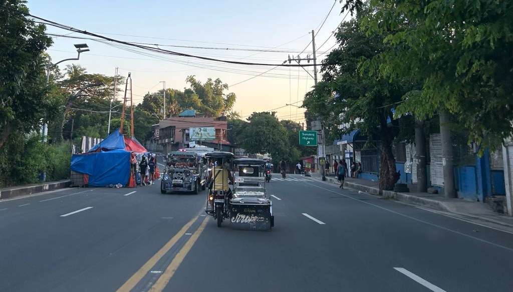
Footbridges along Sumulong Highway – Part 1
There are several new pedestrian footbridges along Sumulong Highway. The intent is simple – provide a safe crossing for people considering the high volume of traffic along the highway and the high risk of being hit by vehicles. Speed is an issue here considering the highway’s slopes and curves. Footbridges present a quick solution. However, it is not necessarily the most appropriate given the objective of improving safety. Perhaps slowing down or ‘calming’ traffic is a better approach?
 A new pedestrian footbridge near the San Pedro Calungsod Church. The intention is for people to use this footbridge to cross to or from the church. Considering the relatively narrow carriageway, crossing on road level is actually the shortest and most efficient way. However, the volume and speed of traffic is a major consideration here and elsewhere along Sumulong Highway.
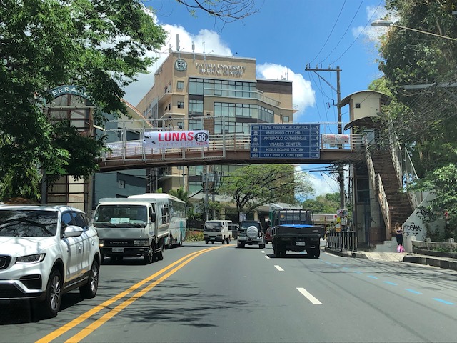 This pedestrian overpass or footbridge near Fatima University Hospital is intended for students and staff of the university and hospital. While many, even most, use the overpass, there are a significant number of people who prefer crossing directly on the highway. Before, there were school personnel, usually a guard, who helps people cross. I don’t see them anymore. Even Antipolo does not have traffic enforcers or aides in the area.
More on these pedestrian footbridges.
–
Cool Walkability Planning
I am sharing this article about planning and design for more walkable streets. The term ‘cool’ in the article refers to temperatures as people are less likely to walk if it is too hot to do so.
From the article:
“Improving walkability (including variants such as wheelchairs, hand carts, low-speed scooters) can provide significant benefits to people, businesses and communities, particularly in dense urban areas where land values are high and vehicle travel is costly. However, walking can be uncomfortable and unhealthy in hot climate cities, particularly those that often experience extreme temperatures (over 40° Celsius, 105° Fahrenheit). These conditions make walking unattractive and infeasible during many days…
A well-planned networks of shadeways (shaded sidewalks) and pedways (enclosed, climate-controlled walkways) incorporated into a compact urban village can provide convenient, comfortable and efficient non-auto access during extreme heat. They can create multimodal communities where residents, workers and visitors rely more on walking and public transit, reduce vehicle use, save on vehicle costs, and require less expensive road and parking infrastructure…
The main obstacle to comprehensive pedway development is the well-entrenched biases that favor motorized travel and undervalue non-motorized modes in transportation planning and investment. Transportation agencies have tools for planning and evaluating roadway improvements, and funding to implement them, but lack comparable tools and funding for walkability improvements such as shadeways and pedways, even if they are more cost effective and beneficial than roadway projects.”
Source: Cool Walkability Planning
