
Home » Posts tagged 'road safety' (Page 17)
Tag Archives: road safety
Habal-habal in Metro Manila
I posted about our ongoing research on motorcycle taxis. One of our subject areas are Pasig and Taguig in Metro Manila. These would likely represent the urban motorcycle taxi operations that we wanted to document and assess. One terminal I specifically asked our staff to visit as part of the recon/pre-survey activities is located at Pinagbuhatan, Pasig City near where the Pasig River connects with the Laguna de Bay. It is along Circumferential Road 6 and, based on my observation, has transferred locations several times since C-6 was being widened and paved.
 This is the terminal at Pinagbuhatan, Pasig City along C-6 and near the Napindan Ferry Terminal.
 The current terminal stands along what used to be the older C-6 lane. The newer paved section of the widened C-6 is shown in use. It used to be closer to the bridge that crossed the Pasig River and near the Napindan Ferry Terminal.
 The habal-habal riders and operators have an organization and are generally tolerated by the local government. Unlike their provincial “relatives”, they usually only take one passenger seated at the back of the rider. Two passengers are not unusual or irregular especially if one is a child.
I will post about the characteristics of habal-habal operations soon. However, I don’t want to preempt the research we are doing so I would also prefer that we submit our report first and maybe even submit a paper or two for publication before I post them here. Among the things we have obtained so far are video recordings of what its like to ride these motorcycles. We used an action camera mounted on the rider’s helmet for this purpose. Our staff also did a quick interview of the service providers and will be doing a full survey soon to get substantial information for our research.
–
“Semplang” – motorcycle self accidents
There is a Filipino word used for falling by yourself for whatever reason or factor – semplang. The term applies for those riding a bicycle or motorcycle where a person has basically no one to blame but himself/herself for falling. Of course, there will be factors like weather and road conditions. Wet, slippery roads can be very treacherous. So are roads with potholes and/or open manholes. In most cases, however, the rider’s skill more than the other so-called factors that could have affected his movement and balance.
 This is a case of a motorcycle rider losing his balance. I know because this happened as the motorcycle rider made a U-turn right in front of my vehicle at the slot across BF Steel in Cainta.
I am not certain about the condition of the rider in the photo above. While he looked shaken up (surprised?) by the incident, it did not seem to me as if he was moving abnormally (i.e., intoxicated or disabled). Perhaps its his skill that led to this? Such could not have been the case if he had sufficient training and experience and properly licensed to ride a motorcycle. Sadly, a lot of motorcycle riders are not well trained and gain skills only from experience. Yet, there are many who ride like they are stuntmen, often risking their lives and limbs as they maneuver (weave) through traffic.
–
Another look at Marcos Highway pedestrian overpasses – Part 1
My daily commute allows me to have a look at the progress of the LRT Line 2 Extension construction. I also became curious about the situation of the pedestrian facilities along Marcos Highway particularly the crossings since many at first seemed to be affected by the elevated rail structure that was to be built. Now, we already have a good idea of the fates of these pedestrian overpasses. This article shows the conditions/situation of pedestrian overpasses (also called footbridges) along Marcos Highway. Most overpasses are not covered; exposing pedestrians to the elements. Most are also made of steel, which can be traced to the MMDA’s (and later the DPWH’s) preference for these structures.
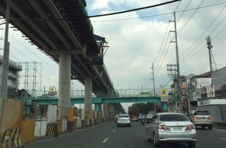 Overpass near Filinvest East-Vermont Park gates – the overpass actually is between a technical college and the commercial building across from it.
 The overpass across from Vermont Royale in front of a new Shell service station was actually among the newest facilities along Marcos Highway. Apparently though, it was built without considering the impending construction and design of the Line 2 extension. As such, the overpass needs to be modified or would have to be reconstructed elsewhere near the area.
 Overpass at Town & Country Executive Village that is also near the San Benildo School
 Overpass at Marcos Highway-Felix Avenue-Gil Fernando Avenue intersection – is probably the busiest among the pedestrian overpasses as it is at a busy junction where there are major commercial establishments (i.e., malls) and where many public transport routes converge.
 Robinsons Metro East overpass – this one also survived the clearance requirements with respect to the elevated superstructure for the Line 2 extension. However, since one of the two stations to be built will be nearby if not right across (part of the station at least) from the mall, then the station itself may function as an overpass.
 Overpass at De la Paz – note the ramp for bicycles and wheelchairs. This is one of the more bike- and PWD-friendly facilities along Marcos Highway. The slope is gentle enough for pedestrians, too, especially senior citizens who might have difficulty with steps.
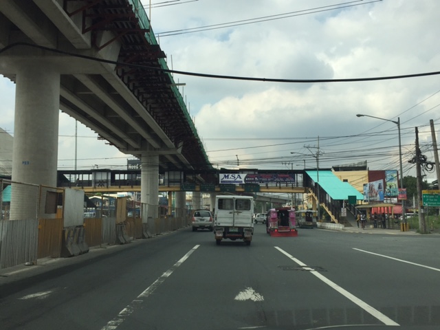 Overpass at Ligaya – this one also has ramps that make it easier for people to use to cross the busy highway. This will eventually be the closest overpass to the huge Ayala mall (Feliz) currently under construction at the Marikina side of Ligaya. I suspect that there might be a need for another overpass to be built with respect to the mall for one to directly serve the mall’s customers.
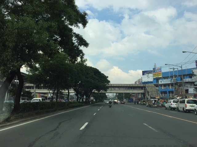 Line 2 Santolan Station overpass connects the Marcos Highway westbound public transport stop with the rail station along the eastbound side of the highway.
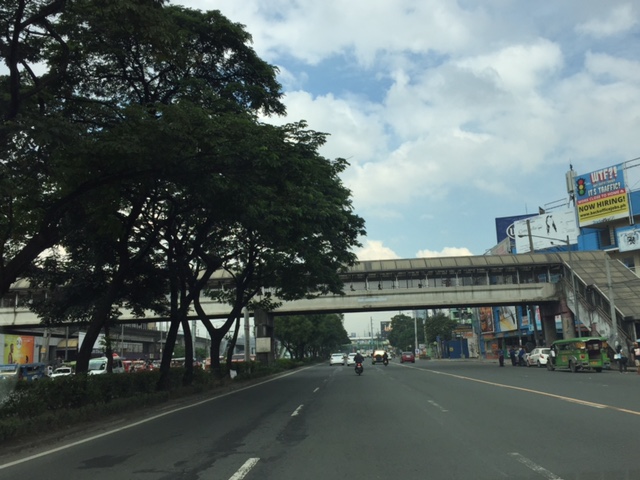 A closer look at the Santolan Station overpass, which is used by a lot of Line 2 passengers who cross the highway to continue on their journeys/commutes via train from their origins in Rizal, Marikina and Pasig. During the mornings, the observer will see a lot of jeepneys and UV Express vehicles emptying of passengers who cross the bridge to get to the station.
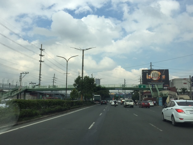 Santolan footbridge – this is actually more complicated than what is seems in the photo because the steel footbridge also connects to the SM City Marikina overpass (which is not included in this compilation but is visible in the photo). The footbridge branches to provide and almost direct connection between the mall and the Line 2 Santolan Station. That structure is shown at
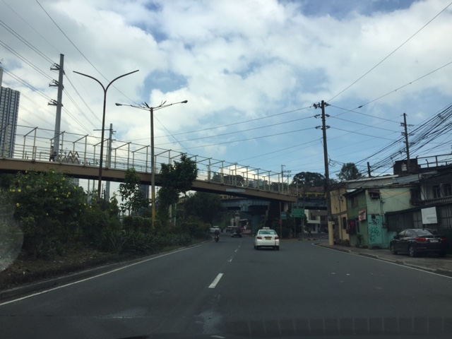 Monte Vista footbridge allows people to cross Marcos Highway (at its Marikina/Quezon City end) to and from A. Bonifacio Avenue, which is in Marikina City (Barangka)
More on pedestrian overpasses in the next post!
–
Global Street Design Guide
Here’s another quick post. I just wanted to share this article with a link to a Global Street Design Guide that was developed by the National Association of City Transport Officials (NACTO) in the United States (US). It’s a nice guide that’s based on the experiences of many cities in the US including transformations that have made commuting more efficient, enhanced mobility and, most important of all, improved safety. Following is the link to a more direct link to the guide:
NACTO and the Global Designing Cities Initiative Release Global Street Design Guide
This will be a good reference in the Philippines where many cities are in need of transformation to address current and future challenges in transportation. Planners, engineers and students should read this and use it to make our streets safer and more efficient in terms of mobility for all. It would be nice to see fresh ideas on how we can improve our streets not just in Metro Manila but elsewhere across the country. Of course, it would be nice if city planners of local government units (LGUs) can adopt this design guide parallel with efforts to improve public transport services. It should be understood that simply imposing lane allocations and traffic flow policies (one way?), for example, will not solve problems but may create more. The approach should always be integrated, inclusive. In other words, complete.
–
Extreme commutes on a jeepney
I chanced upon this overloaded jeepney along Sumulong Highway. I counted eight people hanging behind the vehicle including the conductor. This is actually illegal and not just at present but always. The practice of hanging behind a jeepney is obviously unsafe and there is a high risk of people falling off. It would be a miracle not to have major injuries if one falls from the vehicle, and there is a high likelihood of fatality especially of a falling passenger gets hit by another vehicle trailing the jeepney.

‘Sabit’ or hanging on for a jeepney ride is more a necessity and males usually do this in order to get a ride home or to work. On many occasions, you will see men or boys in their office or school uniforms in the morning, braving it just so they won’t be late for work of school. While it is illegal, authorities seem to apprehend overloaded jeepneys from time to time (or according to some, just for show). I guess they, too, understand how difficult it is to get a ride and how this somehow allows people to get to their destinations. Surprisingly and despite reckless behavior among drivers, there seem to be few untoward incidents reported. Hopefully, public transport will improve so that people will not have to do such extreme commuting.
–
Motorcycle lanes along Sumulong Highway?
I noticed something along my commute and that is the newly marked pavement along Sumulong Highway at the section in Barangay Mambugan until Barangay Mayamot at Masinag Junction. I guess this is more likely part of Antipolo City’s initiative in managing motorcycle and tricycle traffic. In a meeting with the City Administrator, Robert Nacianceno, last year, he said that the city was moving towards improving road safety. That included addressing concerns about tricycle and motorcycle operations that has led to crashes and congestion. Motorcycle lanes designated by blue pavement markings are not new and likely was inspired by the MMDA’s initiatives along major roads in Metro Manila.
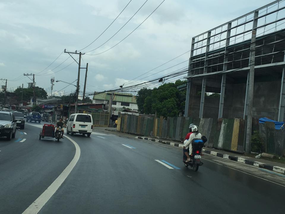 Motorcycle running along the designated lane
 The blue markings are present along both sides of Sumulong Highway
The real challenge with these motorcycle lanes would be on the enforcement. That is, how would the city be ‘encouraging’ motorcyclists and tricycle drivers to stick to the outer lanes of the highway. Such would require a tremendous effort for the city as they will definitely have to apprehend erring motorists and also clear the designated lanes of obstructions. Should this program be successful along Sumulong Highway, perhaps they should consider the same for Marcos Highway.
–
Roads to Baguio: Marcos Highway – Part 2
To open September, I continue on the feature on Marcos Highway. Following are more photos I took on our way back to Manila from a short vacation in Baguio.
 Many sections of Marcos Highway have some form of protection against landslides or rock slides. Note the concrete faces fences along the left in the photo.
 There are many structures along the highway including houses and stores
 The mountain limits sight distance along curves like this.
 We encountered this group of motorcyclists heading up to Baguio on what appeared to be what is termed as “big bikes”, that typically are the more expensive ones, too. Other photos in this series will show these motorcycles. I lost count of them while we were traveling the opposite direction.
 This seems to be a popular stop for hungry travelers. The location though and its driveway are not at all desirable from the highway engineering perspective.
 Combination of signs to guide motorists along this sharp curve.
 Curved sections like this one offer breathtaking views of the mountains.
 Shoulders may function as space for emergency stops including for breakdowns or changing tires. Full shoulders allow for stopped vehicles to be completely clear of the traveled way. That is, they don’t pose as obstacles that traffic would need to evade.
 More examples of poorly located establishments along a curve
 The road seems to disappear in the mountains
 Another home along the highway and right at one of the curves. This one seems to be wisely located behind the barriers though its pretty obvious where their driveway is located.
 Conspicuous location for a religious site along the highway
 More motorcyclists and their big bikes
 Barriers along both side of the highway seem sturdy enough to keep vehicles from flying off the road in case their drivers/riders lose control. This section offers enough to satisfy sight distance requirements and noticeably does not feature double yellows like the other photos in this post.
 A residential community along the highway including this big house just clear of the shoulder.
 Another community including a home atop the mountain. The barriers appear to be newly constructed along with the PCC paved shoulders. These would have to be painted for them to be visible to motorists especially at night-time or when visibility is poor.
More photos of Marcos Highway soon!
–
TSSP 23rd Annual Conference Proceedings
The 23rd Annual Conference of the Transportation Science Society of the Philippines (TSSP) was held at the University of the Philippines (UP) Diliman last August 8, 2016. It was hosted by the National Center for Transportation Studies (NCTS), which for some time was practically inactive in its dealings with the society. The conference was a very successful one with more than 170 participants, mostly students from the undergraduate programs of Mapua Institute of Technology (MIT), De La Salle University (DLSU) and UP Diliman.
The Proceedings of the 23rd Annual Conference contains 22 technical papers, which I have already listed in a previous post showing the technical program for the conference. The link is to the current website of the TSSP hosted by NCTS. Those wishing to have copies of the papers may download them directly from the link. Meanwhile, those interested in the presentations should contact the authors. Their contact information are stated in the paper and it is ethical to get the nod of the authors for their presentation file as these still fall under what can be defined as their intellectual property. I am aware of people who tend to get presentation slides and then pass them of as their work when they use the slides or the data/information therein. There are proper ways for citations of references and sources but sadly such ways are not observed by many.
–
TSSP 2016 Conference Program
I am sharing the banner and final program for the Transportation Science Society of the Philippines 23rd Annual Conference to be held on Monday, August 8, 2016. The final program features a Keynote Speech by the Undersecretary for Road Transport and Infrastructure Anneli R. Lontoc, a Panel Discussion on Road Safety, and technical sessions in the afternoon.


 –
–
TSSP 2016 Conference: Tentative Program
I am sharing below the tentative program for the 23rd Annual Conference of the Transportation Science Society of the Philippines (TSSP):

Soon, I will post on the list of papers to be presented for the Technical Sessions to be held in the afternoon part of the one-day conference.
–

