
Home » Posts tagged 'traffic congestion' (Page 9)
Tag Archives: traffic congestion
On weather and traffic
With the onset of the wet season, heavy rains have reminded us how terrible commuting can be especially in Metro Manila where public transport services are much wanting in terms of quality. But whether you are driving or riding, using private or public transport, there is always something about the rains that make you feel uncomfortable. Metro Manila’s roads are becoming more and more notorious for flooding and I guess that goes the same with many other roads in other cities as well. Drainage is almost automatically blamed but closer inspection of the cause of flooding shows even the newest drainage systems being unable to accommodate rain waters in part due to their being clogged (by garbage, mud and/or other stuff) or having inferior design for intense rains. With extreme weather now becoming the norm, that is not a good thing especially with what is perceived as poor maintenance of our waterways and road drainage systems. Just look at how overpasses get flooded everytime the rain pours; causing traffic congestion that could have been averted if only we can weather-proof our roads to a certain extent.
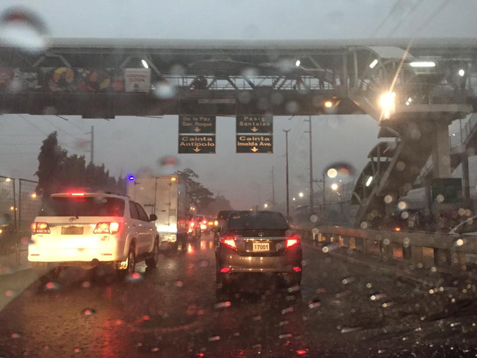
Low visibility even during the middle of the day plus slippery pavement surfaces due to heavy rains can cause congestion and lead to unsafe conditions for traveling. The latter outcome is even worse during the night and, in higher elevations, when you have fog to add to the complexity of the environment you are traveling along. Aside from travel time, nothing more serious like life or limb can be lost by practicing safe driving whenever it is raining hard. That includes slowing down, turning on your lights (for visibility) and refraining from undertaking risky maneuvers. Pedestrians and cyclists, too, need to take more caution knowing the higher risks they face or are exposed to when traveling under inclement weather conditions.
–
On cable cars as a solution to Metro Manila transportation problems
I was asked about my take on the pronouncement about cable cars being a potential solution to Metro Manila’s traffic woes. I say pronouncement because careful qualification of the news articles on this clearly show that this is not yet a proposal. I leave it to the reader to Google these articles on cable cars for Metro Manila.
The first thing that came to my mind are capacity and demand. What would be the capacity for such a system and what could be the demand given that you would have to determine where stations would be. There’s also the fear factor as many people would not be comfortable riding a vehicle so high up in the air and then of course, there’s the wind that will obviously have to be factored in the operation of such cable cars. Suitability is very much an issue here. Perhaps cable cars like the one featured in the news articles are more appropriate for cities like Baguio, Antipolo and Tagaytay? There are very limited applications for Metro Manila even including perhaps possibilities for Ortigas and perhaps Loyola Heights.
I like what my friend, Rene Santiago, said about the cable being one possible answer but not The Answer to Metro Manila’s traffic problems. I am aware of and quite amused by the comments posted on social media about the so-called ‘cable car solution’ as it is definitely not going to make a big impact on Metro Manila transport. I like comments proposing instead improved river transport as well as protected bicycle lanes around the metropolis. These are well-grounded proposals that have been proven elsewhere to be very effective in reducing congestion while mass transit projects are under construction and to be operational in 2 to 3 years time. I think it would be wiser to put your money on bike lanes and even bike bridges than in cable cars.
I was also asked about what should be the first project the new Department of Transportation Secretary Art Tugade should take on. Metro Manila is still very much a “battleground” for transport and traffic, and there are already projects lined up for implementation like the much delayed MRT 7 and the extension of LRT1. The new administration should strongly support such efforts, whether its via Public Private Partnership (PPP) or public funded. That said, I think the incoming Department of Transportation Secretary should work on an urban mass transport project in one of our major cities. Either Cebu or Davao come to mind as these cities are already also congested and would need to have an urban transit system (rail?) very soon in order to avoid becoming another Metro Manila. There are low-hanging fruits in these cities, for example, with the Cebu BRT ready to be taken on by the new administration for full implementation and Davao already being the subject of public transport studies pointing to it being ripe for a rail transit system.
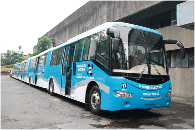
Finally, there are also the outcomes of research & development work by the Department of Science and Technology (DOST). I am referring to the DOST-MIRDC’s road train, AGT and hybrid train projects. The road trains, for example, may be used for Bus Rapid Transit (BRT) lines that are proposed for C5 and Quezon Avenue. I also think it is worth considering for EDSA. BRT is not technology-specific as far as buses go so why not use Philippine-made buses for this? While these are still subject to third party safety and technical certifications, the Transportation Department could lend a helpful hand towards this certification and this could perhaps ultimately lead to building an industry out of these buses and trains.
–
Will a flyover at Katipunan-C.P. Garcia solve the traffic problem in the area?
I read a news article about the proposal by the Department of Public Works and Highways (DPWH) to construct a left-turn flyover at the intersection of Katipunan Avenue (C5) and C.P. Garcia Avenue in Quezon City. The flyover is supposed to be for vehicles turning left from the northbound side of Katipunan to C.P. Garcia Ave., which goes through the University of the Philippines Diliman
Will the flyover solve the traffic congestion problem in the area, particularly at the intersection and Katipunan in general? I would say no, it would not solve the congestion problem both for the intersection and for Katipunan. This assessment is due to the following reasons:
- The overpass does not address the root cause of congestion in the area, which is trip generation related. There are many major trip generators along Katipunan alone including three major schools (UP, Ateneo and Miriam) and a mall (UP Town Center). Add to this the traffic generated by the high density residential developments along Katipunan (notice the high rise condominiums lining up across Ateneo and Miriam?) and the through traffic coming from various areas that use C5’s Katipunan section.
- Congestion is caused by saturated intersections corresponding to Ateneo Gate 3 and main gate of Miriam College. Traffic going in and out of these schools are favored over through traffic along C5 resulting in congestion in the area. Perhaps it would be more appropriate to build overpasses to bypass these intersections.
- Congestion is caused by vehicles bound for and coming from the UP Town Center. The congestion due to traffic generated by the commercial development is actually alarming considering it is not yet completed and trips attracted and produced is not yet at full potential.
- The heaviest flows at the Katipunan-C.P. Garcia intersection are along Katipunan (northbound and southbound through traffic). Logic and traffic engineering principles point to grade separation to be more appropriate for such traffic and NOT for the left turn movement. A flyover should also be able to bypass UP Town Center as vehicles bound for the mall already blocks traffic along both sides of Katipunan and directly affects the intersection.
I think the DPWH should do well to re-assess their proposal along the lines of the reasons I have listed here rather than continue with the folly of building a left turn overpass alone. UP Diliman should also resist this overpass as, based on the news article, it would mean UP giving up some 8,000 square meters of its property for the project. UP already has given a lot for widening C.P. Garcia but that goes without saying that a through flyover might also require UP to give up property and particularly from its National Science Complex for such a project.
–
Shopping malls and Ortigas Avenue Extension traffic congestion
Recently, I noticed that traffic has somewhat eased along the eastbound side of Ortigas Avenue Extension. For one, this was probably due to the completion of road works and the reopening of lanes between Cainta Junction and Brookside. This improved traffic flow as traffic personnel didn’t have to resort to the balancing act that is the counter-flow scheme they had been employing to alleviate congestion for mostly home-bound traffic. But a major contributor to congestion was the Ever Gotesco Mall in the former Riverside industrial complex. Malls like this are major trip generators and if traffic coming in and out of the malls are not managed properly or facilities are not provided for efficient movement of people and vehicles, then there will surely be congestion along access roads. I stated that the Ever mall ‘was’ a major contributor because the mall recently closed down and the property is now fenced off from the road. At present, there is practically zero traffic that can be attributed to the former mall.
Following are a few photos of the closed and fenced off property that was the Ever Ortigas mall.
 Jeepneys and UV Express vehicles now use the service road of the mall as a terminal.
 It’s now a breeze passing through the eastbound section of Ortigas Extension in front of the former mall. There are signs stating the property has been acquired by retail giant SM. It will probably be transformed into an SM mall.
 This driveway used to cause congestion as jeepneys and private vehicles exited the mall through this driveway and many turned left towards Ortigas westbound. These vehicle often effectively blocked traffic along the eastbound direction with queues reaching all the way past Countryside and reaching De Castro on a bad day.
There were only two shopping malls along Ortigas Avenue Extension – the Robinson’s Place near Cainta Junction and Ever Gotesco. Ever has recently close but it is expected to re-open as an SM Mall sometime in the near future. SM doesn’t have a mall in the area and the ‘nearest’ ones would be Megamall, Marikina and Taytay (not counting the Super Center beside Tiendesitas and the Super Center along Felix Avenue). If indeed an SM mall will be there soon, we could expect heavier traffic in the area given the trip generation characteristics of SM. Perhaps, though, there is an opportunity to improve traffic in the area if SM can consider some improvements to its driveways and circulation. They could probably do something like what SM Novaliches had done with their generous setback to ensure that there will be no serious congestion along Quirino Avenue due to mall-generated traffic.
SM will not be the only major commercial development that is expected to generate traffic that will lead to congestion along Ortigas Extension. Almost across the former Ever mall is a commercial development under construction with a building I think is too close to the road. Then there is also the commercial/residential project that is being constructed along the westbound side of Ortigas Extension near the Kaytikling Junction in Taytay, Rizal. I wonder if these had the necessary traffic studies to support their impacts on at least the immediate areas they will be affecting.
–
On the Ortigas Avenue counter-flow scheme again
Here are some more recent photos of the morning traffic congestion and counter-flow scheme along Ortigas Avenue. The counterflow scheme starts at the approach to the Manggahan Channel Bridge and ends at the approach to C-5 right after the Rosario Bridge. This counter-flow scheme has been used by Pasig, as far as I can remember, since the early 1980s. Ortigas Avenue is one of those roads where the directional distribution of traffic very pronounced for the peak direction.
 Vehicles crowding towards the counter-flow lane on the eastbound side of Ortigas Avenue. Traffic along this lane is moving, unlike the standstill you will likely experience along the westbound side. This is particularly true at the bridge where buses and jeepneys occupy two lanes and stop for long periods to get passengers. Congestion is exacerbated by vehicles coming out of the residential development in the area. Pasig and MMDA traffic enforcers fail miserably at their duties here. Perhaps this is a job for the PNP-HPG?
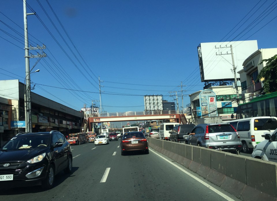 The effort of positioning towards the counter-flow lane is worth it as traffic moves faster here. The argument for counter-flow lanes (or zipper lanes as they are also called) is based on the availability of capacity along traffic lanes of the opposing direction that can be used to optimize utility of these unused lanes (i.e., off-peak direction) by peak traffic. This is a classic transport systems management scheme directed towards efficient and optimum use of existing facilities.
–
Proposals for EDSA and some alternate roads
The hellish traffic congestion along EDSA and other roads in Metro Manila spawned a bunch of ideas for alleviating congestion. Among those that were offered as solutions are the following:
- Odd-Even Scheme – suggested by the Philippines President himself in a speech delivered in Mandaluyong City
- Car-pooling (and HOV lanes) – suggested by the DPWH Secretary in another forum
- Bus Rapid Transit (BRT) and/or express bus – proposed and being studied by the DOTC
What seems to have been forgotten was a proposal to have two lanes of EDSA, one on either direction, devoted to bicycles. This proposal now seems to be the most viable compared to the above three and could have the potential for major behaviour change towards a departure from motor vehicle use. Cycling along with walking does not require fuel and these modes also promote healthy lifestyles. Also, this could become the ultimate example for road diets, which can also be applied along other roads as well. What sounds or reads like an outrageous idea (i.e., bicycle lanes along EDSA) might just be revolutionary and result in what could be a tipping point for sustainable transport in the midst of traffic mayhem.
EDSA has become the proverbial battleground representing the war with traffic congestion. However, EDSA is just one part of our arterial network comprised of circumferential and radial roads. There is also C-5 (also known for its sections – Katipunan, E. Rodriguez, C.P. Garcia), which is also a very congested road but along which there are few fixed route public transport services. It is a primary alternative route (to EDSA)for people traveling between the northern and southern halves of Metro Manila. It also serves as a collector and distributor, being connected with major radial roads like Aurora Boulevard, Ortigas Avenue and Shaw Boulevard as well as to the South Luzon Expressway. C-5 is a major truck route, however, and so carries a lot of heavy vehicles during the permitted times under the truck ban scheme being implemented in Metro Manila. C-5 is already ripe for a mass transit system and should have one along it. The quickest to put up would be a bus system on exclusive lanes. Strategically though, a rail transit line (likely elevated) should already be planned and implemented and with as seamless as possible connections to current and future lines along major corridors.
There are other routes that can be considered which I think have been overlooked (too much focus on EDSA?). C-6, for example, badly needs to be improved and this has started but is being implemented at a slow pace. This could have significant positive impacts on traffic coming from the east (towns of Rizal province) that are bound primarily for Makati and BGC. But then there also has to be a good road bypassing the narrow and already congested streets of Taguig and Pateros that are currently the only roads connecting C-5 and C-6. The roads on the Rizal side (attention: Cainta and Taytay) also need to be improved including Highway 2000 and the Barkadahan Bridge. Perhaps the Rizal Provincial Government should also get involved in this as such routes are in the best interest of Rizalenos. And then there is also the highly urbanized city of Antipolo that is a major destination and already is the 7th most populous city in the country, whose residents also use this route, which is often a faster option to Ortigas and C-5 despite the poor conditions of roads.
–
Technology push?
An acquaintance announced that his company is planning to sponsor an event aiming to attract developers to come up with apps that could help alleviate transport problems in Metro Manila (and probably and potentially, elsewhere). This reminded me of a similar event a few years ago that was sponsored by an international institution that sought to have people come up with applications (apps) that would enhance transport using transport data they have compiled. While the event attracted a healthy number of app developers and arguably came up with some useful software, the impact of such apps on commuting is at best marginal. For one, some apps attempted to reinvent the wheel, so to speak, as one app developed was too similar to the well-established Waze but with an inferior interface. Then there were those which probably could be useful if only most people had smart phones and were dependent on them for their trips.
Metro Manila is at the point when most major arterials are already saturated. Stricter traffic management (as it should be) can only do so much to address congestion along thoroughfares such as EDSA and Circumferential Road 5. Apps that are aimed at enhancing commuting would ultimately be limited as the transport infrastructure is lacking and those proposed or under construction would take time to complete. Yes, carpooling can probably help and an app enabling people to find travel/commuting companions would probably help. But it does not assure participants (both drivers and passengers) of their safety or security and so isn’t for everyone. Apps and similar or related technology pushes are categorized along with other stop-gap or band aid solutions. It might have some positive impact but these are short lived and eventually will not be productive. It definitely though will satisfy a lot of geek or nerdy egos in terms of what they can create that they think can help improve transport or traffic. And I suddenly recall a term used by one of my friends chiding others one night we were engaging in some academic discourse about transportation theory as applied to traffic problems in Metro Manila – “intellectual masturbation” – which seems an apt description for this (app development, etc.) type of exercise. One colleague even made the observation that such efforts only provide an excuse for government not to act on the urgent matter of traffic. Innovation may be welcome but it seems such a waste of time and talent to be solving the unsolvable through apps. (Can someone develop an app to fix MRT trains? Or perhaps solve contract issues of the PPP kind? I think you get my point.)
The main reason why people buy and drive their own vehicles is because these cars and motorcycles enable them from being dependent of public transport, which is generally perceived as having low service quality. While there is a need to manage the demand for private vehicles, restraint without the suitable public transport alternatives (think Singapore or Hong Kong for best practice examples) will not make sense as these punish people for something the government is not able to deliver in terms of transport services. This is a message I have seen in many papers that are the outputs of many studies presented at the recently concluded 11th International Conference of the Eastern Asia Society for Transportation Studies. In fact, this has been a message in past conferences as well. You can find the technical papers in their searchable site at the following link: www.east.info
–
Causes of congestion along Ortigas Ave. Extension
I have written about the common causes of congestion along Ortigas Avenue. The past articles mentioned the undisciplined loading and unloading along the entire stretch of the road and particularly at either ends of the Manggahan Floodway bridge in Pasig City. I have also written about the congestion caused by private vehicles generated by a private school just a stone’ throw away from DOTC headquarters. This time, I focus on Ortigas Avenue Extension, particularly the stretch from Cainta Junction to Valley Golf.
The current and more critical choke points along Ortigas Ave. Ext. are along the stretch of the road between Cainta Junction and Valley Golf. These are due to the road and drainage works along that section that effectively made the westbound side of Ortigas a single lane road between Brookside and Park Place. There are also road and drainage works along the eastbound side between Brookside and Valley Golf where the entire road section is being elevated. This section is flood prone and has been problematic during the wet season when heavy rains often result in flash floods.
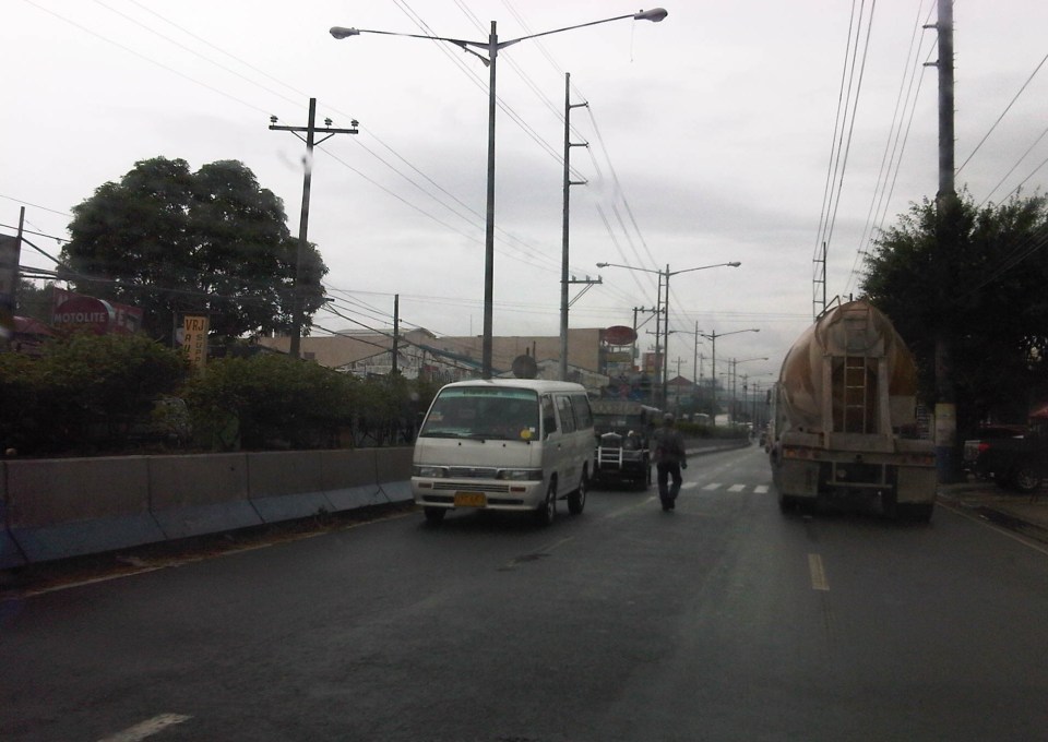 Counter flow along Ortigas Avenue Extension – this scheme has been the only option for the section between Valley Golf and Park Place Subdivision as the work proceeds one lane at a time. At the time, I took this photo, the counter flow lanes allowed for 2 lanes each for both the eastbound and westbound directions of this corridor. The past week, however, I noticed that during the afternoons and evenings, I noticed that two lanes were allocated for westbound traffic while only one was for the eastbound direction. This should not be the case as the peak direction in the afternoon to the evening is eastbound when people are home bound mainly from work and school.
 The section across from STI is another choke point as the area is one of the ends of the project raising the elevation of the avenue as well as improving the drainage along the road. The traffic along this area has improved much though vehicles still have to slow down to transition between the old pavement and new pavement sections, as well as vehicles turning towards Hunters ROTC Road.
 Unfinished sections – at the time this photo was taken, work along the site was intermittent. Commuters making the observation are often frustrated and much disappointed when they see none working along the construction site. The Mayor of Cainta did very well by talking to the contractor and apparently discussing with the latter how to improve traffic conditions as well as how to expedite the implementation of the project. My own observation was that conditions did indeed improve after that meeting (which was related by the Mayor in his Facebook page) and people could see workers busy with the project even at night time.
Traffic will continue to be bad along Ortigas Avenue Extension until this project is completed. While there should be some significant improvement in traffic flow after completion, congestion will again steadily worsen for this corridor whose private vehicle traffic continues to grow. Public transport is provided by buses, jeepneys and UV Express (whose numbers have ballooned during the last 5 years) and these have contributed a lot to congestion because of their drivers’ behavior particularly when they stop for passengers at areas like Valley Golf, Brookside, Cainta Junction, Ever, Countryside, Manggahan and Rosario.
There is hope though as news proclaim that the NEDA Board has approved the LRT 4 project along this corridor. A mass transit system is indeed necessary and this was required perhaps over a decade ago already. I do hope that this ‘LRT’ is more like the current Line 2 trains and stations than the Line 3 kind. Line 2 is a heavy rail system while Line 3 is light rail. The Ortigas corridor requires a heavy rail system considering the passenger demand in the areas that will be served by the transit system. I also hope that Line 4 is implemented like Line 2 with the government taking responsibility for constructing the system. I have maintained my view that the current administration is too fixated with Public Private Partnerships (PPP) that it had practically given up its responsibility to the general public to provide an efficient and equitable means of public transport for commuting. I just now wonder what became of the proposed BRT line along this same corridor. Perhaps the BRT option has already been abandoned by the DOTC in favor of rail?
–
Rains, floods and traffic
The wet season is here and with it the now typically heavy rains in the afternoons. Last week, the heavy rains brought upon flash floods in Metro Manila and adjacent towns. There have been no typhoons yet so these are mainly monsoon rains (Habagat), which we expect to be daily occurrences. Many of these floods are along major roads including EDSA, C5, Espana, and Quezon Ave. that transformed these roads into parking lots as most light vehicles are unable to traverse flooded streets.
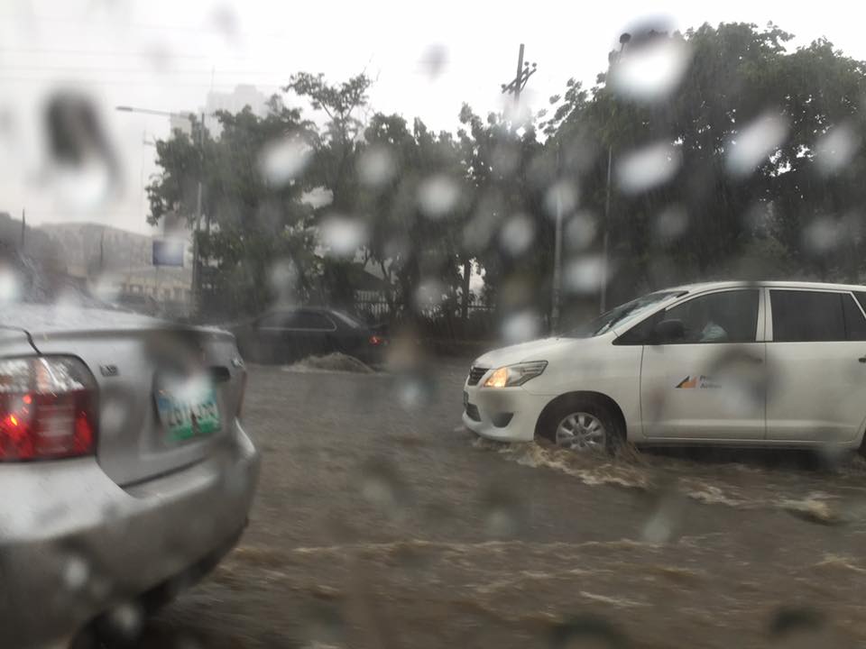 Vehicles run along the flooded Elliptical Road in Quezon City
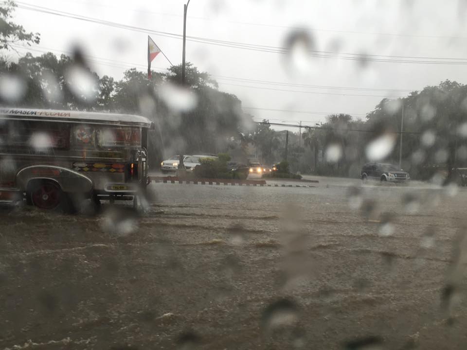 Jeepneys and SUVs (at right in the photo) take on the flooded Elliptical Road-Quezon Avenue intersection
Due to the traffic congestion resulting from the floods, many public utility vehicles especially jeepneys and UV Express vehicles were not able to go back and make their round trips.
 Cars risk the floods along Elliptical Road – the deepest waters are, ironically and curiously, along the section fronting Quezon City Hall where there is a pedestrian underpass connecting city hall with the Quezon Memorial Circle. Since the underpass is not flooded then it can be concluded that there’s something wrong with the drainage for Elliptical Road.
The weather is a very significant consideration for transport planning for cities in the Philippines. For Metro Manila it is almost everyone’s concern about how they can travel between their homes, offices, schools and other destinations without them and their things getting wet. This is what a lot of people advocating for road sharing seem to forget or choose to forget in their arguments for walking and cycling. A person residing in Fairview in Quezon City and working in Makati City will most likely not walk or cycle between his home and office because of the weather. This is a reality that could be solved by good public transportation, which, unfortunately, we also don’t have (yet) so people are ‘forced’ to do what they can to improve their plight. Unfortunately, too, what they are forced to do is purchase a car (or more). The proposal to build infrastructure to enable walking and cycling especially over medium to long distance is in the same dilemma as those for mass transit. And the latter is the more urgent matter needing action for the sheer volume of people they can carry and therefore benefit.
–
Ortigas Ave. Extension choke points
One alternative route for my daily commute is Ortigas Avenue. While there are several choke points along this road, I will focus on those between the Ever mall and Cainta Junction. Congestion is also usually experienced between the Manggahan Bridge and Ever but these are mostly due to traffic interruptions because of vehicles turning to and from the many subdivisions whose access/egress line up along Ortigas Ave.
The Ever mall is already a given as a significant traffic generator in the area. However, there is something about its circulation particularly the flow of vehicles in and out of the complex that detrimentally affects Ortigas Ave. traffic. While through traffic along the eastbound direction should use Ortigas Ave., many opt to go through the wide driveway of Ever in order to bypass the choke point that is the exit driveway of the mall. Many of these exiting vehicles are jeepneys turning left into Ortigas westbound (their routes terminate here and make their turnaround via Ever’s driveway). These effectively block the flow of traffic along Ortigas eastbound especially in cases when the westbound direction is also congested (i.e., due to sheer volume as well as stopping vehicles across the mall).
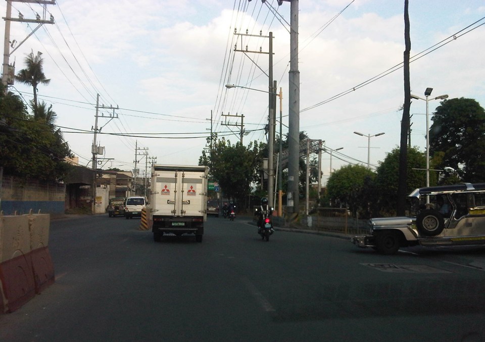 Vehicles exiting from Ever and turning left to Ortigas westbound
Once eastbound vehicles are freed from the blockage of left-turning vehicles, they have to merge with significant right-turning traffic from Ever that includes buses and mostly through traffic vehicles whose drivers were ‘wise’ to have taken the driveway instead of Ortigas to get through the choke point. The situation results in another choke point right after the first one as the traffic along two lanes of Ortigas eastbound merge with the traffic equivalent to 2-3 lanes turning right from Ever. The total of 5 lanes of traffic squeezing into 2 lanes immediately after is a prime example of a bottleneck.
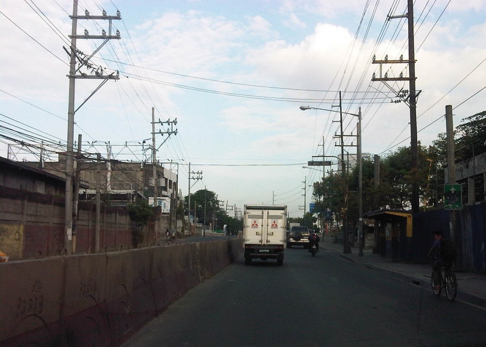 Narrow eastbound two-lane section – additional space should be expropriated to widen Ortigas at this section
Right after the short 2-lane section is a sudden widening of Ortigas Ave. in front of BF Metals. I have heard it said that this is the ideal road width for Ortigas Ave. considering the volume of traffic passing through this major corridor connecting Rizal province with Metro Manila. There are practically 4 lanes for each direction at this short section so its easy to project these lanes on maps to see what properties would need to be expropriated if the objective is road widening. (Of course, the best option should still be to pursue a mass transit system along this corridor.)
 Ideal road width – Ortigas Avenue at its widest is the section across BF Metals. Vehicles here spread out along the many lanes suddenly available. But then people will eventually and immediately realize this is the mouth of a funnel. Note the sign indicating that vehicles are entering the Province of Rizal from this point.
 The eastbound section in front of BF Metals is usually parking lot in the evenings. This is due mainly to the 4 lanes almost abruptly constricting into 2 lanes just past BF Metals. Compounding things is the U-turn slot located here where many jeepneys whose routes end at Cainta Junction make their turnaround. Turning vehicles are assisted by “tambays” earning their money by blocking eastbound vehicles to make way for U-turning vehicles.
Finally, there is Cainta Junction itself, which is a signalized 4-leg intersection that handles a tremendous volume of traffic all-day. I am sure that there are efforts for the traffic signal settings to be optimized but more often there is human intervention for traffic management at the intersection. Whether this causes more severe congestion is quite obvious to many travelers going through this intersection. Queues along Imelda Ave./Felix Ave., for example, can reach way past Village East even reaching Vista Verde on a bad day. This only shows that the intersection is already severely saturated and conventional traffic management or signal settings can no longer handle the traffic. Perhaps the next stage of engineering intervention for this intersection is grade separation or the construction of a flyover or two at the intersection. Notably, such a project should including strategic widening along Ortigas Ave in order to balance the number of lanes feeding into and receiving traffic from the intersection.
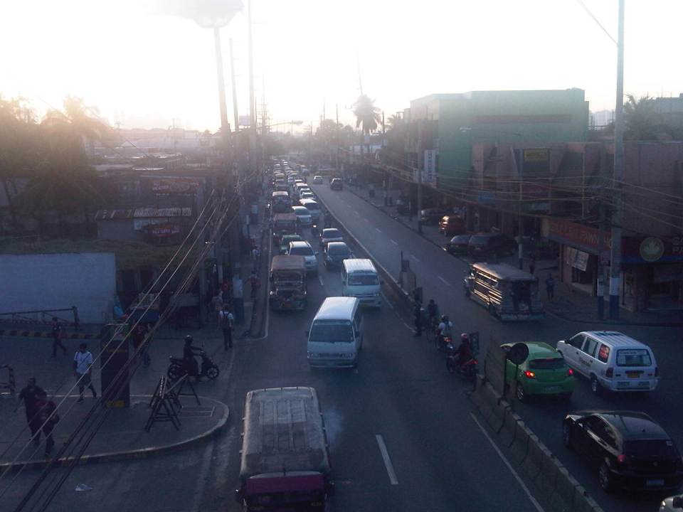 A view of the traffic approaching Cainta junction – there are only 2 lanes along the eastbound side of Ortigas and public utility vehicles stopping here only exacerbates the congestion along the road.
Is road widening the ultimate solution to Ortigas Ave congestion? I personally don’t think so. As I have mentioned earlier in this post and in previous posts the key is still to come up with a mass transit system to serve this eastern corridor. Yes, there will eventually be a Line 2 along Marcos Highway, the main alternate (or competing?) route to Ortigas but is is obvious that even with a railway line along Marcos Highway and connecting to Aurora Blvd., there will still be an urgent need for a similar capacity line along Ortigas. The buses and jeepneys can no longer handle the demand and their poor levels and qualities of service have given rise to a proliferation of UV Express and pushed people to purchase cars and motorcycles. Congestion can be reduced significantly with a mass transit system along Ortigas. Without this transit system, Ortigas will just continue to be congested even if the entire corridor is widened; except perhaps if it is widened like Commonwealth Ave. in Quezon City. I don’t think that is possible and practical.
–

