Home » Posts tagged 'traffic engineering' (Page 2)
Tag Archives: traffic engineering
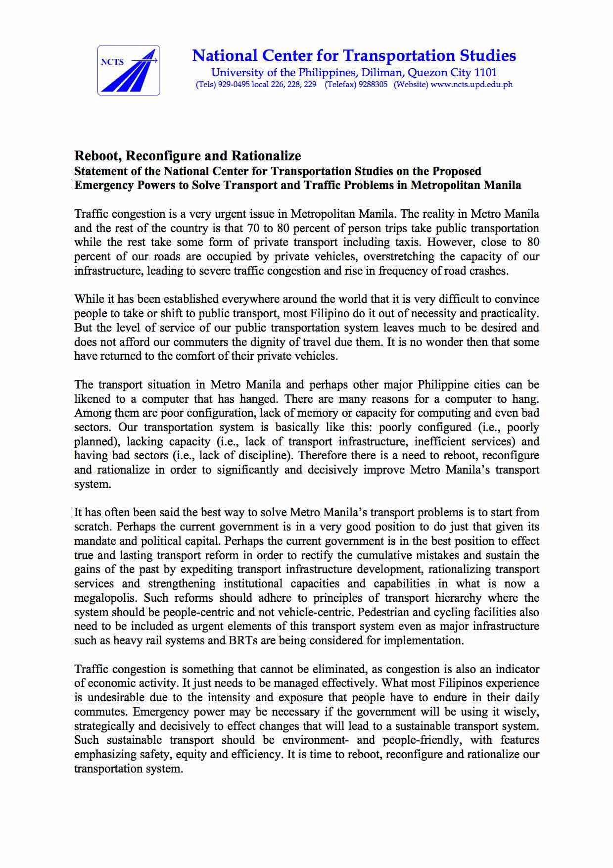
Statement on the proposed emergency powers to solve transport and traffic problems
The National Center for Transportation Studies (NCTS) of UP Diliman submitted a statement to the joint Senate committees evaluating the proposal to grant emergency powers to the Philippines President in order to solve the transport and traffic problems in the country and especially in Metro Manila. Following is a copy of the one-page statement:
–
TSSP 23rd Annual Conference Proceedings
The 23rd Annual Conference of the Transportation Science Society of the Philippines (TSSP) was held at the University of the Philippines (UP) Diliman last August 8, 2016. It was hosted by the National Center for Transportation Studies (NCTS), which for some time was practically inactive in its dealings with the society. The conference was a very successful one with more than 170 participants, mostly students from the undergraduate programs of Mapua Institute of Technology (MIT), De La Salle University (DLSU) and UP Diliman.
The Proceedings of the 23rd Annual Conference contains 22 technical papers, which I have already listed in a previous post showing the technical program for the conference. The link is to the current website of the TSSP hosted by NCTS. Those wishing to have copies of the papers may download them directly from the link. Meanwhile, those interested in the presentations should contact the authors. Their contact information are stated in the paper and it is ethical to get the nod of the authors for their presentation file as these still fall under what can be defined as their intellectual property. I am aware of people who tend to get presentation slides and then pass them of as their work when they use the slides or the data/information therein. There are proper ways for citations of references and sources but sadly such ways are not observed by many.
–
Some interesting (and required) readings on traffic engineering
Christmas breaks allow me to catch up on a lot of reading. The previous months comprising our university’s semester were spent preparing for lectures though I had to do some readings related to researches I am involved in. Browsing the net and social media, I came across 2 articles shared by an acquaintance. He is a very progressive planner who has extensively studied and written about the most relevant issues in urban planning, focusing on transport. A third article I found while reading one of the two. These were very interesting for me in part because they are thought provoking in as far as traffic engineering is concerned.
- What traffic engineers can learn from doctors
- As traffic deaths rise, blame engineering dogma
- The new science of traffic engineering
The author seems to call out traffic engineers in general but these articles should also be contextualized properly. The situations mentioned in the articles are to be found in cities in the United States and may not be applicable in other cities in other countries. Traffic engineers in Europe, for example, have been working on exactly the solutions being mentioned in the articles that would make streets inclusive and safe especially for pedestrians and cyclists. The same with Asian cities like Singapore and Tokyo.
In the Philippines, however, there is so much that we can learn from the articles. The mere mention of the design guidelines being used in the US betrays the flaws of highway and traffic engineering in the Philippines. The Philippines’ highway planning manual and other guidelines used by the Department of Public Works and Highways (DPWH) are heavily drawn from US references. Most highway and traffic engineers in the country are educated using curricula that use US textbooks and references. There are even civil engineering programs that use licensure exam review materials as their references! These exam materials are also known to be based on DPWH guidelines and manuals aside from problems “outsourced” or patterned after the Professional Engineer (PE) exams in the US. Few schools have progressive curricula that look to best practices that take into account the complexities of roads especially in the urban setting. Such ‘copying’ of American standards and practices in many cases do not consider Philippine (local) conditions and blind applications to our roads instead of proper adaptation often have lead to unsafe and inequitable roads.
–
The return of traffic signals at Katipunan
It’s been more than a decade since the MMDA implemented what was formally called the Grand Rotunda Scheme. To most, it will always be the U-turn scheme that was implemented all around Metro Manila. After seeing what seemed like success along roads like Commonwealth and Quezon Avenue, it was concluded that the U-turns were the answer to Metro Manila’s traffic woes or at least the part that’s blamed on signalized intersections. The perception by many at the time was that traffic signals were not working and caused so much congestion as evidenced by the long queues at intersections. This is not entirely false as intersections with in-optimal settings would definitely bring about congestion especially along corridors or networks where signals are not coordinated. It was, however, a generalization at a large scale and led to more experiments of opening and closing slots in order to determine which would be the most effective combinations. These experiments and their outcomes include drivers becoming more aggressive in order to maneuver ahead of others at the U-turn slots. Weaving has become the norm and in many cases have increased the risk of road crashes.
Traffic signals have been installed and the section of the median island has been removed across Ateneo’s Gate 3. This will become a three-leg intersections once again but I hope the signals will not favor Ateneo over through traffic along C5.
Traffic lights are already installed along the southbound side of Katipunan at the approach to the junction with Miriam College’s Main Gate. This will be a four-leg intersection as across Miriam is B. Gonzales Street that connects to Esteban Abada.
The signals are supposed to be operational starting September 13, which is a Saturday. Perhaps this is to try it out first during that weekend and for the MMDA to do some tweaks before the real deal that is traffic on Monday. But then how can you simulate traffic generated by the two schools in the area except maybe if there is significant enough traffic on Saturday? Did the MMDA or its consultants do some simulation using their computers and the VISSIM software they acquired many years ago? Or will we see more of the experiments as signals are fine-tuned according to the conditions along Katipunan?
We are hopeful that the signals along Katipunan will help improve the traffic along this very busy corridor. The results for sections of C5 from Libis (QC) to Ugong (Pasig) are promising and many people I know have told me that traffic has improved. Of course, this may also be partly due to the one-lane policy the MMDA has implemented for trucks. It’s never just one scheme or measure that will work wonders for Metro Manila traffic. It will always be a combination that will alleviate traffic woes in the metropolis. We’ll soon know what will become of traffic along Katipunan. We should, however, temper expectations at least for the 6:30 – 7:30 AM period during weekdays when traffic peaks in the vicinity of Ateneo and Miriam. The sheer volume of vehicles generated by the schools will overwhelm any system that is put up in the area. Nevertheless, for the rest of the day at least traffic flow should improve when signals are operational once again for Katipunan.
–
Countdown
Among the things you get to observe at signalized intersections are the behavior of drivers given the setting of the traffic lights. While the cyclic transition from red to green to amber and then to red again seems routine and possibly trivial to many, it is an opportunity for traffic engineers to examine how drivers react to the lights. Among the most notable behavior are common violations like beating the red light and occupying the area within the yellow box despite full awareness that the exit is already full.
Then there are the not so obvious but risky habit of some drivers to beat the green light. That’s when a driver anticipates the green light and proceeds to move prior to the signal and before the intersection is clear of any vehicles or pedestrians that may have been caught in the change in signals. It is a practice that increases the probability of a road crash occurring as the clearance interval for vehicles whose paths may be in conflict is drastically reduced. This is a habit of many drivers who are familiar with the sequence of signals at an intersection and who know when its their turn for the green light.
In most cases, drivers and pedestrians are unaware of the length of time available for them to cross the street or intersection. There are no indications for when the lights will change and only familiarity would allow for drivers or pedestrians to estimate when it would be their turn to proceed. In Japan, many intersections play music during that tends to speed up when the signal will be changing. This audible indicator allows for both the blind and the busy to know whether it is safe to cross the street and if there is enough time to do so. It is also something that is probably taught to children for them to more easily know when it is safe for them to cross the street.
There is another innovation to traffic signals that is surely welcome to pedestrians and motorists alike but which may also have its disadvantages. I am referring to the countdown timer, which provides road users the information about the lengths of green and red signals (Note: Amber or yellow is usually fixed at 3 seconds.). From the perspective of energy efficiency, such information may allow motorists to turn off their engines, usually done when one practices eco-driving, resulting in fuel savings. Meanwhile, drivers of vehicles approaching an intersection may be able to tell if there is enough time for them to do so, and if there isn’t enough time they may be able to slow down their vehicles to stop at the next red light. Countdown timers may also be a helpful tool for enforcement as the timers establish that a driver should be aware of the time. Thus, a driver can no longer reason with the apprehending officer that he/she was not aware of the remaining time for movement.
Pedestrians may also benefit from the knowledge of available time to make a safe crossing. This information should ultimately reduce the need for running in order to completely cross the street. The photo below shows the new countdown timer installed for the southbound through movement at the Katipunan Avenue (C5) – C.P. Garcia Avenue intersection.
One possible disadvantage would be that aggressive drivers may still try to beat the red light by speeding up upon knowing what amount of time is available for them. Another disadvantage relates to beating the green light as even those unfamiliar with the signal sequence will have the information of how much time remains before they can proceed. Thus, many driver and riders start revving up their engines and push on their gears to anticipate the green signal. You can even imagine the countdown timer being used as if it were ticking towards to start of a race.
Despite the disadvantages mentioned, countdown timers should prove to be more beneficial than detrimental in most situations. In fact, countdown timers like the ones already installed at intersections in Bonifacio Global City should enhance traffic safety provided that these devices are fully complemented by enforcers who would flag down motorists and pedestrians who would attempt risky actions in relation to the timing device. Of course, from the research perspective there needs to be a scientific assessment of the actual impacts of countdown timers much like the studies already conducted elsewhere to determine and even measure the effects of these devices on both motorists and pedestrians. Only then can we truly say if they do enhance safety and promote more efficient operations at a signalized intersection.
Traffic and flooding
Metro Manila and other cities around the country are again in the headlines because of flooding brought about by strong rains. Rains are not new to the Philippines and there are many articles (and blogs) that have been written about the history of flooding in the Philippines. Some even feature old photos or caricatures showing how life was during the Spanish and American periods when floods also occurred, probably due to similar strong rains brought about by the monsoons or by the typical typhoons that regularly visit the country during the wet season.
In those times many years ago, the subject of drainage has already been mentioned and there is evidence that certain infrastructure were constructed to address the problems of flooding. In fact, the esteros that we presently associate with informal settlers and garbage were man-made waterways that functioned as open channels that could alleviate flooding in times of heavy rains. These waterways also functioned as transport facilities as they were constructed wide enough for boats to travel along the network of esteros that also connected with the Pasig River. These were not so different as the waterways that are now being used in Bangkok that have significant commuter and even goods traffic. There are many photos of these esteros as they were back in the Spanish and American periods. There are even more recent postwar photos that allow for comparison with photos at present. Unfortunately, I cannot post these here as there may be IP issues involved. Nevertheless, one can use your preferred search engines to find and view these photos.
Through the years, however, these esteros have been neglected and, as more and more squatters came to construct their shanties above the channels and tons of garbage disposed of, they became clogged and thus resulting to flooding in many parts of Manila. The esteros, however, are not wholly to blame when the subject of floods come up every now and again. It is a fact that the drainage systems of Metro Manila and other Philippine cities are already quite antiquated and their designs cannot accommodate the amounts of rainfall experienced these days. This is the result perhaps of poor planning and even more due to the neglect of national and local governments. And so we now experience floods almost each time we have significant rainfall. In some areas, the floods do not recede until after the wet season is over. Such is the sad plight of many Filipinos who are reduced to prayers and tests of faith if only to assure themselves that things will improve – some day.
Meanwhile, other cities have engaged similar flooding problems head-on and have invested on solutions that have saved their cities from much of the costs due to damages brought about by floods. Among those cities is Kuala Lumpur in Malaysia where they constructed a tunnel that is usable as part of their drainage system as well as a highway. Kuala Lumpur’s SMART Motorway Tunnel is an example of an engineering solution that could help alleviate flooding in Metro Manila. It is quite costly, with construction amounting to about USD 514.6 million at the time of its completion in the first quarter of 2007 with construction starting about 4 years earlier in 2003. Much has been written about this infrastructure and its benefits. It has saved KL and Malaysia from potentially disastrous flooding so many times now since its opening. Was it worth it? No doubt our Malaysian friends with tell us it is and will continue to save them from more floods years from now. Thus, the cost of such projects can easily be justified and the return in investment will be quite quick given the costs of flooding that have been compiling these past years including 2009’s Ondoy (Ketsana). In fact, KL’s SMART Motorway Tunnel is part of its tollway system and was built using a public-private partnership (PPP) arrangement that is much like what the current administration is preaching.
Perhaps its not yet too late for Metro Manila and other Philippine cities? Maybe we should get our acts together in finding and contributing to solutions that also address multiple problems facing our cities in this era of climate change and extreme weather conditions.
Told ya so! And more irony
I was watching the news on TV after having dinner at home and caught one segment where the report featured an assessment of traffic schemes along Commonwealth Avenue. Prominently shown was an interview of the DPWH secretary where he is quoted relating the assessment of Australian and Korean experts about their assessment of safety along Commonwealth Avenue. What struck me about the assessment by foreign experts was that they were practically the same things pointed out by local experts from the NCTS and TSSP back in the day when Bayani Fernando was Chair of the MMDA. At the time, that agency was embarking on what the Chairman called the “Grand Rotunda Scheme” more popularly known as the U-turn Scheme that was to replace most of Metro Manila’s traffic signals with U-turn slots that were supposed to function much the same as roundabouts. This obsession with the U-turn as the ultimate solution to Metro Manila traffic culminated with the construction of the twin U-turn flyovers along C5-Kalayaan that was the subject of a protracted argument between the MMDA and the DPWH. From what I gathered in the news report, the DPWH and MMDA are currently discussing how to come up with an effective scheme for Commonwealth, showing that the two agencies are now quite receptive to alternatives and are keeping their options open, a flexibility that was absent in the past decade.
The Australian and Korean experts mentioned in the report are consultants for the International Road Assessment Program (iRAP) that is to be implemented through the DPWH and is supported by the road safety program of the World Bank. I have mixed feelings about the reception of their assessment particularly because I have seen the same thing happen where the so-called neutral or objective assessment of foreign experts seem to weigh more than those of local experts.
Don’t get me wrong about this feeling as I am also truly happy that their assessment is the same as those made by local experts early last decade and repeated to whomever had the time to listen or pay attention to their assessments. In fact, I am on the Steering Committee of this iRAP project and would be eager to see how the souped-up van that will run through more than 3,000 kilometers of Philippine roads will assess these infrastructure according to the star rating system iRAP has developed and calibrated to become an international standard for road safety assessment. Perhaps the outcomes of this project will allow us to compare with other countries’ roads including those in Malaysia, which the DPWH secretary mentioned earlier this year would be the benchmark for the Philippines. I am hopeful that the outcomes of iRAP Philippines will allow the DPWH and other agencies concerned including the tollway operators to improve the safety features of our highways. After all, the bottomline is not really who made the assessments or the recommendations but whether these would be implemented at all, and if we are able to save lives in the end.
Some issues on walkability in the Philippines
I have written about walking in the past (No Car? No Problem!), and it was mainly about a personal experience I had commuting home one evening. At the time, I had already made the observation that we are generally lacking for pedestrian facilities. We do have sidewalks but most are too narrow for the typically high volume of pedestrian traffic. In cases where there are sufficient width or space, sidewalks are often occupied by vendors. In commercial areas, establishments also have a tendency to encroach on pedestrian space thereby constricting the walkways. This is the predicament in most, if not all, Philippine cities and the result is often that pedestrians are forced to walk along the carriageway, using space that is supposed to be for motor vehicles and effectively causing congestion due to the reduced road capacity. Such are issues pertaining to walkability that touches mainly on the safety, mobility and accessibility aspects of walking.
In rural areas and particularly along national highways, there are practically no pedestrian facilities unless one considers highway shoulders as appropriate for walking. As such, one will most likely find people walking along the shoulders or, should it be the wet season and these shoulders happen to be muddy, along the carriageway. It is not uncommon also to see children walking along the highways since many schools are located along the roads. Such situations often put children at risk, thereby magnifying their vulnerability to becoming victims of road crashes.
Another vulnerable group are senior citizens, who, despite their age, can still be very active and are entitled to mobility just like any person. They, too, deserve facilities that will keep them safe from risks such as wayward public transportation or reckless drivers and riders. Then there are also those who are physically-challenged, people with disabilities who, despite their physical limitations, also have the right to move about. In fact, there are laws with provisions requiring public facilities to be designed according to the needs of persons with disabilities (PWDs). Sadly, pedestrian facilities in Philippine cities generally do not incorporate ramps, guides and other devices that would allow for efficient movement of PWDs.
Crossings are also a big issue considering the statistics of pedestrian involvement in road crashes. Of course, there are two sides of the coin here where, on one hand, hard-headed people still cross at inappropriate locations or say at street-level when there is an overpass or underpass nearby. Such incidences of jaywalking are quite prevalent in urban areas, betraying a lack of discipline that is often in combination with weak traffic enforcement. On the other hand, there are pedestrians crossing along designated locations like zebra crossings but are placed in harm’s way as motorists do not give way.
Heading to the airport last Maundy Thursday to fetch my wife, I took Marcos Highway and saw the many people walking to Antipolo Church, a popular pilgrimage site for Filipino Roman Catholics during the Holy Week as well as the month of May when the feast of Our Lady of Peace and Good Voyage is celebrated. They came from all over Metro Manila but mostly from Pasig, Cainta, Marikina and Quezon City. It was around 10:00 PM and due to the Holy Week, there were very few public transport (and vehicles in general) along the highway, which is a major corridor to the east. Most of them had to walk along the carriageway considering the ongoing construction work along Marcos Highway for a major drainage and pavement project. Considering the volume of people, they has practically occupied one lane (the outermost) of the highway. Fortunately, because there were few vehicles, the people didn’t have to worry much about being sideswiped as they walked.
I could imagine a similar case along Ortigas Avenue, which is along the original way to Antipolo Church. Perhaps there were even more people walking along that road considering that it passes through densely populated areas of Mandaluyong, Pasig, Cainta and Antipolo as well as the avenue being most accessible to people coming from Taguig, Makati, San Juan and Manila. The Way of the Cross along Ortigas Avenue has been enhanced with the construction of stations along the route that can be used as guides, especially by those who are unfamiliar with the pilgrimage. That way is also wanting for pedestrian facilities and often sidewalks are ill-designed and may even have electric posts impeding the flow of traffic.
To me, the solution to such issues on walkability is quite clear and does not require more than common sense. Obstacles along walkways, for example, need to be removed to ensure that there will be space for walking and ensuring smooth traffic flow. The MMDA deserves a lot of credit for waging an aggressive campaign during the time of Bayani Fernando, when he implemented a “sidewalk clearing” program that effectively returned space to pedestrians that were taken from them by vendors and establishments. The latter mostly did so in violation of the building code that is quite common in most downtown areas. Electric posts also need to be relocated and such may be coordinated with power/utility companies who are responsible for their installation.
On the technical side, there is a need to revisit design guidelines, if any, pertaining to pedestrian facilities. The National Building Code actually has provisions for designing sidewalks but there are none, to my knowledge, about designing overpasses and underpasses. There are no criteria currently being used to determine, for example, the suitable locations for overpasses and to estimate their capacities based on the principles of traffic flow. This, considering that there are actually level of service (LOS) criteria for walkways and other facilities catering to pedestrians. These design guidelines should clearly incorporate safety and accessibility so that the resulting facilities will be for the inclusive use of all.
On the enforcement side, there is nothing new and no surprises that the recommendation would be to have firm, consistent and aggressive enforcement of traffic rules and regulations. For this I may sound like a broken record but it only goes to show that we have not progressed much in this aspect of traffic management. The ningas cogon approach must go and programs should also be directed against those impeding pedestrian flow (e.g., vendors setting up on overpasses) as well as those whose behavior endanger pedestrians (e.g., reckless, undisciplined drivers).
I am optimistic, though, that with the combined efforts of many advocates for road safety, we may eventually be able to improve walkability in most cities in this country. For one, there are already several LGUs who have programs with a vision for them to be a walkable city. Among these are Marikina and Makati in Metro Manila, and San Fernando in La Union. More will hopefully follow the examples of these cities and, who knows, one day perhaps we can walk safely wherever and whenever we wish to do so.
Discipline along a killer highway
Commonwealth Avenue in Quezon City was given a tag as a killer highway due to the frequent occurrence of road crashes along the road, many of them resulting in fatalities. Only last December, a retired judge was about to cross the highway on his vehicle, his wife (a retired teacher from a prestigious science high school) with him as they were heading to church. It was very early in the morning since they were going to the Simbang Gabi or night mass – a tradition in the Philippines during the Advent Season leading up to Christmas Day. Despite probably signalling and their being cautious enough, their vehicle was hit by a speeding bus. The driver of the bus was to claim later that he used his lights and horns to warn the judge against crossing. There was no mention if the bus driver attempted to slow down, the safest thing to do when driving at night and knowing that there are many crossings along the road he is traversing. In fact, this should be the first thing on the mind of anyone aware and conscious about safe driving.
There are many incidents like the one above and not just along Commonwealth or other Metro Manila road. Road crashes occur along many of our national and local roads everyday and the casualties just pile up, and many are often just treated as statistics especially when nothing is done to address the issue. Such road crashes occur due to many factors that are usually categorized into human, vehicle or environment-related. Most often, as findings in the Philippines indicate, it is the human factor that results in a road crash.
Driver error, poor maintenance of vehicles, and ill-designed roads can all be traced to human shortcomings. Environmental factors are also ultimately rooted on the human element. Speeding is one thing and aggressive driving is probably another but altogether general driver behavior along Philippine roads are clearly a manifestation of a lack of discipline and not necessarily the lack of skill, although the latter is also a significant factor if one is to focus on public transport and trucks.
There are few exceptions and it seems “few” is a relative term often leading to the example of Subic. At Subic, we always wonder how and why drivers seem to be disciplined. Some say it is because of the fines or penalties for traffic violations. Others say it is psychological and a legacy of the base being previously under the US military. I would say it is more of the traffic rules and regulations being enforced firmly and fairly in the free port area. I would add that motorists and pedestrians have embedded this in their consciousness such that there is something like an invisible switch turning on when they drive in Subic and turning off once they are out of the free port.
For a corridor like Commonwealth, perhaps the best example to emulate would be the North Luzon Expressway (NLEX). Along that highway, its operators the Tollways Management Corporation (TMC) have established a strict regimen of enforcement and have applied state of the art tools for both monitoring and apprehension. These tools include high speed cameras equipped with speed radars that detect speeds and capture on photo cases of overspeeding. Photos are used as evidence upon the apprehension of the guilty party at the exit of the expressway.
The current campaign along Commonwealth is premised on the strict enforcement of a 60 kph speed limit along the arterial and the designation of PUV lanes (e.g., yellow lanes) along the length of the corridor. The initiative would be manpower intensive and features novel tools such as the use of placards, loudspeakers and public relations in order to encourage motorists and pedestrians to follow traffic rules and regulations. The results as of today look promising and there has been a significant reduction in speeds and general compliance for PUVs serving the corridor. The numbers might be misleading if we attempt to conclude about the success of the program now. Perhaps the more reliable statistics would come out after the campaign has been implemented and the effort sustained over a month’s time. Nevertheless, it gives us a nice feeling to see less speeding and less weaving among vehicles that were once observed as though they were driven along a race track. It would be nice to once and for all kill the “killer highway” tag and make Commonwealth an example of how traffic management should be implemented. We are always searching for examples of good if not best practices that can be replicated elsewhere. If we succeed in the “Battle of Commonwealth” then perhaps we could eventually win the “War Against Irresponsible Driving and Jaywalking.”
From Odd-Even to UVVRP… and back
Picking up from where I left off in the last post, I reproduce another part of the paper I co-authored with a good friend who now happens to be the Director of the Center for Policy and Executive Development (CPED) of the National College of Public Administration and Governance (NCPAG) of UP Diliman.
“The UVVRP or the “number coding” scheme, as it is commonly called, is a travel demand management measure that has evolved since its first implementation in 1995. The original intent was to use this measure to address congestion brought about in part by the many road and rail infrastructure projects being implemented throughout Metro Manila in the 1990’s. However, due to its perceived success in decreasing traffic along Metro Manila arterials, the scheme’s implementation was extended and even expanded to include public transport vehicles like buses, jeepneys and taxis.
The original programs involved only the main arterials of Metro Manila including its five circumferential and ten radial roads. These included the three expressways that connected the region to surrounding provinces in the north and south. All these are classified as national roads. The current program includes essentially all roads, with traffic enforcement units of cities and municipalities implementing the scheme for city and municipal roads. The MMDA enforces the scheme along most major roads.
The chronology of the development of UVVRP starts in 1995 when the MMDA Regulation No. 95-001 otherwise known as the “Odd-Even Scheme” was issued. The scheme bans private vehicles with less than three (3) occupants from plying restricted thoroughfares during AM and PM peak periods on particular days. Specifically, low occupancy private vehicles with license plates ending in odd numbers are banned on Tuesdays, Thursdays and Saturdays, while those with license plates ending in even numbers are banned on Mondays, Wednesdays and Fridays. Peak period is defined to be between 7:00 AM to 9:00 AM and 5:00 PM to 7:00 PM. The penalty was set at P 300 per offense. Exempted from this regulation are public transport vehicles, emergency vehicles, police and military vehicles, school buses, diplomatic vehicles and official media vehicles.
In 1996, the MMDA issued Regulation 96-004 otherwise known as the “Modified Odd-Even Scheme” in addition to the existing Odd-Even Scheme. The Modified Odd-Even scheme applied to public utility vehicles such as taxis, buses, public utility jeepneys, etc., which are banned from all streets of Metro Manila on particular days of the week from 9:00 AM to 5:00 PM based on the plate number ending of each vehicle, as follows: 1 and 2 on Mondays, 3 and 4 on Tuesdays, 5 and 6 on Wednesdays, 7 and 8 on Thursdays, 9 and 0 on Fridays. This regulation took effect February 19, 1996 and covered all roads in Metropolitan Manila.
Also, in 1996 the Metro Manila Council, MMDA, adopted and promulgated MMDA Regulation 96-005 entitled the “Unified Vehicular Volume Reduction Program” regulating the operation of certain motor vehicles on all national, city and municipal roads in Metropolitan Manila and repealed MMDA Regulation Nos. 95-001 and 96-004. The UVVRP, commonly referred to as “color-coding”, was adopted from the previous “Odd-Even” scheme which was first implemented in December 1, 1995 by the MMDA together with the Philippine National Police. Under this scheme both public and private vehicles are banned for longer hours (i.e., between 7:00 AM and 7:00 PM). This regulation was first implemented last June 1, 1996 and is still in effect.
In early 2003, the MMDA temporarily suspended the UVVRP. The resulting mayhem, probably due to the abrupt reaction of car-users, forced the MMDA to restore the scheme. A variant of the scheme was later introduced with a window from 10:00 AM to 3:00 PM (i.e., the off-peak period within the day) when banned vehicles may travel. Not all cities and municipalities in Metro Manila, however, adopted the scheme due to its perceived detrimental effects on traffic in their respective areas. The prime central business districts of Makati and Mandaluyong prompted these cities to implement the UVVRP from 7:00 A.M. to 7:00 P.M. This created problems as many roads run through different cities and municipalities, especially the circumferential and radial roads. Thus, it is possible for a motorist to use his vehicle in a city adopting the off-peak period window and get apprehended in another city that enforced the UVVRP during the daytime.”
[Source: Regidor, J.R.F. and Tiglao, N.C.C. (2007) “Alternative Solutions to Traffic Problems: Metro Manila in Retrospect,” Proceedings of the 11th World Conference on Transport Research (WCTR 2007), 24-28 June 2007, University of California Transportation Center, University of California, Berkeley, CA, USA, DVD.]
I am aware of certain stories circulating among those in the transportation and traffic circle(s) claiming an even earlier concept of the Odd-Even scheme. All stories seem to eventually lead to Oscar Orbos who had a brief stint as Secretary of the Department of Transportation and Communications (DOTC) in the Cabinet of Cory Aquino in 1990. He is, of course, credited with the conceptualization and implementation of the “yellow lane” scheme, as lanes alloted for exclusive use of public utility vehicles have come to be known. An earlier version of the Odd-Even scheme has been attributed to him and, perhaps subject to verification, was claimed as among the reasons he was eventually relieved and transferred to another post. I say subject to verification because I do remember but faintly that there was a lot of talk about how to drastically lessen the number of vehicles along Metro Manila roads at the time. I was quite naive to such being a college junior at the time and was quite indifferent to policies that years later I would be evaluating and writing about. Moreover, it has been established that certain stories if allowed to circulate long enough gains the appearance of being true.
At this point, I am already tempted to provide a brief conclusion on the lessons and experience of vehicle restraint policies as implemented in Metro Manila. However, I would have to defer until after another post where the topic will be another vehicle restraint scheme, this time one that is even older than the UVVRP and its various incarnations. It is a scheme that has been subject to probably even more discussions and scrutiny given that it is a scheme other cities have implemented in various forms and had its share of successes and failures. I am talking about the “truck ban.”