
Home » Posts tagged 'traffic management'
Tag Archives: traffic management
Ortigas Avenue Extension counterflow
One traffic scheme that has been constant along Ortigas Avenue Extension is the counterflow scheme. The scheme is applied in the mornings for westbound (outbound from Rizal) traffic. It has been implemented for as long as I can remember; perhaps since the early 1980s. One variant before was a form of “Buhos” where eastbound traffic is stopped for several minutes at certain intervals (6:30am, 7:00am, 7:30am and so on), and westbound traffic is allowed to take all the available lanes during the periods.
Considering this scheme has been implemented for more than 4 decades now, there must be some measure of effectiveness there. It is an example where the directional distribution during the peak hours allow for such scheme to be implemented. Note that the scheme pre dates number coding and similar counterflow schemes elsewhere in other major roads in Metro Manila (correct me if I’m wrong).
The scheme though only shows that there should have been a better transport system put in place along the corridor, which has had a steady growth in travel demand. There should have already been a transit line along this corridor a long time ago. What happened? Was it not in the government’s radar? There was a line proposed and shown in various master plans before.
–
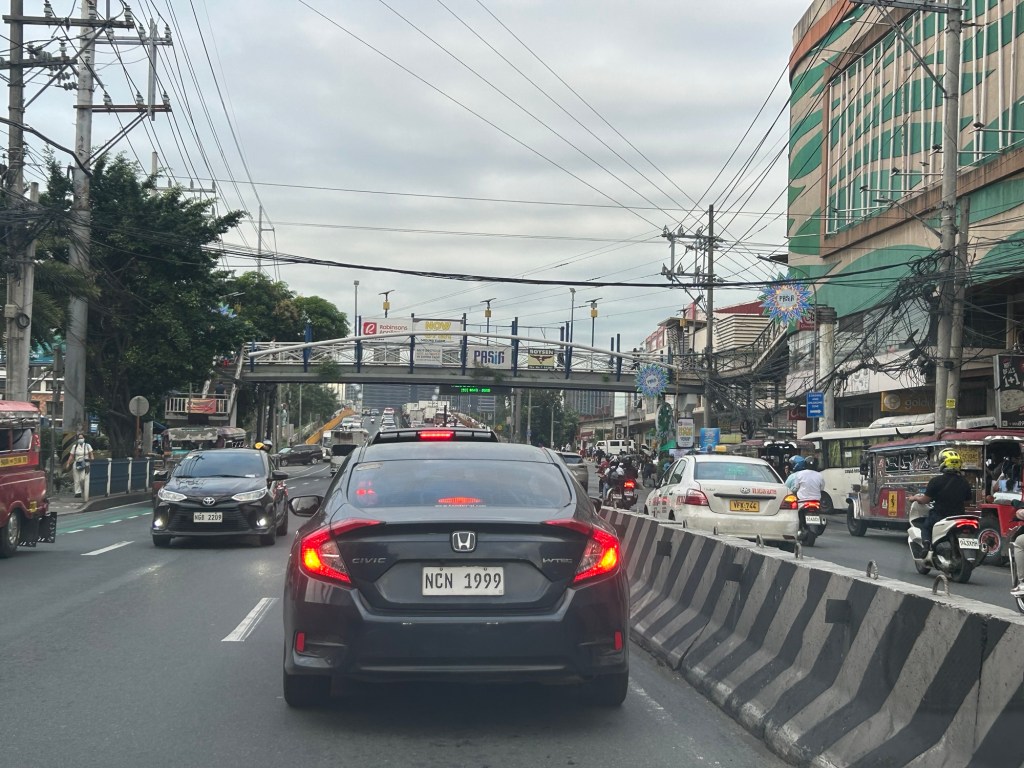
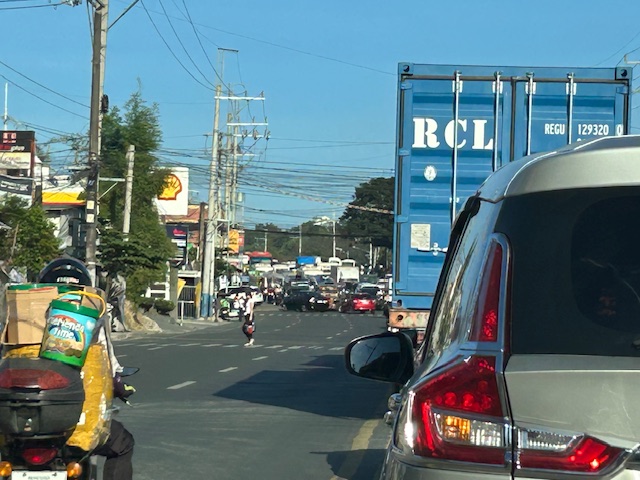
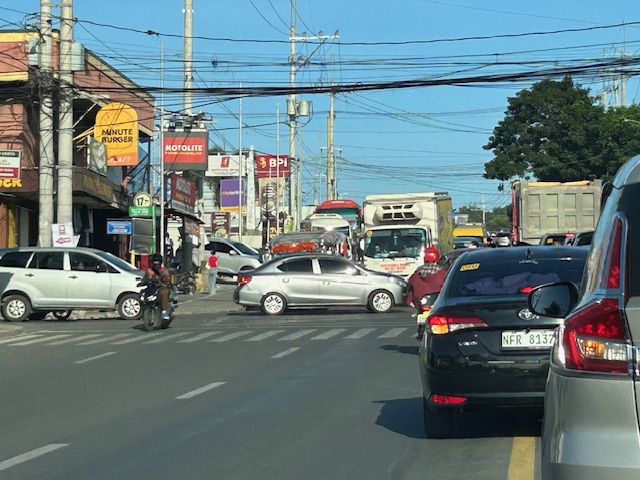
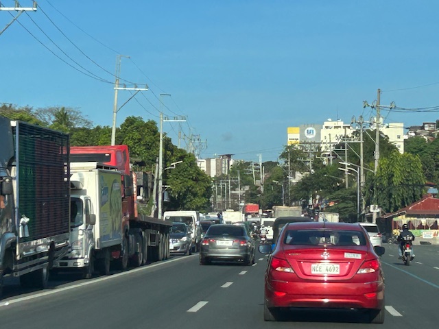
On the chronic congestion along Ortigas Avenue Extension
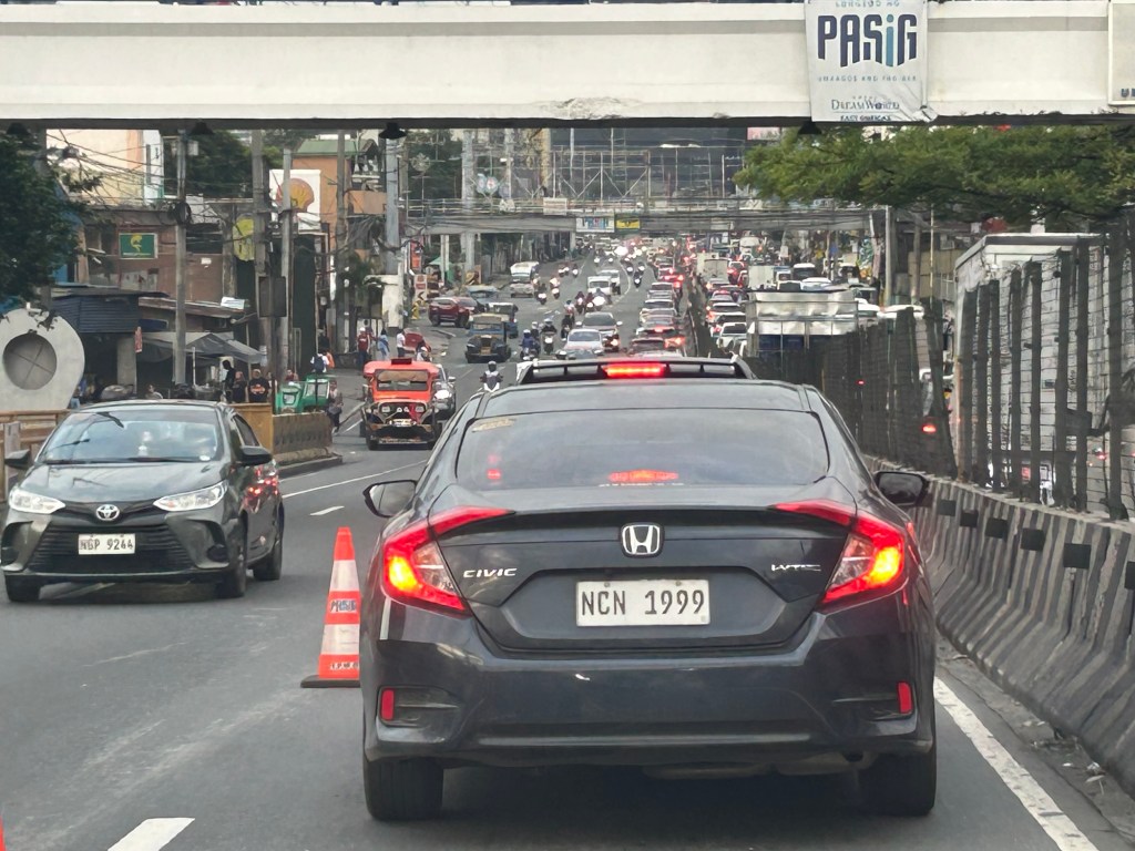
I previously wrote about the counterflow scheme along Ortigas Avenue Extension. While this is usually implemented during the mornings. A similar scheme is not applied in the afternoons or evenings. Apparently, the directional distribution in the afternoons and evenings is not suitable for a counterflow scheme. The photos below show the typical eastbound traffic as seen from the Manggahan Floodway bridge.
 Typical weekday evening traffic along Ortigas Avenue Extension
 The photos show that the traffic along the opposing direction (westbound) is as heavy as the eastbound traffic. This means a counterflow scheme similar to that in the mornings cannot be implemented during this period.
I have mentioned in the previous article that the corridor already required a mass transit system since the 1980s. Despite the operations of several bus companies over the past decades, these have not been enough (together with jeepneys and vans) to serve the demand along the corridor. It is not uncommon to find so many people stranded along the corridor and waiting to get a ride even during the early mornings. While Lines 2, 3 and 7 were being constructed, people in Rizal who have long endured the traffic along Ortigas Avenue Extension could only wonder why a transit system has not been provided for them. Will the proposed Line 4 be finally constructed? When will it be completed? What could be the traffic impacts of construction considering the limited space available for the construction? Should commuters prepare for more miserable travel once construction is underway?
–
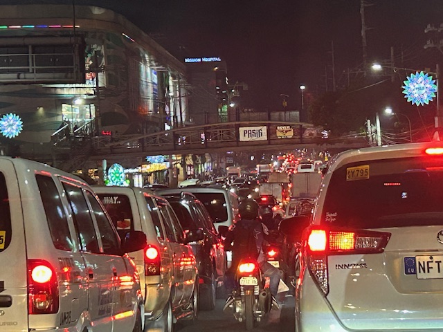
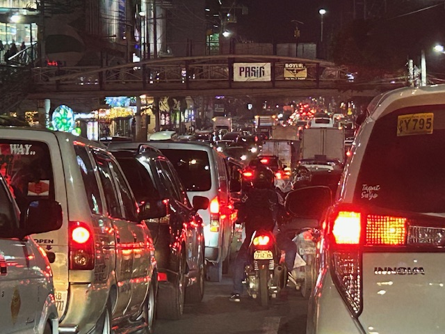
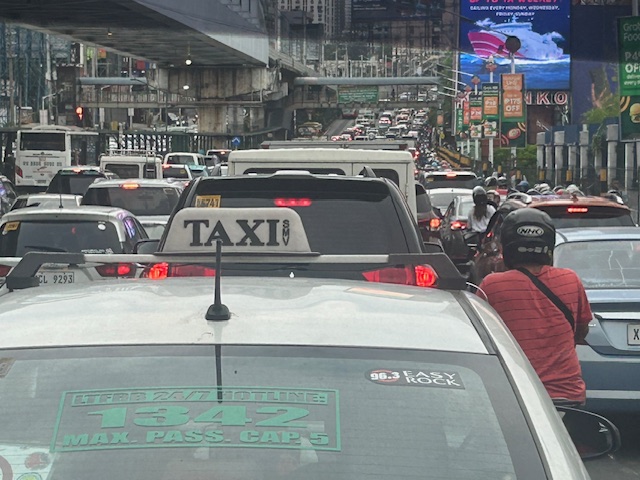
Traffic congestion along EDSA
I’ve taken some photos of EDSA traffic as well as the EDSA Carousel buses. Here are the more recent EDSA photos I took as I traveled from Makati to Quezon City after serving as a panelist in the Energy Transitions Dialogue last Wednesday.
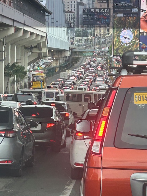 I took this photo as we passed Guadalupe. I like this in the sense that it shows the clear ROW for the EDSA Carousel buses. One wonders why most of these motorists would prefer to drive their vehicles rather than take the bus or the MRT.
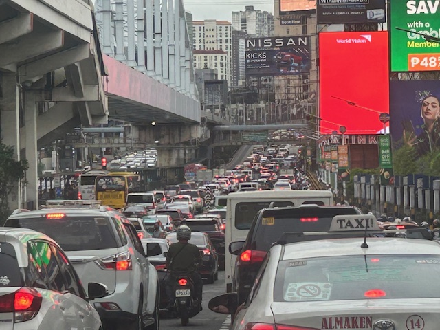 You can see in the photo that EDSA’s northbound side is clogged as far as the eye could see. If you check the image under the MRT bridge, it shows the southbound side was also congested. These photos were taken around 4 PM so this was still an hour before most people would be going home from work.
 I mentioned in my comments at the panel that one consequence of giving number coding exemption to electric and hybrid vehicles is that this further diminishes the effectiveness (is it still effective?) of the MMDA’s number coding scheme. I don’t have the stats of how many EV’s and hybrids are registered and running in Metro Manila. Those numbers combined with actual counts will tell us how they are impacting traffic. That would be a nice topic for a paper. 🙂
The photos pretty much describe the transport situation in Metro Manila. Many of our major cities will be heading this way unless they improve their public transportation fast. If they do, then public transport mode share will be sustained if not increased. Metro Manila’s is already being eroded by inefficient public transport, motorcycles (including taxis) and perhaps unintentionally, electric and hybrid vehicles.
–
On the need to rethink traffic metrics
While Level of Service (LOS) criteria is a concept that can be applied to many other transportation facilities and aspects, among the LOS criteria that have been the subject of much criticism (and perhaps rightfully so especially in the context of safety) are the ones used for intersections. These are associated with delay reduction, which always favors vehicular throughput. The latter means basically, high LOS corresponds to prioritizing car (or motor vehicle) movement while not particularly taking into consideration the safety and movement needs of other road users (not using motor vehicles). Here is an interesting article on this matter:
Boenau, A. (July 9, 2025) “The old traffic math that keeps destroying neighborhoods,” Fast Company, https://www.fastcompany.com/91362348/road-design-traffic-math-destroying-neighborhoods-los [Last accessed: 7/15/2025]
Quoting from the article:
Here are three important questions for experts to ponder:
- Is slow-moving car traffic ever safer than fast-moving traffic?
- Do we have any obligation to provide safe and convenient access for people when they aren’t inside cars?
- What are the economic downsides of wider, faster streets in the central business district?
When planners and engineers truly wrestle with those questions, they can choose to remain a conformist who ignores the damage of traffic metrics, or become an outlier in the industry and make a positive impact that might be felt for generations to come. Things can get better in the end.
–
Again, I must say that rethinking roads and streets should be context sensitive. Still, safety should be the top concern especially for areas that is predominantly residential and/or school. Safety, after all, comes first in the definitions of transportation and traffic engineering.
–
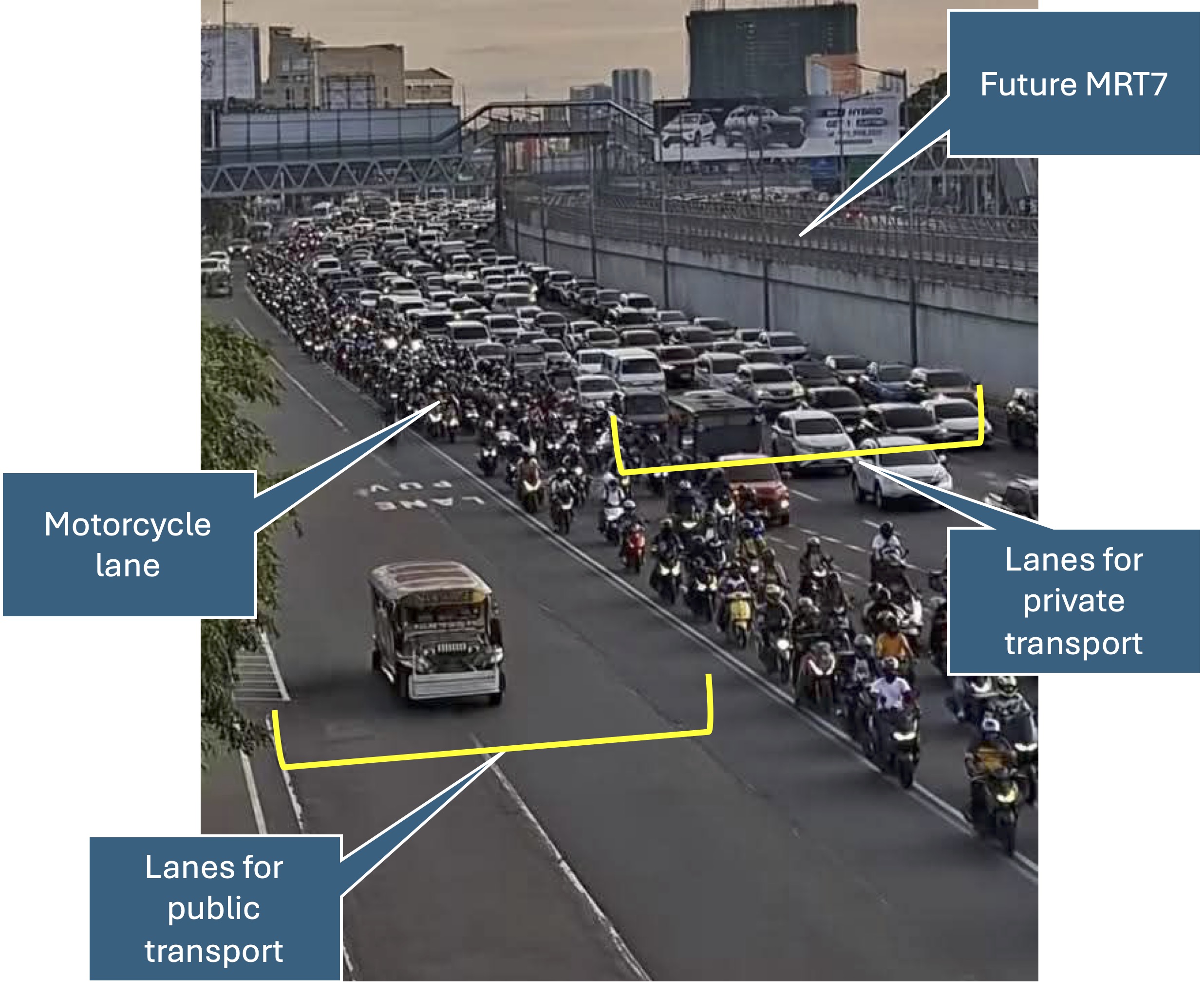
Quick comments on the NCAP
The No Contact Apprehension Policy (NCAP) is finally being implemented in Metro Manila. The results so far has been dramatic in terms of the number of violations recorded and the images being shared so far about how motorists are behaving. Below is one of those photos being shared on social media to which I added some annotations. I will use this later to comment on the NCAP and how we can use the outcomes to assess the transportation situation and determine what interventions can be done. Some are already obvious from the photo – the lack of public transport options lead to people depending on private motor vehicles like cars and motorcycles for their commutes. MRT7 is yet to be operational and road public transport has not been rationalized.
More on this topic soon!
–
On transportation problems being treated like diseases
I am sharing this relatively old article on transportation problems needing treatments as if these were diseases. I say it’s ‘old’ because it’s from last year, and these days when much content is being pushed everywhere including mainstream and social media, things get old, quickly. Rewind to more than a decade ago and Intelligent Transportation Systems (ITS) wasn’t as popularly applied as today and Artificial Intelligence (AI) seems to be everywhere now including in transportation systems.
Menard, T. (September 1, 2024) “Transportation Rx: Treating Traffic Glut Like Doctors Treat Sinus Congestion,” Planetizen, https://www.planetizen.com/features/131478-transportation-rx-treating-traffic-glut-doctors-treat-sinus-congestion [Last accessed: 4/21/2025]
To quote from the article:
“Traffic congestion is not unlike congestion that builds up in the human airways. When we see a doctor, we are prescribed a treatment that clears the backup. Similarly for roads, rather than setting up road signs and cones to redirect traffic, cities can take a more prescribed treatment approach through methods such as congestion pricing and other road pricing strategies, as well as technologies like edge computing, navigation-enabled Mobility-as-a-Service (MaaS) modeling, and transit signal prioritization. “
This is not the first article to allude to medicine when the topic is traffic congestion. There are others that use terminology from the human body’s circulatory system. When an artery gets blocked, a bypass can be a solution. But perhaps we don’t need bypasses and look at other. more effective ways of dealing with transportation problems.
–
A new bottleneck along Marcos Highway in Antipolo City?
I’ve been wondering why there seems to be much congestion along the westbound side of Marcos Highway in the morning just before we reach SM Cherry. It is usually flowing there but the past weeks when we used the route instead of Sumulong Highway, traffic was really bad. As I am quite observant about the traffic and always looking for reasons or causes, I found that this was due to the alternative route Antipolo ‘opened’ that many motorists now take when traveling between Marikina and the side of Antipolo heading in the general direction of Cogeo.
The alternate route connects Marcos Highway and Sumulong Highway via TOCS Avenue (which intersects Marcos Highway near SM Cherry) and Sampaguita Street (which intersects Sumulong Highway past Masinag Junction and near the Hillside Centre Plaza before Soliven Avenue). If you’re coming from Marikina and heading in the direction of Cogeo or even Antipolo Simbahan then this route may provide shorter travel time as you won’t have to go around Masinag Junction to make an effective left turn to Marcos Highway (direct left turns at Masinag are not allowed).
 This is the view from the queue approaching the intersection of TOCS Avenue with Marcos Highway from the eastbound side of the highway. Note that traffic is not flowing from the junction along the eastbound (Metro Manila bound) side of the highway.
 A closer look with vehicles turning left to Marcos Highway from TOCS Avenue. There are usually Antipolo traffic enforcers facilitation (read: favoring) traffic from and to TOCS Avenue. This results to build-up along Marcos Highway where most traffic is through traffic.
 The resulting congestion affects many travelers including freight along the westbound (Metro Manila-bound) direction of Marcos Highway.
While the alternate route likely provides shorter travel times for those coming from Marikina to Antipolo/Cogeo and vice versa, this is at the expense of more people and goods who and that travel along Marcos Highway. Antipolo should realize this even with basic observations on the traffic build-up in the area. Traffic for that alternate route should not be prioritized to the detriment of travelers along Marcos Highway.
–
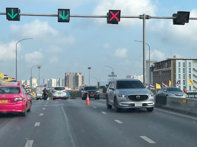
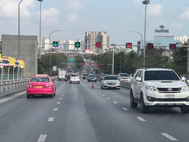
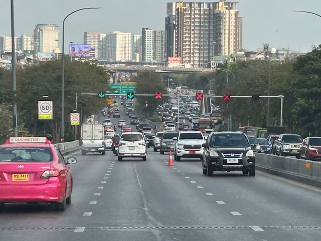
Counterflow lanes in Bangkok, Thailand
I almost forgot again about this set of photos showing the implementation of a counterflow scheme along a long stretch of road in Bangkok. Heading out of Bangkok, I was able to take photos of the counterflow lanes and variable traffic signs used for this purpose. We were northbound meaning we were traveling outbound of the metropolis and opposed to the peak direction (southbound was inbound to Bangkok).
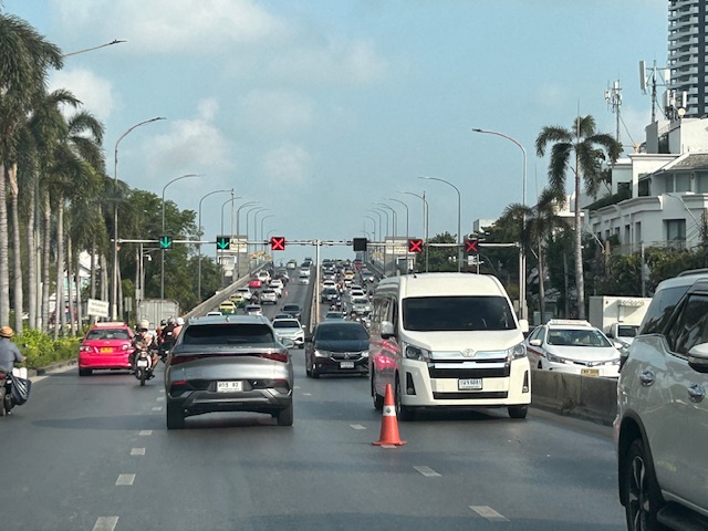 Approaching an overpass where variable traffic signs are installed overhead (i.e., on a gantry).
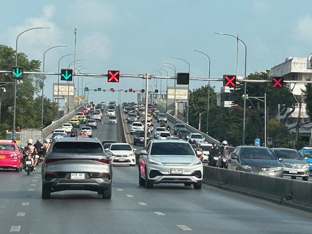 It is easy to see which lanes are assigned for our direction and which ones for the opposite flow.
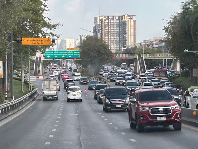
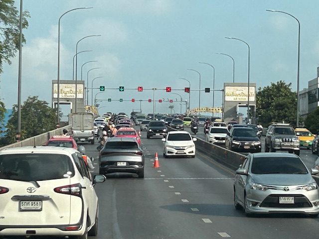 On the overpass, you can see that the variable signs are installed at regular intervals. There are a few cones that act as physical separators (not really barriers) between opposing flows.
 Sort of a close up of the variable signs and a cone. I assume the cones are placed there by traffic authorities. They might be transferred to the other side of the overpass if the counterflow was in favor of our direction.
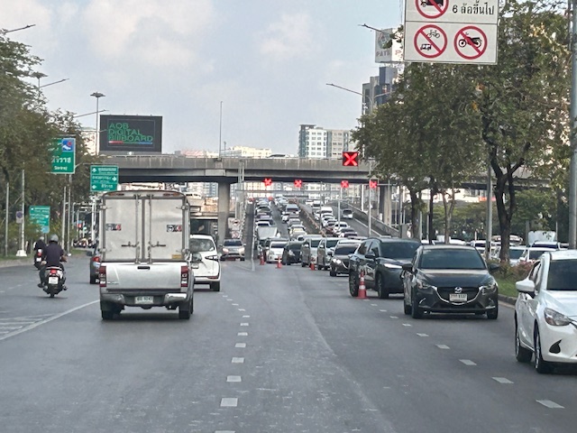
 Another photo showing the installed variable signs towards the other end of the overpass.
 Four lanes are assigned to inbound traffic while only two are for outbound traffic.
 At the foot of the overpass is a pedestrian overpass. The stairs appear to be quite steep based on the photo. I’m not aware of criticisms of the pedestrian footbridges in Bangkok. I would have to ask my Thai friends about their designs.
 Another overpass where all lanes are assigned to the southbound direction
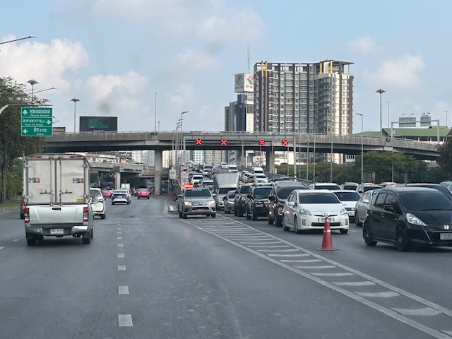 The parked vehicle on the chevron is with the traffic authority of Bangkok.
I actually started writing this in April last year. I will try to finish some drafts I started last year this month while also posting about my recent travel to Bicol.
–
On civil works for transferring cables and wires underground
I got messages this week about the civil works to be implemented in relation to transferring overhead cables and wires underground at the Ortigas Center in Pasig City. This is a screenshot of what’s been circulating the past days:
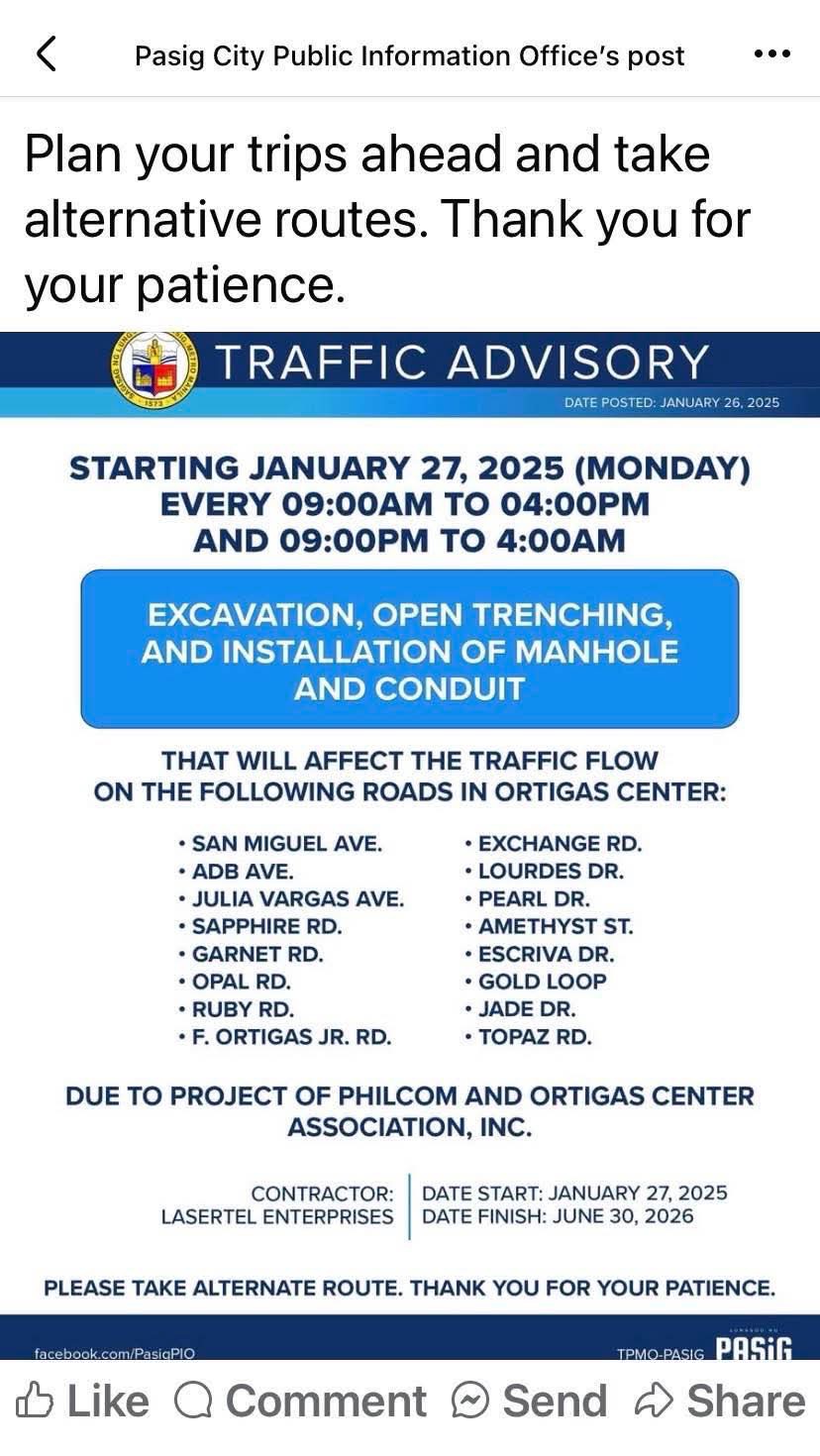
I think this follows the examples of cities like Iloilo and Davao already transferring or placing power and communications cables and wires underground. Prior to these, Bonifacio Global City (BGC) in Taguig City already did so but that was from the start considering BGC is a masterplanned development. Other masterplanned developments are already consciously doing this so there will be no overhead cables and wires that are often criticized as unsightly or ugly. Such works will require traffic management as excavations will surely reduce road capacities and lead to more congestion. The timeline or schedule can also be affected once they do the excavations as conflicts among utilities are expected. Note that water lines and drainage are already underground and there will be the need to resolve the intersections of these with the power and communications lines to be transferred.
Perhaps we can learn from this experience that Ortigas Center will undergo until 2026 as other Metro Manila LGUs also consider transferring their overhead cables and wires underground. Quezon City, for one, is already at the early stage of identifying an area or corridor to serve as a pilot for the city. That can be a road like Commonwealth Avenue or Visayas Avenue or perhaps the Araneta Center in Cubao.
–
Davao 8th, Manila 14th worst in Tomtom Traffic Index
I just want to share this news report here:
Source: Davao 8th, Manila 14th worst in Tomtom Traffic Index
I have to admit that I still have to figure out in detail how exactly their data were collected and evaluated. However, knowing and experiencing traffic in these cities, I would like to opine that traffic is still worse in Metro Manila cities compared to Davao and perhaps others across the country.
