
Home » Posts tagged 'traffic management' (Page 2)
Tag Archives: traffic management
From 9-to-5 to Anytime: How Telecommuting Changes the Traffic Game
Here’s a quick share of an article on telecommuting:
Source: From 9-to-5 to Anytime: How Telecommuting Changes the Traffic Game
To quote from the article:
“As we look across these 83 cities, it’s clear that remote work has brought relief to some areas while leaving others just as crowded as before. The cities seeing the most benefit from WFH were those with a flexible, remote-friendly workforce and a supportive economic structure. For fast-growing cities, or those with heavy industry or logistics, WFH alone wasn’t enough to solve congestion.
Telecommuting has no doubt reshaped our roadways, but it’s clear that tackling urban congestion will require more than just a remote work policy. As cities continue to grow and evolve, the future of urban mobility will rely on creative solutions, from smarter infrastructure to updated transit options, to keep America’s cities moving in this new, work-from-anywhere world.”
There are lessons to be learned here for us in the Philippines. Telecommuting is not a new thing here especially considering we have many BPOs operating across the country. Indeed, it is not to be considered as the only solution but one of many we can use to reduce congestion and improve commutes in our towns and cities.
–
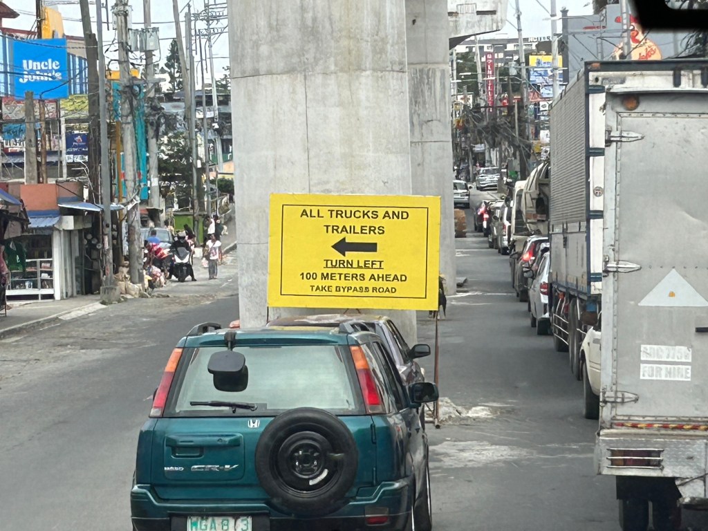
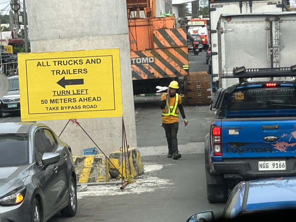
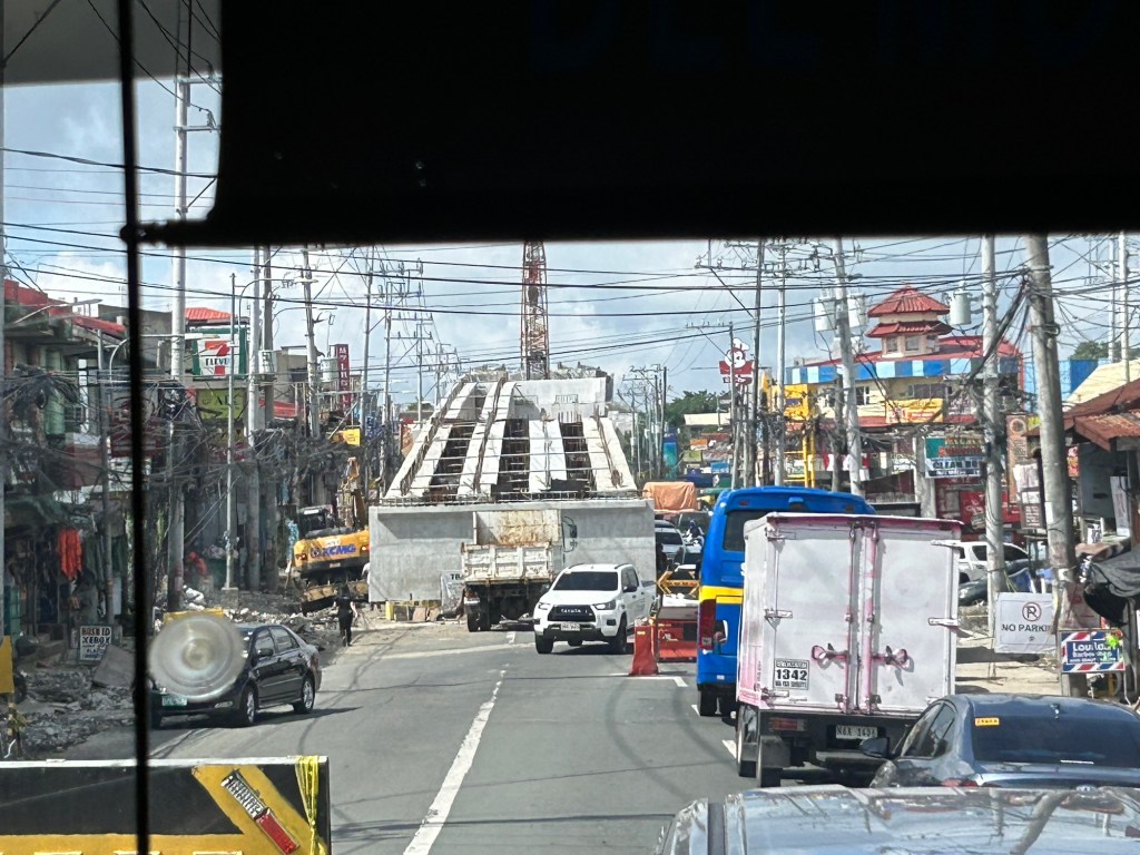
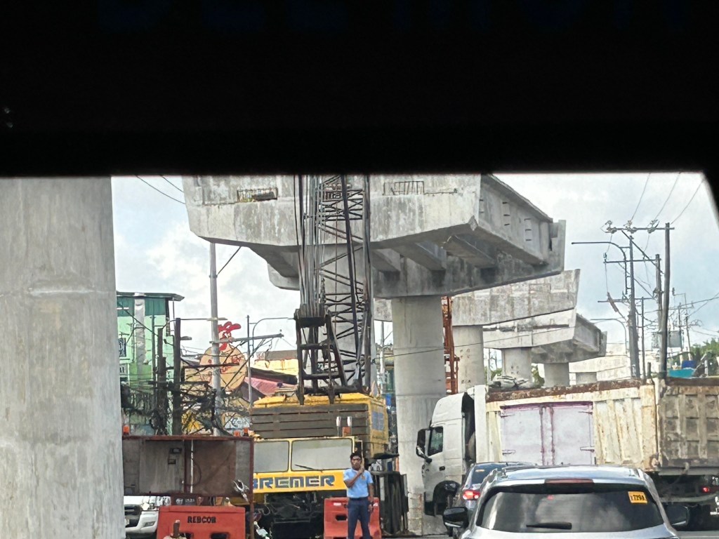
Congestion due to flyover construction: Tagaytay-Nasugbu Road – Part 2
I showed photos of the construction of an overpass along the Tagaytay-Nasugbu Highway coming from Tagaytay in the previous post. This time, here are some photos taken along the opposite direction.


–
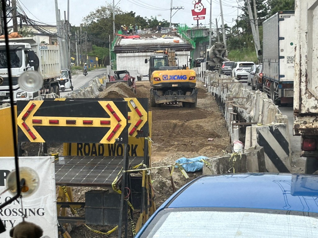
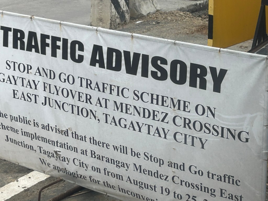
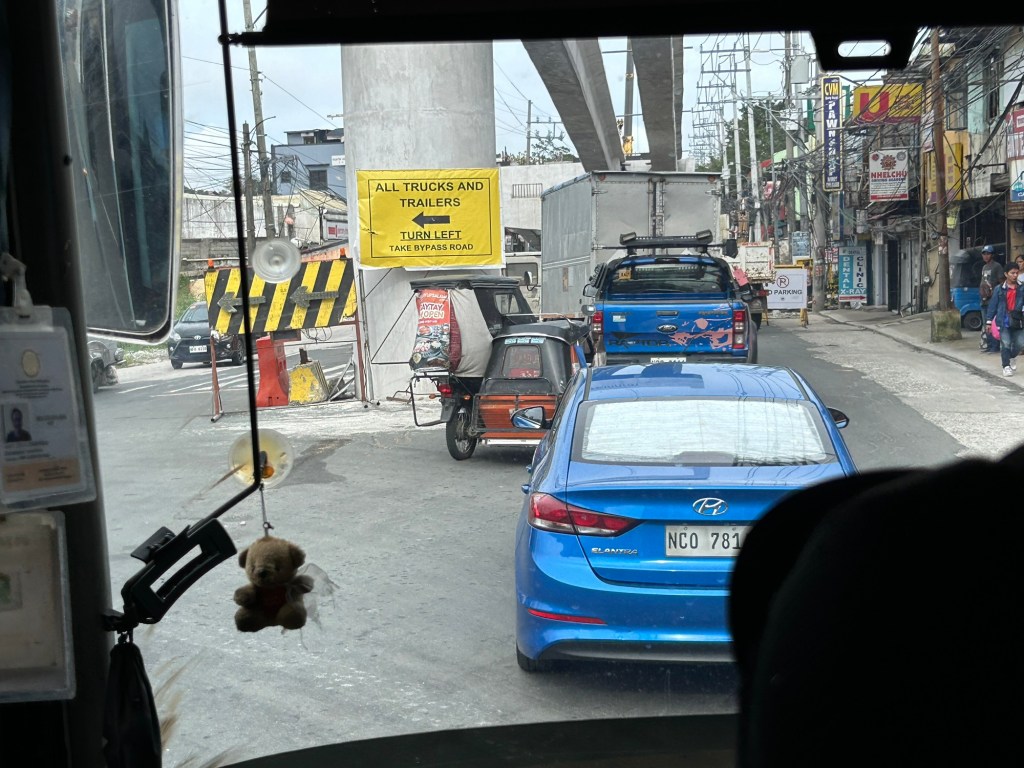
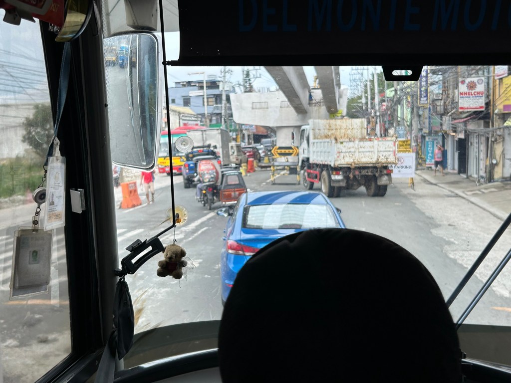
Congestion due to flyover construction: Tagaytay-Nasugbu Road – Part 1
There is significant traffic congestion along the Tagaytay – Nasugbu Highway due to the construction of an overpass along the highway at its junction with the Tagaytay – Mendez Highway.


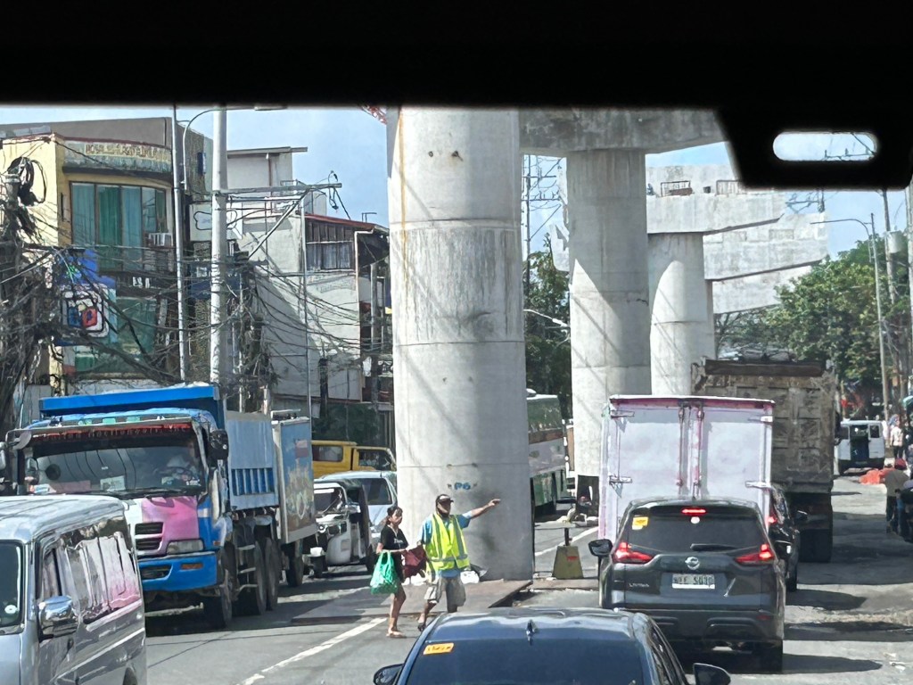
Was there a need for a flyover here? Otherwise I would suggest instead a set of good old-fashioned traffic signals and geometric improvements to the intersection.
–
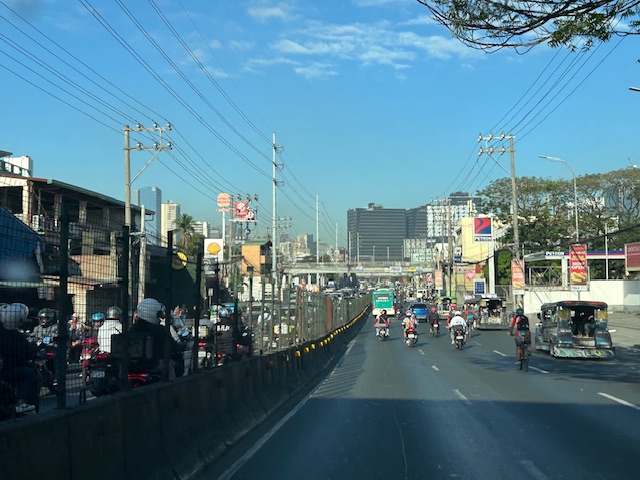
Counterflow irony along Ortigas Avenue Extension, Pasig City
One Friday, I traveled to Ortigas Center from Antipolo via the most direct route using Ortigas Avenue Extension. I was not surprised by the counterflow scheme being implemented starting from De Castro all the way to Rosario Bridge. I was also not surprised that the more congested lane was the counterflow lane. I thought everyone expected the main traffic lanes to be congested as PUVs like jeepneys, buses and vans usually create bottlenecks as they block traffic while passengers board/alight along that section of Ortigas Avenue Extension. Here is what you might encounter in terms of traffic if you opt to stay along the westbound traffic lanes:
 Traffic before the Manggahan floodway bridge at what was generally called Mariwasa. The Filinvest residential development on the left used to be the Mariwasa tiles plant.
 Traffic after the crossing the bridge. Note the pedestrian overpass in the photo.
 Meters after and near the overpass, you can already see the build-up in the Rosario area
 The Rosario bridge area is usually congested not just because of the PUV operations but also because there is the junction of Ortigas Avenue Extension and Amang Rodriguez Avenue, which is another major thoroughfare connecting this area to other parts of Pasig, Quezon City and Marikina City.
I will post about the counterflow scheme in Bangkok in the next post.
–
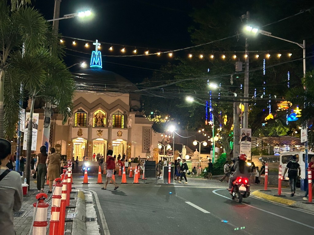
International Shrine of Our Lady of Peace and Good Voyage
It’s Maundy Thursday today and there will be the Alay Lakad later this afternoon. Here are photos I took yesterday morning at the shrine including the road closures sign or tarp posted at the intersection of P. Oliveros Street, Ortigas Avenue Extension and L. Sumulong Circle near the provincial capitol site.
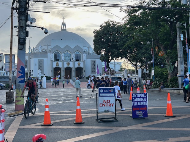 Access was already being limited as of yesterday morning. On regular days, there will be a queue of vehicles mostly new and to be blessed at the shrine. There’s limited parking at the shrine itself so visitors or pilgrims would have to find parking around the church including the nearby mall.
 View of the shrine from the entrance to the complex
 The main altar of the shrine
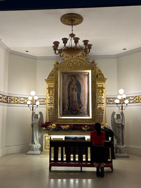 Retablo to Our Lady of Guadalupe
 The main road to the shrine, P. Oliveros Street, is an extension of Ortigas Avenue Extension from the Provincial Capitol site. This will be the main route to the shrine and will be filled with people later this afternoon and overnight.
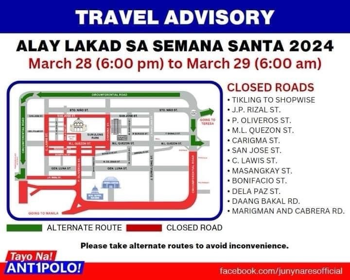
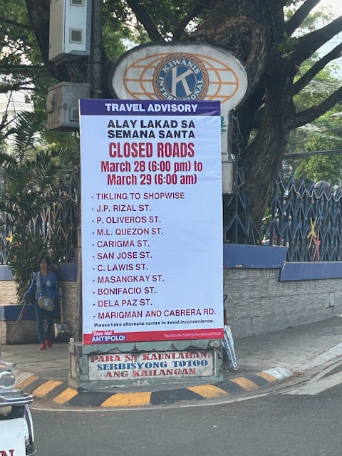 Road closures from 6:00 PM today until 6:00 AM tomorrow (Good Friday)
The Alay Lakad is a spectacle by itself and probably rivals if not exceeds the Traslacion of the Black Nazarene in Quiapo, Manila in terms of the number of participants.
–
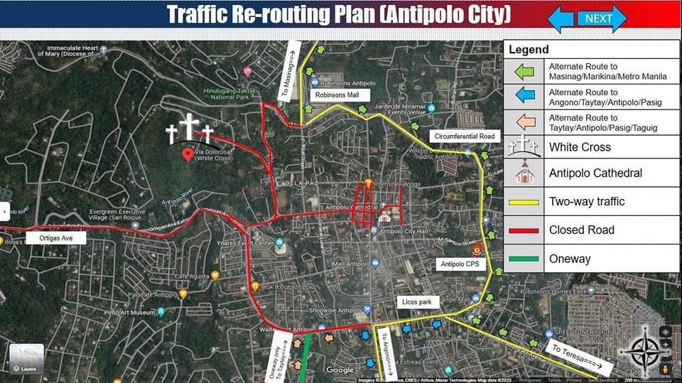
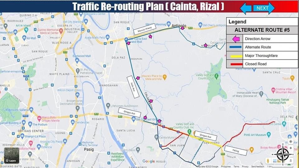
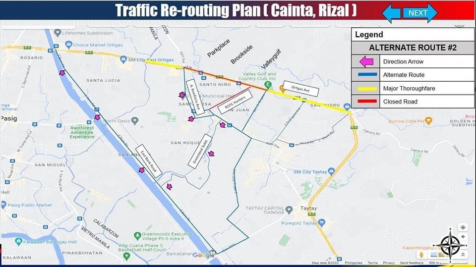
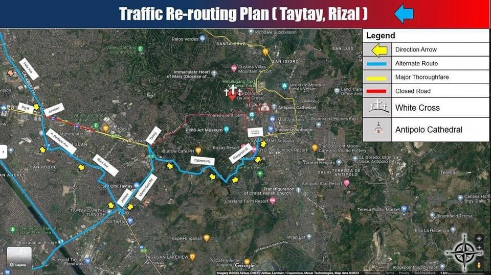
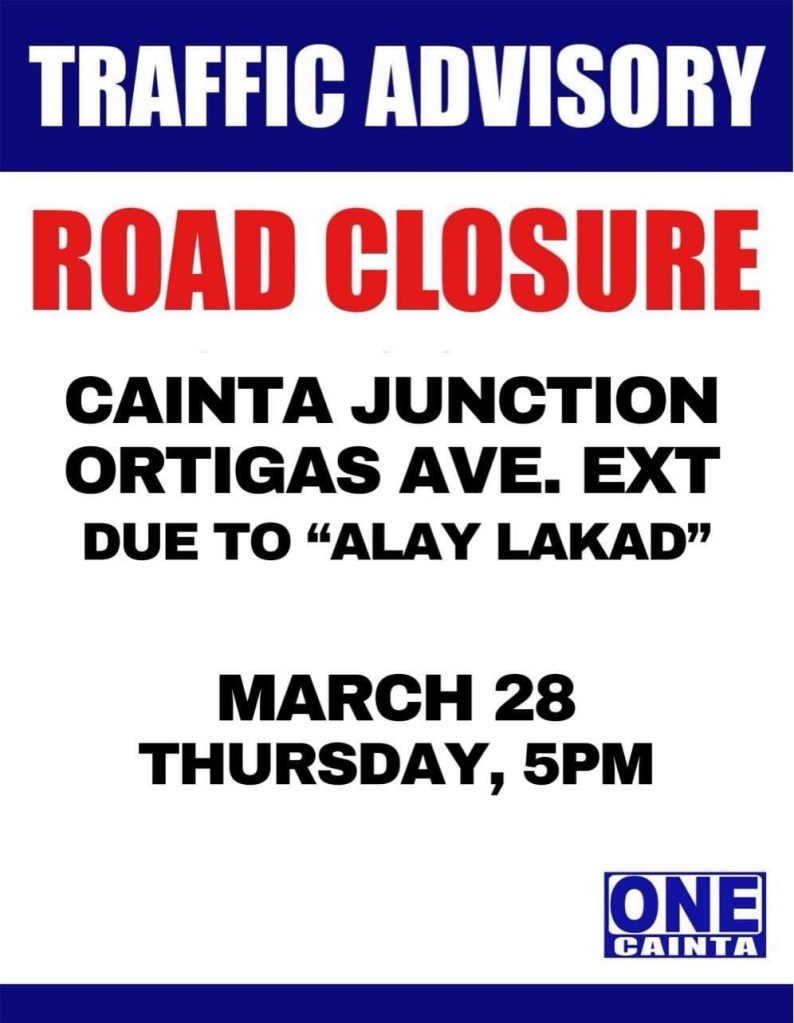
Alay Lakad 2024
I’m sharing here the announcements and maps shared by Antipolo, Cainta and Taytay regarding road closures and alternative routes during the Alay Lakad this Holy Week. The roads leading to the Antipolo Shrine will be closed from 5pm of March 28 (Maundy Thursday) to 6am of March 29 (Good Friday). Expected are hundreds of thousands of people making the trek to the Shrine of Our Lady of Peace and Good Voyage, which is among the most popular pilgrimage sites in the country.
Many are probably walking as part of their panata or commitment in exchange for a favor they have prayed for. This may be healing for an illness or finding work or passing a licensure exam. Of course there are those who also pray for wants rather than needs like a new car, a big house or winning the lottery. And then there are those who are in it for the adventure, treating this as an excursion or a gig with the barkada.
Here are the maps and announcements posted in the official pages of the LGUs:
–
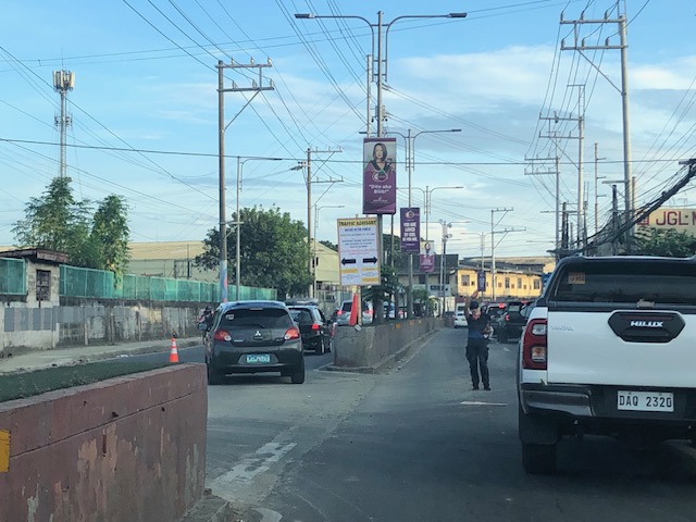
Counterflow lane to Cainta Junction along Felix Avenue
Counterflow traffic schemes seem to be in these days. Cainta used the scheme temporarily while one lane of Felix Avenue was blocked due to the maintenance work being conducted by Manila Water. Following are photos showing the traffic advisory and photos during the counterflow.
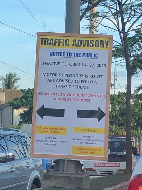 Traffic advisory showing the period when the counterflow traffic scheme was implemented.
 There was a median opening across from a factory’s main gate that allowed vehicles to counterflow.
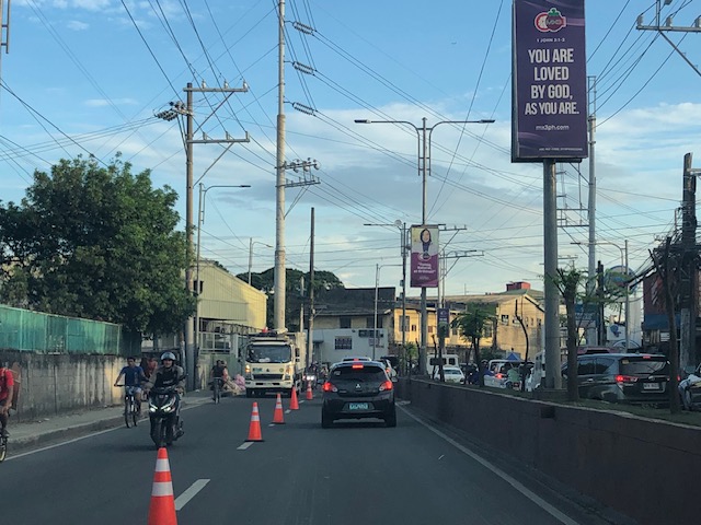 The counterflow lane allowed vehicles to bypass the utilities maintenance works being performed by Manila Water’s contractor that blocked the median side lane of Felix Avenue.
 Approach to Cainta Junction
 The counterflow ends at Cainta Junction where left turning vehicles are positioned correctly for the movement. Through traffic were expected to occupy the other/normal approach lanes.
As the Manila Water concluded its maintenance work, the counterflow scheme was already lifted and traffic is back to normal.
–
On Undas traffic 2023
The past two years, I have not written about the traffic situation or conditions during Undas or the holidays corresponding to All Saints and All Souls Days (November 1 and 2). There wasn’t much to write about really. The usual traffic congestion would be along roads near cemeteries and memorial parks. Marikina City’s Barangka area and Bonifacio Avenue near Loyola Memorial are usually congested due to the city’s public cemetery and the memorial park combining for significant traffic generation during Undas. The days leading to Undas find people traveling, usually back to their hometowns but these days many go out for vacations instead. And so the roads near the airports, seaports and bus terminals are also congested. Tollways and national roads (especially the main corridors) can also be congested with the exodus of people from Metro Manila to the provinces in Luzon Island. I assume something similar occurs for other major cities as well.
Many people I know seem to be vacationing this week as they took advantage of the October 30 Barangay elections and the declaration of November 2 as a holiday to take the week off. Many probably took leaves for the two days that were not declared as holidays – October 31 (Tuesday) and November 3 (Friday). Many if not most schools I know declared a break for the week. It is, after all, an opportunity for students, teachers and school staff to take a breather. At UP though, this week came shortly after its Reading Break so its likely people were not able to gain momentum despite the opportunity to catch up on matters like assignments and correcting exams or papers.
I saw some social media posts early this week about expressways being congested. A few even opined that tollways were a scam because of the toll fees being collected despite congestion. I found those quite amusing as the alternative would have been national and local roads that would also be congested. Tollways have been proven to provide shorter travel times (and therefore higher level and quality of service) compared to the free roads. Also, its a free country so those who have their own vehicles may choose to take free roads. We also have apps like Waze to help us find alternative routes other than those that involve tollways. But for long distance travel (e.g., Manila to Baguio, Manila to Legazpi, etc.), tollways will always have the advantage over free roads. Of course, the timing of the travel also matters and the long Undas week should allow for some flexibility in travel especially those taking the road trips.
Here’s to a meaningful and reenergizing Undas!
–
Still on the Katipunan zipper lane
I’ve occasionally arrived at Katipunan with the experimental zipper lane still in use. I usually take Major Dizon from Marcos Highway in order to have a chance of using the zipper lane. That is, I take the left-most lane of C5 so I am in a good position in case the lane was available when I get to the Ateneo area. Perhaps it is already assumed that the right most lanes are already dedicated to vehicles bound for Ateneo or Miriam (mostly Ateneo I suppose).
So far, I’ve been able to use the zipper lane only once. On the other times, I stay on the left-most lane (beside the island) of Katipunan/C5. The zipper is relatively short as vehicles return to the correct side of the road at Ateneo Gate 3. The merging there means slower movement of both the zipper lane and the median lane traffic. So is the zipper lane a success? I would say the experiment is just above “marginal success” (or pasang awa) given its limited application. It doesn’t hurt to implement the scheme as traffic along the southbound side of Katipunan is generally light anyway.
–
Tikling junction traffic
Easily a pet peeve along my commute is Tikling or Kaytikling Junction in Taytay, Rizal. I think traffic here is worse than two other major junctions in Rizal Province – Cainta Junction and Masinag Junction in Antipolo City. And that is because of the combination of traffic management (or mismanagement) by elements of the Taytay Municipal Government and motorists lack of understanding of how vehicles should position (or travel) at roundabouts. Of course, the volume of motor vehicle traffic converging at this junction would probably merit traffic signals over a roundabout but for most times when there are no enforcers here, traffic is somewhat more efficiently flowing as drivers and riders are forced to give way in order to not constrict traffic.
 Enforcers often employ the “buhos” system of prioritizing traffic for one leg at a time. However, instead of a quick transition from one leg to another, they tend to give more time to vehicles coming out of the Manila East Road and turning left and (west)bound for Ortigas Avenue Extension. The long time allocated to the latter means long queues for traffic coming down from Antipolo and those from Cainta.
 Enforcers are partial to outbound traffic from Taytay rather than make an effort to have more equitable ‘go’ time for all legs at the junction.
One wonders who is in charge of traffic for Taytay considering they mismanage traffic everyday. [Though I also wonder why the rest of Rizal including Antipolo and Cainta can’t seem to be bothered by the congestion emanating from Tikling.] As if to prove the point of incompetence, another problematic intersection is the Highway 2000 – Barkadahan Bridge – East bank road intersection, which is signalized and yet somehow always congested (or saturated). But that’s another story.
–
