
Home » Posts tagged 'walking' (Page 9)
Tag Archives: walking
Footpaths at the College of Engineering Complex, UP Diliman
There are newly constructed concrete footpaths connecting the buildings of the College of Engineering complex at the University of the Philippines Diliman. These are intended for pedestrians to be able to walk between buildings without worrying about weather-related concerns such as muddy paths during the wet season.
My colleague took the following photos while walking towards the Institute of Civil Engineering building from Velasquez Street where the university has a portal leading to its housing for faculty and staff.
 The concrete pathway is a significant improvement from the old dirt path that seemed to have been carved out of people’s trekking along this path over the last year or so.
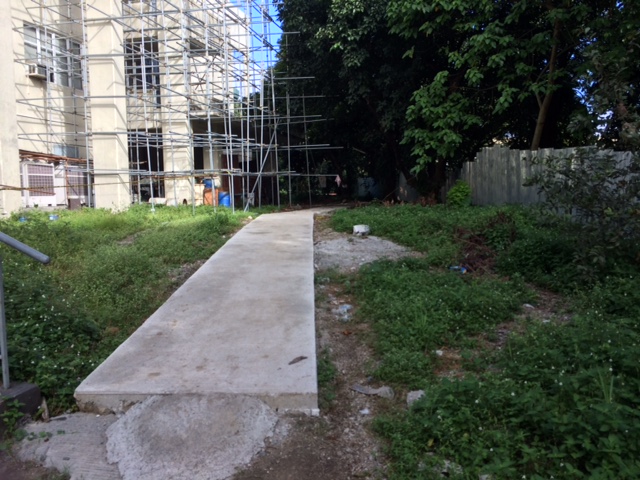 The path connects buildings at the area designated for the College of Engineering Complex. Many buildings such as the one above are under construction or to be constructed in this area.
 Much of the pathway goes through trees and other plants, preserving the greens already there that help provide a more enjoyable environment for walking.
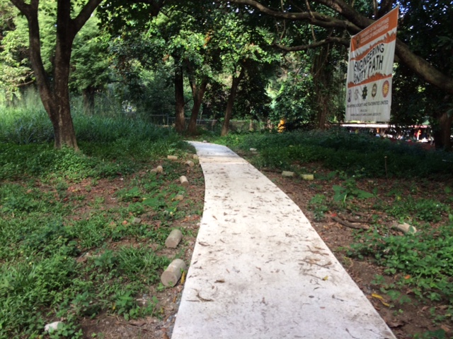 The pathway was dubbed the “Engineering Unity Path” as it connects buildings that are homes to individual institutes and departments that constitute the College of Engineering.
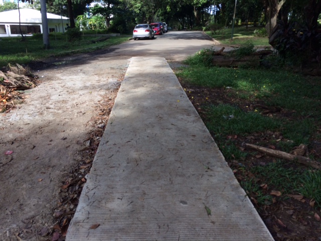 End of the road – one end of the foot path leads to Maramag Street and the driveway to the Executive House, the official residence of the UP President.
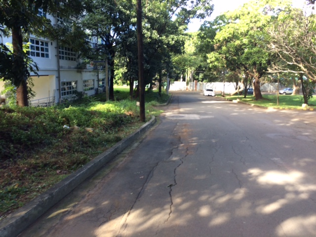 Maramag St. towards the Institute of Civil Engineering (ICE) complex with the ICE main building at left
While the pathway seems to be a permanent structure it is something I think is basically evolving just like the College of Engineering Complex. The complex already has a master plan but implementation towards a cohesive complex seem far from completion. For one, much of the complex covers a residential area in the university that has many (too many) informal settlers. And then there is the Executive House at the heart of the complex that probably needs to be moved elsewhere.
–
Walking is good for you!
I found the following graphic on social media (Facebook). It shows the benefits of walking, particularly 30 minutes of walking per day. There are many studies that have established the benefits of what is now termed as ‘active transport’ that includes walking and cycling to promote healthy communities and cities. If only our communities and cities are more walkable then perhaps more people can be encouraged to walk more and there will be a reduction of motor vehicle traffic. The latter will be those vehicles used for short distance trips that are typically associated with distances suitable for walking rather than riding or using a motor vehicle.

–
NAIA Terminal 3 – Newport connector
Currently under construction is a bridge connecting the Ninoy Aquino International Airport (NAIA) Terminal 3 and the Newport City complex across it. Once completed, it will be a convenient physical connection between the airport and the complex of hotels, residential condominiums and commercial establishments. The connection will be at a third level above the NAIA Expressway that is currently under construction. Here are a few snapshots of the bridge:
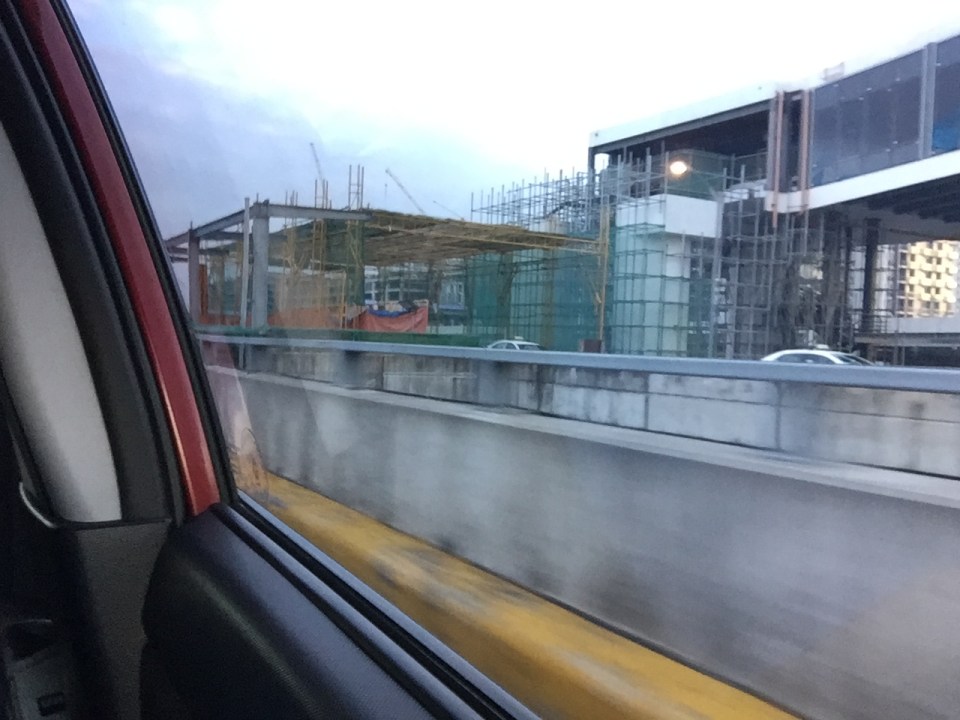 Under construction: a bridge connecting NAIA Terminal 3 and the complex that includes, among other, the Marriott Hotel and Resorts World Manila
 Another snapshot of the bridge under construction. The dome in the background is of the Shrine of St. Therese of the Child Jesus across from Terminal 3.
–
The benefits of walking
I came across an old article on walking that appeared in The New Yorker in 2014. This was after reading another article my wife shared that also was about walking. One is about both the physical and intellectual benefits of walking while the other was about walking without a purpose. Both were about walking and thinking, and definitely about the benefits of even a short stroll to our physical and mental being.
Here’s the article from The New Yorker: Why walking helps us think
And the article from BBC: The slow death of purposeless walking
I highly recommend both articles as we ponder about making our cities safe for pedestrians/walking.
–
Encouraging and providing incentives for walking
A friend based in Singapore posted a photo showing a poster promoting a ‘National Steps Challenge’. The objective apparently and obviously is for Singaporeans and foreign nationals living there to get into walking. The target, according to the poster, is 10,000 steps per day. There are even illustrations in the poster showing estimates of how many steps you can do at the home, the office or during your regular commute.
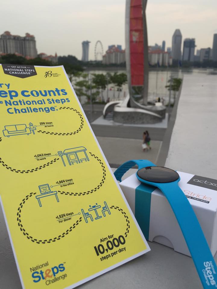 [Photo courtesy of Engr. Joy Garcia]
Such programs are exemplary and are aimed at boosting citizen’s health and welfare. Of course, Singapore can do this and many will respond even without rewards because Singapore has excellent transport infrastructure including an extensive public transport system and suitably designed pedestrian facilities.
Can cities in the Philippines come up with a similar challenge? Are there cities with good enough pedestrian facilities that can lead the way and become good practice examples in promoting walking; not just for the reason of commuting but also as a means to achieve better health among its citizens? Authorities can even include infographics on promotions showing the number of calories you can burn for typical walking trips as well as the health benefits one can derive from walking regularly. I think there are many cities that have decent infrastructure and attractive routes to promote walking. Among them are Vigan City, Marikina City, Legazpi City, Iloilo City and Davao City. Hopefully, these cities can take the cue from Singapore in promoting walking and perhaps, too, a national agency like the Department of Health can pitch in to promote this worthwhile cause for healthier lifestyles.
–
Unprepared and incomplete – realizations from the APEC transport experience
Before I forget about what transpired during the holding of APEC in Manila a week ago, here’s a couple of photos I found over the internet and shared via social media.
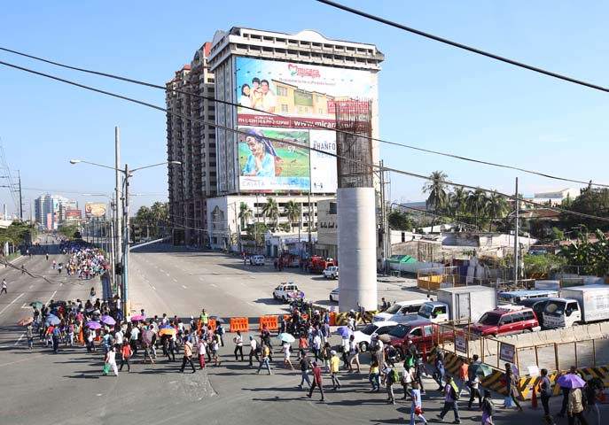 Commuters along Roxas Boulevard walk past a column of the unfinished NAIA Expressway, one of the transport infrastructure projects that has not been finished. [Photo from The Manila Bulletin]
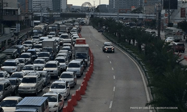 APEC lanes and severe traffic congestion along EDSA – there’s an opportunity here for a prrof of concept test for BRT. [Photo from Facebook]
I saw many memes and read some articles mentioning BRT specifically as one solution to Metro Manila’s transport problems. The second photo above was modified to replace the car travelling along the APEC lanes with a bus.
It is easy to imagine what could have been if the government decided to use the event and the lanes they allocated for APEC vehicles to do a ‘proof of concept’ run of BRT services or at least express bus services (what some DOTC people call high quality bus services). Perhaps what could have been done for part of the 10 billion PHP expended for APEC was to buy a fleet of brand new buses and provided these for free public transport for people who would need to commute during APEC. Services along two corridors would have sufficed – these two would have been EDSA and Roxas Boulevard. [The other option would have been to talk to bus operators and cooperate with them to organize express bus services along EDSA and Roxas Blvd.] Aggressively promoting these free services ahead of APEC would also have meant commuters, including those who usually used their own vehicles, could have opted for these transport services and not affected by the ‘carmageddon’ that ensued over that period. There should have been services to the airport terminals, too, but I will write about this in another article.
The dry run could have yielded essential data for assessing the feasibility of such bus services as an alternate to rail systems that would take much time to build. Incidentally, if the LRT Line 1 Extension to Cavite was built right after the current administration took over, that line could have already served tens of thousands of passengers from the south who regularly commuted to Metro Manila for work and school. The first photo above does not lie about just how many people could have benefited from that rail project. Meanwhile, MRT Line 3 remains dysfunctional and with its reduced capacity could not handle the demand for transport that it should have been able to carry if services had not deteriorated over the years.
–
Caught up in trAPEC
It’s a corny title to this post and perhaps is practically what people would call ‘click bait’. But then it is a very appropriate one considering it describes what happened last Monday and is still happening today and for the rest of the week affected by the Asia Pacific Economic Cooperation (APEC) forum hosted by the Philippines and held in Metro Manila. Yes, Metro Manila. And many people have been asking loudly or in their mind why the capital city when the government was supposed to be promoting and bragging about growth in other cities (inclusive growth anyone?). I would have thought and preferred to have APEC in either Subic or Clark, which have been touted as rapidly growing areas and as international gateways. In fact, Clark is being pitched as the location of a potential new city in the Clark Green City project as well as the aerotropolis currently being developed (slowly) near the airport and the SCTEX Clark South interchange.
Instead, we have the APEC forum and all its attendant activities in Metro Manila. And it seems that the forum has maximized its detrimental impacts on the economy as it practically shut (some people even say shat) down the capital because of severe traffic congestion and a lack of public transport infrastructure and services to carry commuters safely and efficiently between their homes and work places. The Manila Bulletin posted the following photo last Monday:
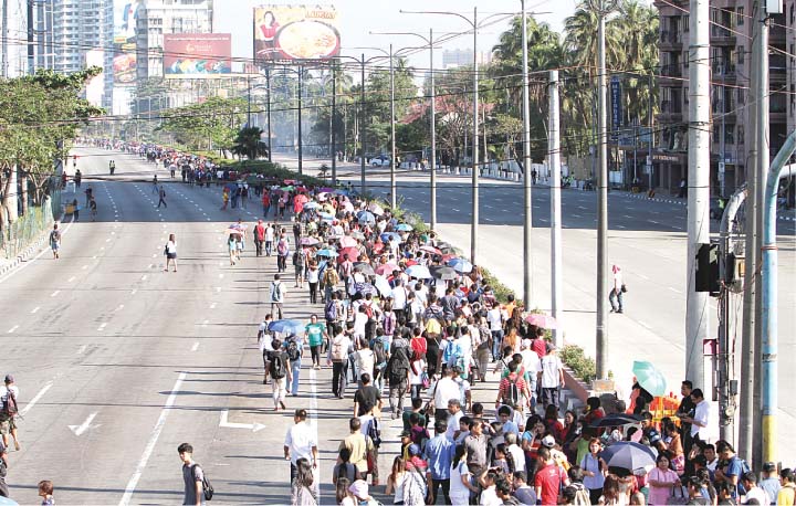 Commuters were forced to walk along Roxas Boulevard just to get to work.
Here are a few more photos courtesy of an old friend from high school:
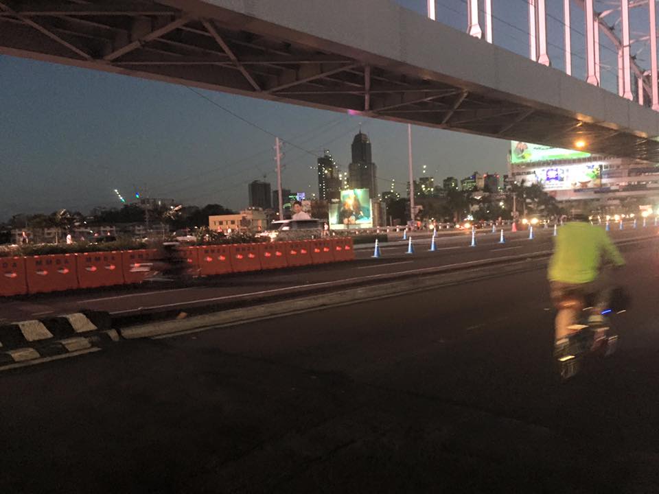 A lone cyclist pedaling along a practically empty section of EDSA (photo credit: Bong Isaac)
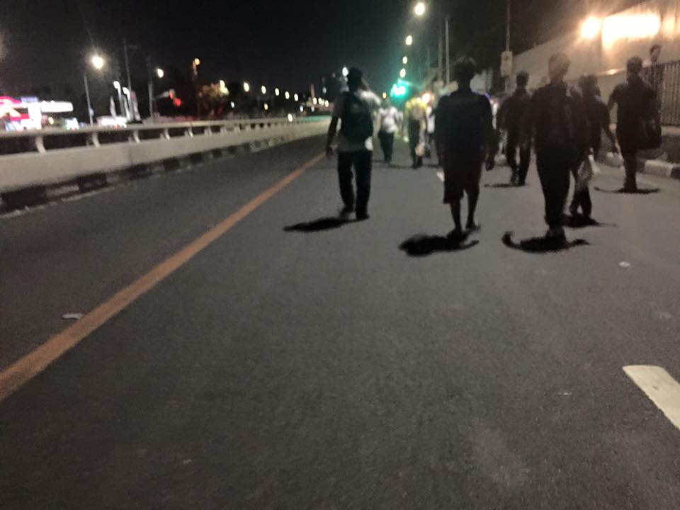 Walkers? – commuters took to walking along EDSA, one of the country’s busiest and most congested thoroughfares. I was amused of the memes about the ‘Walking Deadsa’ referring to people seemingly walking like zombies after a hard day’s work just to get home. (photo credit: Bong Isaac)
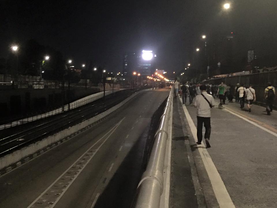 Commuters walking along a vehicle-less EDSA. The MRT 3 line at the left in the photo also seems to be ‘lifeless’ at the time (evening I was told) the photo was taken. (photo credit: Bong Isaac)
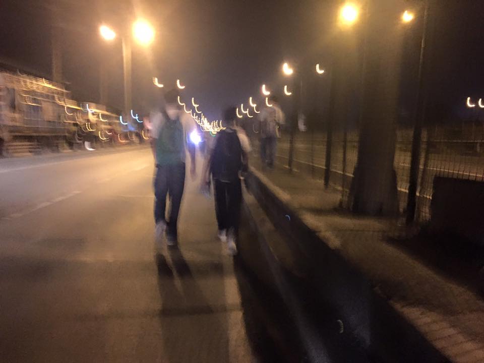 People walking along the service road along the SLEX – most affected of the road closures were people from the southern parts of Metro Manila including those from Laguna and Cavite. (photo credit: Bong Isaac)
I remember being asked once during an interview if it was possible to determine the cost of congestion due to a single event such as a road crash or perhaps a rally. I replied that it is possible given the available tools and expertise in making such assessments. What could be the cost of such a week-long event? Would the holidays for Metro Manila have lessened the economic impacts on traffic of the APEC? Or was it assumed that agreements and the media mileage we got from APEC more than enough to cover economic losses?
Could this disastrous traffic mess have been averted or at least mitigated despite APEC in Manila? Yes, perhaps, if the transport infrastructure particularly the LRT Line 1 Extension to Cavite, the upgrading of the MRT Line 3 and an airport access transit system were completed prior to APEC. These along with other major projects for Metro Manila were promised years ago and yet have not been realized. Add to this the apparent lack of contingencies (BRT-like express buses? bicycles?) that could have eased the pain of hundreds of thousands of commuters affected by APEC traffic schemes. Government has no right to tell people “I told you so” when government efforts for the benefit of its own commuting citizens have been deficient these past years.
–
Antipolo public market pedestrian overpass
I took some photos atop the pedestrian overpass connecting the New Antipolo Public Market and the Robinson’s Place mall. The overpass is across Sumulong Highway, which terminates nearby at the intersection with Antipolo Circumferential Road (Daang Bakal), which is currently being widened.
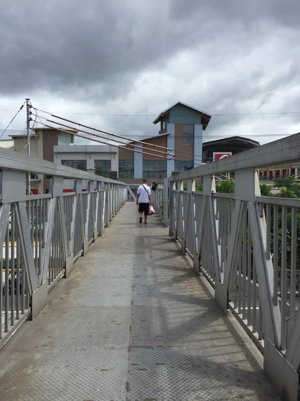 The overpass is a steel structure, including the flooring, which reminded me of factories. This industrial look is not new as there are other overpasses that have been constructed in Metro Manila similar to this.
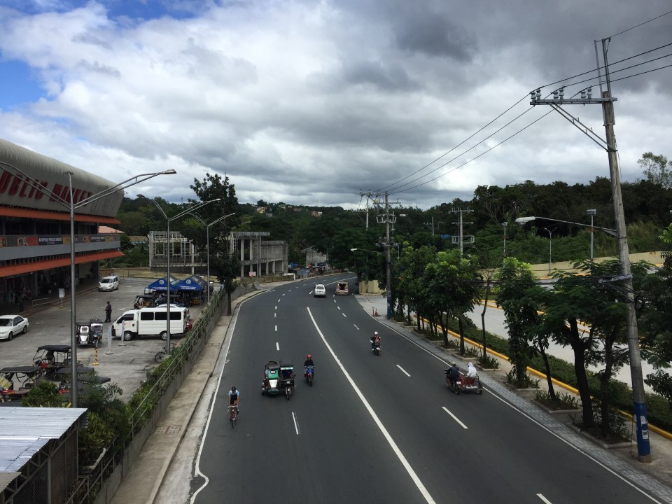 A look at Sumulong Highway towards Masinag. The highway has 4 lanes and at this section has sidewalks on either side of the road. There is no median island to separate opposing flows of traffic. The Antipolo Public Market is on the left side.
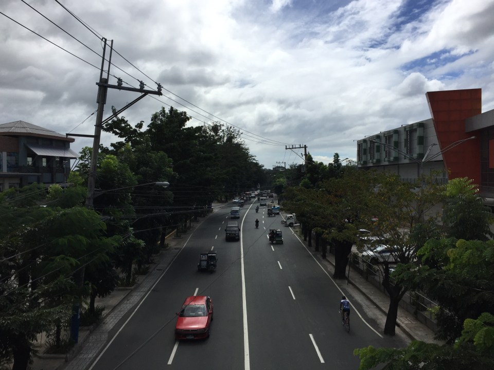 A view of Sumulong Highway towards the Antipolo Shrine of Our Lady of Peace and Good Voyage. The Public Market is at the right and the mall is at the left.
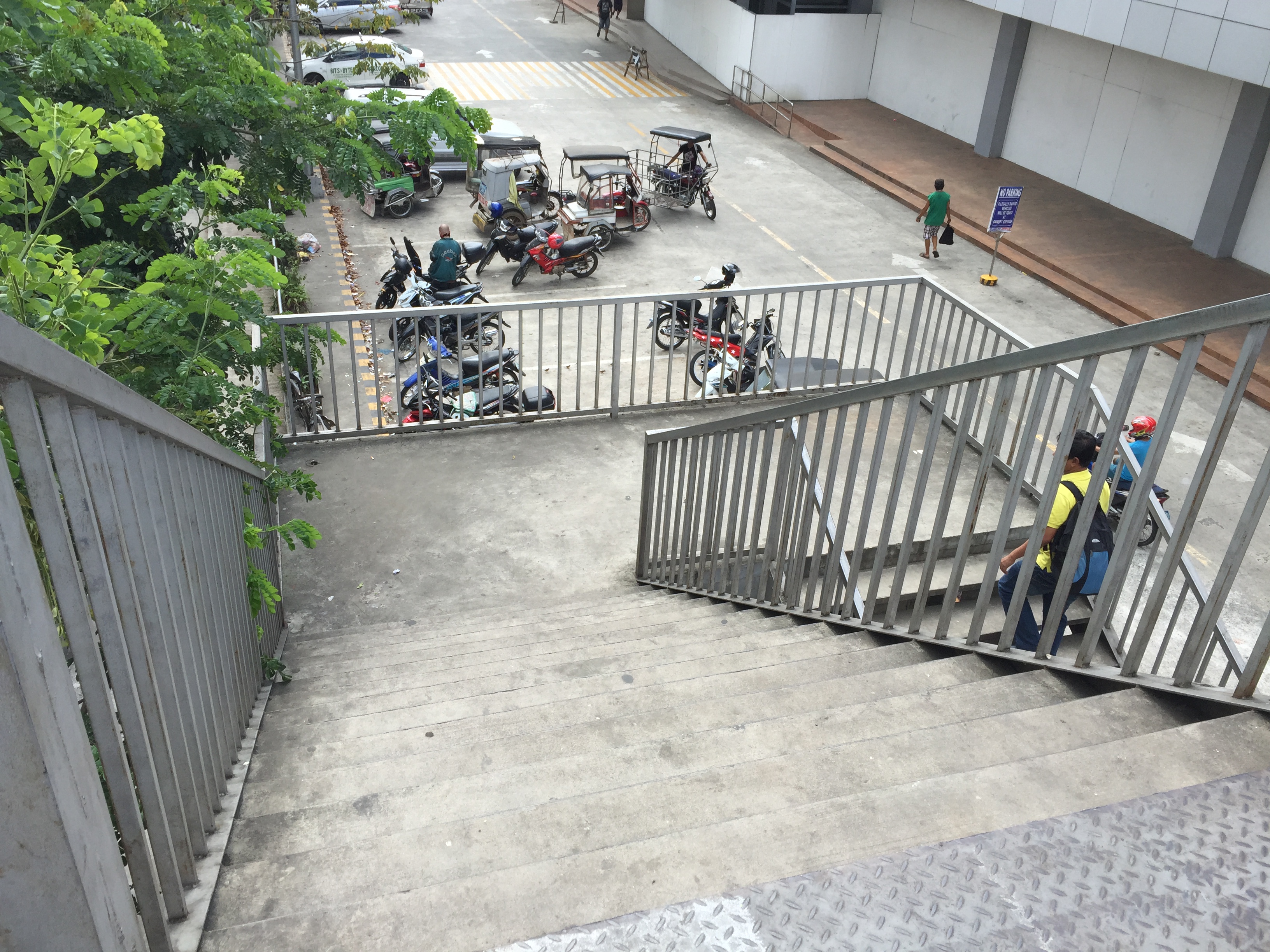 The overpass’ stairs are a bit steep and perhaps not so friendly to senior citizens. There should probably be a ramp for persons with disabilities or for cyclists to use as they carry their bicycles to cross using the overpass.
Despite calls from some advocacy groups for pedestrians to be prioritised and for them to cross at-grade, the reality is that we are still far from achieving safe roads for pedestrians given the way motorists run their vehicles. In the case of Antipolo, many jeepneys, UV Express and tricycles (freely roaming the city) are operated by reckless drivers. Private vehicle drivers are not so different and I have seen scenes of road crashes along Marcos Highway and Sumulong Highway where those involved are private vehicles including motorcycles. Clearly, many of these people should not have driver’s licenses in the first place given their mindset when driving. So until this improves, pedestrians are safer when they do use these overpasses. Of course, that goes without saying that the location and design of overpasses need to be thought over carefully so that these facilities will be used and not just become white elephants.
–
Construction of pedestrian overpass at Masinag
What’s been causing a lot of traffic jams the past week emanating from the Masinag area is the installation of the pedestrian overpasses (or footbridges, if you prefer the term) at the junction. Components of the overpasses were constructed and installed intermittently over several months already. Last Sunday, major works were undertaken including the raising of the main girders that are also to be the walkways for pedestrians. The work entailed closing sections or parts of the intersection and resulted in monstrous traffic jams along both Marcos Highway and Sumulong Highway. The congestion spread to local roads that were used to divert traffic as work was underway during the daytime. Yes, daytime! I found it unusual that such works would be undertaken when traffic was already significant for the two major roads here even if it were a Sunday. Most people had little or no information about this including residents of Antipolo and Marikina who were the most affected by partial closures.
 The still unfinished pedestrian facility at Masinag Junction
The pedestrian facility at Masinag junction has four spans that are supposed to cover crossings across all four legs of the intersection. Thus, theoretically, pedestrians may cross any time despite the busy traffic at ground level. I haven’t seen the stairs yet but if they are much like other footbridges including recent ones of similar design, then I would say that they are not that friendly to senior citizens, persons with disabilities and those who want to cross with their bicycles. Then there are those who are just too lazy to use the overpass and instead would just risk it by braving traffic as they cross at ground level. Already, many pedestrians choose to cross the roads a few meters from the intersection (it used to be that they crossed at the intersection) and it will take a lot of education and enforcement to make most people use the footbridges. Meanwhile, Antipolo should ensure that vendors do not set up shop at the overpasses. This facility is for walking and not shopping.
Among the implications of the four overpasses is the need to re-install traffic signals at the intersection as the current set-up is already obscured by the pedestrian structure. Incidentally, that it also why Antipolo City had to assign personnel to manage traffic at the intersection for much of the day. It is expected that the signals will be installed where motorists can easily see them. The pedestrian facility is also expected to enhance safety at the intersection especially for pedestrians as well as ease congestion for vehicular traffic. Call it car-oriented but it is a necessity given the steadily increasing volume of traffic at the junction. Until there is a good public transport system to help reduce the number of motor vehicles on roads such as Sumulong and Marcos Highways, cars and the like will continue to rule our road space. Ultimately, the provision of pedestrian facilities (hopefully, appropriately designed) is a people-oriented endeavor that should be promoted.
–
Health and commuting
Why is good public transportation especially transit important? Perhaps transport engineers and planners often get lost in trying to explain this from the perspectives of travel efficiency (e.g., reduced travel times, fuel efficiency, more capacity in terms of people carried, etc.) and environmental concerns (e.g., reduced emissions, reduced noise, etc.). Perhaps, too, there’s a need to articulate the importance of good public transport from the perspective of health. How many people do running, jogging or walking in the mornings, afternoons or evenings just to lose weight? How many go to gyms to workout? Perhaps the key to health lies in just walking everyday and integrating that healthy walk in your daily commutes. Here is a nice article from the Wall Street Journal on the link between the way you commute and a healthy life:
Your Commute Could Help You Lose Weight
Somethings I miss from living in Japan and Singapore are my regular walks to and from the transit station. I recall really good walks between the Transport Laboratory in YNU to the Soetetsu Line Kami Hoshikawa Station. You have to walk up a small mountain almost everyday from the station to the university. I also had good walking buddies back then during my 3 years in Yokohama. Later, I also enjoyed walking or cycling between the Transport Lab at Saitama University and the International House. Often, too, I would walk or cycle to the supermarket, the transit station or just around the neighborhood during free times. In Singapore, our home and the office were also near transit stations so we could take nice walks between them aside from the four flight of stairs to our apartment on the fourth floor. Such healthy commutes can be realized in Philippine cities if proper planning is undertaken and transit projects are implemented not just from the perspective of efficiency but, importantly, from the viewpoint of health. The current state of public transport is not healthy and many, especially those taking the EDSA MRT 3, will say that it is quite stressful to commute in Metro Manila. And stress is definitely not the way to lose weight. Is this true for other Philippine cities as well? Hopefully, we can work out transport solutions that include good public transport to promote healthy lifestyles.
–

