
Home » Posts tagged 'weather' (Page 3)
Tag Archives: weather
Maulan, ma-traffic
I just wanted to share this photo taken a couple of weeks ago when there were a few rainy days. These were not light rains but downpours that caused some flash flooding on streets along my commuting route. The flash floods plus vehicles generally slowing down due to the rains lead to traffic congestion. I thought this was what brought about the saying “maulan, ma-traffic” that translates into “it’s rainy so expect traffic congestion”.
 Vehicles caught up in a traffic jam along Ortigas Avenue Extension
–
Musings on rainy day commutes
I sympathize with a lot of people whose activities were disrupted by the inclement weather the past days. The rains from the other night and today resulted in floods around Metro Manila and Rizal (where I live). The forecast of more rains during the past days made government suspend classes at all levels for both public and private schools. However, many and particularly students have already traveled to their schools as some announcements came late or not early enough for those who usually leave home early to avoid the usual traffic congestion around schools.
I myself used to leave our home early to go to school. As I took public transportation to the university, I had to leave before 6:00 AM (even earlier if it was raining) to be able to get a jeepney ride and have a comfortable trip (shorter travel time than when I leave later in the morning). I had one transfer at what used to be the K-Mart terminal. Both legs of the trip were via jeepneys. I recall silently cursing the guards at Ateneo for prioritizing what seemed to be an infinite number of cars entering and exiting that university via their Gates 2 and 3. At the time, Ateneo still operated the blue school buses and you can see few students on those buses. I observed already then that most of their students probably had their own vehicles to take them to school. Once past the gauntlet of Ateneo and Miriam (which was Maryknoll before), traffic was smoother. And to think that there was no C.P. Garcia yet and Katipunan at the UP Diliman and MWSS areas was not as wide as it is now. The old Katipunan section was basically a two lane road with UP on one side and MWSS on the other. What is now a center island with large acacia trees used to be the frontage of MWSS. UP’s walls were lined with eateries and small stores catering to students and workers.
My commutes during the wet season can be quite difficult as you can’t simply hang on to the jeepney (at the back) when it’s pouring. And when the weather’s particularly bad, there were flooding along my route, not to mention where I resided. I also remember wading in floodwaters along Katipunan (yes, there were floods along Katipunan before) because the road was impassable to vehicles and the only way to get home was to walk from UP to Aurora Boulevard. Our home in Cainta was often flooded during typhoons, and I also waded in floodwaters along portions of Felix/Imelda Avenue an in our village. The flood experiences probably deserve separate articles here and I will share some stories as soon as I can organize my thoughts and memories of these. Of course, I will relate these to transportation as there were lots I learned from these experiences. The frustration though is that it seems we have yet to do in order to address climate’s and weather’s impacts on transportation.
–
Changing for the rains
A common seen these days of the wet season are motorcycle riders stopping to take out their rain gear to wear so they can continue with their travels. I’m not surprised that many if not most already have their rain gear ready if it rained and they needed to use them. Oftentimes, the location would be under any shade or shelter including underneath footbridges, waiting sheds or trees. If there were nowhere to seek shelter, they change right in the open. Following is an example where riders stopped at a parking area of a residential development to don their raincoats and jackets.
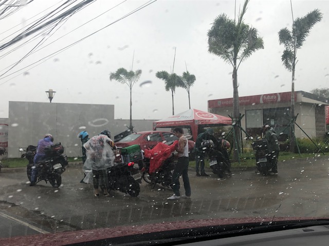
In the above example, riders do not impede traffic flow as they change off-street. In other cases though where they congregate under footbridges, they tend to block traffic and cause congestion where there was none. Perhaps there can be more areas or designated locations for changing to rain gear?
–
On weird weather’s impact on air travel
With the wet season comes a lot of thunderstorms and there have been increasing occurrences of lighting alerts around Ninoy Aquino International Airport (NAIA) that led to the grounding of many planes. That resulted in long delays and surely an inconvenience to a lot of passengers. It looks like ‘weird’ weather or extreme weather events are here to stay and may even become worse as we continue to grapple with climate change and warmer weather. I am sharing a recent article about this here:
Hoover, A. (July 13, 2023) “Weird weather is making air travel even worse,” Wired, https://www.wired.com/story/weird-weather-is-making-air-travel-even-worse/?bxid=5bd6761b3f92a41245dde413&cndid=37243643&esrc=AUTO_OTHER&source=Email_0_EDT_WIR_NEWSLETTER_0_DAILY_ZZ&utm_brand=wired&utm_campaign=aud-dev&utm_content=WIR_Daily_071323&utm_mailing=WIR_Daily_071323&utm_medium=email&utm_source=nl&utm_term=P4 [Last accessed: 7/14/2023]
Quoting from the article:
“But there are more complicated, invisible effects of a warming world too. Hotter air is trapped near the ground, and cooler air above. Shifts in temperature gradients affect the wind shear, or the changes in speed and direction between air near the ground and at higher elevations. These eddies create clear air turbulence, which occurs in the absence of clouds. Light turbulence can cause sudden changes in altitude that feel like bumps, but severe turbulence can cause structural stress to the aircraft.
Turbulence isn’t just unpleasant. It’s the cause of more than one third of injuries aboard air carriers, according to the US National Transportation Safety Board, and in rare instances can even lead to death.
Changing wind patterns may also alter flight lengths. If, for example, there are stronger eastward winds, flights from the US to Europe will speed up, but flights in the other direction may take longer. Transatlantic flights may even need to reroute and refuel.
Research from Paul Williams, a professor of atmospheric science at the University of Reading in the UK, found that jet stream changes could increase the amount of time flights are in the sky each day, leading to more fuel burning, higher costs, and more CO2 emissions. Jet streams are high-altitude air currents that drive weather systems. As the Arctic warms, the North Atlantic Jet Stream is changing, leading to more odd weather.
But heat alone can also lead to delays and cancellations, like when a 119-degree day in Phoenix grounded planes in 2017. That’s because high temperatures decrease air density. When the air is less dense, planes need more time and distance to fight gravity as they take off—so they may need a longer runway to become airborne. Not all airports can accommodate these sudden changes.”
–
On a canceled trip due to a typhoon
I was supposed to be traveling with my family to Singapore over the Undas long weekend. That did not push through due to the circumstances brought about by Typhoon Paeng. What could have been our daughter’s first travel abroad did not materialize and we were left with sunk costs from the tickets we had already bought online for Universal Studios and the Singapore Zoo. We also had to cancel meet-ups with friends in Singapore.
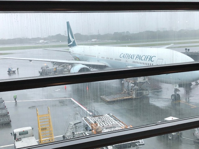 This Cathay Pacific plane landed safely before noon and later departed for Hong Kong without incident.
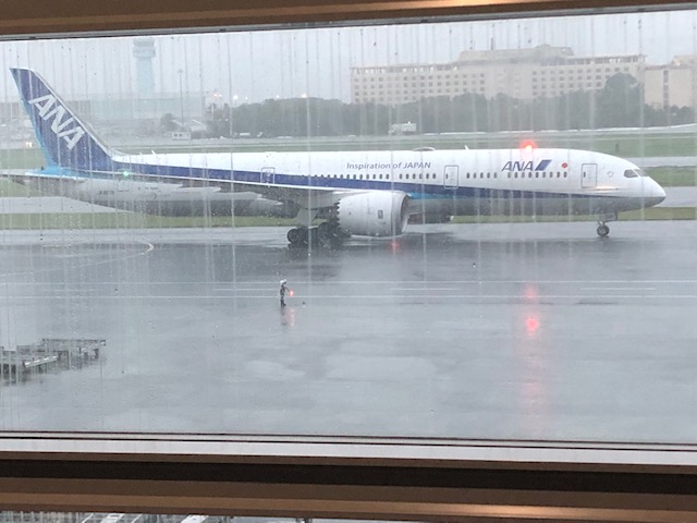 An earlier ANA flight arrived and departed without incident. This one arrived mid afternoon but was similarly grounded due to the typhoon.
The airport announced all flights were canceled just before 6:30 PM. This was a late announcement that some airlines were waiting for. Cebu Pacific apparently had advance information as they canceled all their international flights one after the other around 6:00PM (probably to manage the crowds that would file out of the departure area to reclaim their luggage). We were disappointed that Singapore Airlines did not act immediately and decisively on the matter. We were expecting at least an announcement of when we could expect to be on the next flight. For an airline of their stature, I was also expecting that they could have made arrangements for accommodations due to the great inconvenience brought upon passengers. That was the least they could do if they intended to put us in the next available flight (planes were cleared to operate at 10:00PM that night). Apparently, the typhoon (and its implied acts of nature/acts of God aspect) was also a convenient excuse for the airline (and others, too) to practically abandon their passengers. [Note: A pilot friend intimated that these decisions and behavior by airlines are partly due to policies and actions of the previous administration/government of the Philippines where all the blame was put on airlines for cancellations and they were penalized for acting independently or ahead of government announcements.]
Of course, we later received a series of emails from the airline informing us that we were rebooked to flights the following day. I say ‘flights’ here because these the first email informed us of a flight at 10:00AM. A subsequent email then said we were to be in a 12:00 flight. A third then said that we were to be on a 2:00 PM flight. We got to read these emails around 7:00 AM the following day as they were sent overnight when we were already occupied in finding accommodations during inclement weather. Flabbergasted, we decided to request a refund instead of re-booking and rescheduling our trip. It was already difficult to reschedule as there weren’t any weekends long enough remaining this 2022 and this Undas was the ideal time for a getaway. We’ll try again another time.
–
On floods, transport and traffic, again
It’s that time of year again when the heavy rains lead to flash floods along many roads. I took the following photo as we slowly progressed towards Cainta Junction early this week. The Felix Avenue approach was flooded after more than an hour of heavy rains fell upon Cainta and neighboring towns. We learned later that the rains fell on a larger area as EDSA and other major road in Metro Manila also experience flash floods. These cause traffic to slow down if not outright stoppage. Many commuters can get stranded when PUVs are not able to run due to the floods. Deeper waters mean light vehicles including motorcycles and bicycles cannot proceed along certain roads, further exacerbating the traffic situation.
 Motorcyclists emerge from their shelters to travel along flooded roads. A common sight when there are downpours are motorcyclists huddling under overpasses, bridges, or whatever shelter may be available to them. Many bring rain gear but opt to just stop and wait it out until the rain stops.
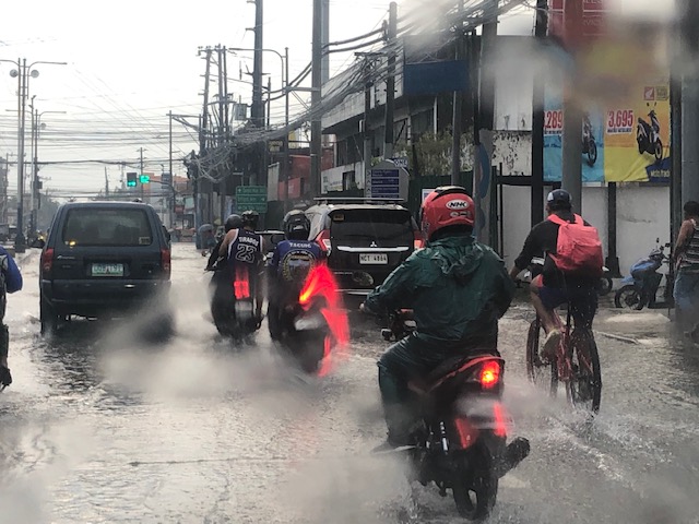 A cyclist braves the floods – while pedestrians will likely stop and wait it out for the rains to stop or for the floods to subside, cyclist might just pedal on. They just have to be more careful as potholes and other dangers may be hidden by the floodwaters.
 Cainta Junction has been submerged by so many floods over so many years. Even with the new drainage constructed under and along Ortigas Avenue Extension, Felix Avenue and Bonifacio Avenue, it seems their capacities are not enough to handle the rainwaters. That or perhaps their intakes need to be redesigned to more efficiently take on the heavy rains and the resulting runoff.
–
Tumana during and after the flood
I was heading to the office the Monday after Typhoon Ulysses had devastated wide areas in Luzon. I was aware of the congestion along my usual routes so I used Waze to guide my trip. Waze took me to Tumana instead of Marcos Highway, which I assumed would have been less congested. I took the following photos in the Tumana area:
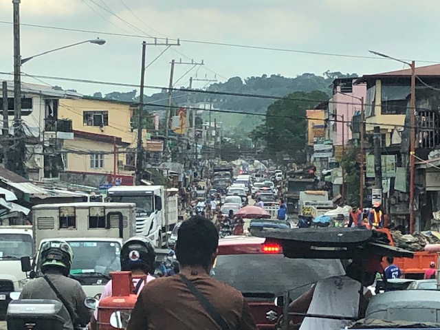 Congested main road due to heavy equipment like bulldozers, backhoes and dump trucks clearing the mud and trash in the area. There were also lots of parked vehicles along each side of the road including Marikina service and emergency vehicles.
 There was trash all around that included what looked like the belongings of people residing in the area. Many people were busy clearing their homes of items destroyed or damaged by the floodwaters.
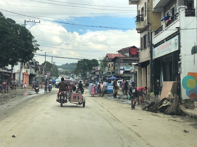 Despite being cleared for traffic, you can see the mud and water still in the area and signs of how deep the flood waters were by markings on the buildings.
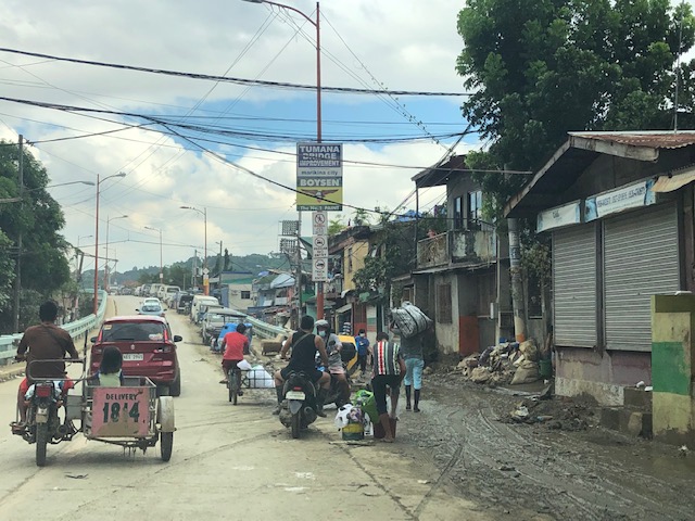 At the foot of the bridge connecting to Quezon City, you can see that there is still so much mud in many areas especially those closest to the river. Sidestreets were so narrow that the heavy equipment cannot enter them and cleaning the mud had to be done entirely manually.
 Here are what looks like the vehicles that survived the floods. I thought people must have rushed to get their vehicles on the best positions atop the bridge when they realized the waters were rising fast. It was likely few if anyone left their vehicles there during the height of the typhoon. That’s because the winds were so strong that perhaps people though it would be unsafe to leave their vehicles exposed to the winds.
The following photos from Facebook shows the extent of the flooding that reached the other side of the river – Loyola Grand Villas and another subdivision that’s directly along the banks of the Marikina River. The first photo shows the submerged end of the bridge from the LGV side in the foreground and Tumana in the background at the other end of the Tumana Bridge. The second photo is atop LGV and shows many submerged homes and cars.
 Only the cars on the bridge likely survived the floods.
 This was definitely at the level of the floods of Typhoon Andy (Ketsana) given the spread and depth of the floods.
One wonders what is now the return period for these typhoons. Ondoy was 11 years ago and the monsoon (Habagat) rains that also brought heavy rains and floods were in 2012 (8 years ago). Such floods cannot be solved by improving drainage systems alone but have to go to the root cause of flooding while also addressing how people could cope with these phenomena. Infrastructure alone cannot solve this and certainly will cost a lot for any initiative to provide some relief from such.
–
A bigger picture for the ‘new normal’
Here’s something different thought not totally unrelated to transportation. The article is about the emergence of super typhoons and their aftermaths:
Niiler, E. (November 4, 2020) What Is a Super Typhoon, and Why Are They So Dangerous? Wired. https://www.wired.com/story/what-is-a-super-typhoon-and-why-are-they-so-dangerous/?bxid=5bd6761b3f92a41245dde413&cndid=37243643&esrc=AUTO_OTHER&mbid=CRMWIR092120&source=EDT_WIR_NEWSLETTER_0_DAILY_ZZ&utm_brand=wired&utm_campaign=aud-dev&utm_mailing=WIR_Daily_110420&utm_medium=email&utm_source=nl&utm_term=list2_p2
With the typical influx of typhoons (i.e., during the wet season there are months that can be referred to as ‘typhoon season’) and the prospects of super typhoons becoming more regular, there is now a need to review infrastructure, building guidelines and standards for cities and municipalities to become more resilient vs. these phenomena. Not long ago, disaster resilience became part of the agenda for infrastructure development; including maintenance and retrofitting vs. the anticipated calamities from typhoons, earthquakes and volcanic eruption that are experienced in many parts of the country. Perhaps the transportation system can be structured to be more disaster-resistant. And, if these phenomena happen, the transportation system can survive and serve for relief operations.
–
Rainy days ahead
It’s that time of year again when it rains a lot. This year’s typhoon season has moved again to the latter part (last quarter) of the year. It used to be that we had typhoons lining up as early as June with the peak arrivals around August to September. This year, the bunch of them seem to be arriving in October and probably Novembers. These are the ones that usually cross the main island of Luzon through the Bicol Region. Typhoons in November tend to cross the Visayan Islands (central Philippines). Meanwhile, in December they tend to go through the southern island of Mindanao. The rains usually make roads slippery and risky to many travelers especially if the driver or rider choose to be reckless or less cautious. Floods cause congestion and wreak havoc to commuters who might get stranded due to the stoppage of traffic and transport services when roads are impassable to vehicles.
 Model storm tracks for the Western Pacific from the National Oceanic and Atmospheric Administration (NOAA) of the US.
The model storm tracks suggest a number of typhoons may be forming in the Pacific Ocean and cross the Philippines from this week onwards. Of course, these are still just models that are generated from the data obtained from various sources using tools such as weather satellites and on-the-ground weather stations. Many of these typhoons might never materialize. One thing positive for sure is that these occurrences will bring more water and recharge depleted reservoirs to get us through the next dry season.
–
About the weather and other thoughts this weekend
We interrupt our regular posts with an article on the current state of the weather and some thoughts while a super typhoon (Mangkut) was devastating the northern and central Philippines. First the article from Wired:
Rogers, A. (2018) An Equator Full of Hurricanes Shows a Preview of End Times, http://www.wired.com, https://www.wired.com/story/an-equator-full-of-hurricanes-shows-a-preview-of-end-times/?CNDID=37243643&mbid=nl_091418_daily_list1_p4 [Last accessed: 9/15/2018]
I am not into doomsday articles and thinking but am always fascinated by it if has foundations in science and fact rather than of religion or the “prepper” type of thinking. This one is based on fact and should not be dismissed as “fake new” – an excuse many use if the information presented to them offers an inconvenient truth about our state of affairs or, in this case, state of the earth.
 Gloomy weather brought about by Typhoon Mangkut
I was thinking about the bad weather and what previous strong typhoons have brought about early this morning as I was awaken by the sound of the strong winds and the heavy rains that followed. I easily come awake and cannot sleep whenever we have inclement weather. Its been like this since my childhood as our home was in a flood prone area.
The last times there were typhoons comparable in perceived and actual physical impacts, the socio-political impacts also eventually manifested. Typhoon Ketsana (Ondoy) in 2009 dumped record rainfall across a wide area that included Metro Manila, Central Luzon (Region 3) and Southern Luzon (Region 4A). The government’s response then and the issues that came about afterwards essentially contributed much to the doom for many of the administration’s candidates in the 2010 elections including its standard bearer who was Defense Secretary at the time. The follies of many politicians and government agencies were also exposed and most people judged them for that in the elections.
Come 2013, another typhoon, Haiyan (Yolanda), laid waste to much of the central Philippines. It was a super typhoon that again caught most, especially government, unprepared for the devastation that was its outcome. It spelled disaster, too, to many political aspirations with the then Interior Secretary becoming the poster boy somewhat for the government’s failures. Apparently, many of the lessons of Ondoy were not heeded despite gains here and there in weather forecasting and disaster preparedness. But then these were perceived to be more on the side of politicians. There were no lack in politicking, self promotion and grandstanding. And there was even more drama among rival sides in Philippine politics. There was enough material for fodder come 2016.
The current administration is much aware of the issues and the dangers of playing into the same script. After all, they created much of the political storm that led to an almost complete defeat of the previous admin’s ticket (the current VP survived that and hopefully gets to finish her term instead of being replaced by the ambitious son of a former dictator). But the present set of leaders and wannabees are not lacking for distasteful maneuvers as relief goods are being prepared by government agencies and local government units bearing the name (and sometimes even face) of aspirants for electoral posts in the 2019 elections. Among these are a Presidential “alalay” who is somewhat desperate for a senate post if only to protect himself from charges once his sponsor(s) bow down from power.
Will Mangkut/Ompong effect positive change in the country? Perhaps so and we can only hope it will be for the better. And that we, as a people, learn from mistakes we have made including electing certain people who are not fit or qualified to lead us.
–

