
Home » 2013 (Page 5)
Yearly Archives: 2013
Pedicab fares
Tricycle and pedicab fares are set quite variably depending on the service areas and those regulating the services. In many cases, it is the pedicab association comprised of drivers-operators who set the fares, which are then supposed to be approved by local officials like those in the barangay or municipal/city hall. I say “supposed” here since most rates are not formally regulated in the manner like how the Land Transportation Franchising and Regulatory Board (LTFRB) sets fares for buses, jeepneys and taxis. While the principles of “willingness to pay” is applied to some extent, pedicab and tricycle fares are usually imposed (to use a strong word) by tricycle and pedicab associations with very rough estimates of operating costs or, in the case of NMTs, the equivalent of physical effort, required to convey people.
In residential subdivisions or villages, associations may have a say in the fare rates. Where I live, the association sets the standard rates and these go to the extent of differentiating between day time and night time rates. There is even a rate for when streets are flooded! There is also a definition for regular and special trips and rates are according to the general distance traveled by pedicab. That is, fares to Phase 2 are generally higher than those for Phases 1 and 3 because Phase 2 streets are generally farther from the reference origin/destination, which is the village gate. Given the effort of pedicab drivers to transport passengers, I think the rates are just right. The only part there that seems unusual is the rate of PhP 1/minute for waiting time, which to me seems to high. Nevertheless, there is nothing to stop passengers from showing their appreciation for hard work in the form of tips. And there is no limit to the generosity of some passengers who choose to pay more to the (pedi)cabbie.
 Tariff sheet displayed inside the sidecar of every pedicab of our village. The information is useful especially to guests or visitors who are not familiar with pedicab rates in the area.
–
All weather transport
The flooding brought about by heavy rains around the country rendered many roads impassable to motor vehicles. This meant traffic congestion in many areas and so many commuters being stranded due to the lack of public transport vehicles available to them. In these times, the only modes for traveling are reduced and limited to walking and non-motorized tranport (NMT). While cycling is an option for some people, a more popular mode in many areas and local roads are pedicabs. Known by various names in the vernacular such as padyak, trisikad, sikad, etc., these three wheelers are found providing transport services particularly in residential areas. These tend to use national roads and busy streets in cities, and such often causes conflicts with motor vehicles as the NMTs slow down traffic. During times of heavy rains due to typhoons or the monsoon, pedicabs become the mode of choice for many who need to get to their workplaces, schools or home despite flooded streets.
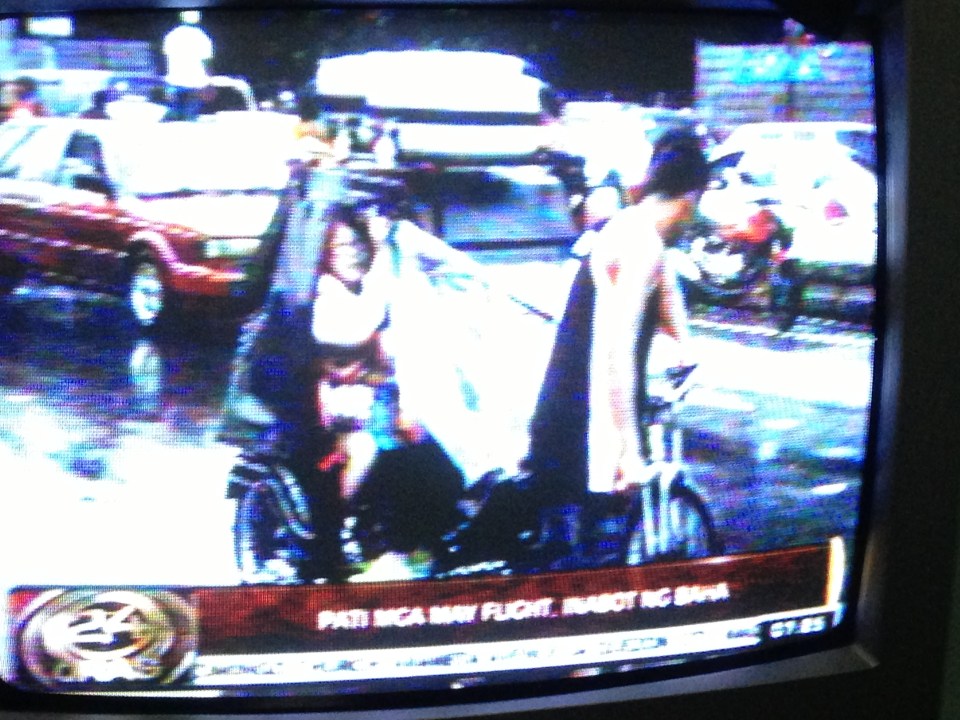 Photo of TV news report (GMA News’ 24 Oras) on air passengers taking pedicabs in order to get to the airport and catch their flights. Traffic was terrible due to floods along airport roads and only the non-motorized transport could navigate the flood waters. Interviews of passengers including tourists and foreigners showed their appreciation of the alternative mode of transport they had to take to catch their flights.
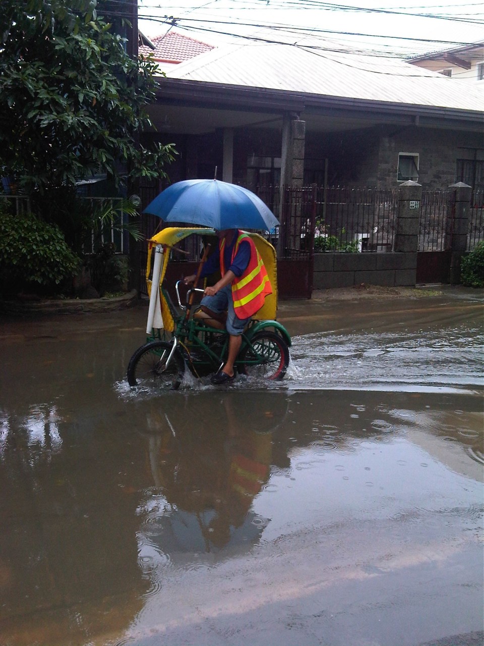 Pedicab service along a flooded residential road – special rates are often charged by pedicab drivers during the rainy season and when go into flooded streets. Regulated fares are charged in areas like residential subdivisions where homeowners associations have a say in fare rates. In other places, fares can be arbitrary or according to the willingness to pay of prospective passengers.
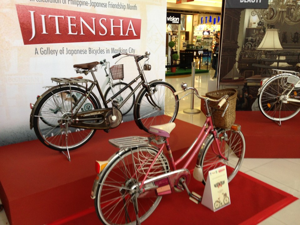 Bicycles are becoming popular for commuting not especially due to floods but more because of increasing fuel prices and fares. There is also an influx of second-hand or used bicycles from Japan (Note: Jitensha is bicycle in Japanese). These have become collectibles but are in actual use by their owners like the bikes shown in the photo that were exhibited at a mall recently.
–
Getting reacquainted with the JR lines in Tokyo
My recent trip to Tokyo allowed me to re-charge the wife’s and my Suica cards. We got these when we were in Japan in 2008 and rode mainly Japan Railways (JR) trains between our hotels and various destinations in Tokyo, Yokohama and Kamakura. I also used the JR Keihin Tohoku Line for trips between Saitama and Yokohama during the weekends when I would hear Mass at Yamate and then go around Minato Mirai, Shibuya, Ueno or Akihabara. It was easy for me to get reacquainted with commuting with the JR trains. It’s probably because it was so easy commuting in Japan and nothing much has changed in terms of the transport system. This is proof of an efficient public transport system and one which I have also used in Singapore and Hong Kong. Hopefully, we can have at least a bit of this efficiency in public transport and commuting in Metro Manila.
 JR East railway map for Tokyo Metropolitan area and environs (available for download in the internet)
 I found an improved/renovated JR Akihabara Station when I was in Tokyo in July.
 Ticket machines at the JR Okachimachi Station are bilingual. One just has to press the button for English translation/option.
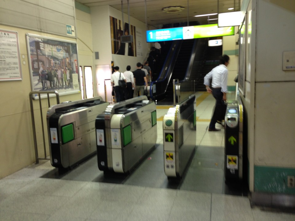 Turnstiles at a JR station
 Coin lockers at a JR station allows travelers/commuters to leave their things while going around for business, shopping or other purposes. A traveler heading to the airport, for example, who wants to do some last minute shopping may want to leave luggage using the larger lockers so he/she won’t have difficulty moving about.
 There are small restaurants and shops around JR stations. This one is a ramen shop frequented by commuters with a ticket dispensing machine to expedite orders. One purchases tickets for meals and drinks using the machine and presents the tickets to the staff inside the restaurant.
I hope to be able to go around my old haunts in Yokohama the next time I’m in Japan. Perhaps I can take a few photos then about transport in a country where I spent some significant time over the past years.
–
Narita departure
I will be traveling to Japan again in the next few weeks and so I felt I had to finish a draft that I started last month about Narita Airport. Departing for Manila after a few days of meetings in Tokyo, I was able to take some photos around the airport’s Terminal 1. Narita was the first large international airport I have been to because my first foreign trip back in the 1990s was to Tokyo. I was impressed by what I saw as a huge terminal compared to what we had in Manila back then, the current NAIA Terminal 1. Following are photos taken during my recent trip to Japan. Note that there are no photos taken in the sensitive areas where the use of cameras are prohibited.
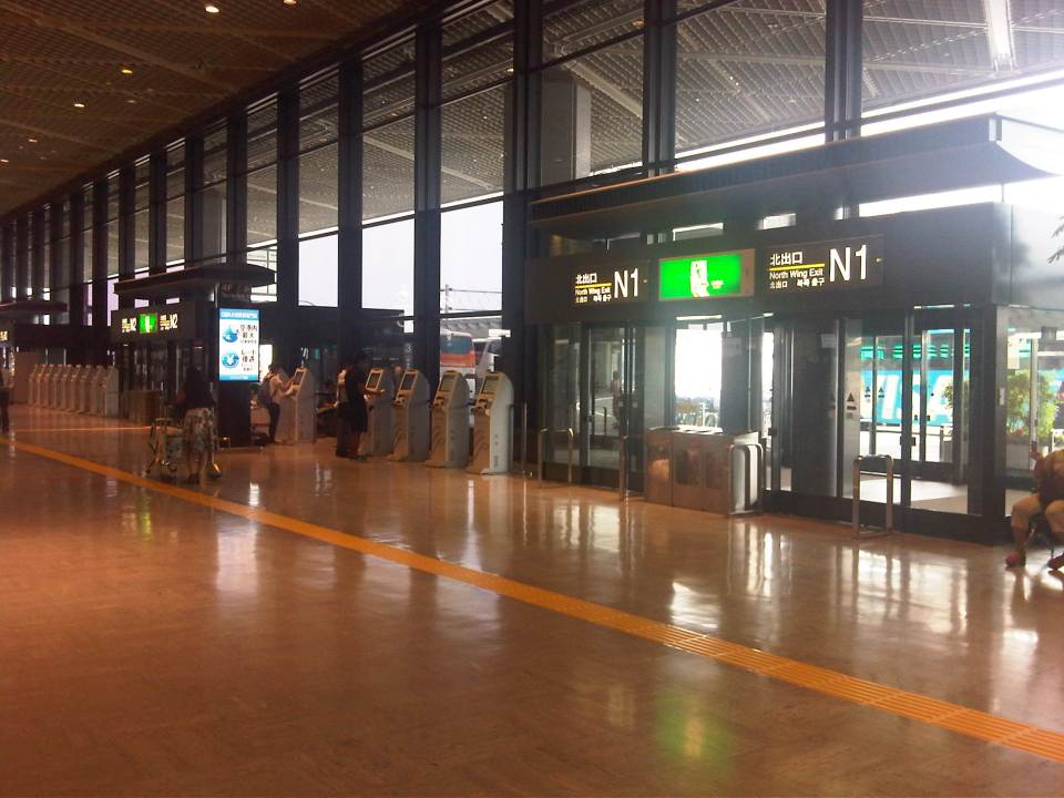
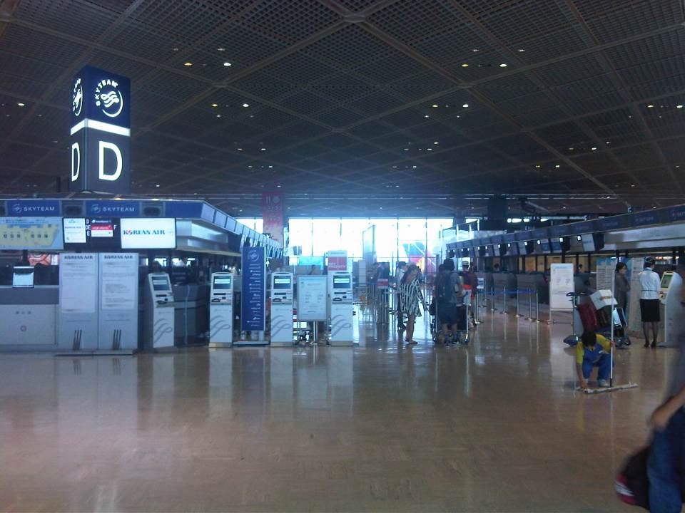 Airline check-in counters at Narita’s Terminal 1 North Wing
 Artistic design of a column at the terminal helps lighten the environment inside the terminal
 Passengers line up to check-in their luggage at the Delta counter
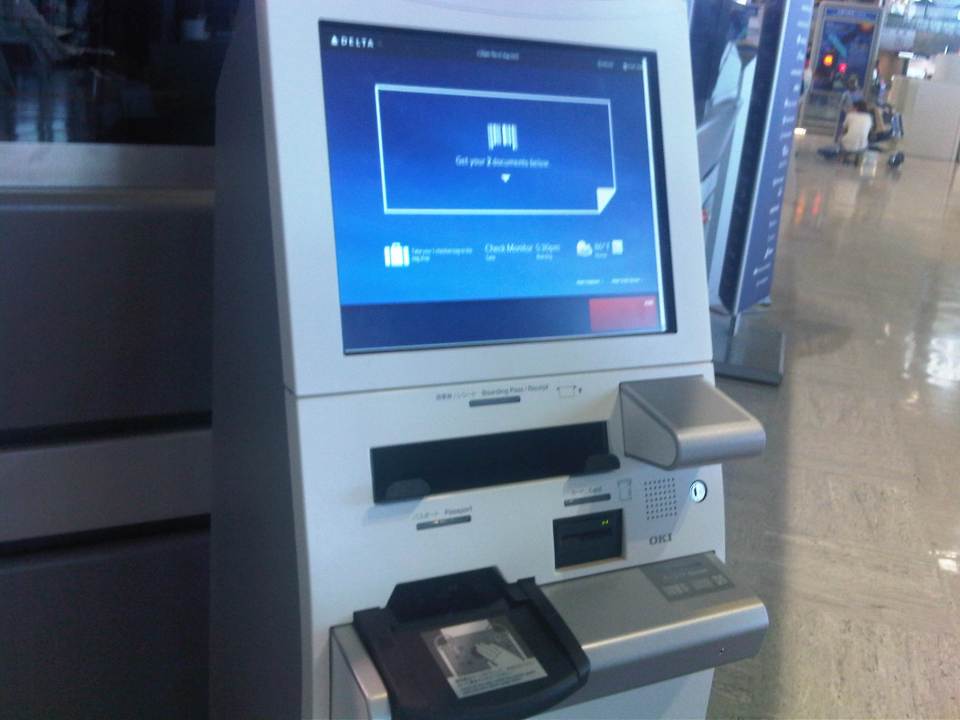 Passengers can check in at one of the many terminals or booths by using their passports and ticket information. If one has not yet selected a seat via online check-in, seats can be selected using the interface.
 Airline and airport ground staff provide assistance to passengers.
 Entrances/exits at the airport. Shown in the photo is a bus parked at the curbside just outside the terminal building.
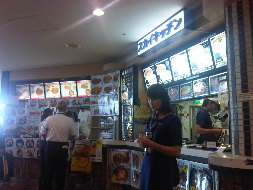 The airport has a nice food court where passengers and well-wishers can have their meals prior to going through immigration control to the pre-departure area.
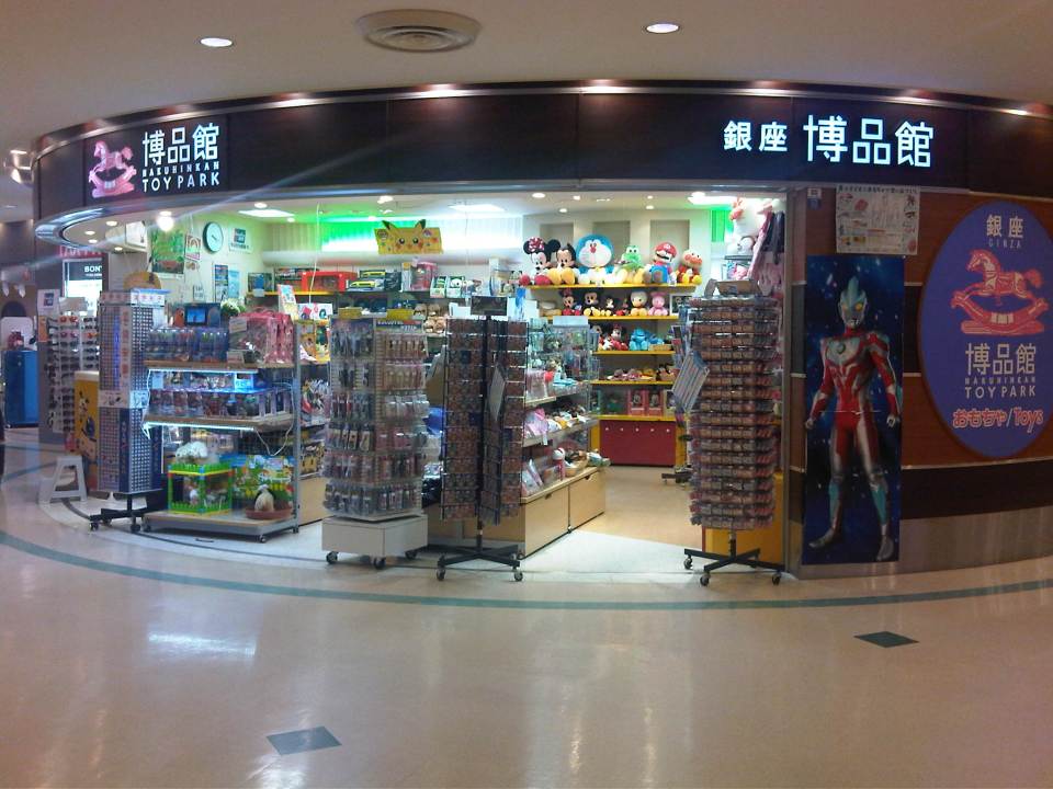
 There are many shops at the terminal including those selling souvenirs.
 Shops include those selling Japanese crafts and clothing. Traditional crafts like silkware, woodcrafts, papercraft, etc. are popular souvenir items.
 Toys, especially those from anime characters, are very popular with the younger people and children. I myself bought a few souvenirs with characters from Miyazaki’s Totoro (Studio Ghibli) and, of course, Hello Kitty for my niece. There are also Disney and Nintendo themed toys and other items at these shops.
 Information boards are strategically located around the terminal to guide passengers.
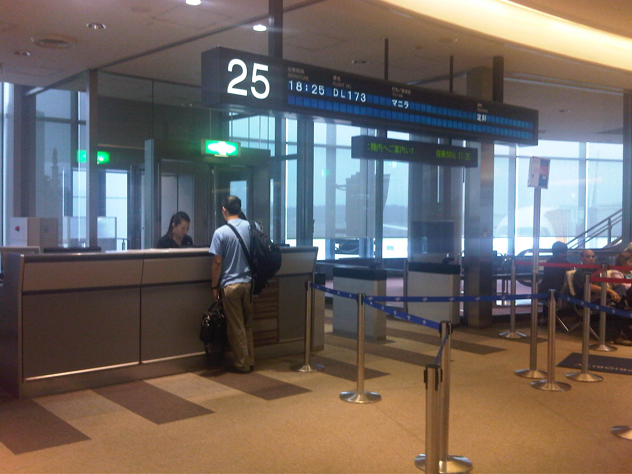 Counter at Gate 25 of Narita Terminal 1’s North Wing.
I have used only five airlines in my trips to Japan; four if one considers Delta’s acquisition of Northwest. These are Philippine Airlines, Northwest/Delta Airlines, Pakistan International Airlines (yes, it was a practical choice back in the 1990s when I was a student in Japan), and Japan Airlines. During a couple of trips within Japan, I took the domestic flights on All Nippon Airways (ANA). Perhaps I will try ANA in my next trip to Japan as the schedule for its flights are good (morning flight to Narita and evening flight to Manila) and the airline uses NAIA Terminal 3, which means its more convenient than the farther NAIA Terminals 1 or 2.
–
Tricycles in the Philippines – Part 1
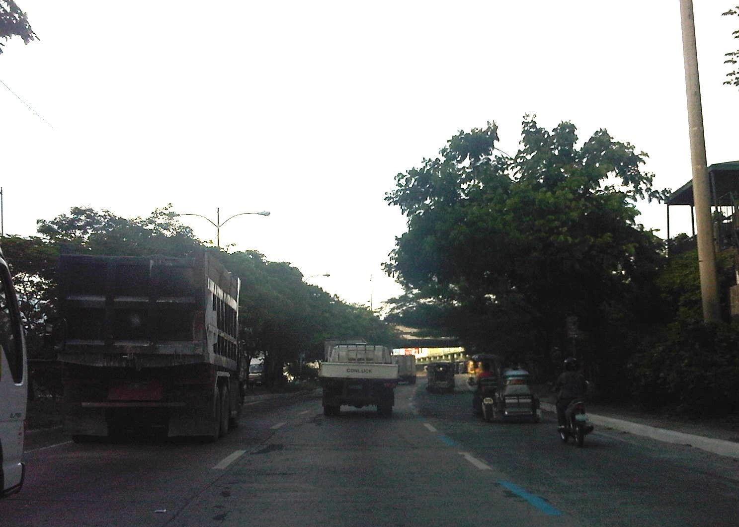
We start the “ber” months strong with an initial feature on an ubiquitous mode of transport in the Philippines. While the jeepney seems to have had most of the attention when the subject of public transport in the Philippines is discussed, the truth is that there is arguably another, more dominant mode of public transport in the country. These are the tricycles, a motorized three-wheeler consisting of a motorcycle and a sidecar. You see these everywhere around the country in most cities and municipalities where they thrive particularly in residential areas. They are usually the only mode of public transport for most people in rural areas where local roads are typically narrow. In many cases the only roads connecting communities may be national roads. And so, there is really no other choice for tricycles but to travel along national roads and against existing laws prohibiting tricycles from these roads.
 Tricycle along the motorcycle lane of Circumferential Road 5
 Tricycles racing along the Olongapo-Castillejos Road in Zambales
 Tricycle along Romulo Highway, Tarlac
 Tricycles along Catolico Avenue in Gen. Santos City
Unlike buses and jeepneys, tricycles are not regulated under the Land Transportation Franchising and Regulatory Board (LTFRB). Instead, they are under the local government units that through one office or another issue the equivalent of franchises for tricycles to operate legally. Fares are quite variable but are usually according to distance though there are special rates for when passengers want to have the vehicle for themselves much like a taxi.
Unfortunately, few LGUs have the capacity to determine the optimum number of tricycles for service areas under their jurisdictions. As tricycle operations are often the source of livelihood for many, the granting of franchises is often seen as a way for mayors to have influence over people who would have “utang na loob” (debt of gratitude) for being granted franchises. The tendency, therefore, is to have too many tricycles as mayors try to accommodate more applicants who seem to have no other options to earn income or to invest in. This poses a challenge to many who want to reform the system and modernize or upgrade public transport in cities around the country.
–
Undergraduate research topics on Transportation at UP Diliman, 2013
Topics this year for undergraduate researches on transportation under the Transportation Engineering Group (TEG) of the Institute of Civil Engineering of the University of the Philippines Diliman are quite a mix. There are topics focusing on issues at the the UP Diliman campus, traffic signals, driver behavior, public transport, environment and aviation. Following are the current topics being developed and for implementation during this academic year 2013-2014:
- Development of a micro-simulation model for the UP Diliman College of Science complex
- Traffic impact analysis of new academic complexes in UP Diliman
- Study on parking supply and demand in UP Diliman
- Field testing of Smart Traffic Light, a video-actuated traffic signal system
- Pinoy driver behavior at uncontrolled intersections
- Characteristics of demand and operations of UP-Katipunan jeepneys
- Improving passenger flows at Metro Manila LRT/MRT stations
- Use of carbon footprint tool (TransCO2) to estimate carbon emissions and energy consumption of transportation measures
- Philippine air transport safety: analysis of incidents over the last decade
–
Commuting on the EDSA MRT 3
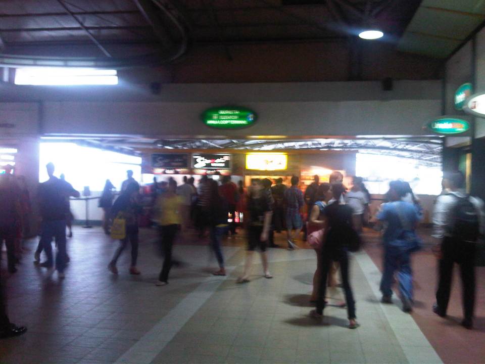
There’s a lot of buzz these days about the challenge posed to government officials responsible for our transport and traffic in Metro Manila and the rest of the country. I must admit I regularly drive between home and my workplace but I often commute to meetings and will usually leave my car at the office when I don’t feel like driving. While its often perceived as difficult to take public transport, it is really quite easy as long as you plan your trip. That is, familiarize in advance with what jeepneys, buses, UV express or rail lines your going to take. I’m sure there are so many tools available to those with smart phones or internet access but then nothing beats asking for directions from those familiar with the commute. Following are photos I took en route to a meeting at Bonifacio Global City (BGC) from UP Diliman. I took a jeepney from UP until the EDSA MRT Quezon Avenue Station where I took a train to Ayala Station. From Ayala Station, I walked towards the Fort Bus Terminal at the corner of EDSA and McKinley where I purchased a ticket at the Fort Bus booth beside the Shell gas station.
 Passengers queuing at the platform at Quezon Avenue Station – there is some semblance of discipline but not like what we saw in Japan, Singapore or Bangkok where people do step aside for alighting passengers before entering the train.
 A crowded platform vs. a congested EDSA – commuting is often perceived as a hassle for many in Metro Manila partly because of crowded public transport and the inefficiencies including poor transfers and low quality of service. Many who could afford to own cars or motorcycles take private vehicles instead.
 Passengers on a crowded platform form lines directly in front of the train doors instead of allowing for space for disembarking passengers. While there are markings on the platform to guide passengers where to position with respect to the door, these are not followed and there are no MRT staff to guide people to do so.
 Passengers lined up for an arriving train can be too close to the train, risking accidents where a simple nudge from behind could get a passenger killed by an oncoming train.
 The photo clearly shows the narrow platform of the EDSA MRT station and the markings to guide people where to position with respect to the train doors. This contributes to the congestion on the platform and perhaps is a reason why people can’t line up properly. I’ve observed many people getting stressed out simply because of the undisciplined mix-up during the unloading/loading process whenever a train arrives at the platform. Note also from the photo the sign on top of the guard post informing people of the segregation being implemented in favor of women, children, PWDs and senior citizens. The latter have some cars reserved for them so they won’t have to wrestle it out with other passengers to get in a train.
 A Taft-bound train arrives at the Quezon Ave. Station. On a way to increase the MRT-3’s capacity is to have shorter headways between trains. However, this can’t be done without additional trains.
 A train is not full as it leaves Quezon Ave. but more passengers board at subsequent stations at GMA Kamuning and Cubao. The train cars are eventually crowded and I stopped taking photos in case someone fancies my phone or gets offended by my taking photos inside the train.
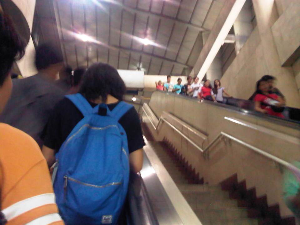 Escalators at the Ayala Station where the platform is practically underground.
 Small shops and stalls at the Ayala Station. There is a direct access to SM Makati, which a lot of people take to also have a more comfortable walk through the malls nearby.
 Ayala Station is one of the larger and more developed stations along EDSA-MRT and among the busiest given its location.
 Among the shops and stores at the station is a local courier service and a license renewal center of the Land Transportation Office (LTO). These cater to people on the go and quite convenient to commuters.
 Direction signs to guide passengers transferring to the Fort Bus of Bonifacio Global City (BGC).
 MRT stored value card – these along with the single journey cards may be pruchased at the stations. A stored value card is worth PhP 100 with the last journey assured regardless of the remaining balance in the card. As can be seen, the card has seen better days. However, the long-delayed common ticketing system for rail transit in Metro Manila should be implemented soon (crossing my fingers). Perhaps other ways can be explored like commuter passes for regulars including discounted ones for students and senior citizens. In Japan, for example, one can get such passes for 1 month, 3 months, 6 months or even a year, paid in advance for unlimited trips between one’s “home” station and “work” or “school” station.
I think our government owes it to the more than 80% of travelers who take public transport to improve our transport system. There’s a lot of room for improvement in terms of the quality of service including comfort, convenience and reliability that can be addressed only if we invest in public transport infra and introduce reforms that have long been recommended but not implemented (for many reasons). Let’s take it from Enrique Penalosa, who was mayor of Bogota and a leading proponent of the Bus Rapid Transit (BRT) was quoted as saying “a developed country is not a place where the poor have cars. It’s where the rich use public transport.”
–
Floods and traffic
Transport and traffic problems take a backseat to the flooding problem during this time of the year in the Philippines. Since there are practically only two seasons (dry and wet) in the country, floods become a genuine concern once monsoon rains arrive and these are usually complicated by a high frequency of typhoons between August and November. Many major roads in Metro Manila are prone to flooding including Espana Avenue, Araneta Avenue, Gil Fernando Avenue, Ortigas Avenue, and EDSA. Flash floods often lead to traffic congestion and commuters and motorists alike would have a hell of a time traveling yet it seems very little has been done to address a situation that’s been here since the Spanish period. This is a perception by many people and a reasonable one given the historical evidence of flooding in the area and elsewhere in the country.
 Pedicab ferrying passengers in a flooded residential area
There are many images on the current floods in Mega Manila that one can find in various reports online and on TV. The Telegraph provides good photos for describing the situation around Metro Manila and the surrounding areas, and especially in the low-lying areas like Marikina, Malabon, Rodriguez and Cainta. These images could have been taken in any other year in the past and the images would probably be the same with slight changes in some buildings that could have been improved (e.g., additional floor?) in response to the flood experience.
Floods and possible solutions have been the topics of discussions every year and usually during this rainy season. While there have been efforts to address this problem, these are usually and obviously not enough and a more comprehensive approach is needed. Quite obviously, too, solutions that tend to dig up faults in urban planning throughout Metro Manila have led nowhere as legitimate residents and other locators in these areas are not in a position to give up their properties just like that. Relocating informal settlers and others who have encroached from waterways and other critical areas is a start but will have limited impacts in part because Mega Manila does not have a good drainage system in the first place.
Expensive as they are, engineering solutions like perhaps what Tokyo has done in this underground wonder. Of course, this example is a kind of ultimate solution and would require tremendous resources to realize. But then this is also like the transport and traffic problems we are experiencing where years (or decades) of inaction and hesitation due to resource and technical questions have led to the despicable transportation we have now The reality is that solutions will not get cheaper as we continue to balk at the cost of the required solutions. Floods and traffic will not be solved overnight. It will take years to improve the lives of many people in flood prone areas and implementing solutions should have started yesterday.
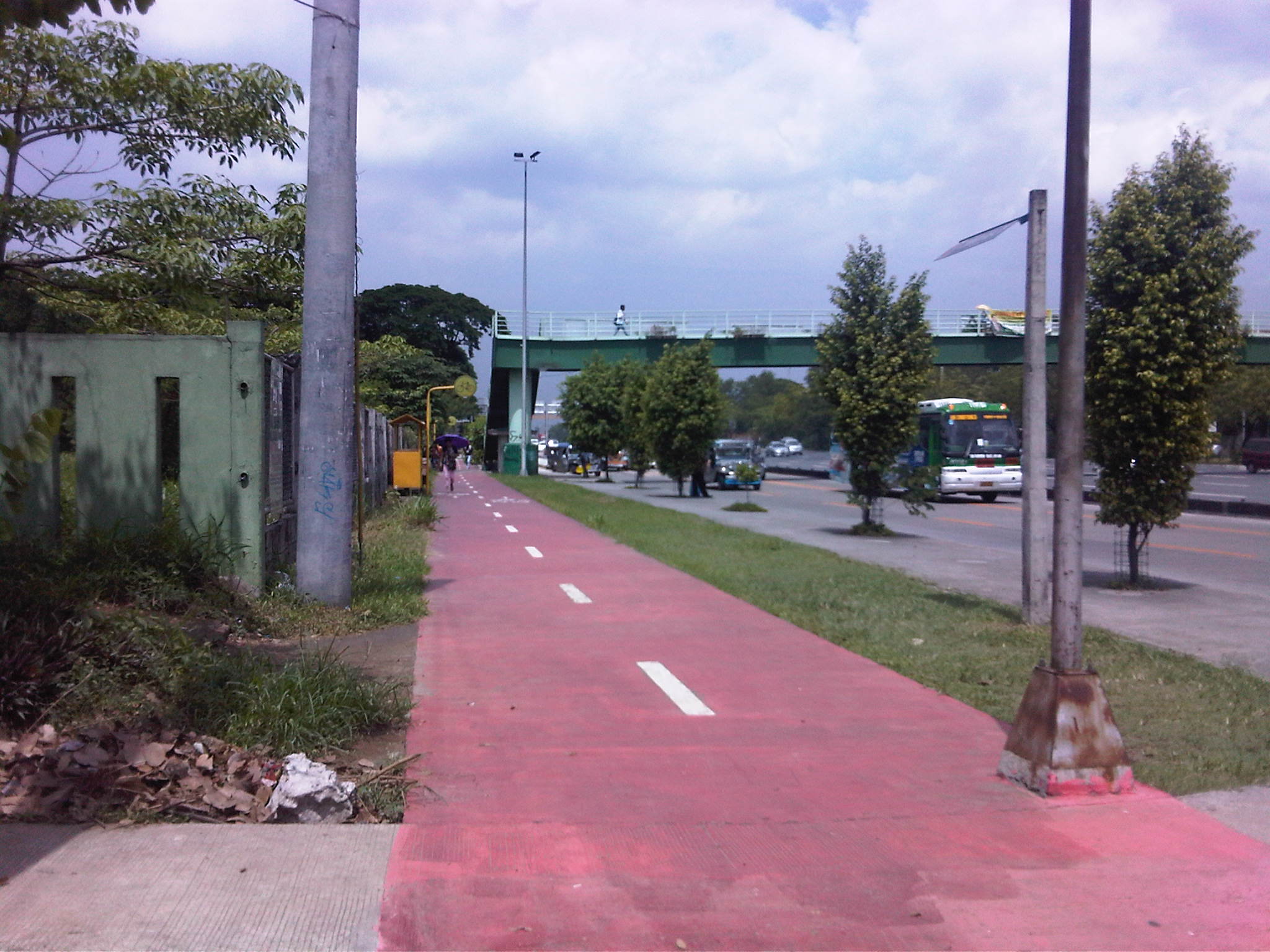
More bikeways please!
After the construction of a bikeways network in Marikina City, the city became a poster child for sustainable transport in the Philippines. The bikeways was initiated with assistance from the World Bank for the pilot route and was later expanded by the city under the leadership of its Mayors, the former MMDA Chair Bayani Fernando and his wife Marides Fernando. The bikeways were promoted as a good practice example for non-motorized transport (NMT), with the National Center for Transportation Studies (NCTS) of the University of the Philippines Diliman involving the Marikina City Bikeways Office (MCBO) in its studies and advocacy work on Environmentally Sustainable Transport (EST).
 Bikeways between pedestrian walkway (red pavement) and parking slots in Marikina City.
 Bike lane along the Academic Oval at UP Diliman in Quezon City.
 Bike lane integrated into the sidewalks along Marcos Highway in the cities of Marikina, Pasig and Antipolo.
 Bike lanes (red pavement) in Malate, Manila.
 Bike lanes integrated with the sidewalks along Commonwealth Avenue in Quezon City.
 Bike lanes integrated with the sidewalks along Commonwealth Avenue in Quezon City.
This is obviously not a comprehensive list of bike lanes and bike ways in the Philippines. I am sure there are similar projects in other cities and I am aware that cycling is becoming more popular around the country. These are but examples of what has been accomplished so far and it is clear that we need to do more to promote cycling not just as a sport or for recreation but, more importantly, as a means for commuting. Integrating cycling into one’s daily routine is a healthy and money-saving option, and segregated bikeways and bike lanes ensure the safe travels for cyclists. This, of course, is in consideration of the little respect cyclists (and pedestrians) get from motorists who believe road space is theirs alone.
–
Some thoughts on the issues on bus bans and terminals in Metro Manila
I had originally wanted to use “Clarifying issues on bus bans and terminals in Metro Manila” as the title for this post. However, I felt it was too strong a title, and one that would be more appropriate for a government agency like the MMDA or DOTC, or an LGU like Manila. More than fault-finding and criticizing government agencies and local governments, I believe we should take a closer and more objective look at the issues (or non issues?) pertaining to the Manila bus ban and the opening of the southwest provincial bus terminal for Cavite-bound buses. Following are my comments on issues raised the past weeks about the two initiatives.
Issue 1: There were no or few announcements about the implementation of the bus ban in Manila and the southwest terminal in Cavite.
Comments: While the bus ban in Manila came as a surprise to many, the move was actually a consequence of a Manila City Council resolution. Normally, such resolutions would take time to implement and would entail announcements for stakeholders. Though we will probably never know the truth or who is saying the truth about the resolution and its implementation, it is likely that bus operators already knew about the implications but decided to call Manila’s bluff and play the media and public appeal cards rather than comply with Manila’s requirements for franchised buses and terminals as they have done before in other issues like fuel prices and fare hikes.
I find it difficult to believe that the MMDA did not do its part in announcing the opening of the southwest terminal. Perhaps people thought the announcement was over a very short period? Or maybe people didn’t mind the announcement and are also at fault for paying no or little attention to the announcement? If so, then the public is also partly to blame for disregarding the announcement from the MMDA, assuming the agency won’t push through with its initiatives to implement central terminals for buses. Next up will be another southern terminal at Alabang and a northern one near Trinoma.
Issue 2: Poor transfer facilities and services including a lack of pedestrian facilities between the bus terminal and transfer point, and lack of public transport like jeepneys to ferry passengers to their destinations.
Comments: I think it’s quite clear that the MMDA and LGUs are at fault here. Despite the construction and scheduled opening of the southwest terminal, there have been limited effort in improving pedestrian facilities. Such facilities needed to be in place prior to or upon the opening of the southwest terminal and requiring all provincial buses to terminate at the facility instead of continuing to Metro Manila. People-friendly facilities could have helped people in adjusting to the new policy though walking from 100 to 200 meters is certainly not for all, especially during this rainy season. Senior citizens and persons with disabilities (PWDs) would have specific needs that could have been addressed from day one of operation of the terminal. One approach to “bridge the gap” between the terminal and where people could take city bus and jeepney rides could have been to modify some city bus and jeepney routes to make these closer to the terminal. Ideally, the terminal could have been an intermodal facility providing efficient, seamless transfers between modes of transport.
In the case of Manila, the jeepneys were already there with routes overlapping with buses but their numbers and capacity could not cope with the demand from the buses. Since the main objective of Manila was to weed out colorum buses, it could have coordinated with the LTFRB to check the registration and franchises of buses rather than generalizing among all buses. Perhaps Manila just wanted to make a big statement? But then this was at the expense of the riding public, which obviously got the attention of many including the media. Coordination among agencies and LGUs, however, has not been a strong suit for these agencies, and this thought leads us to the next issue.
Issue 3: Lack of coordination among LGUs and agencies in implementing transport schemes.
Comments: This issue is an enduring one and has been the topic of discussions, arguments and various fora for as long as we can remember. On one hand, the DOTC and the LTFRB should provide guidelines and guidance to local governments on transport planning and services. The agencies should be proactive in their engagement of LGUs in order to optimize transport services under the jurisdiction of national agencies and local governments. On the other hand, LGUs must accept the fact that most if not all of them are ill equipped or do not have the capacity nor capability to do transport planning much less addressing issues regarding public transport. Citing the Local Government Code and its devolution of local transport to LGUs everytime there’s a transport issue certainly won’t help LGUs solve their problems.
Issue 4: Terminals required for city buses in Manila.
Comments: There should be a terminal for city buses in Manila but not a terminal for each company. There should only be one or maybe two terminals where buses can make stops prior to making the turnaround for the return trip. There is actually a terminal in Manila, which the city can start with for city buses. This is the one just beside the Metropolitan Theater and near City Hall, which can be utilized by city buses. It is also close to the LRT Line 1 Central Station so the facility can be developed as a good intermodal terminal for land transport.
Issue 5: Colorum or illegal public transport vehicles in Manila
Comments: This is actually a problem not just for Manila but for the rest of Metropolitan Manila and the rest of the country. The colorum problem is there for both conventional and paratransit services as there are illegal buses, jeepneys, UV express, multicabs, taxis, tricycles and pedicabs everywhere. Many of these are allegedly being tolerated by national agencies and local governments with many allegedly being fielded or owned by public transport operators themselves.
–
In most cases, the best time to evaluate a traffic policy or scheme is NOT during its first days or weeks of implementation but after a significant time, say at least a month, after it was implemented. This is because the stakeholders, the people involved would take some time to adjust to any scheme or policy being implemented. This adjustment period will vary according to the magnitude or scope of the scheme/policy and can be quite “painful” to many who have gotten used to the old ways. Usually, a lot of comments and criticisms are quite emotional but it is clear that the collective sentiment is the result years or decades of poor transport services and fumbling by government agencies. Transport in Metro Manila is already quite complicated with routes overlapping and services competing with each other for the same passengers. Perhaps it is time to simplify transport while also in the process of optimizing and rationalizing services. I have written about this in this previous post.
More transport issues in Manila will come about should the city train its attention on other modes of transport including jeepneys, UV express vehicles, tricycles, pedicabs and kuligligs. If the city is really intent on reforming transport services within its jurisdiction, it should consider the needs of all stakeholders and especially and particularly the riding public. Transport should be inclusive, people-friendly as well as environment-friendly and there are many good practices in other cities that Manila could refer to and study for adaption and adoption for the city. If it is successful in improving transport, then perhaps Manila could be the country’s model for transformation from being the “Gates of Hell” to being a “Portal to Heaven” to residents and visitors alike.
–
