
Alternative to Highway 2000, Taytay, Rizal – Part 2
The stretch of Don Hilario Cruz Avenue between Megawide and the Manila East Road is paved and generally wider than Highway 2000. While there are residential villages along this stretch as well as a significant traffic generator in Club Manila East, which is a resort, traffic is usually light. There are actually few establishments and informal settlements along the road, which retains its exclusive subdivision feel.
 Section in front of Club Manila East
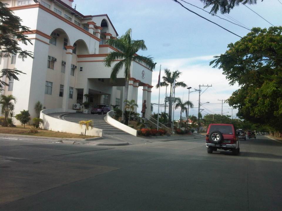 Taytay (Rizal) Municipal Hall – the Land Transport Franchising and Regulatory Board (LTFRB) office is just beside the municipal hall and often you could see taxis lined up along this road to have their meters calibrated and sealed.
 This entire area used to be an exclusive subdivision and Don Hilario Cruz Ave. was a private road. The old guardhouses are still there and heavy vehicles may not use this road without paying a toll fee.
 On-street parking is prevalent along the section connecting to the Manila East Road because of the clothes/garments market on either side of the road. Taytay, Rizal is well-known for its garments factories and tailors.
 Section approaching the Manila East Road
The only setback when traveling using this alternate route to Highway 2000 is that stretch beside Megawide. It very dusty during the dry season and muddy during the wet season. The road can be quite rough and will damage cars over time. You definitely cannot speed up along this section even if you are on an SUV and are familiar with the bumps along the road. Hopefully, the Taytay could address this issue and the Rizal Provincial government can also facilitate the paving of this section, which is used by many Rizalenos heading to work or school in Metro Manila.
–
Community road works
There have been a lot of roadworks recently at the subdivision where we reside. This is a good thing for the residents as many roads have deteriorated after so many years of non-maintenance. The rehabilitation of the main roads, I understand, were and are funded by public money through the City Government and the DPWH. This is made possible by the subdivision’s roads being already turned over to the city government and with the subdivision being also a barangay. In fact, the subdivision is the smallest of the city. Following are some photos of roadworks in our village.
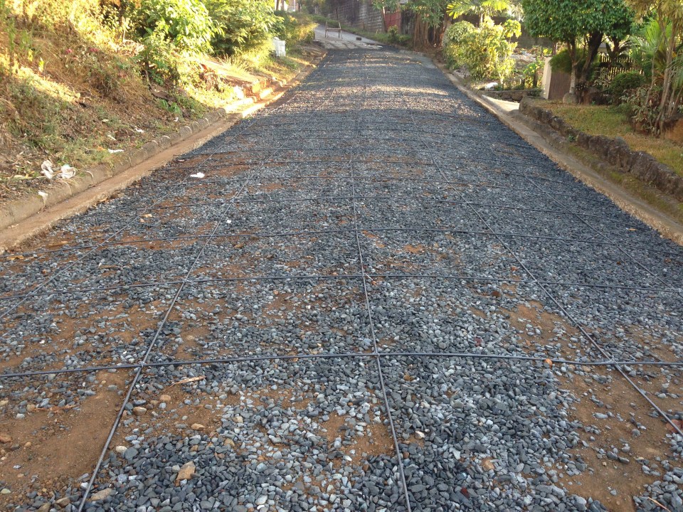 Base layer and steel reinforcement
 A close-up of the “ties that bind” the steel bars together
 Section for concreting
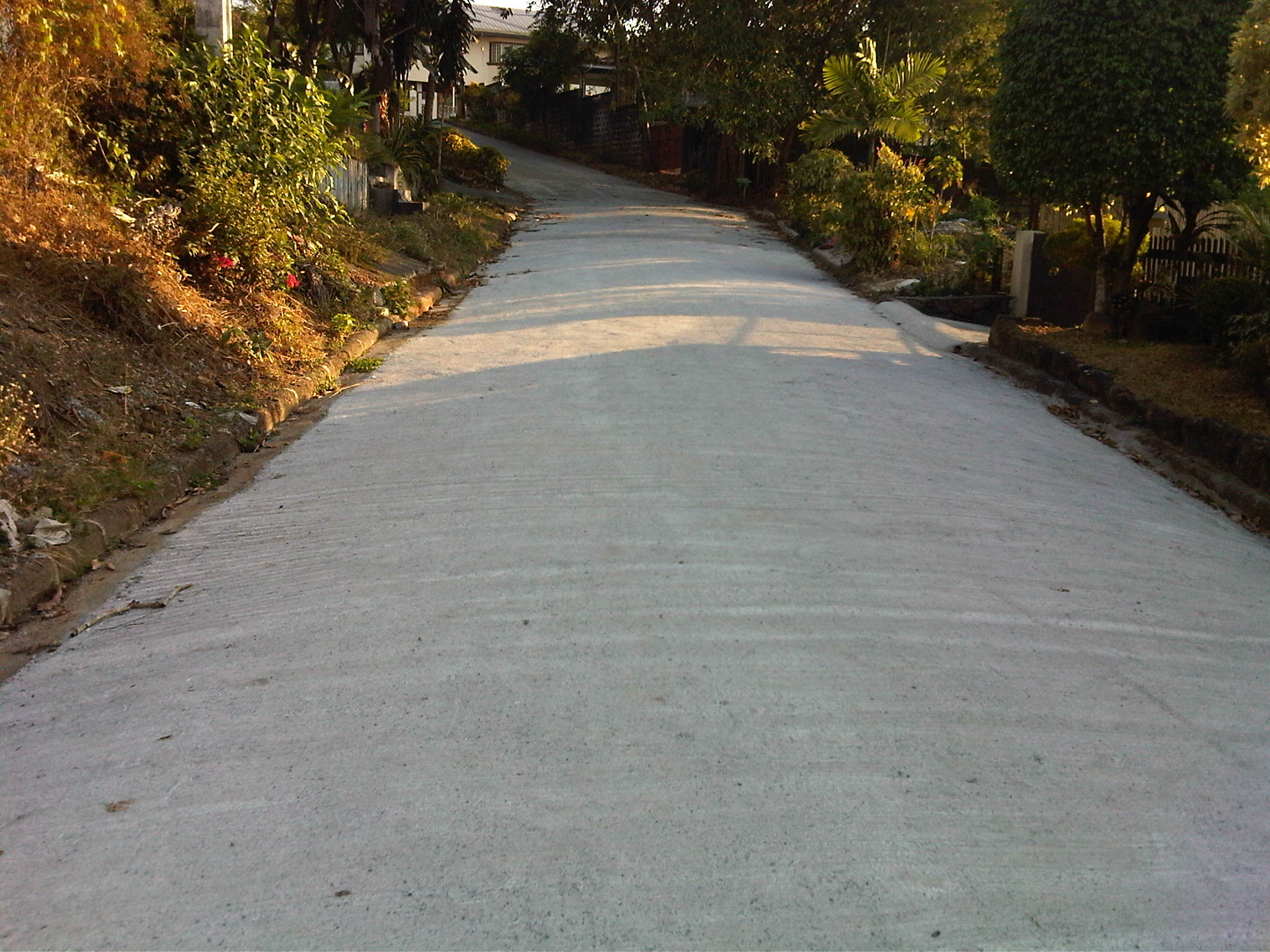 The finished product
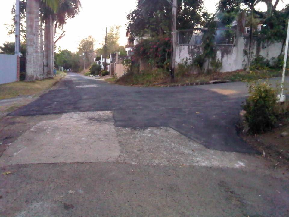 Asphalted pavement at an intersection near the homeowners’ association office
We are very appreciative of the efforts of our village homeowners association in improving the infrastructure in the subdivision. The current policy calls for the prioritization of road sections where residents are up to date in paying their dues. I think this is a fair approach to prioritizing community road works. In fact, there are more road works being implemented now. This is good timing considering it is the dry season. The only drawbacks of such projects are temporary road closures and re-routing of traffic.
–
Alternative to Highway 2000, Taytay, Rizal – Part 1
An alternate route to the poorly maintained Highway 2000 in Taytay, Rizal that leads to Barkadahan Bridge and Circumferential Road 6 (C-6) is via Don Hilario Cruz Avenue, along which is the new Taytay Municipal Hall, the Land Transportation Office in Taytay, and Club Manila East. While most of Don Hilario Cruz is paved, there is a significant section that remains unpaved. It is very dusty during the dry season and muddy during the wet season.
 The road section is unpaved but appears to be graded (probably by the tires of all the vehicles using it everyday). The wall on the right is Megawide’s. Megawide is a major contractor.
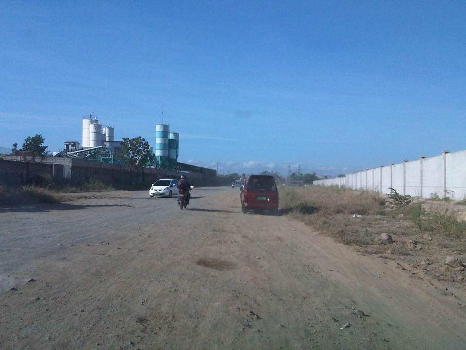 Motorcycles are the fastest along these types of roads. Other vehicles including trucks need to slow down so their suspensions will not be damaged by the rough road.
 I have wondered whether Megawide has considered contributing to paving the road considering their stature in the construction industry. This can be their CSR project and one where a lot of people will be very appreciative with the results.
 Intersection with Velasquez Street, which connects to the Manggahan East Service Road to the north and the Manila East Road to the south.
–
Ortigas Ave. Extension choke points
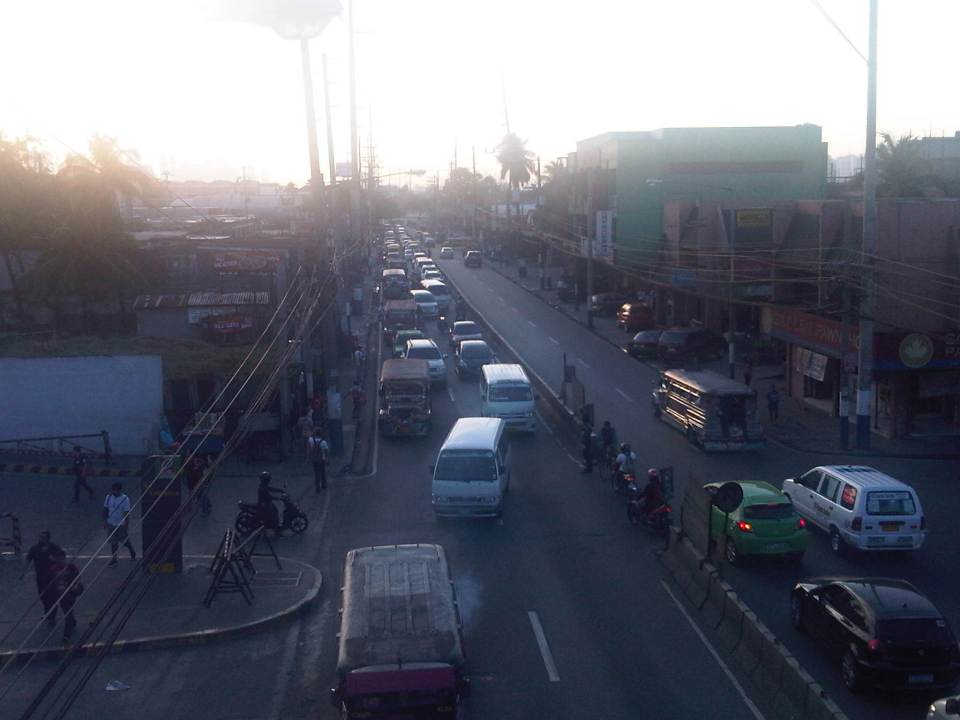
One alternative route for my daily commute is Ortigas Avenue. While there are several choke points along this road, I will focus on those between the Ever mall and Cainta Junction. Congestion is also usually experienced between the Manggahan Bridge and Ever but these are mostly due to traffic interruptions because of vehicles turning to and from the many subdivisions whose access/egress line up along Ortigas Ave.
The Ever mall is already a given as a significant traffic generator in the area. However, there is something about its circulation particularly the flow of vehicles in and out of the complex that detrimentally affects Ortigas Ave. traffic. While through traffic along the eastbound direction should use Ortigas Ave., many opt to go through the wide driveway of Ever in order to bypass the choke point that is the exit driveway of the mall. Many of these exiting vehicles are jeepneys turning left into Ortigas westbound (their routes terminate here and make their turnaround via Ever’s driveway). These effectively block the flow of traffic along Ortigas eastbound especially in cases when the westbound direction is also congested (i.e., due to sheer volume as well as stopping vehicles across the mall).
 Vehicles exiting from Ever and turning left to Ortigas westbound
Once eastbound vehicles are freed from the blockage of left-turning vehicles, they have to merge with significant right-turning traffic from Ever that includes buses and mostly through traffic vehicles whose drivers were ‘wise’ to have taken the driveway instead of Ortigas to get through the choke point. The situation results in another choke point right after the first one as the traffic along two lanes of Ortigas eastbound merge with the traffic equivalent to 2-3 lanes turning right from Ever. The total of 5 lanes of traffic squeezing into 2 lanes immediately after is a prime example of a bottleneck.
 Narrow eastbound two-lane section – additional space should be expropriated to widen Ortigas at this section
Right after the short 2-lane section is a sudden widening of Ortigas Ave. in front of BF Metals. I have heard it said that this is the ideal road width for Ortigas Ave. considering the volume of traffic passing through this major corridor connecting Rizal province with Metro Manila. There are practically 4 lanes for each direction at this short section so its easy to project these lanes on maps to see what properties would need to be expropriated if the objective is road widening. (Of course, the best option should still be to pursue a mass transit system along this corridor.)
 Ideal road width – Ortigas Avenue at its widest is the section across BF Metals. Vehicles here spread out along the many lanes suddenly available. But then people will eventually and immediately realize this is the mouth of a funnel. Note the sign indicating that vehicles are entering the Province of Rizal from this point.
 The eastbound section in front of BF Metals is usually parking lot in the evenings. This is due mainly to the 4 lanes almost abruptly constricting into 2 lanes just past BF Metals. Compounding things is the U-turn slot located here where many jeepneys whose routes end at Cainta Junction make their turnaround. Turning vehicles are assisted by “tambays” earning their money by blocking eastbound vehicles to make way for U-turning vehicles.
Finally, there is Cainta Junction itself, which is a signalized 4-leg intersection that handles a tremendous volume of traffic all-day. I am sure that there are efforts for the traffic signal settings to be optimized but more often there is human intervention for traffic management at the intersection. Whether this causes more severe congestion is quite obvious to many travelers going through this intersection. Queues along Imelda Ave./Felix Ave., for example, can reach way past Village East even reaching Vista Verde on a bad day. This only shows that the intersection is already severely saturated and conventional traffic management or signal settings can no longer handle the traffic. Perhaps the next stage of engineering intervention for this intersection is grade separation or the construction of a flyover or two at the intersection. Notably, such a project should including strategic widening along Ortigas Ave in order to balance the number of lanes feeding into and receiving traffic from the intersection.
 A view of the traffic approaching Cainta junction – there are only 2 lanes along the eastbound side of Ortigas and public utility vehicles stopping here only exacerbates the congestion along the road.
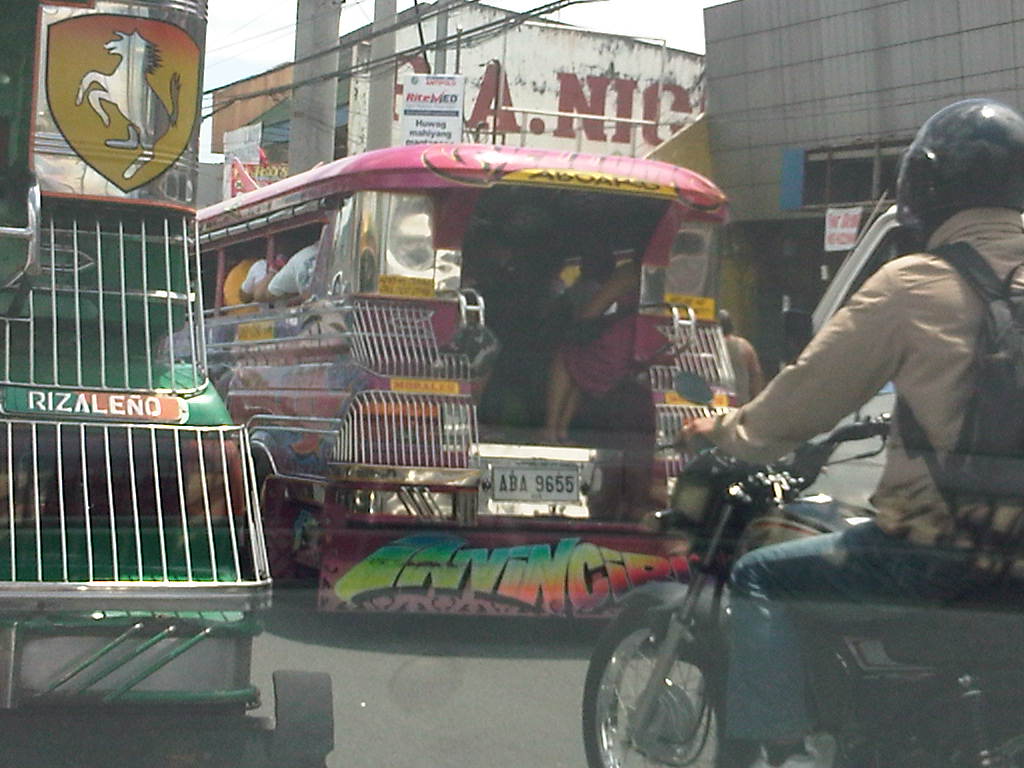
Is road widening the ultimate solution to Ortigas Ave congestion? I personally don’t think so. As I have mentioned earlier in this post and in previous posts the key is still to come up with a mass transit system to serve this eastern corridor. Yes, there will eventually be a Line 2 along Marcos Highway, the main alternate (or competing?) route to Ortigas but is is obvious that even with a railway line along Marcos Highway and connecting to Aurora Blvd., there will still be an urgent need for a similar capacity line along Ortigas. The buses and jeepneys can no longer handle the demand and their poor levels and qualities of service have given rise to a proliferation of UV Express and pushed people to purchase cars and motorcycles. Congestion can be reduced significantly with a mass transit system along Ortigas. Without this transit system, Ortigas will just continue to be congested even if the entire corridor is widened; except perhaps if it is widened like Commonwealth Ave. in Quezon City. I don’t think that is possible and practical.
–
Another look at the Puerto Princesa Airport passenger terminal
I was in Puerto Princesa, Palawan recently and too the opportunity to take a few photos at the passenger terminal. The last time I was in Puerto Princesa was in November of last year and that was during the off-peak season. This time, I wanted to capture scenes at the airport during the peak season (i.e., summer) when Palawan is a major destination for a lot of tourists who want to enjoy its excellent beaches and other attractions including the famous Underground River, which is a UN Heritage Site and a wonder of nature.
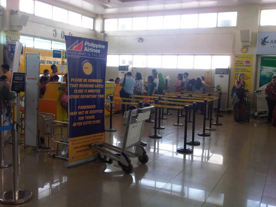 Check-in counters for Cebu Pacific and Philippine Airlines
 Check-in counters for Air Asia Zest
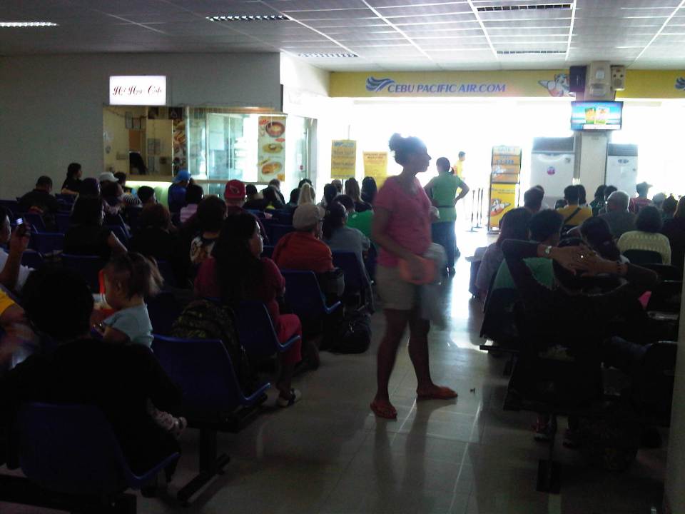
 The pre-departure area has been expanded recently and it looks like it was enough for now. There were many people but there were enough seats and no one really had to stand around or sit on the floor as they wait for their boarding calls.
 A look at the expanded area of the terminal. There are a few concessionaires here selling the usual souvenirs. There is one good coffee stand here for those who need their shot of caffeine.
 Passengers on the next flights sit up front awaiting their boarding calls
Puerto Princesa is currently building a new airport terminal on the other side of the runway. This terminal should have a much larger capacity than the current, expanded one. The project is necessary as the number of visitors to the city and the island of Palawan continues to increase mainly due to tourism. the airport will eventually become a full international airport with regular flights to/from regional cities like Hong Kong and Singapore.
–
Still on license plates
I can’t seem to get over this pet peeve of mine that is the earlier move of the Land Transportation Office (LTO) for all new vehicles to adopt the same license plate design. It was an illogical move even as the LTO claimed the new plates had security features that allowed easy verification of vehicle registration. Common sense tells us that the easiest verification of whether a vehicle is for private or public utility is by simple vision. You don’t need high tech equipment to tell you that a van sporting a private plate and picking up passengers for fares is operating illegally. You didn’t need to exert a lot of effort to read the very small lettering on the new license plate for where the vehicles is registered because the first letter of the old license plates already indicated the region (i.e., the first letter corresponds to a region – ‘B’ for Region 2, ‘F’ for Region 6, and so on).
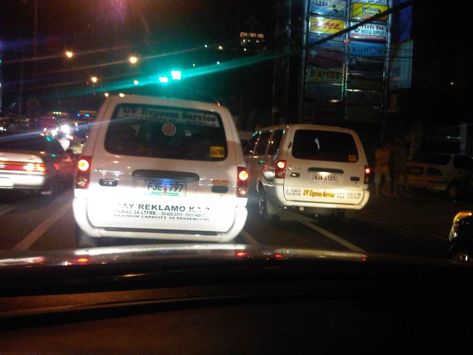 Two UV Express vehicles bearing plates that are supposed to be for private vehicles. The one on the left didn’t even make the cut for the new plates, being issued the older green plates.
I really hope that this is corrected ASAP considering that the LTO has rescinded the earlier policy and is supposed to issue yellow plates again for public utility vehicles.
–
Resistance is futile? The case against electric jeepneys
There is a strong sentiment against electric jeepneys along the route where the COMET is currently operating. This opposition has always been there even before the COMET came about. I would like to think that this is partly due to the perception among many operators and drivers that conventional jeepneys would be phased out and replaced by e-jeepneys. But then isn’t this replacement supposed to be an upgrade in terms of having a more energy efficient and therefore economical vehicle that had a significant bonus of being low emission as well.
I finally got a photo of the sign Katipunan jeepney operators and drivers put up at the terminal below the Aurora Blvd. flyover.
 Protest against electric jeepneys written on Manila paper and posted on overpass column at the Katipunan jeepney terminal
Given the recent innovations and the rapid advances in electric and other fuel vehicles, it should come as no surprise that more reliable and more efficient models of these vehicles will be available in the market. In the case of the Philippines where the thrust for e-vehicles is focused on public transport, there will eventually be a model that will comprehensively beat conventional jeepneys in every aspect. That is, if there is not yet a model that good. Arguably, the COMET and the latest e-jeepney model (BEEP) are already better than conventional jeepneys. However, their acceptability is pending with operators and drivers who seem uninterested with the case against conventional jeepneys. Perhaps these people are being fed false information by another party? Hopefully, they will open their eyes and mind to the reality that will eventually catch up with them if they do not embrace change.
–
Another example of mismatched plates
My most recent post was on the inappropriateness of the new license plates issued by the LTO to public utility vehicles. New taxis, UV express and jeepneys suddenly had the back and white license that’s supposed to be issued only to private vehicles. This meant that it would be difficult to distinguish the legitimate PUVs from colorum or illegally operating ones. In the last post, I was able to show an example each for these license plates on a taxi and a UV Express van. Yesterday, I was able to get a photo of a jeepney bearing this “anomalous” plate as I was caught in an unexpected traffic jam along an otherwise free-flowing road in Rizal.
 Jeepney bearing the black and white license plate issued to private vehicles
–
On the uncommon sense on license plates
The issuance of new license plates has been a very “painful” process and experience to a lot of people and it is not without serious issues. For one, there is still a backlog in license plates as evident from Strictly speaking, these vehicles shouldn’t be operating or not allowed to be driven even considering they are technically registered with the Land Transportation Office (LTO). The proliferation of vehicles without license plates allows for the abuse of such by owners of relatively new vehicles who can remove their plates in order to be able to take their cars on their coding days. It is also possible to be involved in a road crash or incident where the driver of a vehicle without a license plate can make an escape (the details on the conduction sticker are not easy to spot and memorize) or evade apprehension.
Among the most problematic is the issuance of plates of the same design as that used by private vehicles to public utility vehicles like UV Express and taxis. This creates a lot of opportunities for abuse especially private vehicles masquerading as PUVs. These are without the proper franchises and are illegal (i.e., colorum). What the LTO claims as security features on the plate are meaningless as the uniform color of the plates defy the simple logic behind the old policy of having a specific color to quickly distinguish among vehicles bearing different color plates. This makes it easier for traffic officers including the Philippine National Police (PNP) to spot vehicles with mismatched or inappropriate license plates.
 Taxi cab bearing plate with the same design as that used by private vehicles.
 UV Express van bearing license plate for private vehicles
The purpose of having plates with different colors is for quick identification and distinction of vehicles. A plate with yellow background has always been associated with public utility vehicles. Those with blue lettering or background are those for diplomatic plates. Those with red lettering or background are for government plates. Fortunately, the LTO has reverted to the original policy pertaining to the license plate colors and new plates to be issued to PUVs will once again be a distinctive yellow. Perhaps corrections are due for those legitimate PUVs that were issued inappropriate design (i.e., color) plates.
–
Metro Manila Urban Transport Development Plan (1990-2000) Project (UTDP)
I stumbled upon an unfinished draft I have on a study or series of studies conducted back in the 1990’s. These studies were conducted by several agencies over a decade. I think I have been procrastinating on finishing this brief post on a project that has had a major impact on Metro Manila transport and traffic since that time and prior to the completion of the JICA-funded Metro Manila Urban Transportation Integration Study (MMUTIS) in 1999. The project actually overlapped with MMUTIS’ implementation from 1996-1999 and probably influenced MMUTIS in terms of what government agencies provided as inputs to the study.
The Metro Manila Urban Transport Development Plan (UTDP) is an inter-agency collaboration among the DOTC, DPWH, MMA (precursor of the MMDA), NEDA, CHPG (Constabulary Highway Patrol Group of the Philippine National Police) and MTPC. This consists of various studies undertaken from the year 1990 to 2000 aimed to determine what projects can be implemented to improve urban transport in Metro Manila towards the turn of the century. Sounds familiar?
Among the most relevant studies conducted was the comparison of proposals for a mass transit system along EDSA. The two proposals compared were the Philtrak bus system and Street-level LRT. The Philtrak option is quite intriguing because its description is very much like the current bus rapid transit (BRT) systems in many cities around the world. However, there is no reference to bus systems already operating abroad at the time (e.g., Curitiba in Brazil already had an extensive BRT network at the time).
The study concluded that the Philtrak was preferable to the LRT along EDSA. Of course, we now know what got built along EDSA – a light rail system (EDSA MRT) that is now carrying more than twice the number of passengers it was estimated to carry. This is despite the conclusion from collaborating government agencies including the DOTC favoring the bus system with an exclusive ROW. It is also now obvious that neither the LRT nor Philtrak is most suitable as a mass transit system along EDSA. What is most appropriate is a heavy rail system that would be able to carry more passengers along the corridor.
[Reference: UTDP reports, 1999-2000, NCTS Library, UP Diliman]
–
