
Statement on the proposed emergency powers to solve transport and traffic problems
The National Center for Transportation Studies (NCTS) of UP Diliman submitted a statement to the joint Senate committees evaluating the proposal to grant emergency powers to the Philippines President in order to solve the transport and traffic problems in the country and especially in Metro Manila. Following is a copy of the one-page statement:
–
On being constructively skeptical on transport and traffic
Social media is full of news or what is being passed off as news about various transport projects or initiatives. These include a proposed subway line for Metro Manila, road sharing initiatives, inter-island bridges, gateway airports and others major infrastructure projects that are being conceptualized, planned, studied or designed. Too often, people who support the projects/initiatives brand those who do not share their enthusiasm and interest as skeptics and even simply “nega” or negative people. These supporters and their opposites are most likely those who fall under one or more of the following categories:
- Overly optimistic
- Unaware of the process towards a project’s realization
- Troll
- Naive
Hopefully, he/she is not of the third kind who basically are posting against anyone and don’t really have any valuable opinion or constructive comment to offer. There are many groups and individuals out there including those who claim to be fanatics of urban planning, railways and other things on transport. Some even get to write in mainstream media. Unfortunately, to the untrained minds their opinions passed on as expert advise appear to be legit and that can be especially true to people who are more inclined to believe them such as very fanatics and trolls I mentioned. It is very important that proper research is undertaken before any article is written. Otherwise, there will always be bias. Of course, some articles are written with bias a given and with the objective of misleading people.
When government officials (or candidates) claim something and offer nothing as concrete proof (e.g., numbers to support a claim of improving traffic), one has to think twice about believing them. One has to be critical of such claims. Promises are often just that – promises. It is important to ask how certain programs or projects will be delivered, how infrastructure will be implemented (i.e., through what mode of financing, timelines, etc.), and what would be its impacts (i.e., social, environmental, traffic). Of course, it should be expected that officials provide suitable answers to these queries.
It should also be expected for officials to understand that institutions such as the academic ones are there to provide objective criticism. Unfortunately, there are those in the academe who themselves have some agenda they are pushing and can be deliberately misleading and misinforming with their flawed assessments and statements. Then there are experts who offer nothing but negative comments. To these people, any idea not coming from them are essentially wrong and it is often difficult to deal with such people among whom are experienced engineers and planners. Being a skeptic is one thing but being a constructive skeptic. That is, one who offers solutions and also willing to tread the middle ground or some reasonable compromise based on the situation and conditions at hand.
This is why an evidence-based approach is needed and should be mainstreamed in many government agencies, particularly those that are involved in evaluations. National agencies like the NEDA, DOTr and the DPWH have the capacity and capability to perform quantitative analysis using recent, valid data. The quality of data tells a lot about the evidence to back up analyses, evaluations and recommendations. One must not forget that with quantitative analysis it is always “garbage in, garbage out”. That is, if you have crappy data, then you will have flawed analysis, evaluations and recommendations.
–
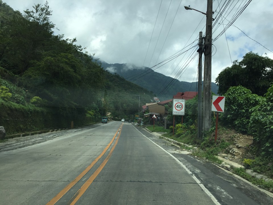
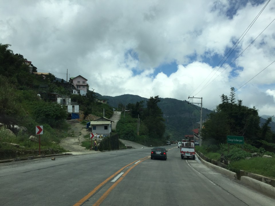
Roads to Baguio: Marcos Highway – Part 1
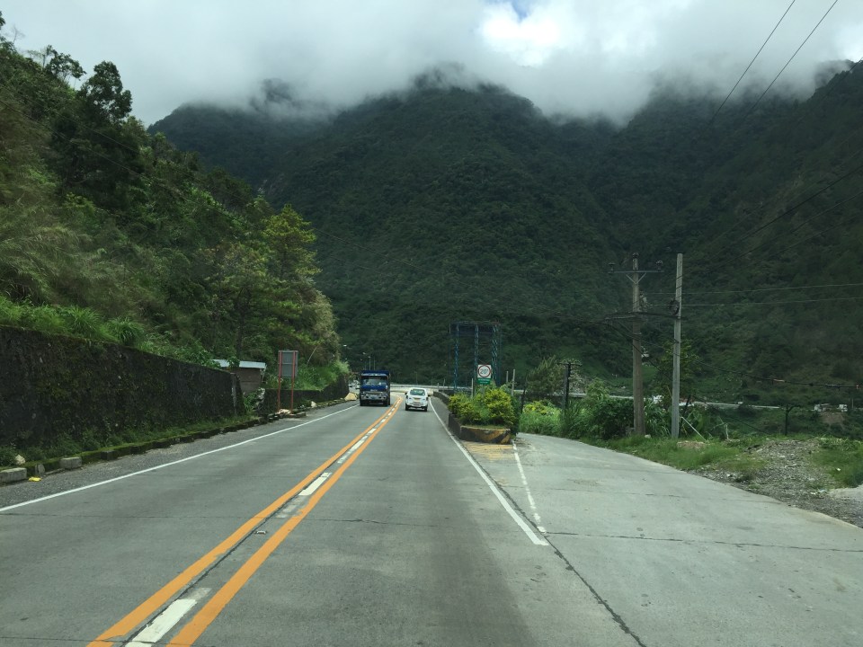
In my recent trip to Baguio, I made sure to take new photos of roads particularly the major ones that made that city in the mountains accessible. Of course, one objective was also to have an updated selection for my highway engineering lectures. Following are the first batch of photos I took of Marcos Highway last June 2016. I won’t be writing a caption for many of these photos as well as those in the succeeding batches. I’ll just put these here for others to refer to whether for practical uses or for research.
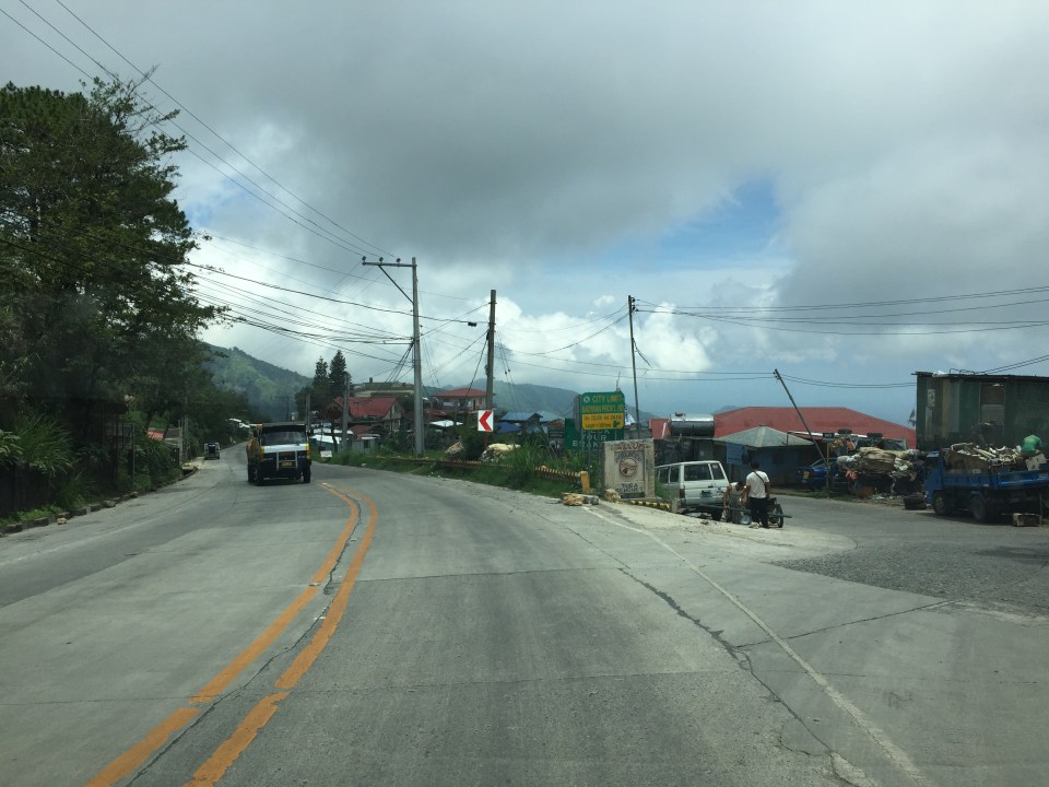
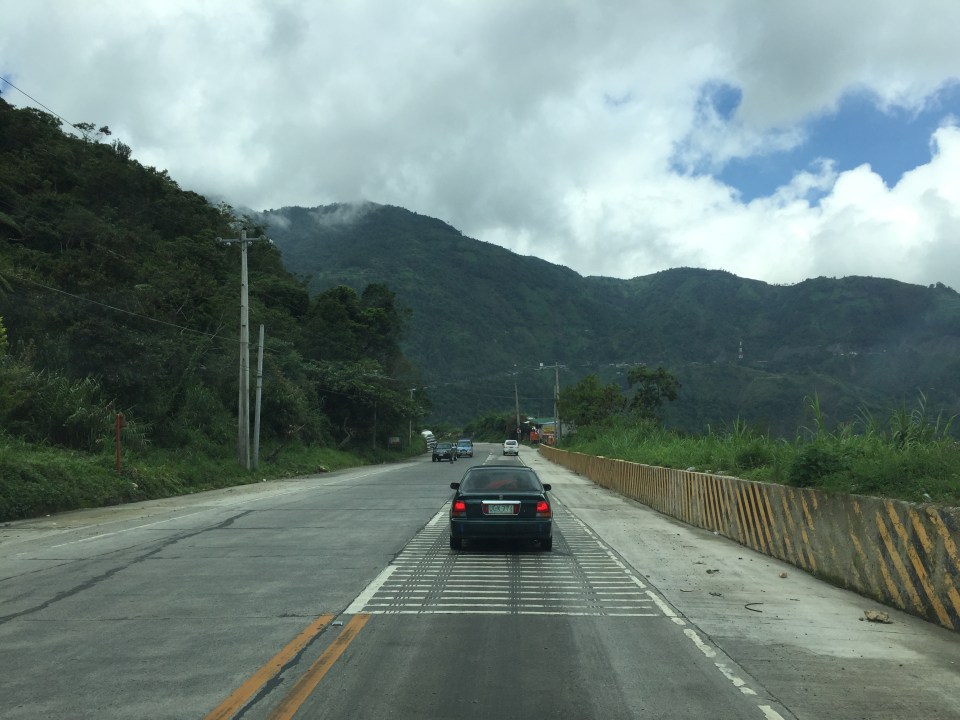
 I found it unusual to see double yellow along a relatively straight and level section of Marcos Highway. It is perhaps a section where there have been a significant number of road crashes?
 There are many roads built to provide access to areas previously uninhabited but now have houses giving some spectacular mountain views.
 There are rumble strips along many sections of the highway; seemingly there to wake up travelers that where getting sleepy.
 It can get quite foggy along the highway

 Old barriers look sturdy enough to prevent heavy vehicles from falling off the highway.
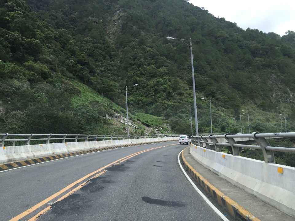
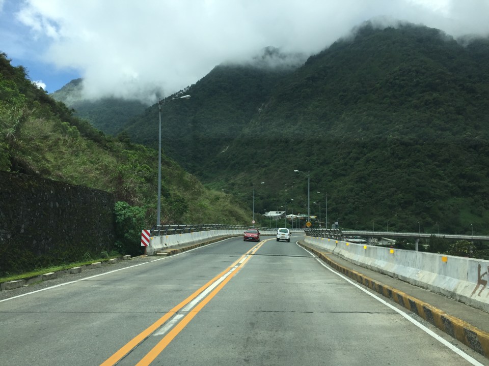 One end of the viaduct alongside the mountains
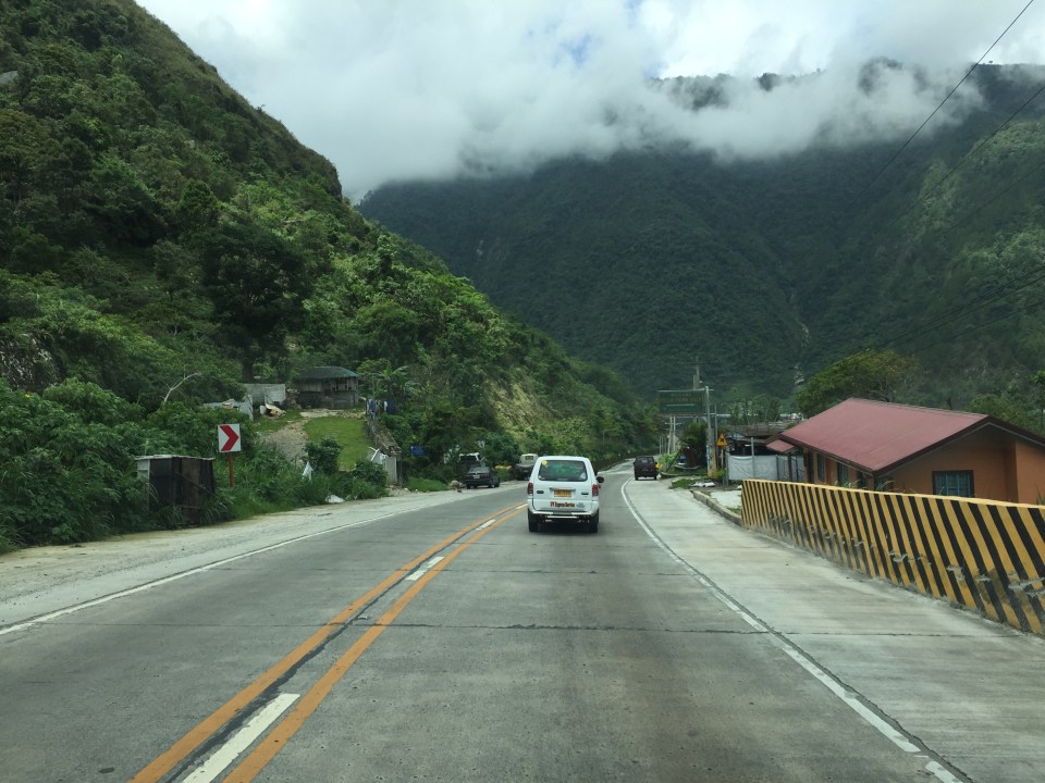
 There are communities in many places in the mountains along the highway. Access would be via local roads, some of which are private roads.
 I thought perhaps bridges and viaducts in the Philippines should have shoulders and more generous space for pedestrians.
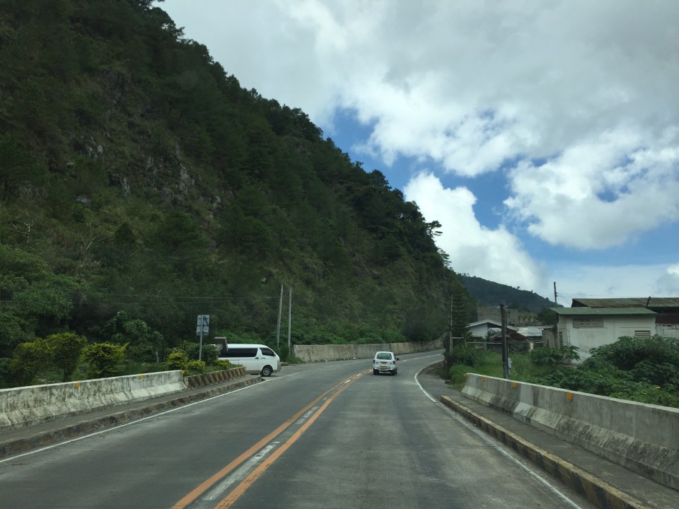 The van in the photo enters the highway from one of the many driveways and local roads connecting to the national highway.
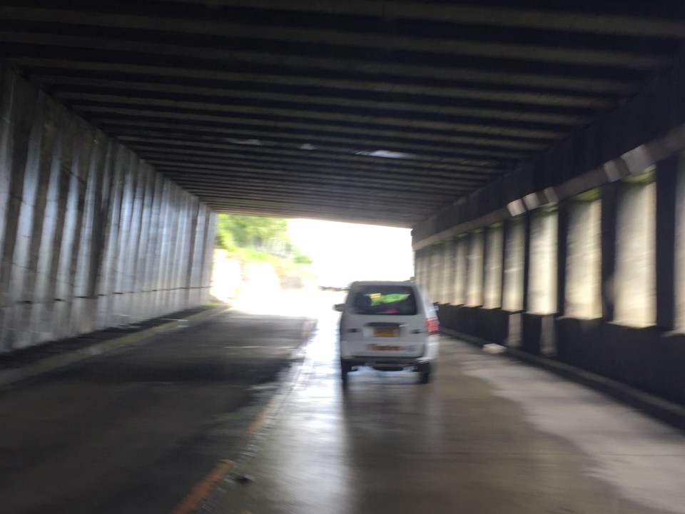
 What appears to be a tunnel for many people is actually a roof structure to protect travellers and the road from landslides.
 During the day, it is bright inside the structure given the openings along one side of the highway.
 The light at the end of the tunnel?

More photos in Part 2 coming up soon.
–
Line 2 to be transformed into a BRT? Definitely not a good idea!
There are news reports stating that the Department of Transportation (DoTr) is considering replacing the LRT Line 2 with a BRT instead. I think this is not something worth considering at this point since the construction of the Line 2 extension from Santolan to Masinag is already underway. Also, there is the fact that Line 2 is the only heavy rail system among the three LRT/MRT lines in Metro Manila. It has the potential to have the highest capacity among the three as well as the potential to have the highest ridership especially after the extension is complete and the two additional stations are operational.
With lots of people requiring public transport beyond Masinag, the question is not whether to convert Line 2 into a BRT but instead what services can be provided for a more efficient system for Rizal and Marikina. I took the following photos along my commute from Antipolo to Quezon City. Note the number of people waiting for public transport along Marcos Highway.

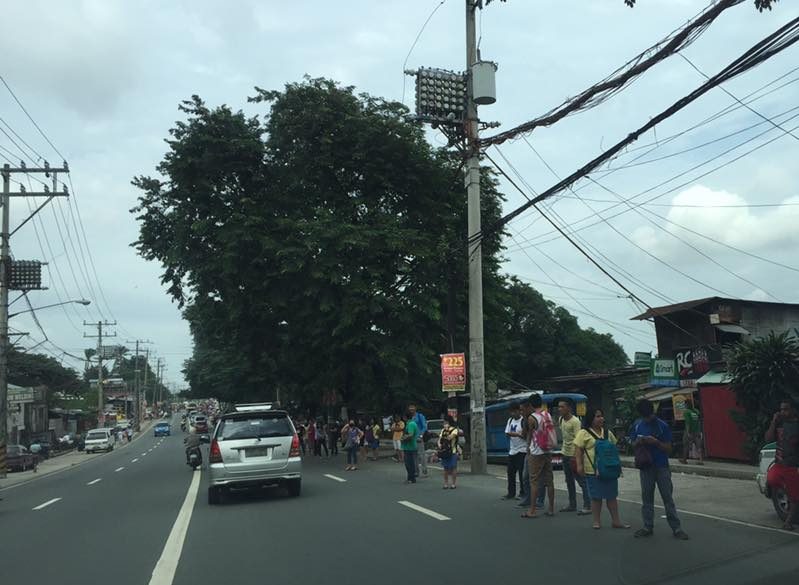
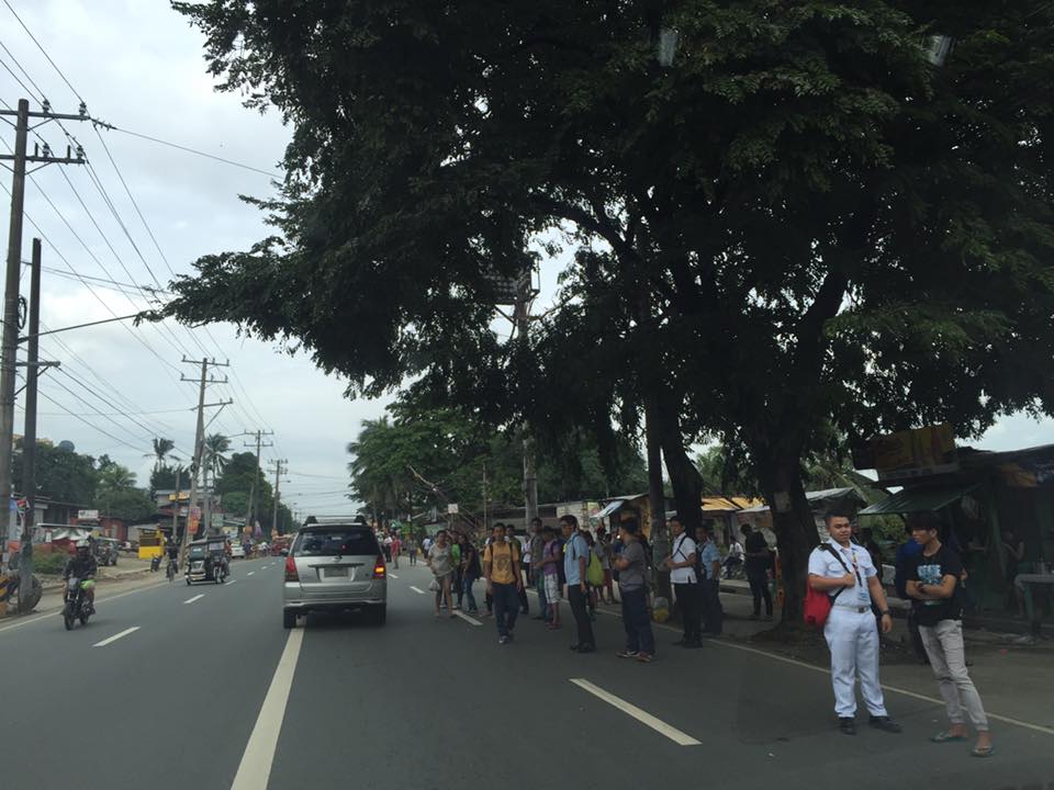

These are people who would typically take jeepneys or UV Express for their commutes. It is obvious from my regular observations that jeepneys and UV Express cannot cover the demand for public transportation and my opinion is that it is high time to introduce a higher capacity and more efficient mode in order to encourage people to keep taking public transport and to encourage those taking private transport to shift to PT.
A BRT service can be connected to Line 2. Since the Line 2 extension to Masinag is scheduled to be completed next year and be operational by third quarter of 2017, a bus service can already be piloted between Santolan and several end points. Four for consideration would be Cogeo, Antipolo Simbahan, Marikina and Cainta.
- Cogeo should be a no-brainer given that there is already demand there and this is growing rapidly with all the subdivisions being developed in this area.
- For Antipolo Simbahan, perhaps the final stop need not be at the shrine but at Robinsons Antipolo.
- For Marikina, there can be three lines – one branching from Ligaya where there is a major Ayala development, a second at Gil Fernando and another at Masinag. These may terminate at the city center, perhaps in the vicinity of the Rodriguez Sports Complex, which is near the Marikina City Hall and public market.
- The last line could traverse Felix Avenue (Imelda Avenue) and may terminate at Cainta Junction where commuters can transfer to transport along Ortigas Avenue Extension.
Surely, pilot services can be provided where limited stops or express services can be experimented on to see what clicks in terms of ridership. It would be nice to get feedback about such services and hopefully there will be champions for these bus services. Note that such services terminating at Santolan means that there should be terminal facilities in that area. Former MMDA Chair and now Marikina Congressman Bayani Fernando has developed an area precisely for an eastern transport terminal and so bus services present a good opportunity for this terminal to be a busy one. Maybe BF can champion these bus services? And perhaps the Antipolo and Cainta (paging Mayors Ynares and Nieto!) can also push for these services as commuters from these would stand to benefit the most from a good transport system.
–
TSSP 23rd Annual Conference Proceedings
The 23rd Annual Conference of the Transportation Science Society of the Philippines (TSSP) was held at the University of the Philippines (UP) Diliman last August 8, 2016. It was hosted by the National Center for Transportation Studies (NCTS), which for some time was practically inactive in its dealings with the society. The conference was a very successful one with more than 170 participants, mostly students from the undergraduate programs of Mapua Institute of Technology (MIT), De La Salle University (DLSU) and UP Diliman.
The Proceedings of the 23rd Annual Conference contains 22 technical papers, which I have already listed in a previous post showing the technical program for the conference. The link is to the current website of the TSSP hosted by NCTS. Those wishing to have copies of the papers may download them directly from the link. Meanwhile, those interested in the presentations should contact the authors. Their contact information are stated in the paper and it is ethical to get the nod of the authors for their presentation file as these still fall under what can be defined as their intellectual property. I am aware of people who tend to get presentation slides and then pass them of as their work when they use the slides or the data/information therein. There are proper ways for citations of references and sources but sadly such ways are not observed by many.
–
Another look at the Tacloban Airport
The Daniel Z. Romualdez Airport in Tacloban City is the busiest in Region 8 (Eastern Visayas). Tacloban being the regional center in terms of commerce/business, attracts significant air traffic and should continue to do so as it steadily recovers from the devastation brought about by Typhoon Yolanda (Haiyan). Following are photos of the airport from our recent trip to Leyte, where we had meetings in Tacloban and Ormoc.
 Passengers arrive at the Tacloban Airport
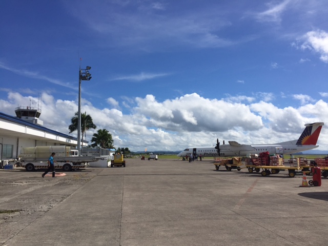 Philippine Airlines turboprop aircraft arriving at the airport
 Cebu Pacific passengers disembarking from the plane
 Passengers waiting for the checked-in luggage at the carousel
 Passengers file out of the arrival area unto the terminal’s driveway and parking lot
 Visitors may inquire about the Tacloban at the city’s information desk located at the arrival area.
 Sign of a rent-a-car service at the airport showing rental options and available vehicle models.
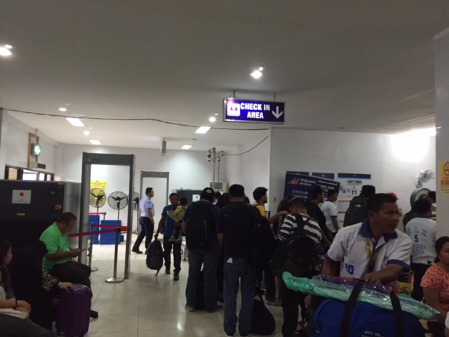 Crowded check-in area at the Tacloban airport passenger terminal
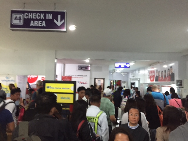 There were long queues at the check-in counters as well as the payment booths for the terminal fee.
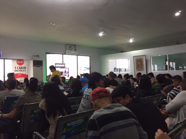 We entered a very crowded departure area as flights were delayed and people accumulated at the terminal. These are Air Asia passengers.
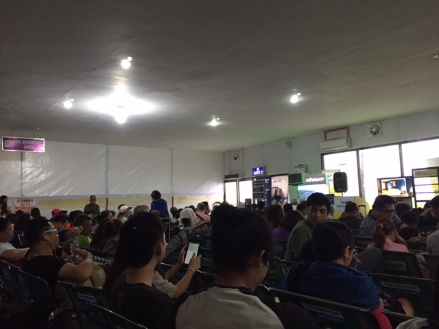 These are Philippine Airlines and Cebu Pacific passengers. Notice the temporary wall behind which is a section of the departure area that’s being renovated.
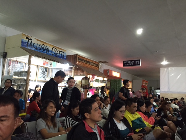 Shops at the departure area sell souvenirs and food items including local delicacies like moron and binagol.
The airport terminal is already very congested and it doesn’t help that flights are frequently delayed for various reasons. In the aftermath of Typhoon Yolanda (Haiyan), there have been proposals to move the airport to another location. However, it now seems that there is no better location for this within the city and elsewhere in the province. There are opportunities and potential though to improve the current airport and perhaps make it more resilient against typhoons of the scale of Yolanda.
The proposed new passenger terminal building is already much delayed and the runway can be extended. The latter is now possible with the areas for the extension already cleared of informal settlers mainly due to these areas being ravaged by Yolanda and authorities not permitting people to rebuild their houses there.
–
TSSP 2016 Conference Program
I am sharing the banner and final program for the Transportation Science Society of the Philippines 23rd Annual Conference to be held on Monday, August 8, 2016. The final program features a Keynote Speech by the Undersecretary for Road Transport and Infrastructure Anneli R. Lontoc, a Panel Discussion on Road Safety, and technical sessions in the afternoon.


 –
–
Walking is good for you!
I found the following graphic on social media (Facebook). It shows the benefits of walking, particularly 30 minutes of walking per day. There are many studies that have established the benefits of what is now termed as ‘active transport’ that includes walking and cycling to promote healthy communities and cities. If only our communities and cities are more walkable then perhaps more people can be encouraged to walk more and there will be a reduction of motor vehicle traffic. The latter will be those vehicles used for short distance trips that are typically associated with distances suitable for walking rather than riding or using a motor vehicle.

–
Straddling bus prototype?
What was peddled as a unique public transport mode concept in social media is now a reality. Check out the article and video here:
China’s Futuristic Straddling Bus Is Finally Here
This is a welcome development for public transportation. However, some issues need to be addressed, particularly regarding road safety. Motorists traveling under the straddling bus may have reactions to the vehicle as it passes above them and such may lead to road crashes. Of course, with the advent of driverless vehicles such incidents may be minimised if not altogether eliminated.
–
TSSP 2016 Conference: Tentative Program
I am sharing below the tentative program for the 23rd Annual Conference of the Transportation Science Society of the Philippines (TSSP):

Soon, I will post on the list of papers to be presented for the Technical Sessions to be held in the afternoon part of the one-day conference.
–
