
Home » 2017 (Page 6)
Yearly Archives: 2017
Melbourne’s transit system
One thing I always look forward to whenever I am traveling is to try out the public transport system of the cities I am visiting. My first day in Melbourne gave me an opportunity to familiarize with the city’s transportation including the trams and bikeways. Following are some photos I took as I went around the city center on-board their trams. I actually purchased a myki card but discovered a bit later that tram rides were free when you’re within the zone defining the city center. You only need to swipe or tap when you leave the zone where transit will charge the corresponding fares to your destination.
 Tram passing by the stop where I decided to stand by to take a few photos while familiarizing with the network map.
 Melbourne transit network map and information on priority seats
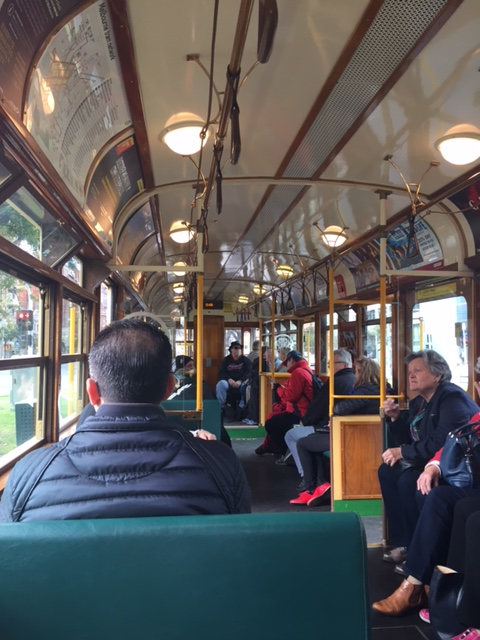 Inside the circle tram that goes around the city center
 Typical transit stop
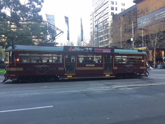 Vintage tram
 Tram crossing an intersection
 Modern transit vehicle
I found Melbourne’s transit to be quite efficient and the coverage was comprehensive enough considering the city was walkable and bicycle-friendly. This meant people had many options to move about and this mobility definitely contributes to productivity. More on transportation in Melbourne and Sydney in future posts.
–
Why do we need to reduce speeds?
A common observation made of Philippine drivers is that they seem to hesitate from slowing down even at hazardous locations or situations. Note, for example, vehicles approaching an intersection and you will observe that many if not most will not reduce their speeds. Most guilty for me are motorcycle riders who tend to maneuver and even speed up instead of slowing down for a safer approach. Slowing down (i.e., reducing one’s vehicle’s speed) is actually a no-brainer and something that is explicit in any country’s traffic rules and regulations and driver’s handbook.
I saw a lecture on why reducing speeds are important. This is not just from the specific perspective of safety but is explained in favor of mobility and quality of life. Here’s the lecture:
Reducing speeds for better mobility and quality of life by CarlosFelipe Pardo
–
Melbourne airport arrival
I traveled to Australia recently to attend a symposium on Sustainable Development in Melbourne. As such, I was able to observe and experience transport in a couple of major cities – Melbourne and Sydney. I arrived in Melbourne via Sydney at Terminal 1, which is for the domestic flights of Qantas. Here are some photos upon my arrival at the airport:
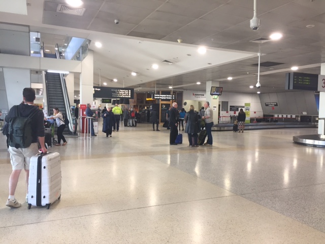 Upon deplaning, we proceeded through the shared departure areas with the shops and restaurants to go to the baggage claim area.
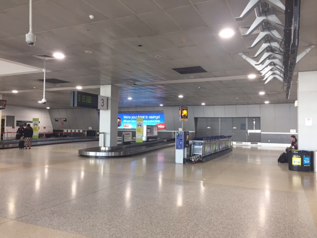 Baggage claim area
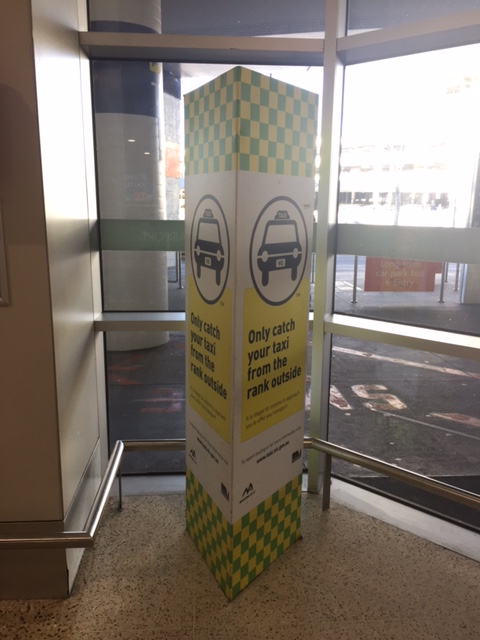 Guidance for those taking a taxi from the airport
 Machine for paying airport parking fees
 Taxi queue at the airport – the queue appeared to be long but there were many taxis so it didn’t take long to get one to the hotel. The airport had staff to direct passengers and taxis to the designated berths.
I will be writing more about transport in Australia in future posts. It is always a good thing to experience transport in cities abroad. And of particular interest for me when I was in Melbourne and Sydney was their cycling facilities so I will also feature those in future articles.
–
Some thoughts on the proposed Metro Manila subway
The detailed design for the proposed Metro Manila subway is supposedly underway. Here’s a graphic of what the system may look like underground. I got this from the American Chamber of Commerce newsletter.
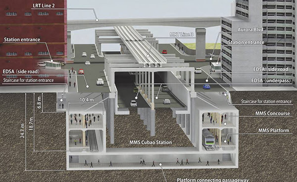
What is not shown, and which I think should also be emphasized, are the drainage tunnels that need to be constructed in relation to the underground transport system. Tokyo’s subterranean drainage, for example, are so extensive and spacious that it could handle the precipitation/runoff during rainy days so its subways are flood-free. Metro Manila stands to benefit much if similar drainage systems are built together with the subway. I think a lot of people can appreciate this feature of the subway nowadays when we all feel the impacts of the intense monsoon rains (Habagat) not to mention the typical typhoons that come our way. The subway’s construction may be seen not only from the transport perspective but also as an opportunity to improve the metropolis’ drainage system.
–
Some issues at Barkadahan Bridge
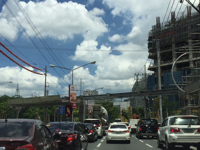
Perhaps one of the worst places to be in terms of traffic during the morning peak is Highway 2000, and particularly the approach to the Barkadahan Bridge that crosses the Manggahan Floodway. Traffic management at the intersection of the East Bank Road and Highway 2000 is so atrocious that everyone passing the junction would likely incur delays of more than 30 minutes.
The congestion in the area is also attributable to the fact that you have major roads carrying traffic from all over the eastern town of Rizal that are bound for Makati and Taguig (Bonifacio Global City), mostly for offices in those CBDs. These commuters likely use the completed C-6 sections including those at Lupang Arena and the expansion along the Laguna de Bay coast.
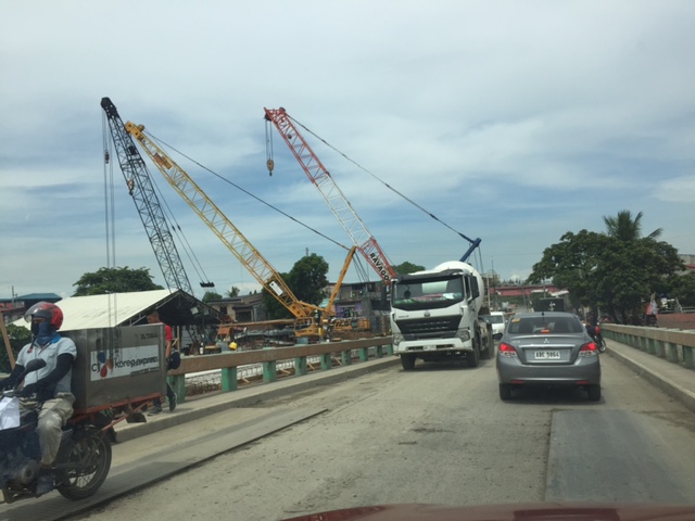
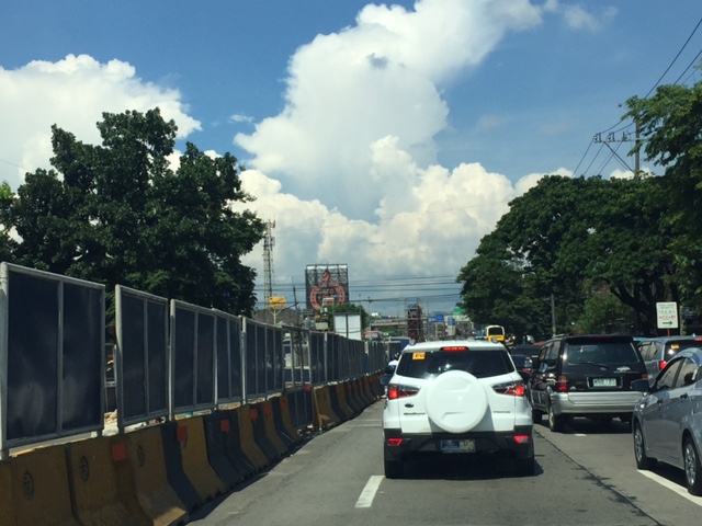
 Barkadahan Bridge is a 2-lane structure with significant local traffic such as the tricycles in the photos
 On either side are narrow walkways and it no uncommon for people to walk on the carriageway itself .
 The bridge’s expansion is underway but, from my observation, is taking too much time. Perhaps the contractor is having problems with the foundations for the posts? Or maybe the funds aren’t flowing as required for the effective implementation of the project?
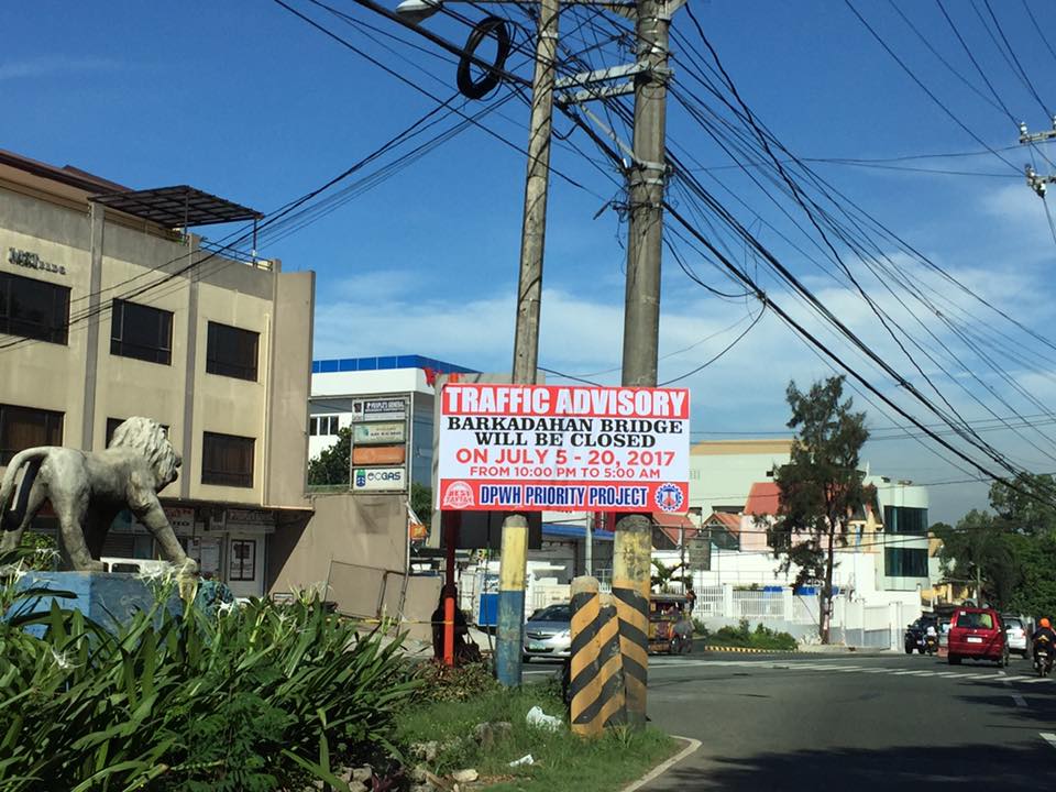 This is an ‘old’ sign now as July 20 is already more than a week ago.
A lot of people look forward to the completion of the bridge but the bigger issue is still the traffic management at the intersection that is also influenced by factors such as the tricycle terminal near the junction and the undisciplined local traffic. The situation is exacerbated by those who counter flow along Highway 2000 and generally get away with it. Perhaps the Municipality of Taytay should get some help in improving their capabilities for traffic management?
–
On the East Metro Transport Terminal in Marikina
This site has been visited a lot the past few days by people searching for information on the eastern transport terminal that’s being developed in Marikina City just across from SM City Marikina. I wonder if its for a study (i.e., students doing research) or perhaps some folks curious about the signs they’ve seen while crossing the Marcos Highway bridge across the Marikina River.
 Signs informing people about the existence of a transport terminal beneath the bridge
The sign also states BFCT, the first part of which are the initials of the former MMDA Chair/Marikina Mayor. CT probably means ‘city transport’, ‘city terminal’ or ‘central terminal’? I haven’t been to SM Marikina lately so I haven’t had the opportunity to see how complete the facility is and if it is already operational. However, one can see from the bridge, as you travel along the outermost eastbound lane, that work is ongoing and there are vehicles (mostly vans, jeepneys and small trucks) that are parked there.
Is this a good location for a public transport terminal? I believe so; considering that there is a railway station nearby and the area is a convergence point for a lot of people (not only those residing in Marikina and Pasig). Do I think this should be a provincial bus terminal of the same level as the ones proposed for the north and south of Metro Manila? Yes, but only for trips bound for the east (e.g., Rizal and Infanta, Quezon) and south (e.g., Quezon, Laguna, Bicol) via the eastern route (Marcos Highway, Antipolo-Teresa Road or Manila East Road). I don’t think it is appropriate for trips heading to Boracay, Baguio or Ilocos. Buses headed for the latter destinations should terminate at the proposed north and south terminals. Buses to/from those places that would be terminating in Marikina would mean they would have to travel along C-5 in order to get to this eastern terminal. If these are in significant numbers then the traffic generated by such a terminal will contribute to congestion along C-5 and Marcos Highway. Of course, such proposed terminals should be subject to rigorous studies as these facilities can be major traffic generators and some mitigating measures must be in place to address potential issues.
–
MRT 7 on the way
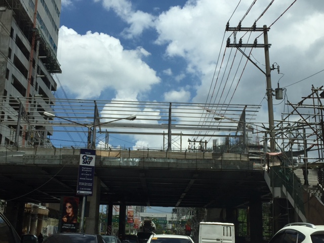
The construction of the much-delayed Line 7 is underway. Hopefully, this project will be completed and be operational (or at least partly) before the end of the current administration. This would be one of the game-changers in terms of commuting along a corridor that has steadily increased in population and therefore travel demand. The ultimate end of the line in San Jose del Monte, Bulacan also means it will be serving relocation communities, many of whom are employed in Metro Manila and have to travel every weekday using buses, jeepneys and vans. Following are photos we took along the Commonwealth in the Fairview and Litex areas.
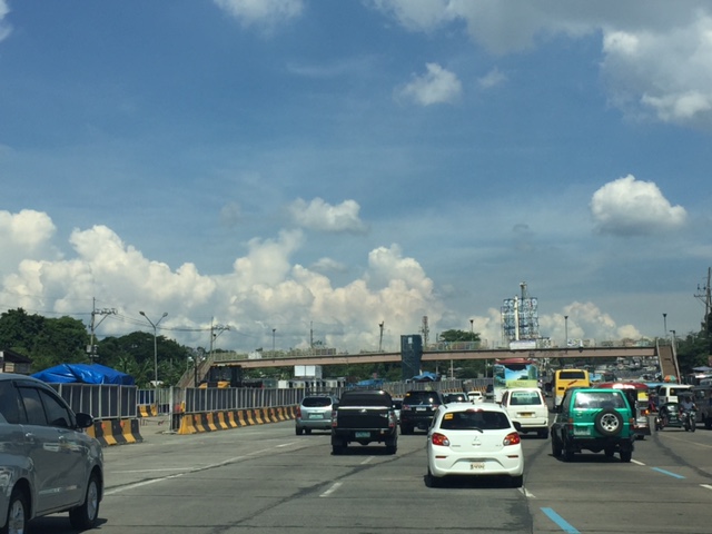
 Construction is underway and this means traffic congestion as the number of lanes along either direction of Commonwealth Ave. has been reduced to provide space for the staging areas of the project.
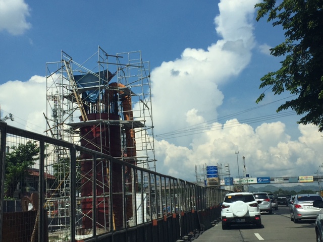 A column going up near the rotunda near Litex Market
 MRT Line 7 worksite along the Commonwealth Avenue median is secured by lines of barriers cum fences on either side of the median.
 These full-grown trees in the middle of Commonwealth will be or already removed
 What has been a green row in the middle of Commonwealth Avenue will give way to an elevated railway line. I sure hope the proponents do some landscaping after the structure is built to restore the greenery.
More updates on the project soon…
–
TSSP 2017 Conference
The Transportation Science Society of the Philippines (TSSP) holds its 24th Annual Conference tomorrow, July 21, 2017. It will be held at the National Center for Transportation Studies at the University of the Philippines Diliman, Quezon City. More than a hundred participants are expected to attend this 1-day affair.
The final program for the conference may be found in the following link:
http://ncts.upd.edu.ph/tssp/index.php/2017/07/17/tssp-conference-program/
The theme for this year’s conference is “Improving Quality of Life in Urban and Rural Areas Through Inclusive Transportation.” This is also the theme for the panel discussion in the morning. The afternoon will feature four parallel technical sessions where 18 papers will be presented.
The keynote lecture will be delivered at the start of the conference by Prof. Tetsuo Yai of the Tokyo Institute of Technology, who is also the current President of the Eastern Asia Society for Transportation Studies (EASTS) under whose umbrella the TSSP is part of. TSSP is a founding member of EASTS and actually preceded EASTS by a year.
–
On the Uber and Grab predicament
A lot has been said and written for or against Uber and Grab. Social media made sure the more popular but not necessarily the truthful ones are spread. One popular personality associated with motoring has even led an online petition against the rulings by the Land Transportation Franchising and Regulatory Board (LTFRB). An objective check of the facts reveal that LTFRB is not solely at fault here. Uber and Grab should not have promoted themselves and took in additional drivers (nagpaasa ng mga drivers) after the agency issued a moratorium last year. Estimates vary but it seems they have taken in tens of thousands of drivers (20.000? 30,000? 40,000?) and earned revenues along the way to what is now an historic penalty levied upon Uber and Grab by the LTFRB.
Perhaps the most level-headed article I’ve seen online is the following:
The thing about Grab, Uber and the LTFRB [by Vince Pornelos, July 18, 2017, https://www.autoindustriya.com/editors-note/the-thing-about-grab-uber-and-the-ltfrb.html]
It seems all is well, for now, as meetings were held between the DOTr, LTFRB and the concerned parties (Uber and Grab). In one of the meetings, a couple of Senators seem to have brokered a deal to resolve what appeared to be an impasse that a lot of people on social media reacted to. There are definitely a lot of vested (and veiled) interests involved here including those by various “operators” in the transport sector on both the sides of government and private sector. One takeaway though that I observed is that many appear to be against LTFRB even though the agency was truthful about their statements regarding the illegally operating transport vehicles. They seem to have made up their minds about the LTFRB and this is not surprising as transport problems have been festering for decades with little progress in terms of improving transport, conventional or innovative. Most people seem to have lost their patience about transport services and regulation, and perhaps this is a good thing if it translated to demanding for mass transit, too.
–
Ortigas Center walkways under construction
Currently under construction at the Ortigas Center are elevated walkways that are part of the Ortigas Greenways Project. Following are some photos I took a few weeks back (they’re old!), and so the current state should show significant progress from what is in the photos.
 Elevated walkways are currently under construction at the Ortigas Center. This part can be seen along Julia Vargas Ave. at the intersection with Garnet St.
 Structure at F. Ortigas, Jr.
 Close-up of the F. Ortigas part of the elevated walkways
 Walkway section under construction along the approach of ADB Ave./San Miguel Ave.
 Crossing under construction at the intersection of Julia Vargas with San Miguel Ave. (to the left) and ADB Ave. (to the right).

 View of the F. Ortigas crossing walkway along the eastbound direction of Julia Vargas Ave.
This project is perhaps one of the most hyped pedestrian facilities in Metro Manila and if I recall right, the concept for this can be traced to workshops conducted during one of the Transport Forums organized by the Asian Development Bank (ADB), whose headquarters are located in Ortigas Center. It took a while to be realized but should be completed soon. This won’t be the first of its kind in Metro Manila as Makati already has one connecting office and residential buildings to Greenbelt and Glorietta. I really do hope it is able to reduce congestion in the area but this would require studies after the facilities are opened for public use. We need more of these around Metro Manila as well as other major cities. We direly need facilities to encourage walking as a preferred mode over motorized transport.
–
