
Home » 2017 (Page 7)
Yearly Archives: 2017
More major traffic generators along Ortigas Ave. Extension?
There’s another mall being constructed along the westbound side of Ortigas Avenue Extension just before the Lucky Gold Plaza and across from the One Oasis residential enclave. That area is already very congested as will be attested to by the thousands who pass this way especially during the morning rush. Here’s a photo of the mall that is currently under construction as seen from the bridge crossing the Manggahan Floodway. The steel frame on the left and behind the pedestrian bridge is the mall’s.
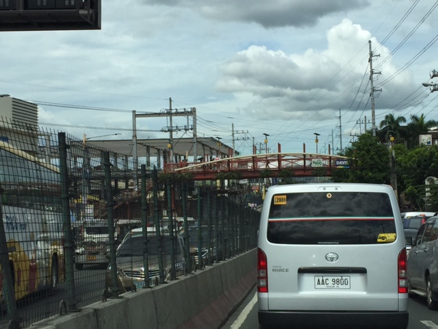 That’s another mall being built across the Bali Oasis near the Manggahan Floodway
Among the future major traffic generators that will likely make traffic congestion along Ortigas Avenue worse are the following:
- Residential development across Countryside subdivision
- Town center development near Valley Golf
Commuters using this corridor will likely find traffic worsen (could it really get worse than what it is now?) and traffic schemes by the LGUs along the corridor (i.e., Pasig, Cainta and Taytay) will not be enough to alleviate traffic over the medium to long term. Only a dedicated mass transit line can provide significant improvements for travel along this corridor.
I am still wondering about the mass transit solution for this corridor. There are arguably more people traveling along Ortigas Avenue compared to Marcos Highway that already has Line 2 under construction. I’m sure if you asked people when a mass transit line’s needed along Ortigas, they will reply “years ago”. Being one who has traveled along this corridor since the 1970s (I was a resident of Cainta and then of Antipolo), I can say that traffic indeed has worsened over the last 3 decades. Travel demand management (TDM) measures such as number coding and transport systems management (TSM) schemes such as Pasig’s one-way scheme will not be enough to address the growth along the corridor as they were and are not enough in the first place.
–
Public transport’s importance to a city
I found an “old” article on public transportation and its importance to cities:
Public Transport is Worth Way More to a City Than you Might Think, [by Eric Jaffe in http://www.citylab.com, August 14, 2013]
While much attention has been on walking and cycling, which are essential modes of transport, I believe public transport has an even much more value especially given the land use in many cities. This is particularly true in the Philippines where land use planning is basically a term since implementation is generally weak. This is very much evident in the case of residential development and the limited choices for transport. Many people, for example, reside in the periphery of Metro Manila and its surrounding areas. They often commute over long distances and incur long travel times due to congestion roads. Mass transit infrastructure could have made commutes faster, saving precious time that translates into economic value.
–
New ruralism, anyone?
I found this interesting article that tackles what to me is a new concept although it shouldn’t be. The concept of new ruralism to me is somewhat going back to the basics. While urbanization seems to be an unstoppable force, there is still the need to preserve rural areas and also the way of life as well as the industries that we need to sustain urban living. Food production, for example, is something that is being advocated or promoted in urban areas but hasn’t really caught on. Farming seems to have lost a lot of people as it is perceived as backward and yet it is essential.
New Ruralism: Solutions for Struggling Small Towns [by Jared Green in The Dirt, June 14, 2017]
What do you think about this concept of new ruralism? Is it something that’s also applicable to the Philippines or is will it be just a fad?
–
Challenges for students commuting to/from schools
Its our first day of school for our daughter today. But unlike her, I recall that I had to wake up early when I was in grade school and high school because the ‘service’ providing transport to and from school had to pick me up and then others. That usually meant a 5:30 AM wake up, a quick shower, dress-up (we wore uniforms) and breakfast before the ‘service’, an AUV, picked me up at home. School started at 7:30 AM and it took something like 45 minutes (depending on traffic) from our last pick-up to get to school at exactly 7:30. If our vehicle is able to finish pick-ups earlier, that meant we were assured of not being late for homeroom period. If the other kids (and there are many) are running late and we end up waiting longer for each, then we would likely be late. In many cases, our driver would have to resort to being reckless in order to make the time.
Nowadays, I think its much more difficult for kids due to the worsening traffic congestion. What was a 30 to 45-minute travel time between our home in Cainta to Pasig/Mandaluyong is now easily twice or longer that. And I am only referring to a direct trip. Even with Waze available, one can only have few options for routes between home and school.
While there are still many school ‘service’ vehicles (and not so many actually buses), many parents seem to have opted to Ateneo, for example, used to have a fleet of buses transporting students. These were replaced by AUVs and vans accredited by the school, and the many (too many?) private vehicles ferrying mostly individual students to and from their Quezon City campus.
 School children have to wake up early to go to school. Some probably take their breakfasts as baon in order to save time for traveling. Some take their breakfasts at nearby eateries or fast-food restaurants.
 Many children may be at risk as they are ferried to school via motorcycles and usually without helmets. In other cases, there are tricycles acting as school service vehicles. Often these are overloaded with children and their school bags.
Pedestrian facilities are also lacking in many cases and particularly in rural areas where public schools are located along highways that have no sidewalks or cities where pedestrian walkways are not built to standards for one reason or another. These are issues that need to be addressed and would be nice topics for research, especially those with practical and safety applications.
–
On the transportation aspects of Antipolo’s pitch for the senate to relocate there
I was browsing Facebook the other day and found an interesting post by the Antipolo City Government’s official account. They posted about the presentation made by the current mayor to the staff of the Philippine Senate, selling the idea for the Senate to relocate from its current location in Pasay City. There are currently two options known to us: Fort Bonifacio in Taguig City and Antipolo City in Rizal Province.
The Antipolo government’s post stated that it only takes 25 minutes between the the Batasan Complex and the proposed site, which is on land owned by the Antipolo City Government. This was probably based on travel time estimate using a tool such as Open Street Map. This though is inaccurate since travel times are affected by various factors and will vary according to time of day, day of the week and even month.
 Open Street Map visualization of travel route and time between Batasan Complex and the proposed site for the Senate
 Google Maps visualization of alternative routes and typical travel times
I took the preceding screen captures at 10:00 AM on June 23, 2017 (Friday). Open Street Map’s version can be misleading because it states a travel time assuming practically no traffic (~26 km in 27 minutes or about 58 km/hr in terms of travel speed). Google Maps version is better as it accounts for typical traffic during a certain time of travel (i.e., 10AM). Thus, there’s the more realistic 1 hour travel time for the same distance (about 26 km/hr travel speed). Google’s is based on crowdsourced data and can be customized based on the day and time of travel (e.g., 8:00 AM on a Monday). And I wouldn’t even want to get into the discussion of the accuracy of the claimed 40-45 minutes to/from the airport (i.e., NAIA). Again, anyone with Waze or Google Maps can get more realistic travel time estimates for such trips.
What would be the transport impacts of such a relocation. For one, employees of the Senate (and I am not even considering the Senators and their closest staff here) would have to travel from their residences to the proposed site in Cabading, Antipolo City. Where do these staff live? If they were from Manila and they take public transport, that probably means they would have to take the LRT Line 2 to Masinag and then take a jeepney from Masinag to the site. Line 2 would present the most efficient option in terms of travel time and cost compared to taking a jeepney or van via Cubao. I am not aware of any direct transport services for them although we can speculate that perhaps new routes can be established. The Senate has shuttle buses so these would also be an option for those taking public transport. Car owners will have to travel and converge along Marcos Highway. It is uncertain when the extension to Cogeo will be decided and constructed, if at all.
There is also mention of the plans for Circumferential Road 6 (C-6). However, the reality is that government is taking its time in upgrading the existing sections in Taguig, Pasig and Taytay. The Taguig sections are in a very bad state now after the onset of the wet season. Dealing with the ROW acquisitions necessary for planned C-6 sections is already a big challenge as the areas are already built up or developed (mostly residential subdivisions).
Having the Senate complex in Antipolo will have repercussions on land use/development as well as land prices and rent. It will be located at a relatively undeveloped part of the city and will likely encourage urbanization there. Antipolo should be careful in regulating land development so that the area will not become another Batasan with all the informal settlements and the low density developments around it. There are many opportunities here to develop the area into a showcase government center and that should include planned development for residential, commercial and institutional uses. The housing options should include affordable walk-up apartments as well as medium rise buildings like those by DMCI and Filinvest. It is important to emphasize that options for affordable housing near the workplace cannot be provided in Fort Bonifacio since land and residential unit prices there are already very expensive; forcing most Senate staff to live outside and away from their offices. Such a situation necessitates long commutes and contributes to congestion.
To be fair, there is a good potential for congestion reduction if the Senate relocates to Antipolo. Perhaps the concept of a “New Town” in the proposed site can be developed in more detail. But questions arise: Will this attract major schools, for example, as well as offices such as BPOs? What is definite is that Antipolo will not be the only LGU that will benefit (economically) here but perhaps much of the Province of Rizal, too, as well as the nearby cities of Marikina and Pasig.
Decongestion can happen if:
a) Senate staff decide to move to Antipolo and environs (e.g., Marikina, Cainta, Tanay, etc.).
b) A significant number of staff reside at the proposed dormitories during much of the weekdays, and go home only for the weekends and holidays.
c) Efficient public transport is provided for them and Antipolo constituents along the corridor to be served.
d) Sustainable transport facilities like walkways and bikeways be developed to reduce dependence on motorized transport especially for short distance travel.
In the end, though, I think it will be the Senators who will be making the decision on this matter. Will they be more practical, pragmatic, or insensitive to the consideration of their staffs? Abangan!
–
Praise and criticism about Uber
I found a couple articles on Uber. These are by the same author and are interesting because of some changes in perspectives considering the more than 1 year separating the two.
In Praise of Uber [by Jean-Louis Gassee in mondaynote.com, Medium, May 9, 2016]
Uber’s Complicit Board [by Jean-Louis Gassee in mondaynote.com, Medium, June 26, 2017]
I’m posting these here as additional references on ridesharing/ridesourcing. Such perspectives are also invaluable for us doing research on these topics. I am not so much interested in the personalities but on the operations and the experiences and preferences of passengers.
–
Give way!
Road courtesy can be a scarce thing in many Philippine roads. In many road crash incidents, it can be quite obvious even to the casual observer that one of the problems we have is drivers and riders not practicing common courtesy. Hindi nagbibigayan. This is the case in most intersections where no traffic signals are installed and operational. Congestion occurs as drivers and riders try to impose their right of way over others. The absence of traffic personnel, even those who have limited capabilities managing traffic, further exacerbates the situation as motorists tend to ignore traffic personnel. Based on my observations, the most guilty of ignoring traffic rules and regulations including the enforcer on duty are motorcycle riders, followed by public utility vehicle drivers.
Below is a scene that greeted me one morning during my commute to my workplace. Maj. Dizon is a secondary national road passing through a residential area in Quezon City and Marikina; connecting C-5 with Marcos Highway.
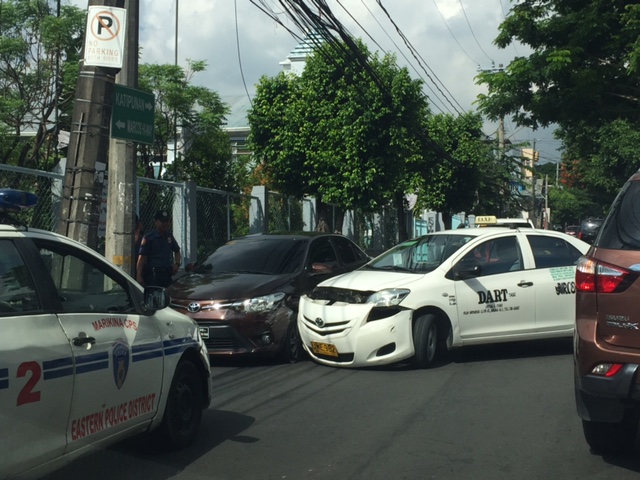
Who had the right of way here? Did the private car have the ROW and the taxi driver tried to impose himself (cut into the path of the private car) thinking that the private car driver will slow down to give way? Or did the taxi driver have the ROW but then the private driver decided to accelerate so as to prevent the taxi from completing the maneuver? Either are likely cases and are often the cause of crashes like this.
Other situations that are common are vehicles maneuvering (e.g., backing or turning) but tricycle drivers and motorcycle riders proceeding despite the clear ROW for the maneuvering vehicles. In certain cases, large vehicles like trucks have blind sides and have resulted in their inadvertently hitting motorcycles who riskily and recklessly maneuver with respect to the trucks.
How do we address such behavior? It likely is rooted from how drivers and riders learn to drive or ride so its starts with that stage. Many people learn to drive or ride from peers or their seniors (e.g., parent, uncle, family driver, company driver, etc.) while others learn via driving schools. Do they learn courtesy from their ‘teachers’? Are driving schools imparting this or just teaching people how to operate a vehicle? Then there is the licensing stage. The Land Transportation Office (LTO) is also responsible for assessing whether those applying for licenses are qualified. Both the written and practical exams should contain elements related to the practice of courtesy. And then there is the enforcement aspect, which has the burden of educating drivers and riders by accosting and reminding (lecturing?) motorists about proper driving and riding etiquette. Of course, you have to have capable enforcers in the field whether they be traffic aides or police officers.
–
Some nice articles on innovation in transport
Following are a couple of articles on innovation as applied to transport. Uber is often seen merely as a transport option much like the taxi but there’s more than meets the eye in terms of its operations never mind its surge pricing schemes. It has succeeded in much part because it is an innovative company with innovative people. They were not afraid to take on the challenges against what the establishment had regarded as an upstart in a sector that was seen as having fewer opportunities for thinking out of the box.
Today is my first day at Uber [by Chris Messina in Medium, January 5, 2016]
Today is my last day at Uber [by Chris Messina in Medium, January 7, 2017]
–
Challenges for Uber, and ridesharing in general
Uber was in a crises of sorts after several leading to its controversial head stepping down a few days ago. Several articles came out including one from Wired that provided some details to some of the significant stumbling blocks or obstacles Uber had to go through the past years (even recent months). There’s an even better article by one of Uber’s co-founders, which I found and regard as “even better” because it appears to be a self assessment, a reflection of how the company should move forward.
Following are the two articles, one from Wired and another from Uber (via Medium):
- A Short History of the Many, Many Ways Uber Screwed Up [by Davey Alba in Wired, June 21, 2017]
- Uber’s path forward [by Garrett Camp in Medium, June 21, 2017]
These are important to us who are doing studies on ridesharing/ridesourcing. I believe Uber and its kind including Grab has revolutionized transport and contributed in significantly improving mobility among a lot of people who have been marginalized by what we have termed as conventional transport. Senior citizens and persons with disabilities, for example, who have had difficulties getting rides can (if they can afford it) get Uber or Grab vehicles to take them where they need to be. There are indeed issues but as the article by Camp states, these can be resolved or addressed to improve the services provided by ridesharing/ridesourcing companies.
–
Some articles on walking, biking and transit for wellness
Here are a couple of recent articles on walking, biking and transit:
Walk, bike, and transit benefits boost people of all incomes [McAnaney, P. in Greater Greater Washington, June 13, 2017]
“Bikes are happiness machines.” Behind the Handlebars with cyclist extraordinaire Joe Flood [Maisler, R. in Greater Greater Washington, June 7, 2017]
I posted these partly for future reference but also to promote walking, biking and public transport. These are essential elements for mobility anywhere and governments should ensure that people have these as options for traveling about and not be dependent on automobiles for transport.
–
