
TSSP 2019 Conference in Cebu City
We just concluded the 2019 version of the Annual Conference of the Transportation Science Society of the Philippines (TSSP). This year’s conference was co-organised with the University of San Jose-Recoletos (USJR), whose College of Engineering hosted the event. The conference included a pre-event activity – the Workshop for Young Researchers (WYRe) held on July 25, the conference proper on July 26, and the Technical Tour at the project site of the Cebu-Cordova Link Expressway (CCLEX) project on July 27. Here are some initial photos from the conference:

Dr. Sheilah Napalang, former Director of the National Center for Transportation Studies (NCTS) and now Asst. Secretary of the Department of Transportation (DOTr), facilitating the Workshop for Young Researchers (WYRe).

Backdrop for the plenary sessions of the conference

Opening program speakers included (L-R) Rev. Fr. Cristopher Maspara, OAR (USJR President), Dr. Ricardo Sigua (TSSP President), Dr. Enrico Paringit (DOST-PCIEERD Executive Director). The photo also shows our co-organizers, Dr. Dennis Anthony Kilongkilong (Dean of the USJR College of Engineering) and Engr. Elvira Sales (Chair of USJR Dept. of Civil Engineering).
More photos on the conference in the next post!
–
Walking in downtown Cebu City
Last month when we were in Cebu to coordinate with our counterparts at the University of San Jose-Recoletos (USJR), I took some quick photos of the sidewalk scenes near the university. We stayed at a nearby hotel so that meant we only needed to walk to/from USJR for our meetings. Here are some of those photos.
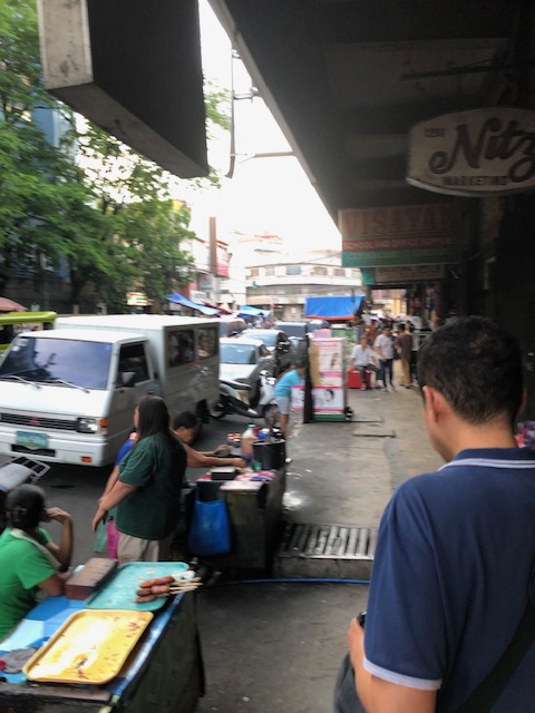 Many buildings in the downtown area have designs where sidewalks are practically covered, protecting pedestrians vs. the elements. This alludes to arcade design architecture you find in many old cities’ downtowns including Manila, Iloilo and Bacolod.
 There are many shops and stores at ground level. Depending on the area, there will be hardware stores, electronic stores, school supplies and others.
 Along some streets, one will find makeshift stalls occupying the road itself. I assume these are allowed by the city along certain streets.
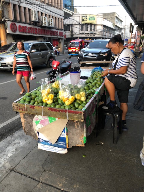 Typical street vendor with his mobile store. Fruits, local delicacies and snacks, and refreshments are popular.
I believe these scenes reflect on the character of the city and gives the visitor a view of life in the downtown area of the city, which in this case is Cebu, the oldest city in the country. I will be back in Cebu soon and will be taking more photos around downtown. I’ll be posting these, too.
–
One small step and a giant leap
Here’s a different kind of article that blends three of my favourite topics – transport, space and watches. Its the 50th anniversary of the first moon landing. That’s the Apollo 11 mission in 1969. It took a lot of calculations for men to finally reach the moon and return safely to earth. There certainly were a lot of factors that affected the trip and these are not as simple as traveling between points A and B like what we usually try to figure out for conventional earthbound transport.
Did you know the first watch on the moon was an Omega Speedmaster chronograph? They needed them and other instruments for their precision that’s required for such sensitive and demanding missions.
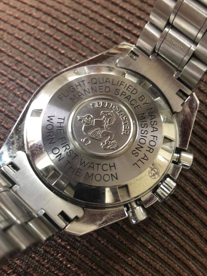 Subsequent versions of the moon watch have already had updated movements inside them but these Speedmasters are still the standard in as far as NASA is concerned.
There were actually 2 moon missions in 1969. The first one, Apollo 11, in July and the second, Apollo 12, in November. The next one, Apollo 13, was a failure in terms of the moon mission but succeeded in terms of the astronauts surviving what must have been a terrifying ordeal in space. If you watched the movie, there was a part there that was supposed to have happened where they used it the chronograph of their watch to time a procedure they had to do while troubleshooting their module.
Quite expensive these Omegas are. However, there’s another watch that has been officially recognised as used on a moon landing. That other moon watch is a Bulova (sorry Rolex but the watch that was supposed to have been brought to the moon was more an accessory or memento than an instrument actually used by an astronaut on the moon). Here’s a piece associated with the 4th (Apollo 15 in 1971):
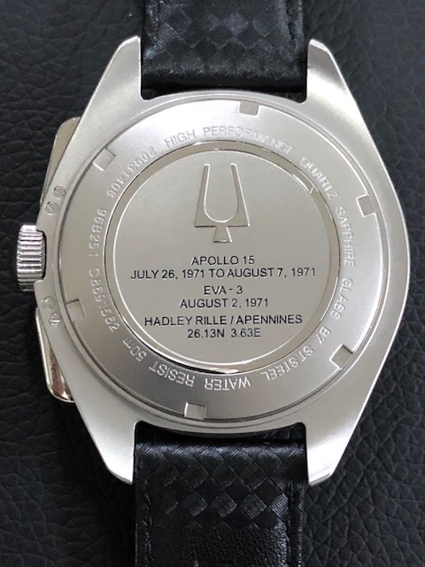 Back of a Bulova moon watch model stating the mission when it was used.
–
Slippery when wet
On rainy days like this, motorists need to heed advice to be more careful in driving or riding. Pavement surfaces are slippery and conditions may lead to drivers or riders losing control when they speed or execute risky manoeuvres.
It is not uncommon for road crashes to occur during rainy days. However, most if not all are preventable if people would just exercise extra caution. Slowing down, for one, is among the most effective ways to avoid situations that lead to crashes. You tend to lose control of your vehicle with excessive speeds and so slowing down makes sense.
Spacing also helps; especially between you and the the vehicle in front of you. Braking distances are longer along wet roads so make sure to maintain the proper distance between vehicles. A good rule of thumb is at least 1 car length per 10kph you are traveling. That’s at least 3 car lengths between your vehicle and the one in front, for example, when you’re traveling at 30 kph.

New public utility vehicles in Cebu
There have been a lot of new models of vehicles serving as public transport in Metro Manila. It came as no surprise that we found similar vehicles (e.g., Beep or modern jeepneys as some people refer to them) as well as buses in a city that was supposed to have had the first operational Bus Rapid Transit (BRT) line in the country. Sadly, the Cebu BRT has not been constructed and now national government agencies and the local government is mulling a light rail transit system instead. Here are some photos of the Beep vehicles operating in Cebu as well as a couple of bus services.
 Beep mini-bus beside an old jitney – the vehicle sizes are comparable but the Beep capacity is larger. The Beep is also air-conditioned and features a layout similar to buses.
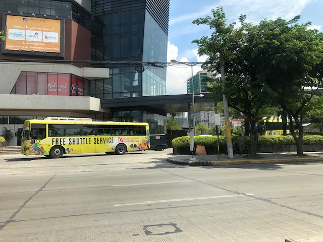 Free shuttle bus service provided by Robinsons Malls
 Beep serving the City Hall – IT Park route
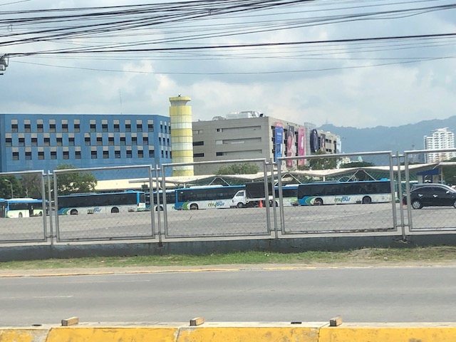 MyBus depot at the SM City Cebu North Reclamation Area – these are currently plying the route connecting SM City Cebu with SM Seaside. The route is actually one that was considered for a pilot Bus Rapid Transit (BRT) line – supposedly the first one in the Philippines – that did not come into reality.
–
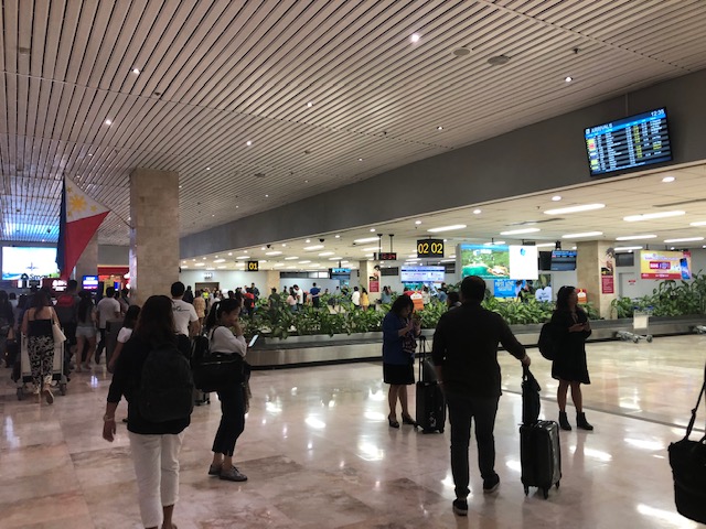
Another look at the Mactan Cebu airport taxi stands
This is the last of three posts about our recent arrival at Mactan Cebu International Airport. Following are more photos; this time from exiting the terminal building to the transport stand and driveway.
 Arriving passengers exiting the Terminal 1 building and heading to the driveway for transport
 Directional signs for various road transport options at MCIA. These include metered taxi, white taxi (airport taxi) and bus
 The driveway also includes bays for private vehicles. These are mixed with rideshare vehicles such as those with Grab.
 Metered taxi stand – there used to be a Grab booth here but I couldn’t find them in the area so either they might have set up somewhere in the airport or perhaps it is assumed that people can manage with their apps on their smartphones.
–
A little bit of history – on how the US interstate highway system came to be
Here’s one of those quick shares that I usually post here. I am a bit of a history buff and mixing that with transport will likely lead to a post like this. Here is a short article about an event in the history of the US Army that happened 100 years ago:
editor@aashto.org (2019) Celebrating Highway History: The US Army’s 1919 Cross-Country Convoy, aashto.org, https://aashtojournal.org/2019/07/12/celebrating-highway-history-the-u-s-armys-1919-cross-country-convoy/ [Last accessed: July 12, 2019]
The article was particularly interesting for me because of two items: the road conditions and the man behind the US inter-state highway system. It took them a little over 2 months to cross the continental US because of poor road conditions. Many people have no sense of history and appreciation of what has been accomplished over the years and how difficult it was to travel at the time. I haven’t done the cross country trip but I have close friends who’ve done it and are thankful for the generally good roads they could use for the experiential road trip. Meanwhile, the person in the article – then Lt. Col. Dwight D. Eisenhower – is a man who made his mark in history at first as the Supreme Commander of the Allied forces in the European Theater in World War 2, who would later on become President of the US. I read elsewhere that the US interstate highway system was designed so aircraft may use them as runways in cases when the US were at war and the enemy had bombed their airports and airfields (just like what the Japanese did in the Pacific).
Do we have similar accounts for our roads and bridges in the Philippines? Were there key persons who may or may not be larger than life figures instrumental in developing our road infrastructure with their vision and leadership (Marcos doesn’t count because of his bogus military record and corrupt regime)? It would be nice to compile these and perhaps it should be a collaboration between the Department of Public Works and Highways (DPWH) and the National Historical Commission (NHC). They could even get the history departments of local universities involved for us to understand the evolution of transportation in this country.
–
Mactan Cebu airport arrival – Part 2
This is a continuation of the feature on arriving at the Mactan Cebu International Airport (MCIA). In the previous post, I shared photos of our arrival at the new Terminal 2 and our walk from T2 to the domestic Terminal 1.
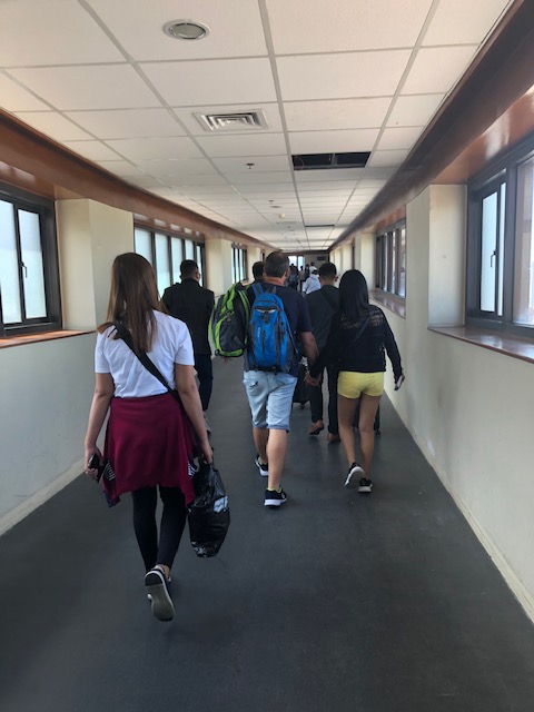 Passengers continue to the corridor on the Terminal 1 side
 Take-off run for a commercial flight
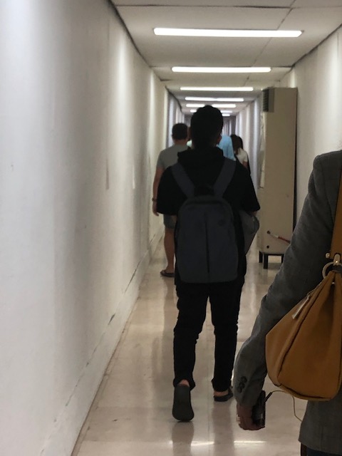 Cramped corridor for arriving passengers heading to the baggage claim area
 Bridgeway or tube at T1
 We emerged from the corridor to the T1 building and a sign showing us the way to the baggage claim area
 Descending the stairs or escalator to the arrival level and the baggage claim area
 Visitors are greeted with posters showing Cebu’s attractions as well as ads for residential and resort developments. Also shown in the photo are information boards on arriving flights.
 Baggage claim area for domestic flights – notice the passengers with their carts or trolleys crowding along the conveyor system.
 Another look at the baggage claim area and a less crowded conveyor
More photo of the arrival including the taxi stand soon…
–
Mactan Cebu airport arrival – Part 1
We were treated to a somewhat pleasant surprise upon arriving in Cebu’s Mactan International Airport a couple of weeks ago. The surprise was that our plane taxied to and berthed at the new Terminal 2, which was for international flights.
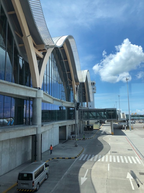
 A view of the MCIA Terminal 2 from our taxiing aircraft
 A closer look at MCIA T2 as our plane turned towards the apron
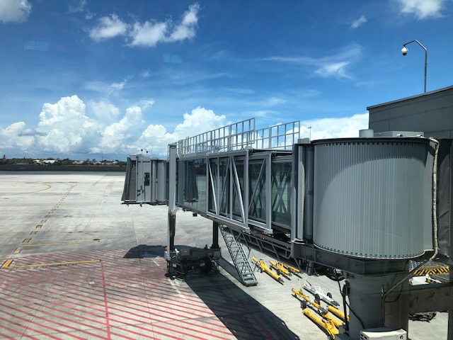
 Passengers deplaning via the T2 tube
 A view of MCIA T2 from the airbridge
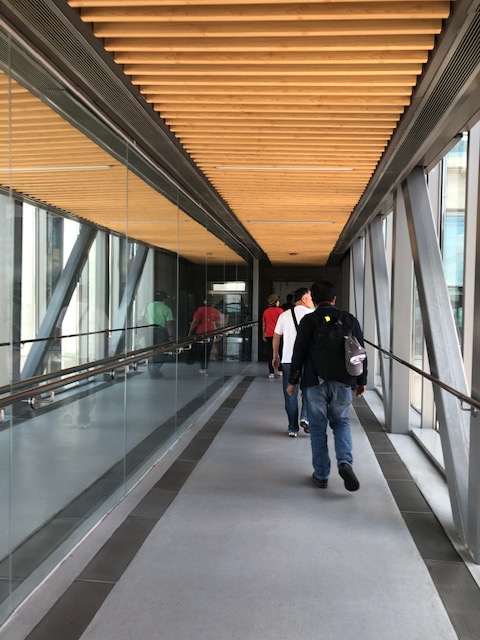
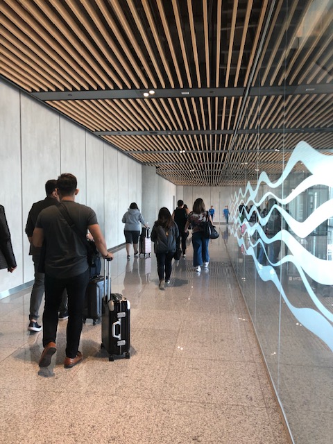
 View of the tarmac and one of the airbridges as we walked along the corridor lined along the terminal’s departure level that connected to another corridor for the old Terminal 1.
 Corridor along Terminal 2 connecting to Terminal 1
 A snapshot of the tarmac
 The interior design elements of MCIA Terminal 2 evoke a local, Asian flavour
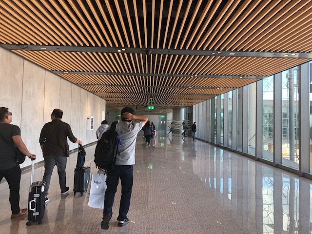 Spacious corridor towards Terminal 1
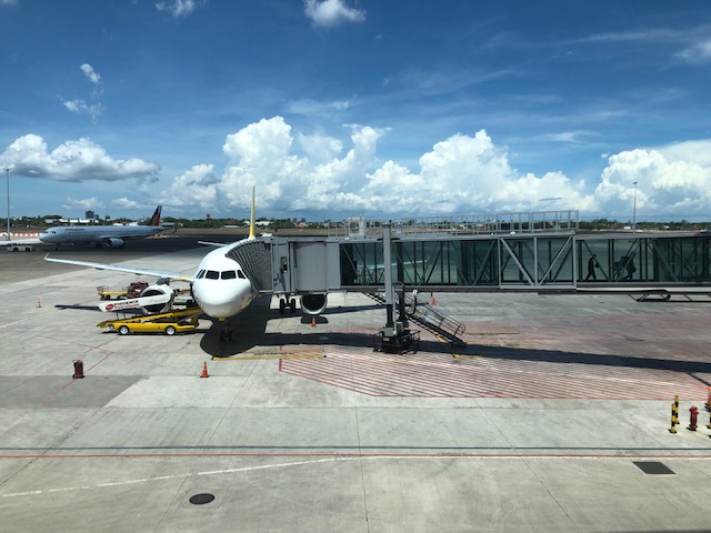 A look at an aircraft berthed at MICA T2
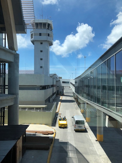 Bridge connecting Terminals 1 and 2 with a view of the air traffic control tower
 Passengers walking to T1
 Interphase of T2 with T1 at this point of the bridgeway
More on MCIA soon!
–
Aerial photos of Cebu and Mactan
I enjoy taking aerial photos when the opportunities present themselves. Leaving Cebu for Manila a couple of weeks ago, I was able to take some nice photos as or plane took off and cruised over Mactan Island. Here are some of the better photos:
 A view of Mandaue and Cebu cities across from Mactan Island as our plane took off from the airport
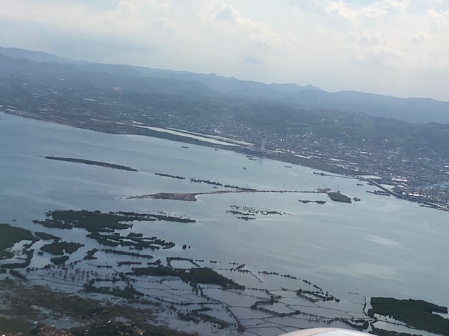 Here’s a first look (a bird’s eye view) of the ongoing construction of the third bridge connecting Cebu and Mactan Islands. This is part of the Cebi-Cordova Link Expressway (CCLEX) project.
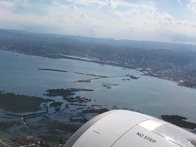 Here’s another view of the island with the airplane engine in the photo.
 Here is a close-up photo of the island where tall columns will be built to support the CCLEX bridge. The viaduct in the photo is the one connecting downtown Cebu City with the South Reclamation Project area that includes the SM Seaside development.
 The SM Seaside as seen from the air
 Here’s a view of the South Reclamation Project area with SM Seaside as our plane turned north towards Manila.
 Another view of Cebu City and the SRP
 Here’s my favourite shot of Cebu and Mactan Islands with the SRP on the foreground, the CCLEX bridge under construction and Mactan International Airport
–
