
Disaster preparedness and resilience for the Philippines
The earthquakes that affected mainly the provinces of Bohol and Cebu in central Philippines this morning reminds us of the need to be more prepared for such natural occurring calamities that are practically unpredictable. I like what the Phivolcs Director Renato Solidum stated about the need to check design, materials and construction workmanship for structures in order to have these built in compliance with structural engineering guidelines covering seismic design. These apply also to transport infrastructure like roads, bridges, airports and ports. These are important for relief operations as accessibility is critical to mitigate impacts of disasters.
I post the photos of some of the heritage churches we were able to visit during travels to Bohol in 2008 and 2012 as a reminder of sorts of what we probably have lost in terms of cultural heritage assuming we are unable to restore these structures to their old forms. Perhaps the local (and national) chapters of architects (UAP) and civil engineers (PICE) should pitch in to make sure restoration work will be undertaken with care and of the highest quality.
 Bell tower of the Loboc Church in Bohol, which crumbled due to the earthquake
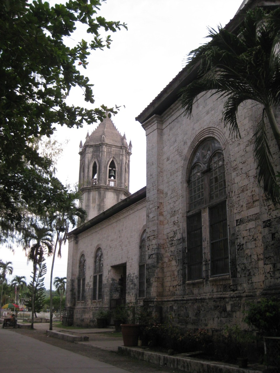
 Loboc Church, which was also destroyed by the earthquake
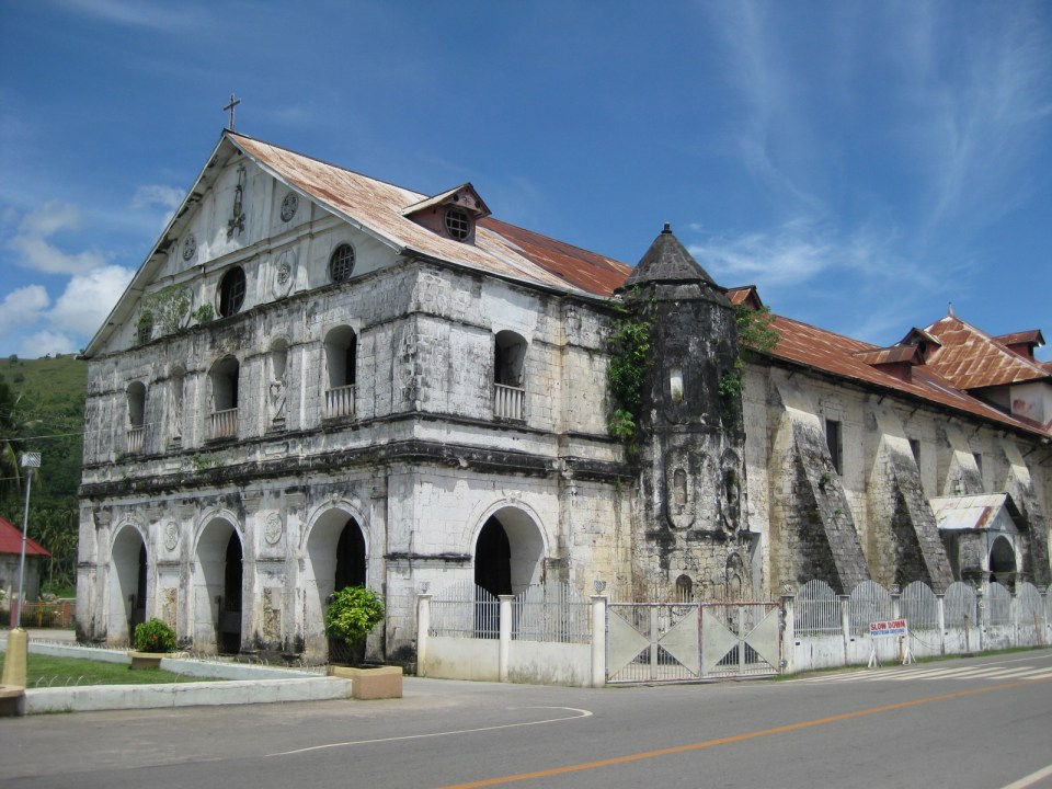
 Baclayon Church, also in Bohol, whose watchtower was destroyed by the earthquake
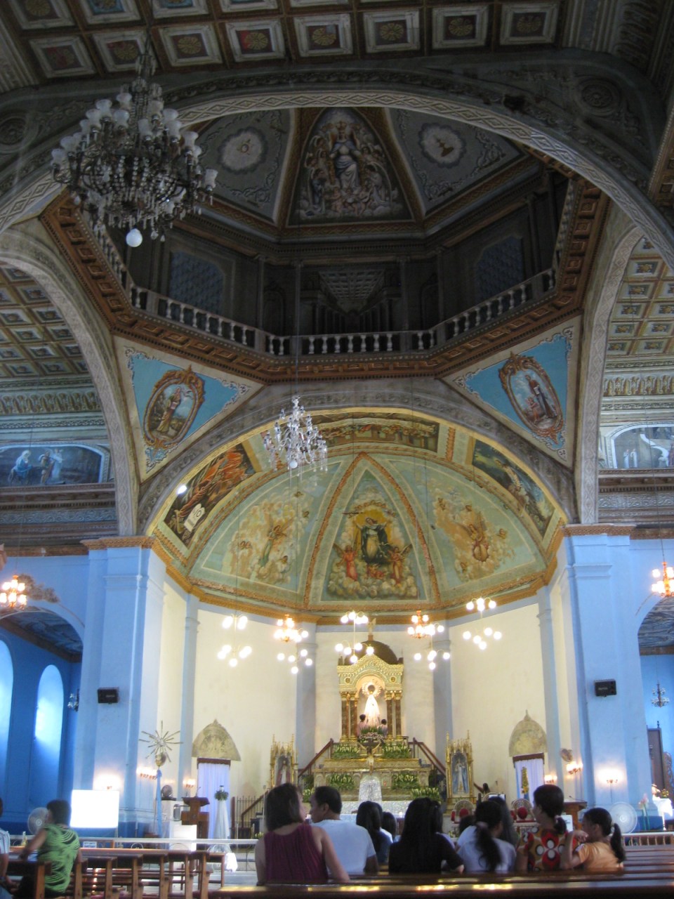
 Interior of Baclayon Church
 Facade of Dauis Church in Bohol that was also destroyed in the earthquake
 Another view of Dauis Church
 Interior of Dauis Church
.There are many heritage structures around the country and in the nearby islands of Panay and Negros alone, there are many examples of these that need to be assessed and perhaps fortified in the likely occurrence of a powerful quake in the future. In addition, the damaged roads and bridges and the landslides that have blocked many roads reminds us of the need for more disaster resilient transport infrastructure. Resilience may also mean the provision of redundant infrastructure to ensure alternate routes for relief operations.
–
Dissertation defense
After a series of posts on my recent travels, here’s something on the serious side:
The oral defense of the dissertations of Ph.D. in Civil Engineering (Major in Transportation Engineering) Program doctoral candidates, Mr. Ernesto B. Abaya (staff/affiliate student/ERDT scholar) and Mr. Alex S. Ladaga (affiliate student/CHED scholar) with topics on transportation & environment and traffic flow theory, respectively, will be on October 21, 2013 (Monday) from 9:00 AM and from 1:00 PM at the National Center for Transportation Studies. Details are shown below:
ERNESTO B. ABAYA
“DEVELOPMENT OF DRIVE CYCLES & ESTIMATION OF FUEL CONSUMPTION FACTORS OF LIGHT DUTY VEHICLES IN METRO MANILA”
21 October, 2013, Monday, 9:00 AM at the Toyota Training Room, NCTS, UP Diliman
Dr. Edwin N. Quiros (UPD-DME), Panel Chair
Dr. Hilario Sean O. Palmiano (UPD-ICE), Panel Member
Dr. J. B. Manuel M. Biona (DLSU-COE), Panel Member
Dr. Karl B. N. Vergel (UPD-ICE), Panel Member (Adviser)
Dr. Ricardo G. Sigua (UPD-ICE), Panel Member (Co-adviser)
Abstract: The urban drive cycles for five different light duty vehicles (LDV) are developed in this study. Furthermore, the fuel consumption factors for each of the type of LDV are estimated. The study presents the methodology in the development of the drive cycles in which the speed profile of the specific type of vehicle is surveyed, downloaded and processed. In the survey of speed data, a Global Positioning System (GPS) device is used as an on-board instrument. The GPS device is placed on the dashboard of every surveyed vehicle and it recorded instantaneous speed in its memory. The speed data is downloaded from the device using software provided by the maker of the device (Garmin) called Mapsource. The speed data is processed using a program to execute the methodology in generating candidate drive cycles. The program creates drive cycles by randomly appending microtrips to form a minimum of twenty minute speed time profile. Furthermore, along with the generated drive cycle, the program also indicated how it compared with the target drive cycle by computing their individual absolute value difference of their joint speed-acceleration probability distribution. Ten drive cycles for each type of LDV are developed which have absolute value differences less than 20%. The final drive cycle is selected from the ten (10) candidate drive cycle developed from each type of LDV. The selected drive cycles are then used in the Vehicle Research and Testing Laboratory at UP College of Engineering, Mechanical Engineering Department, to estimate the fuel consumption factors of each type of light duty vehicle considered. The developed drive cycles for the different types of light duty vehicles, namely (1) private cars, (2) taxicabs, (3) public utility jeepneys, (4) asian utility vehicles express, and (5) light cargo vehicles have average speeds of 17.97 kph, 13.57 kph, 10.87 kph, 14.69kph and 8.43 kph respectively. The fuel consumption factors estimated for all the light duty vehicles tested in the chassis dynamometer laboratory ranges from 9 to 12 km/liter.
Keywords: light duty vehicles, drive cycles, chassis dynamometer laboratory
—
ALEX S. LADAGA
“EFFECTS OF GAP FORCING ON THE CAPACITY OF TWO LANE ROUNDABOUTS IN THE PHILIPPINES”
21 October, 2013, Monday, 1:00 PM at the Toyota Training Room, NCTS, UP Diliman
Dr. Karl B. N. Vergel (UPD-ICE), Panel Chair
Dr. Jose Regin F. Regidor (UPD-ICE), Panel Member
Dr. Hilario Sean O. Palmiano (UPD-ICE), Panel Member
Dr. Ma. Sheilah G. Napalang (UPD-SURP), Panel Member
Dr. Ricardo G. Sigua (UPD-ICE), Panel Member (Adviser)
Abstract: Traditional method in estimating roundabout capacities using gap acceptance theory involves the assumption that vehicles entering the roundabouts give way to vehicles running along the circulatory road. Parameters usually used include the critical gap and the follow up times used by the entry vehicles. Gap forcing persists in local roundabouts and this common Filipino driver behaviour renders the existing models derived from traditional assumptions unsuitable for local applications. The study embarks on the development of the simulation model which takes into account gap forcing in the estimation of capacity of roundabouts in the Philippines. It explores the feasibility of introducing more realistic driver behaviour assumptions and the inclusion of additional parameters to come up with a model suitable for local use.
Keywords: roundabouts, gap forcing, capacity
—
On vending machines at rail station platforms in Japan
Earlier, I featured some conveniences at train stations that included vending machines on the platforms. Following are a few more photos including a couple showing the newest models of vending machines. These have touch screens showing the products for sale and even shows weather forecasts.
 Passengers using the new touch screen vending machines at a JR Line platform.
 The screen displays products as well as the weather forecast. On the right are disposal bins for bottles and cans.
 Conventional vending machines and trash bins at the Enoshima Dentetsu platform.
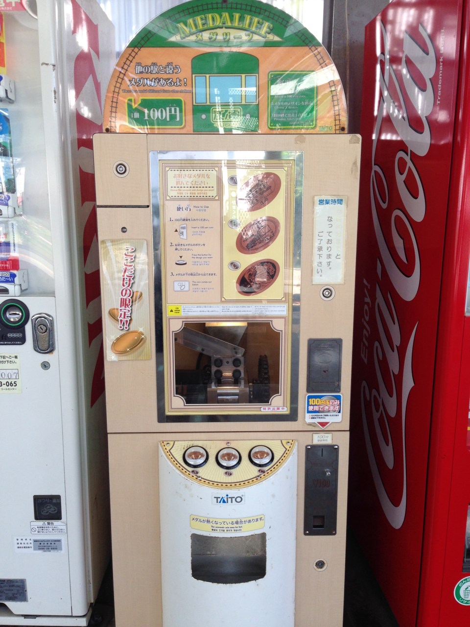 A souvenir machine featuring a metal press where the customer can choose among 3 designs.
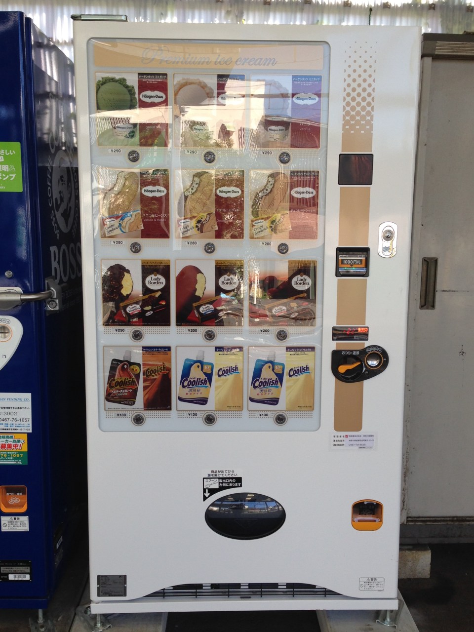 Ice cream vending machine.
–
Conveniences at the train stations and platforms
Japan is also famous for having a lot of vending machines dispensing everything from snacks, softdrinks and beer to toys and electronics, and even shirts and underwear! At the train stations there are also many vending machines in addition to the kiosks that are basically convenience stores. Here are a couple of vending machines and the garbage disposal bins beside them.
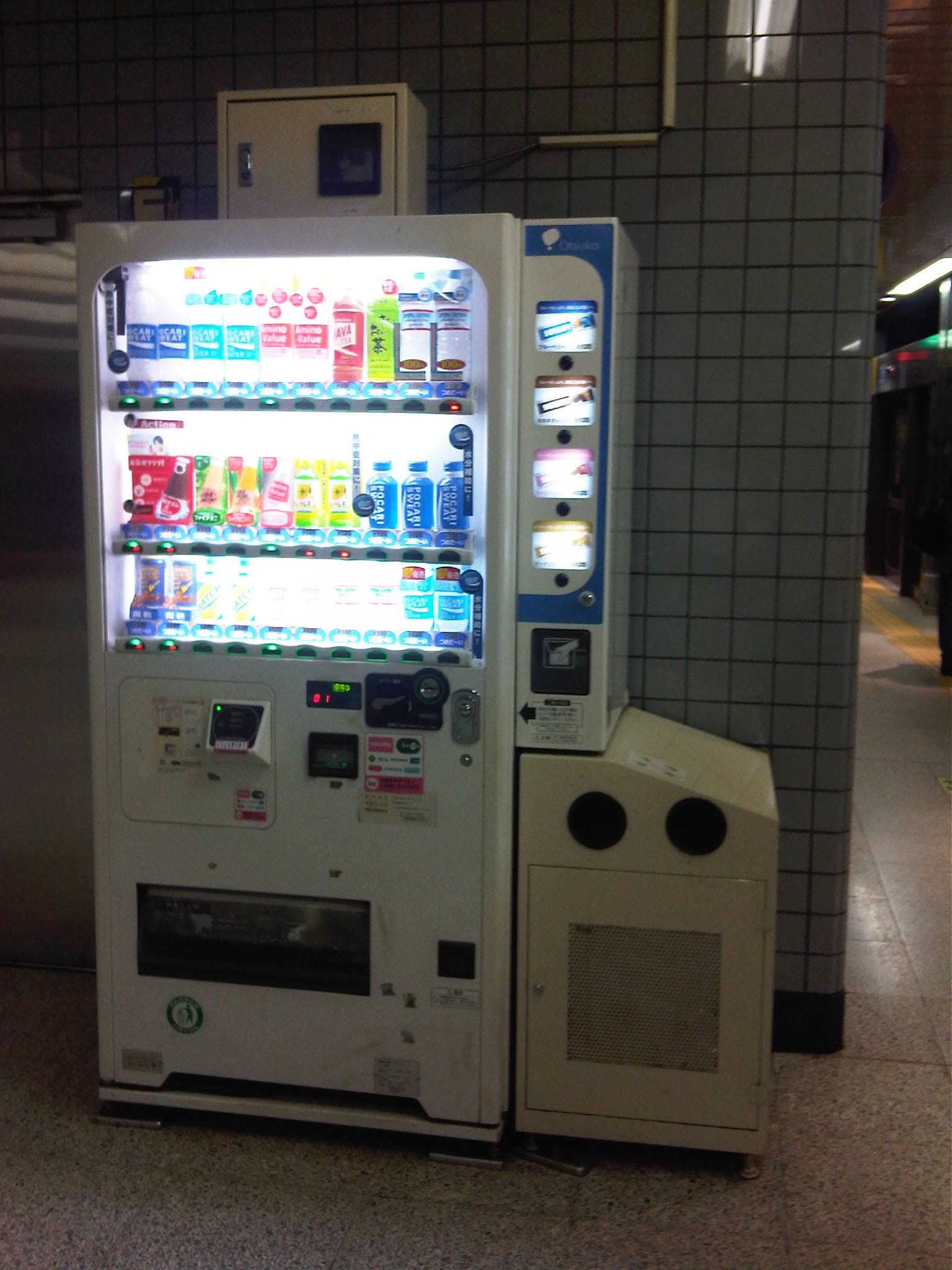 Vending machine at a Tokyo Metro platform
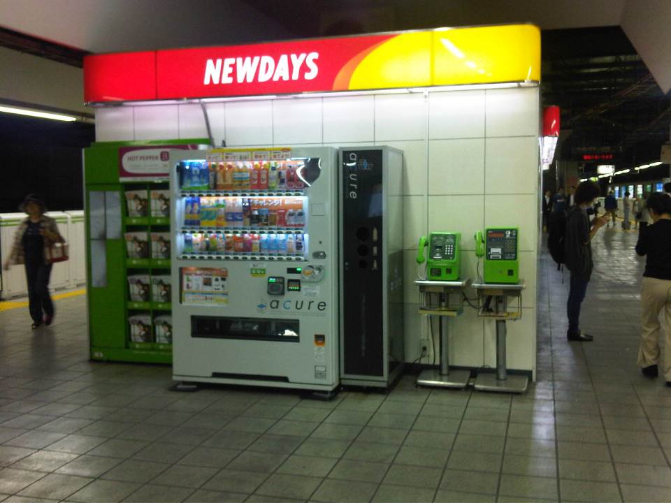 Vending machine and telephones behind a kiosk at a JR Line platform
Within the larger stations, there are also restaurants or eateries for those wanting a quick meal but happen to have already gone past the turnstiles. These are not your typical holes in the walls or fast food types. Instead there are also full service restaurants or cafes. Then there are food courts where commuters may have a good variety to choose from like the Tokyo Food Bar that I found at the JR Akihabara Station.
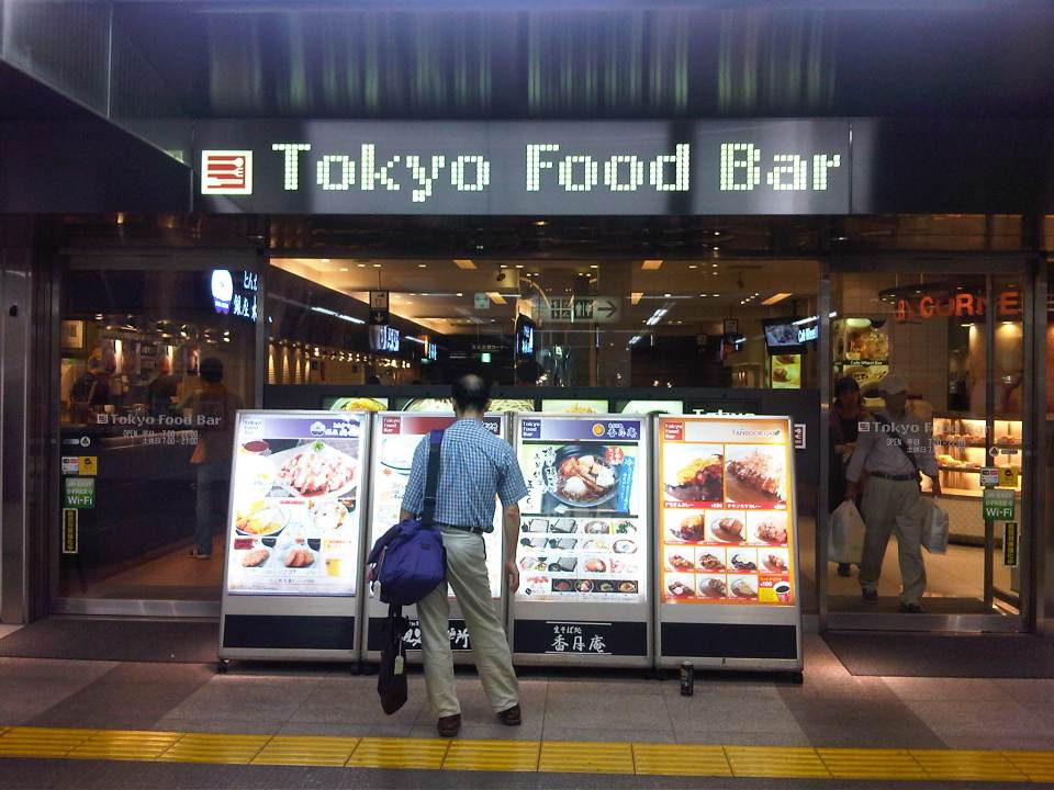 This food bar is very much like the food courts we find at malls. These offer a variety of selections for the hungry commuter. The signboards show the menus of establishments inside the food bar.
–
Calapan Port Passenger Terminal
Calapan City port’s passenger terminal is a nice, modern facility though I think it is insufficient for the number of people that are now using the terminal on a daily basis. I can imagine that the terminal can be congested during the peak seasons of travel. I took a few photos inside and outside the terminal during a recent trip between Batangas and Calapan.
 Pre-departure area at the Calapan port passenger terminal. I was impressed with the terminal that seems better than some airport passenger terminal I’ve seen in the country.
 Fellow SuperCat passengers waiting for our boarding call. One needs to approach the staff at the booth near the gate in order to get a seat number. Seats on board the fast craft are designated even with few passengers making the trip.
 Exiting the terminal to board our vessel, we proceed along a covered pier where our SuperCat and a FastCat ferry (shown at center) are moored.
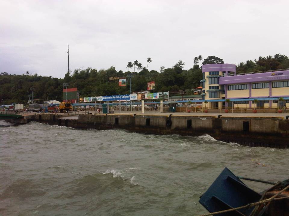
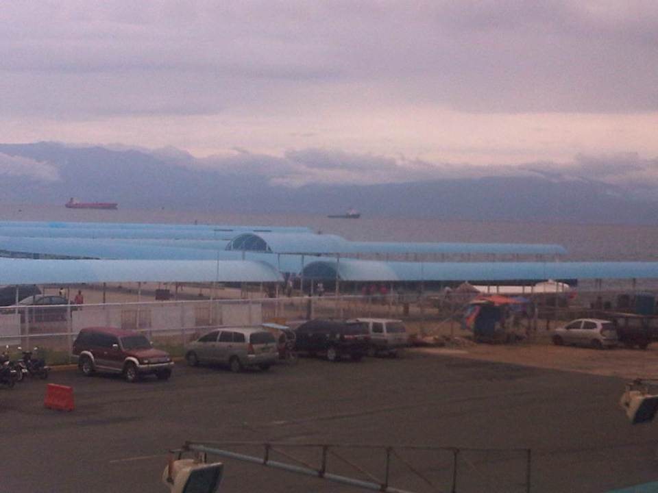
 The Calapan port passenger terminal as seen from the pier.
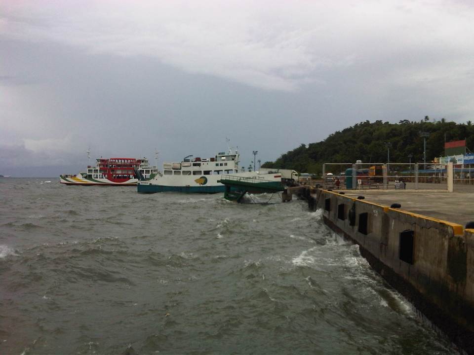 Rough waters hitting the port. Shown in the photo are RORO ferries docked at the port. We rode one of these on our trip from Batangas to Calapan.
 The FastCat is a relatively new service between Batangas and Calapan. It can carry a few vehicles much like the conventional RORO ferries but its twin-hulled design provides stability with speed over rough waters.
 Rear of the SuperCat
 A friend walking along the pier between a SuperCat and a FastCat. The SuperCat is purely a passenger vessel while the FastCat can carry a few vehicles with stability provided by its twin-hulled design.
 Rough waters in the late afternoon – similar conditions in the morning prevented us from taking a SuperCat to Calapan as fast craft trips were suspended.
–
Rail incidents
The big news in Japan today seems to be the rail incident where a woman saved the life of a man who attempted suicide or fell unto the rail tracks of the JR Yokohama Line. Unfortunately, the woman died as she was ran over by the train as she apparently positioned the man in between the tracks. As far as I could understand, it seemed that the barriers for a crossing were already down and the alarms announcing the arriving train were also engaged when a man entered the danger zone and fell (or laid) at the tracks. People including pedestrians and those in their cars were shocked by the situation but only the woman who was with a companion in a car decided to act to save the man from the oncoming train. Following are photos I took from a TV news report on the incident.
 Simulation of train operations using JR East’s simulator to review what could have happened
 Demonstration of train approach to station
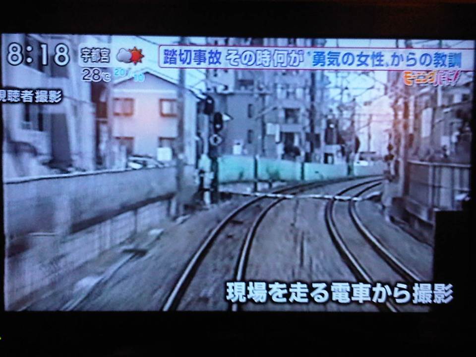 Footage of the crossing where the woman perished.
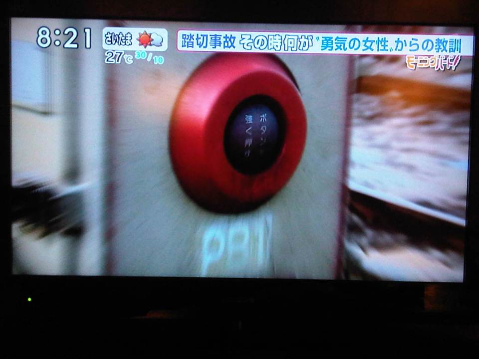 Emergency button that was supposed to be used by people in exactly such cases but people were apparently too shocked or unfamiliar with this safety device at railway crossings.
 Demonstration of the ill-fated rescue
 Photo of the heroine who, if I understood from the report, will be awarded posthumously for her effort to save another person.
 Another photo of the 40-year old woman, Murata-san.
Japan takes pride in their work towards making their transport systems safe. Rail incidents have been minimized by using modern, high technology tools including sensors and monitoring systems. However, it seems that there are cases such as these where the intervention of people (including those who might be spectators of an incident) are still necessary as these are likely beyond the capabilities of even high tech countermeasures installed at rail crossings. We salute and honor this woman who was willing to help another person at the cost of her own life. She deserves the honor and recognition for this great humanitarian act.
–
U.P. Town Center
Passing along the University of the Philippines’ part of Katipunan, one will see a new development at the area where the UP Integrated School (UPIS) is currently located. The UP Town Center is being promoted as part of a university town center concept and is the second major Ayala development on UP land after the Technohub in the north side of the 493-hectare campus. The surrounding area to the newly built Town Center will most likely host business process outsourcing (BPO) including call centers that currently populate Technohub.
I learned that the development’s design was reviewed on the UP side by a team that included faculty members from UP Diliman’s College of Architecture and School of Urban and Regional Planning. I assume that they were able to cover most if not all the aspects of the design for this particular development and the rest that will follow once UPIS moves to the main campus and the entire lot is developed much like into what Technohub is at present. I would assume that they provided recommendations to Ayala and that these recommendations were used to improve on potential issues with the development. However, my worry is that the transport or traffic component of the design (i.e., transport impact assessment) was not sufficient for the traffic that will be generated by the development. While Technohub had no serious problems regarding traffic as it was along the wide Commonwealth Avenue, the Town Center was located in the narrower C-5 that is the route for much private traffic as well as trucks.
Let us look at the potential problems for the UP Town Center in relation to transport and traffic. For one, the development is close to a major intersection, the junction of Katipunan-CP Garcia. The current traffic signal cycle for the intersection allows for continuous through traffic for the northbound side of Katipunan. Thus, traffic in front of the development, which is along this same northbound side of C-5 will be continuous. Vehicles slowing down to enter the parking lots at either end of the building will likely slow down traffic along C-5. Meanwhile, there are no driveways or bays for transport to load/unload passengers in front of the building. Instead, the driveway is right after Katipunan-C.P. Garcia intersection and does not appear to be designed for jeepneys, taxis and cars will, instead, likely stop on the road and such will mean one lane of C-5 will be occupied, contributing to a decrease in the capacity of the roadway.
Another thing is the parking. Currently, there are limited spaces as understandably the area is still being developed and the lots are temporary facilities. I presume that there will be more spaces available soon considering the parking generation characteristics of such types of developments that tend to attract car-owning people though perhaps the target is a broader range of customers.
And then there are the issues regarding walking and cycling. One friend was asking if there were bicycle racks at the Town Center. I saw none (yet?) but perhaps there will be facilities for cyclists. As for walking, this section of Katipunan is more walkable compared to the segments in front of Ateneo and Miriam where cars seemed to be parked or standing everywhere and pedestrians are forced to walk on the road. Along the side of the U.P. Diliman campus, there are sidewalks where pedestrians can safely walk. On the Town Center’s side, there are also sidewalks and we hope these can still be improved once construction is at full swing. Perhaps what requires attention for both pedestrians and cyclists are crossings. With the increased traffic along C-5 due to the opening of the Luzon Avenue overpass crossing Commonwealth, it has become more dangerous to cross C-5. As such, there is a need to address such issues as surely there will be significant pedestrian traffic crossing to and from the Town Center.
 No driveways or bays for public transport? Construction work continues for the soon to open UP Town Center even as the fences are taken down to reveal a modern building that will host restaurants and shops.
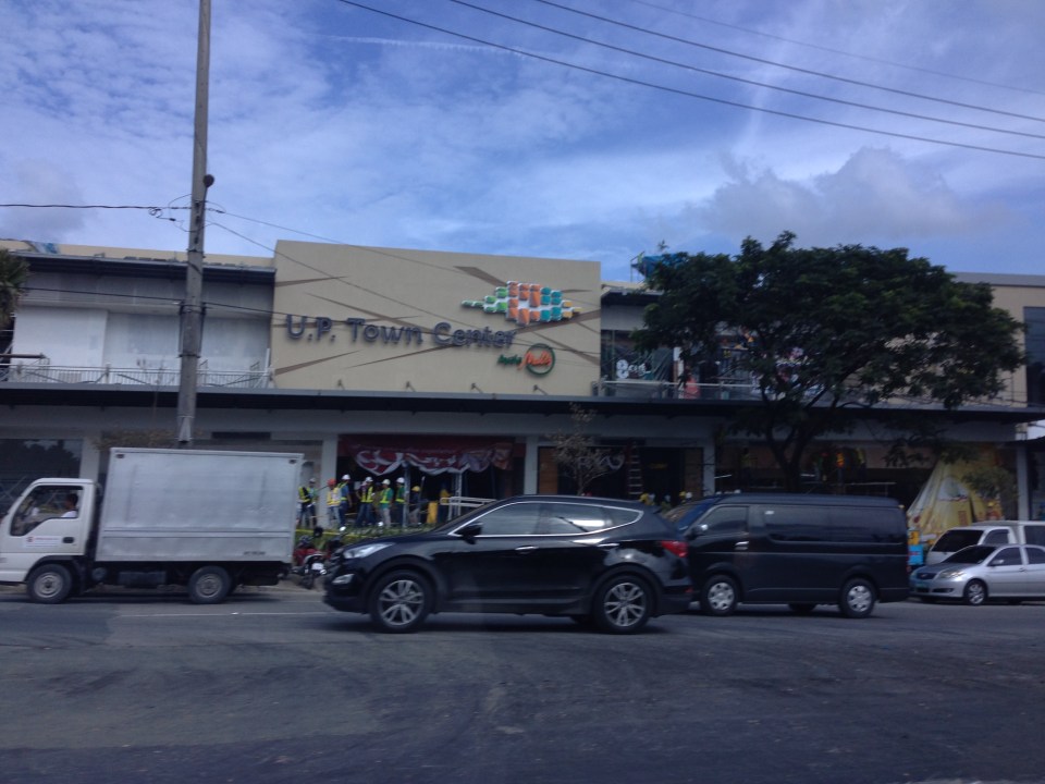 The UP Town Center is already attracting traffic as some restaurants and shops have already made “soft” openings.
A colleague once made the comment that the Town Center was not really for UP but, like the Alabang Town Center, was for the posh residential subdivisions in the area. These include nearby La Vista, Loyola Grand Villas and Ayala Heights subdivisions. Also, it will likely attract more car users than public transport users as locator restaurants and shops are mainly upper-middle to upper class. There are no Jollibees, Chowkings or McDos here. For now, the developer and UP Diliman deserves to be given the benefit of the doubt in as far as the development’s design is concerned. Perhaps the issues I mentioned above will be addressed once the entire area leased to Ayala would have been fully developed. And until then, there would be opportunities to check and ascertain if the development is indeed people friendly and something that can be called a university town center and not just another commercial development that attracts traffic.
–
RORO Ferry trip from Batangas to Calapan
[This post has generated a lot of inquiries about fares and schedules for RORO services between Batangas and Mindoro. I would like to clarify that what I wrote about is on one experience we had on a trip about 2 years ago. I am not connected with any of the ferry companies nor am I connected with the port authorities. For more info/details, here as some useful links:
SuperCat: http://www.supercat.com.ph/Fares/fares.asp
Montenegro Lines: http://www.montenegrolines.com.ph/index.php?nav=4
Port of Batangas: http://www.ppa.com.ph/batangas/about.html
Port of Calapan: http://www.ppa.com.ph/Calapan/cal_about.htm
Safe trips!]
—
Following is the original post:
Due to rough seas, there were no SuperCat trips between Batangas and Mindoro when we arrived at Batangas Port one Thursday morning. It seemed that there was only one fast ferry under the banner of SuperCat that plies the Batangas-Calapan route and it was on hold in Calapan due to rough waters. Later in the day though I would theorize that there might not have been enough passengers that morning between the cities and a decision had to be made not to make the trip, with the convenient and irrefutable reason of rough seas.
 RORO Ferry ticket (left) and passenger terminal fee ticket
 A view of two RORO ferries docked at the Batangas Port. One was operated by Montenegro Lines’ Marina Ferries and the other by Starlight Ferries.
 Passengers boarding the ferry Reina Hosanna. Some vehicles, mostly trucks were already loaded on the ferry. Others would have to wait until passengers have boarded the vessel.
 A view inside the ferry where vehicle and freight are positioned and secured for the voyage. People form a line before the narrow stairway to the passenger level.
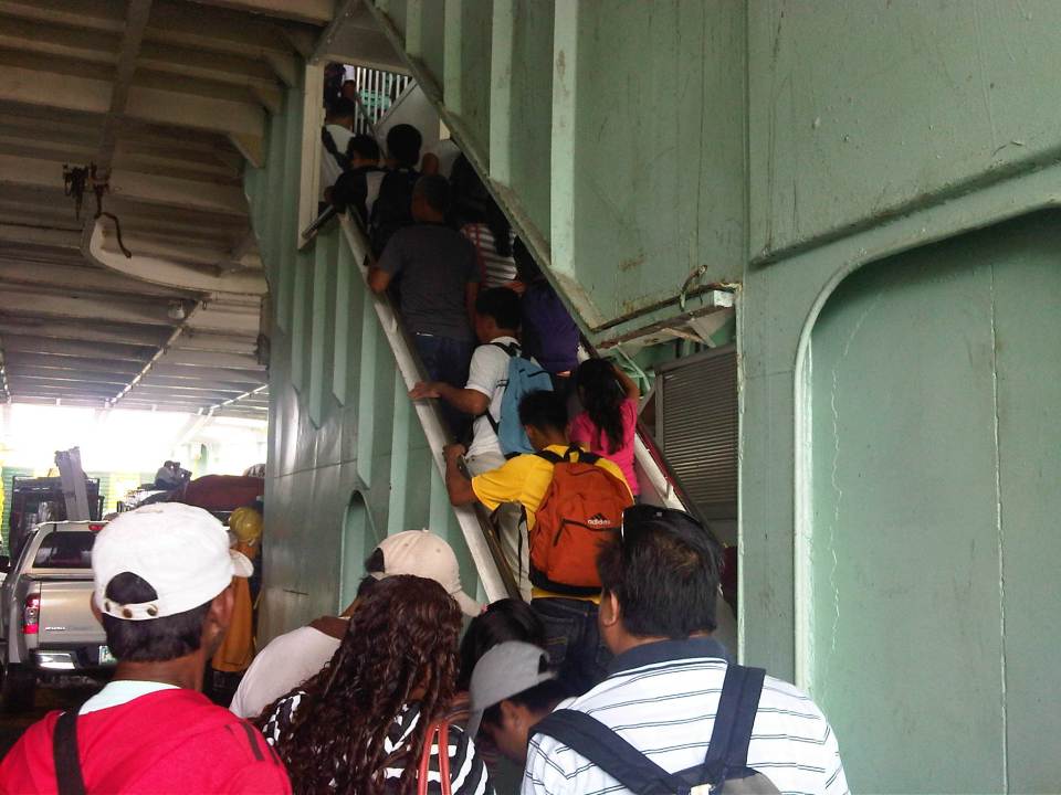 Passengers climbing the narrow stairway to the passenger deck of the Reina Hosanna.
 A view of the Batangas Port from the upper (view) deck of the ferry right above the passenger deck. Trucks can be seen boarding (rolling on) the ferry. The orange things are lifeboats lined along the rear of the passenger deck.
 A provincial bus arrives to board another RORO ferry, the Starlight Nautica, which was scheduled to leave an hour after our scheduled departure. There are many bus companies plying the western nautical highway route , which can take the traveler to Caticlan, the jump off point for Boracay Island.
 Reina Hosanna crewmen raise anchor.
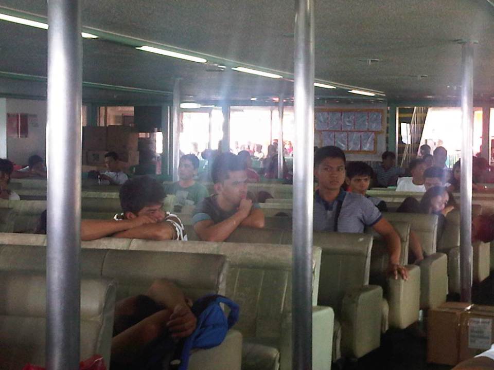 A view inside the passenger deck – seats were cushioned but mostly dilapidated and obviously requiring re-upholstery. The cabin seemed to be originally air-conditioned and we were lucky that the weather was fine and not so hot that day. Some passengers went to the upper deck to get some air.
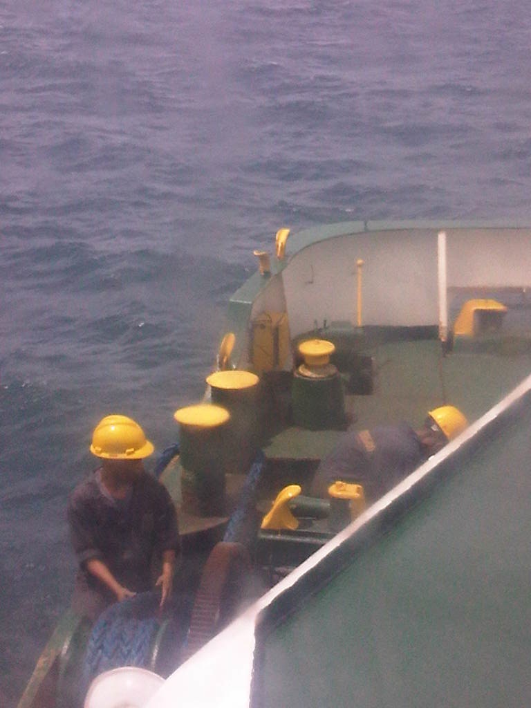
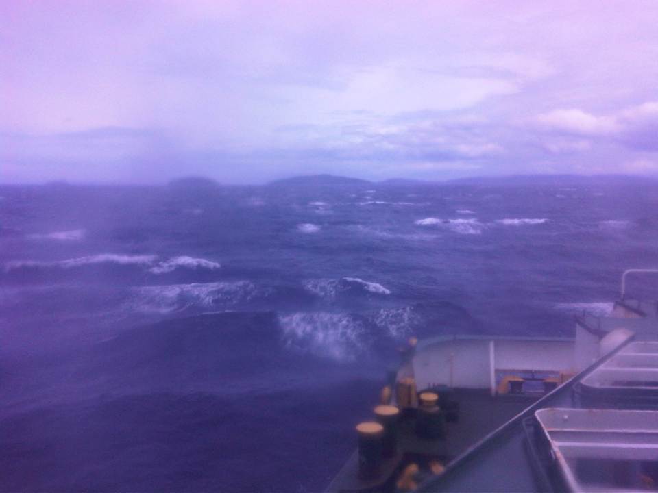 Rough seas along the Verde Island passage to Calapan. We actually saw two fast craft going the opposite direction during our almost 3-hour voyage to Mindoro. One was a SuperCat and another was a FastCat, and they were traveling despite the same rough waters shown in the photo!
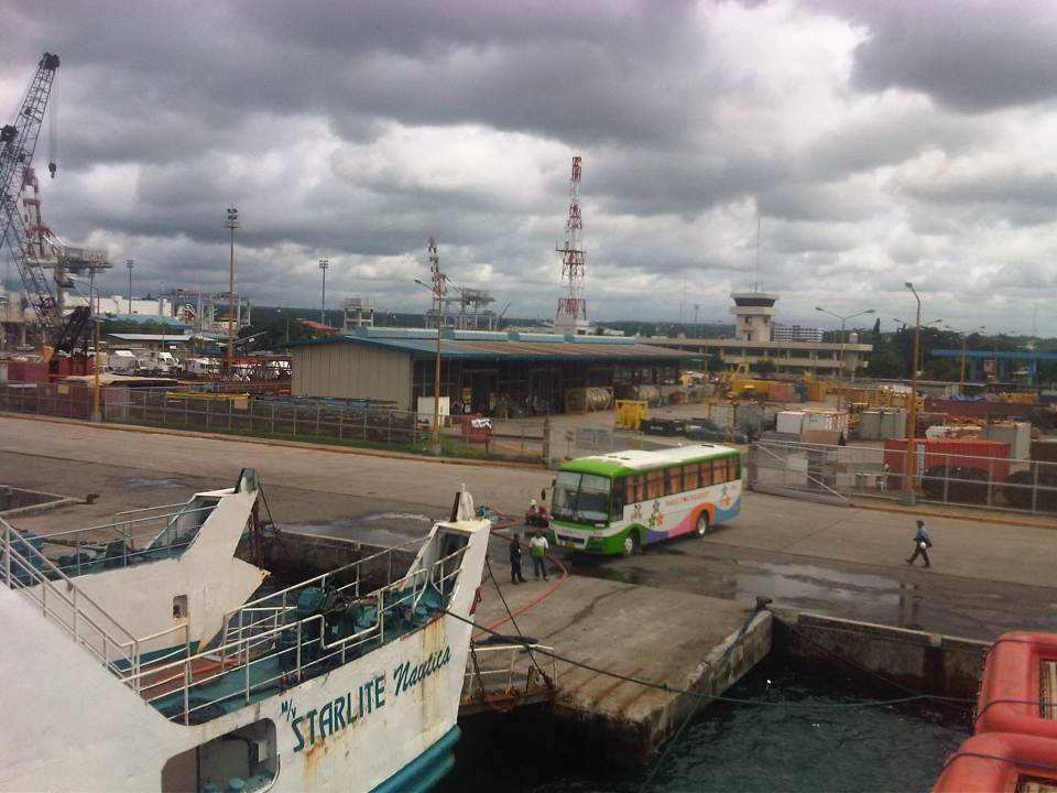
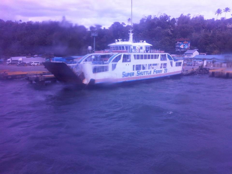 Another ferry preparing to leave Calapan Port.
 Crew throwing a line to the port as our ferry docked at Calapan.
 Passengers disembarking from the ferry.
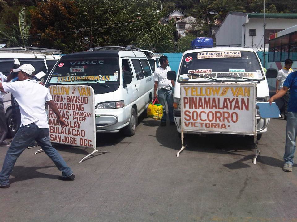 Vans waiting for passengers bound for various destinations in Mindoro including those in Mindoro Occidental on the other side of the island.
It was my first ferry ride in a long time. The last one was a fast ferry trip using the SuperCat service from Cebu to Tagbilaran, Bohol. That was in the afternoon and was quite a rough ride, too. I think shipping lines should not balk on the safety and comfort of passengers. People would be willing to pay a higher fare if the vessels are in better condition and facilities such as seats are well-maintained. I can only imagine the traveling conditions during the peak periods when a lot of people would take these RORO ferries as they are usually the cheaper and practical option between islands. –
Batangas Port RORO Passenger Terminal
In a previous post on the Batangas Port, I featured the newer passenger terminal for fast crafts or fast ferries and large outriggers (katig). This time, I am writing about the Roll-On, Roll-Off (RORO) passenger terminal just across the road from the fast ferry terminal. Heading to Calapan for a meeting there, we were disappointed that we could not take a fast ferry (i.e., SuperCat) to Mindoro. SuperCat ticketing staff informed us that fast ferry services were suspended due to rough seas between Batangas and Calapan. And so to be able to make our appointment, we had to take the slow ferry, which is actually a RORO ferry to Mindoro.
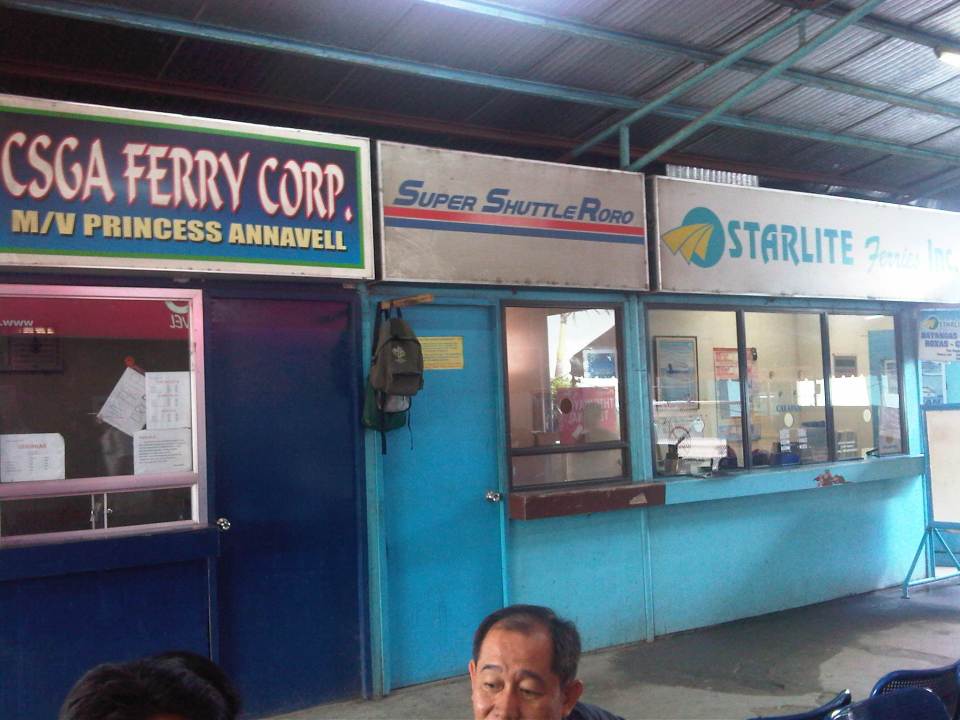
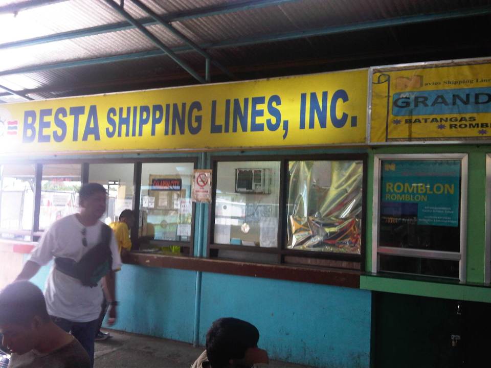 Passengers can purchase their tickets from one of the booths just beside the terminal. Various shipping lines provide services between Batangas and the islands of Mindoro and Romblon.
 Schedules and fares of ferry services are posted on the windows of each shipping lines’ booth.
 Montenegro Lines operates the most frequent RORO ferry trips between Batangas and Mindoro. RORO ferries leave Batangas every hour for destinations in Mindoro and there is a 24-hour service between Batangas and Calapan. We paid PhP195.00 for a one-way trip to Calapan, Oriental Mindoro.
 Waiting area outside the terminal, which can become very crowded during holidays. One passes by this area right after paying the terminal fee (PhP 30.00) prior to entering the terminal building.
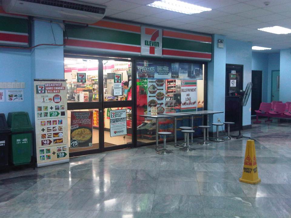 Convenience store at the ground floor inside the passenger terminal. At the ground floor are several other eateries where passengers can purchase and eat meals before boarding a vessel.
 The passenger terminal had clean restrooms at the time we were there. I just hope these restrooms are of similar conditions during the peak periods of travel.
 View from across the passenger terminal showing berths for large outriggers (katig) that people can opt to take between Batangas and Mindoro. These are popular for people heading to the resort town of Puerto Galera. These rides can be quite bumpy (and dangerous) so there are concerns regarding safety.
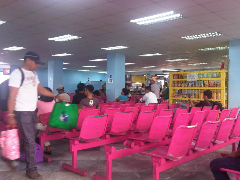
 Seats and shops inside the passenger terminal. On the right is a passenger having a pedicure inside the terminal. My companion was asking me about the women who were carrying small chairs around. Upon observation, we found that the answer was that these chairs were used by women offering manicures and pedicures to waiting passengers.
 The waiting area is located at the second level of the terminal.
 Passengers can get snacks and souvenirs from the small shops at the terminal waiting area.
 When boarding was announced, people filed out of the waiting area to walk across towards the pier. There is a walkway connecting the terminal to the pier.
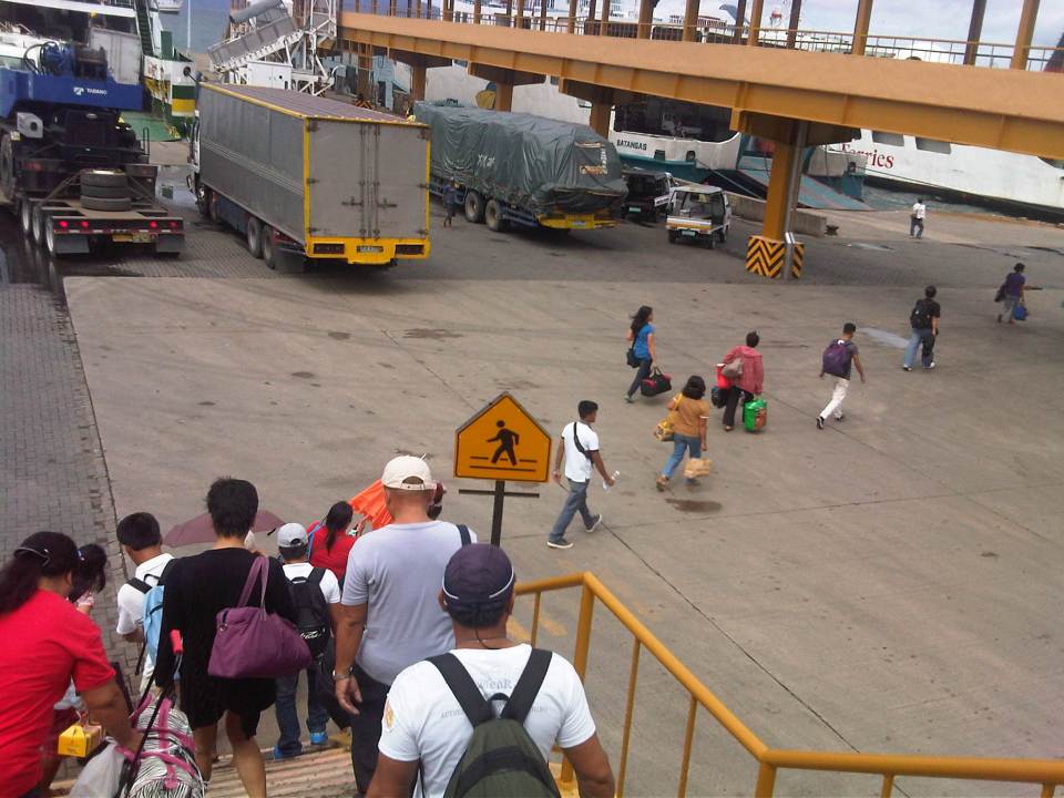 Passengers descend the walkway towards the ferry we were to board. Shown in the photo are people walking past trucks waiting to board the RORO ferries.
 While many passengers travel light, there are some who probably had a lot of luggage because they were coming from longer trips (e.g., flew in from abroad) or maybe taking a long vacation.
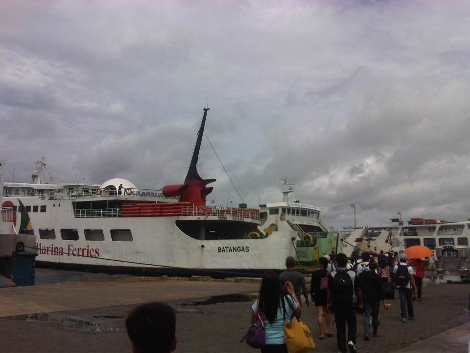 Fellow passengers walking towards our ferry to Calapan.
–
How to cite social media
Given the popularity of internet sources among researchers (especially the less experienced ones) these days, there is a tendency for many to rely on online resources rather than put some effort to browse actual libraries for references such as hard copies of books and journals. Research supervisors usually allow this for cases when the online resource happens to be electronic or digital versions of published material. There are both formal and informal sources online for such published material including online versions of journals managed by reputable publishers like SpringerOpen and Science Direct and websites by researchers and research centers themselves like the Victoria Transport Policy Institute. These are rich sources of refereed/reviewed material that are highly recommended for any literature review that students and researchers need to do before embarking on any serious work.
Nowadays, however, there have been a lot of other material found online including those on blogs, YouTube video, Twitter, Facebook and email that have been gaining acceptance as valid references. For example, it is possible that an interview may be conducted through an exchange of emails or via the chat features of Facebook. Lectures or talks like the popular can be found on YouTube or at TED. As such, these materials should be cited properly in research work.
I found this article on “How to cite social media…” on Facebook and below is a graphic that provides a guide for social media citation:

Obviously, I deliberately posted this material on proper citations here to remind people using or intending to use material from my posts in their research or other purposes. It is also quite timely considering the news featuring a plagiarist (i.e., a person passing off someone else’s work as their own).
–
