
How can e-scooters become a safer way to travel?
I’ve shared some articles and opinions about electric scooters. Here is another one that delves into the safety about these vehicles that have become quite popular in the US. Here in the Philippines, they still seem to be in infancy in terms of popularity and to some, are seen as more a novelty and touristy rather than a mode of transport for the typical work trips.
Donahue, B (June 11, 2022) “How to Make Electric Scooters Become a Safer Way to Travel,” Bloomberg, https://www.bloomberg.com/news/features/2022-06-11/how-to-make-electric-scooters-safer [Last accessed: 6/18/2022]
To quote from the article:
“Dediu believes that in time micromobility will attain critical mass, as other modes of transit have already done, and that infrastructure will come as the user base grows. “We didn’t build airports and then have airplanes show up,” he’s said. “I’m confident, given the history, that we’ll see things like more safe roadways for micromobility vehicles.” “
 Scoot-to-work at BGC, Taguig, Metro Manila
It is not really about the vehicle but the environment in which it is being used. One can say a lot about walking, for example, being dangerous but without touching on the why and the how its become a dangerous or risky mode of travel. It’s the lack of infrastructure or facilities as well as the car-oriented environment (that includes archaic laws and other regulations) that make active mobility and micro mobility modes dangerous or risky. If we can address these basic issues, then perhaps we can entice more people to use these modes more often and for the most trips we make everyday.
And don’t forget that these modes are the most fuel efficient! Saves you from the every increasing prices of fuel!
–
Tagbilaran – Panglao Airport Departure
With the recent popularity of my post on the Tagbilaran-Panglao Airport, I was encouraged to write this second part about the airport. Following are photos taken during our departure from Panglao. I took photos from the driveway, the check-in area and the pre-departure area and lounges. I hope this helps my readers including and especially travelers and tourists.
 Curbside at the new airport – the area is very spacious and should be able to handle the steadily increasing number of passengers and well-wishers at the airport.
 Passengers alight from their vehicles near the Philippine Airlines office at the terminal.
 Air Asia ticket office near the terminal curbside
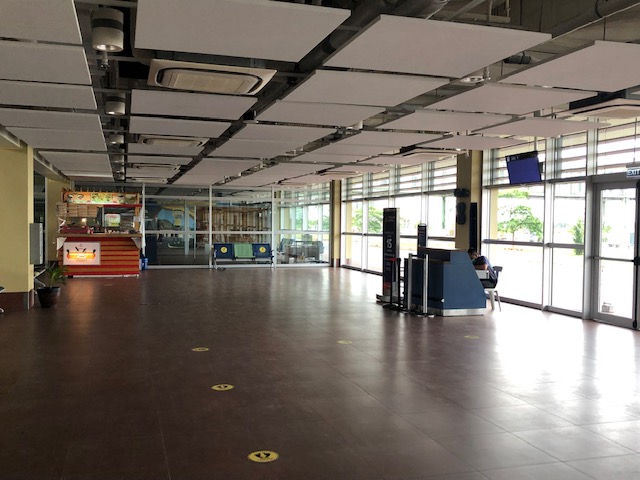
 Spacious check-in area – I was just discussing the requirements and standards for check-in counters and frontage to my students this last semester.
 Check-in counters for PAL
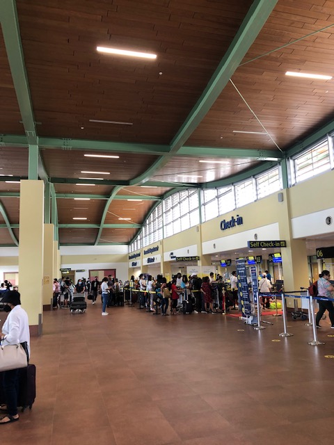 The check-in counters for Cebu Pacific were crowded when we arrived at the terminal.
 Stickers on the floor mark where passengers are supposed to position themselves to comply with health protocols (i.e., social distance).
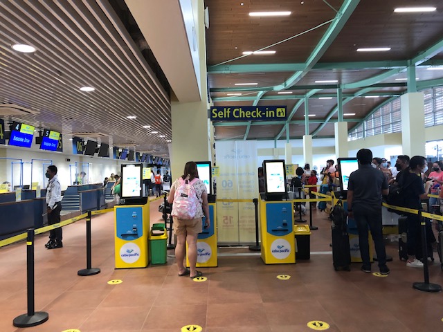 CebPac has their self check-out portals at the airport for those who have not done their online check-in and to facilitate and expedite check-in procedures.
 There’s a separate section for international departures. The airport used to service international flight (before the pandemic). I assume this is where immigration (i.e., passport and visa control) and customs would have been located for International travel.
 After checking-in, travelers are greeted by very spacious lounges
 This is the ground floor. Visible is the elevator and escalators to the second level pre-departure area for domestic flights. I assume this is a mirror image of the international departures wing.
 Unfortunately, there are only two kiosks at the terminal when we were there. One is this stall that sells snacks, sandwiches, instant noodles, and soft drinks and water. There are no souvenir shops or stores for last minute pasalubong shopping.
 A view of the tarmac from the lounge
 The elevator to the second level lounges and boarding gates.
 Stairs and escalators to the second level
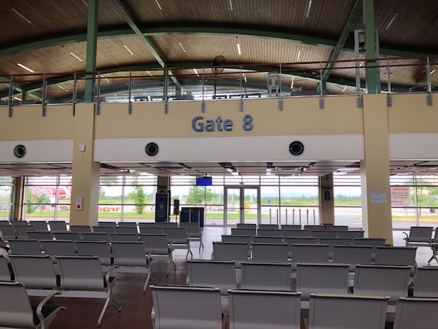
 One of the boarding gates at the second level
 The second level pre-departure area
 A look at the ground floor
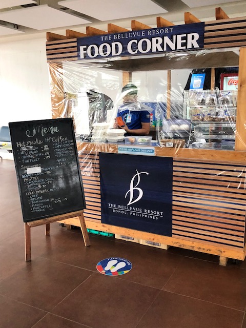 The other kiosk is by The Bellevue Resort. Their coffee is good but they ran out of food at the time we were there. We thought this was not good considering there were other flights scheduled for the rest of the day and passengers will end up with very limited or no options for meals before their flights.
 Another look at the boarding gate and kiosk at the ground level
 Another look at the other kiosk at the pre-departure area that sells snacks, light meals and drinks.
 Passengers walk towards the tube connecting to aircraft
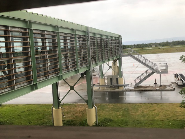 Bridge connecting the terminal to the aircraft
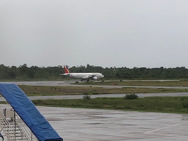 A PAL plan taking off
 The airport control tower
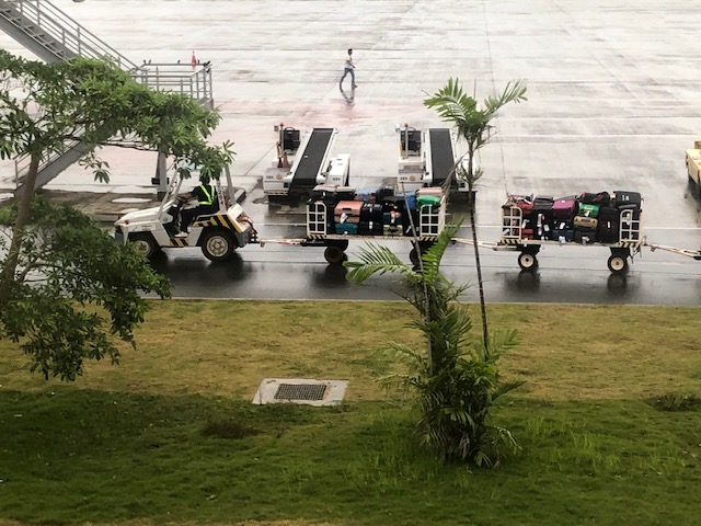 Baggage being transport for loading unto the aircraft
 A family walks to board the awaiting aircraft bound for Manila.
 A view of an Air Asia plane that had just arrived and with its passengers just starting to deplane.
This airport is probably one of the better airports in the country now. There is a new airport in Bicol (replacing the old Legazpi Airport) that just started operations recently, which I have yet to visit but is likely better than Panglao in terms of shops and stores. Facilities-wise, this is a modern gateway that should serve the projected number of passengers for Bohol for the next so many years including the expected international operations for the terminal. We are still in the midst of the pandemic but the number of travelers is steadily increasing. And so I wonder how the airport will be once the ‘old normal’ number of visitors return.
They definitely need more shops and stores than the current two kiosks at the airport. They also would need to improve on the ventilation and air-conditioning (it was quite humid inside the airport when we were there – the aircon was not functioning). As a tourist, I am already looking forward to the next trip to Panglao. Hopefully, the airport will be even better on that next trip.
–
On how traffic enforcement enhances road safety
It seems to be a no-brainer and has always been an assumption to many traffic engineering studies including those employing simulation to determine the outcomes of various scenarios involving transportation. The element that is traffic enforcement, however, cannot be assumed as something uniform across countries, cities, barangays or even individual road sections and intersections (yet we often do assume uniformity and a certain level of strictness).
Here is an article that reports on new research pertaining to how the enforcement of traffic laws makes roads safer:
Mohn, T. (June 8, 2022) “Enforcing traffic laws makes roads safer, new research shows,” Forbes.com, https://www.forbes.com/sites/tanyamohn/2022/06/08/enforcing-traffic-laws-makes-roads-safer-new-research-shows/?sh=74b03c97591e [Last accessed: 6/10/2022]
To quote from the article:
“High visibility enforcement of traffic safety laws actually works. When carried out, regulations governing driving have a positive and measurable impact on safety by reducing dangerous behaviors behind the wheel that put road users at risk…
““Enforcement alone will not solve the traffic safety crisis,” Adkins added. “We cannot simply enforce, build, design or educate our way out of this problem. The Safe System necessitates a comprehensive approach for achieving our collective goal of zero traffic deaths, including equitable enforcement that focuses on risky driver choices that endanger all road users.”
The article points to new research published by the US National Highway Traffic Safety Administration. The synthesis to that research may be found here while the full report is found here.
Such research and articles are very relevant especially as incidents like the one involving a driver running over an enforcer become viral and bring to the forefront traffic enforcement or the lack of it (some will word it differently – like why many drivers don’t follow traffic rules and regulations). The discussion must continue especially in the context of road safety.
–
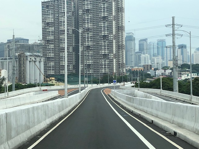
Kalayaan Bridge (BGC – Ortigas Center Link)
The Kalayaan Bridge, also known as the Bonifacio Global City (BGC) – Ortigas Center Link opened about a year ago and was supposed to ease traffic along the usual routes along EDSA and C5 that crossed the Pasig River. The new bridge is located between the EDSA and C5 bridges and is a more direct route to and from BGC if you reside in Pasig and choose the route to/from BGC via Pasig/Shaw Boulevard.
 The approach ramp to the bridge from the BGC side is in the vicinity of the Uptown part of BGC. The bridge goes over Kalayaan Avenue, which is one of the major access roads to BGC from C5 or EDSA, and J.P. Rizal Avenue Extension but there is access and egress to Kalayaan Avenue.
 The ramp is practically a single lane with painted bike lanes on either side of the bridge. There is noticeably no space for pedestrians on this bridge. That is only a curb on the right side. This lack of pedestrian provisions is a major flaw of this bridge.
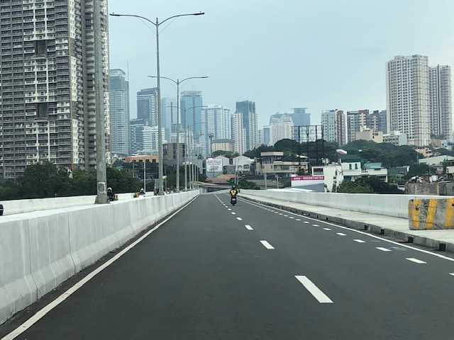
 A lone cyclist traversing the bridge – the merge for traffic from BGC and vehicles from Kalayaan Avenue is seen downstream.
 Approaching the merging section (from this perspective; its diverging on the other side) of the bridge.
 A motorcycle merges with the traffic from BGC. Notice the chevron markings separating merging flows as well as the yield marking for vehicles coming from Kalayaan (i.e., priority is for vehicles coming from BGC). The bridge from this section becomes two lanes per direction. There is, however, a risky part for cyclists who will cross paths with vehicles coming from Kalayaan. Cyclists from BGC will have to cross a lane to get to the bike lane on the outer side of the bridge. There is no space for pedestrians along this bridge.
 There is only this part of the bridge where there appears to be a sidewalk. Was this really the design for this bridge? It is very obvious that many people failed in both design and implementation of this project.
 The view towards the Pasig side of the bridge. There are two lanes per direction and narrow bike lanes along the curbsides.
 There is an intersection at the end of the bridge but the road immediately at the right is closed to incoming traffic so right turns are currently prohibited despite the pavement markings that indicate they were allowed at one time.
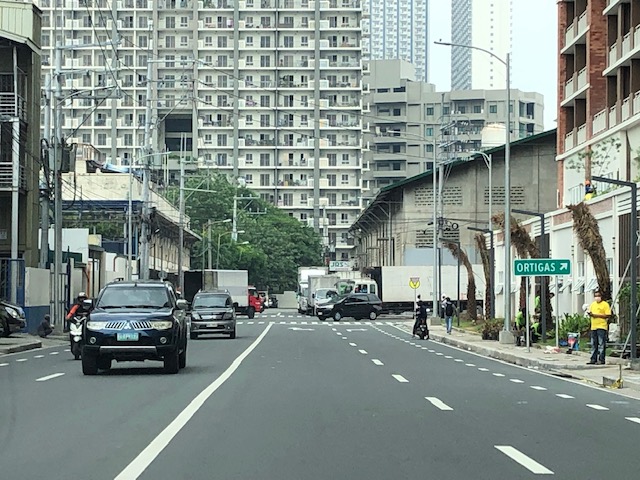 The road leads to this intersection which is in area generally referred to before as ‘Pioneer’. The area hosts many warehouses or storage buildings and I remember going here many years ago to check out the imported wood furniture and office surplus items. Turning right leads one to the area generally known as ‘Unilab’ because that was where United Laboratories had their plant and offices. It retained the property where now stands an events venue. Further on leads you to Kapitolyo and the Estancia Mall.
–
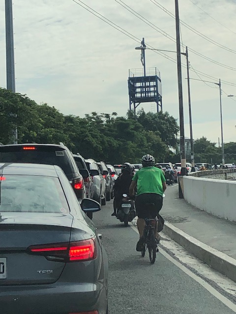
Micromobility anyone?
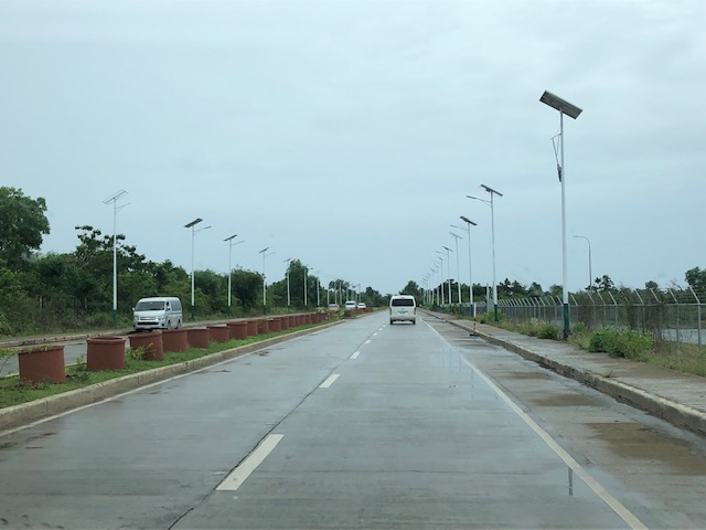
I just wanted to share a couple of photos I took en route to BGC last week. Yes, the traffic is already terrible and yes, I drove to BGC (or more accurately, I was driven as we were hauling stuff to our home away from home at BGC). I couldn’t help but take photos of the motorcycles and bicycles passing our vehicles. These were definitely more efficient forms of travel considering they require less space and likely incur less travel times. In addition to these modes (and walking, of course), there seems to be an increasing popularity for other micro mobilities. I wouldn’t define and enumerate these emerging modes but you’ve probably seen some of them along your commutes – electric kick scooters (EKS), gas-powered versions of these scooters, other forms of electric vehicles including trikes, etc. Here are a couple of examples I captured in photos last week.
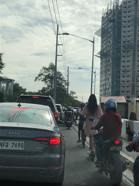 Cyclists and micro mobility users slugging it out with motor vehicles
E-scooter in BGC: comfy clothes-check! backpack-check! helmet-check! Commuting to work should be something like this rather than most people using their cars.
Suffering and salvation for transport and traffic
I shared the following photo on social media with the label “Kalbaryo at Kaligtasan”:
 Cyclist pedaling ahead of cars queueing along the C5 ramp towards BGC
The label or title has double meaning. Conspicuous in the photo is the image of the Crucifixion atop what is a small shrine along Circumferential Road 5 across and facing SM Aura. The image appears to be a reminder or symbol of suffering but with the superimposed image of traffic congestion, alludes to the suffering endured by motorists on a daily basis. The “kaligtasan” or salvation part of the photo is in the form of the cyclist or the bicycle (I really have to explain that, right?) that offers an alternative or even hope for those who seek it. One thing the pandemic has taught us is that active transport in the form of walking or cycling is part of the solution to the transport problems we are experiencing. Public transport, of course, is touted as an ultimate solution but the reforms and infrastructure required are and will take time to implement, and these are already encountering problems leading to further delays or ineffectiveness.
–
Articles on railway safety
I shared a link to a Medium writer who specialized on articles about air crashes. These were investigative articles that provide details about air crashes especially since these are all tragedies and include those that have remained mysteries like Malaysian Airline Flight 370.
I am sharing today another collection of articles pertaining to transport safety. This time they are about railway or rail safety. Here is the link to the collection of articles from Max Shroeder:
https://mx-schroeder.medium.com
And here is an example of what he writes:
https://mx-schroeder.medium.com/stressful-schedule-the-2005-amagasaki-japan-derailment-12156ddd488
Again, there is much to be learned about these incidents. The circumstances, factors and experiences need to be examined in order to draw lessons from these incidents and reduce the likelihood of them happening again. In the case of the Philippines, this is especially applicable as the country rebuilds its long distance railways infrastructure with a line connecting Manila and Clark, Pampanga along what used to be called the Main Line North (MLN) of the Philippine National Railways (PNR), and another currently being rehabbed and for upgrading to the south in what was called the Main Line South (MLS). Other rail projects are also underway like the Metro Manila Subway and the MRT Line 7. All pass through populous areas, and railway crashes may not just lead to passenger and crew fatalities and injuries but also the same for those residing or working along these rail lines.
–
On the right to a walkable life
Here is an article from a perspective that’s very relevant today everywhere. We need to examine our daily routines particularly when it comes to commuting or moving about. Do we live in walkable communities? Is walking to certain places like school, the market, or the office an option to many of us? Or do we automatically choose to ride a car, a tricycle or motorcycle to get to these places?
Malchik, A. (May 13, 2022) “Driving is killing us,” Medium.com, https://antoniamalchik.medium.com/driving-is-killing-us-6a1b35158458 [Last accessed: 5/28/2022]
To quote from the article:
“Ask yourself this question: if you stepped foot outside your door, would you be able to walk anywhere you needed or wanted to go? Can you walk to a store, a library, school, or work? If your answer is “no,” what’s stopping you? Distance, highways, private property, broken or absent or inaccessible sidewalks? …
The loss of walking as an individual and a community act has the potential to destroy our deepest spiritual connections, our democratic societies, our neighborhoods, our freedom, our health, and our lives. But we can reclaim it. We can start to make a world that welcomes the walker, the pedestrian, rather than paving over that incredible human inheritance.”
I myself have enjoyed the benefits of walking when I was a college student in UP, when I was studying abroad in Japan, when we lived in Singapore and now in our community in the midst of the pandemic. I always think about opportunities and even schedule times for walking. Nowadays I am even conscious of my daily step count, which I equate with being active.
–
Tagbilaran – Panglao Airport Arrival
The last time we were in Bohol, the airport was still in Tagbilaran City. One had to travel about 45+ minutes if you were staying at a resort in nearby Panglao Island that is part of the province. The old airport was closed (the runway though served as a venue for ) and replaced by a new airport. This one is located in Panglao Island and close to the resorts that are the main attraction of the province.
 We deplaned via tube/bridge at the new airport terminal
 A photo of the control tower from the bridge
 Did the airport terminal architecture take inspiration from Bohol’s famous Chocolate Hills?
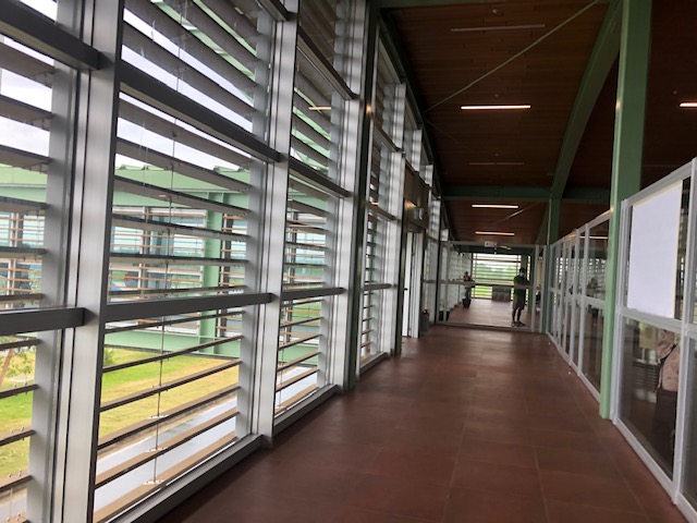 The corridors were well lighted, again thanks to the building design.
 Our plane at the tarmac or apron unloading luggage and cargo
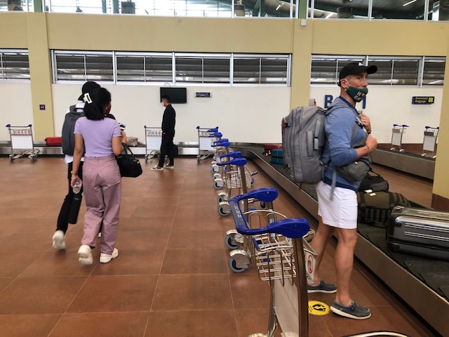
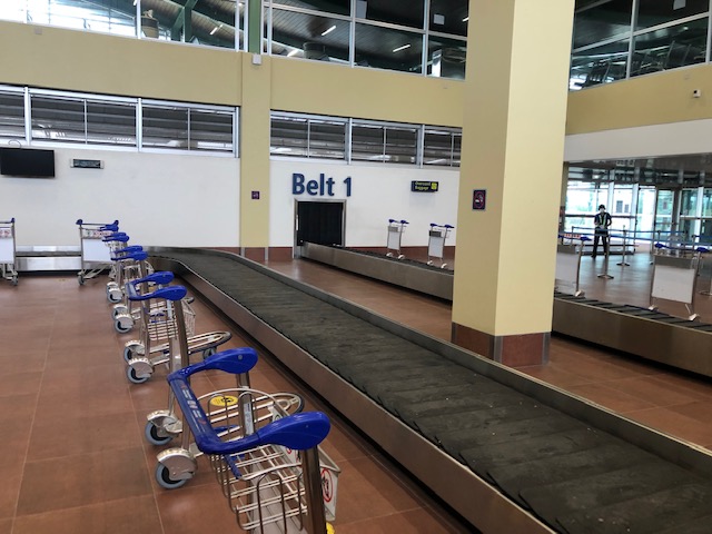 We arrived at the baggage claim area ahead of most people. The carts were already placed across the conveyor belt by airport staff.
 Belt 2 on the other side is for international arrivals. The airport already served international flights before the pandemic. These have yet to resume.
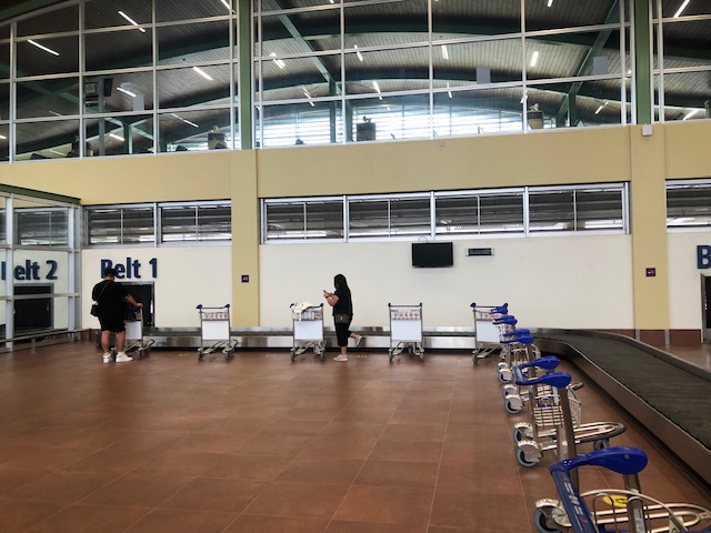
 Passengers file unto the baggage claim area to pick up their luggage.
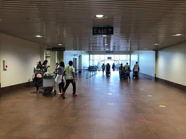 The hallway towards the terminal exit. The toilets are on the left side of the hallway.
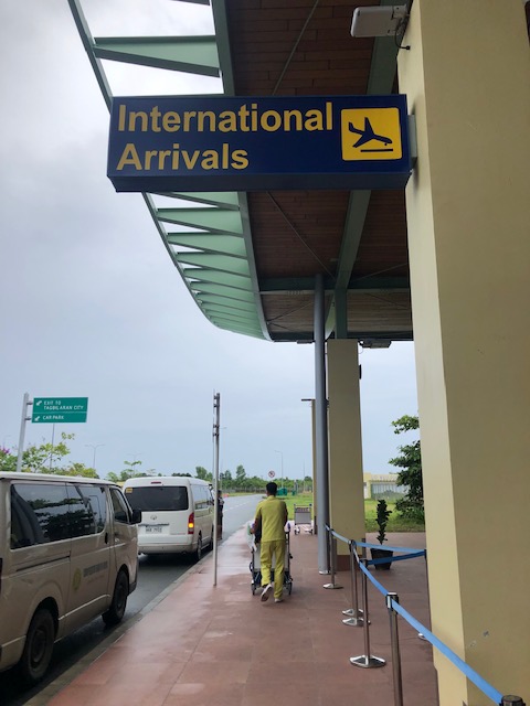 The sign indicates international arrivals. The airport currently does not serve international flights but these will likely resume once the pandemic threat is clearly contained. Other airports like Iloilo and Bacolod have also suspended international flights.
 The international arrival area at Tagbilaran-Panglao Airport
 Airport driveway
 Exit towards our destination
 A view of the control tower as we headed towards the airport exit gate
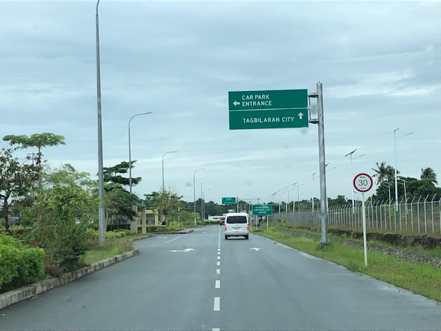
 The new road connecting to the national road circling Panglao Island, which connects to the local roads leading to the resorts and towns in the island.
It now only takes something like 10 to 15 minutes to many of the resorts in Panglao Island. This is a convenience to tourists. However, the distance from the main island of Bohol (the rest and most of the province) means a longer travel time for Boholanons or Bol-anons to/from their hometowns from/to the airport. This looks to be a non-issue considering the pros of the new airport outweighs its cons.
More on this airport soon!
–
On phasing out cars in cities
I’m sharing another article on reducing car dependence. The article was referred to by the previous series that I shared recently.
Nicholas, K. (April 14, 2022) “12 best ways to get cars out of cities – ranked by new research,” The Conversation, https://theconversation.com/12-best-ways-to-get-cars-out-of-cities-ranked-by-new-research-180642 [Last accessed: 5/20/2022]
Here are a few excerpts from the article:
“Question: what do the following statistics have in common?
The second-largest (and growing) source of climate pollution in Europe.
The leading killer of children in both the US and Europe.
A principal cause of stress-inducing noise pollution and life-shortening air pollution in European cities.
A leading driver of the widening gap between rich and poor urban residents.Answer: the vehicles on our streets, primarily the not-so-humble passenger car.”
also this:
“The research is clear: to improve health outcomes, meet climate targets and create more liveable cities, reducing car use should be an urgent priority.”
and this:
“To meet the planet’s health and climate goals, city governments need to make the necessary transitions for sustainable mobility by, first, avoiding the need for mobility (see Paris’s 15-minute city); second, shifting remaining mobility needs from cars to active and public transport wherever possible; and finally, improving the cars that remain to be zero-emission.”
You can also listen instead of reading it as it is a narrated article.
–
