
Home » Bridges (Page 4)
Category Archives: Bridges
Another look at Marcos Highway pedestrian overpasses – Part 2
I purposely didn’t include the overpasses at and near the Masinag Junction because I felt they deserved their own article. For one, the area will be the location of the future end station of the current LRT Line 2 Extension project. Here are a couple of photos of the overpasses in the area.
 Overpass at SM City Masinag – note the tall columns for the elevated tracks of Line 2. Will the Masinag Station be located that high or will it be at a lower level, perhaps closer to the SM City overpass?
The overpass at SM City Masinag is something that has been replicated in many other locations where an SM mall has been constructed. Note the similarity of the situation with the likes of SM City Iloilo, SM City Novaliches where SM built pedestrian facilities to allow for safe crossings between the mall and the area across from it along the highway. In many cases, it is the mall which provided the overpass in coordination with the local government unit and, I assume, the DPWH.
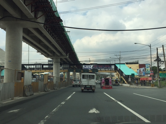
 Overpasses at Masinag Junction – there are actually 4 bridges here, each spanning one leg of the junction.
One of the intents for these is to eliminate at-grade pedestrian crossings at the junction. While crossing have been reduced significantly, there are still many “pasaway” who cross even when there is a green light for vehicular traffic along the leg they are crossing. Traffic enforcers here are quite lax about this and don’t seem to put in an effort to inform people about the overpass. There is no excuse for those who might claim they are too old or weak to climb the steps since the overpass has 4 working elevators for those unable to make the stairs. I noticed though that most of those using the elevators are able bodied people who probably are just too lay to take the stairs.
–
Another look at Marcos Highway pedestrian overpasses – Part 1
My daily commute allows me to have a look at the progress of the LRT Line 2 Extension construction. I also became curious about the situation of the pedestrian facilities along Marcos Highway particularly the crossings since many at first seemed to be affected by the elevated rail structure that was to be built. Now, we already have a good idea of the fates of these pedestrian overpasses. This article shows the conditions/situation of pedestrian overpasses (also called footbridges) along Marcos Highway. Most overpasses are not covered; exposing pedestrians to the elements. Most are also made of steel, which can be traced to the MMDA’s (and later the DPWH’s) preference for these structures.
 Overpass near Filinvest East-Vermont Park gates – the overpass actually is between a technical college and the commercial building across from it.
 The overpass across from Vermont Royale in front of a new Shell service station was actually among the newest facilities along Marcos Highway. Apparently though, it was built without considering the impending construction and design of the Line 2 extension. As such, the overpass needs to be modified or would have to be reconstructed elsewhere near the area.
 Overpass at Town & Country Executive Village that is also near the San Benildo School
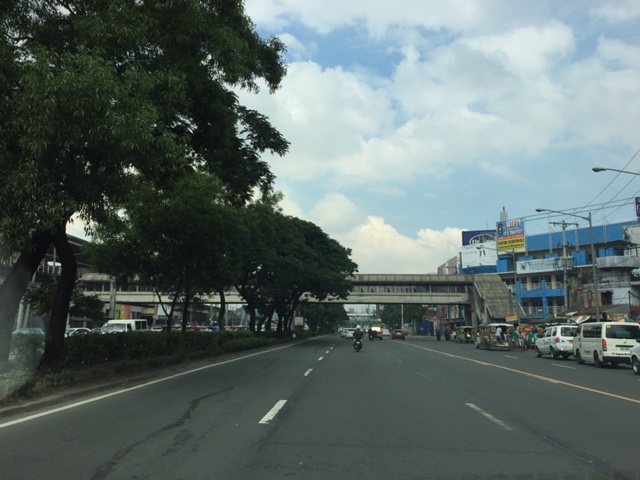
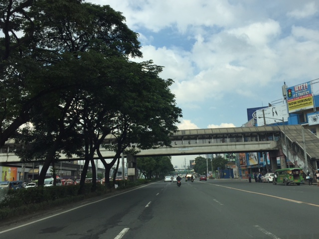
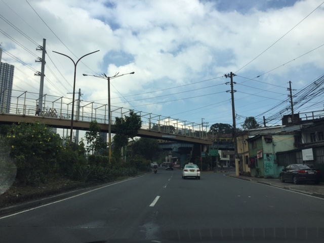
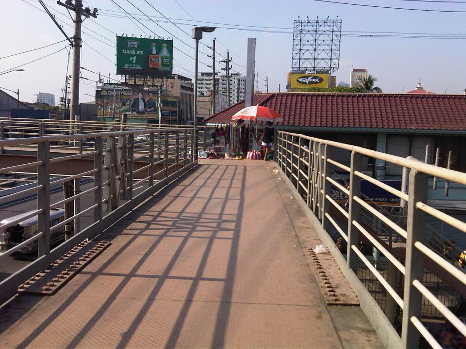
 Overpass at Marcos Highway-Felix Avenue-Gil Fernando Avenue intersection – is probably the busiest among the pedestrian overpasses as it is at a busy junction where there are major commercial establishments (i.e., malls) and where many public transport routes converge.
 Robinsons Metro East overpass – this one also survived the clearance requirements with respect to the elevated superstructure for the Line 2 extension. However, since one of the two stations to be built will be nearby if not right across (part of the station at least) from the mall, then the station itself may function as an overpass.
 Overpass at De la Paz – note the ramp for bicycles and wheelchairs. This is one of the more bike- and PWD-friendly facilities along Marcos Highway. The slope is gentle enough for pedestrians, too, especially senior citizens who might have difficulty with steps.
 Overpass at Ligaya – this one also has ramps that make it easier for people to use to cross the busy highway. This will eventually be the closest overpass to the huge Ayala mall (Feliz) currently under construction at the Marikina side of Ligaya. I suspect that there might be a need for another overpass to be built with respect to the mall for one to directly serve the mall’s customers.
 Line 2 Santolan Station overpass connects the Marcos Highway westbound public transport stop with the rail station along the eastbound side of the highway.
 A closer look at the Santolan Station overpass, which is used by a lot of Line 2 passengers who cross the highway to continue on their journeys/commutes via train from their origins in Rizal, Marikina and Pasig. During the mornings, the observer will see a lot of jeepneys and UV Express vehicles emptying of passengers who cross the bridge to get to the station.
 Santolan footbridge – this is actually more complicated than what is seems in the photo because the steel footbridge also connects to the SM City Marikina overpass (which is not included in this compilation but is visible in the photo). The footbridge branches to provide and almost direct connection between the mall and the Line 2 Santolan Station. That structure is shown at
 Monte Vista footbridge allows people to cross Marcos Highway (at its Marikina/Quezon City end) to and from A. Bonifacio Avenue, which is in Marikina City (Barangka)
More on pedestrian overpasses in the next post!
–
Metro Manila Skybridge: for cars or bicycles?
I was browsing over a not so old, pre-election issue of Top Gear magazine and came upon an article that featured then Senatorial candidate and already former Metro Manila Development Authority (MMDA) Chair Francis Tolentino. The article stated the former MMDA Chair’s frustration that his pet project didn’t get approval from NEDA. The Skybridge he was proposing was basically an elevated road that was to be built on top of Metro Manila rivers. This is in part to save on RROW costs and supposedly to also reduce traffic impacts of construction (note the traffic congestion due to the Skyway Stage 3 construction).
I think that such a Skybridge could have had a positive impact on traffic congestion but for a short time only. The sheer number of vehicles in Metro Manila will only lead to congestion elsewhere being transferred here and, under equilibrium conditions that will eventually be attained as some time in the near future, will ultimately be congested. The concept of tollways is for people to pay for the use of a facility in return for high level of service (read: faster travel). Skyways and other elevated highways cost a lot and the NEDA probably didn’t see a free use elevated structure like the Skybridge having much in terms of ROI.
There is, however, something that may be worth it in terms of potential congestion reduction as well as enhancement of traffic safety and quality of life – a Skybridge for bicycles and pedestrians. This should encourage people to cycle as travel via such mode will be much safer and could possibly be faster. Friends and acquaintances who are cyclists often post about similar facilities in Europe and how these are able to reduce congestion as people opt to cycle and leave their cars at home during the weekdays.
–
Throwback to 1995 – Baguio flyover
Baguio retains a special place in me as it is where I did my first out of town project back in 1995. This was just after I finished my master’s at UP Diliman. The project was Baguio’s first flyover or overpass and it was being proposed along Bokawkan Road, which is then as now a very busy thoroughfare connecting the city to La Trinidad, the capital town of Benguet province. Our task was to determine the best configuration for the flyover including the required capacity for it and the remain at-grade roads once it was built.
I remember it was very rainy when we were there and our accommodations (which was volunteered by our client – their family’s vacation house in the city) turned out to be quite inhospitable. We had to buy blankets and make our own beds as we had practically no budget to stay at a hotel. I recall the house was a bit creepy especially for the last few days I stayed there by myself (my mentor had to go back to Manila) to supervise the traffic surveys at the proposed site of the flyover. That was quite the adventure for me then as I also tried to explore the city on foot. I walked the entire stretch of Session Road when it was still the Session Road (old) people reminisce about. I also walked around neighborhoods in the Gen. Luna area where the house I was staying at was located.
Here are some photos of the flyover now and the area where I supervised traffic surveys together with the bridge engineer who was from Baguio.
 The flyover as seen from one of the side streets in the Trancoville district.
 A closer look at this almost 20-year structure.
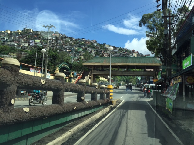 Traveling along the service road along the flyover and towards the direction of La Trinidad. Shown also in the photo is one of the pedestrian overpasses in the city. I actually like the architecture of these overpasses that seems more apt compared to Metro Manila’s steel structures.
 I included this photo past the overpass to show how crowded Baguio is already with houses having replaced trees in many mountains and hills. These used to be all green with trees back in the 1990s with only a few shanties that had started to sprout back then. I have other photos of such scenes of houses growing out of the mountains around the city and will share those in another post soon. Such have become the representation of unsustainable development for a city that has become overcrowded and yet continue to attract many people who eventually become residents.
–
Minimum vertical clearance for railway, flyover, bridge and footbridge structures
Further to the discussion in the last post, the Department of Public Works and Highways (DPWH) recently came out with a Department Order providing a guide for minimum vertical clearance for railway, flyover, bridge and footbridge structures. A PDF of the DO may be found in the following link:
Department Order_No. 53_ Series of 2016
Of course, the DPWH Department Order No. 53 Series of 2016 may be found and downloaded directly at their website. Here’s a figure from the DO:

–
LRT Line 2 issues: elevated tracks vs pedestrian overpasses
The ongoing construction of the LRT Line 2 Extension has reached a point where it is clear that several pedestrian overpasses will be affected by the project. Following are photos of overpasses between Angel Tuazon Ave./Felix Ave. and Masinag. Most are clearly along the elevated superstructure of the Line Extension and will have to be redesigned if not removed. Some are relatively new and so brings some questions whether those behind the overpasses coordinated with the proponents of the Line 2 Extension project.
 The practically new pedestrian overpass near the Vermont Royale subdivision gate will have to be redesigned to give way to Line 2’s elevated tracks. This is the view along the westbound side of Marcos Highway. Hopefully, the design will not be similar to the somewhat awkward and, some say, ‘people-unfriendly’ designs of overpasses along EDSA due to the MRT 3 tracks.
 Here’s a view of the same overpass from the eastbound side of Marcos Highway.
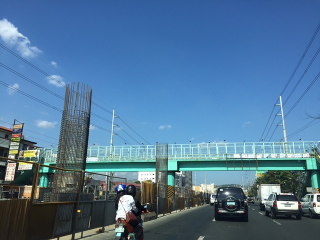 Another overpass that will have to be dismantled from the looks of the columns currently under construction is the one near the Filinvest East gate.
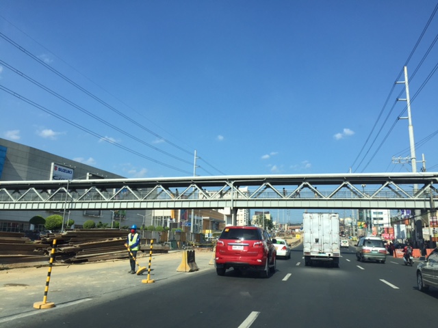 The overpass across from SM Masinag may also have to go but since there will be a stations to be constructed in this area, there is an opportunity to integrate the pedestrian walkway with the elevated station.
I will try to take photos of other overpasses between Santolan and Sta. Lucia that may be affected by the construction of the Line 2 extension. The ones across Robinsons Metro East and De La Paz though might be integrated with the station that is to be constructed in the area. This would be similar to the SM Masinag overpass, which will presumably be integrated with the Masinag Station of the Line 2 extension.
–
The need for basic transport infrastructure
The need for basic transport infrastructure cannot be emphasized more when we see photos or reports on makeshift bridges and very rough roads that many people use for travel between their homes and the places where they work, attend school or to go to markets to sell or purchase items like food. Many people living in rural areas continue to be in poverty because they lack the infrastructure required for them to be productive. Nevermind that most wealth and productivity is in urban areas. Are we encouraging people who don’t have to be in cities to flock to the cities? And who will be left in the farms? To fish? To produce the food that is so vital for everyone? This is actually a delicate system that hangs in the balance if we cannot support rural development as well as we have urban development.
 A hanging bridge in Tarlac is basically the only way for people to travel across this river, which swells during the wet season. The span is suspended from two columns at either ends of the bridge where there are makeshift stairs for people to climb unto and off the bridge.
 Another view, this time from one end of the hanging bridge shows a crude structure made out of steel cable, reinforcing bars and whatever wood they could use as planks and hand rails. It looks flimsy but they make do with it out of need. We learned that in times when the bridge was destroyed by typhoons, they would rebuild it with little help from the government.
The term “buwis buhay” comes to mind every time I look at these photos and others I have taken of rural roads in Tarlac and other parts of the country. People, especially children and those working hard to care for their families, should not have to risk lives or limbs just so they could go to work or school. Farmers and fishermen should be provided efficient access to markets so as to encourage them to continue in their contribution to food production. And perhaps we should think twice about building expensive white elephants for vainglorious attempts at mega structures especially when we still have a lot to accomplish in basic transport infrastructure.
–
Bridges too far (from being practical)
I am always amused whenever I read or hear news about big bridge projects being proposed by politicians in the Philippines. There is no lack of interest in these types of projects considering the many islands comprising the country. However, at this time and with the urgent demand for other transport infrastructure like access roads (farm to market, tourism, etc.), public transport systems, airports and ports, bridge projects of the “mega”-scale can be considered more as follies than smart investments.
Among the projects I have heard or read about are bridges connecting:
- Cebu and Bohol
- Cebu and Negros (Negros Oriental)
- Panay (Iloilo) and Negros (Negros Occidental)
- Panay (Iloilo), Guimaras and Negros (Negros Occidental)
- Batangas and Mindoro
There is also a bridge proposed to cross the Pangil Bay in Mindanao that has been part of many conversations pertaining to development in Northern Mindanao. These bridges are entirely different in terms of scale and traffic from, say, the proposed third bridge connecting Cebu and Mactan Islands or even the more basic bridges that should have been built many years ago in order for people in rural areas to have direct and safe access to schools, hospitals and workplaces. We see so many images and viral videos of children crossing swollen rivers using make-shift foot bridges, boating or even just walking or swimming across the rivers. Shouldn’t our leaders prioritize these instead of mega bridge projects?
I still have the same questions as before for the proponents of these bridges:
- Are these bridges economically and financially viable?
- What would be the traffic for these bridges?
- Would the money spent for any of these bridges be better allocated for other infrastructure projects in their constituencies?
The first and second questions are often easily answered but it can be argued that traffic forecasts and estimated benefits can be drastically and dramatically increased just so a project is justified. The third one is usually the testy question that, when combined with the first two could be very difficult to answer and explain. Many cities and provinces in the country lack basic transport infrastructure as well as infra for social services (e.g., schools, health centers, hospitals, etc.). And even with health centers, hospitals and schools being built, their facilities and human resources are often less than satisfactory or adequate for the people they are supposed to serve and benefit. These should be on the top of priorities rather than mega bridge projects whose potential benefits will take years, if ever, to actually realize.
–
On jaywalking, overpasses and informal terminals
I had some errands last December and decided to take public transport instead of taking our car and wasting time parking the vehicle. There was significantly less traffic at that time of the year because schools already on Christmas break and everyone else seemed to be on the slow side of the holiday mode (read: not in shopping mode). I needed to cross the wide road that is Quezon Avenue and there was a sign where I usually crossed that it was now prohibited to cross there. I had to take the overpass to get to the other side and to the jeepney stop to board one to get back to the university.
The overpass at the Quezon Ave.-Araneta Ave. intersection is under-utilized. I base this on the several times I’ve used the overpass. Most people prefer to cross at road level, taking advantage of the traffic signal cycle that allows for gaps in the traffic for pedestrians to cross safely. Of course, there are those who cross any time and seem to tempt fate by their behaviour. They seem to tempt also the MMDA traffic enforcers assigned in the area but from what I have observed, enforcement of the “no jaywalking” policy is usually lax or non-existent. People regularly cross at ground level in plain view of traffic enforcers.
 A vendor set-up at the corner of the pedestrian overpass at the Quezon Ave.-Araneta Ave. intersection. Obviously, there are few pedestrians using this overpass as most prefer to cross at ground level.
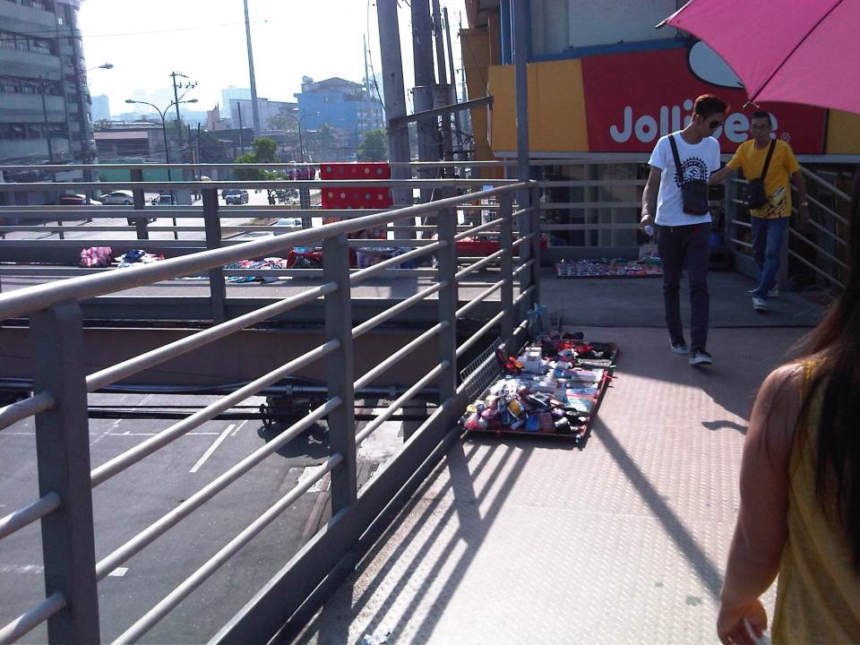 More vendors on the overpass – fortunately, there were few pedestrians using the overpass at the time. Its not the same for other overpasses that are crowded due in part to vendors occupying much of the facility.
 The stairs for many overpasses around Metro Manila are a bit on the steep side. That’s generally not okay with senior citizens, children or persons with disabilities.
There is an informal, on-street jeepney terminal right at the foot of the overpass. If you are in a hurry, its best to try to board a jeepney on the second lane as they are more likely to proceed when the approach is given a green light. From my experience, it takes about 2-3 cycles before the “queued” jeepneys finally cross the intersection. It takes that time to at least have several passengers for the jeepneys before it proceeds to cross the intersection. Most passengers here are transferring from jeepneys plying routes along Araneta Ave. There shouldn’t be an informal terminal here and jeepneys occupy 1-2 lanes of the road at a critical point – the intersection approach. This means intersection capacity is significantly affected and many vehicles could not proceed as they are blocked by the jeepneys. Special mention is made of vehicles wanting to make a right turn but have to go through this “gauntlet” of public utility vehicles. Again, there are MMDA enforcers in the area but it seems the jeepneys and the barkers hold sway and likely with the blessing of enforcers. Such situations are commonplace in Metro Manila and many other cities, and contribute to traffic congestion and other problems commuters regularly encounter.
–
Inappropriate designs for pedestrian overpasses
There was a photo that circulated in social media the last two weeks showing electric and telephone cables coming out of the stairs of a steel pedestrian overpass. It was obvious that the people responsible for both the overpass (MMDA) and the cables (power and phone utilities) did not coordinate their work and so people had to risk electrocution to be able to cross the street at what is assumed to be a busy intersection. Such is an example of unsuitable designs and bad implementation of infrastructure projects; in this case, that of a pedestrian facility. There are many other examples of these flawed execution of projects including electric posts in the middle of lanes after road widening projects, short span pedestrian overpasses that are not utilised by people (preferring to cross at ground level) because the road was narrow in the first place. Many are a waste of resources considering they may not have been required in the first place if careful assessment were made about the situation.
The pedestrian overpass under construction at the Masinag junction (photo below) is a good example of what looks like flawed design. The elevated walkway is narrow and is located right at the corners of the intersection. The width is important here because there are many people usually crossing at Masinag and the overpass can become congested for users. The stairs have not yet been constructed but if past designs of overpasses like this is to be considered, the stairs will likely be steep and therefore difficult to use for senior citizens, PWDs and children. Note, too, in the photo that the bridge already obscures part of the traffic signals previously installed at the intersection. This means the lights would have to be reinstalled or transferred so motorists can clearly see the signals.
 Pedestrian overpass under construction at the Masinag junction in Antipolo City
My friends at the DOTC tell me that it is only a matter of time before the Line 2 Extension project is bidded out an construction finally goes underway. Depending on the the final design of the line and end station, there might be a need to revisit the pedestrian overpasses along Marcos Highway. Hopefully, they don’t become like the overpasses along EDSA that had to be raised more due to the elevation of the Line 3 facilities including the catenary for the trains. I’m sure there is a suitable design for pedestrian facilities for crossing the wide Marcos Highway. It only requires careful thinking and creative minds to come together to come up with the appropriate facilities.
–
