
Home » Bridges (Page 5)
Category Archives: Bridges
On jaywalking, overpasses and informal terminals
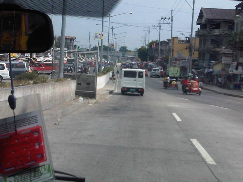
I had some errands last December and decided to take public transport instead of taking our car and wasting time parking the vehicle. There was significantly less traffic at that time of the year because schools already on Christmas break and everyone else seemed to be on the slow side of the holiday mode (read: not in shopping mode). I needed to cross the wide road that is Quezon Avenue and there was a sign where I usually crossed that it was now prohibited to cross there. I had to take the overpass to get to the other side and to the jeepney stop to board one to get back to the university.
The overpass at the Quezon Ave.-Araneta Ave. intersection is under-utilized. I base this on the several times I’ve used the overpass. Most people prefer to cross at road level, taking advantage of the traffic signal cycle that allows for gaps in the traffic for pedestrians to cross safely. Of course, there are those who cross any time and seem to tempt fate by their behaviour. They seem to tempt also the MMDA traffic enforcers assigned in the area but from what I have observed, enforcement of the “no jaywalking” policy is usually lax or non-existent. People regularly cross at ground level in plain view of traffic enforcers.
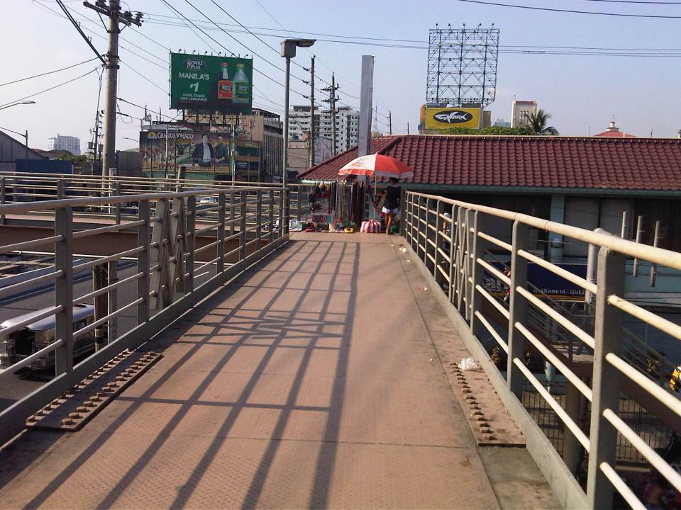 A vendor set-up at the corner of the pedestrian overpass at the Quezon Ave.-Araneta Ave. intersection. Obviously, there are few pedestrians using this overpass as most prefer to cross at ground level.
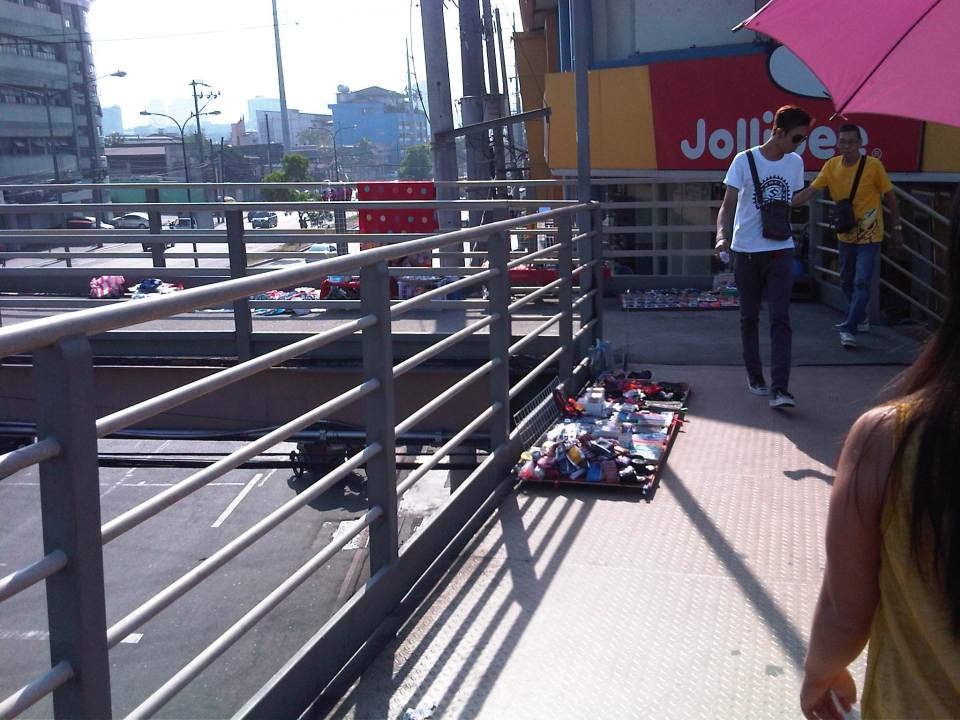 More vendors on the overpass – fortunately, there were few pedestrians using the overpass at the time. Its not the same for other overpasses that are crowded due in part to vendors occupying much of the facility.
 The stairs for many overpasses around Metro Manila are a bit on the steep side. That’s generally not okay with senior citizens, children or persons with disabilities.
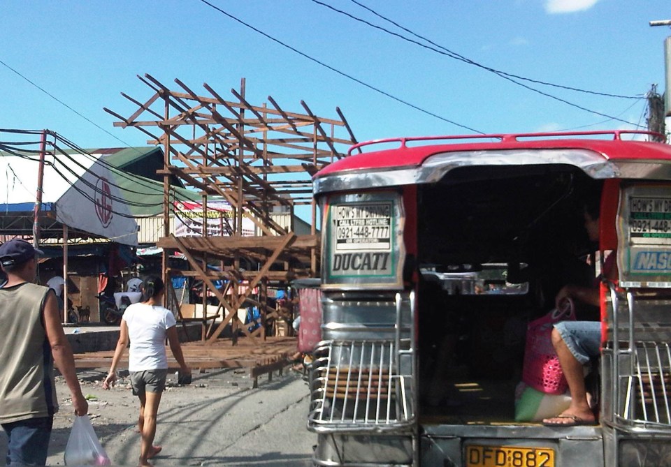
There is an informal, on-street jeepney terminal right at the foot of the overpass. If you are in a hurry, its best to try to board a jeepney on the second lane as they are more likely to proceed when the approach is given a green light. From my experience, it takes about 2-3 cycles before the “queued” jeepneys finally cross the intersection. It takes that time to at least have several passengers for the jeepneys before it proceeds to cross the intersection. Most passengers here are transferring from jeepneys plying routes along Araneta Ave. There shouldn’t be an informal terminal here and jeepneys occupy 1-2 lanes of the road at a critical point – the intersection approach. This means intersection capacity is significantly affected and many vehicles could not proceed as they are blocked by the jeepneys. Special mention is made of vehicles wanting to make a right turn but have to go through this “gauntlet” of public utility vehicles. Again, there are MMDA enforcers in the area but it seems the jeepneys and the barkers hold sway and likely with the blessing of enforcers. Such situations are commonplace in Metro Manila and many other cities, and contribute to traffic congestion and other problems commuters regularly encounter.
–
Inappropriate designs for pedestrian overpasses
There was a photo that circulated in social media the last two weeks showing electric and telephone cables coming out of the stairs of a steel pedestrian overpass. It was obvious that the people responsible for both the overpass (MMDA) and the cables (power and phone utilities) did not coordinate their work and so people had to risk electrocution to be able to cross the street at what is assumed to be a busy intersection. Such is an example of unsuitable designs and bad implementation of infrastructure projects; in this case, that of a pedestrian facility. There are many other examples of these flawed execution of projects including electric posts in the middle of lanes after road widening projects, short span pedestrian overpasses that are not utilised by people (preferring to cross at ground level) because the road was narrow in the first place. Many are a waste of resources considering they may not have been required in the first place if careful assessment were made about the situation.
The pedestrian overpass under construction at the Masinag junction (photo below) is a good example of what looks like flawed design. The elevated walkway is narrow and is located right at the corners of the intersection. The width is important here because there are many people usually crossing at Masinag and the overpass can become congested for users. The stairs have not yet been constructed but if past designs of overpasses like this is to be considered, the stairs will likely be steep and therefore difficult to use for senior citizens, PWDs and children. Note, too, in the photo that the bridge already obscures part of the traffic signals previously installed at the intersection. This means the lights would have to be reinstalled or transferred so motorists can clearly see the signals.
 Pedestrian overpass under construction at the Masinag junction in Antipolo City
My friends at the DOTC tell me that it is only a matter of time before the Line 2 Extension project is bidded out an construction finally goes underway. Depending on the the final design of the line and end station, there might be a need to revisit the pedestrian overpasses along Marcos Highway. Hopefully, they don’t become like the overpasses along EDSA that had to be raised more due to the elevation of the Line 3 facilities including the catenary for the trains. I’m sure there is a suitable design for pedestrian facilities for crossing the wide Marcos Highway. It only requires careful thinking and creative minds to come together to come up with the appropriate facilities.
–
Designing for walking and cycling
There are current discussions regarding the highway and street designs mostly from the perspective of safety. These discussions include those hosted by the academe and those posed as challenges by practitioners, mainly architects with experience designing similar facilities abroad and who are advocating for more people-friendly designs. Such discussions are slowly but steadily gaining traction in the Philippines but has met with some resistance in the form of key persons and agencies not giving due attention to the design challenges being posed that would have implications on planning and design guidelines. That is, the implications of promoting people-friendly designs in our roads will require changes in the National Building Code as well as the Highway Planning Manual of the Department of Public Works and Highways (DPWH). These changes will include standards and specifications for the geometric design of walkways and bikeways integrated into our roads and a departure from the current approach that basically treats pedestrian and cycle facilities as an afterthought to motorways.
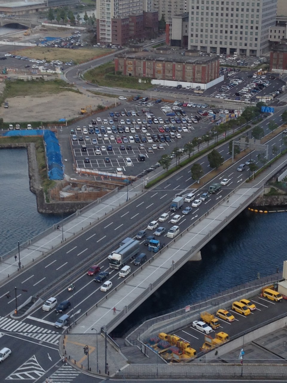
I’m posting a few photos I took from a recent visit to Yokohama, Japan, which was my home for 3 years back in the 1990s. Much has changed in Yokohama since I last visited in 2008 but notable are the people friendly transport infrastructure including pedestrian and cycling facilities. Following are photos taken in the Minato Mirai district of the city.
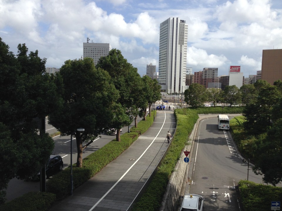 Pedestrian and cycling lanes along the main road of Yokohama’s Minato Mirai district. The tree-lined street provides a conducive environment for walking and cycling.
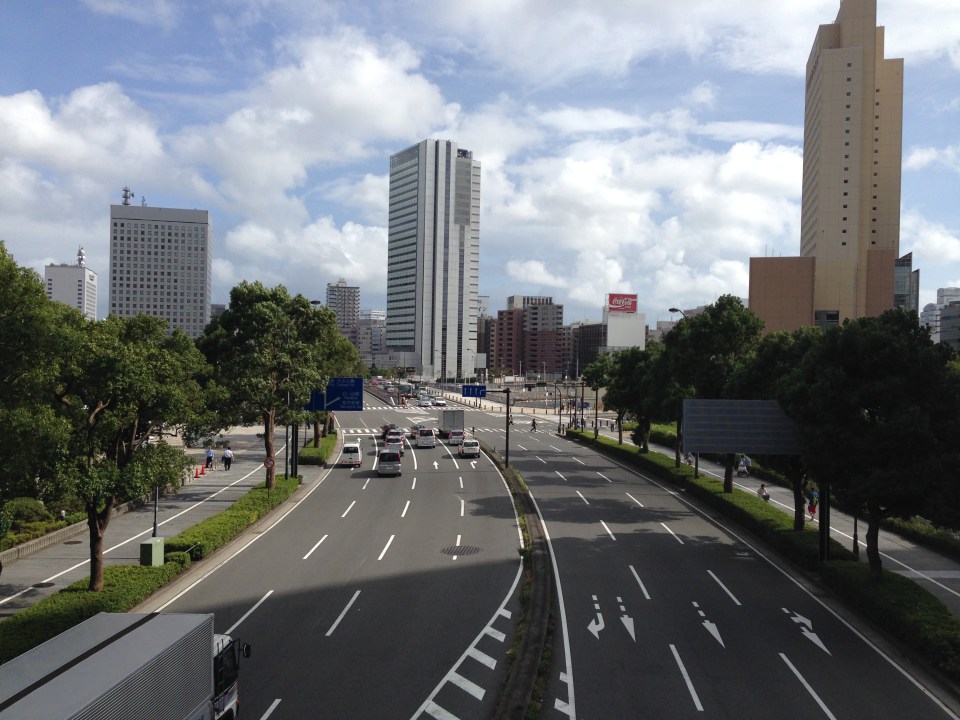 Depending on how one sees it, Minato Mirai Odori is a 10-lane road with 4 lanes allocated for walking and cycling (i.e., 1 lane each on either side of the lanes for motor vehicles).
 Pedestrian bridge connecting Minato Mirai Odori with the World Porters commercial development
 A 10-lane bridge with 2 of 5 lanes per direction devoted for walking and cycling. That’s a full lane of at least 3.2 meters allocated for pedestrians and another full lane for cyclists. While it is not shown in the photo, the pedestrian and cycling lanes are efficiently utilized during the peak periods.
–
Luzon Avenue Flyover
The Luzon Avenue flyover spanning the width of Commonwealth Avenue is now open to two way traffic. Previously, only the northbound side was open, allowing vehicles to cross Commonwealth from Tandang Sora Ave./Katipunan Ave. to Luzon Ave. and towards Congressional Avenue. I took a few photos of the flyover and the vicinity of Luzon Avenue en route to NLEX a few days ago.
 The Luzon Avenue flyover has a total of 4 lanes, divided by a median island.
 The lamp posts indicate a well lighted road during night time. The pedestrian walkways on either side are quite narrow and I think the designers of the flyover could have widened this feature of the facility.
 A view of Commonwealth Avenue from the flyover.
 Along the other end of the flyover is Luzon Avenue, which has been widened to accommodate the flyover and the at-grade sections connecting to the QMC-bound side of Commonwealth Avenue.
 A pedestrian overpass was constructed at the foot of the Luzon Ave. flyover so pedestrians will not cross at this critical part of the flyover when vehicles would typically be picking up speed as they descend (or ascend on the other side) the flyover. There are still construction work along the northbound side of Luzon Avenue.
 Luzon Avenue, which is a 6-lane, 2-way road divided by a median, is quite crowded with either side of the road occupied mostly by informal settlers. There is also an informal wet market (talipapa) along the road.
 The pavement is elevated compared to the land on either side of the road. There are stores and shops set up by those living along the road.
 Side streets are narrow and could probably accommodate only cars or small vehicles like tricycles (also shown in the photo traveling along Luzon Ave.
 Some stalls are just along the street like this fruit stand that’s already on the carriageway. The photo also shows a better view of a side street with parked vehicles along one side of the road.
 Approach to Congressional Avenue – there is another pedestrian overpass near the junction with Congressional. Note the height of the plant box on the median that is designed to discourage or minimize jaywalking across Luzon Ave.
 Water works at the junction of Luzon Ave. and Congressional Ave. Luzon Ave. continues as a narrow 2-lane street towards the direction of Bgy. Holy Spirit.
–
Highway 2000 and Barkadahan Bridge
There is an alternate route from the towns of Rizal Province to Taguig and Makati. The route will allow people to avoid the congested Ortigas Avenue, C-5 and EDSA, which is the typical route between the Makati CBD and Bonifacio Global City and the Rizal Province towns along Ortigas Avenue Extension and the Manila East Road including Cainta, Taytay, Antipolo, Angono and Binangonan. The alternate route utilizes a road that was constructed as part of a network of roads intended to encourage development in idle lands in Taytay that came out of the reclamation that was part of the Manggahan Floodway project.
 One-way section beside the Taytay Public Market
 Parts of the market were under renovation
 Past the market, Highway 2000 becomes a 2-way road. There are no lane markings and the pavement shown in the photo indicates a poorly maintained road.
 Along the road are subdivisions, a few commercial establishments, a columbarium under construction, informal settlers and much open space.
 Junction with the Manggahan East Bank Road and approach to the Barkadahan Bridge
 Crossing the East Bank Road to the 2-lane Barkadahan Bridge, you can immediately notice the narrow sidewalks along each side of the bridge. I think they should have designed this to be wider considering the significant number of people crossing the bridge on foot.
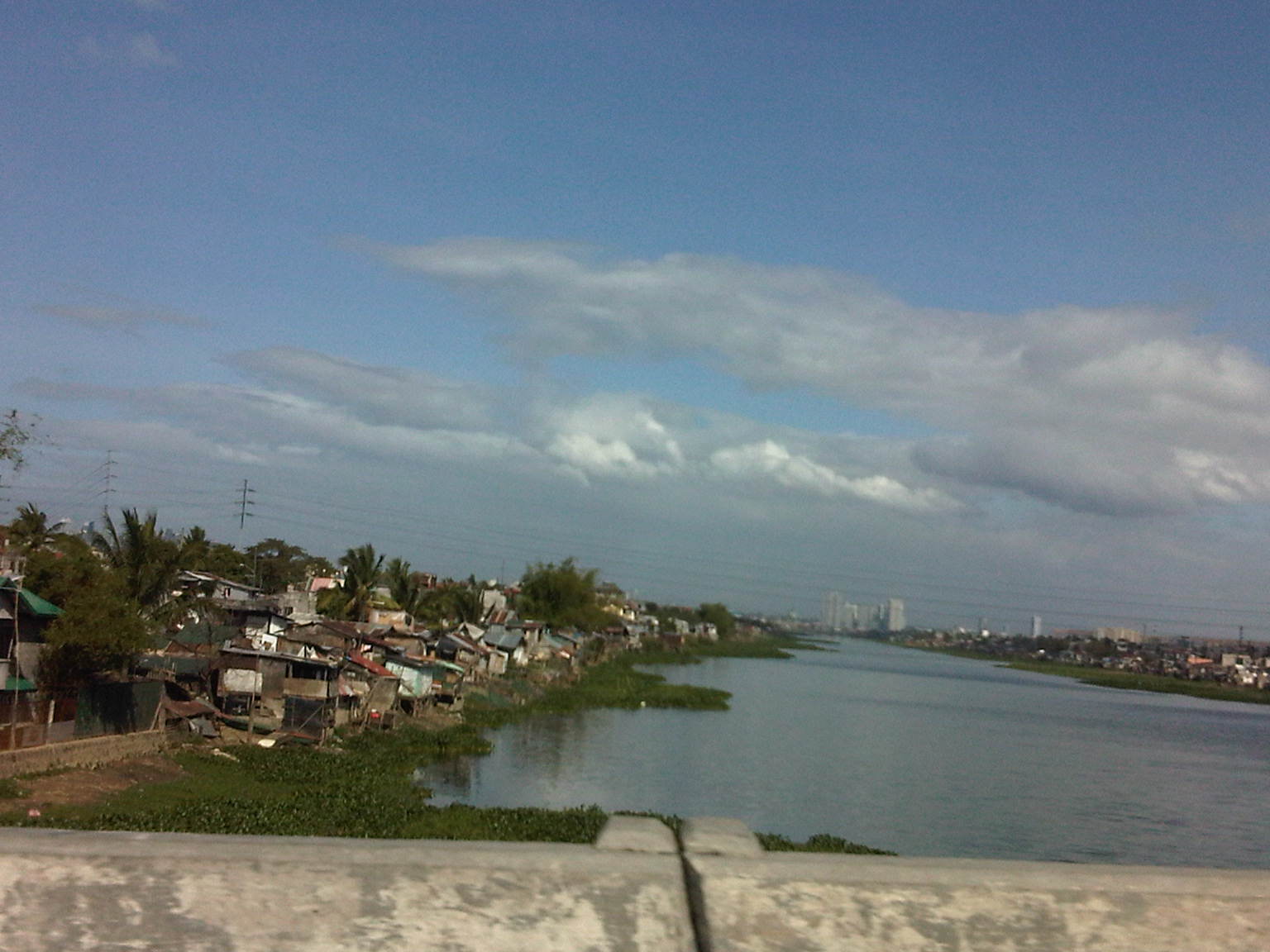
 One can have a good view of the southernmost end of the Manggahan Floodway from the bridge.
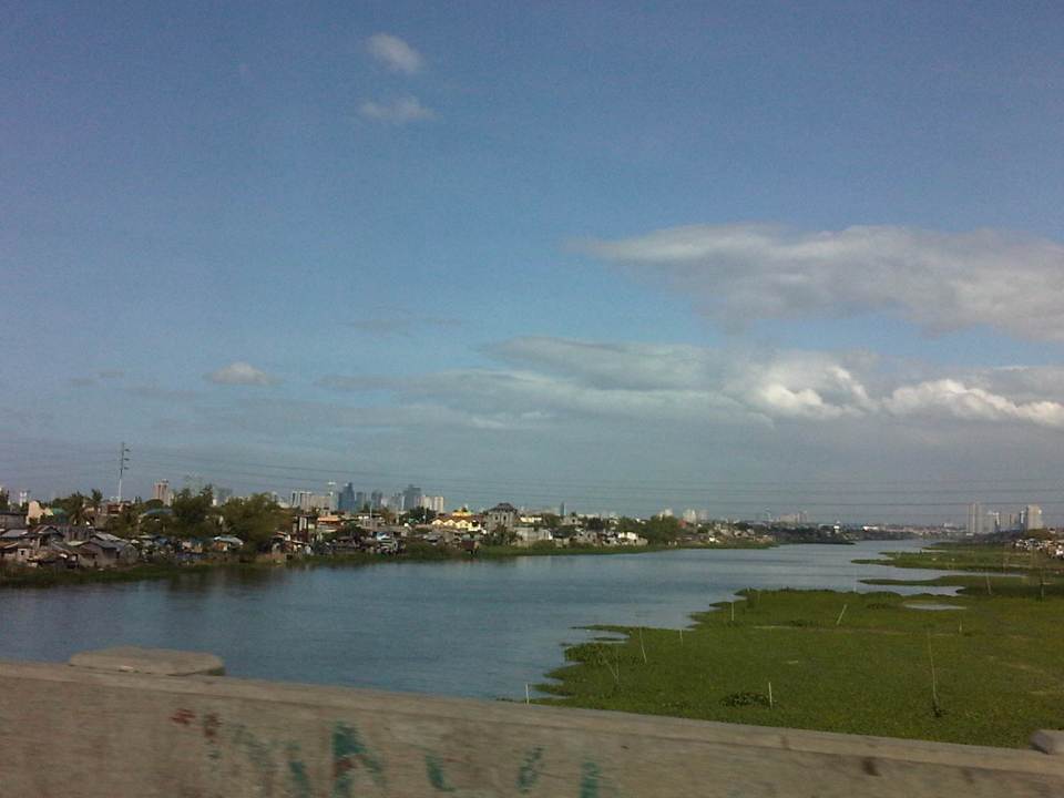 The view shows a lot of informal settlers along both the west and east banks of the floodway and a lot of water lily and kangkong on the waters, which lead to the Laguna de Bay.
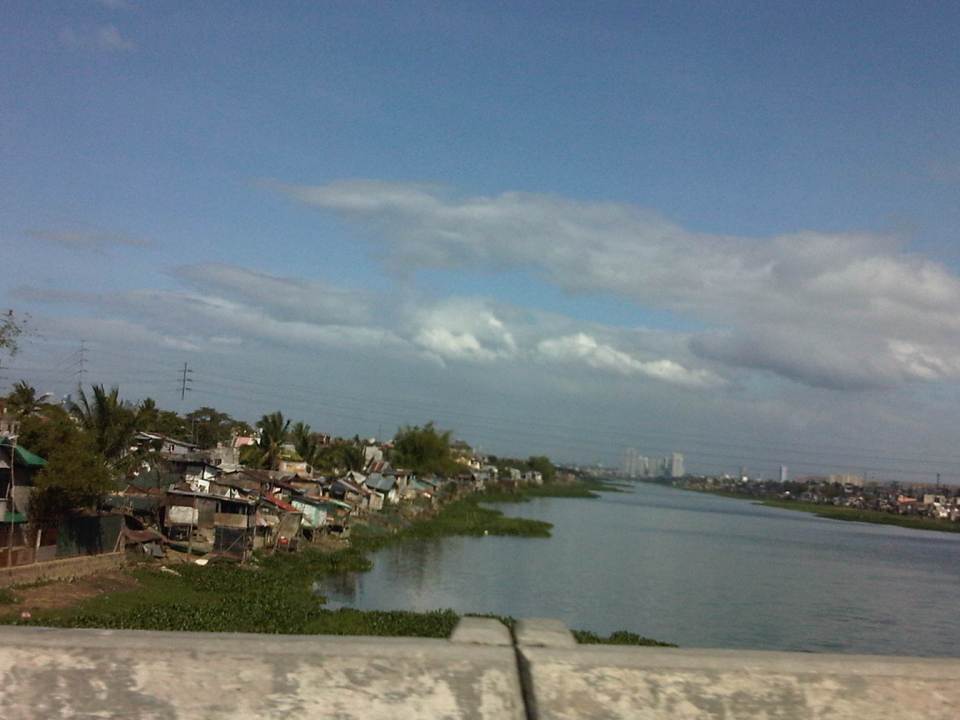 Shanties along the west bank of the floodway. The tall buildings in the horizon and downstream from the bridge are located in Quezon City’s Eastwood along Circumferential Road 5. Behind Eastwood is the Marikina River, which connects to the Manggahan Floodway via the Rosario Weir.
 The other end of the Barkadahan Bridge is a junction with the Manggahan West Bank Road and a generally residential area that is still part of Taytay, Rizal.
The same route can also be used by those residing in Pasig and Marikina cities to the east of the Manggahan Floodway as there is a direct connection to Highway 2000 and the Barkadahan Bridge via the East Bank Road of the Floodway.
–
Sales Bridge repairs completed
The repairs to Sales Bridge, which connects the Fort Bonifacio area to Villamor and the NAIA terminal complex, has been completed and all lanes along the bridge are now passable. The bridge has been a bottleneck for some weeks as repair works have led to serious traffic congestion in the area, particularly along Sales Road that’s among the main access roads to NAIA, particularly Terminal 3, which is at the end of the road and along Andrews Avenue. From another perspective, the bridge is also a main access route to Fort Bonifacio (and Bonifacio Global City) and Makati (via Pasong Tamo Extension) via Lawton Avenue, of which the bridge is a part of. I took a couple of photos while en route to T3 clearly showing all lanes open to traffic.
 Under the Skyway, traffic flows smoothly on either side of the bridge. When the bridge was being repaired, only 3 lanes were available to traffic – one westbound and two eastbound.
 Mixed traffic along the Sales Bridge includes trucks and bicycles. Further downstream is a roundabout at the intersection of Sales Road and the West Service Road along the South Luzon Expressway. Also, shown in the photo is the Skyway ramp connecting the tollway to the Villamor and the NAIA terminal complex.
–
The San Juanico Bridge
The longest bridge in the Philippines is found between the islands of Samar and Leyte in the Visayas (central Philippines). Flying on a clear day, we saw the bridge as our plane maneuvered towards Tacloban Airport. I took a few shots before our plane turned for the landing. Later, we also took a few photos along the bridge en route to Catbalogan, Samar.
 Our first look at the San Juanico Bridge was from the air as our aircraft maneuvered towards Tacloban Airport. Leyte Island is on the right while Samar Island is on the left.
 The Samar end of the bridge is in the town of Basey and the Leyte end is in Tacloban City.
 The bridge is designed in order for vessels to be able to navigate under the superstructure. The construction obviously takes advantage of the islands in the San Juanico Strait.
 Traffic along the bridge was quite low. Heavy vehicle traffic like the truck in the photo are usually regulated when using the bridge as the structure cannot carry too much load given the heavier trucks we have now. The DPWH is in charge of monitoring such heavy vehicle traffic and large trucks must get permission before traversing the bridge.
 Quite unusual – this was the first time I saw a public utility motorcycle, called habal-habal in many parts of the country, that had a makeshift roof to provide shade to the rider and his passenger(s).
 This is a view I’ve seen as a background in many photos as it shows an interesting section of the bridge as it eventually lands in Samar.
Given the light traffic along this bridge that connects two of the largest islands in the country, I am tempted to ponder on the proposals to build much longer bridges connecting other islands. One such proposal is for a bridge to connect the islands of Panay and Negros in Western Visayas. While traffic between these two islands will surely be more than that between Samar and Leyte, I would bet that this won’t be enough to justify the staggering cost of such infrastructure. Indeed, it will be a longer bridge and one that will be a marvel of engineering but it is a folly if seen from the perspective of the people in both islands having more pressing needs in both social and institutional infrastructures (e.g., health centers and schools) that spending money on such a bridge is just plain obscenity.
–
Batasan-San Mateo Road
The Batasan-San Mateo Road is one of two roads directly connecting Metro Manila (through Quezon City) to the northern towns (San Mateo and Rodriguez) of Rizal Province. One end of the road is at the junction with the IBP Road that is the main access to the Batasan Complex, where the Philippine House of Representatives is located. The other end is at the junction with Gen. Antonio Luna, which is also known as the Marikina-San Mateo-Montalban Road.
 The road descends from the higher elevation hills of Quezon City and the Batasan area towards the Marikina River and the Marikina Valley.
 The road has 2 lanes along each direction and opposing traffic are separated by a narrow median island tht probably won’t stop larger vehicles should their drivers lose control and go towards the other side.
 Part of the road was carved out of the hill and this is clear from the sections where the rock or soil is exposed. This is similar to the way Ortigas Ave. in Pasig was constructed in the 1970’s out of the rock of the hills of Pasig and Mandaluyong.
 Traffic is generally light along this road but there are incidence of congestion uphill (to QC) due partly to the slope and in many cases due to trucks or tricycles.
 Lands on either side of the road are residential areas with a mixture of exclusive subdivisions, low income communities and informal settlers.
 A concrete bridge spans the Marikina River.
 The bridge is long and if traveling along the outer lanes, one can get a good view of the Marikina River and its flood plains. When traveling to QC, one would have a good view of the structures dotting the hills, which are mostly houses and shanties of different types.
 Jeepneys started plying routes along the road as it provided a shorter way between Metro Manila and the towns of San Mateo and Rodriguez as well as the northern barangays of Marikina. Travelers won’t have to pass through the traditional way via Marikina.
 Median opening just meters away from the junction with Gen. A. Luna.
 End of the road – the junction with Gen. A. Luna, which is already in San Mateo, Rizal. Turning right takes the traveler to Marikina City while a left will bring one to San Mateo town proper and Rodriguez (Montalban) further on.
–
Montalban Highway
The Montalban Highway is located between the junction with J.P. Rizal Avenue in Rodriguez, Rizal (formerly known as the town of Montalban) and the junction with Payatas Road in Quezon City, Metro Manila. It serves as part of an alternate but somewhat longer (distance-wise) route between Metro Manila (via QC) and the northern towns (San Mateo and Rodriguez) of Rizal Province. The other route is through the Batasan-San Mateo Road, which also has a bridge crossing the Marikina River. While it is longer, it is often the less congested road and may perhaps offer faster travel (shorter travel times) between QC and San Mateo or Rodriguez. It is definitely the faster route to Montalban since travelers won’t have to pass through the town proper of San Mateo, which can get congested due to the local traffic and narrow roads.
 Turning right from J.P. Rizal and unto the QC-bound side of Montalban Highway
 The road is a 4-lane/2-way highway with a median island with a plant box separating opposing traffic.
 Traffic is a mix of cars, tricycles, jeepneys, buses, even bicycles and pedicabs.
 Along the highway is the Montalban Town Center, which has buildings on either side of the road midway through the highway. The buildings are connected by a covered elevated walkway.
 Past the town center is the Montalban Public Market and the area reminds of what Kalayaan Avenue in Makati City looked like before it was widened.
 We couldn’t understand exactly what the tagline “committed to change with honor” really meant, especially when it’s placed together with the sign for the market.
 Tricycles easily clog up the highway with many trying to get passengers by slowly traveling along the curbside.
 Past the commercial/market areas, traffic is free-flowing.
 Approach to the San Jose Bridge crossing the Marikina River
 There’s a steel structure alongside the bridge that carries water pipes. From distance, the structure together with the bridge makes it look like the San Jose Bridge is a steel structure.
 What looks like a hill at the end of the highway is actually part of the La Mesa Dam reservoir and watershed.
 After crossing the bridge, traffic is still light but vehicles generally slow down as they approach the end of the highway where there is a junction.
 It turned out that vehicles were also slowing down due to major waterworks being conducted at the intersection of Montalban Highway and Payatas Road.
 A closer look at the pipes being laid out in the area when we passed by this June.
–
Romulo Highway: San Clemente – Lingayen
Romulo Highway originates from Tarlac City and passes through the towns of Sta. Ignacia, Camiling and San Clemente in Tarlac, and then the towns of Mangatarem, Aguilar, Bugallon and in Pangasinan. It ends at Lingayen, Pangasinan, in essence connecting the capitols of two major provinces in Central Luzon (Region 3/Tarlac) and the Ilocos (Region 1/Pangasinan).
 Solar dryers – a common sight along Philippine highways is palay spread out along the shoulders to dry naturally under the sun
 Good condition – pavements along sections of the Romulo Highway between San Clemente and Lingayen are generally well-maintained
 Approach to intersection – the island is part of the channelization at the junction to physically separate vehicles approaching the junction.
 Channelization – the islands along with directional signs help guide motorists at the junction.
 Approaching a curve – this section can be a little tricky with a climb towards a horizontal curve.
 Sharp curve – the curve is sharp enough to necessitate the installation of chevrons. This is combined with a climb or descent.
 Reverse – it turns out that this section is actually a reverse curve, which increases the complexity of the section for drivers and riders.
 Transition to a bridge – the reverse curve leads travelers to the Bugallon Bridge across the Agno River (direction towards Lingayen). Note the 20-ton limit of the bridge indicating that it is a relatively new bridge applying the DPWH standards for load limits.
 Bugallon Bridge – is typical concrete bridge structure without an arch. Barriers are concrete and should be able to withstand collisions with most type of vehicles.
 Agno River – is part of one of the larger river systems in Luzon Island and the country. The river becomes the Tarlac River when it branches out to Tarlac Province.
 Bugallon Bridge – continuation of the long bridge terminating at an embankment that leads to another bridge towards Lingayen.
 Padilla Bridge – is a steel truss bridge that is older than the Bugallon Bridge not only based on the form (many old bridges along national highways are steel truss bridges) but also on the load limit of 15 tons. The lane widths are also narrower than that of the Bugallon Bridge.
 Padilla Bridge – is longer than the Bugallon Bridge as it crosses a wider branch of the Agno River system.
 San Jose Bridge – viewed towards Lingayen from Bugallon is a relatively short steel truss bridge.
 San Jose Bridge – view towards Bugallon from Lingayen is probably the same age as the Padilla Bridge. This bridge also has a 15-ton load limit.
 Crossroads – vehicles turning to the left will be headed back towards Tarlac through Bugallon and Mangatarem. Going straight will take the traveler to the towns of Labrador, Sual and the general direction of Alaminos and Bolinao. The SUV on the left is headed for Lingayen and Dagupan.
 Provincial boundary – a simple arch marks the boundary between Pangasinan and Tarlac. A little further downstream is another arch formalizing the boundary for the Municipality of San Clemente in Tarlac.
 First town after the border – San Clemente is the first Tarlac town along the Romulo Highway upon crossing from Mangatarem, Pangasinan.
–
