
Home » EST (Page 35)
Category Archives: EST
EVA and PCA stand on the ADB’s eTrike initiative
The Electric Vehicle Alliance (EVA) and the Partnership for Clean Air (PCA) wrote to the ADB regarding the proposed “reallocation of USD 110 million away from the original stipulation in the approved Country Investment Plan of the Philippines with respect to the Clean Technology Fund (CTF).” The amount will pay for the purchase of about 100,000 electric tricycles, with the intention of having these replace conventional ones currently operating in many Philippine cities and towns. Following is the letter from the EVA and PCA:
Warm greetings!We wish to inform you that the Electric Vehicle Alliance (EVA) represents a broad assembly of private sector organizations involved in vehicle manufacturing and assembly, fleet operations, battery solutions, electricity provision and after-sales servicing, academic institutions, government officials and civil society groups. EVA is spearheading the transition of the country towards a low emission transport regime, particularly through the sustained deployment of electric vehicles.We wish to inform you that, in principle, EVA supports the aims enunciated by the eTrikes proposal that your office is currently evaluating. We urge your office, however, to postpone decisions over the requested reallocation of USD110 million away from the original stipulaton in the approved Country Investment Plan of the Philippines with respect to the Clean Technology Fund.
We believe further deliberation is warranted in order to correct what may be flaws in the proposal as designed and which can help ensure the genuinely transformational utilization of the CTF.
Among many other reasons, the following deserves serious scrutiny:
1) Country ownership: As documents from the Philippine government will demonstrate, country ownership of the initiative is far from certain. We attach, as an example, a document from the Department of Energy expressly stipulating that this is largely an ADB-driven initiative, a fact that is the subject of public debate at present.
In addition, as the the lead agency that determines climate change policy and operational coherence with regard to Philippine mitigatory and adaptation measures, there has been no formal involvement of the Climate Change Commission in the crafting, much less finalization, of the said proposal. The eTrikes initiative remains under intensive discussion at the National Economic and Development Authority (the Philippine planning authority) as to whether or not it will be included in the Investments Coordination Committee of the country.
2) Lack of government consultations with the private sector, civil society and academe. The Department of Energy itself has stated that it has not undertaken formal consultations with stakeholders to the enterprise, particularly the transport sector and the banking sector. (Using subsidized credit from the CTF the eTrikes project may potentially crowd out commercial banks intent on opening lending windows for e-vehicle financing) and, particularly, the renewable energy industry from whose sector the USD110 million is going to be diverted. No member of the renewable energy industry, in fact, has been consulted over the reallocation of the funds.
3) Design flaws. Unless corrected – which is also the purpose behind the need for quality undertaking of consultations – huge gaps in the project design are likely to have an adverse impact on the long-term success of the transition to low carbon transport in the Philippines. For instance:
* No feasibility study has been presented to sectors that stand to gain from, or be adversely impacted by, the eTrikes proposal. We believe such a brief should actually be the basis for consultations that the Philippine government is obliged to undertake.
* The project unbundles the undertaking into four operational clusters that will be bidded out: motor and controller; battery supply; charging station and chassis/body. It is uncertain if there is a fifth cluster on after-sales service, specifically because is no bidding process for the assembly stage of the operations. This last point particularly invites sticky warranty and legal issues – if there is no aggregator of the different clusters of the project, the question is who will assume liabilities? We hope it is not the Philippine government.
Furthermore, haphazard unbundling may also involve questionable transactions down the road given the size of the undertaking. (A single firm that does not undergo bidding may end up assembling 100,000 E-Trikes that, as the project proponent states, will be given away to “beneficiaries”).
We can identify further concerns but suffice it to say, from the examples cited above, a postponement of decisions by the CTF board is warranted.
We would be pleased to share with you further details about issues that will arise if decisions are made with undue haste.
Thank you for your attention.
Signed,Mr. Rene Pineda Jr.President, Partnership for Clean Air, Inc. (PCA)Convenor, Electric Vehicle Alliance (EVA)EVA Members:
Danilo Villas – AMMEO; David Garcia – Atin ‘To; Michael Alunan – Atin ‘To; Atty. Glynda Bathan – CAI-Asia; Bert Fabian – CAI-Asia; Alvin Mejia – CAI-Asia; Dir. Gregorio Tangonan – COMSTE; John Sognco- COMSTE; Engr. Jean Rosete – EMB-DENR; Asec. Cora Davis – DENR; Manny Sabater – DENR; Dir. Zenaida Mendoza – DOE; Arnel Garcia – DOE; Lourdes Capricho – DOE; Dr. Manuel Biona- DLSU; Rey Esguerra – DOST; Cynthia Lazo – DOT; Engr. Terry Galvante Jr. – DOTC; Art Valdez – former DOTC Undersecretary; Yuri Sarmiento – e-jeepney; Sec. Bebet Gozun – Office of the Phil. President; Yvonne Castro – EVAP; Red Constantino – iCSC; Efren Cruz – FPAD; Engr. June Yasol – JAYAREC; Ma. Theresa Calo – Mandaluyong City Office; Rannie De leon – Mandaluyong City Office; Anthony Agoncillo – Meralco; Mack Dizon – Meralco; Melinda Derpo – Meralco; Frank Collantes – Meralco; Jufaleh Constable – Meralco; Annie Reodica – Meralco; Victor Baylosis – Meralco; Carlo Nombres – Meralco; Tessa Oliva – Miriam P.E.A.C.E.; Raquel Naciongayo – MMASBA; Arnold Sarmiento – Motolite; Rhene Borja – Motolite; Abelardo Mendoza – Motolite; Rommel Juan – MVPMAP; Bong Cruz – MVPMAP; Ferdie Raquelsantos – MD Juan Enterprises; John Marasigan – PhUV; John Lee – PhUV; Rene Pineda – PCA; Vicky Segovia – PCA; Aileen Tepace – PCA; Alberto Suansing – SOPI; Jose Regin Regidor – UP-NCTS; Atty. Gia Ibay – WWF; Denise Galvez – WWF; Vince Perez – WWF; Lory Tan – WWF; Elsie de Veyra – ZWRMP
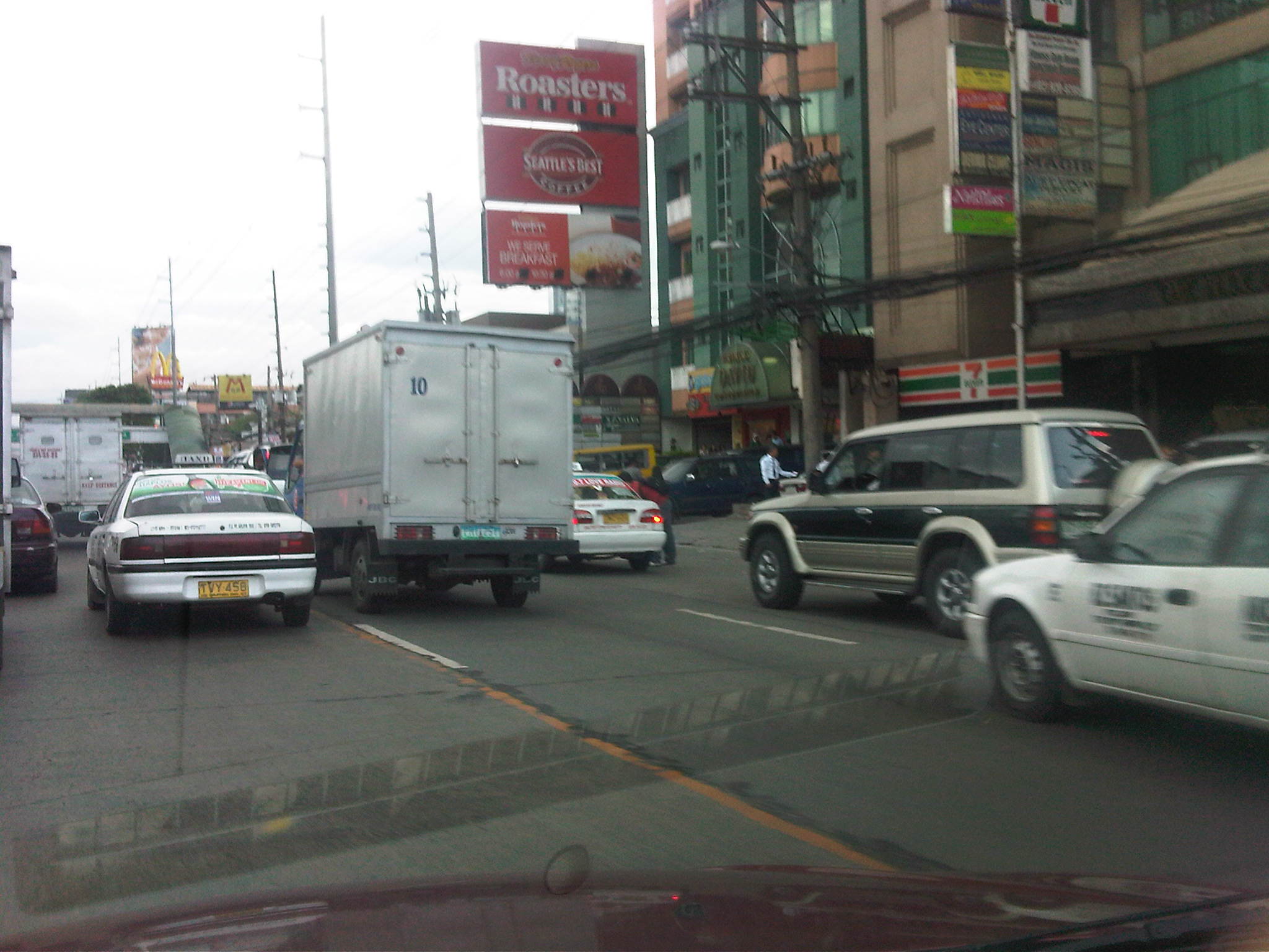
The statement is a clear expression of the stand taken by stakeholders in the e-trike saga. It is also clear that many if not most stakeholders have not been consulted in the rush towards the deployment of 100,000 electric tricycles. While the ADB and the DOE may have meant well in pushing for electric tricycles to replace the conventional ones, railroading e-trikes will cost the fledgling local industries a lot considering the possibility that the electric vehicles will all be imported from China. It should be noted, however, that there has really been little or no success at this stage since the e-trikes that have been donated have only added to the current fleets comprising of legitimate and colorum tricycles. Perhaps in the haste or excitement associated with the potential positive impacts of e-trikes (e.g., low emission transport) on the environment, the bigger picture concerning issues on public transport in Philippine cities and towns has been disregarded. But then this might be understandable since the approach appears to be still mostly from the energy perspective rather than transport’s. It should be emphasized again that the DOTC, as the lead transport agency with a mandate to draw up policy concerning transport in the country, should be active in the discussions and present a clear road map for what transport should be in terms of hierarchy and taking into consideration the relationship between demand and supply. Then perhaps the direction we are taking in relation to low emission transport such as electric vehicles will be a clearer and, not to mention, a straighter one.
–
Pedestrianizing Session Road
When visiting Baguio City, one should never fail to go to Session Road whether to have a meal or just to take walk along the street. It is perhaps the city’s most famous street and a landmark itself where it used to be that a lot about Baguio is going about along Session Road. Here you will find shops, restaurants, bars and other establishments. Since my first time to go to Baguio in 1995, I have seen the city become more crowded and Session Road become more congested. There have been proposals for the street to be pedestrianized but I am unaware of any detailed study concerning pedestrianization and its implications on traffic and commerce in the area. This, I think, should now be among the things Baguio City should look into with more urgency and perhaps a study can be initiated among the universities there, together with the local chapters of planning, architecture and civil engineering societies.
The following article is from the Business Mirror entitled Road Revolution, which appeared in the newspaper’s February 4, 2012 issue:
BAGUIO CITY—Architect Joseph Alabanza keeps a long-held dream: to see Session Road pedestrianized.
As early as 1972, when Alabanza, former head of National Economic and Development Authoriy-Cordillera Administrative Region (Neda-CAR) was head of the city planning office, policies then had pointed out strongly that something had to be done about Session Road as it was predicted to soon become polluted and congested, and lose it aesthetic heritage, being at the heart of the city’s central business district.
A scene that is exactly what Session Road has become.
Then there were not too many cars and the population was much lower than the almost 400,000 mark today, and there was a lack of urgency to control the traffic situation in the city.
In more recent years, as lecturer and consultant of the architecture department of the St. Louis University, his class drafted, as their theses, a layout plan for the streets of the city. The central blueprint was that of Session Road pedestrianized.
Some consultations were made, but this was strongly opposed by business establishments around.
The yearly “Session Road in Bloom,” a market event for Panagbenga (meaning a season of blooming in the Igorot Kankanaey dialect) on Session Road, which stayed closed for a week, was used as a vehicle to test the plan. But it proved to be too hectic and the pedestrian is too heavy to be desirable for a longer period of time.
Even if it seemed that Alabanza’s dream was far from becoming a reality, the glimmer of hope remains as he continuously lamented the continuing deterioration of Session Road—the heavy pollution, the unkempt façades, the heavy traffic, crimes, the insane cat-and-dog chase of the police with sidewalk vendors. Life in the heart of the city was in shambles, but business thrived as usual.
Road Revo
THEN a group of environmental advocates heard of this dream. Something that was a success in Cebu. They came to tell the people of Baguio about their winning game plan in a forum on January 27.
It is called Road Revo—a revolution to change the way people think about the way they transport themselves.
Road Revo is a concept developed by lawyer and environmental activist, Antonio Oposa, a 2009 Ramon Magsaysay awardee in environment.
“We cannot have a Hollywood kind of transportation system, one of individual and expensive mobility. They have eight-lane highways and their roads are like moving parking lots,” he said.
Our insistence at individual mobility has resulted in serious collective mobility, he said.
“Kanya-kanyang galaw kaya lahat di makagalaw [Everybody wants his own way to move that’s why all could not move],” he said, referring to the traffic congestion that has also resulted in serious air and noise pollution.
The road is supposed to be for everyone, that is why Road Revo is for making road use fair. This would mean a turn-around in priorities.
“There’s a need to change mindsets. Road use and policies must have a bias for people, not for cars,” he said.
A World Bank study shows that only 300 out of a thousand own a car in the country. Oposa pointed out that only 3 percent own cars, and they occupy 97 percent of the road, while showing an image of a street jammed with cars in chaos, while people walked on narrow sidewalks.
He said Executive Order 774 specifically cites the new paradigm that the movement of men and cars must follow the principle that “those who have less in wheels must have more in roads,” and that the system must favor nonmotorized transportation and collective transportation.
EO 774 also ordered the Department of Transportation and Communications and the Department of Public Works and Highways to follow the same principle in transforming the road system.
Oposa said that ideally a good public transport system provides 30 percent for all-weather walkways, 30 percent for bicycle lanes, and 30 percent for a greenbelt and what remains would be for cars.
EO 774 also directs all public open spaces along sidewalks and roads no longer needed to be devoted to urban agriculture, something that has been done in Cebu.
“If we could do it in Cebu, so can you,” Oposa said.
Alabanza said that the city has lost its sense of space, referring to walking and open spaces.
“People used to have a sense of belonging here. Now we feel like strangers in our own place,” he said.
Session Road closed: Music, dining on road, sidewalks
AS an experiment, one side of Session Road was closed from 3 p.m. to midnight the day Oposa and his group of environmental activists were in the city on January 27.
And it did happen. Families dined on tables set on the road and sidewalks. Young people were seen just hanging out with one another. Lovers strolled leisurely. Musicians and poets drew a crowd as they beat on their percussions and read poems. Passersby even stopped to do a few dance steps.
For those few hours, the spirit of community was palpable, one of the aims for pedestrianizing Session Road.
Alabanza said that minimizing pollution was one of the first objectives of the proposed road closure as Session Road has become but a passageway for cars and people between the market and the SM Mall on opposite ends. The safety of pedestrians is also compromised as the sidewalks have become too narrow for the crowd who had to walk on parts of the road.
Oposa showed some examples of the ingenious Filipinos’ inventions of environment-friendly modes of transportation. There is the blueprint for a rail bus. There is already a carousel where people pedal to make it run. There is the idea of giving discounts to volunteers who pedal trolleys on train rails. A prototype for a wind-powered bamboo train is on the works, which can run both with an electric motor or the option for pedaling.
“We are a unique place and we cannot but just copy the transportation systems and models of other places,” Alabanza said. The transportation crisis can give rise to opportunities, something that will serve the city well, he said.
Change attitudes
OPOSA pointed out that the world is now experiencing so much disasters because of climate change and it becomes everybody’s responsibility to change attitudes about transportation systems, as this is the sector that emits one of the highest volume of carbon dioxide to the atmosphere.
He reminded that people need to think out of the box and to get out from the inertia of collective insanity, of doing the same thing because everybody else is doing it, no matter how senseless it has become. To illustrate, he said that the bicycle runs on fat and saves you money, while the car runs on money and makes you fat. But all the cars suffering the cost of insurance, stress and productivity lost to traffic jams, loss of a healthier lifestyle indicate that habits are hard to break.
Road Revo will help decrease man’s dependence on oil, restore sense of community, reduce criminality as this allows visibility of one another and, most of all, give people a sense of belonging and owning the space which is a secret tip to keeping it clean.
Oposa is on a nationwide campaign to promote Road Revo. Pasig City opened a road for a day on July 8 last year and Ongpin Street in Binondo became a festival road for the Chinese New Year celebration. After Baguio, Oposa will do the rounds in Subic, Dumaguete, Marikina, Davao and Puerto Princesa.
Alabanza’s dream may not even happen in his lifetime, but the wisdom of keeping the air clean, of enlivening the spirit of community and giving importance to people rather than cars has been sown in the few hours of not closing Session Road but opening it for people.
Perhaps pedestrianization will be more beneficial to the stakeholders of Session Road. It would not be an easy task to convince people that a car-free session road will be the way to go. There probably would also be other options, even a middle ground between status quo and pedestrianization. But doing nothing and letting Session deteriorate further is surely unacceptable to most people.
–
Transport and health
The University College London (UCL) recently released a publication with the title “Transport, Physical Activity and Health: Present Knowledge and the Way Ahead.” It is authored by Roger L Mackett and Belinda Brown of the Centre for Transport Studies, University College London. The material presents an excellent discussion relating travel behavior (like the preference for car use or taking public transport) to physical activity. It should be a good reference for those seeking to explore the link between healthy living and transport and a study that can be replicated in other countries. It should be of interest to cities looking at ways to promote public transport, walking and cycling (sustainable transport). Perhaps our own Department of Health (DOH) should collaborate with the Department of Transport and Communications (DOTC) to put in the local figures so we can determine how much our dependence on cars is affecting our health especially in our cities. The outcomes should further reinforce the need to put up infrastructure to encourage people to leave their cars. Perhaps the more progressive cities or the MMDA could also look into such studies so that we can have a firm foundation for appreciating the benefits of a good transport system and healthy cities.
–
Some thoughts on airport parking for NAIA T3
I had another unpleasant experience parking at NAIA Terminal 3 just before Christmas. It seems its getting more difficult to park at the airport every time and authorities have yet to address the parking problem despite the solutions staring them in the face. I would like to believe that the typically higher demand for parking during the Christmas season can be accommodated if the available parking space can be managed and equitably allocated for users of the terminal.
 Queue at the entrance to the airport – the guards were still inspecting each vehicle but they had to wait for these to inch towards them at the inspection point.
 While the signs seem to suggest different parking facilities for arrivals and departure, there is actually one large open parking lot located in front of Terminal 3. This lot is segregated among airport taxi services, employee parking, overnight parking and general parking. Meanwhile, the parking area to the right side of the ramp to the departure area is generally empty but for a few vehicles that are said to be owned by employees of the airport. This is quite odd considering they also have a lot of parking space for them
 Everyone had to wait for the security to wave them through to to parking lot. Others were content with staying inside their vehicles while waiting to pick-up their passengers.
In the end, I had to rush to the airport terminal after parking my car as my wife’s plane was already arriving. I wasn’t able to take more photos of the parking situation that day but knew I had other opportunities to do so in the near future. That future was when I was back again recently at Terminal 3 when I drove someone to the airport for an outbound flight after the Christmas break. The queue at the gate was much better and we were able to enter the parking area without a glitch. There were many spaces available but these were mostly along the fringes of the lot, with some requiring a few minutes walk to or from the terminal.
 View from the inspection gate with the on-ramp for the departure level to the right and the driveway to the parking and arrival areas to the left.
 The way to the arrivals driveway (right) and the parking lot (left) was unlike the condition shown in the earlier photos taken just before Christmas.
 There was a sign stating that the overnight parking area was full. The overnight parking area for those who opt to leave their vehicles until their return is actually the driveway on the right side of the photo that eventually leads to the on-ramp for the multilevel parking building that until now has not been opened for various reasons. To the left is the driveway to the parking lot.
 Those vehicles lined up in the photo are not part of a queue for arrivals. These are parked along the driveway designated for overnight parking.
 Meanwhile, these are vehicles at the parking area designated for the general public.
 There seems to be a lot of signs for “Employees Parking” when airport authorities should prioritize space in this area for passengers and well-wishers. There are other under-utilized areas better suited for employees. I also wonder just how many employees actually have cars.
 Turning towards the exit from the parking facility, one is greeted by more vehicles parked along the curbside (both sides of the driveway, actually). The fence separates this driveway from another that leads to the ramp to the multilevel parking building that is visible on the right side of the photo. This latter driveway also has vehicles parked along its length, which is allocated for overnight or long term parking. Above is the ramp from the departure level.
 In this photo, the ramp to the multilevel parking facility can be seen clearly and is occupied by parked vehicles. I still wonder how long it would be and what it would take before NAIA Terminal 3 finally makes the parking building available for use of the general public when, according to some sources, there are no structural issues barring the use of the building. Meanwhile, there is already an obvious demand given the evolving preferences of travelers with their own vehicles.
 Motorcycle parking at the fringe of the parking. This is actually another driveway utilized instead for motorcycles.
The layout of the open parking lot at Terminal 3 can be seen via Google Earth as shown in the image below. The area designated for public parking (center to right before the off ramp from the departure level) is conspicuously full while there seems to be a lot of spaces available in the area allocated for taxis and airline and airport employees (left in the image and prior to the on ramp to the departure level). There is also a relatively spacious open lot to the left and adjacent to the terminal building itself. This seems to be reserved for employees (again?) and VIPs. While the last area may be allocated for employees and VIPs, I would like to point out that more parking spaces should be allotted for travelers and well-wishers. Questionable for me is the allocation of so many spaces for taxis and vans that seem to be using the lot as their depot. I seem to remember that these public utility vehicles should have their garage somewhere and not necessarily at the airport where they seem to be lording it over “regular” taxis. These airport taxis charge significantly higher if not exorbitant rates compared to the typical taxi and to some, their preferential treatment at the airport is at the expense of passengers and well-wishers who certainly deserve better public transport service.
 Layout of NAIA Terminal 3 (image from Google Earth)
In the image above, the building with the light-colored roof to the right of the terminal building is a multilevel parking facility. The parking building is directly connected to the terminal and is accessible via the southeast wing of the terminal. I am not aware of the capacity of this facility but based on what one can see from the outside, its 5 levels should be able to accommodate quite a lot of vehicles and offer other opportunities for business (e.g., car wash, small shops, etc.) much like what is already available in similar facilities found in shopping malls.
[Note: An news article appearing on January 27, 2012 states that the parking building has a 2,000 car capacity while the open area can hold 1,200 cars. I assume these numbers refer to the number of spaces and do not include waiting or circulating vehicles.]
–
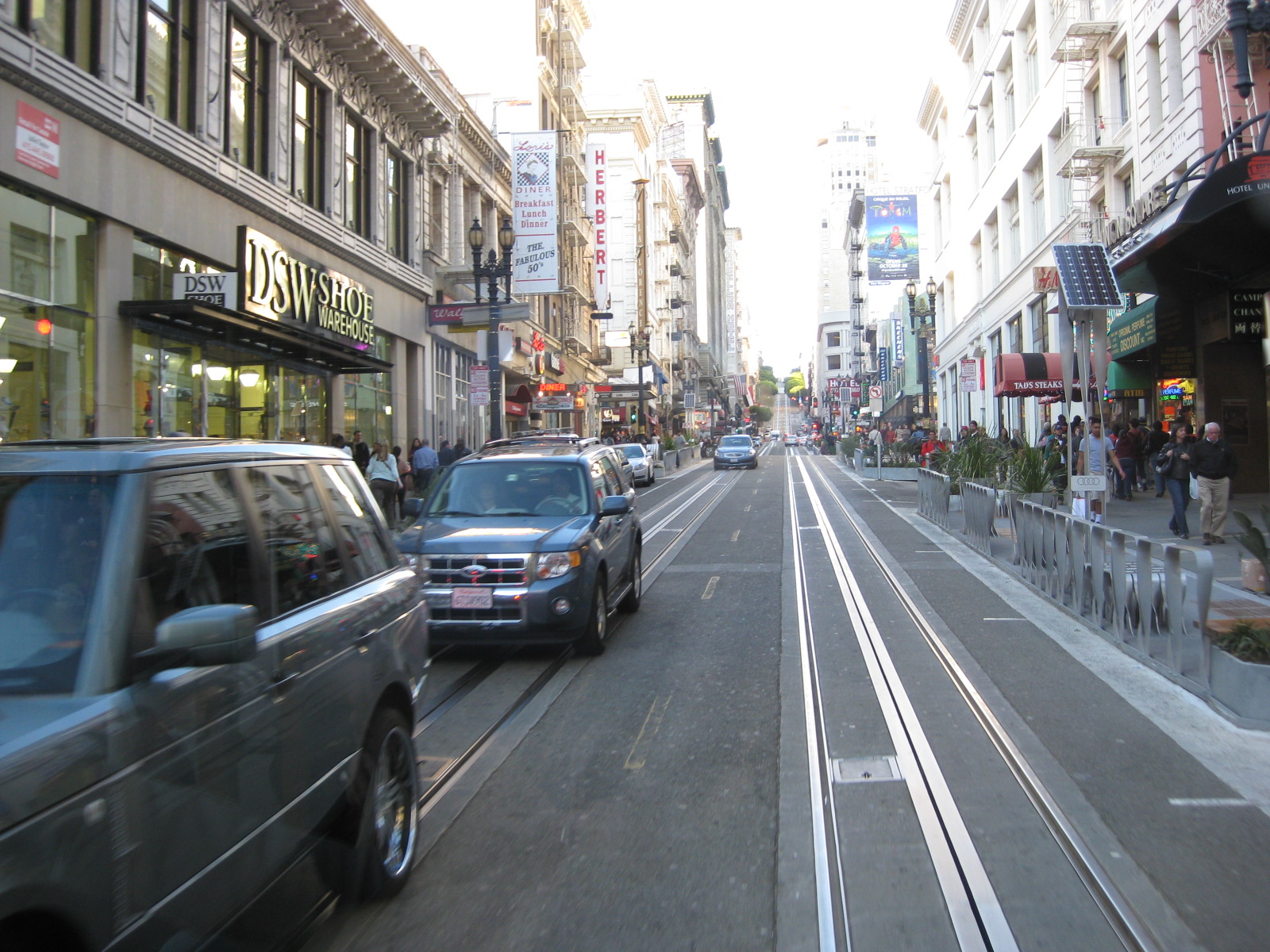
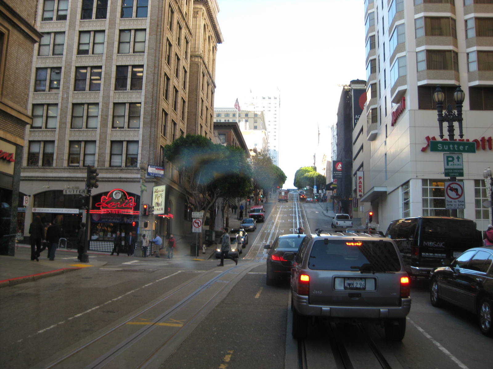
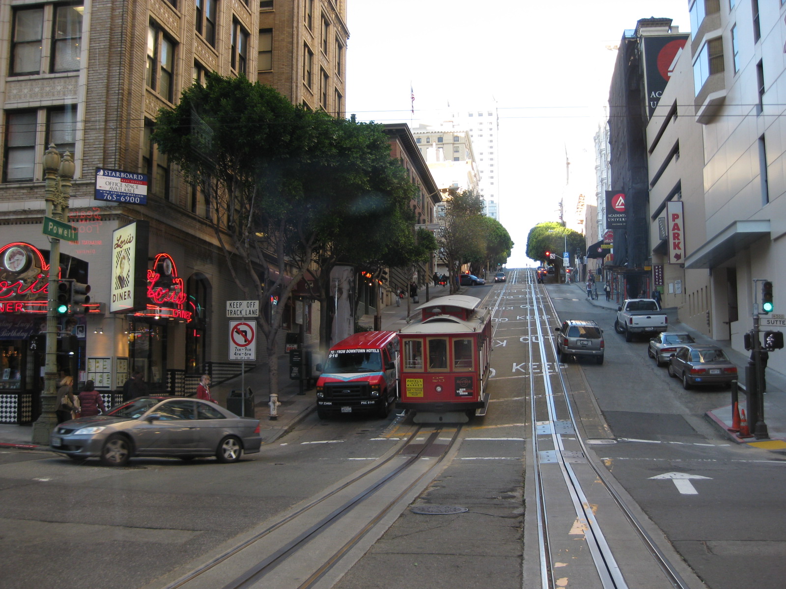
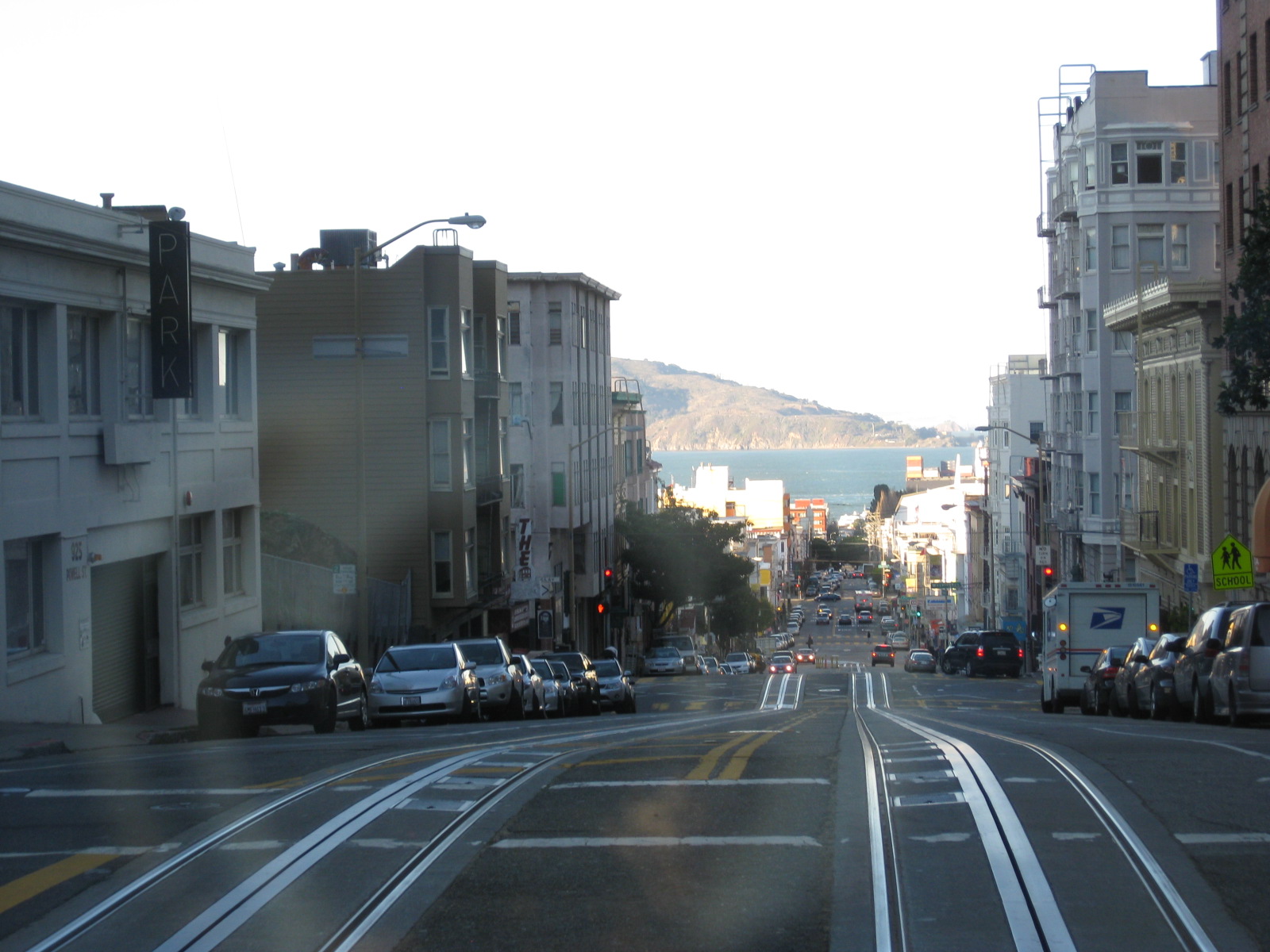
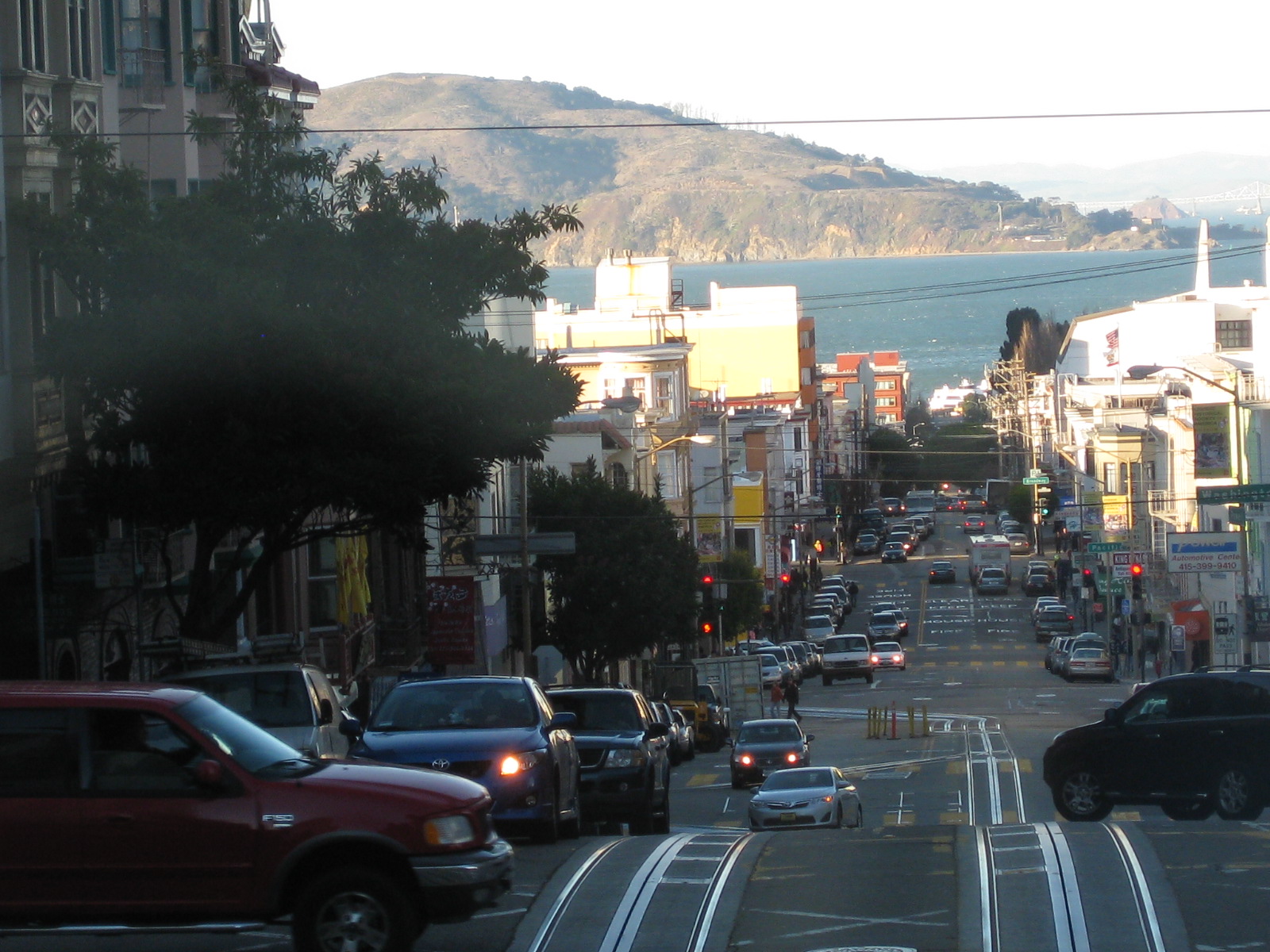
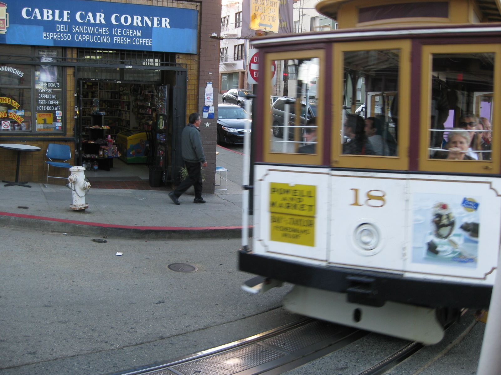
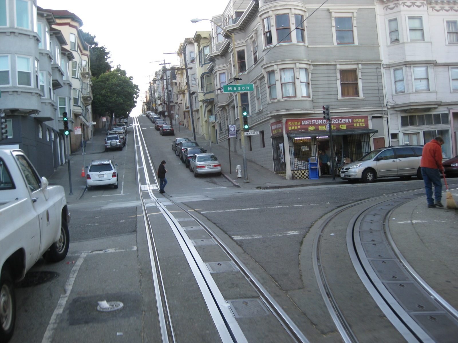
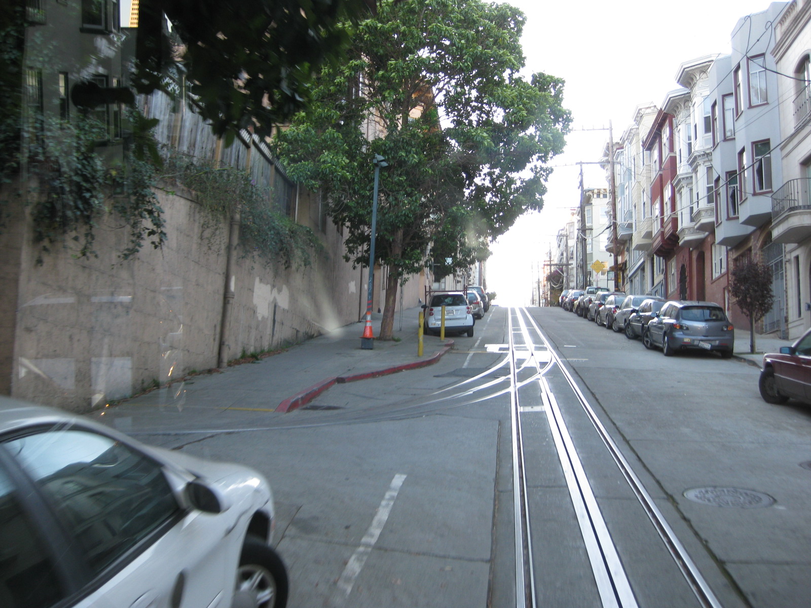
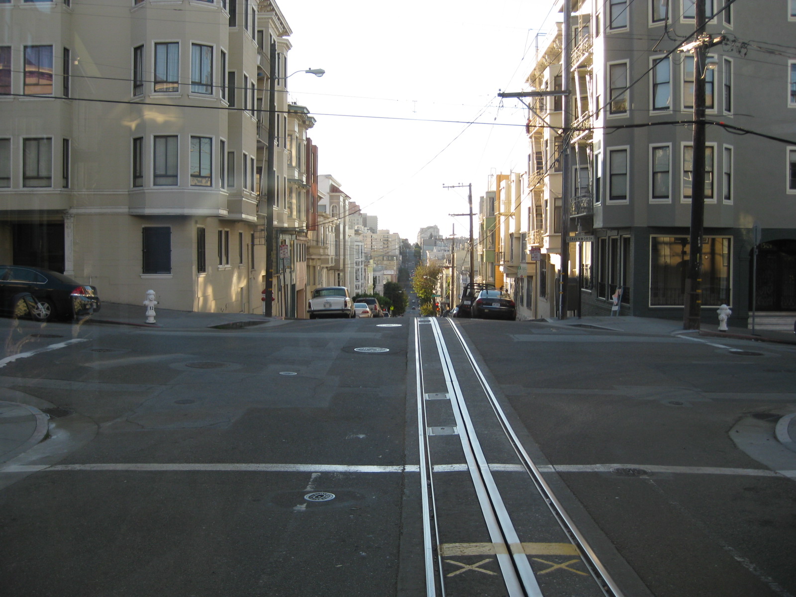
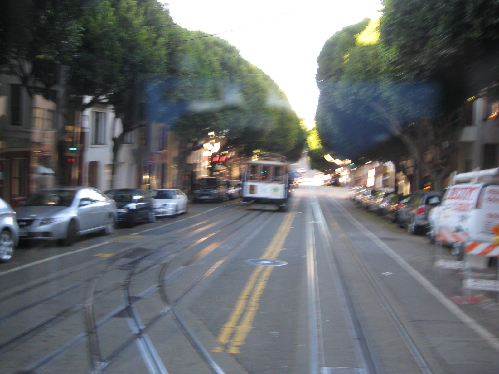
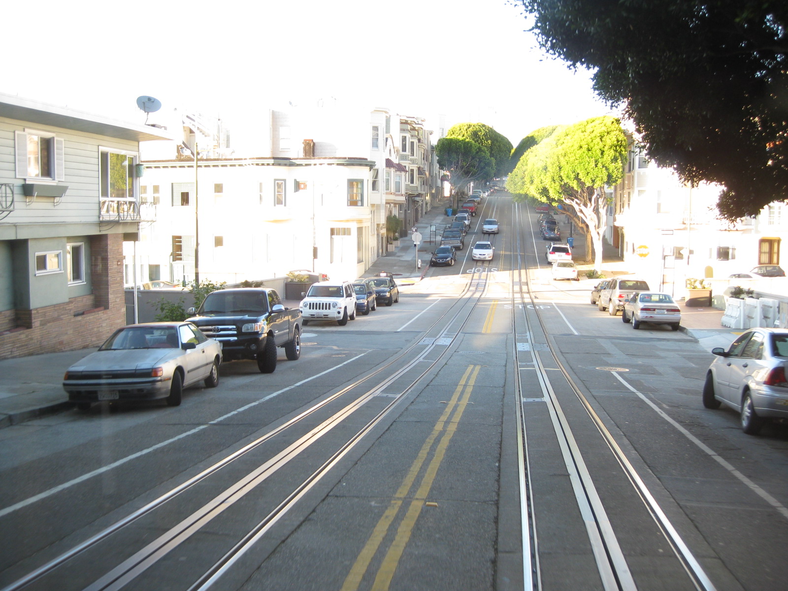
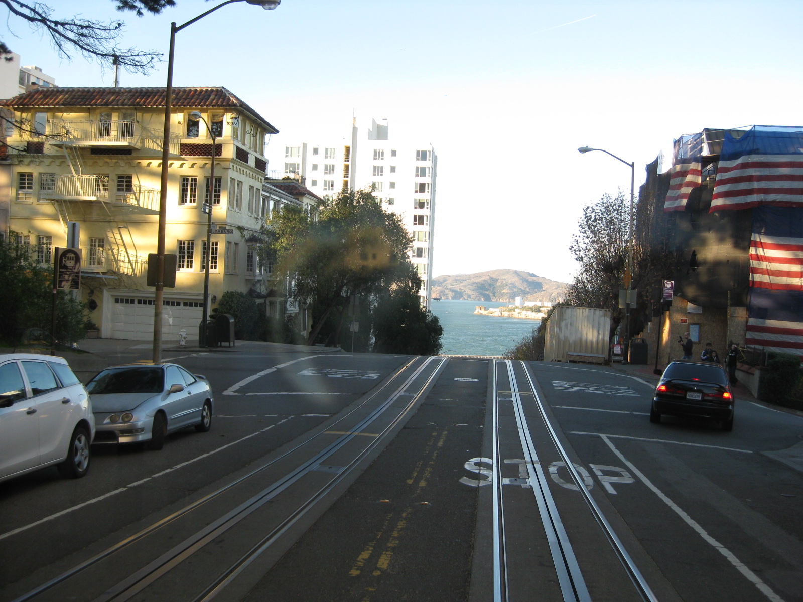
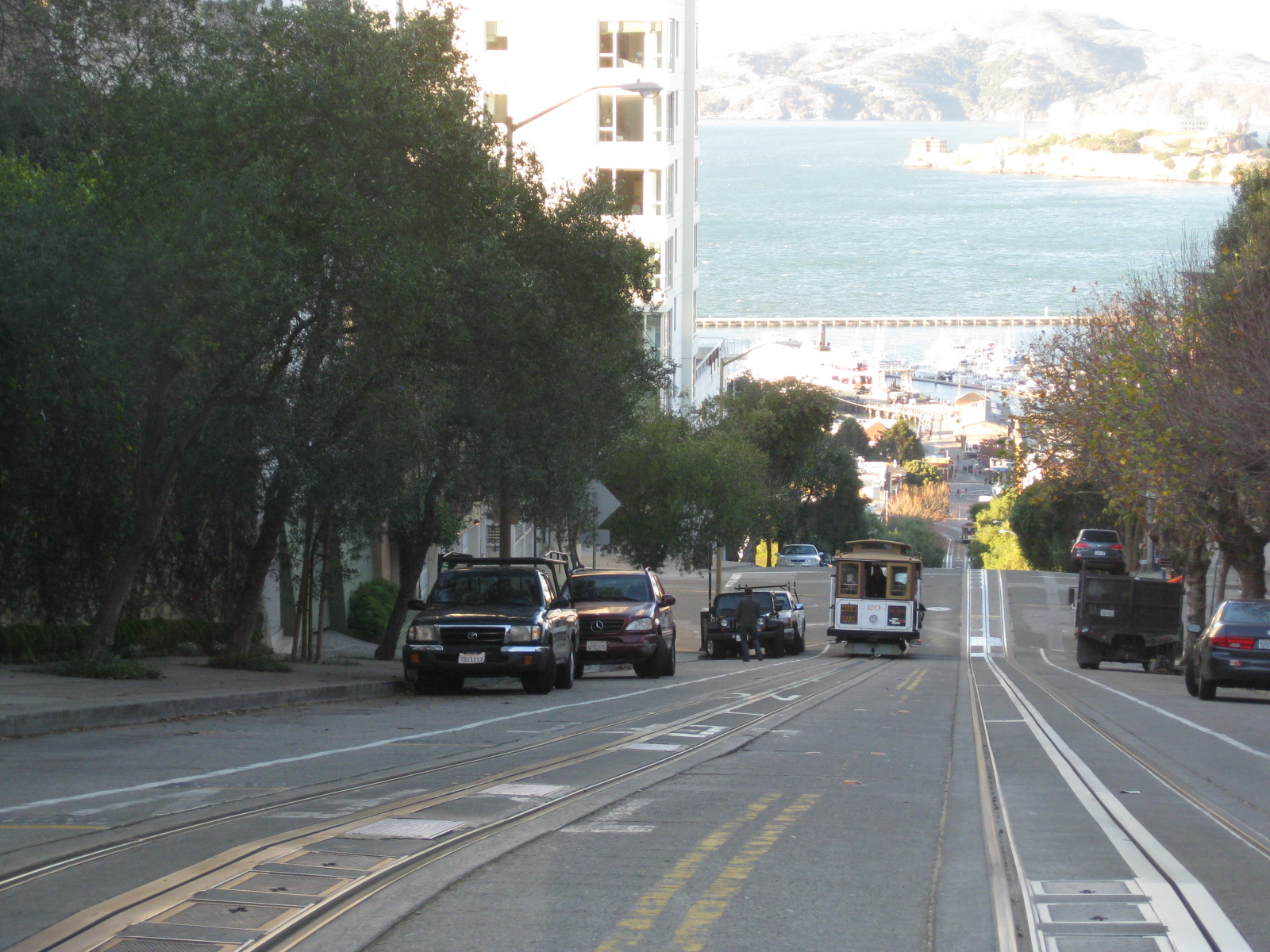
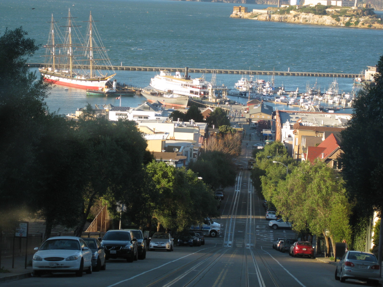
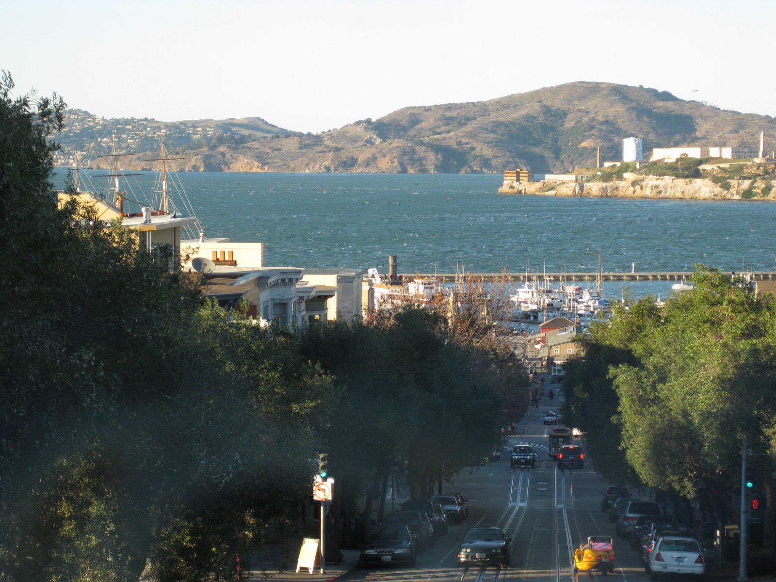
San Francisco’s Cable Cars
The photos show a particular journey aboard a Powell & Hyde cable car from Market Street (near Union Square) to Hyde Street (near Argonaut Hotel). The trip takes one through notable spots like Union Square, Chinatown, Nob Hill and Russian Hill, including a stop at Lombard Street that has that famous crooked section popular with tourists and residents alike. There are also breathtaking views of the bay as the cable car descends towards Mason or Hyde Streets, towards the pier.
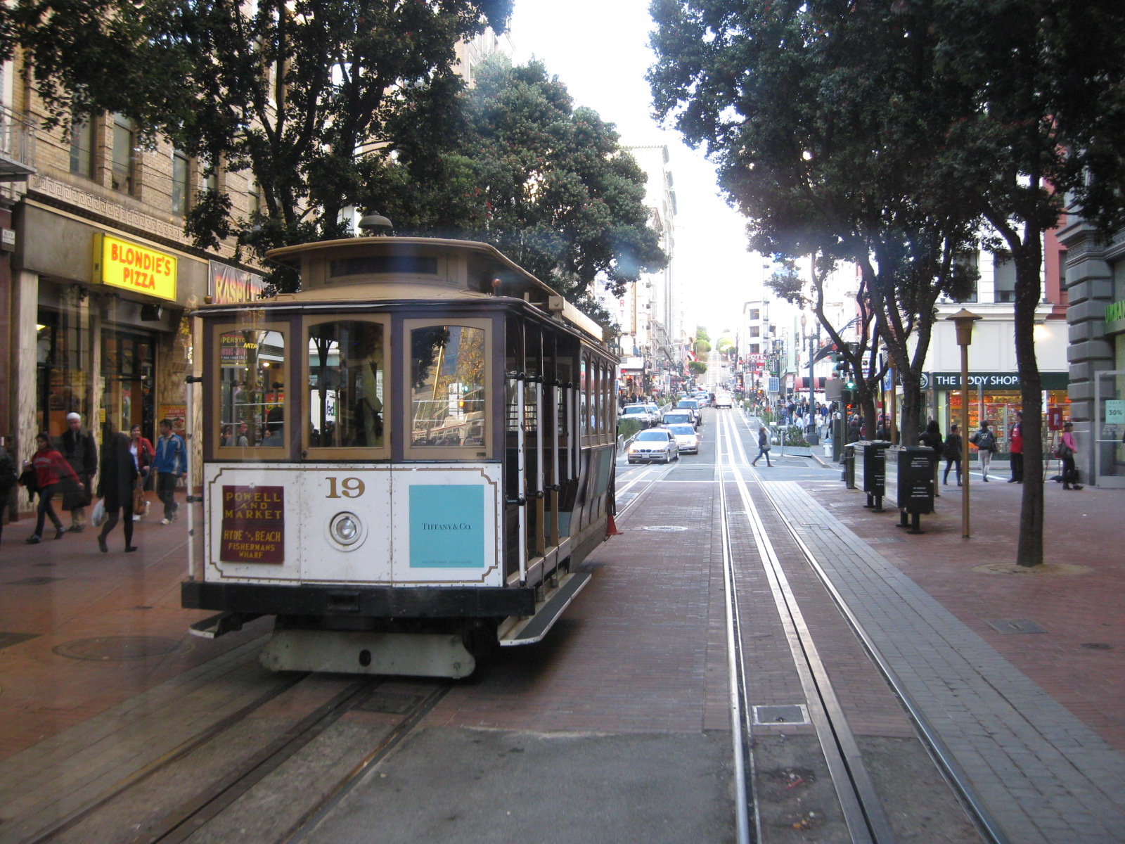 Cable car arriving at the end of the line near Market Street
–
 To the right is Union Square famous for its Christmas Tree. However, there is that monument at the square that people tend to take for granted. Filipinos should be aware that it is one commemorating the victory of one Comm. Dewey and the US Fleet over Adm. Montojo and the Spanish Fleet in Manila Bay back in 1898, a significant part of Philippine and American histories.


Parking galore
I met Paul Barter not too long ago when he visited Manila to give a presentation on parking at the ADB. This was at the then annual ADB Transport Forum held around May every year at the ADB’s headquarters in Manila. He is a faculty member at the Lee Kuan Yew School of Public Policy of the National University of Singapore. I keep forgetting that he is a regular blogger and writes a lot about sustainable transport and particularly about parking. And so I share this awareness to my readers about Paul’s blog Reinventing Parking.
Reinventing Parking is an excellent resource for a lot of articles and references on parking. Paul has researched on parking in most Asian countries and has been to major cities in the region where he has collected first hand data on parking policies and behavior. I find his materials well researched and his discussions and opinions on parking quite interesting as many of the issues he has delved into in his posts are very much applicable to our experience in the Philippines. I have had the pleasure of sitting down with him to talk about parking policies and standards (?) in this country for his comparative research and a paper he was doing at the time. I’m sure there’s a lot our planners and developers will learn from Paul’s work. Perhaps, even decision-makers or government officials in-charge of parking standards (e.g., National Building Code) can pick up a thing or two from his body of work.
–
EST and Green Urbanism
I had the great opportunity of presenting excerpts of the National Environmentally Sustainable Transport Strategy (NESTS) and talk about its implementation at the local level at the recently concluded Green Urbanism Conference. The Conference was organized by the School of Urban and Regional Planning (SURP) of the University of the Philippines Diliman in cooperation with the Faculty of Design of Kyushu University, with support from various partners including AusAID. It ran from October 18-20, 2011 at the Heritage Hotel Manila, featuring a variety of topics divided into 5 sessions namely:
- Green Cities
- Green Architecture and Ecological Landscapes
- Green Infrastructure
- Environmentally Sustainable Transport
- Developing Climate and Disaster Resilient Urban Centers
“This paper presented current and past efforts focusing on sustainable transport. Many of these are continuing especially the promotion of good practices in EST that emanate from the national strategy that was recently formulated. The national EST strategy identifies action plans and the corresponding responsible agencies or entities. The key competencies and skill sets that will enable cities to formulate and implement meaningful programs and projects were also presented. More importantly, the paper examined the capacities of cities for transportation planning and recommended for collaborative agreements with local universities with sustainability in mind.
The general observation has been that LGUs are often unaware that certain programs and projects they are implementing or planning actually fall under EST. As such, they are unable to package their programs and projects in a way that can be attractive to both local and foreign support. One main objective of social marketing for EST is to assist cities by capacitating them with the fundamentals they would need to undertake projects geared towards sustainable transport.
The strategies developed for each EST thematic area are collectively called the national strategy and implies responsibility of a national agency for its implementation. Upon closer scrutiny, however, it must be realized that significant impacts will only be attained if EST is successfully implemented at the local level. The role of national agencies such as the DOTC and the DENR is to provide guidance and capacity to cities for the latter to be able to come up with meaningful programs and projects. After all, while big ticket EST projects may be initiated by national agencies, their success will be determined by how these are implemented at the local level. In the Philippines, cities have been empowered for such purposes and localizing national programs and strategies would be essential in addressing enduring and emerging problems concerning transport and traffic.”
First battery swap program for E-jeepney
I am posting a press release from the proponents of the electric jeepney about the first battery swap program launch this morning. The program will allow for the continuous operations of the e-jeepney in Makati, extending its operating hours as they are no longer limited by the depletion of their batteries. This program will surely have a significant impact on how e-vehicles (not just e-jeepneys) are deployed and presents a model for local government units who are at least curious about having the electric vehicles (perhaps) to replace conventional public transport in their respective cities. This should be a game-changer in the promotion of EST in the Philippines.
Electric jeepney fleet proponent pioneers country’s first battery swap program
(October 19, Manila) The pioneer of the country’s first electric jeepney fleet unveiled this morning an innovative battery swap scheme which its proponents expect “to dramatically improve the efficiency and revenue generation of eJeepney operators.” Over thirty guests, including 22 British volunteers headed to Bohol on Friday for climate change solidarity work, graced the occasion.
“With a little practice, we expect the battery change to take the whole of 10 minutes, which is like a common stop in a gasoline station. The previous eight-hour charging process becomes a thing of the past with this program. It means eJeepney drivers can use their vehicles for a longer period and reduce battery depreciation as well,” said iCSC executive director Red Constantino.
Constantino said “green aims must be coupled with robust economic benefits. We anticipate double earnings for operators, which is superb since we’re already saving a huge amount just because we’re using electricity instead of gasoline to power the vehicles.”
The Institute for Climate and Sustainable Cities, which owns and operates the celebrated eJeepney fleet in Makati City, designed and fabricated the battery program with the support of the British Embassy in Manila. Also known as iCSC, the group is implementing the program in partnership with private sector groups Ejeepney Transport Corp (EJTC) and Motolite.
The scheme is based on a simple roll-off, roll-on logistical set-up, using eJeepneys retrofitted with battery trays and a battery loading bay at the eJeepney depot. A dispatcher rolls out spent battery sets of an eJeepney and replaces it with a fully charged set through a palette lifter manufactured by iCSC.
“Ejeepneys represent carry huge business potential and improvements in operations such as this scheme can create new revenue streams for groups interested not just in eJeepney operations but in battery leasing as well,” said the CEO of EJTC, Yuri Sarmiento.
“We are with you not as passengers but as partners. Together, we can steer our way to a brighter, more sustainable and prosperous future,” said Trevor Lewis, the British Embassy’s Deputy Head of Mission in remarks made during the event.
“Our company is determined to invest in the future of this country and we are elated to be part of this venture,” said Arnold Sarmiento, who represented leading Philippine battery manufacturer Oriental Motolite.
The battery swapping project aims to accelerate the expansion of electric public utility vehicle applications in the Philippines by increasing the operating time of electric jeepney fleets while reducing time used to charge eJeepney batteries. The pilot test period will take place from October 19, 2011 to February 14, 2012. Partners in the initiative hope data from the project can promote a more rapid transition to low carbon transport in the Philippines.
The battery swapping system is located in Makati City’s Fire Station, the site of the country’s first battery-charging station for electric vehicles. Ejeepney units plying the country’s first two routes – the Legazpi Village loop and the Salcedo Village loop — will utilize the battery swap pilot system, which will be run by iCSC, EJTC, Motolite and Makati City jointly.
“We thank the British Embassy in Manila for their support of the city’s endeavors. We are committed to build a low carbon future together with climate change-resilient development,” said Makati City transportation consultant Ernie Camarillo.
iCSC works on fair climate policy and innovative energy solutions for localities. It is the pioneer of the Climate-Friendly Cities project, which integrates sustainable waste management and renewable energy generation with electric public transport alternatives.
Traffic going bananas
I’ve written about land use and parking along Katipunan Avenue, which is part of Metro Manila’s Circumferential Road 5. Katipunan extends southwards to Blue Ridge, St. Ignatius and White Plains (the latter subdivisions just across the street from Camp Aguinaldo) where there are also many establishments along either side of the road. Most of these establishments are restaurants that attract significant private vehicle traffic. Note that there are no public transport routes along Katipunan/C5 in the Blue Ridge, St. Ignatius and White Plains areas. As such, establishments are more likely to attract people with cars rather than those taking public utility vehicles.
Many of these establishments are on lots formerly occupied by residential buildings (i.e., houses) considering the predominant land use in the areas. These were eventually purchased and converted for commercial use, resulting in layouts that generally do not include adequate parking spaces. The consequence of shortcomings in parking have been the propensity for on-street parking such as shown in the following photo in the Blue Ridge area.
 On-street parking for a popular restaurant/cafe along Katipunan/C5 at Blue Ridge.
Such case and many others like it along Katipunan (and other Metro Manila or Philippine cities roads) are the result of both poor planning and lax enforcement of traffic rules and regulations in this country. Being a primary arterial, Katipunan/C5 should be clear of such unnecessary sources of roadside friction that effectively decreases road capacities while also increasing the risk of crashes as vehicles maneuver, or in some cases wrestle, for parking spaces.
Katipunan parking predicament
Developments along Katipunan Avenue in Quezon City are good examples of fragmented land use and transport planning in Philippine cities. The developments, particularly the high rise condominiums have been the subject of much opposition from residents of subdivisions in the area as well as two major institutions of higher learning that have defined the stretch of Katipunan that has been developed in the 15 years. I mention 15 years because this is the period during which most of the high density developments along Katipunan have been constructed, apparently with the blessings of city hall. It is also in the last decade that schemes such as road widening and the U-turns were implemented.

On-street parking along Katipunan at lanes that used to be part of what was a west service road. In many cases, onstreet parking has been the result of a violation of a very basic provision of the National Building Code, which prescribes the minimum number of parking slots for establishments such as restaurants, shops, banks and offices. Despite being quite outdated and disconnected with more progressive parking generation principles, the NBC should have been a basis for the local government to assess whether minimum guidelines are satisfied, and perhaps impose penalties on those who are not able to comply such provisions. This is a fundamental case where individuals (owners of parked vehicles) impose external costs (e.g., congestion and crash risk) upon the general public.

Another look at onstreet parking just beneath the pedestrian overpass across from Ateneo’s Gate 2 – restaurants along Katipunan are major traffic generators and despite the presence of public transport (jeepneys and tricycles) a significant number of trips generated by these establishments use private vehicles including cars, vans and SUVs. Katipunan’s pedestrian facilities are inadequate as there are practically no sidewalks, thereby forcing people to walk along the road. This exposes many and particulrly students to risks like getting sideswiped by vehicles driven by reckless drivers.

Waiting vehicles effectively occupying 2 lanes of Katipunan – many employ drivers who can stay with the vehicles while the occupants eat, shop or transact at establishments. In most cases, standing vehicles are practically parked vehicles as they occupy road space. High-rise residential condominiums along Katipunan may have complied with minimum parking requirements stipulated in the NBC but their trip generation characteristics considering the commercial establishments located at the same buildings surely require many more parking spaces than what are available.

Congestion along Katipunan’s southbound side – may be caused by onstreet parking, standing (waiting), or vehicle maneuvers with respect to the limited parking slots fronting most establishments along the road. One tutorial center located near a U-turn slot, for example, generates significant vehicle traffic that it affects both U-turn and through traffic. Meanwhile, traffic enforcers seem either ineffective or helpless in their efforts to manage traffic, including preventing vehicles from taking 2 lanes of Katipunan.

Standing/waiting vehicles in front of a new development along Katipunan – the new building hosts several establishments including a major bank, a book shop, a popular gym, and several restaurants or cafes. Despite the potential for vehicle attraction, only a few parking spaces were provided, leaving all other vehicles and their drivers on their own to find parking spaces or just occupy road space in front of the building. The footbridge across Ateneo’s Gate 3 has been extended to the building but this obviously has marginal impact in reducing vehicle generation and parking demand.

Another photo showing the parking situation in front of the new building – while traffic is generally a manifestation of economic activity, one opinion is that many developers are irresponsible by designing buildings that have inadequate parking and resulting in the general public bearing the burden of traffic externalities. Add to this local governments that turn a blind eye on such discrepancies in design (who reviewed the design that obviously violated the building code?) only to be on the receiving end of complaints. In some cases, LGUs probably will be forced to shoulder costs of providing solutions that developers should have covered in the first place if they were responsible enough or made responsible for mitigating negative impacts of their projects.
In the end, it is inevitable that we need to address the root of the problem, which pertains to land use planning and the zoning policies LGUs are implementing. Consistency is one thing and being circumspect about established guidelines is another. Sustainable development, after all, does not pertain to continuous transformation from low to high density development but more about balancing elements that would preserve the character of neighborhoods and communities, particularly and most importantly to ensure that quality of life is not compromised.
