
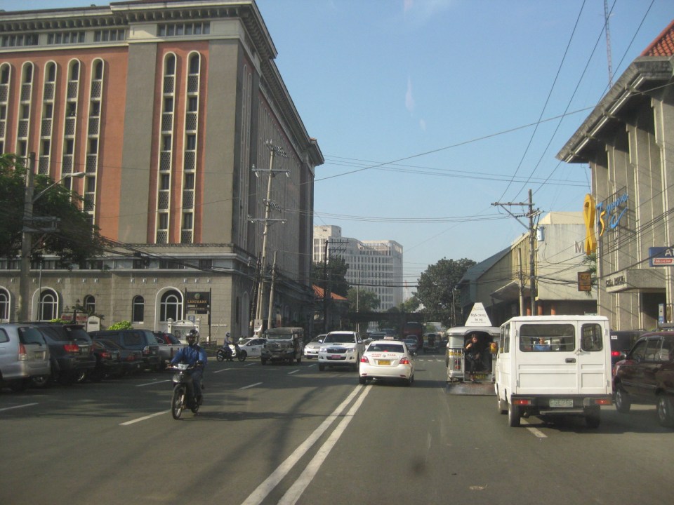
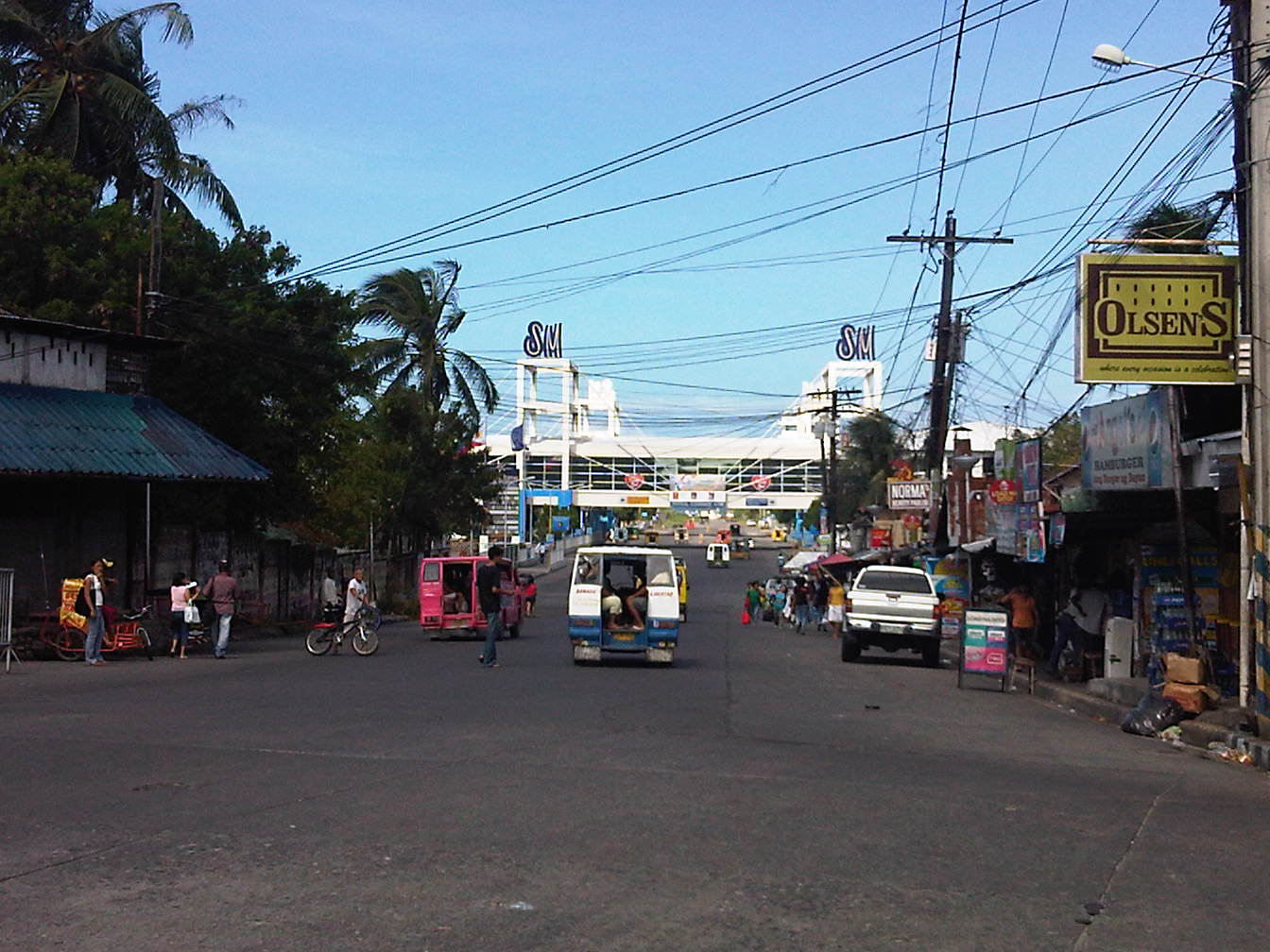
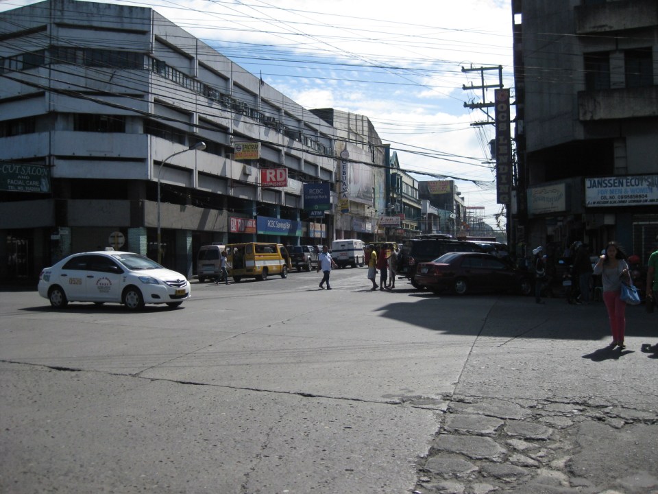
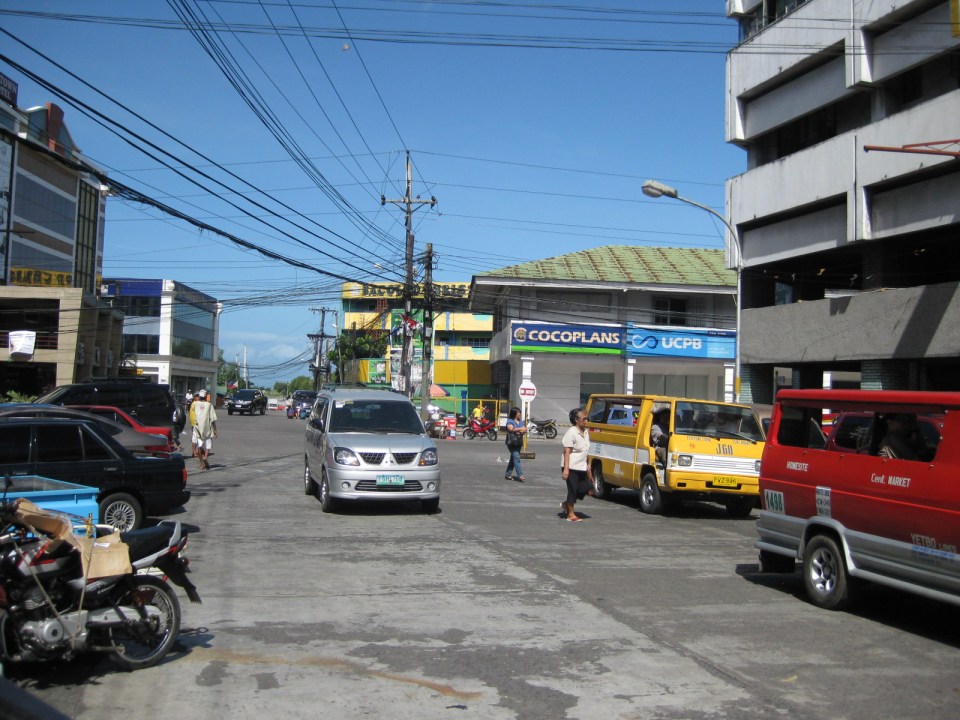
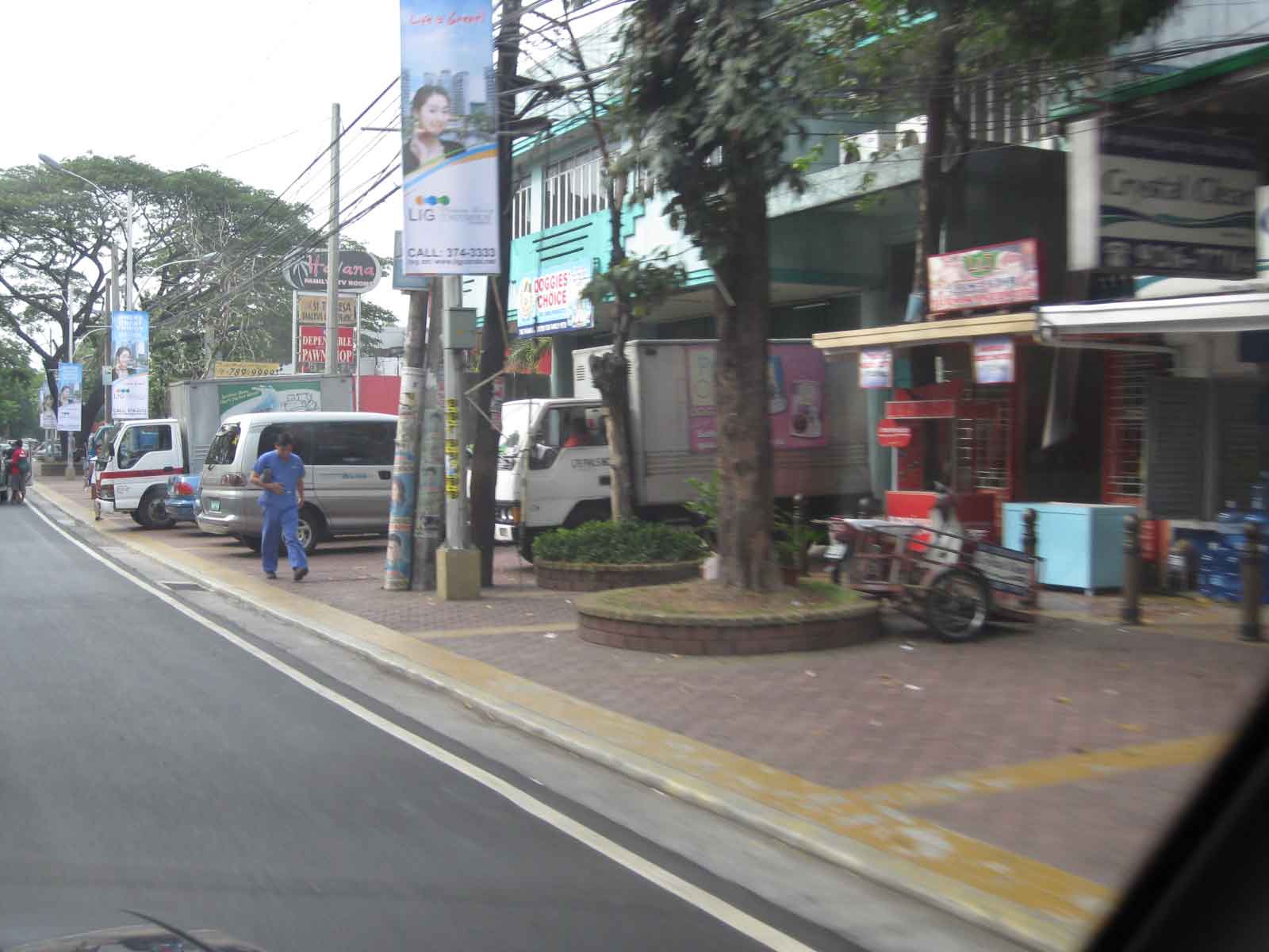
Streets of Olongapo: Rizal Avenue
Olongapo City is located in the Province of Zambales, the only city in that province, and beside the Subic Freeport. It is a pioneer in public transport service innovations in the form of the first initiative on the color-coding of jeepneys according to their routes. Despite what seemed to be forever being linked to the Freeport in terms of economic development, the city has enjoyed continued growth and is currently experiencing more challenges attributed to this growth. Among these challenges are those pertaining to traffic congestion and public transport services for the city. A Transportation and Traffic Management Plan Study was conducted by UP Diliman through the National Center for Transportation Studies and is up for formal adoption of the city.
Following are photos taken along the city’s main street, Rizal Avenue, where many of the city’s transport and traffic problems are manifested.
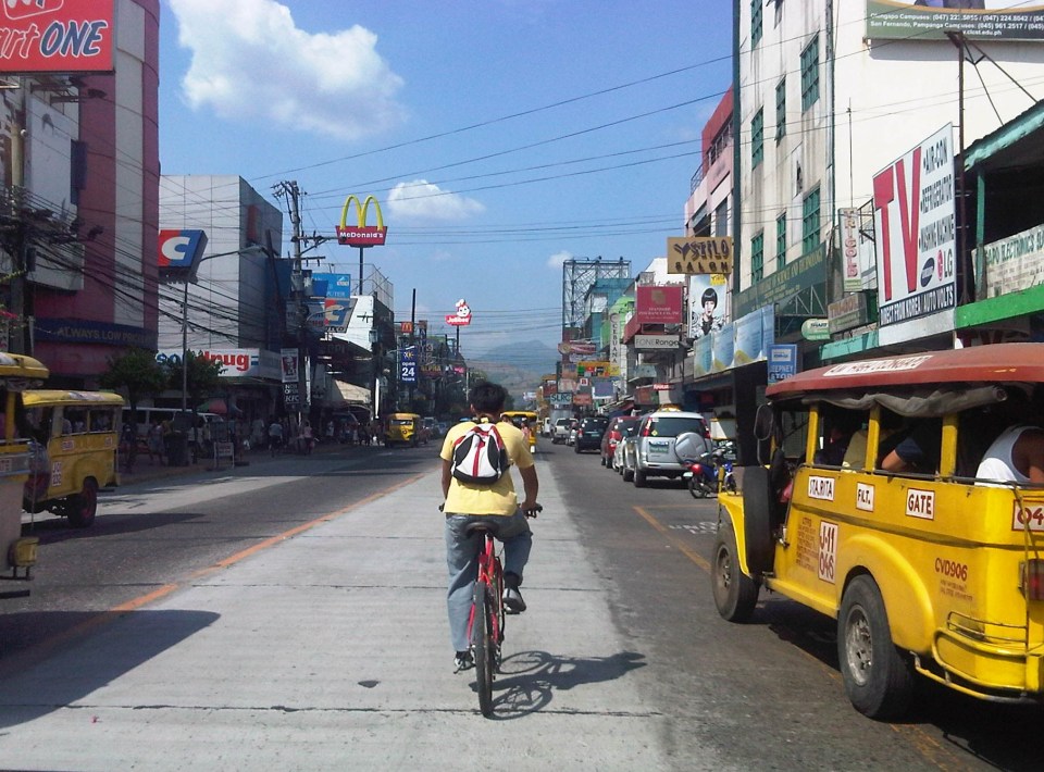 Cyclist pedaling along Rizal Avenue beside a yellow jeepney taking passengers at the designated stop at curbside. Downstream are parked vehicles along the road.
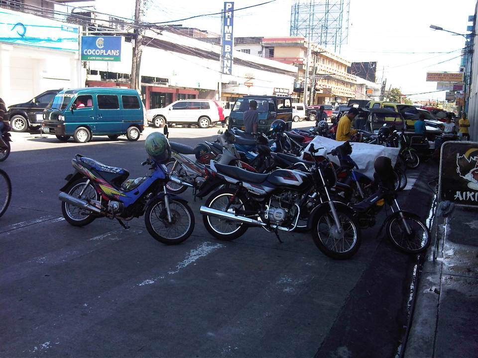
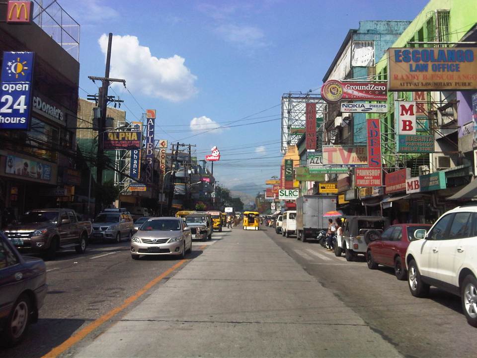 More parked vehicles at either side of Rizal Avenue effectively reducing road capacity for the 4-lane street.
 On-street parking is a problem for the city as there are few, if any, off-street parking facilities in the city. On-street parking turnover is quite low since many of the parked vehicles are not clients or customers but establishment owners or managers.
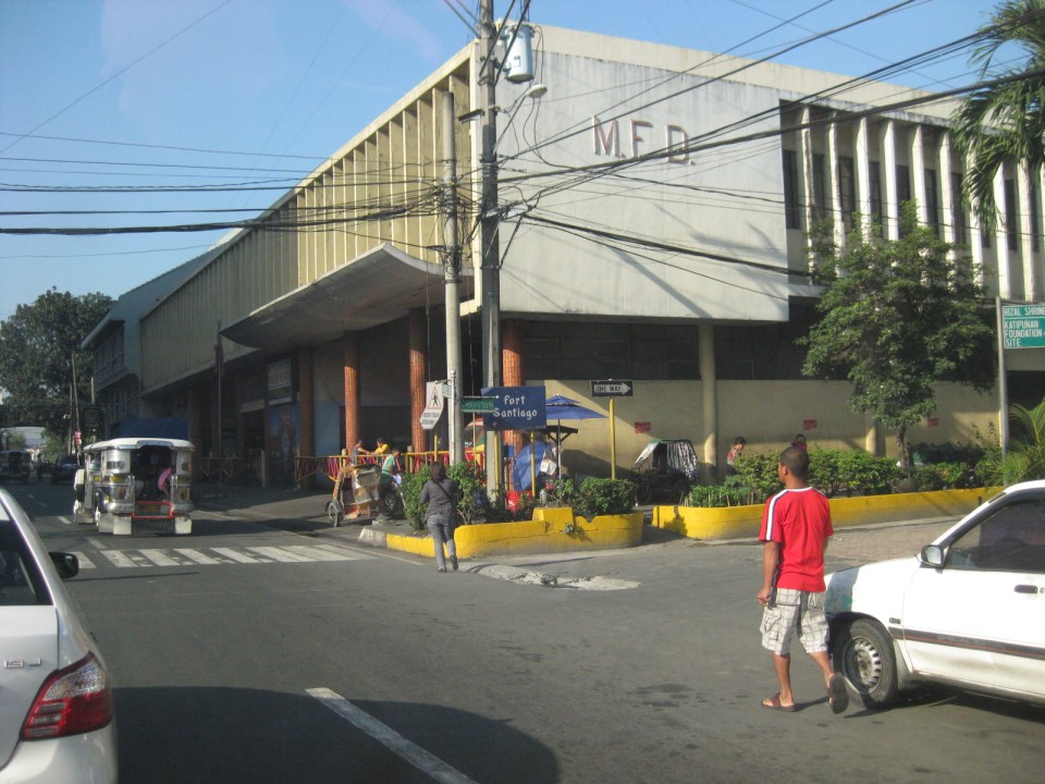
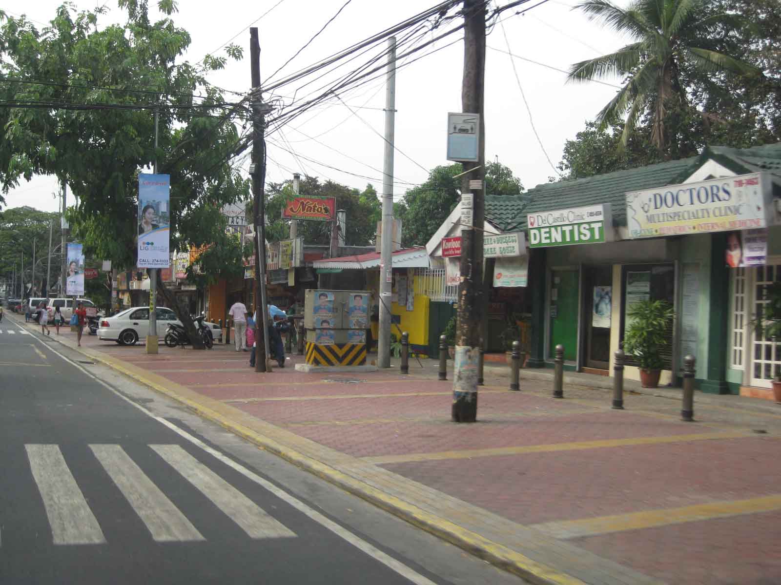
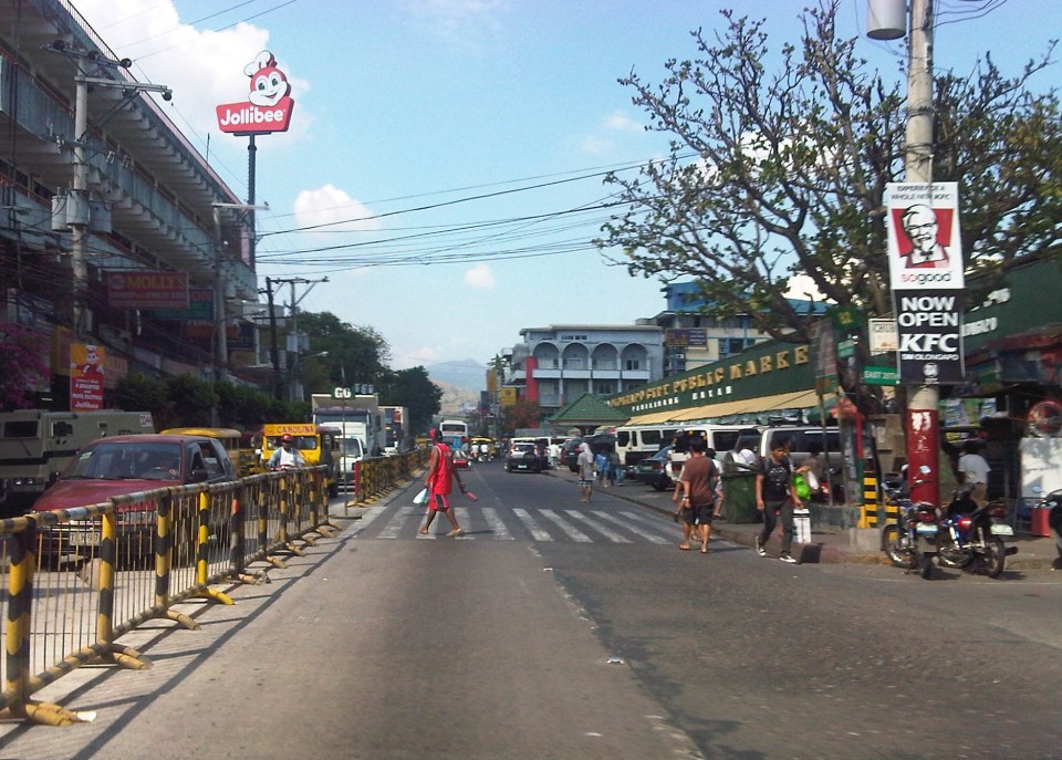 Most of Rizal Avenue is undivided but there are median barriers along the section in front of the public market to reduce jaywalking among pedestrians.
 The section in front of city hall – just across are many commercial establishments and on-street parking.
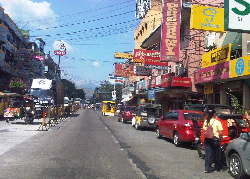
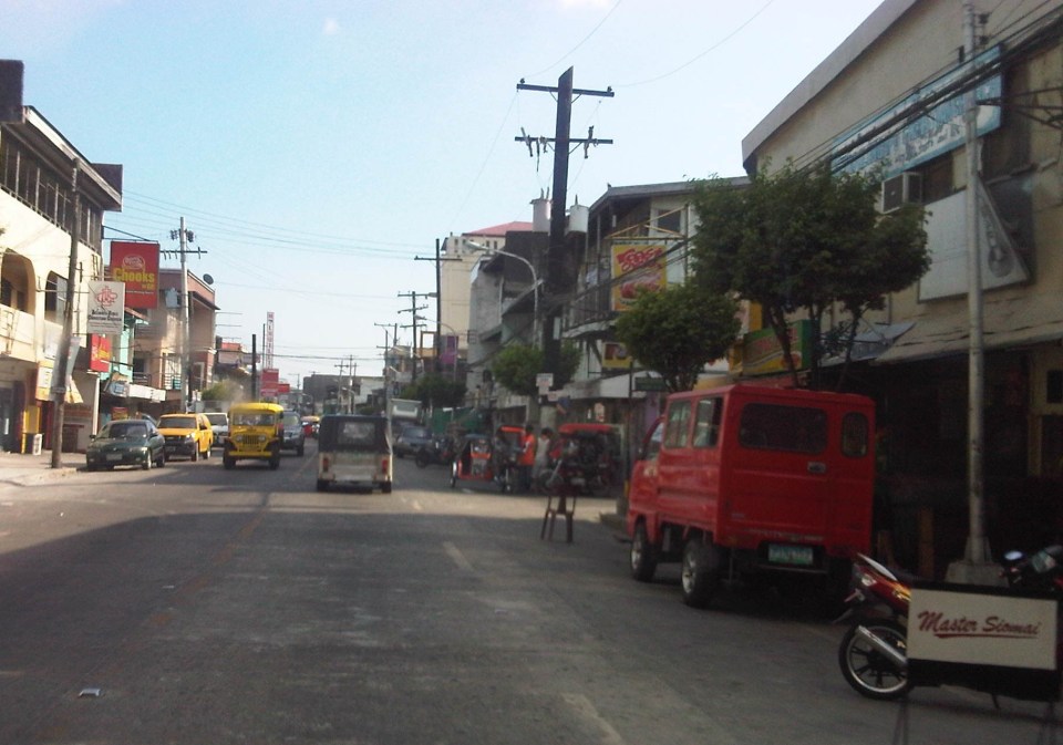
 Another view of the Rizal Avenue, this time along the westbound side, with the the market on the left side. The yellow jeepneys are quite conspicuous and remind me of the UP Ikot jeepneys.
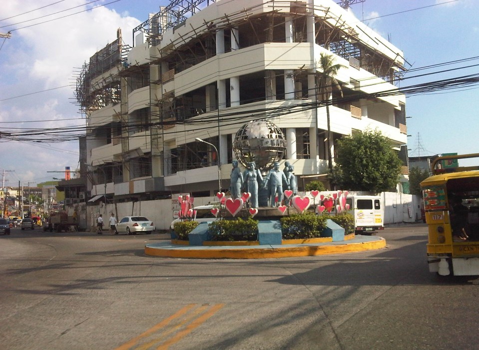
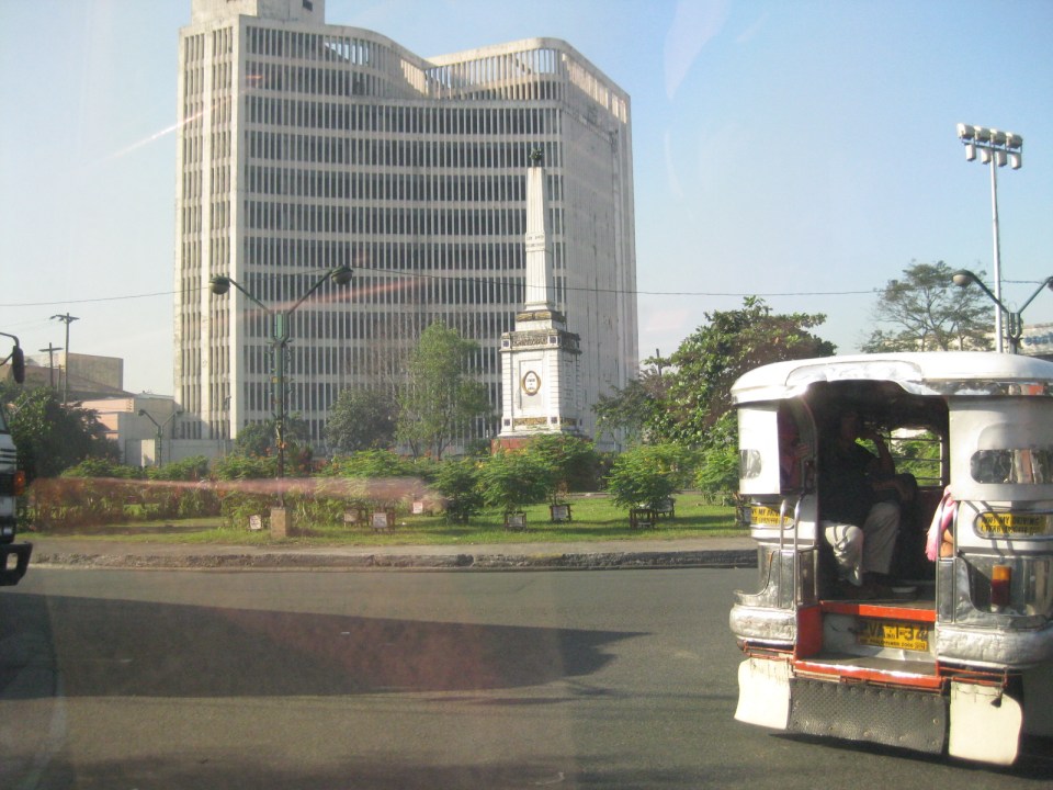
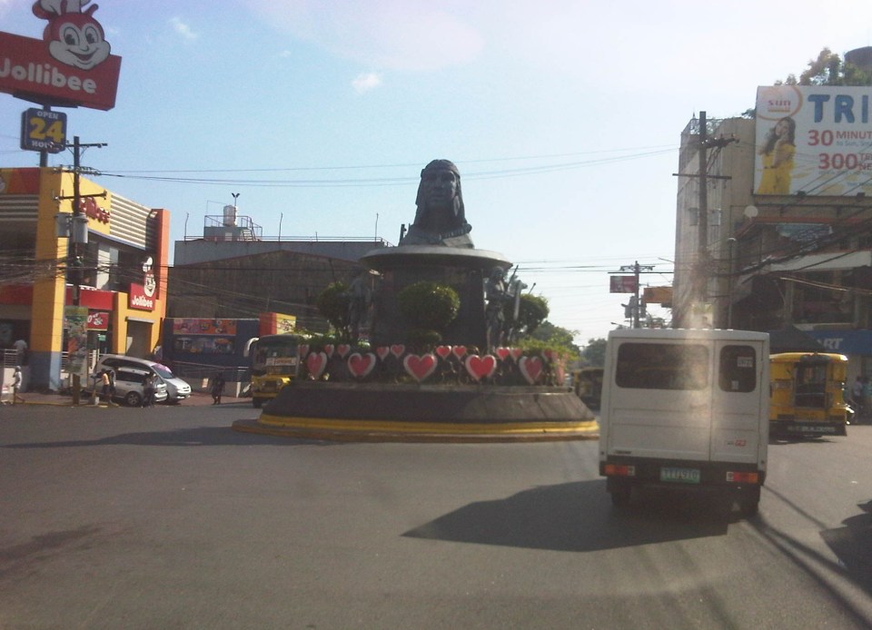 A monument to the Ulo ng Apo, from which the name of the city is said to be derived from, is right in the middle of a rotunda at a major intersection along Rizal Avenue. Around the rotunda are commercial establishments and a major provincial bus terminal.
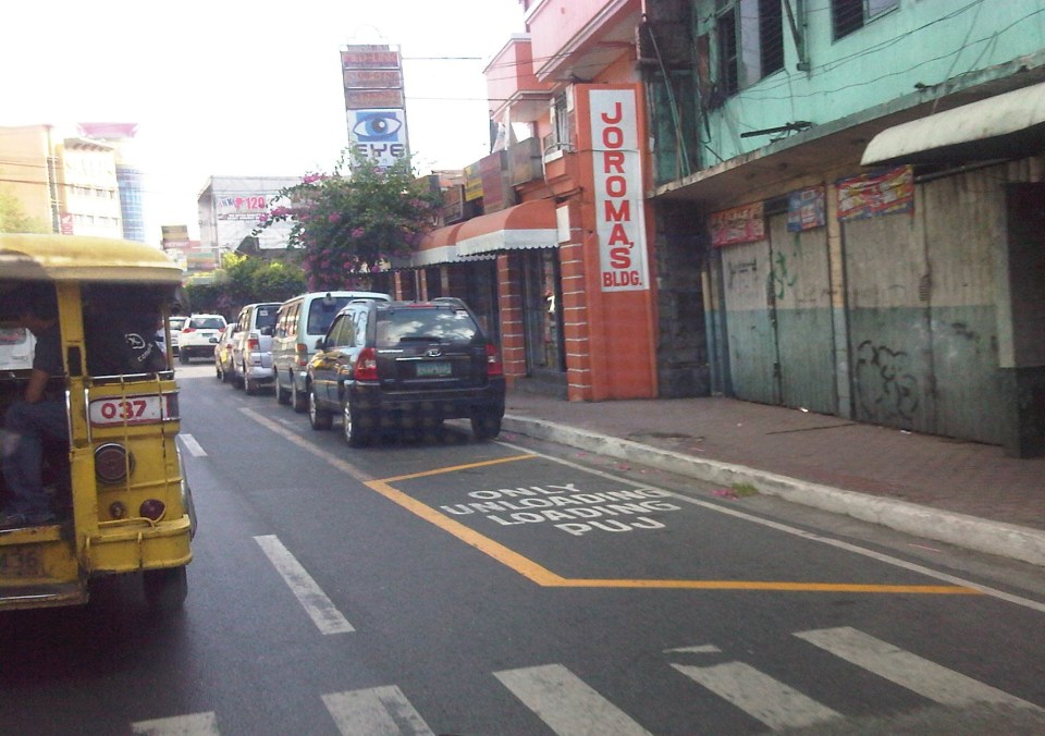 There are designated stops for jeepneys along the avenue but these are often crowded out by parked vehicles. As a result, jeepneys could not maneuver properly and end up unloading/loading passengers in the middle of the road.
 On-street parking along curves tend to impede the flow of traffic. There are also issues where electric posts like the one shown in the photo have not been transferred, posing risks to vehicular traffic.
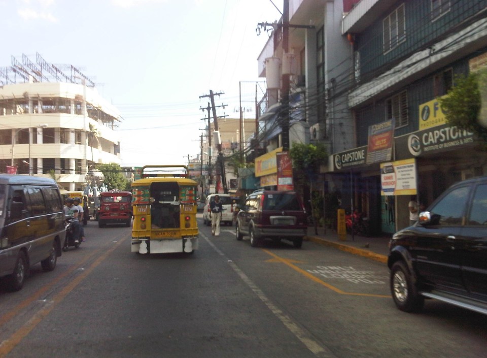 Another example of a designated jeepney stop along the avenue where parked vehicles constrict maneuvering space for jeepneys.
 A monument to the volunteers of Olongapo during the Mt. Pinatubo episode after the closure of the U.S. Naval Base in what is now a Freeport. I wonder if the building under construction in the photo has enough parking spaces for the traffic it generates.
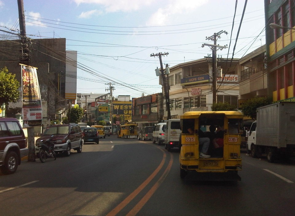
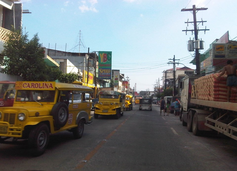 More jeepneys and more on-street parking – there is a perception that there are too many (oversupply) of jeepneys. Note though that most PUJs in Olongapo are not the bigger 20 to 24 seater jeepneys we see in Metro Manila but the older, 16 to 18 seaters like the ones shown in the photo.
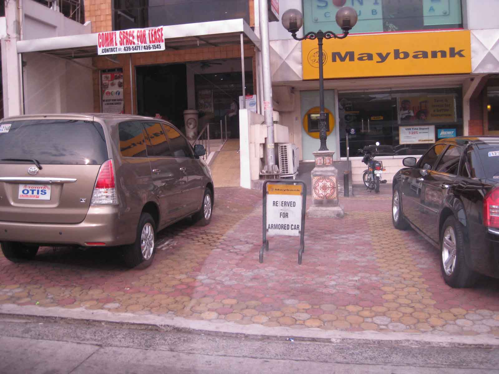
 Some on-street parking spaces are “reserved” by establishments. I didn’t mention that on-street parking is free of charge and such situation probably encourages longer parking durations. Perhaps the city should seriously consider parking fees to reduce long-term parking and ensure smoother flow of traffic along its streets. There are examples of these parking schemes in other cities including Makati City that Olongapo can adopt and adjust.
–
Streets of Intramuros: Calle Real del Palacio
I haven’t had a good chance to take photos of the streets in Intramuros, Manila. The historic streets within what was for hundreds of years regarded as Manila deserves a more detailed treatment. Recently, I have been able to go around a little bit thanks to meetings at the DPWH and a lecture at the Mapua Institute of Technology. I took full advantage of the opportunity to take photos along some streets along the way to my meetings and am posting these in a few articles about what I think should be a good example for heritage conservation including the street names and old structures within the walled city.
The original name of Andres Soriano Jr. Avenue, the main road stretching from Plaza Mexico along the Pasig River to A. Bonifacio Drive in the Port Area, was Calle Real del Palacio. I believe they should have stuck with the original name in order to preserve this piece of history. Our politicians have a penchant for renaming streets after their kin, heroes, or for purposes like claiming that we should exorcise names associated with our colonial past. While the latter seems to be a basis for changing names elsewhere (not just in the Philippines), perhaps the remedy here is to still retain the original name under the new one.
 Ruins of the aduana or customs building, visible upon turning from the Muelle Del Rio at Plaza Mexico towards Andres Soriano Jr. Ave.
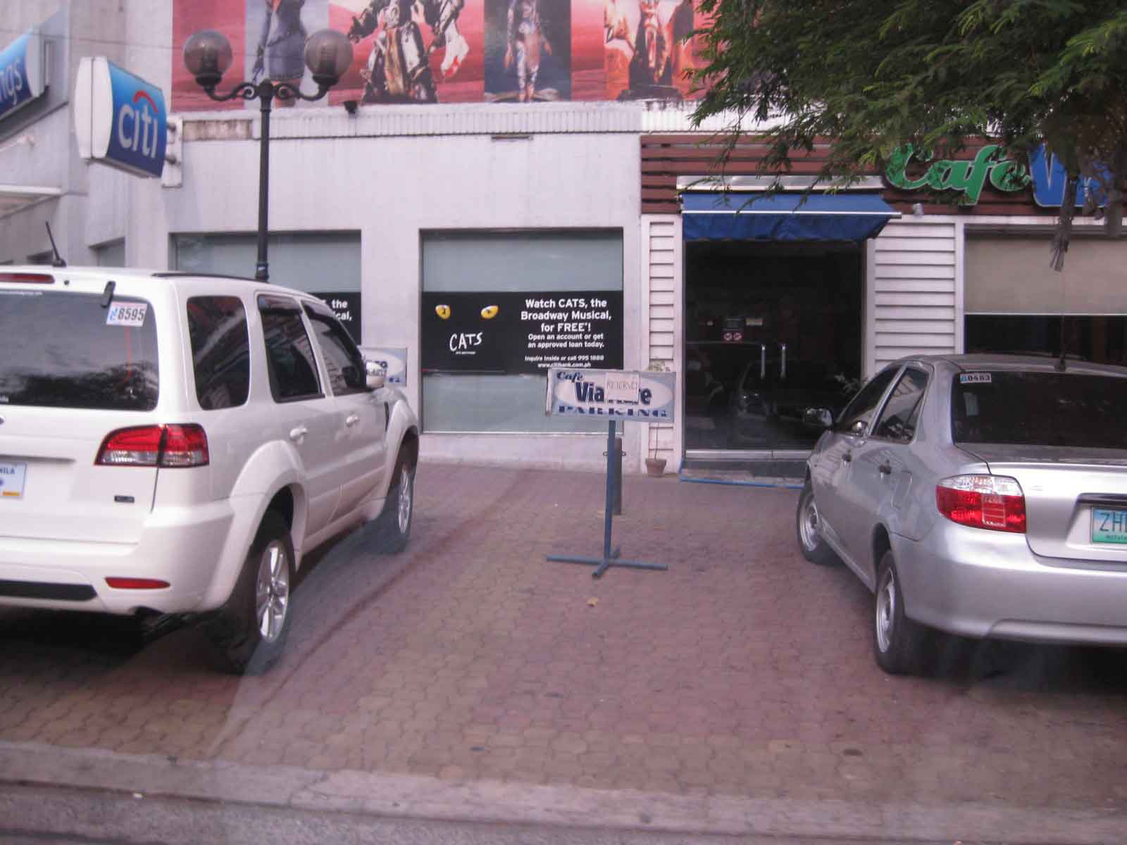
 The road is a four lane, two-way street. It is usually congested because of public transport loading and unloading operations (usually in the middle of the street) and roadside parking, which is tolerated. In fact, there are parking aides in charge of collecting fees from drivers parking along the streets. Intramuros is host to a lot of offices, commercial establishments and schools – all major traffic generators that attract so many vehicles thereby requiring a lot of parking space. The building to the left is the reconstructed building where the old ayuntamiento used to stand.
 The new building where the ayuntamiento was is now supposed to be the new offices of the Bureau of Treasury.
 The open space at left is the along which are many parked cars is the Plaza Roma, which is in front of the Manila Cathedral. The building right after the plaza is where the Palacio del Gobernador used to be. It is now the offices of the Bureau of Treasury.
 Cabildo Street, one of the side streets from across the Plaza Roma, which ultimately leads to Fort Santiago.
 6Another look at the building where the old Governor’s Palace used to be. Visible downstream along the Soriano Ave. is the gate leading to the Simeon de Anda monument located at a roundabout along A. Bonifacio Drive.
 At right is Gen. Antonio Luna Street, which is another main road that has one end at Puerto Real, the southernmost gate of the Intramuros and the other at Fort Santiago. Curiously, this road was also called Calle Real del Palacio as it passed in front of the Palacio del Gobernador.
 A view along Gen. Antonio Luna Street towards Fort Santiago, which is a one-way street.
 Western entrance to Intramuros along Soriano Ave. leads to Bonifacio Drive and the Port Area.
 Arzobispo Street, which also leads to Fort Santiago but also passes along the Archbishop’s Palace, the office of the Archdiocese of Manila and with its southernmost end at San Agustin Church.
 The Simeon de Anda monument at the Anda Circle along Bonifacio Drive.
–
The Streets of Bacolod: Around the Public Plaza
The streets surrounding the Bacolod Public Plaza are one-way streets following a counter-clockwise circulation around the plaza. Typical of plazas of old, the latter has around it the church (in this case San Sebastian Cathedral), the old city hall, commercial establishments, the police headquarters, and a major school (La Consolacion College). The following photos were actually taken a year ago in February 2012. I doubt if much has changed since then but the circulation and traffic situation should practically be the same give and take the normal traffic growth due to progress for the capital city of Negros Occidental.
 Intersection of San Juan St. and Gonzaga St. (view along San Juan St. towards southwest)
 Intersection of San Juan St. and Luzuriaga St. (view from east corner of intersection towards Westown Hotel)
 Roadside parking along San Juan St. Noticeable above are the motorcycle parked along the road, with some occupying pedestrian crossing space.
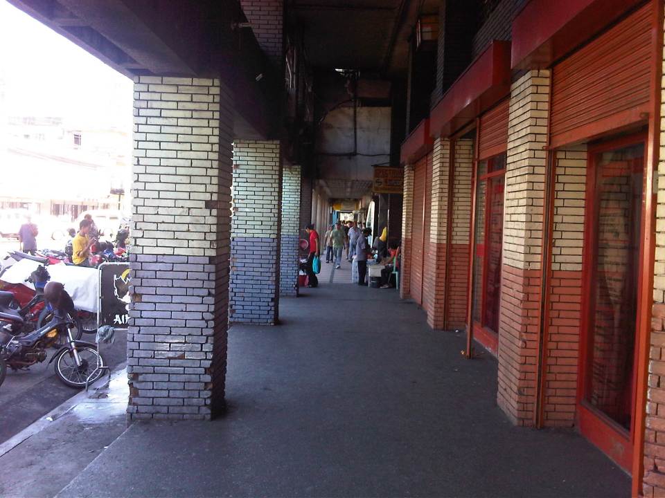 Old cities like Bacolod have buildings featuring arcades like this where pedestrians have the ROW and are sheltered from the elements. I was glad to see that the city basically cleared these facilities from obstacles. It is not entirely without impediments though as shown in the photo.
 Luzuriaga Street (view towards southeast)
 Arcade of Plaza Mart building along Gonzaga Street and across from the Bacolod Public Plaza (view towards Araneta Ave. and Gatuslao Street)
 Another view of the arcade of Plaza Mart, this time along San Juan Street (towards Luzuriaga St.)
 San Juan Street (view from the corner at Gonzaga Street) – at right is the Plaza
 Gonzaga Street (view at corner of the Plaza along San Juan Street) – vehicles downstream are at the intersection of Gonzaga St. and Araneta Ave. Further downstream is Gatuslao Street
 Rizal Street taken from the plaza side and featuring San Sebastian Cathedral
 Rizal Street leads to SM City Bacolod, which is found in the reclamation area. (View from the intersection of Rizal St. with San Juan Street)
 Steel barriers along Rizal Street prevent vehicles crossing the street from the northeast side of San Juan St. All traffic must turn right towards SM. (view from the corner of San Juan and Rizal along San Juan towards the southwest direction) The PNP headquarters is the building on the opposite corner with the blue roof.
 Intersection of San Juan Street and Luzuriaga Street (view along San Juan St. towards southwest)
 San Juan-Luzuriaga intersection (view from Westown Hotel corner)
 San Juan-Luzuriaga intersection (view along Luzuriaga St. towards southeast)
 Luzuriaga Street is also a one-way street and with significant roadside parking as shown in the left side of the photo. View of traffic coming from the intersection with San Juan St. Westown Hotel is the building at left.
The circulation scheme at the plaza seems to be working out well at the time. This is despite the proliferation of roadside parking along the streets and around the plaza. The streets are relatively wide and so a one-way scheme works well in terms of taking advantage of the capacities of the streets while allowing for curbside parking that typically occupies one lane of road space as shown in the photos above. We didn’t see anyone charging parking fees for the vehicles and so we assume that these are practically free though we did see some informal “watch-your-car” boys who rely on tips from those parking along the road. Ultimately, though, the city should look into the provision off-street parking facilities as I can imagine traffic congestion, for example, in the vicinity of San Sebastian Cathedral on Sundays. Traffic in the area should be expected to increase as the city continues to experience economic growth and more developments ultimately locate at the reclamation area.
–
Parking issues in the Philippines
Saw this report from the GMA News YouTube channel that appeared in several of their news programs in Channels 7 and 11. It’s a good report as it is informative and the reporter did sufficient research on parking provisions stipulated in the Philippines’ National Building Code. I also found it interesting that one mall in Manila is already using an automated parking facility such as the one shown in the report. These multilevel parking facilities maximize the space required for slots and do not require much space for ramps or driveways. They are already found in cities in many other countries and should be considered in many other cities in the Philippines that are now facing parking problems.
Establishments such as shopping malls and other commercial areas are significant traffic generators. One aspect of trip generation is parking generation, and malls attract many people who tend to use private vehicles as their means for travel. This is especially true in Metro Manila and other major cities in the country where there are limited choices for public transport. For one, it is not so convenient nor comfortable for people taking public transport in Metro Manila. And so, a lot of people would bring their cars or motorcycles for shopping trips.
There is little information or data on parking generation characteristics in the country and it is unclear if the National Building Code’s provisions are sufficient. The NBC’s prescribes the number of minimum parking spaces for establishments but these are already being violated by many, which brings us to question the manner by which authorities approve designs for buildings given this requirement for parking.
–
Walking and parking in Quezon City: Tomas Morato
Continuing on the series featuring pedestrian and parking facilities in Quezon City, featured in this post is the case of Tomas Morato Ave. Like Visayas and West Avenues, the pedestrian sidewalks and off-street parking spaces along the avenue were constructed to address the lack of off-street parking facilities and sufficient pedestrian walkways along streets that had significant commercial development. It should be noted, however, that the lack of parking spaces is due likely to many establishments not complying with the minimum standards set under the National Building Code and City Hall’s approval of plans and construction despite this non-compliance (note: LGUs issue the building permit upon approval of plans including what is supposed to be a review of compliance to various standards.).
 A view of a stretch of Tomas Morato Ave. – note the absence of or weathered pavement markings and the vehicles parked at spaces constructed by the Quezon City government. Space was relatively more limited along Morato and so much of the spaces available were allocated for parking. Pedestrians, thus end up walking along whatever remained or along the edge of the carriageway.
 Establishments such as the many restaurants along the street. From a purely transport planning perspective, one wonders how these establishments were able to get approval from City Hall without having enough parking slots for their customers. These are not your neighborhood turo-turo or karinderya types and so they will generate a lot of vehicle traffic and require more parking spaces in addition to the token slots they provide.
 Some of the larger and older establishments along Morato already have sufficient parking spaces and these were upgraded by the LGU to have uniformity along the road.
 The off-street parking spaces definitely benefited traffic as road capacity is not reduced by on-street parking. There are still problems though especially during noon and night time when the restaurants generate traffic resulting to some vehicles parked or standing along the street.
 One issue along the street are public parking constructed using public funds being reserved by establishments such as this bank along Morato.
 Another case concerns slots reserved by restaurants like this one.
There are still issues concerning the construction of parking spaces for establishments who have not complied with building standards (minimum parking spaces). These issues are rooted on the use of public funds that otherwise could have been used for other, perhaps more important purposes such as healthcare or classrooms. However, one should not lose sight of the fact that there are benefits derived from these parking spaces from the perspective of traffic flow. Moreover, the inclusion of pedestrian facilities definitely enhance safety. These are benefits which are often quite difficult to quantify in monetary terms but contribute to better quality of life for the general public. Such projects also show that the city is doing something to improve public facilities unlike the cases of other LGUs that have sufficient revenues but seem to be lacking in the provision of similar infrastructure.
–
Walking and parking in Quezon City: West Avenue
Parking spaces and walkways were also constructed along West Avenue. Bollards separate the parking spaces from the pedestrian right of way. As mentioned in a previous post, many commercial establishments benefitted from this “freebie” from the Quezon City government considering many establishments didn’t even have the minimum number of parking spaces as stipulated in the National Building Code. The local government balked at charging parking fees but one opinion is that they should charge fees for on-street parking facilities that generally benefit car-owners more than they benefit non-owners. I personally believe that there should be parking fees in order to recover some funds that could be used for other programs that could have otherwise received funding that also could have benefited more people. Following are photos taken along West Ave.
 Parking along West Ave. in front of an office building
 One advantage of the project was the reduction of on-street parking though there are still those who prefer to wait along the roadside (i.e., those with drivers).
 Parking spaces in front of a fine dining restaurant.
 Parking spaces near the Delta area, which is the intersection of 3 major roads – Quezon Ave., West Ave., and Timog Ave.
–
Walking and parking in Quezon City: Visayas Avenue
I’m initiating a series of posts on Quezon City – focusing on the pedestrian and parking facilities that were constructed not so long ago. As part of a city-wide project using local funds generated from QC’s internal revenue allotment (IRA) and other incomes, the city constructed pedestrian sidewalks and off-street parking spaces along its major roads. These included roads like Quezon Avenue, Visayas Avenue, West Avenue and Tomas Morato Avenue. I believe that these facilities provide example of good practices for other cities seeking to enhance walkability while addressing on-street parking issues.
Following is a photo journal of pedestrian and parking along Visayas Avenue.
Spacious pedestrian walkways along Visayas Ave. visible upon turning right from the Elliptical Road.
 Combination of parking and pedestrian walkway along Visayas Ave. along a line of commercial establishments, mostly restaurants and shops along the road. There are bollards to separate parking spaces from the walkways.
 Despite the opportunities during the project, many lamp or electric posts have not been moved/transferred. These create obstructions in addition to the common practice of delivery trucks backing up and blocking pedestrian paths.
 Commercial and residential buildings along Visayas Ave. have benefited from the project as there were no off-street parking along most sections of the road and pedestrian facilities were often the token sidewalks that are also often obstructed with debris or vendors.
 There are few other cities in the Philippines with off-street parking such as this that does not intrude into the rights of way for pedestrians. Then again, there are also limited opportunities where space is generally not available for such projects.
 Most establishments along this side of Visayas Ave. had adequate frontage space or buffers (likely part of the road’s ROW) that made it possible to have pedestrian and parking spaces.
In the last local elections, parking fees for these spaces became an issue. Since government money was used to construct the parking facilities where there were none despite minimum parking requirements for establishments as stipulated under the National Building Code, some councilors proposed parking fees to recover the cost of construction. Some sectors including the businesses rejected the proposal stating that these benefit the general public. In an unusual move, the Catholic Church in QC even stated in a pastoral letter (!) that parking fees were anti-poor, something that was difficult to understand given that car-owners were the first to benefit from off-street parking. I doubt if what we regard as poor people would own cars. Parking fees were never implemented along this road and others like it.
–
Some thoughts on transport and traffic while commuting between Cainta and Antipolo
Commuting from the Ortigas (Cainta) end of Imelda Ave. to its other end at Marcos Highway (near where Pasig, Marikina, Cainta and Antipolo meet), one should be able to observe and make a quick assessment of the positives and negatives of our local transport system. While there are more negatives at Cainta Junction and along Imelda Avenue, Marcos Highway definitely has improved particularly in terms of walkability. It is a commute that I have taken so many times since my childhood days and I can only now remember times when one could walk safely from one end to the other when there were far less vehicles than the volume that flows along Imelda Ave. these days.
Junction is still quite the mess despite some road widening at the intersection owing to various factors including the fact that the intersection simply cannot handle the volume of vehicles using it even after the elimination of some turning movements from Ortigas Ave. in favor of U-turns particularly for traffic coming from the eastbound side of Ortigas. It seems the traffic signal settings can no longer handle peak period traffic and manual traffic management probably aggravates the situation especially when enforcers employ the buhos technique of trying to dissipate as much of the queued vehicles per approach or movement. The latter technique does not take into consideration that the longer a movement or group of movements are allowed to move, there are corresponding build-ups in traffic along all other approaches. It is a vicious cycle (pun intended) that is supposed to be addressed by an optimally times signal system. Saturated conditions, though, are inevitable due to the sheer volume of vehicles using the intersection given that Junction is a catchment for vehicles from Rizal Province that ultimately uses Ortigas Ave. to head into Metro Manila in the mornings. The reverse is true in the afternoon to evening periods.
Imelda Avenue, which was also known for a time as Francisco Felix Ave., is plagued congestion due to notoriously bad pavement conditions, so many median openings, and high vehicle trip generation rates from the many residential subdivisions or village along the road. The pavement conditions are due mainly to damage brought about by trucks and, during the wet season, frequent flooding along many sections of the avenue. Bad pavement conditions and flooded streets significantly slow down traffic as Imelda Ave only has two lanes along each direction and is divided by a narrow median island that’s just enough for a few plant boxes and lamp posts.
There are mostly middle class subdivisions including the large Vista Verde, Village East, Karangalan, and Pasig and Cainta Green Parks along the road. There is also a DMCI medium rise development has its main access road also connecting to Imelda Ave. These villages generate much vehicle traffic and each have their own median openings that practically function as intersections along the entire stretch of the avenue. These openings create a lot of conflict between through traffic and vehicles entering and exiting the villages, especially those taking left turns to or from their gates.
While there are commercial establishments along the avenue, most were small and traffic generation characteristics were not so significant as to cause severe congestion. The first major generator in the middle of the avenue was a branch of the membership-concept Makro supermarket cum depot. Makro generated significant traffic but did not cause much congestion along the stretch in front of the Village East gate. It was eventually acquired by commercial giant SM and the branch is now an SM Supercenter that seems to be generating much more traffic than Makro did at its peak. While traffic studies are usually the norm before such developments are constructed given the trips attracted by SM, the congestion experienced along Imelda Ave has been reported to be generally un-managed despite the need for more disciplined loading and unloading by public transport, pedestrian movements and vehicle entries and exits.
Jeepneys are the main public transport mode along Imelda Ave. although there are tricycles serving the various subdivisions that often not only cross the road but also travel along Imelda Ave. for short distances. I remember in the 1970’s and early 80’s that the tricycles used to be the primary mode of transport from Junction and the Cainta Public Market as Imelda was not yet connected to the still to be completed and unpaved Marcos Highway. There was even a Metro Manila Transit Corp. bus service (probably missionary route and with low frequency of service) along Imelda Ave. that turned around near Kasibulan Village, one of the first subdivisions in the area. Many jeepneys are noticeably the patok or popular type known for their loud stereos and reckless driving. Still, there are the smaller, older jeepneys whose route connects either ends of Imelda Avenue. Most patok jeepneys are from the many longer routes between Rizal towns and Cubao overlapping along Imelda Ave (e.g., Angono-Cubao, Antipolo-Cubao, Binangonan-Cubao, Taytay-Cubao, etc.).
–
School traffic impacts – issues along Ortigas Ave., Part 2
I had written recently about traffic congestion along Ortigas Avenue that is due mainly to traffic generated by a private school in the area. In the previous post, the photos only show vehicles parked on the sidewalks on either side of the road. They did not show the actual traffic congestion experience. The parked vehicles seem more incidental and indirect than concrete evidence of congestion brought about by school traffic generation though they are a definite manifestations of parking generation, which is directly related to traffic generation.
 Parked vehicles on the sidewalk are seen as we approached the tail of a very slow moving platoon owing to the congestion generated by an exclusive school.
 Traffic jam with road capacity reduced by the parked and standing vehicles along the EDSA-bound side of Ortigas Ave. The trees are witnesses to the chronic traffic jams and help alleviate their impacts by absorbing emissions from the vehicle.
 Severe congestion as we approached the school – the overpass downstream in the photo is a reference for where the school is located
 The overpass bears the name of the mayor of Mandaluyong City, where this school is located and which has jurisdiction, together with the MMDA, for traffic management in the area. At the time we passed the area though, there were no enforcers in the area despite the severe congestion. Is this because they gave the responsibility (or burden) of managing traffic to the school? Perhaps there was no need to post enforcers here as congestion is a regular thing and people seem to have been conditioned with the almost daily experience.
 The area at the foot of the pedestrian overpass actually functions as a pick-up and drop-off area for students of the school. As such, vehicles occupy not just the the sidewalk but also more than a lane of Ortigas Avenue. This effectively constricts traffic along this major road.
 Traffic is slow along the San Juan-bound direction of Ortigas as vehicles waiting for their passengers (students of the school) are lined up and occupying the outermost and even the middle lane of the road.
 This queue is not entirely attributed to traffic generation by the school but is likely due to traffic management at the EDSA-Ortigas intersection, which is signalized. If the signal setting is not optimized or if the intersection is not cleared of straggler vehicles, traffic is backed up along all the approaches to the intersection. The tall building in the background hosts DOTC’s headquarters. I wonder if our officials are taking in the congestion that occurs almost daily (weekdays) and if they are even crosses their minds how to solve this problem and others like it around the country.
 Proof that congestion is along both directions of Ortigas Ave. is seen in the middle of the photo where vehicles are also backed up along the overpass ramp coming from EDSA’s northbound side. For what it’s worth, the DOTC headquarters is right along this road at the building where the 7-Eleven (sign visible in the photo) is located.
 Another and even closer look of what is literally bumper-to-bumper traffic along both sides of Ortigas Avenue during the afternoon peak triggered by the exclusive school along its San Juan-bound side. Visible in the photo is the congestion along the overpass from EDSA.
–
School traffic impacts – issues along Ortigas Ave., Part 1
I have written about school traffic generation in this blog and have mentioned about the traffic congestion experiences along major thoroughfares due to the vehicles attracted by private schools. La Salle Greenhills (LSGH) is an exclusive school found along Ortigas Avenue and during the summer months of April and May, people passing through the stretch of the road from EDSA to the Greenhills Shopping Center are relieved that they won’t have to go through traffic jams due to the school-generated traffic. From June to early December and January to March, however, the area is almost always congested in the morning and afternoon. Such congestion is predictable since it occurs during a period when students come to school and when they are dismissed mid-day or in the afternoon.
Heading to a meeting at the DOTC from the University one morning, we decided to take an alternate route. Instead of EDSA or C5, we took East Ave., Tomas Morato Ave., Gilmore Street and then emerged at the westernmost end of Ortigas in San Juan. It was already 9:00 AM when we arrived at the section most affected by the traffic generated by LSGH and so we didn’t to get caught in a jam as we proceeded towards our destination. We were proven right as traffic was almost free-flowing, and I took advantage of the traffic conditions and to take a few photos of the indicators for the potential traffic congestion in the area. The following photos also show a serious parking problem and (sadly) the usurpation of space from pedestrians. For shame!
 School service vehicles parked along the sidewalk along Ortigas Avenue – beyond the wall on the right is Wack-wack, a high-end residential subdivision named for the sound of golf clubs swinging at its famous course.
 Private vehicles parked along the same sidewalk – noticeable in the photo is the pink line drawn by the MMDA to supposedly demarcate space that should not be obstructed and instead allocated for pedestrian use. It is clear in the photos that pedestrians would have to walk along the edge of the sidewalk or the outer lane of the carriageway itself, increasing the risks for them to get sideswiped by motor vehicles.
 More parked vehicles along Ortigas Avenue, mostly private vehicles that are highly likely owned by those studying at LSGH.
 It’s actually worse on the other side of Ortigas Ave. as vehicles occupy a lane of the carriageway, effectively reducing capacity along this stretch of the road.
 It seems the main purpose of the pedestrian overpass is to allow students to safely cross the street to get from and to their vehicles. I can only imagine the congestion caused by drop-offs and pick-ups along Ortigas Ave., which for certain times of the day functions as a driveway for the school.
–
