
Home » Governance (Page 40)
Category Archives: Governance
Proposal for a Special Mass Transit Support Fund
There are three bills currently being discussed at the Senate that were filed by Sen. Ralph Recto. These propose the restructuring of the special funds derived from the Motor Vehicle Users’ Charge (MVUC) in order to allocate funds for mass transportation.
Senate Bill 446 – An Act Creating The Special Mass Transit System Support Fund, Reallocating The Disposition of Monies Collected From The Motor Vehicle User’s Charge, Amending For The Purpose Sections 7 And 8 Of Republic Act No. 8794, Otherwise Known As The Motor Vehicle User’s Charge Act of 2000.
Senate Bill 611 – An Act Creating The Special Mass Transit System Support Fund To Provide Additional And Long-Term Funding To Priority Mass Transit Projects In The Greater Metro Manila Area, Amending For The Purpose Sections 7 And 8 Of Republic Act No. 8794, Otherwise Known As The Motor Vehicle User’s Charge Act of 2000.
Senate Bill 621 – An Act Creating The Special Mass Transit System Support Fund Amending For The Purpose Sections 7 And 8 Of Republic Act No. 8794, Otherwise Known As The Motor Vehicle User’s Charge Act of 2000.
The National Center for Transportation Studies (NCTS) was requested to submit a position paper on these bills by the Senate Committee on Public Works that is chaired by Sen. Ferdinand “Bongbong” R. Marcos, Jr. The Center drafted one and submitted the 4-page document to the Committee secretariat last October 16, 2013. A copy of the position paper may be downloaded from the following link:
NCTS PositionPaper MVUC 16Oct2013
The Senate Committee on Public Works held a public hearing last October 17, 2013 at the Lorenzo Tanada Room at the Senate. The NCTS Director, Dr. Hilario Sean O. Palmiano, was invited as a resource person for the hearing and joined representatives of agencies such as the DPWH, DBM, DOF, LTO and the Road Board in providing insights and comments on the proposed bills. The same agencies were also requested to provide pertinent data for the committee to evaluate the proposed changes to R.A. 8794. Such data include information on past disbursements and approved projects that used the special funds under the MVUC.
–
Pedicab regulations
With the proliferation of non-motorized transport (NMT) as public transport, there are questions raised pertaining to their regulation or management. Perhaps most pedicab, padyak, sikad or trisikad services around the country a regulated in some way. I use the term “some way” since there will always be either or both formal and informal rules for these services to be provided and patronized by people. These rules or regulations include the setting of pedicab fares that are most likely based on travel distance though not necessarily similar in structure to those of buses and jeepneys. Pedicab fares are practically similar to those for tricycles in that they operate within areas or zones. The rough locations of an origin and destination (i.e., rough distance between origins and destinations or distances between zones) would be the basis for fares.
Private exclusive residential subdivisions or villages would have their own homeowners’ or residents’ associations. These will likely have a say in tricycle or pedicab regulations. Otherwise, many would probably have the power to restrict or prevent tricycles from entering and operating within the subdivision or village. Most if not all tricycles are organized as Tricycle Operators and Drivers Associations (TODA) and so might have some say or bargaining power when dealing with barangays or associations where many operators or drivers may be residing. In the case of pedicabs, there are also pedicab associations with similar compositions where operators or owners of cabs are residents of an area or village. In well-organized subdivisions, however, the associations hold sway over pedicab operators and drivers and enforce rules through contracted, private security staff.
Pedicab rules are not very complicated. In fact, the rules can be provided or posted for every cab such as the example shown in the following photo. I took this as I was riding a pedicab to get home one afternoon.
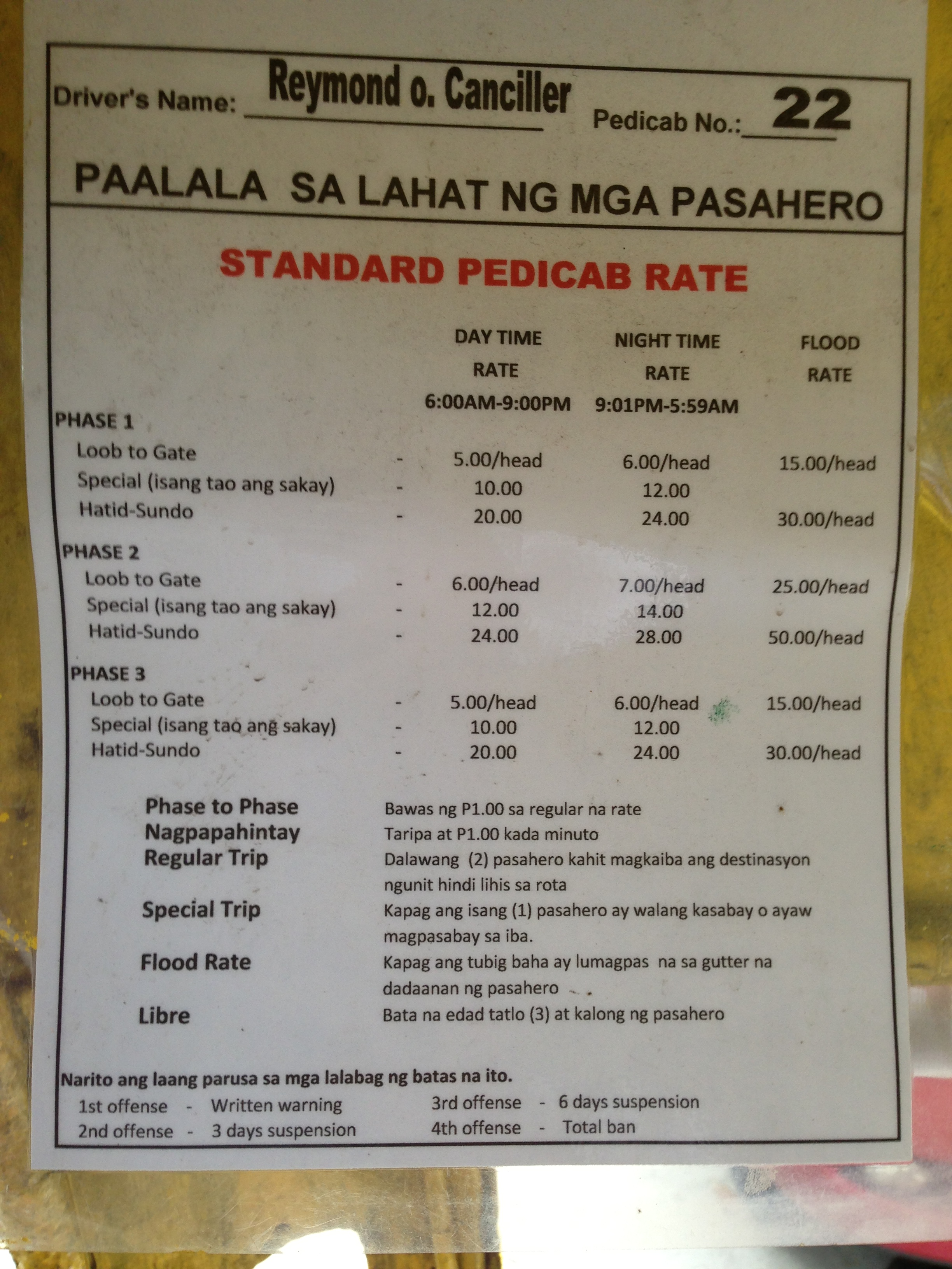
In the laminated reminder (paalala) to passengers, the fares as set with respect to the phases of the subdivision, which serve as zones of operation for pedicabs. There is a daytime rate, a nighttime rate and even rates for when there’s flooding along the streets! Penalties for pedicab drivers violating the rules are stated at the bottom of the announcement with four offenses resulting in a total ban of the driver. I assume the ban is also enforced by security and is aided by the fact that all drivers are issued IDs by the village homeowners association. In our neighborhood, the number of pedicabs operating at late nighttime to the early hours of the morning are regulated and there is a list of drivers providing services during these times of the day. This was a measure passed years ago in part to address the lack of public transport during the nighttime but more so to combat burglaries that involved pedicab drivers who might have become familiar with the routines of residents.
These rules can easily be replicated and implemented elsewhere as long as residents are able to organize themselves. Perhaps in other cases they would also need to coordinate with barangay officials in residential areas where there is no exclusivity like that of a gated subdivision. That way, the rights and interests of passengers are well represented and can be articulated more effectively with respect to tricycle and pedicab associations who might just be exercising too much of their prerogative on passengers. After all, the interest and rights of passengers including their safety should be the priority here as in all other public transport because these are services being provided, and not just any business where revenue seems to be the only end.
–
Tricycles in the Philippines – Part 1
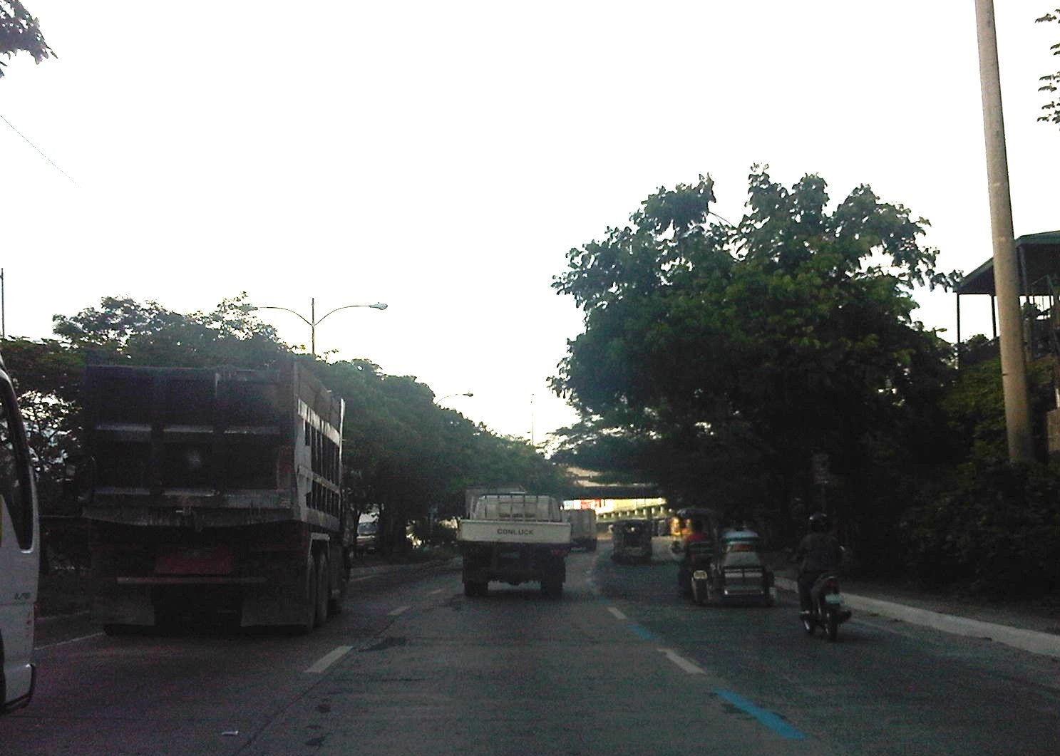
We start the “ber” months strong with an initial feature on an ubiquitous mode of transport in the Philippines. While the jeepney seems to have had most of the attention when the subject of public transport in the Philippines is discussed, the truth is that there is arguably another, more dominant mode of public transport in the country. These are the tricycles, a motorized three-wheeler consisting of a motorcycle and a sidecar. You see these everywhere around the country in most cities and municipalities where they thrive particularly in residential areas. They are usually the only mode of public transport for most people in rural areas where local roads are typically narrow. In many cases the only roads connecting communities may be national roads. And so, there is really no other choice for tricycles but to travel along national roads and against existing laws prohibiting tricycles from these roads.
 Tricycle along the motorcycle lane of Circumferential Road 5
 Tricycles racing along the Olongapo-Castillejos Road in Zambales
 Tricycle along Romulo Highway, Tarlac
 Tricycles along Catolico Avenue in Gen. Santos City
Unlike buses and jeepneys, tricycles are not regulated under the Land Transportation Franchising and Regulatory Board (LTFRB). Instead, they are under the local government units that through one office or another issue the equivalent of franchises for tricycles to operate legally. Fares are quite variable but are usually according to distance though there are special rates for when passengers want to have the vehicle for themselves much like a taxi.
Unfortunately, few LGUs have the capacity to determine the optimum number of tricycles for service areas under their jurisdictions. As tricycle operations are often the source of livelihood for many, the granting of franchises is often seen as a way for mayors to have influence over people who would have “utang na loob” (debt of gratitude) for being granted franchises. The tendency, therefore, is to have too many tricycles as mayors try to accommodate more applicants who seem to have no other options to earn income or to invest in. This poses a challenge to many who want to reform the system and modernize or upgrade public transport in cities around the country.
–
Floods and traffic
Transport and traffic problems take a backseat to the flooding problem during this time of the year in the Philippines. Since there are practically only two seasons (dry and wet) in the country, floods become a genuine concern once monsoon rains arrive and these are usually complicated by a high frequency of typhoons between August and November. Many major roads in Metro Manila are prone to flooding including Espana Avenue, Araneta Avenue, Gil Fernando Avenue, Ortigas Avenue, and EDSA. Flash floods often lead to traffic congestion and commuters and motorists alike would have a hell of a time traveling yet it seems very little has been done to address a situation that’s been here since the Spanish period. This is a perception by many people and a reasonable one given the historical evidence of flooding in the area and elsewhere in the country.
 Pedicab ferrying passengers in a flooded residential area
There are many images on the current floods in Mega Manila that one can find in various reports online and on TV. The Telegraph provides good photos for describing the situation around Metro Manila and the surrounding areas, and especially in the low-lying areas like Marikina, Malabon, Rodriguez and Cainta. These images could have been taken in any other year in the past and the images would probably be the same with slight changes in some buildings that could have been improved (e.g., additional floor?) in response to the flood experience.
Floods and possible solutions have been the topics of discussions every year and usually during this rainy season. While there have been efforts to address this problem, these are usually and obviously not enough and a more comprehensive approach is needed. Quite obviously, too, solutions that tend to dig up faults in urban planning throughout Metro Manila have led nowhere as legitimate residents and other locators in these areas are not in a position to give up their properties just like that. Relocating informal settlers and others who have encroached from waterways and other critical areas is a start but will have limited impacts in part because Mega Manila does not have a good drainage system in the first place.
Expensive as they are, engineering solutions like perhaps what Tokyo has done in this underground wonder. Of course, this example is a kind of ultimate solution and would require tremendous resources to realize. But then this is also like the transport and traffic problems we are experiencing where years (or decades) of inaction and hesitation due to resource and technical questions have led to the despicable transportation we have now The reality is that solutions will not get cheaper as we continue to balk at the cost of the required solutions. Floods and traffic will not be solved overnight. It will take years to improve the lives of many people in flood prone areas and implementing solutions should have started yesterday.
Some thoughts on the issues on bus bans and terminals in Metro Manila
I had originally wanted to use “Clarifying issues on bus bans and terminals in Metro Manila” as the title for this post. However, I felt it was too strong a title, and one that would be more appropriate for a government agency like the MMDA or DOTC, or an LGU like Manila. More than fault-finding and criticizing government agencies and local governments, I believe we should take a closer and more objective look at the issues (or non issues?) pertaining to the Manila bus ban and the opening of the southwest provincial bus terminal for Cavite-bound buses. Following are my comments on issues raised the past weeks about the two initiatives.
Issue 1: There were no or few announcements about the implementation of the bus ban in Manila and the southwest terminal in Cavite.
Comments: While the bus ban in Manila came as a surprise to many, the move was actually a consequence of a Manila City Council resolution. Normally, such resolutions would take time to implement and would entail announcements for stakeholders. Though we will probably never know the truth or who is saying the truth about the resolution and its implementation, it is likely that bus operators already knew about the implications but decided to call Manila’s bluff and play the media and public appeal cards rather than comply with Manila’s requirements for franchised buses and terminals as they have done before in other issues like fuel prices and fare hikes.
I find it difficult to believe that the MMDA did not do its part in announcing the opening of the southwest terminal. Perhaps people thought the announcement was over a very short period? Or maybe people didn’t mind the announcement and are also at fault for paying no or little attention to the announcement? If so, then the public is also partly to blame for disregarding the announcement from the MMDA, assuming the agency won’t push through with its initiatives to implement central terminals for buses. Next up will be another southern terminal at Alabang and a northern one near Trinoma.
Issue 2: Poor transfer facilities and services including a lack of pedestrian facilities between the bus terminal and transfer point, and lack of public transport like jeepneys to ferry passengers to their destinations.
Comments: I think it’s quite clear that the MMDA and LGUs are at fault here. Despite the construction and scheduled opening of the southwest terminal, there have been limited effort in improving pedestrian facilities. Such facilities needed to be in place prior to or upon the opening of the southwest terminal and requiring all provincial buses to terminate at the facility instead of continuing to Metro Manila. People-friendly facilities could have helped people in adjusting to the new policy though walking from 100 to 200 meters is certainly not for all, especially during this rainy season. Senior citizens and persons with disabilities (PWDs) would have specific needs that could have been addressed from day one of operation of the terminal. One approach to “bridge the gap” between the terminal and where people could take city bus and jeepney rides could have been to modify some city bus and jeepney routes to make these closer to the terminal. Ideally, the terminal could have been an intermodal facility providing efficient, seamless transfers between modes of transport.
In the case of Manila, the jeepneys were already there with routes overlapping with buses but their numbers and capacity could not cope with the demand from the buses. Since the main objective of Manila was to weed out colorum buses, it could have coordinated with the LTFRB to check the registration and franchises of buses rather than generalizing among all buses. Perhaps Manila just wanted to make a big statement? But then this was at the expense of the riding public, which obviously got the attention of many including the media. Coordination among agencies and LGUs, however, has not been a strong suit for these agencies, and this thought leads us to the next issue.
Issue 3: Lack of coordination among LGUs and agencies in implementing transport schemes.
Comments: This issue is an enduring one and has been the topic of discussions, arguments and various fora for as long as we can remember. On one hand, the DOTC and the LTFRB should provide guidelines and guidance to local governments on transport planning and services. The agencies should be proactive in their engagement of LGUs in order to optimize transport services under the jurisdiction of national agencies and local governments. On the other hand, LGUs must accept the fact that most if not all of them are ill equipped or do not have the capacity nor capability to do transport planning much less addressing issues regarding public transport. Citing the Local Government Code and its devolution of local transport to LGUs everytime there’s a transport issue certainly won’t help LGUs solve their problems.
Issue 4: Terminals required for city buses in Manila.
Comments: There should be a terminal for city buses in Manila but not a terminal for each company. There should only be one or maybe two terminals where buses can make stops prior to making the turnaround for the return trip. There is actually a terminal in Manila, which the city can start with for city buses. This is the one just beside the Metropolitan Theater and near City Hall, which can be utilized by city buses. It is also close to the LRT Line 1 Central Station so the facility can be developed as a good intermodal terminal for land transport.
Issue 5: Colorum or illegal public transport vehicles in Manila
Comments: This is actually a problem not just for Manila but for the rest of Metropolitan Manila and the rest of the country. The colorum problem is there for both conventional and paratransit services as there are illegal buses, jeepneys, UV express, multicabs, taxis, tricycles and pedicabs everywhere. Many of these are allegedly being tolerated by national agencies and local governments with many allegedly being fielded or owned by public transport operators themselves.
–
In most cases, the best time to evaluate a traffic policy or scheme is NOT during its first days or weeks of implementation but after a significant time, say at least a month, after it was implemented. This is because the stakeholders, the people involved would take some time to adjust to any scheme or policy being implemented. This adjustment period will vary according to the magnitude or scope of the scheme/policy and can be quite “painful” to many who have gotten used to the old ways. Usually, a lot of comments and criticisms are quite emotional but it is clear that the collective sentiment is the result years or decades of poor transport services and fumbling by government agencies. Transport in Metro Manila is already quite complicated with routes overlapping and services competing with each other for the same passengers. Perhaps it is time to simplify transport while also in the process of optimizing and rationalizing services. I have written about this in this previous post.
More transport issues in Manila will come about should the city train its attention on other modes of transport including jeepneys, UV express vehicles, tricycles, pedicabs and kuligligs. If the city is really intent on reforming transport services within its jurisdiction, it should consider the needs of all stakeholders and especially and particularly the riding public. Transport should be inclusive, people-friendly as well as environment-friendly and there are many good practices in other cities that Manila could refer to and study for adaption and adoption for the city. If it is successful in improving transport, then perhaps Manila could be the country’s model for transformation from being the “Gates of Hell” to being a “Portal to Heaven” to residents and visitors alike.
–
Manila’s bus experiment
Manila recently banned provincial and city buses from entering the city stating this is because many of them do not have franchises and/or terminals in the city. Those without franchises are the ones labeled as “colorum” or illegally operating public transport vehicles, which really don’t have a right to convey people in the first place. It’s become difficult to catch them because many carry well-made falsified documents. But it’s not really an issue if the LTFRB, LTO and LGUs would just cooperate to apprehend these colorum drivers. The LTFRB and LTO are under the DOTC, and so the agency is also responsible for policies and guidelines to be followed by the two under it. LGUs (and the MMDA in the case of MM) are tasked with traffic enforcement and so they can apprehend vehicles and act on traffic violations including operating without a franchise.
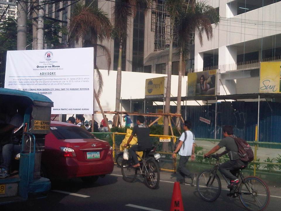
Those without terminals are both city and provincial buses. For city buses, this can be because they “turnaround” in Manila and operators do not feel the need to have a formal terminal. For example, G-Liner buses plying the Cainta-Quiapo route will stop at Quiapo only to unload Quiapo-bound passengers, and then switch signboards and proceed to load Cainta-bound passengers as they head back to Rizal. There is very little time spent as the bus makes the turnaround. It’s a different case for provincial buses, whose drivers should have the benefit of rest (same as their vehicles, which also need regularly maintenance checks) after driving long hours. Thus, if only for this reason they need to have formal, off-street terminals in the city. Following are photos I took near the Welcome Rotunda en route to a forum last Friday.
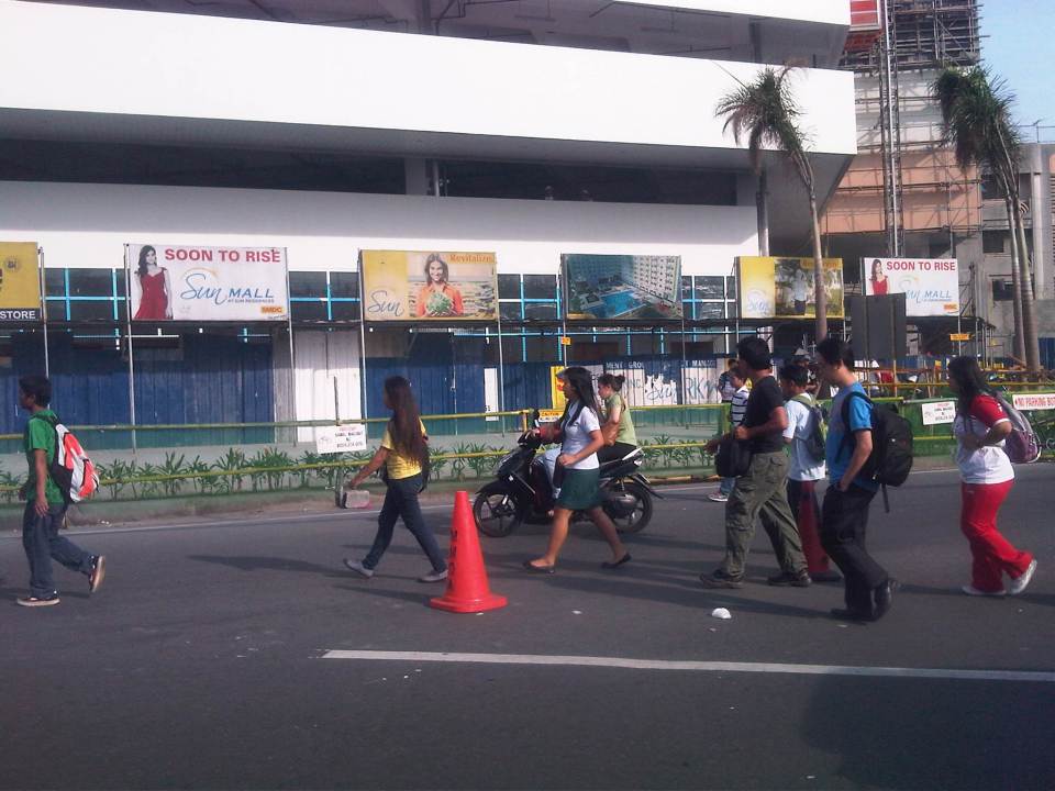 Commuters walking to cross the street at the Welcome Rotunda to transfer to jeepneys waiting for passengers to ferry to Manila.
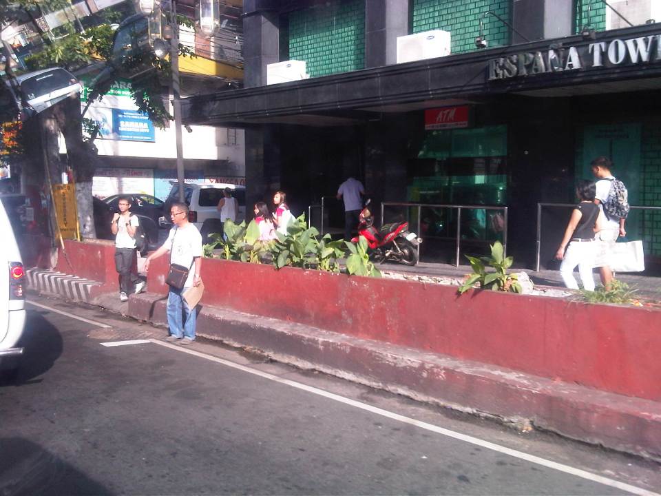
 Commuters and cyclists moving along the carriageway as there are no pedestrian or cycling facilities in front of a construction site at the corner of Espana and Mayon Ave.
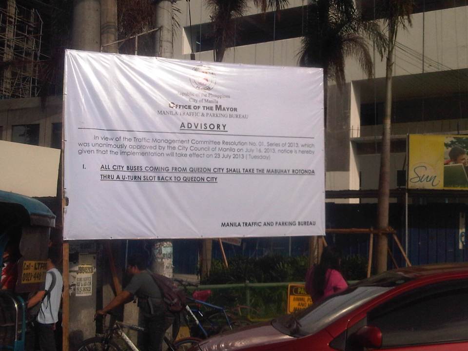 Advisory for buses coming from Quezon City
 Commuters waiting for a jeepney ride along Espana just after the Welcome Rotunda
 Some pedestrians opt to walk on instead of waiting for a ride. Manila used to be a walkable city but it is not one at present. Many streets have narrow sidewalks and many pedestrian facilities are obstructed by vendors and other obstacles.
So, is it really a move towards better transport systems and services in Manila or is it just a publicity stunt? If it is to send a message to public transport (not just bus) operators and drivers that they should clean up their acts and improve the services including practicing safe driving, then I’m all for it and I believe Manila should be supported and lauded for its efforts. Unfortunately, it is unclear if this is really the objective behind the resolution. Also, whether it is a resolution or an ordinance, it is a fact that the move violates the franchises granted to the buses. These franchises define their routes and specify the streets to be plied by buses. Many LGUs in the past have executed their traffic schemes and other measures intended to address traffic congestion, without engaging the LTFRB or at least ask for the agency’s guidance in re-routing public transport. Of course, the LTFRB is also partly to blame as they have not been pro-active in reviewing and optimizing PT routes.
One opinion made by a former government transport official is that this is just a ploy by the city to force bus companies to establish formal terminals in the city. This will require operators to secure permits, purchase or lease land and build terminals. And so that means revenues for the city and perhaps more traffic problems in the vicinity of the terminals just like what’s happening in Quezon City (Cubao) and Pasay City (Tramo).
Transport planning is a big part of the DOTC’s mandate and both the LTO (in charge of vehicle registration and driver’s licenses) and LTFRB (in charge of franchising of buses, jeepneys and taxis) look to the agency for guidelines and policy statements they are to implement. Meanwhile, LGUs have jurisdiction over paratransit like tricycles and pedicabs. In the case of Manila, these paratransit also include the “kuligligs,” 3-wheeler pedicabs that were fitted with engines and have been allowed (franchised?) by the city to provide transport services in many streets. Unfortunately, most LGUs do not have capacity nor capability for transport planning and so are limited or handicapped in the way they deal with transport (and traffic) issues in their jurisdictions. We have always maintained and promoted the stand that the DOTC should extend assistance and expertise to LGUs and the LGUs should also actively seek DOTC’s guidance in matters pertaining to transport. There needs to be constant communication between the national and local entities with cooperation leading to better, more suitable policies being formulated and implemented at the local level.
–
Transport in the State of the Nation Address 2013
The President of the Republic of the Philippines delivered the State of the Nation Address (SONA) last July 22, 2013. The SONA is for the mid-term as 3 years have passed since the current president was elected into office. The address was most awaited by a lot of groups. These include allies of the administration and those who have been critical of the administration. For the latter group, they would have been interested to see/hear what the SONA will report on for what seemed to them was a slow pace in the introduction and execution of reforms as well as the slow implementation of programs and projects including those regarding transport infrastructure. Of course, there is not a short supply of sycophants in Congress as in the past administrations, who would easily clap their hands at the slightest hint of accomplishment that is mentioned in the SONA. I pity their constituents who are responsible for voting them into office.
While the speech mentions a lot of gains in all fronts of the so-called war against corruption following the administration’s policy for “matuwid na daan” (straight path), the details or information most useful for people dealing with policy and technical assessments are found in the SONA Technical Report. This report is supposed to have been written based on the inputs provided by government agencies and is a more comprehensive, if not the most comprehensive, material documenting what has been accomplished so far. More importantly, it is supposed to contain material on what the administration looks forward to seeing through until the end of its term in 2016. There is the opinion that it would have been better if the report and the speech followed an outline similar to the Medium Term Philippine Development Plan (MTPDP 2011-2016) so that the reported accomplishments can be placed side by side with what the administration set out to do at the start of its term. Then, it would be possible to gauge clearly where we are and if indeed we are heading towards achieving our targets by 2016.
The transcript and video of the 2013 State of the Nation Address may be found in the Official Gazette of the Republic of the Philippines. That link is for the speech delivered in Filipino and a translation in English may be found through a link right after the end of the transcript. Similarly, there is a link SONA 2013 Technical Report found after the link to the translation.
Dream plan for the Greater Capital Region?
A report came out last Saturday on a major daily about a JICA study estimating losses of as much as 2.4 Billion pesos per day due to traffic jams experienced in Metro Manila. Not mentioned was the 1.0 Billion pesos per day estimated losses for the Bulacan, Rizal, Laguna and Cavite areas that are at present considered part of what has been loosely defined as Mega Manila or the Greater Capital Region (GCR). That’s 3.4 Billion pesos per day of lost productivity and potential income that if reduced, could generate resources that could be distributed to the rest of the country. The JICA estimate, as reported by NEDA, is the product of a study that is in its concluding phase that looked into transport for an area comprised of Metro Manila, Region 3 (Central Luzon) and Region 4A (Southern Tagalog or Calabarzon). The main objective of the study was to come up with a Transport Infrastructure Framework and Roadmap for the GCR that would guide planners and engineers, and most importantly decision-makers (i.e., our leaders) in identifying and prioritizing transport infra projects that would ultimately improve the way we travel in the GCR.
While I am not at liberty at present to divulge the details of this study as the entirety has not been made public yet, I can say that the study was comprehensive and the conclusion an urgent reminder to what needs to be done for transport in the GCR. The latter is necessary because we have failed to deliver on the transport infrastructure required by Metro Manila and its surrounding areas since the late 1970s adn early 1980s when some decisions were made that were detrimental to public transport development and, to my view, inhibited and limited us from implementing a much more efficient transport system than what we have now. In my own conversations with the person who led the study, I can understand his own frustrations as he was himself a witness to the deterioration of transport in this country. Much of this deterioration have been attributed to a lack of political will to make the hard decisions in relation to transport. These decisions include those pertaining to the rationalization of transport services like phasing out jeepneys and tricycles where they are no longer suitable and committing to the implementation of mass transit projects that have been delayed for decades now.
 Network of recommended rail rapid transit (RRT) lines for the Manila Metropolitan area in 1973 (UTSMMA, 1973)
Perhaps we are at a crossroads in terms of transport in this country. Perhaps our leaders should listen to the clamor of their constituents for better transport systems in our cities, for more efficient ways to move about. Perhaps, too, we could finally see what’s really at the end of the tunnel rather than the proverbial light that we have always seen, frustratingly, for the past few decades. Perhaps the current administration will prove itself the catalyst for transforming transport in this country towards what it has preached as a “straight path.” Will we have a champion or champions who would push for the realization of a dream plan for transport? Whoever should step forward would definitely get my vote in 2016!
–
The Streets of Intramuros: Muralla Street
Intramuros is known as the “old” Manila as the enclave was practically The City when the Philippines was under Spain. Streets are generally narrow as they were designed at a time when there were no motor vehicles like automobiles, jeepneys, buses or trucks. People walked or rode on horses. Luxury vehicles were carriages while goods were carried by carts or people. The following photos show the stretch of Muralla Street from the Victoria Street (Bayleaf Hotel) to Real Street (Lyceum University).
 Entrance to Muralla Street with the Bayleaf Hotel at left, which is run by Lyceum University
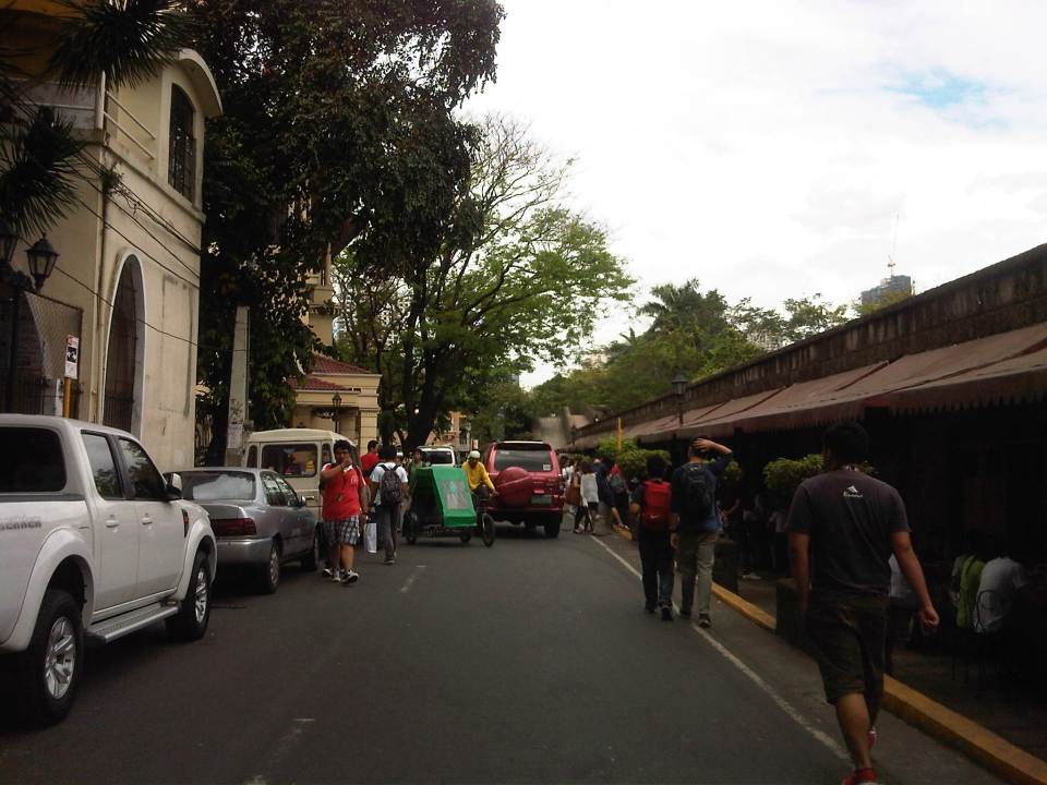
 Muralla Street runs along the eastern wall of Intramuros. It is a one way street and so the photo shows a pedicab (also called padyak or sikad), a non-motorized tricycle, running counter to the flow of traffic.
 These streets were made for walking – Intramuros has narrow streets and can barely accommodate two way traffic so many have been designated for one-way flow.
 There are schools along the left side of the road including the Mapua Institute of Technology, Lyceum University and Colegio de San Juan de Letran. As such, there are usually many students in the area walking around, having their meals at the nearby canteens/eateries (right side) or perhaps just sitting and admiring the view from the top of the wall.
 Parking is a major problem in Intramuros and one would see vehicles parked along one side of the street (evident in most of the photos in this post), obviously taking valuable space away from people and other motor vehicles (i.e., reduced road capacity).
 There are many eateries or small restaurants along Muralla St. and just under the wall. These are patronized mainly by students so meals are inexpensive.
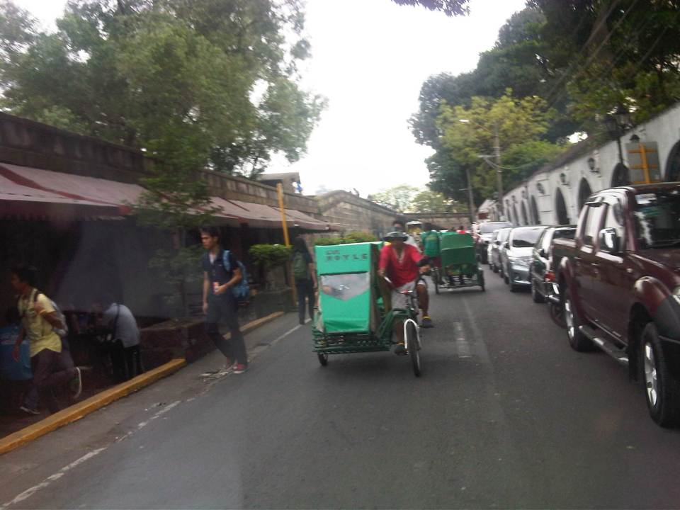 There are many pedicabs in the area with long queues at the gate waiting for passengers coming from the general direction of Padre Burgos Ave., where people can transfer to and from jeepneys serving the area. Frankly, I think there is an excessive number of pedicabs in Intramuros considering roads in the enclave can be transformed into walkable streets, just like they were during the Spanish and American periods. Notice again the on-street parking along one side of the road.
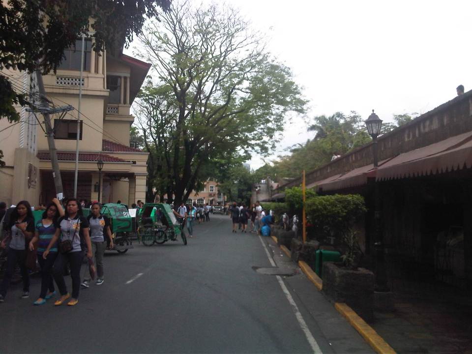 More students and more pedicabs along Muralla Street. People are used to traffic mix and generally stay clear of the space allocated for motor vehicles.
 Security personnel posted along the walls are appropriately dressed as Katipuneros or Rayadillos (honor guards). The building down the street is a dormitory just beside the buildings of Lyceum University, whose buildings are split up by public streets making it tricky to define a campus for the university.
 Junction of Muralla Street and Real Street with a private dormitory building at the center of the photo. Muralla Street continues along the side of the wall and proceeds all the way to Plaza Espana and the old Intendencia. Meanwhile, Real Street proceeds to the left of the dormitory. Also shown at the left is the entrance to one of the buildings comprising Lyceum University. Other buildings are behind the dorm.
–
Whatever happened to…?
Today, we step back and review a few items we have written about in this blog. I’ve chosen my top ten of what I thought were transport programs and projects that deserve to be checked. Here they are with notes on what went on from the year 2010 and the current state on these items. They are not arranged in any order so there is no item prioritized over the others.
Whatever happened to:
1. Wangwang – In 2010, the current administration through the Land Transportation Office (LTO) and the Philippine National Police (PNP) implemented a program practically eradicating our roads of illegal users of sirens (wangwang) that have become a major irritant (and perhaps pet peeve) to many road users. At present, there are many reports of politicians and other (feeling) VIPs employing PNP escorts to part traffic. In some cases, motorcycle police or bodyguards in escort vehicles rudely engage other motorists and there have been allegations of some pointing guns at other drivers to force them to give way.
2. LRT Line 2 extension to Masinag – In 2010, plans to extend LRT Line 2 from Santolan to Masinag were revived. The extension is supposed to be a no-brainer considering the design of the elevated line including the two stations comprising the extension could be based on the existing Line 2. The only major modifications here would be if the stations were to be connected to the shopping malls in their areas (Sta Lucia or Robinsons Metro East at Imelda Ave/P. Tuazon and SM at Masinag). Do we really need to have another study to tell us how many people will be riding Line 2 should it be extended to Masinag? The number of people waiting at Katipunan, Santolan and the Metro East/Sta. Lucia and the number of jeepneys cutting trips are strong indications of demand. In fact, I believe the line should be extended all the way to Cogeo but then the design there is more challenging as that extension would be up the mountains of Antipolo.
3. EDSA-MRT capacity expansion – The past 3 years have seen a steady increase in users of rail mass transit in Metro Manila and particularly as congestion along our roads continue to worsen. EDSA is always congested and the experience of last Monday’s monstrous congestion along the corridor reminded us of just how important a higher capacity MRT Line 3 would be to ease congestion along EDSA. The bidding for the rolling stock have been delayed and there might be a need to expand stations in the future to accommodate the longer trains required to serve the demand for this line. Needless to say, the only option now is to increase service frequencies but these have limitations.
4. Cebu Bus Rapid Transit (BRT) – Much work has been rendered for the Cebu BRT, which was touted as the less costly (compared to rail transit) solution to traffic woes in Philippine cities. After a presentation of the Cebu BRT in Malacanang, the President was supposed to have asked for a “proof of concept” for the transit system before giving his approval for the project to be implemented. This boggles our minds because it is not like the BRT is a conceptual system. In fact, there are BRTs that are currently operational in many countries including our neighbors in ASEAN. Among the most successful lines are found in Brazil (Curitiba) and Colombia (Bogota), and there is also the success story of the Lagos (Nigeria) BRT where the transit system has succeeded despite the odds it faced from the start.
5. NAIA Terminal 3 parking building – I have written about this before and it remains a pet peeve of mine considering I and the wife are frequent flyers who used Terminal 3 every month in 2011 and 2012. It’s difficult to get parking space at Terminal 3, especially slots for leaving one’s vehicle overnight or a few days (e.g., for business trips). The news is that the government is now working towards having T3 fully operational by 2014 and so there is hope that the multi-level parking facility will also be finally opened for use by the public.
6. Organized Bus Route (OBR) – Unlike the UVVRP or number coding, which has evolved little since its inception in the 1990s, the OBR has somewhat mutated but with little impact along the stretch of EDSA where it is supposed to contribute to significant improvements to traffic. The latest version is a dispatching system using computer tools. The jury is still out there regarding the success or failure of the system but the scheme still does not address the root cause of problems regarding bus operations along EDSA including the perceived over-supply of buses, colorum (illegal) buses, and overlapping routes.
7. Metro Manila BRT – The Pre-Feasibility Study for a Bus Rapid Transit (BRT) was completed back in 2006. The MMDA has attempted to come up with its version of the BRT but has failed to implement plans along EDSA and C5. In the last 2 years, however, there has been some activity with the World Bank pushing the DOTC to identify a corridor for a Metro Manila BRT line. Two corridors so far have been studied: Ortigas Avenue (Aurora Blvd to Tikling) and Quezon Ave./Espana (Philcoa to Lerma). The project so far has also been subject to the “proof of concept” challenge.
8. Clark Airport expansion – The number of flights at Clark is steadily increasing as more passengers have been using the airport for both domestic and international flights. Flights are served by budget airlines like Cebu Pacific and Air Asia, and allows passengers from Central and Northern Luzon a close airport for international travel. There is a need for a larger terminal for Clark and the master plan for the airport has called for a facility that would allow the airport to handle passengers of the magnitude currently being served by NAIA. Unfortunately, there is no pronouncement yet about whether NAIA, Clark or both will serve as the gateway(s) to the National Capital Region and surrounding regions.
9. Northrail – The rail line was supposed to provide a high speed connection between Metro Manila and Clark, connecting what is now Bonifacio Global City (Fort Bonifacio) and the Clark International Airport, which are developments that were under the Bases Conversion and Development Authority (BCDA). After so many years and several proponents, there are now plans for an airport express train connecting Metro Manila with Clark but it seems something that is still at the study stage and quite far from being implemented.
10. NAIA Terminal 1 renovations – In 2010, a group of architects and designers came up with a plan to renovate and upgrade NAIA’s Terminal 1. The government dropped this proposal in 2011 and had the project bidded out with the original designer of T1 emerging as the winner. Nothing happened after that and now the news is that the DOTC is engaging the designers to work with the winning firm to finally work on the much maligned T1. This is a project a lot of people would like to see implemented as T1 serves most of the international flights connecting to Manila. Currently, only PAL, Ceb Pac and ANA use T2 and T3. All other airlines use T1, which means most foreigners likely have a first impression of the country based on what they see in T1.
–
