
Home » Governance (Page 39)
Category Archives: Governance
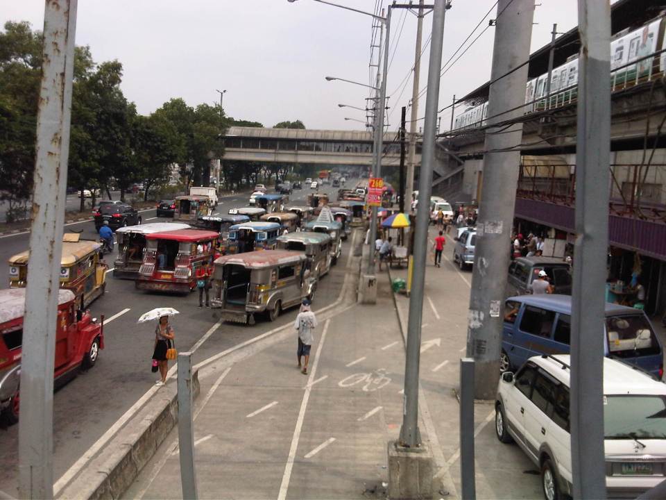
Manila’s truck ban experiment
The City of Manila has announced that it will implement a truck ban from February 10, Monday. Trucks of at least 8-wheels and 4,500kg gross weight will not be allowed to travel in Manila’s roads from 5AM to 9PM. Manila’s City Ordinance No. 8336 calls for the daytime truck ban in the city in order to reduce traffic congestion that is perceived to be brought about by trucks. 8-wheelers are likely 3-axle trucks with a 4-wheel, 2-axle prime mover pulling a 1-axle, 4-wheel (double-tired) trailer. I am not aware of the technical basis for the ordinance. Perhaps the city has engaged consultants to help them determine the pros and cons of this daytime truck ban. I hope it is not all qualitative analysis that was applied here as logistics is quite a complicated topic. And such schemes in favor of passenger transport (and against goods movement) actually creates a big problem for commerce due to the challenges of scheduling that they have to deal with. To cope with this ordinance, companies would have to utilize smaller vehicles to transport goods during the daytime. This actually might lead to more vehicles on the streets as companies try to compensate for the capacity of the large trucks that will be banned from traveling during the restricted period by fielding smaller trucks.
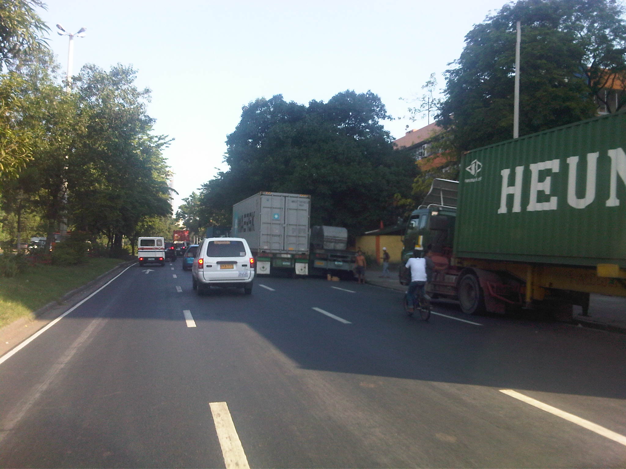 Trucks parked along Bonifacio Drive near the DPWH Central Office in Manila’s Port Area.
The latest word is that Manila has postponed implementation of the ordinance to February 24. This was apparently due to the reaction they got from various sectors, especially truckers and logistics companies who would be most affected by the restrictions. It was only natural for them to show their opposition to the scheme. Reactions from the general public, however, indicated that private car users and those taking public transport welcomed the truck ban as they generally stated that they thought trucks were to blame for traffic congestion in Manila. The truck ban will definitely have impacts beyond Manila’s boundaries as freight/goods transport schedules will be affected for the rest of Metro Manila and beyond. The Port of Manila, after all, is critical to logistics for the National Capital Region, and its influence extends to adjacent provinces where industries are located. Such issues on congestion and travel demand management measures focused on trucks bring back talks about easing freight flow to and from the Port of Manila to major ports in Subic and Batangas. There have been studies conducted to assess the decongestion of the Port of Manila as Batangas and Subic are already very accessible with high standard highways connecting to these ports including the SLEX and STAR tollways to Batangas and the NLEX and SCTEX to Subic. Perhaps it would be good to revisit the recommendations of these studies while also balancing the treatment of logistics with efforts necessary to improve public transport. After all, trucks are not all to blame for Manila’s and other cities’ traffic woes as buses are repeatedly being blamed for congestion along EDSA. In truth, there are more cars than the numbers of buses, trucks, jeepneys and UV Express combined. And the only way to reduce private car traffic is to come up with an efficient and safe public transport system. –
On high definition cameras to improve traffic enforcement and management
Watching the news one evening, I saw a report that featured traffic enforcers being caught on camera extorting money from drivers caught violating traffic rules and regulations. Extortion, “kotong” or “pangongotong” is not a new thing. It is actually a given to many motorist, particularly those who spend a lot of time on the road like drivers of public utility vehicles and trucks. In many cases, the enforcer or police officer is already or automatically assumed to be an extortionist even without the subtle suggestions via talk or body language. Motorists simply slip a bill with their license or in the form of a handshake to the apprehending officer. This, of course, translates into bribery, which is also a crime for both parties involved.
Traffic violations carry penalties in the form of fines that vary in amount depending on the violation. Usually, the amount is commensurate to the bribe or the “suggested” amount being extorted by the apprehending enforcer(s). In other cases, a larger amount is “suggested,” often to remind the erring motorist Of course, this assumes that the motorist is indeed guilty or in any case (guilty or not) didn’t want to waste time and opts for the perceived easy way out. However, there have also been cases when corrupt enforcers/officers meet their match in motorists who are aware of their rights and are knowledgable of traffic laws (e.g., lawyers, etc.) or are well-connected and simply show business cards of influential people (e.g., politicians, high government officials, police or military officers, etc.) to get out of a traffic bind. These instances actually reveal that many enforcers/officers are not so familiar with traffic rules and regulations so are unable to justify their apprehensions beyond their very basic knowledge.
The MMDA has made a lot of effort in trying to simplify the process of paying the penalties with the guilty party now being allowed to take the ticket and pay the fine through accredited banks within a certain grace period. Traffic enforcers can no longer take your driver’s license (Note: Only Land Transportation Office officers and deputized personnel may confiscate licenses.) and this eliminated the long lines of drivers at the MMDA offices to get back their confiscated licenses. This has also reduced the incidence of extortion as many private motorists can just opt to have tickets issued to by the apprehending officer. The latter is basically no longer allowed to collect money and contact time is also reduced. There is a grace period for the erring driver so he/she has to pay the fine within this period or else risk being flagged by the LTO itself.
The new camera system that the MMDA has in place is part of Phase 1 of its traffic signalization project. With this project, the MMDA hopes to upgrade the network of traffic signals in Metro Manila and have in place a dynamic, adaptive system to better address traffic circulation in the metropolis. This is actually a departure from a past program that was premised on the continuous traffic flow that was supposedly derived from U-turns masquerading as rotundas or roundabouts. Though the sensors and software for the traffic signal system are not yet in place, the MMDA already has a new traffic control center just across its building at the corner of EDSA and Orense Street in Makati City, from where they can now monitor traffic conditions using high definition cameras installed across the metro.
Davao has been in the forefront of using such high definition cameras for traffic management as well as for monitoring the behavior of traffic enforcers and motorists. Their traffic management center has been operational for the past few years and I’ve had the chance to have a look at how the city is able to monitor traffic conditions in that city. With this tool, they are able to address issues by deploying personnel on sight or by changing the setting of traffic signals. In certain cases, they can watch out for incidents like road crashes or monitor apprehensions to make sure both apprehending personnel and erring motorists are honest and no anomalies are encountered.
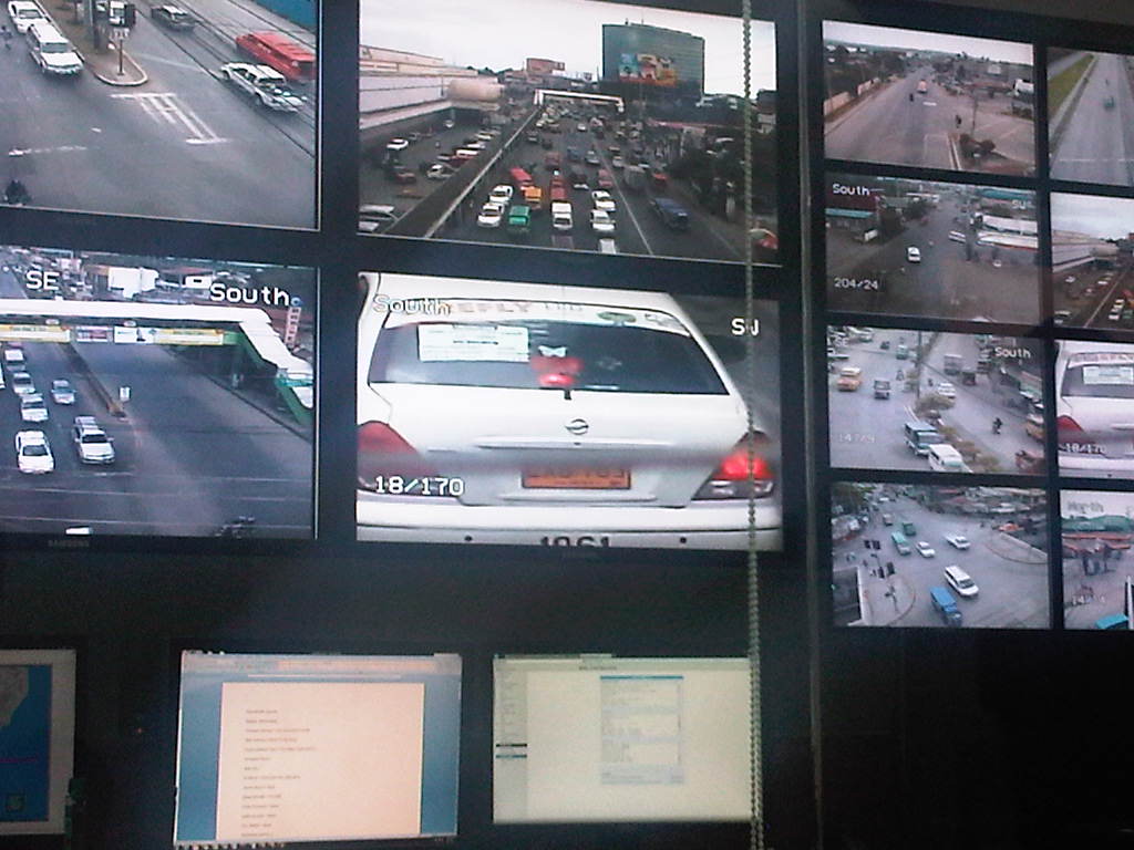 Davao’s cameras have been used to monitor not just erring motorists and pedestrians but also erring traffic enforcers and policemen who might be preying on road users. The city has also been able to use their system to record and evaluate incidences of road crashes.
Perhaps in the near future, many other cities would be able to acquire and apply such tools in traffic management. I think the larger and highly urbanized cities in the country already require sophisticated systems for traffic. Unfortunately, there is always the issue of having limited resources, which usually discourages a city from investing in expensive systems, often opting for basic signals for their intersections. Such basic systems, however, can be optimized if city personnel in-charge of these have the knowledge or capability for setting signals to be synchronized with each other. These are fundamentals necessary for whoever will be dealing with traffic engineering and management in these cities. Also, there are now ongoing researches at universities with some now sponsored by the Department of Science and Technology (DOST) through its Philippine Council for Industry, Energy and Emerging technology Research and Development (PCIEERD) seeking to produce traffic systems at lower costs. These should eventually be deployed in our cities to help alleviate traffic problems.
–
Off-street parking along Tomas Morato
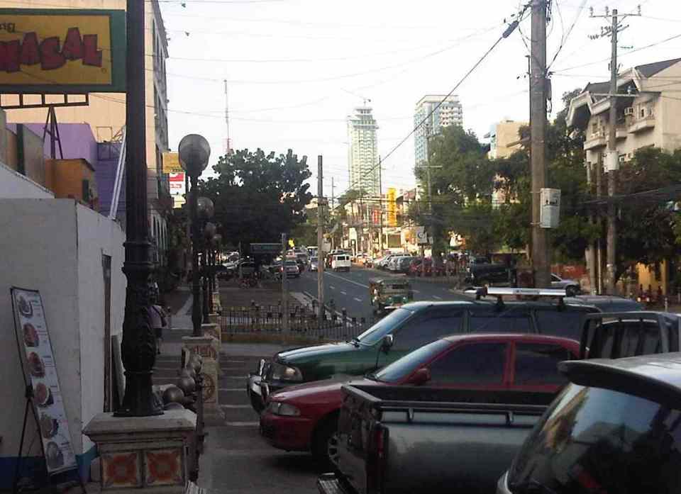
Not too long ago, the Quezon City government constructed off-street parking slots throughout the city. These included spaces along major roads such as Visayas Avenue, Mindanao Avenue, Quezon Avenue, West Avenue and Timog Avenue. Tomas Morato as well as the streets connecting to it were also included in the project, which benefited many people, whether they be car-users or taking public transport. I took a couple of photos last week as the wife picked up some food at a panciteria along Morato. It was early an early afternoon so traffic was free-flowing and many parking spaces are available along the avenue. Morato is well known for having many restaurants and cafes lined up along either side of the street and during their off-periods, Morato would usually be an easy drive.
 The off-street parking spaces along Tomas Morato are free and are not allocated for any specific establishment. In practice though, the spaces in front of certain restaurants, shops, banks, etc. are “reserved” by their staff for their customers/clients.
 Many newer establishments along Tomas Morato have no provisions for off-street parking for their clients. This means the burden for parking continues in being passed on to the local government and, likely, at the expense of taxpayers.
I still believe that establishments that are required under law to provide at least the minimum number of parking spaces as per national building code should be made to compensate for the city’s construction of parking spaces to solve on-street parking issues along streets like Morato. I understand that they pay local taxes but that is an entirely different requirement that is not related to their being required to provide parking spaces for their customers/clients. It’s really a matter of doing the right thing for both city and these establishments but such cases are often muddled and are not tackled as the general public is usually not interested in these somewhat unpopular topic of parking.
–
Clear message to transport service providers
The cancellation of the franchise of the Don Mariano Bus Transit last January 14, 2014 is a long overdue decision. I say this because there have been so many incidents of road crashes in the past involving public transportation that led to the deaths and serious injuries of a lot of people whether they are passengers, the drivers themselves, pedestrians or even innocent people who happen to be at the wrong place and the wrong time (i.e., when and where the crash occurred). The cancellation of the franchise sends a strong message to erring operators and drivers of public utility vehicles including those of buses, jeepneys, UV express and taxis that the Land Transportation Franchising and Regulatory Board (LTFRB) is dead serious about enforcing franchise rules and regulations particularly in the light of road and public safety concerns. The decision is also a strong statement by the agency. One that says they have the balls to make game-changing decisions that is assumed to be intended for operators and drivers to take heed.
I had the opportunity to attend a few congressional hearings at the Batasan a few years ago that were convened by the Committee on Metro Manila Development. The main topics of those hearings were on public transportation. I recall that one hearing focused on the proposal to increase the penalties for traffic violations while others focused on policies being introduced by the MMDA (e.g., dispatching scheme, painting the bodies of buses with their plate numbers, RFID, etc.). In these hearings, the MMDA had been asked by the congressmen to present statistics on road traffic violations by public transport vehicles and they did present the numbers indicating also which bus companies were involved in the most crashes and which incurred the most violations. One question asked by a congressman was why, despite all the incidents and violations that bus companies were involved in, have no franchises been cancelled or revoked. The MMDA quickly and correctly replied that it is the LTFRB that has authority over the franchises. I do not recall how the LTFRB managed to answer the follow-up question trained on them but I don’t think anything close to a solution came out of those hearings. The transcript of these meetings and the data reported by the MMDA should be with the committee and, I presume, should be for public consumption given that these hearings were made in the interest of the general public.
Public transport as a form of “livelihood” should not be made an excuse for the poor quality of public transport services. A driver cannot drive like crazy, crash into other road users and claim that they were only trying to earn a living. Operators cannot scrimp on maintenance and spare parts costs (resulting in poorly maintained vehicles that are prone to mechanical failure and obviously violate emission regulations) just because they want to earn a larger profit. It is a card that is always put on play by public transport operators, drivers, conductors and their lawyers when interviewed, especially by TV reporters. One take on the news reports on TV is that those interviewed were nagpapaawa lang (acting for people to pity them or sympathize with them. Yet afterwards, once the suspension is lifted, these same drivers go back and drive as if nothing happened and still oblivious to the dangers they pose on others travelers. I have written about this in the past and share the opinion that we will get nowhere near the efficient and safe transport services we aspire to have unless we do away with the current practices of reckless driving and smoke-belching PUVs. And the improvement begins when the LTFRB starts canceling franchises of erring operators of public utility vehicles and the Land Transportation Office (LTO) starts revoking the licenses of irresponsible drivers.
Now, if we can only have the LTFRB cancel the franchises of erring jeepney, taxi and UV express operators, then that will send even clearer messages to all that government is really serious about road safety and public transport regulations. Included also are initiatives on truck operators and drivers who are also guilty of irresponsible driving. Perhaps the LTO should follow suit and be more aggressive in their part to rid our roads of erring private vehicle drivers and motorcycle riders? I think such actions are definitely what’s needed under the banner of “Matuwid na Daan” (literally “straight path” but also translates to “right or correct path”). In order to achieve “Matuwid na Daan,” we should also have “matuwid na pagmamaneho” (“responsible driving”).
–
To commute or not to commute
To commute or not to commute? That seems to be the question many people would like our political leaders and government officials to ponder the answer to. Of course, the word “commute” itself refers to traveling whether by public or private transport. However, in the Philippines we have equated “commuting” with taking public transportation. Anyhow, the reality is that most of our top officials, elected or appointed are car owners and are most likely to drive or be driven between their homes, offices and appointments. This is what is perceived by many people as “The Reason” why public officials have little or no appreciation of the difficulties experienced by the commuting public.
While sympathy is usually assumed or claimed by responsible persons, it is empathy that is most desirable from our public officials as they should feel how most people feel when they commute every working day. But how can you empathize if you have not experienced the difficulties of commuting in Metro Manila or other city? How can you say you understand the plight of pedestrians, cyclists and those taking public transport if you prefer or opt to drive or be driven in your car or SUV to and from your office? Did you really commute when you were in high school or college? Or maybe you were one of those cool guys or gals driving their own cars?
Almost every week, I have left my car at the office to commute or hitch a ride with my wife where our routes overlap. I have used public transportation since I was in high school so I am quite familiar with taking pedicabs, tricycles, jeepneys, buses and trains. I have also commuted whenever I am on trips to other cities including those abroad. Public transport is part of the experience whenever I am on trips and when I am in a new place, I make it a point to take long walks first to explore the surrounding area. It is a familiarization of sorts and makes me comfortable with the area. I remember that when I was a student in Japan, I would try to look for the nearest church to where I was staying, especially if I was there over the weekend.
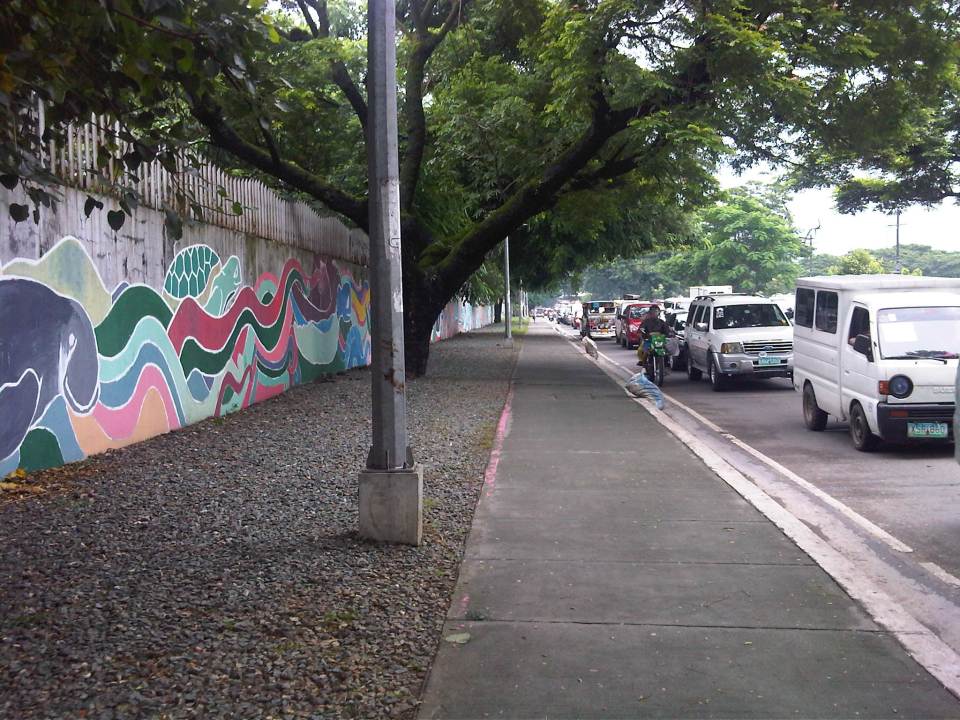 Walking is part of commuting and I am thankful that where I work, the surroundings are basically pedestrian-friendly. The photo above shows the sidewalk along Katipunan Avenue on the side of the university.
 Seamless transfers are not yet quite the norm in the Philippines. The photo shows one of the better examples where transfers between modes are more convenient. This is at the LRT 2 Santolan Station. Note the markings for the bicycle path. I took this as I was descending from the pedestrian overpass that connected with a nearby mall by the Marikina River.
While traveling within other cities, whether in the Philippines or abroad, the first option for many if not most people would be to take public transportation. Taking out a rental vehicle is not common and taxis are considered as part of the public transport system. As such, we try to get information on how to get to places of interest from relatives, friends, hosts or staff of the hotel we are staying at. These include maps like the old fashioned ones we can get at airports, train stations and tourist booths. Nowadays, there’s a wealth of information available online and apps that can help us navigate around cities.
We tend to comment on how good the public transportation is in the places we’ve visited or how easy it was to commute in these cities. And upon returning to our country we are quick to criticize our public transport, pedestrian and cycling facilities. The irony, of course, is that many of those who are quick to criticize don’t even use public transport, walk or cycle. Even more tragic (for lack of a better word, I think) is that we don’t demand for better public transport, pedestrian or cycling facilities. Perhaps that should change and in this New Year, we should resolve to push the government and its partners for better transit, pedestrian and cycling infrastructure for our cities. And part of that push is by getting involved in advocacies, including projects, for these causes on transport. We should not forget that though we need and seek champions for public transport, walking and cycling among our leaders, we should also be champions in our own ways.
–
Manila’s jeepney experiment
A few months ago, and almost right after the local elections, the City of Manila embarked on a campaign to reduce the number of colorum or illegal buses plying along the streets of the city. The result was confusion and mayhem as commuters and authorities were unprepared to deal with the sudden decrease in the number of buses (some companies even restrained all of their buses from entering Manila to protest the city’ move) and the jeepneys and UV express couldn’t handle the demand. Much of that seems to have been resolved and buses are now back in Manila; although whether all these buses are legal ones is still unclear. The city, it seems to some quarters, was only after buses with no formal terminals in the city and appeared to have made the drive to show bus companies who’s in-charge there.
Now comes a drive against jeepney drivers, particularly those undisciplined ones that are often found violating traffic rules and regulations, and endangering their passengers with their brand of driving. The result was a one-day strike (tigil pasada) of jeepneys belonging to the Federation of Jeepney Operators and Drivers Associations in the Philippines (FEJODAP), one of several organized jeepney groups in the country. Others like operators and drivers from Pasang Masda, PISTON and ACTO, opted not to join the transport strike. The result was a transport protest that had little impact on most people’s commutes though the group did manage to attract media attention and gave interviews to whoever cared to listen.
Not to judge Manila as I believe it has made huge strides by confronting the many urgent issues in transport in the city. Not many cities take these problems head on as Manila has done this year. However, the jury is still out there if their efforts have been effective and if these will be sustainable and not the ningas cogon kind that we have seen so much of in the past. For definitely, there are a lot of other transport issues that Manila needs to contend with including how to make the city more walkable and bicycle-friendly (not an easy task!) and how to address the excessive number of pedicabs (non-motorized 3-wheelers) and kuligligs (motorized 3-wheelers using generator sets or pumpboat motors for power) in the city. Hopefully, again, the city will be up to the task of addressing these problems along with the persistent congestion along its roads.
–
On data requirements and requests from the NCTS
The National Center for Transportation Studies of the University of the Philippines Diliman regularly gets a lot of requests for transport and traffic data. Most of these requests are quite specific for traffic counts along various roads. In many cases these are national roads but there are also requests for data on local roads. While the center has a library and laboratories where data and other information are available, most of those we can provide for public consumption may be quite dated and would need to be validated or updated. In certain cases, data were derived from our projects with private entities and we are not at liberty to share these without the permission of our clients. Many of these information are covered by non-disclosure agreements since these may be sensitive information or may lead to revealing projects that are still in the pipeline and which clients might prefer to keep to themselves at the time for one reason or another.
The best we could do for data requests would be to refer them to the sources or those who are supposed to collect data first-hand. For traffic counts along national roads, for example, the Department of Public Works and Highways (DPWH) publishes data on Annual Average Daily Traffic (AADT) for sections of national roads throughout the country. Most if not all these counts are made through manual surveys. That is, a team of surveyors literally count the number of vehicles according to categories set by the DPWH as they pass along specific road sections. Complacency, however, coupled with varying degree of quality control or supervision for manual counts can lead to erroneous data. Also, in several cases, one colleague allegedly was able to spot some trending that led him to conclude that some counts are actually projections from previous years rather than those derived from actual counts that should have been performed! It is highly recommended for researchers to make representations to the DPWH District Engineering Office where their study area or site is located or perhaps contact the many bureaus under the department (e.g., Bureau of Construction, Bureau of Design, Bureau of Maintenance, etc.) for other types of information.
Another source for transport data is the Land Transportation Office (LTO), which has information on vehicle registration and licensing. Unfortunately, not all of these data are published or readily available to researchers. Also, specific data requests (e.g., vehicle engine age, fuels, demographics of licenses drivers, etc.) are not easily accessible and may require time to process. In the past, we have also had first hand experience of the private IT company under contract with the LTO suggesting a fee for data processing. For public transport, the primary source would be the Land Transportation Franchising and Regulatory Board (LTFRB), which would have information on road transport routes, franchises, number of units of buses, jeepneys or taxis, etc. These agencies are under the Department of Transportation and Communications (DOTC), which also has several other agencies under it.
While most local transport and traffic data (e.g., number of tricycles and pedicabs, traffic along local roads, etc.) are with local governments, LGUs generally do not have up-to-date transport and traffic data. Only a few conduct regular data collection or will have recent data that would be useful for any meaningful analysis. Even big cities that have been recipients of transport studies have not been able to update basic data like traffic counts and travel speed along major roads. Perhaps the only updated information they would have are AADT for national roads (care of the DPWH District Engineering Office) and data on the number of public transport vehicles like buses, jeepneys and tricycles within their jurisdictions. AADT data from the DPWH are limited to few stations along national roads and there are none for intersections where counts per movement are important for analysis. Meanwhile, public transport operational characteristics are not generally measured so only the number of registered vehicles are known, basically from the LTO, LTFRB and the local tricycle franchising office. And so for very specific data on specific roads, for example, it is recommended that primary data collection (i.e., field surveys) be conducted.
Contrary to popular belief, the Center no longer has copies of reports of the more recent major studies or projects on transportation and traffic. The DPWH and the DOTC no longer furnish the NCTS library with copies of such reports and this limits the recent materials in our library that can be used by researchers for whatever purpose they may have. And so, the center will usually refer researchers to these and other agencies for data or reports that they need for the work they are doing. If the Center knows specific people from the agencies who are involved in the study or project or have worked on the data that’s subject of the inquiry/request then the researcher will be referred to those people.
–
#ReliefPH: Access and needs in many other places
The buzz on the streets and on social media is the focus on Tacloban, Leyte when vast areas and many other towns and provinces have been ravaged by super typhoon Yolanda (Haiyan). This seems unfair to other cities and municipalities considering Yolanda made 6 landfalls at or near peak strength (as a Category 5 typhoon) with winds topping 225 kph and generating destructive storm surges as it hammered through the central Philippines.
If you have Facebook, one provincial government staff has posted a lot of photos describing the situation in the northern towns of Iloilo where the destruction caused by the typhoon is very clear and to many, still unimaginable. These photos along with all others that can be Googled, Yahooed or found via other search engines or news agencies show the extent of the damage brought about by Yolanda.
Some people say that the islands of Cebu, Panay, Negros and Mindoro are fortunate as principal cities in those islands like Cebu City, Iloilo City, Bacolod City, Dumaguete City and Calapan City were relatively undamaged. This is also true, and so the airports and ports in these cities provide direct access to the islands for relief work. Moreover, government agencies and private entities have been able to organize relief activities through these cities and based on various news reports, it looks like a lot of people are already involved in these activities. That goes without saying that more people are still needed to be involved in various capacities for relief, rehabilitation and reconstruction work that are expected to be undertaken over a longer term considering the extent of the damages to towns. But given the circumstances for the said islands, there is no excuse for more rapid aid not being able to reach the affected towns in these provinces. In fact, much more is expected where accessibility is no longer an issue and so faster recovery is possible for Panay, Negros, Cebu and Mindoro. In the cases of Cebu and Bohol, it is important to remember that the provinces already are also still reeling from the impacts of the Magnitude 7.2 earthquake that occurred only a few weeks ago.
On another note…Tacloban Airport is still closed to commercial aircraft but the land routes via RORO or the nautical highways are open to traffic or operational. I think the quickest way to Leyte is via the route from Cebu. There are regular RORO and Supercat services between Cebu City and Ormoc City in Leyte. There are other maritime transport services from Bogo City in northern Cebu but I am not sure those services are back to normal. Then there are also access via the Eastern Nautical Route via the Bicol Region and crossing over to Samar Island (Allen) via Matnog, Sorsogon. Many roads still need to be cleared but the main highway (Pan Philippine Highway) including the San Juanico Bridge that connects the islands of Samar and Leyte.
–
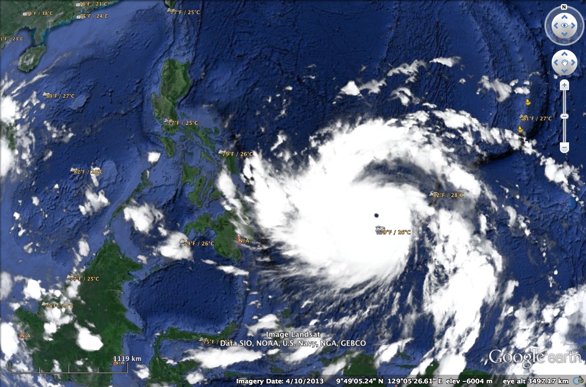
Super typhoon Yolanda (Haiyan)
Lives will be at a standstill for many parts of the Philippines when super typhoon Yolanda (International name: Haiyan) finally makes its presence felt as it takes a path through the central Philippines from tonight until Saturday. The typhoon is already a Category 5 and packing winds above 250 kph. It will be a destructive system as it plows through areas already saturated by rains from a storm that preceded it just a few days ago. The image below is from Google Earth, showing the approaching typhoon as of early morning of November 7 (Philippine time).
Transport will surely be affected by this powerful typhoon with airlines already expected to cancel or postpone flights. Sea craft were also already advised against travel given the waves and storm surges expected from the typhoon. Landslides are also expected in mountainous areas where roads will probably be blocked by debris. Trees, poles and others are also expected to be strewn across many roads, limiting access to communities. As such, our disaster councils are on high alert to respond to the challenges that will be brought about by the typhoon’s onslaught.
People in the provinces of Bohol and Cebu that bore the brunt of the recent magnitude 7.2 earthquake are still reeling from the damages from the quake. Many are still living in tents after their homes were destroyed or damaged by the quake and its aftershocks. We can only assume and trust that our national agencies, disaster councils and local governments are prepared to provide immediate relief to those who will be affected by the typhoon including those who continue to defy advisories issued by authorities in order to minimize casualties from such events.
–
Tricycles in the Philippines – Part 2
In a previous post on tricycles, I featured some photos taken from various trips I’ve taken around the country. Closer to home are tricycles that provide some convenience to commuters along a stretch of C-5 that is more commonly known as Katipunan Avenue. The example below is of a typical tricycle traveling along a section that cuts through lands of the University of the Philippines Diliman.
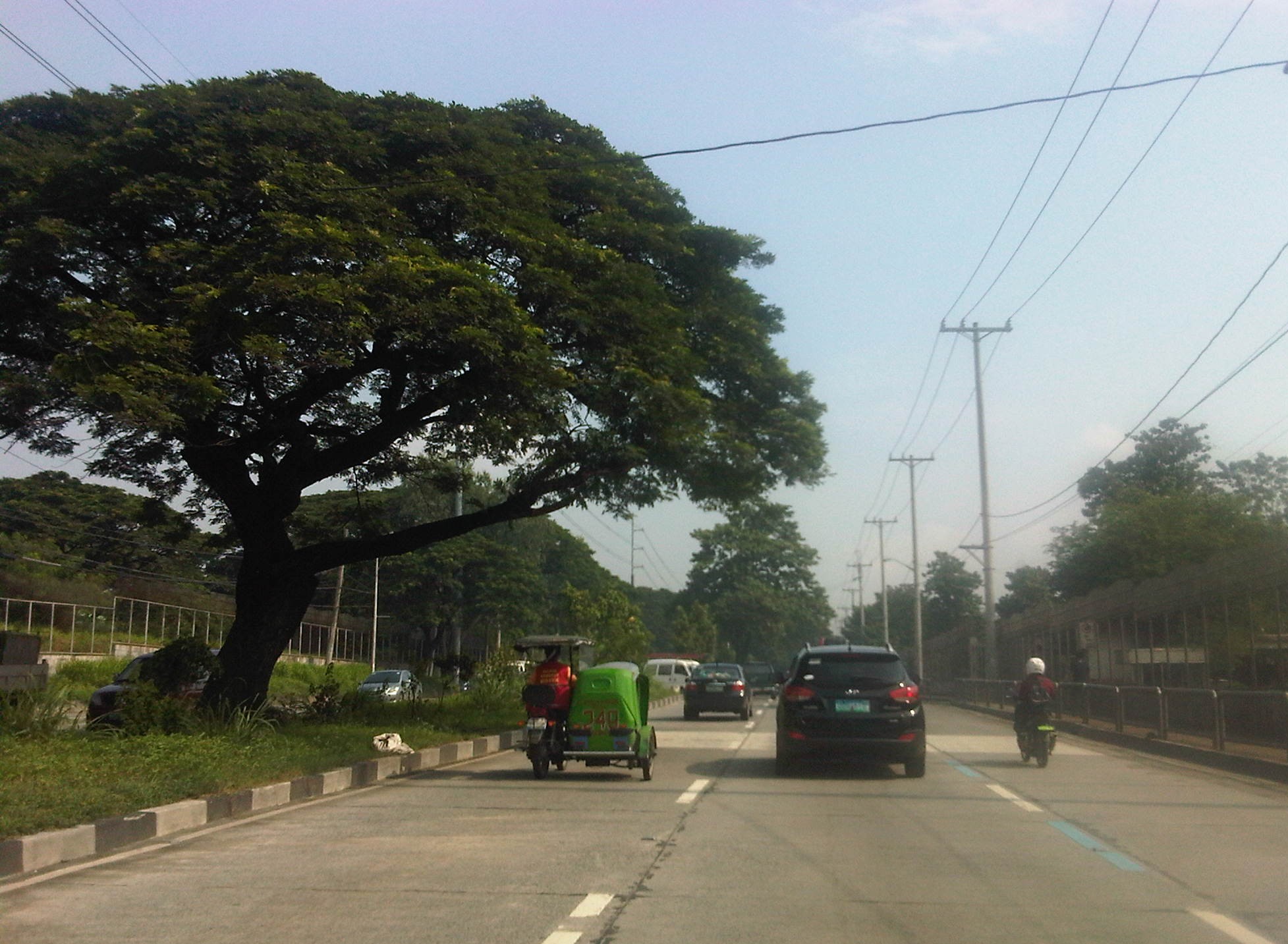 Tricycle along Katipunan Avenue
Tricycles do not necessarily just roam around to get passengers like what we usually see. They do have formal terminals though the informal ones outnumber these and typically cause problems due to the spaces they tend to occupy. These spaces include road space, the consequence of which is a reduction in road capacity, and sidewalks, which deny pedestrians space for walking. The first causes or exacerbates congestion while the second mainly puts people at higher risk as pedestrian safety is compromised. Following are photos of tricycle terminals taken from recent trips north of Manila in the provinces of Tarlac, Pangasinan and La Union.
 Tricycle terminal at the Moncada Public Market
 Tricycles still dominate traffic along the Manila North Road in Urdaneta, Pangasinan where they have terminals around the public market and at the intersections of side streets.
 Roadside tricycle terminal in La Union where the newly paved shoulders are occupied by tricycles waiting for passengers from a nearby public school.
 Tricycle terminal in front of the Civic Center in Agoo, La Union and just across the church.
More on tricycles and their terminals in succeeding posts!
–
