
Home » Highway Engineering (Page 11)
Category Archives: Highway Engineering
Roadway subject to flooding
The outbound approach to the bridge along Marcos Highway was quite congested this morning due to the closure of the underpass leading to C5 located just in front of SM City Marikina. The section was closed to traffic due to flooding caused by Typhoon Pedring (International name: Nesat). Pedring’s rains caused the Marikina River to swell up and inundate significant areas along its banks including what looked like the lower level parking area of the mall. Traffic bound for C5 from Marikina, Pasig and the towns of Rizal had to be diverted to the Riverbanks road via the service road after the bridge. The result was traffic congestion as 6 lanes of traffic tried to squeeze into what was effectively 4 lanes of bridge including the bypass structure fronting SM that eventually merges into 3 lanes of road on the other end.
Following are a few photos I took while en route to the office this morning:
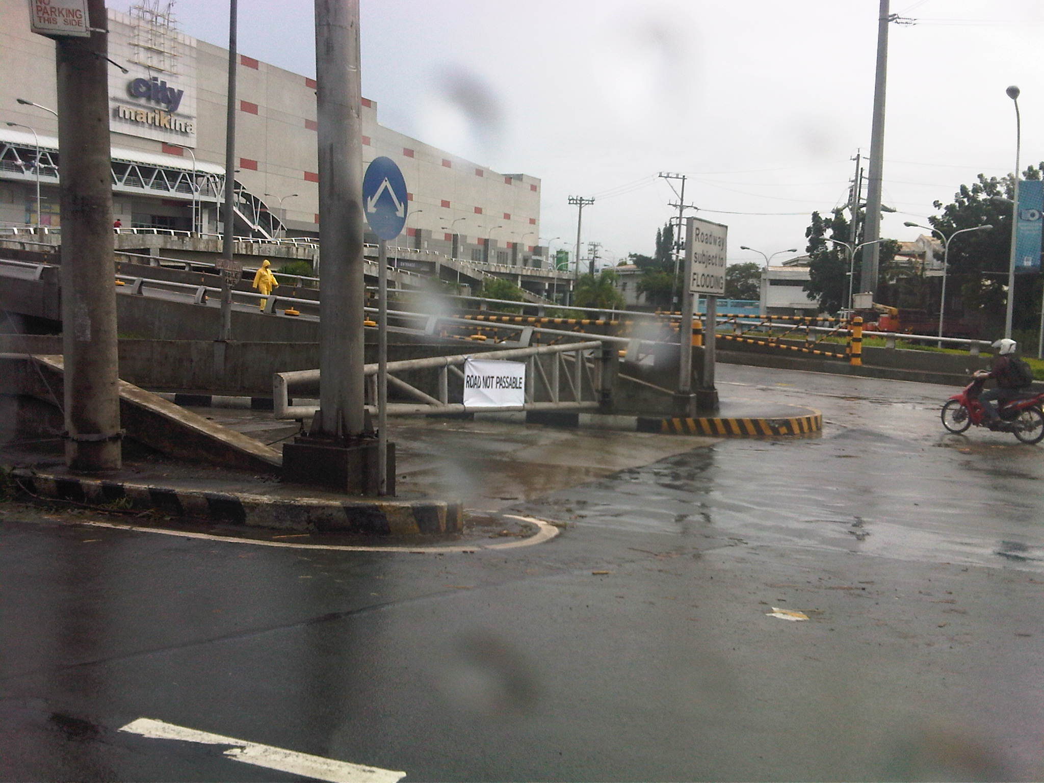
A gate bars access to the underpass connecting to a bridge leading to C5. The sign on the right states: “Roadway subject to FLOODING,” and is a permanent sign placed there to condition the mind of travelers about what may happen should there be inclement weather. This is supposed to be an example of a design where there’s no choice but to sacrifice according to the character of the area. Still, the question on many people’s minds probably is why were other designs that won’t be subject to flooding considered in the first place? Such would surely be worth it considering the frequency our climate and the probability of flooding?

Mud and muddy water on the underpass as seen from the bridge. Such is a scene reminiscent of the aftermath of Ondoy (International name: Ketsana) in 2009, exactly 2 years ago to the day.
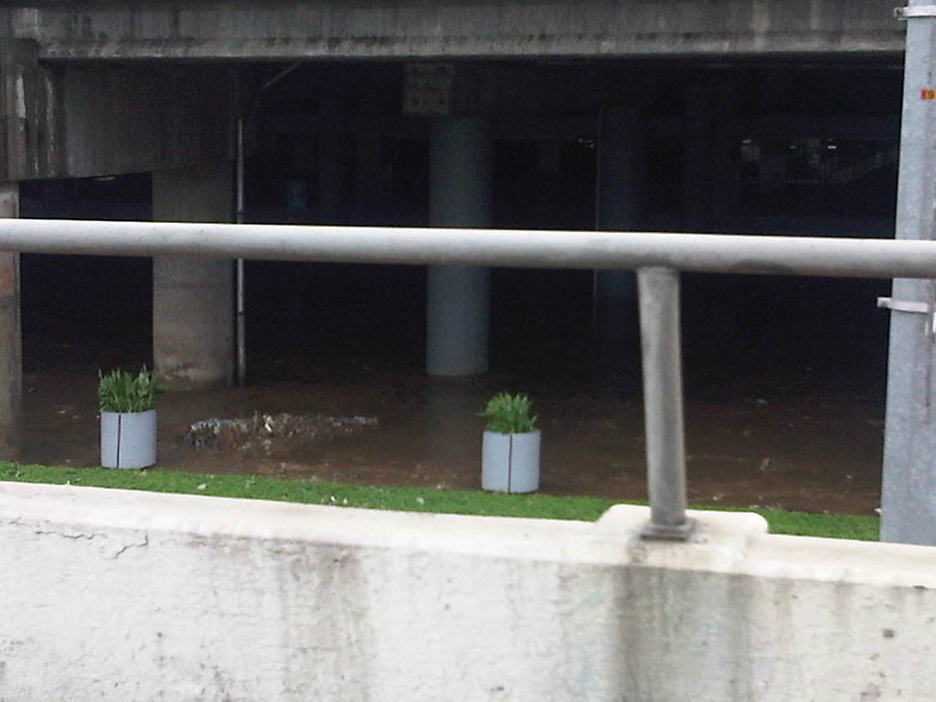 A peek into SM Marikina’s lower level environs show thick mud that settled on the service road and the mall’s lower parking area. The mall’s design already factored the anticipation of floods brought about by the swelling of the river during powerful typhoons such as Pedring and Ondoy. The mall was, after all, constructed on the flood plain, which is an unusual and uncommon location for such developments.
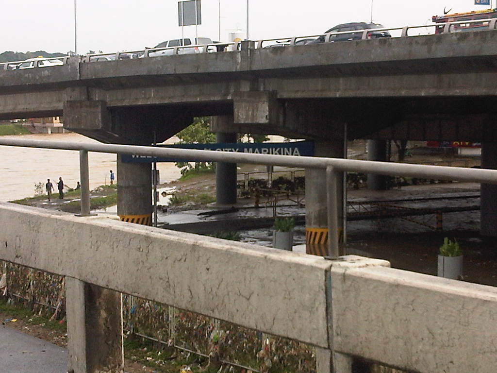
Garbage comprising mainly of plastic trapped on the SM screen fence. These were part of the flotsam and jetsam from the Marikina River. Such debris are evidence of the state of waste disposal and mismanagement in areas along the Marikina River. It is clear that people still have not learned from past experiences and government is partly to blame for this, particularly at the local level.
Road and drainage improvements along Marcos Highway – Part 2
Previous posts on Marcos Highway road works and the resulting congestion did not include photos and discussions on a significant section of the highway. This is the stretch that runs from P. Tuazon/Imelda Ave. to Masinag Junction, where Marcos Highway intersects with Sumulong Highway. Some friends have pointed out the bottlenecks that include Masinag Junction itself and the uncompleted work in the vicinity of the newly opened SM City Masinag. Following are a few photos I took on a Saturday morning while traveling along that stretch of road and a few observations pertaining to some causes of congestion.
 Unfinished drainage and roadworks along eastbound direction of Marcos Highway approaching Golden Meadows gate – note that materials occupy practically 2 lanes of the highway.
 Construction along Marcos Highway eastbound in front of AMA Computer College just after Filinvest East Gate – only 3 lanes available to traffic, sometimes 2 due to heavy equipment maneuvers.
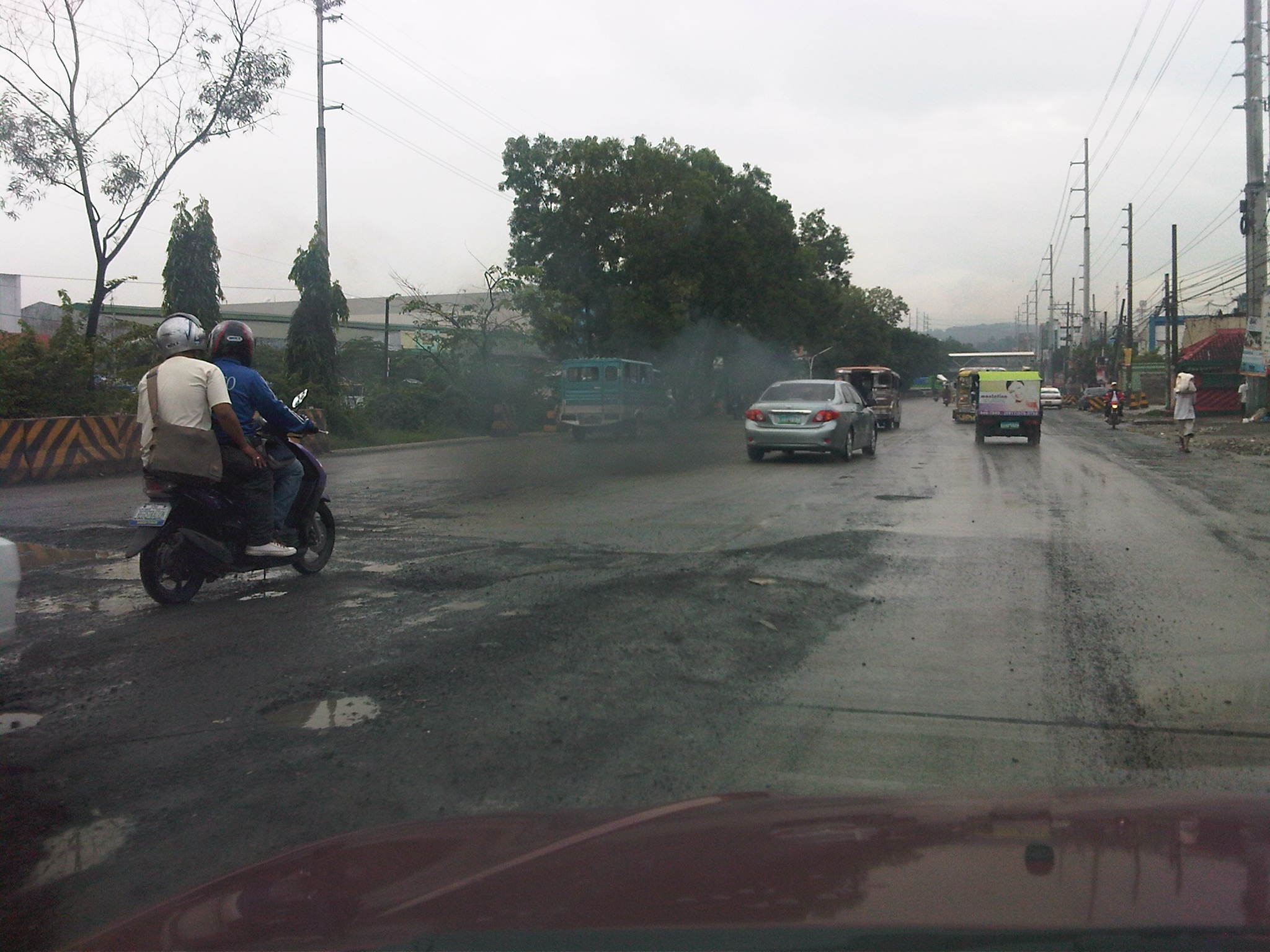 Unfinished road works near Kingsville Gate along Marcos Highway eastbound – bad road conditions lead to congestion as vehicles are forced to slow down due to the potholes and uneven pavement surface.
 Completed PCC pavement sections along Marcos Highway eastbound approaching SM City Masinag area – note that standard signs and pavement markings are still lacking along completed sections. Perhaps there is also a plan to have asphalt overlay as a protective or weathering layer for the concrete slabs?
 Completed section and newly constructed pedestrian overpass across SM Masinag – despite the overpass, many people still brave crossing the wide highway and risk getting run over by speeding vehicles.
 Jaywalking and risky crossing at Masinag Junction – I think traffic enforcers usually fail in managing pedestrians and cyclists crossing at the intersection resulting in the decrease in the throughput of the intersection. In any case, poor control may just lead to a road crash involving pedestrians and/or cyclists.
 More pedestrians crossing at Masinag junction – in this case, the only conflict is with vehicles turning right from Sumulong Highway.
 Another look at the new pedestrian overpass across SM Masinag along Marcos Highway westbound – this was a necessary facility for the safety of people (likely shoppers) crossing the 8-lane highway. The overpass would probably have to be modified later should LRT Line 2 be extended towards Antipolo City.
 Concrete barriers delineating lanes intended for vehicles making a U-turn along Marcos Highway just after SM Masinag – the barriers are also meant to reduce weaving caused by vehicles generated by the mall and intending to make the U-turn. These barriers, however, are also hazards as vehicles accelerating after Masinag will suddenly encounter these without adequate warnings. At present the lane is blocked right after the median opening due to uncompleted roadworks. Thus, erroneously entering the leftmost lanes will require a U-turn. Such barriers would have to be removed so traffic can still opt to pass through the section.
 Unfinished section along Marcos Highway westbound – the number of lanes are reduced from 5 to 2, drastically reducing capacity and causing serious queuing due to the shockwave resulting from the bottleneck.
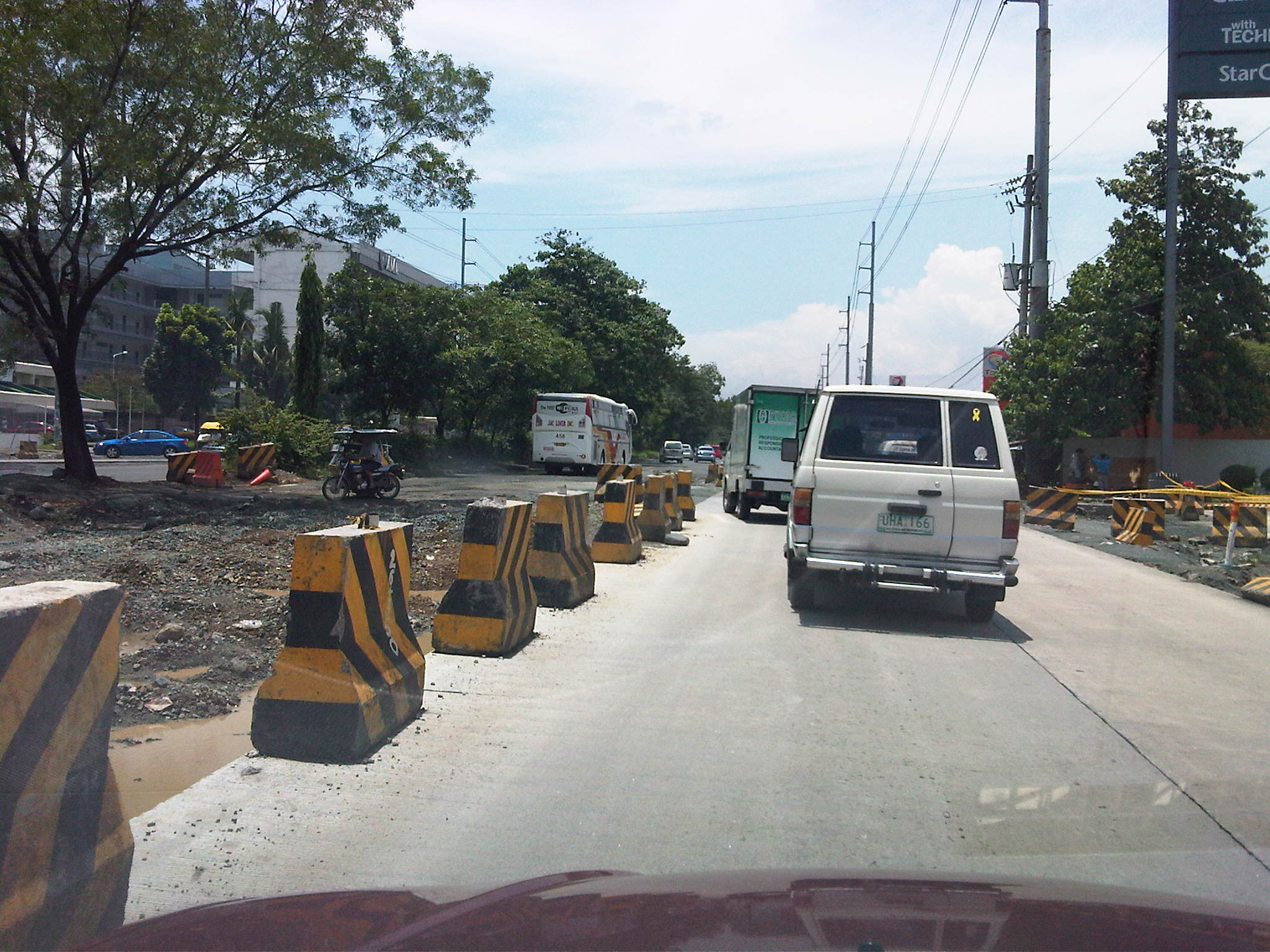 Unfinished drainage and roadworks along Marcos Highway westbound across the Caltex service station approaching the Filinvest East and Vermont Park gates – the section widens just before the subdivision gates and median opening but the inner lanes have not been paved at the time the photo was taken.
 Median opening (U-turn slot) for westbound traffic coming from Imelda Avenue – the old median opening across Burger King was closed and traffic was diverted to this slot located between the Shell and Phoenix service stations right after the Town & Country gate and CVC grocery. The result was less congestion due to weaving traffic between Imelda and this slot. This, however, came with a price – a longer trip for vehicles coming from Imelda Avenue.
With the completion of road and drainage works along Marcos Highway, it is expected that congestion will eventually be eased and the inherent costs will be reduced. Perhaps there will also be an opportunity to revisit traffic management and traffic control at critical junctions including Masinag, Imelda Ave./A. Tuazon, and A. Rodriguez/J.P. Rizal. So far, the perception of continuous movement due to the U-turn schemes along Marcos Highway have resulted in many adjustments to the locations of the slots while only producing congestion and perhaps encouraging aggressive driving behavior. Traffic signals should again be considered though traffic and travel behavior will surely be affected by a proposed extension of LRT Line 2.
Congestion along Imelda (Felix) Avenue
Imelda Avenue was its original name and is taken from the first name of a former First Lady of the Republic. It was appropriate at the time considering it intersected with Marcos Highway, which was being developed as a main thoroughfare to the east and alternate to the older and established corridor of Ortigas Avenue. Imelda Avenue extends from the Cainta Junction where the road continues towards the town center of Cainta as A. Bonifacio Ave., up to Marcos Highway, across which, the road continues towards the Marikina City center as A. Tuazon Ave.
Imelda Avenue is basically a 4-lane, divided road with the division pertaining to the narrow island in the middle of the avenue than separates opposing flows of traffic. At some point in the middle of the avenue, from the Vista Verde subdvision main gate, two 2-lane undivided service roads appear on either side of the highway and continue until Karangalan Village, which has phases on each side of Imelda Avenue. Sometime in the 1990s, the avenue’s name was changed to Francisco Felix Avenue, in honor apparently of a former mayor of Cainta who was the first of a dynasty of three Felixes who became Mayor of the town. The current mayor is a former media personality on his third term and, who seems to be on the way to establishing his own dynasty by already advertising projects and accomplishments of his better half. But that’s politics and definitely another story that we will steer away from. Anyhow, the original name of the avenue was restored sometime ago as most people still referred to it as Imelda rather than Felix.
Adding insult to the injury that is congestion along Marcos Highway are the severe jams experienced by motorists and commuters passing through Imelda Avenue. The congestion is primarily attributed to the civil works related to projects of the Manila Water concessionaire whose pipes happen to be located in the middle of the road and not conveniently under one lane of the highway. Manila Water is not to blame as this was something they inherited from the MWSS who laid down the pipes, apparently without the benefit of foresight. The result of the project is severe congestion as only one lane has been practically available for Cainta-bound traffic.
But even without the project, congestion has been an issue due to the continuously increasing volume of through traffic plus the contributions in vehicle generation of the residential areas on either side of Imelda. These generators include the sprawling Vista Verde, Village East and Green Park subdivisions that have relatively high car ownership due to their mainly middle class residents. Jeepney operations along the highway where loading and unloading operations are indiscriminate and undisciplined. The two service roads offer minor comfort considering these are usually clogged by on-street parking due to commercial establishments. Tricycles operating along these service roads also contribute to slow traffic if one opts to bypass the sections affected by the water project.
The following photos were taken during a weekend trip where I had to pass through Imelda Avenue. Many areas along the highway are flood-prone (much of Imelda was submerged during Ketsana/Ondoy) so this eventuality is partly to blame for what seems to be a slowly progressing project that has already wasted a lot of valuable time and fuel. Hopefully, the project will be completed before the “ber” months arrive when traffic naturally starts to increase due to the anticipation for the Christmas season.
 Cordoned section showing only one lane of Imelda Ave southbound available to traffic. Other vehicles brave the west service road on the right.
 Pavement subgrade prepared for subsequent pouring for concrete at section approaching Vista Verde main gate. The pedestrian overpass downstream serves a national high school along the northbound side of Imelda Avenue and beside the Vista Verde gate. Notice the island on the right occupying space equivalent to 1 lane.
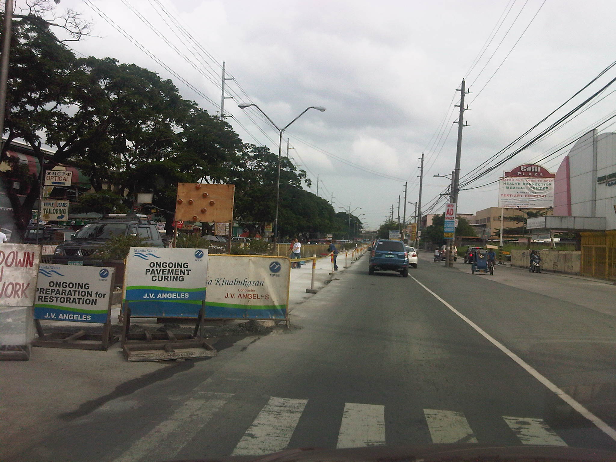 Newly paved lane along Imelda Avenue fronting the Karangalan market. The island separating Imelda from the west service road has been removed along this section to alleviate congestion and permit vehicle maneuvers in the vicinity of the market.
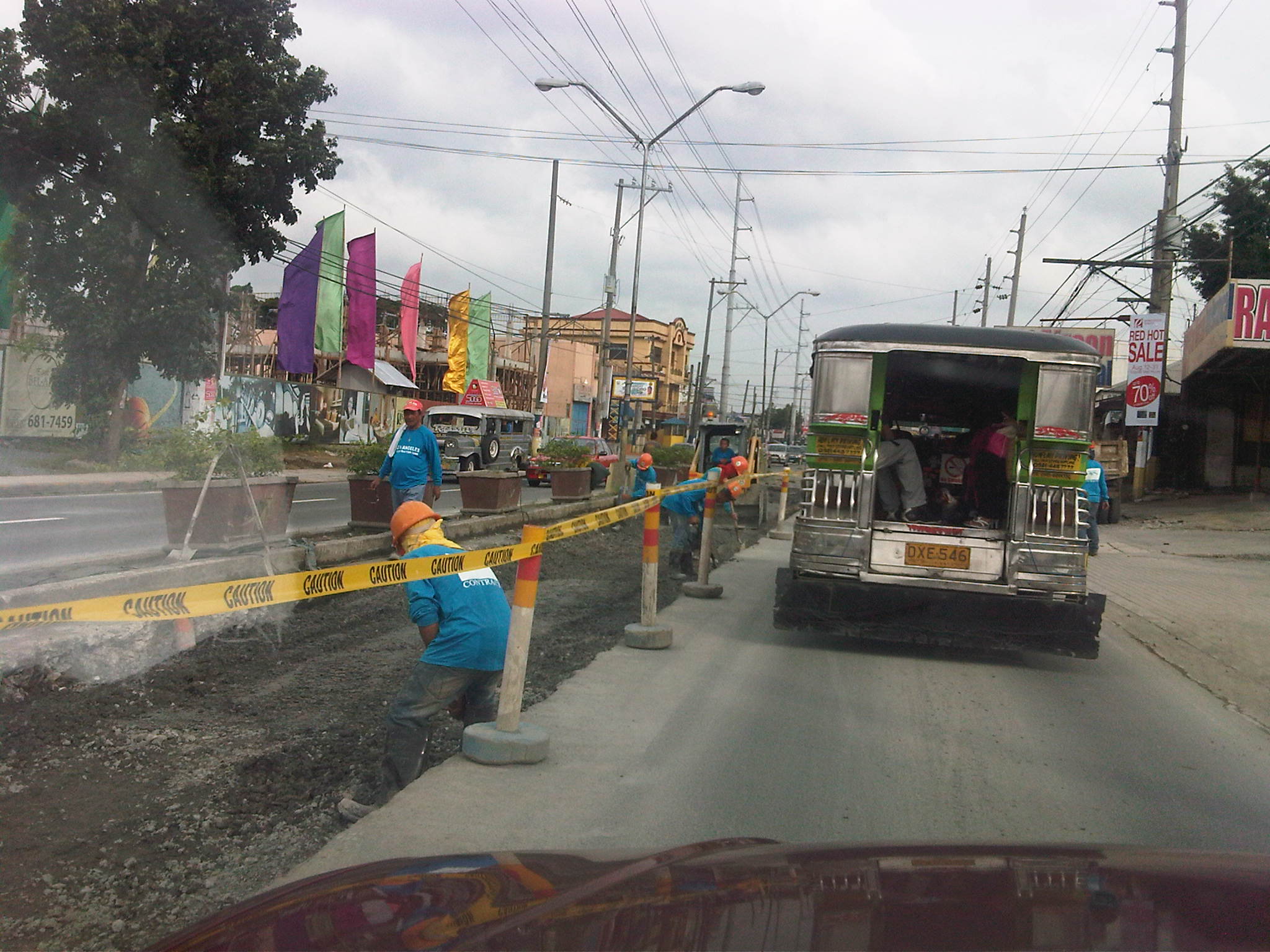 Manila Water contractor working on lane past Vista Verde main gate . Notice that there are no service roads along either side of Imelda from this point.
Road and drainage improvements along Marcos Highway
People driving or commuting from the eastern part of Metro Manila and the towns of Rizal Province have been experiencing traffic congestion for quite some time now due to the civil works associated with the improvement of Marcos Highway. The project is part of the Metro Manila Urban Transportation Integration Project (MMURTRIP) that finally pushed through after failed bids that caused significant delay to its implementation. The major components of the project include road widening and pavement rehabilitation, and the improvement of drainage along the highway. The latter component is quite important as the drainage system is supposed to contribute to the alleviation of flooding in areas along the highway. Who knows if the system could have prevented or at least mitigated the floods brought about by Ketsana (Ondoy) in 2009 if the project had been implemented according to its original schedule?
The photos below were taken during a regular commute along the highway and shows civil works in various stages of completion.
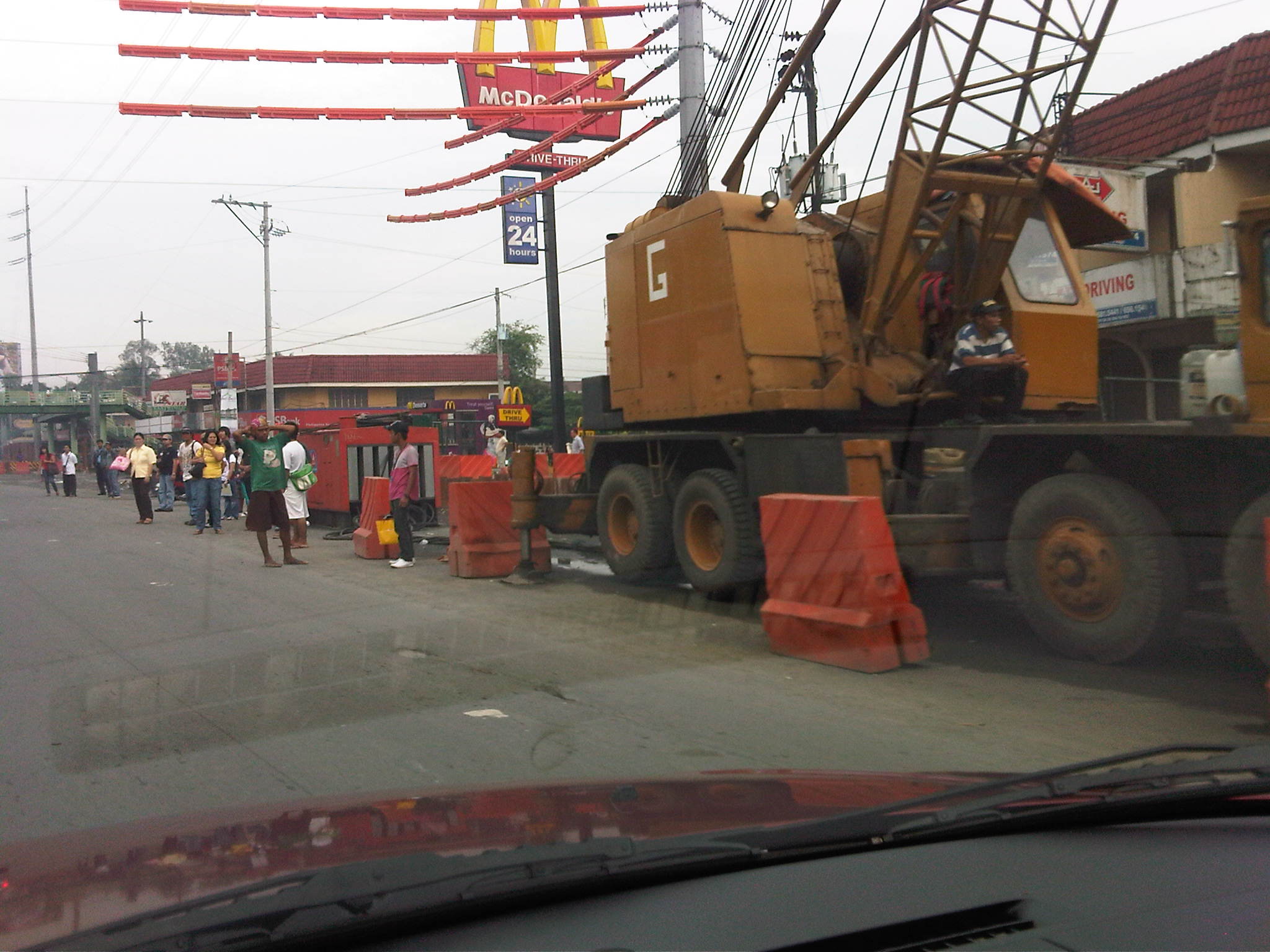 Crane deployed along westbound lane of Marcos Highway – Note the barriers and other equipment that effectively occupy about 2 lanes of the highway and the passengers waiting along the highway.
 Partly completed works along Marcos Highway westbound just after the junction with Felix Ave./A. Tuazon Ave. and across from Sta. Lucia Grand Mall
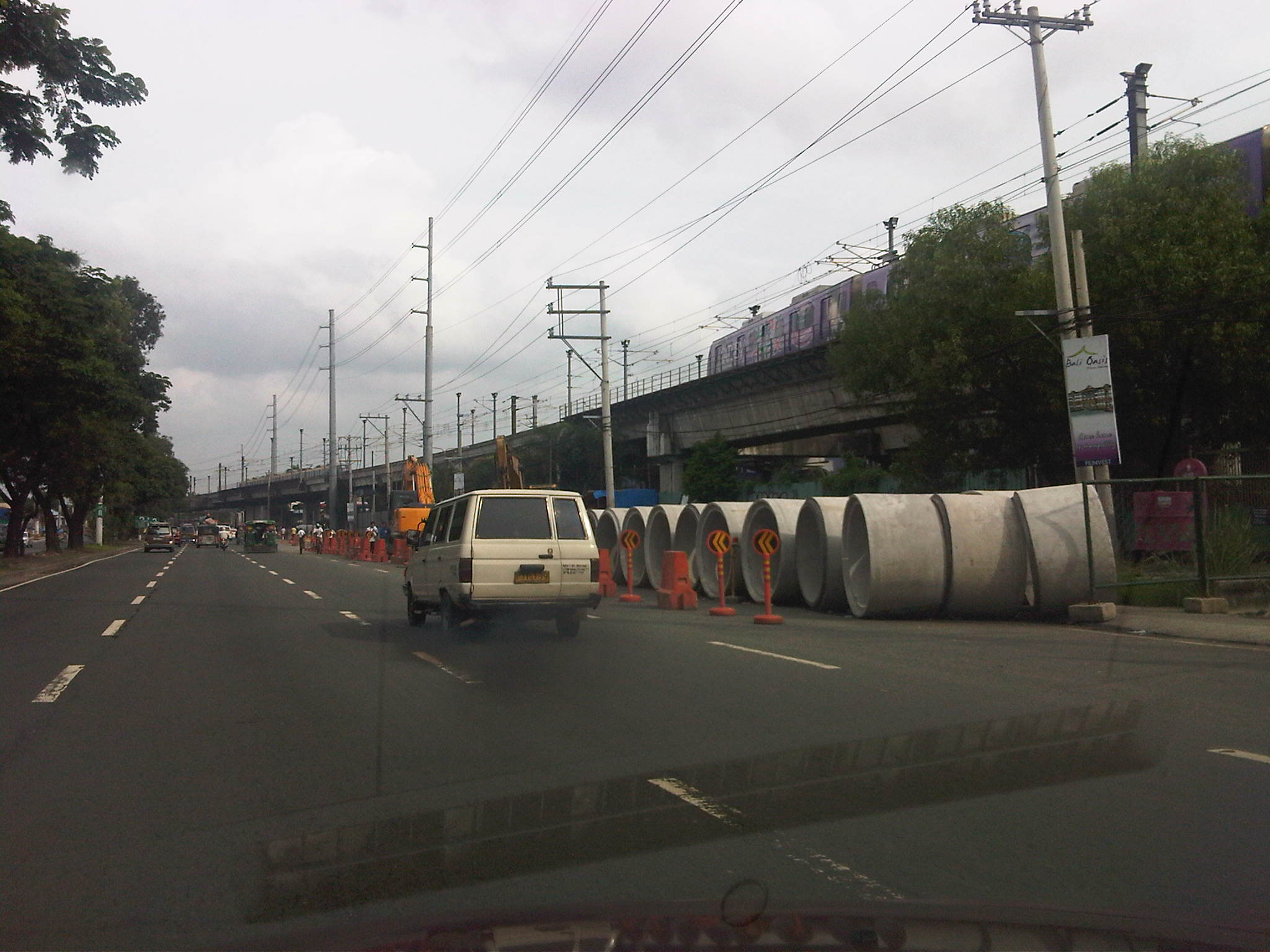 Civil works along Marcos Highway eastbound in front of the LRT2 Depot in Santolan
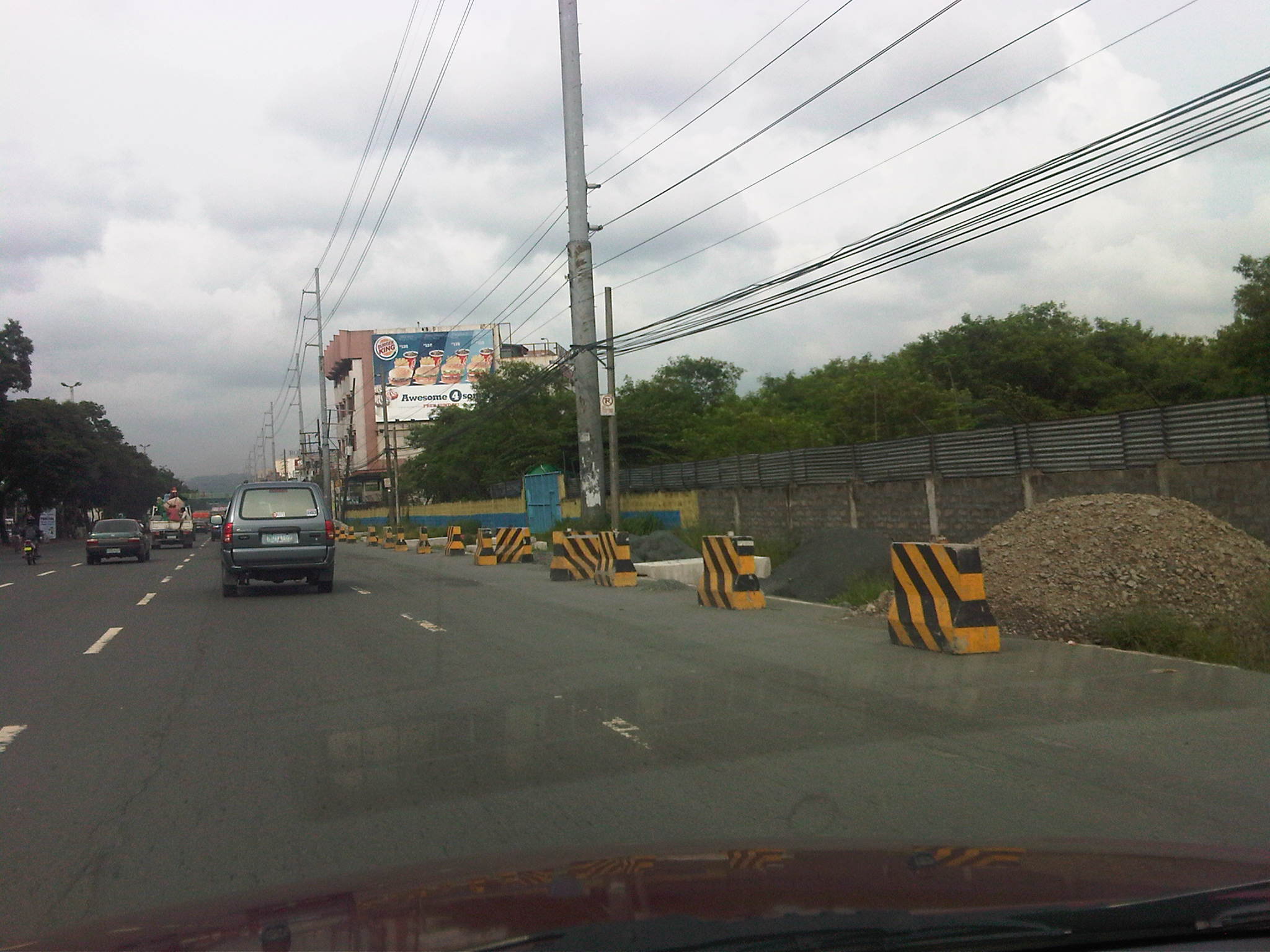 Partially completed works along Marcos Highway eastbound just after junction with A. Rodriguez Ave. (Ligaya)
 Project equipment and materials and informal barracks along Marcos Highway eastbound near the Barrio Fiesta/Slimmer’s World
 Excavations along Marcos Highway eastbound
Due perhaps to the magnitude of the project, traffic congestion along many if not most sections of the highway have been inevitable though prolonged. But partly responsible for the congestion is the Manila Water concessionaire that also did their own civil works at the same time as the DPWH project. As such, the capacity of the highway was significantly reduced with the outer lanes affected by the DPWH project and the inner lanes impacted by Manila Water works.
We should be hopeful though that once the project is completed, traffic flow will greatly improve and flooding may be alleviated along the highway and its catchment area. Works seems to be continuing although there seems to be less people working on the project these days compared to when the project started. Maybe they are just spread out along the highway? The following photos show examples of progress in the civil works.
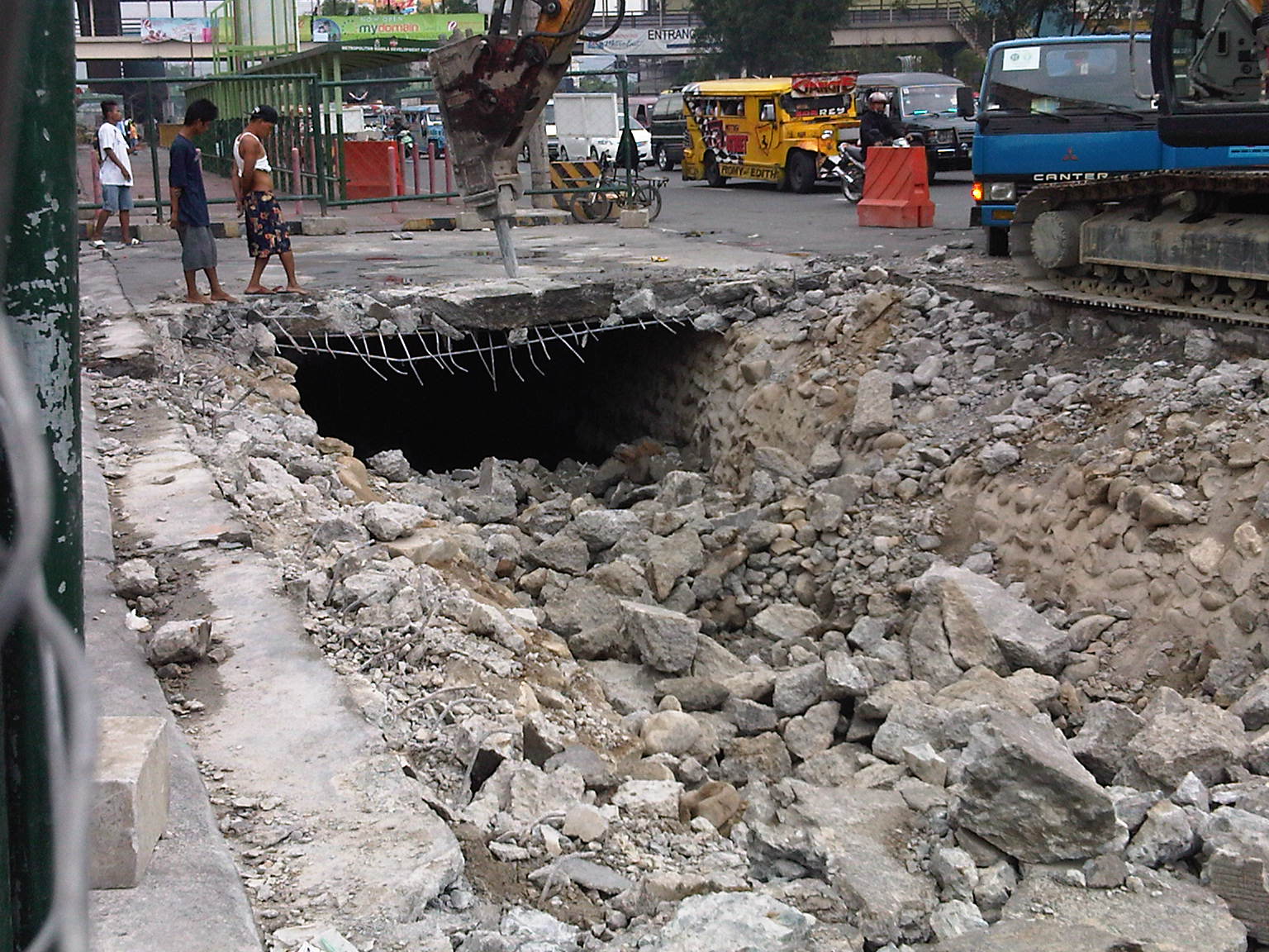 Demolition work of slab covering drainage along Marcos Highway westbound (before)
 Drainage canal covered and pavement engineering works (progress/after)
While it is expected that vehicle flow will be facilitated by the project, it can be said also that this may only encourage more vehicular traffic. As such, perhaps the next project that could be considered for this corridor is the also much-delayed extension of LRT2 towards Masinag.
Clarifying some issues on truck overloading
Following is a Position Paper prepared by the Institute of Civil Engineering and the National Center for Transportation Studies to clarify some issues pertaining to truck overloading. The position paper was presented to the Technical Working Group under the House of Representatives Committee on Transportation, which is handling the issue.
1. Background
This position paper was crafted to clarify some issues pertaining to truck overloading and the implementation of the national law (R.A. 8794) from a technical standpoint, and based on an independent assessment of the concerns put forward recently.
Among the issues raised were on the maximum axle load of 13.5 tons, the computed maximum gross vehicle weight (GVW), and the implications of their enforcement on the transport of goods and the trucking industry.
In the absence of extensive data from measurements on actual roads and bridges in the Philippines, reference is frequently made to tests and studies by the American Association of State Highway and Transportation Officials (AASHTO), which are adopted by many other countries.
2. Maximum axle load
For benchmarking purposes, an 8.2-ton axle is referred to as the equivalent single axle load or ESAL. One (1) ESAL is equivalent to a damage potential of 1.0 based on road tests conducted by AASHTO. Damage potential increases very rapidly as the axle load increases. The maximum axle load of 13.5 tons is equivalent to 60 times the damaging potential of an ESAL or 8.2-ton axle load.
The designation of a 13.5-ton maximum already takes into consideration the practice of overloading. (Note that the original maximum single axle load was 8.0 or 8.2 tons.) The 13.5 tons is based on studies conducted by the DPWH back in the 1990s (Philippine Axle Load Study or PALS), which determined the maximum single axle load that may be allowed without compromising the integrity of structures such as bridges. The study measured the weights of trucks throughout the country to establish typical weights for different types of trucks.
For tandem axles, a different maximum load is prescribed due to established findings by AASHTO that two closely spaced axles have a much greater combined damaging potential than two single axles that are far apart. To keep the damaging potential in check, AASHTO has established that in the case of tandem axles, each axle in the tandem should have a maximum load that is 20% less than the maximum allowed for single axles. Thus, the maximum axle load for tandem axles in the Philippines is 10.8 tons, for a total of 21.6 tons for the tandem.
A similar process of reduction is applied to tridem axles and so on, where the damaging potential changes as a function of the proximity of the axles to each other.
3. Maximum gross vehicle weight
The maximum gross vehicle weight (GVW) computation is partly based on the maximum single axle load. Thus, it is clear that a higher maximum single axle load leads to higher maximum GVW.
The GVW is computed based on the optimum distribution of loads for different types of vehicles. This optimum distribution considers the maximum allowable axle loads as discussed above (AASHTO, 1987) as well as the loading characteristics of bridges, for example as as detailed in the AASHTO LRFD Bridge Design Specifications (2004).
Further, the optimum loads also take into account the stability of the vehicle as it travels along highways and bridges.
The experience in the U.S. where a compromise was reached between government and the private sector concerning maximum GVW is possible because the weights are based on a maximum single axle load of 9.1 tons and the optimum distribution of load for different types of trucks.
4. Consequences of overloaded vehicles
In the previous sections, the impacts of overloading on road infrastructure such as pavements and bridges were taken into consideration. Overloaded vehicles, particularly trucks, can have detrimental effects on highway safety and traffic operations, too.
Highway safety and traffic operations
Overloading would particularly have impacts on the following handling and stability aspects for trucks, affecting safety in highways:
- Rollover threshold
- Braking
- Steering sensitivity
- Low-speed off-tracking
- High-speed off-tracking
Meanwhile, impacts on traffic operations include:
- Speed on upgrades
- Expressway/highway merging, weaving, and lane changing
- Downhill operations
- Intersection operations
- Traction ability
- Longitudinal barriers
The above factors have been analyzed and are the subject of a special report by the Transportation Research Board of the U.S. (TRB, 1990). It has been established, for example, that involvement in fatal road crashes increases as the GVW range increases. Also, it has been established that increased truck weights lead to greater reductions in speed and difficulties in merging, weaving and lane changing, and require greater sight distances for safe stopping.
Modification of trucks
The modification of trucks here pertains to the addition of at least one axle with the objective of increasing the GVW while also decreasing the loads of the axles, in order to comply with maximum axle limits.
Any modifications on trucks, especially the addition of axles, should comply with traffic safety standards including those pertaining to handling and stability. Thus, modified trucks should comply with the specifications of the manufacturer or with established standards, if any, for the modification in question.
Any modifications should also be subject to inspections. Problems will arise if there are no standards. In such cases, the manufacturer or experts in the industry should be consulted. The LTO should defer to the recommendations and disapprove any modifications that are not complying with standards or recommendations by qualified persons especially the manufacturer.
In the absence of comprehensive studies on such modifications, data on road crashes or breakdowns (e.g., flat tires, broken axles) need to be collected in order to establish their frequency, determine how serious these tend to be, and ascertain what the crashes or breakdowns are attributed to. This would require detailed information on crashes and breakdowns over a period of, say, 2 to 5 years for statistical significance.
5. Conclusions and Recommendations
The 13.5 tons designated as the maximum single axle load in the Philippines already incorporated the practice of overloading and thus becomes non-negotiable considering that the DPWH has already taken into consideration the maximum loads that can be withstood by highway structures especially bridges in the country. This maximum single axle load is notably higher than the allowance in the US and most other countries.
The following are recommended for further consideration:
- State the allowable maximum axle loads in terms of single axle, tandem axles, tridem axles and so on, in order not to create confusion on the interpretation of the allowable maximum loads.
- Establish standards, type approval system, and monitoring system for truck modifications, in order to ascertain compliance with safety and stability standards.
- Conduct studies on actual axle loads and GVWs on a more regular basis, say every 5 years, by the DPWH, in order to establish a database from which allowable maximum axle loads and GVWs may be updated in aid of legislation.
- Conduct impact assessments.
The U.S. Department of Transportation (2000) recommendations that may be relevant in the impact assessments include:
- Infrastructure costs – including implications on road pavements, bridges and geometrics
- Safety impacts – including crash/accident rates, public perception, vehicle stability and control, and vehicle comparisons
- Traffic operations – impacts on road capacity and speeds
- Energy and environment – impacts on fuel consumption and vehicle emissions
- Shipper costs – impacts on cost of transporting goods
Impact assessments are essential in order to establish directions for determining the benefits and costs attributed to various scenarios that are currently being discussed at the TWG level. Such benefits and costs will serve as inputs in aid of legislation to improve on the provisions of R.A. 8794 and its Implementing Rules and Regulations.
Design standards particularly for road pavements and bridges in the Philippines are mainly based on AASHTO standards and specifications. The AASHTO standards and specifications are based on AASHTO design vehicles along with their prescribed weight/load distributions. It follows, therefore, that anyone adopting the AASHTO design standards and specifications like the DPWH should also adopt the AASHTO design vehicle specifications. Otherwise, the application of standards and specifications for design will be flawed, resulting in sub-standard infrastructure.
As a general rule, if the Philippines is to adopt a different set of load distributions, maximum axle loads, and gross vehicle weights for its trucks, the country should likewise develop or revise its design standards and specifications to match local experience or setting. This would require comprehensive studies to be led by civil engineering experts in the Philippines and patterned after similar studies conducted elsewhere including the United States.
6. References
AASHTO (1987) Guide for Maximum Dimensions and Weights of Motor Vehicles and for the Operation of Non-Divisible Load Oversize and Overweight Vehicles, Washington, D.C.
AASHTO (2004) LRFD Bridge Design Specifications, 3rd Edition, Washington, D.C.
Department of Transportation, U.S. (2000) Comprehensive Truck Size and Weight Study, Federal Highway Administration, Washington, D.C.
Transportation Research Board (2007) Legal Truck Loads and AASHTO Legal Loads for Posting, NCHRP Report 575, National Cooperative Highway Research Program, Washington, D.C.
York, J. and Maze, T.H. (1996) Applicability of Performance-Based Standards for U.S. Truck Size and Weight Regulations, Semisequicentennial Transportation Conference Proceedings, May 1996, Iowa State University Institute for Transportation.
 Caught (up) in traffic
