
Home » Infrastructure (Page 19)
Category Archives: Infrastructure
NAIA Expressway – T3 to T2/T1
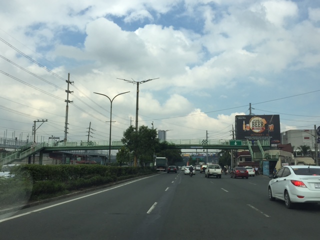
Last Friday was our first time to use the NAIA Expressway. This was one of the major projects under the last administration and under the Public-Private Partnership (PPP) program and became operational last year after being delayed (It was not operational during the APEC summit in 2015.) for some time. I also commented on the need for NAIA X in one post before as I preferred to have a transit system instead. NAIA X is basically and mostly beneficial to cars and not necessarily for public transport. It also practically limits if not eliminates the possibility of having elevated transit (e.g., monorail or AGT) to connect the 4 terminals among them as well as to areas outside the airport zone (BGC, Makati, etc.).
I thought this post would be a useful one for travelers especially those coming in and out of the airports at this time of the year. A lot of people are departing or arriving at the Ninoy Aquino International Airport (NAIA), which is a main gateway to Metro Manila and adjacent regions. It can get congested along the roads between the four terminals of the airport and since there is not internal transport system linking them, travelers would need to travel along public roads. It cost 45 pesos (less than 1 USD) for the stretch from Terminal 3 to Terminal 2 (same if you’re headed for Terminal 1), and I thought it was well worth it considering it can really be quite congested between the 4 terminals. That congestion has already victimized a lot of people before with many missing their flights. But then perhaps one major cause of that congestion was the construction of the NAIA Expressway?
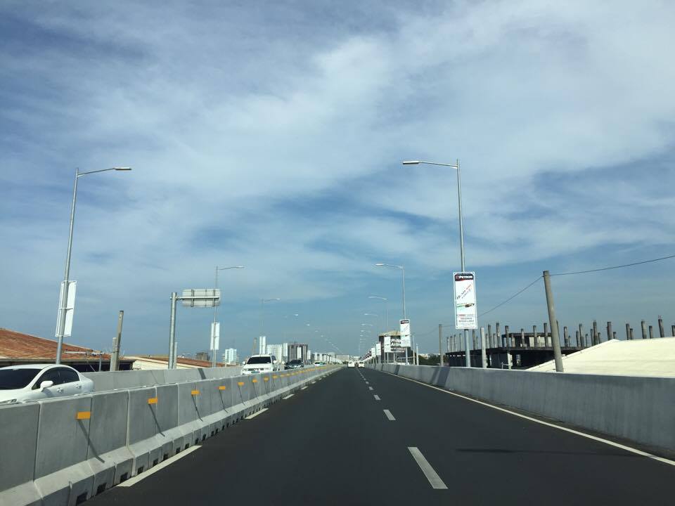
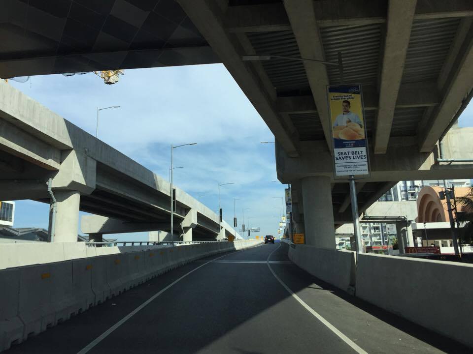 Entry ramp across from Terminal 3 and before the Sta. Clara church at Newport City
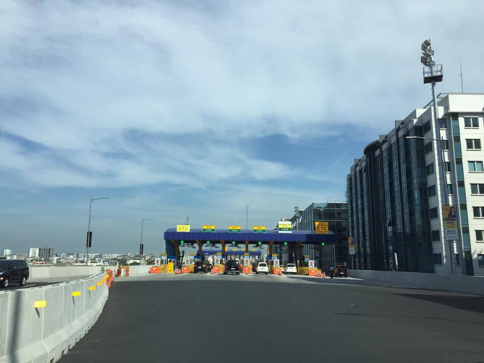 Toll plaza where travelers pay upon entry to the tollway
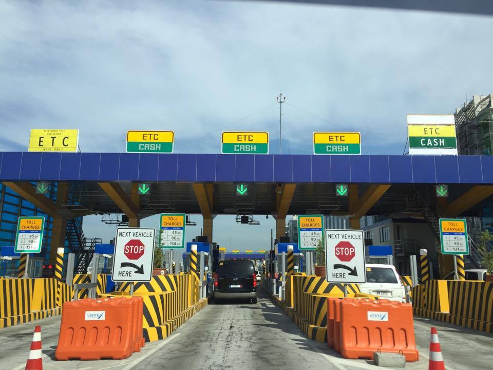 Just before the toll plaza where most booths are for mixed ETC/cash transactions
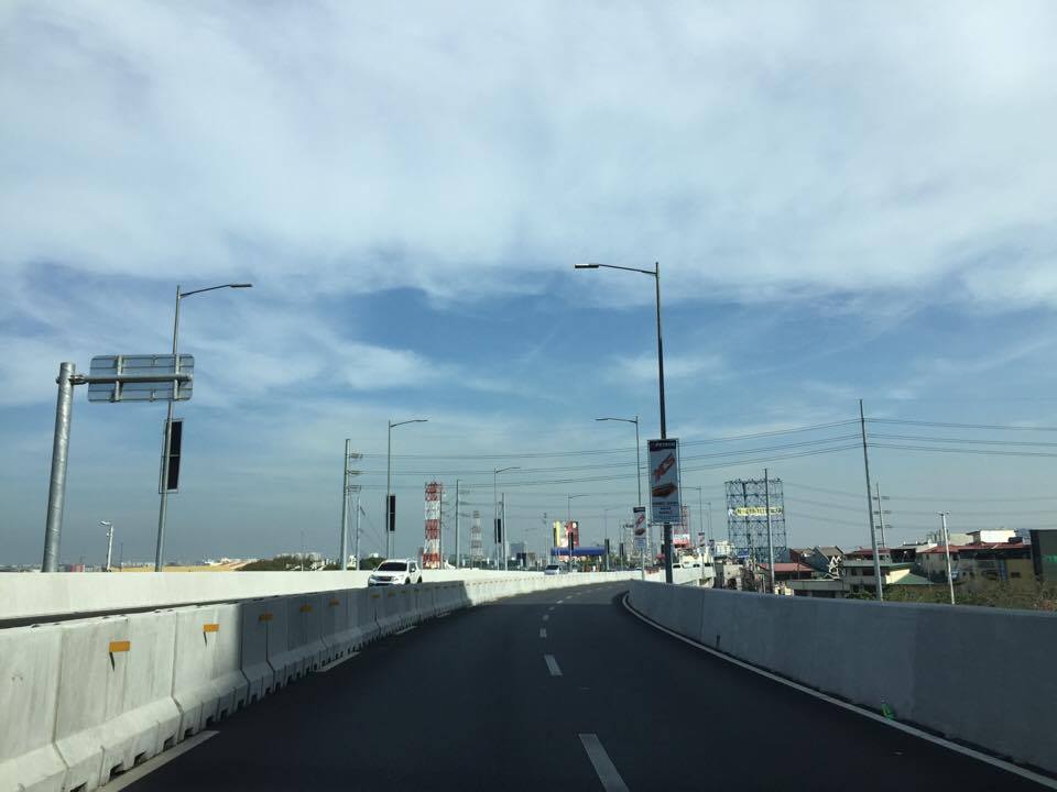
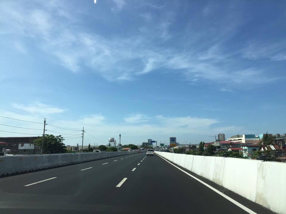
 Upon exiting the toll plaza, travelers have to deal with multiple lanes merging into two
 Two-lane section with neither shoulders nor “elbow room”


 Directional sign providing guidance especially for vehicles headed to Terminals 1 &2
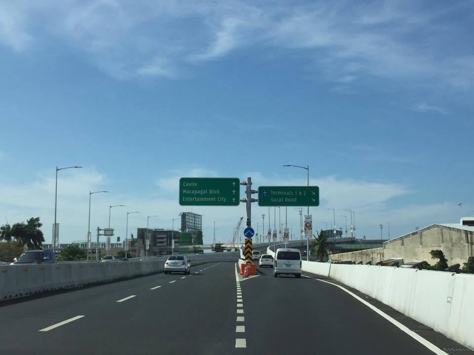 Directional signs for vehicles bound for Cavite and Macapagal Blvd (left) and Terminals 1 or 2 (right)
 The tollway section goes underneath the section headed towards Macapagal Boulevard and the Coastal Road
 The lane from Terminal 3 merges with another from the Coastal Road
 Signs showing which side to stay along towards either Terminal 2 or 1
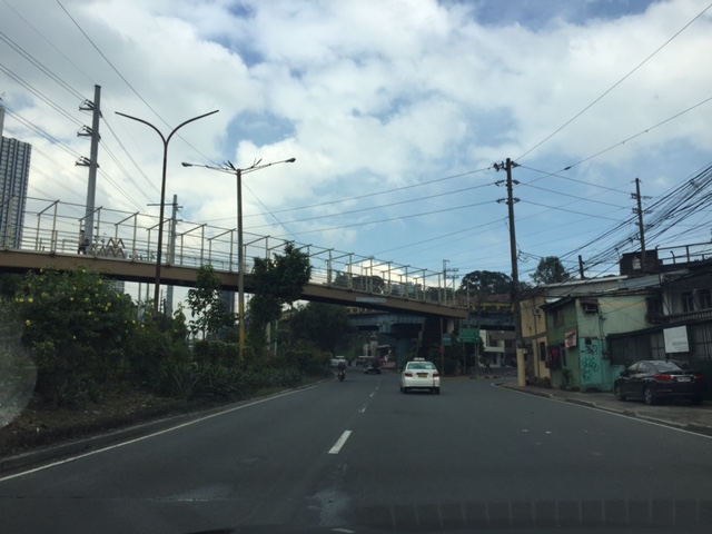
 Fork in the road – the tollway branches our to either Terminal 2 or Terminal 1
 Off ramp towards Terminal 2
Next: Terminal 2 to Terminal 3
–
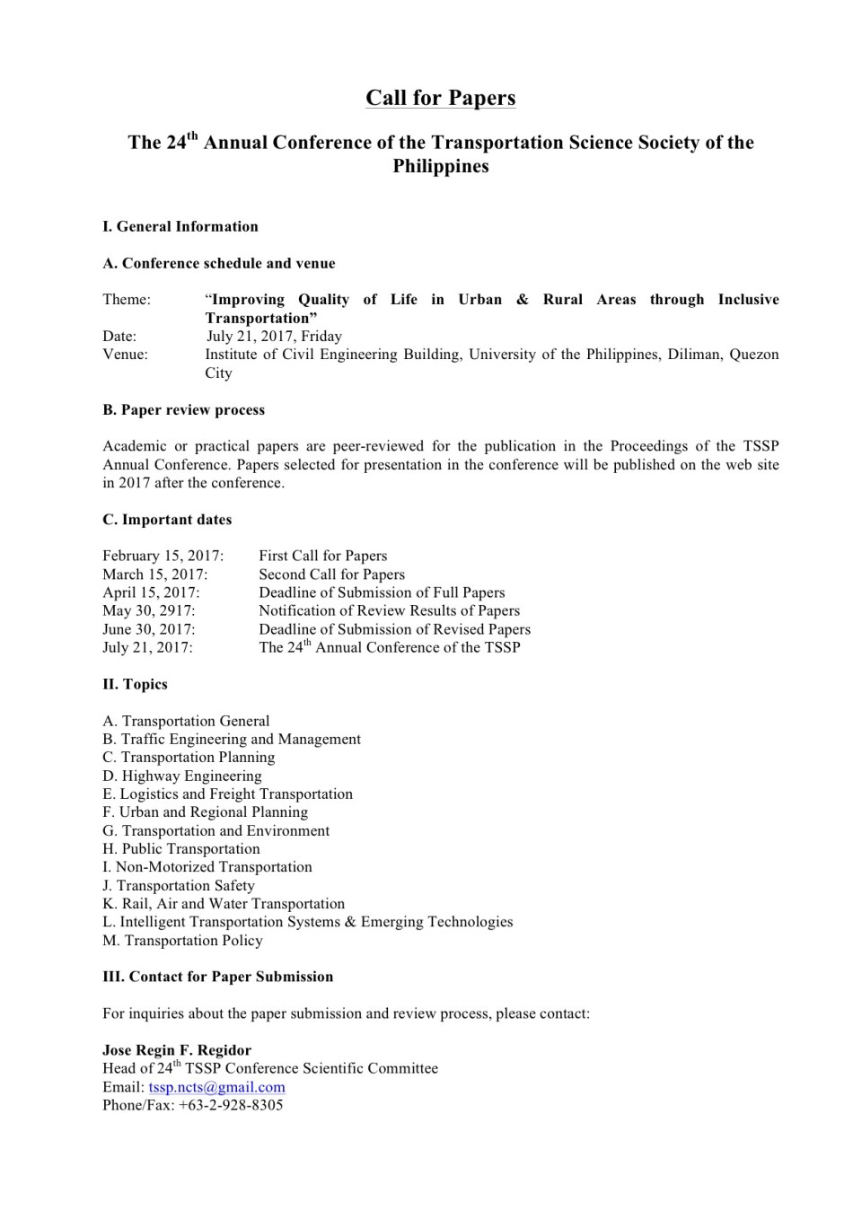
First call for papers for the TSSP 2017 conference
The first call for papers for the 24th Annual Conference of the Transportation Science Society of the Philippines came out last Wednesday, Feb. 15:
–
Opposition to C-6
There had been no significant developments for the Circumferential Road 6 (C-6) not counting the road widening and concreting along the sections at Lupang Arenda in Taytay, Rizal. Meanwhile along its lakeside alignment in Taguig, a 2-lane road has been constructed apparently as part of the widening of the section for what maybe a future 4-lane road with a median island dividing opposing flows of traffic.
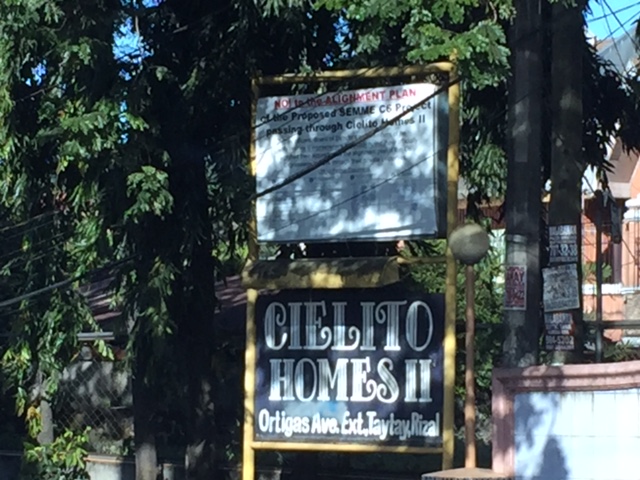 Sign apparently put up by this residential subdivision’s homeowners’ association
 Close-up of the sign shows opposition by the residents to the proposed C6 alignment to pass through their homes.
I haven’t heard or read about anything new or updates about C-6. It seems to be tied to other projects including a proposed elevated tollway along the shores of the Laguna de Bay. The alignment though to the north seem to be unresolved and will definitely be a big concern for many developed residential areas including those in the Province of Rizal.
–
Where exactly will the Line 2 Extension stations be?
A good friend asked me about where the two additional stations of the Line 2 Extension will be. Most articles state that there will be a station at Masinag and at Emerald but since work on the stations has not commenced then many are still speculating on the final locations and how the station will be laid out with respect to the elevated tracks. However, if you look closely, you will see something like a hint to where the stations and their platforms will be laid out. Following are two photos; each showing features of the elevated tracks that taper off at what looks like the start and end points for the stations.
 Future Emerald Station in front of Robinsons Metro East?
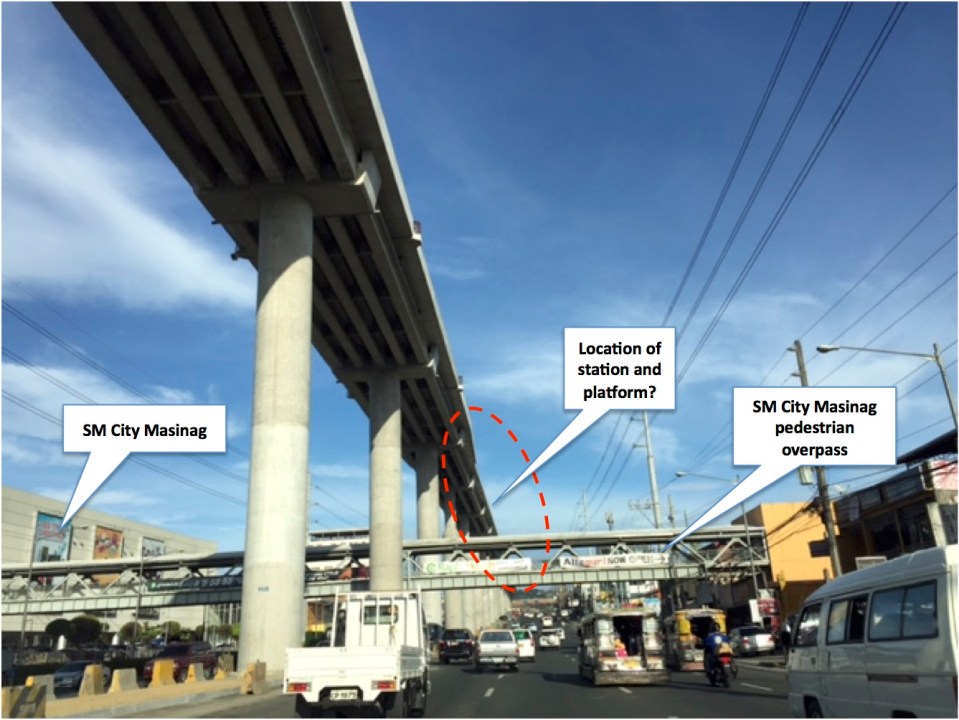 Future Masinag Station across SM City Masinag
Another observation and particularly at Masinag is how tall the structure seems to be. The platforms appear to be already at the 4th level if you compare the elevated tracks to the pedestrian overpass that represents the 2nd level. It seems that the Masinag Station will be quite a tall one and invites more questions from observers especially prospective and current users of Line 2. Perhaps it will be 4-storey building with commercial spaces for shops and restaurants? How massive will this structure be? Will there be a connection with SM other than via the existing pedestrian overpass? How will the inter-modal needs be addressed by the station design? Will there be more parking or maybe park-and-ride facilities? Hopefully, these questions can be answered soon.
–
Updates on the Line 2 Extension: What’s next?
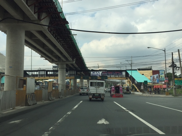
Marcos Highway is part of my regular commuting route and so I have been able to observe the progress of the construction of the elevated tracks for the extension of Line 2. The contractor, DMCI, is nearing the completion of their part of the project. Unfortunately, the stations and the electrical/power systems for the extension have not been bidded out by the DOTr and so there are not a few doubts whether the extension will be operational by 3rd quarter of 2017, which is the original completion date for the whole project. The construction of the two stations alone are expected to take some time and also will have a big impact on transport and traffic despite the construction sites being more concentrated around the stations at Emerald and Masinag. Here are a couple of photos showing what it looks like along Marcos Highway.
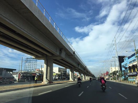 DMCI has almost completed clearing the stretch of Santolan to Masinag of their equipment. The barriers that delineated their work space are mostly gone, freeing up a lane each along either side of Marcos Highway. This has eased traffic along this major thoroughfare connecting Metro Manila to the east.
 The pedestrian overpass across Vermont Royale has been retrofitted so the center section passes under the Line 2’s structure.
Timing is of the essence for the two additional stations of Line 2. As I said, the projected completion and start of operations was 3rd quarter of 2017. Of course, the last quarter of this year would still be most welcome but further delays mean more losses on the part of commuters and, overall, the government. Perhaps it was a mistake for the previous administration to have not included the stations in the package that DMCI eventually got and now has almost completed? Maybe the current administration should expedite the remaining parts of the Line 2 extension. This should prove how serious the current government is with its promises for better public transport (i.e., mass transport).
–
Updates and resolution on the common railway station in North-EDSA
The big news today is the agreement among the government and the big corporations involved in the issue of the common station at North Avenue-EDSA where three rail transit lines (Line 1, Line 3 and the future Line 7) will be converging. The key features of the agreement are reproduced here:
“KEY FEATURES OF AGREEMENT
- The Common Station has three components: (a) Area A, where the platform and concourse for LRT-1 and MRT-3 are located; (b) Area B, which consists of two Common Concourses connecting Area A and Area C; and (c) Area C, where the platform and concourse for MRT-7 is located.
- Area A will be financed and built by DOTr. Area B will be financed and built by Ayala and its partners (NTDCC) (this is Ayala’s contribution to the Common Station project). And Area C will be financed and built by San Miguel.
- The portion of Area A for LRT-1 will be operated, maintained, and developed by LRMC. The portion of Area A for MRT-3 will be operated, maintained, and developed by DOTr. Area B will be operated, maintained, and developed by Ayala. And Area C will be operated, maintained, and developed by San Miguel.
- The MOU contains the design parameters for the Common Station, which will be the basis of the Detailed Engineering Designs to be developed after signing of the MOU. The Detailed Engineering Designs will be completed within 240 calendar days from signing date.
- The designs shall ensure that a defined level of service is maintained at all times by all components of the Common Station.
- The designs shall ensure that all components of the Common Station are interconnected, and that SM City North EDSA and Trinoma are interconnected to the Common Station.
- The Common Station is targeted to be completed by 2 April 2019, subject to extension as may be justified under the MRT-7 Agreement with respect to Area C.
- SM’s TRO will be lifted soon after the Detailed Engineering Designs are completed.
- DPWH will build an underpass along EDSA at the area where the Common Station will be constructed. This will be financed and built by DPWH.”
That was a direct copy and paste from the DOTr’s Facebook page.
There is another piece of information that’s gained a popular following and that is the design for the common station that was shared to the public:
Proposed design of the common station
I think the design is basically okay in terms of location. The layout would need to be refined in order to address concerns pertaining to optimum and efficient transfer of passengers between lines. I assume from the drawings that all three lines will be at the same level but with a plaza separating Lines 1 &3 from Line 7. There are also issues pertaining to proposed road grade separation in the area but that seems to have been addressed already by item #9 in the preceding list. We can only hope that the current government and private sector partnership can expedite this project.
–
Another look at Marcos Highway overpasses – Part 3
The overpass at SM City Marikina is a bit more complex than what it looks like across the bridge. Here are some photos of the footbridge connecting the mall with the Santolan Station of Line 2:
 The overpass is a very long one and provides users with a partially covered walkway connecting to the LRT Line 2 Santolan Station. I say ‘partially’ because the roof over the overpass extends only across Marcos Highway.
 Note the covered bridge is only until the other side of Marcos Highway. From there it is an open overpass as shown at the left in the photo above.
 A closer look at the SM Marikina overpass shows just where the cover ends. There are stairs here leading to the loading/unloading bays across from the mall. There is also a path that leads to stairs to the public transport terminal under the bridge. There is a sign with a blue background in the photo stating the terminal is named after a former MMDA Chair who was also a mayor of Marikina and currently one of its congressmen.
–
Another look at Marcos Highway pedestrian overpasses – Part 2
I purposely didn’t include the overpasses at and near the Masinag Junction because I felt they deserved their own article. For one, the area will be the location of the future end station of the current LRT Line 2 Extension project. Here are a couple of photos of the overpasses in the area.
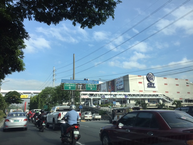
 Overpass at SM City Masinag – note the tall columns for the elevated tracks of Line 2. Will the Masinag Station be located that high or will it be at a lower level, perhaps closer to the SM City overpass?
The overpass at SM City Masinag is something that has been replicated in many other locations where an SM mall has been constructed. Note the similarity of the situation with the likes of SM City Iloilo, SM City Novaliches where SM built pedestrian facilities to allow for safe crossings between the mall and the area across from it along the highway. In many cases, it is the mall which provided the overpass in coordination with the local government unit and, I assume, the DPWH.
 Overpasses at Masinag Junction – there are actually 4 bridges here, each spanning one leg of the junction.
One of the intents for these is to eliminate at-grade pedestrian crossings at the junction. While crossing have been reduced significantly, there are still many “pasaway” who cross even when there is a green light for vehicular traffic along the leg they are crossing. Traffic enforcers here are quite lax about this and don’t seem to put in an effort to inform people about the overpass. There is no excuse for those who might claim they are too old or weak to climb the steps since the overpass has 4 working elevators for those unable to make the stairs. I noticed though that most of those using the elevators are able bodied people who probably are just too lay to take the stairs.
–
Another look at Marcos Highway pedestrian overpasses – Part 1
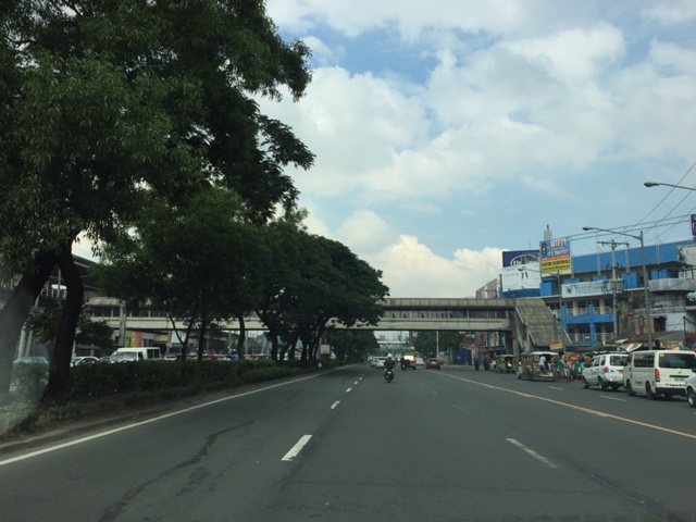
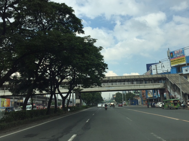
My daily commute allows me to have a look at the progress of the LRT Line 2 Extension construction. I also became curious about the situation of the pedestrian facilities along Marcos Highway particularly the crossings since many at first seemed to be affected by the elevated rail structure that was to be built. Now, we already have a good idea of the fates of these pedestrian overpasses. This article shows the conditions/situation of pedestrian overpasses (also called footbridges) along Marcos Highway. Most overpasses are not covered; exposing pedestrians to the elements. Most are also made of steel, which can be traced to the MMDA’s (and later the DPWH’s) preference for these structures.
 Overpass near Filinvest East-Vermont Park gates – the overpass actually is between a technical college and the commercial building across from it.
 The overpass across from Vermont Royale in front of a new Shell service station was actually among the newest facilities along Marcos Highway. Apparently though, it was built without considering the impending construction and design of the Line 2 extension. As such, the overpass needs to be modified or would have to be reconstructed elsewhere near the area.
 Overpass at Town & Country Executive Village that is also near the San Benildo School
 Overpass at Marcos Highway-Felix Avenue-Gil Fernando Avenue intersection – is probably the busiest among the pedestrian overpasses as it is at a busy junction where there are major commercial establishments (i.e., malls) and where many public transport routes converge.
 Robinsons Metro East overpass – this one also survived the clearance requirements with respect to the elevated superstructure for the Line 2 extension. However, since one of the two stations to be built will be nearby if not right across (part of the station at least) from the mall, then the station itself may function as an overpass.
 Overpass at De la Paz – note the ramp for bicycles and wheelchairs. This is one of the more bike- and PWD-friendly facilities along Marcos Highway. The slope is gentle enough for pedestrians, too, especially senior citizens who might have difficulty with steps.
 Overpass at Ligaya – this one also has ramps that make it easier for people to use to cross the busy highway. This will eventually be the closest overpass to the huge Ayala mall (Feliz) currently under construction at the Marikina side of Ligaya. I suspect that there might be a need for another overpass to be built with respect to the mall for one to directly serve the mall’s customers.
 Line 2 Santolan Station overpass connects the Marcos Highway westbound public transport stop with the rail station along the eastbound side of the highway.
 A closer look at the Santolan Station overpass, which is used by a lot of Line 2 passengers who cross the highway to continue on their journeys/commutes via train from their origins in Rizal, Marikina and Pasig. During the mornings, the observer will see a lot of jeepneys and UV Express vehicles emptying of passengers who cross the bridge to get to the station.
 Santolan footbridge – this is actually more complicated than what is seems in the photo because the steel footbridge also connects to the SM City Marikina overpass (which is not included in this compilation but is visible in the photo). The footbridge branches to provide and almost direct connection between the mall and the Line 2 Santolan Station. That structure is shown at
 Monte Vista footbridge allows people to cross Marcos Highway (at its Marikina/Quezon City end) to and from A. Bonifacio Avenue, which is in Marikina City (Barangka)
More on pedestrian overpasses in the next post!
–
Roads to Baguio: Marcos Highway – Part 3
Still on Marcos Highway, the following photos complete this feature from my most recent trip to a city dubbed as the summer capital of the Philippines. This is the third part of the series on this major road to/from Baguio City, and sections pretty much show very similar characteristics as the previous ones in the preceding posts. Its been a while since the Part 2 of this series and since then, an additional section of the Tarlac-Pangasinan-La Union Expressway (TPLEX) has been opened further cutting down travel time between Manila and Baguio to 4 hours.
 We start with a series of curves. Here is a section complete with signs and markings to guide and protect road users.
 The approach to this curve reveals the uneven terrain on which the road was built.
 These row houses and their driveways seem too close to the road
 That’s a poorly placed driveway right in the middle of the curve
 Many motorists tend to overtake slower moving vehicles via the opposing traffic lane. Here is a bus undertaking a passing maneuver at a curve!
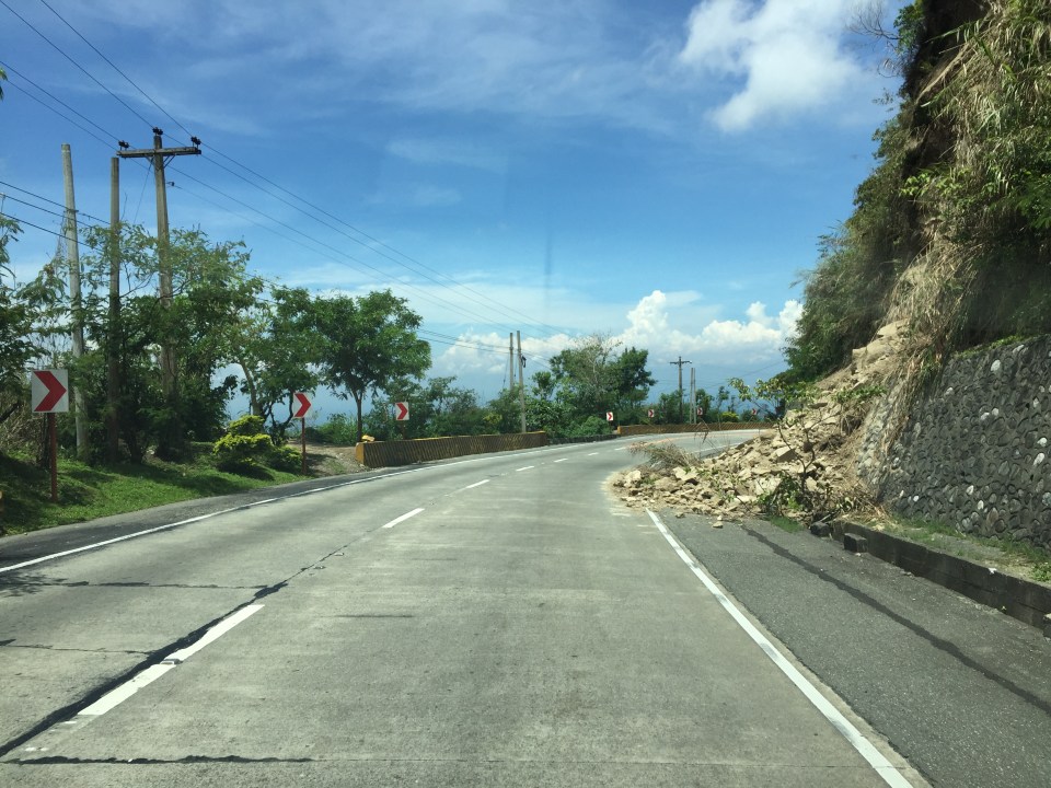 Rockslide – these are frequent along mountain roads such as Marcos Highway. They are even more frequent along Kennon Road and Naguilian Highway.
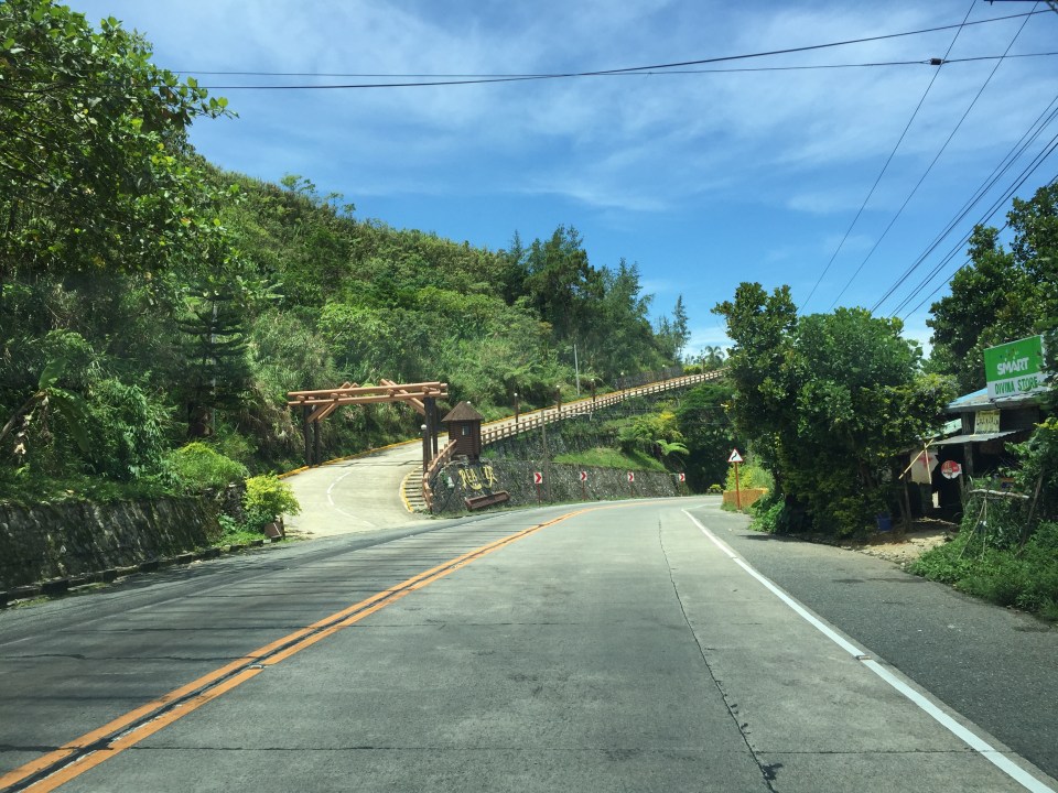
 Yet another section this time showing a reverse curve.
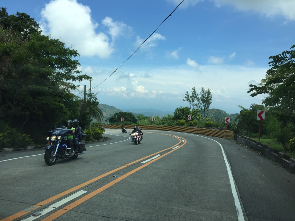 Here are a few more of the big bikes we encountered on our trip down from Baguio. These are of the same group of bikers in Parts 1 and 2.
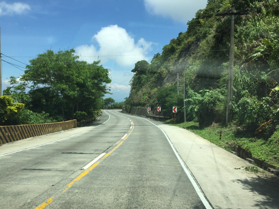
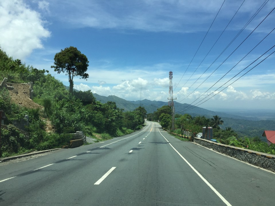
 Many sections of Marcos Highway have excellent sight distance and have usable, paved shoulders.
 There is significant truck traffic along Marcos Highway. These, especially the loaded ones, often slow down traffic. In certain cases, trucks form platoons making it difficult to pass them.
 I was not surprised to see a school along the highway since there are many communities along the road. This is a good example of standard signs and markings including a pedestrian crossing.
 The curve is not a good location for a home.
 The pavement at this section is intriguing as the road seems to have had a different orientation in the past. I suspect this was formerly a paved bay (for emergency stops or for loading/unloading passengers) in what used to be an unpaved shoulder.
 The position of this driveway is quite risky and motorists from both the highway and the driveway will be blind to each other.
 The section shows also what looks like a bay along the inner (left in the photo) side of the highway. Note that the shoulder is rather narrow along the ridge-side (right).
 Curve sections like this offer picturesque views but are actually are treacherous. The barriers are supposed to prevent vehicles from ‘flying’ out of the highway. Their designs should arrest large, heavy vehicles that may lose control and collide with the barriers.
 Marcos Highway offers many breathtaking views and excellent sight distance along many portions.
 This is the final stretch of Marcos Highway that terminates at the intersection with the Manila North Road, which is part of AH-26.
–
