
Home » Infrastructure (Page 20)
Category Archives: Infrastructure
Another look at the Tacloban Airport
The Daniel Z. Romualdez Airport in Tacloban City is the busiest in Region 8 (Eastern Visayas). Tacloban being the regional center in terms of commerce/business, attracts significant air traffic and should continue to do so as it steadily recovers from the devastation brought about by Typhoon Yolanda (Haiyan). Following are photos of the airport from our recent trip to Leyte, where we had meetings in Tacloban and Ormoc.
 Passengers arrive at the Tacloban Airport
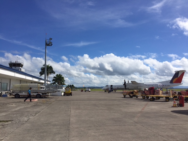 Philippine Airlines turboprop aircraft arriving at the airport
 Cebu Pacific passengers disembarking from the plane
 Passengers waiting for the checked-in luggage at the carousel
 Passengers file out of the arrival area unto the terminal’s driveway and parking lot
 Visitors may inquire about the Tacloban at the city’s information desk located at the arrival area.
 Sign of a rent-a-car service at the airport showing rental options and available vehicle models.
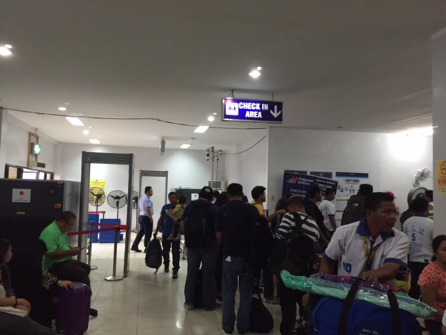 Crowded check-in area at the Tacloban airport passenger terminal
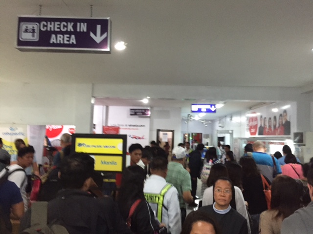 There were long queues at the check-in counters as well as the payment booths for the terminal fee.
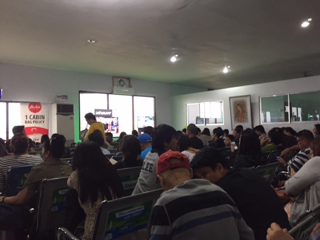 We entered a very crowded departure area as flights were delayed and people accumulated at the terminal. These are Air Asia passengers.
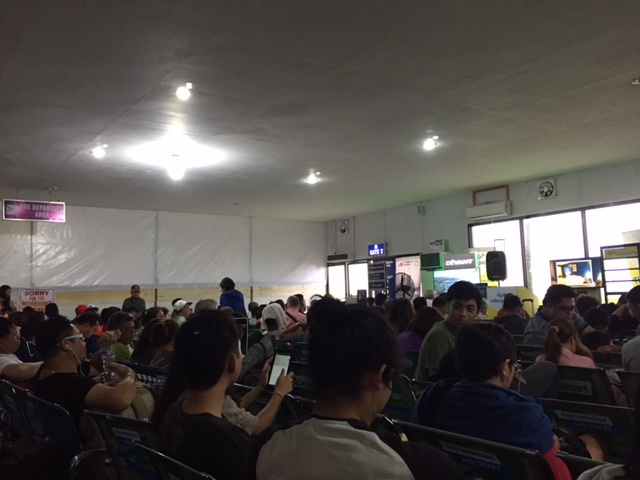 These are Philippine Airlines and Cebu Pacific passengers. Notice the temporary wall behind which is a section of the departure area that’s being renovated.
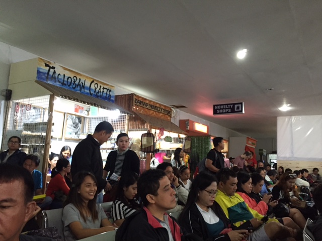 Shops at the departure area sell souvenirs and food items including local delicacies like moron and binagol.
The airport terminal is already very congested and it doesn’t help that flights are frequently delayed for various reasons. In the aftermath of Typhoon Yolanda (Haiyan), there have been proposals to move the airport to another location. However, it now seems that there is no better location for this within the city and elsewhere in the province. There are opportunities and potential though to improve the current airport and perhaps make it more resilient against typhoons of the scale of Yolanda.
The proposed new passenger terminal building is already much delayed and the runway can be extended. The latter is now possible with the areas for the extension already cleared of informal settlers mainly due to these areas being ravaged by Yolanda and authorities not permitting people to rebuild their houses there.
–
Evidence from Montreal: Building bike lanes to reduce car use
I just wanted to share this article showing evidence of car use reduction (and therefore, car traffic along roads) with the provision of bicycle lanes.
Building Bike Lanes Really Does Get More People Out of Their Cars
The article though cautions readers against generalising or assuming great improvements. Some figures mentioned in the article including the following (I took the liberty of copying and pasting):
- “A 10% increase in bike accessibility resulted in only a 3.7% increase in ridership.”
- “…cycling infrastructure also reduced greenhouse gas emissions from cars by 1.7%, a reduction equivalent to converting transit buses to hybrids and electrifying commuter trains.”
These numbers are for the case of Montreal, Canada. Not mentioned are the number of cyclists, vehicle traffic volumes and other pertinent data that are useful in analysis. The article correctly points out the importance of using science (e.g., sound analysis based on good data) in order to convince governments to put up bicycle infrastructure. I would even add that this approach should also be applicable to pedestrian facilities.
–
Standards for integrated railways in the Philippines
With the recent pronouncements about railway projects in Metro Manila including the ongoing Line 2 Extension to Masinag, the impending construction of Line 7 (i.e., along Commonwealth and Regalado Avenues and Quirino Highway) and the proposal for a Line 4 (Diliman, Quezon City to Lerma, Manila), it becomes more imperative to have integrated railway infrastructure including and especially common stations where lines intersect and common specifications guided by standards or guidelines. Do we have such or has there been work towards their formulation in the past? The simple answer to that question is yes. But then we have to qualify that affirmative response because while there was a study a decade and a half ago, the outcomes of that study, which is a comprehensive take on all aspects of railway systems was never formally adopted (again?) by the Philippines.
The following link is for the Executive Summary of the “Study on Integrated Railway Network for Metro Manila (SIRNMM) completed in 2001.
Perhaps there is a need to revisit the outcomes of this study? This can serve as a good platform from which updated guidelines and standards can be developed for a more harmonious development of railways systems not just for Metro Manila but for other cities as well.
–
Metro Manila Skybridge: for cars or bicycles?
I was browsing over a not so old, pre-election issue of Top Gear magazine and came upon an article that featured then Senatorial candidate and already former Metro Manila Development Authority (MMDA) Chair Francis Tolentino. The article stated the former MMDA Chair’s frustration that his pet project didn’t get approval from NEDA. The Skybridge he was proposing was basically an elevated road that was to be built on top of Metro Manila rivers. This is in part to save on RROW costs and supposedly to also reduce traffic impacts of construction (note the traffic congestion due to the Skyway Stage 3 construction).
I think that such a Skybridge could have had a positive impact on traffic congestion but for a short time only. The sheer number of vehicles in Metro Manila will only lead to congestion elsewhere being transferred here and, under equilibrium conditions that will eventually be attained as some time in the near future, will ultimately be congested. The concept of tollways is for people to pay for the use of a facility in return for high level of service (read: faster travel). Skyways and other elevated highways cost a lot and the NEDA probably didn’t see a free use elevated structure like the Skybridge having much in terms of ROI.
There is, however, something that may be worth it in terms of potential congestion reduction as well as enhancement of traffic safety and quality of life – a Skybridge for bicycles and pedestrians. This should encourage people to cycle as travel via such mode will be much safer and could possibly be faster. Friends and acquaintances who are cyclists often post about similar facilities in Europe and how these are able to reduce congestion as people opt to cycle and leave their cars at home during the weekdays.
–
NAIA Terminal 3 – Newport connector
Currently under construction is a bridge connecting the Ninoy Aquino International Airport (NAIA) Terminal 3 and the Newport City complex across it. Once completed, it will be a convenient physical connection between the airport and the complex of hotels, residential condominiums and commercial establishments. The connection will be at a third level above the NAIA Expressway that is currently under construction. Here are a few snapshots of the bridge:
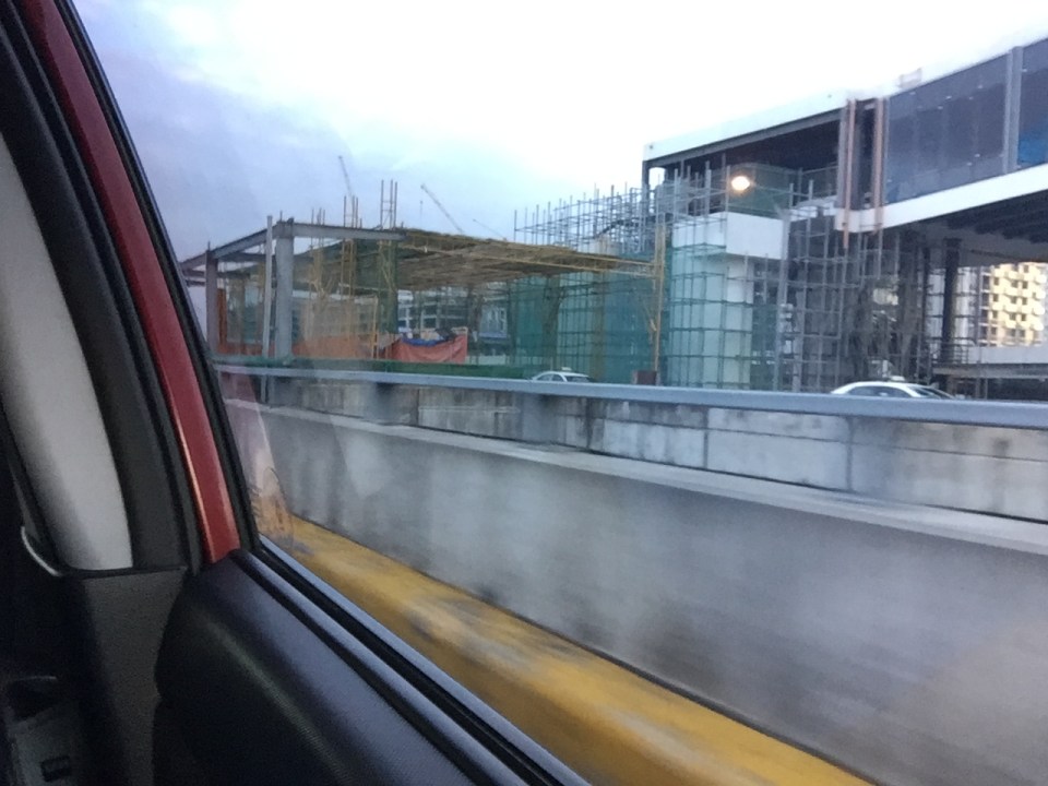 Under construction: a bridge connecting NAIA Terminal 3 and the complex that includes, among other, the Marriott Hotel and Resorts World Manila
 Another snapshot of the bridge under construction. The dome in the background is of the Shrine of St. Therese of the Child Jesus across from Terminal 3.
–
Some thoughts on transport for President-elect Duterte
My colleagues and I were talking about the not so surprising results of the recent national elections in the Philippines. I say not so surprising because people have been clamouring for change for quite some time now. It did not help the current administration and its standard bearer were hounded by the transport and traffic problems experienced by the country especially in Metro Manila. Here are some thoughts for the President-elect and whoever will be part of his transportation team:
- Come up with a framework for developing transportation in the country. The framework should contain both soft and hard measures. On the soft side would be strategies and policies like those promoting sustainable transport especially low carbon transport systems. This many include promoting walking, cycling and public transport at the local level. Hard measures would include infrastructure for all modes of transport including railways, airports and ports. Local roads development might be something President-elect Duterte’s team should look into as local roads basically provide accessibility for rural areas and contribute to development. The framework will serve as a guide for the next 6 years for whoever will be in-charge of transport-related agencies. He should have a sound game plan so as to be systematic in the approach to address transport and traffic issues.
- Watch out for and appreciate low hanging fruits. I think the current administration has already initiated solutions to pressing problems but mostly in Metro Manila in the form of the LRT Line 2 Extension and the MRT Line 7. There is also the new rolling stock for MRT Line 3. Pres.-elect Duterte’s team should already look into the mass transit needs of other highly urbanized cities such as Cebu, Iloilo and his hometown of Davao. Whether these will be road or rail-based systems should be the subject of studies to determine what can be completed immediately and within the term of the President and which need substantial investments and perhaps engagement with the private sector. The mention of “paralysis by analysis” by critics of the outgoing administration can be traced to the latter’s seeming disregard of the accomplishments of its predecessor, which could have been implemented early on during the term. The next administration should not make the same mistake.
- Just do it. That was the mantra of the late Sen. and former DOH Sec. Juan Flavier, which he got from Nike. Transport and traffic problems in this country has worsened over the years due to the slow development of infrastructure coupled with issues on land use planning. These two actually go hand-in-hand. Metro Manila is already at a stage where indeed it will take long-term planning and infra development to solve (i.e., significantly reduce) congestion (note: You cannot eliminate congestion for a megalopolis like the NCR). Meanwhile, it is not too late for other major cities so investments and infra development should start under his watch. For starters, completing the proposed Cebu BRT and building a mass transit system for Davao should serve as inspiration for other cities to follow. Already there is a need for sophisticated public transport in emerging metropolitan areas like Iloilo, Bacolod, CDO and Angeles-Clark-Mabalacat. These do not require 12 years but perhaps with urgent action be addressed within 6 years. This, of course, should go together with the building infrastructure for walking and cycling where applicable and in relation to transit development.
–
Suggested reading on affordable housing and transit
I had written before about opportunities with the construction of the LRT Line 2 Extension along Marcos Highway and the MRT Line 7 along Commonwealth Avenue, Regalado Avenue and Quirino Avenue. There is a nice article that came out last April 28, 2016 at the Mobility Lab site:
Affordable housing and transit should go hand-in-hand
I am afraid though that despite the developments further north of the Line 7 alignment, it seems land values have increased thereabouts. This means homes there will likely be as expensive as those near the city center. Only, the residential units in Caloocan and San Jose Del Monte are low density (e.g., single detached houses) and not medium to high density (e.g., walk-ups, condominiums). The government should have also invested in land and residential developments like how Singapore did it. HDB-type developments could have made the difference in as far as prices and rent are concerned. This could likely made it more affordable to workers seeking homes to purchase or rent near transit stations.
–
Are Filipinos willing to pay for good public transportation?
There is a nice article that appeared last April 1, 2016. I hope it is not an April Fool’s type of an article.
Why is the U.S. unwilling to pay for good public transportation?
Reading the article reminded me of a lot of similar concerns surrounding public transport projects currently being constructed and those in the proposal and pipeline stages in Philippine cities. It seems though that there are still many people who have little appreciation of the benefits of modern public transport systems. Aside from Metro Manila and perhaps Cebu City, there is little clamor for modern mass transit systems. People tend to take commuting for granted with modes that they have grown up with like buses, jeepneys and tricycles until they start to experience first-hand the pains of traveling using inferior transport on severely congested roads. But even then, most seem to take it in stride and carry on, carrying their crosses in a state of purgatory that seems to have no end in sight.
–
Minimum vertical clearance for railway, flyover, bridge and footbridge structures
Further to the discussion in the last post, the Department of Public Works and Highways (DPWH) recently came out with a Department Order providing a guide for minimum vertical clearance for railway, flyover, bridge and footbridge structures. A PDF of the DO may be found in the following link:
Department Order_No. 53_ Series of 2016
Of course, the DPWH Department Order No. 53 Series of 2016 may be found and downloaded directly at their website. Here’s a figure from the DO:

–
Pinagmisahan Street, Antipolo City
A couple of weeks ago, traffic had to be rerouted from a section of the city’s Circumferential Road (also known as the Sen. Lorenzo Sumulong Memorial Circle) between the intersection with Taktak Road and Pinagmisahan Street to Pinagmisahan Street. This was due to the preventive maintenance work that had to be done to the pavement. As such travelers including myself had to use Pinagmisahan to travel between Sumulong Highway and Ortigas Ave. Extension. It was not my first time along Pinagmisahan but it was my first to traverse the road from end to end. Following are photos showing sections of Pinagmisahan Street from the Clinica Antipolo end to the Daang Bakal end (i.e., northbound).
 Pinagmisahan Street on the left with ‘No Entry’ signs for the Circumferential Road section being maintained.
 On a typical weekday, there are many school service vehicles parked along the road. Many of these are for the Montessori school across from Clinica Antipolo, which does not have sufficient parking for vehicles it attracts.
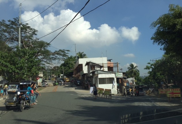
 Pinagmisahan used to be a narrow 2-lane road. It has been expanded recently into a 4-lane road with Portland Cement Concrete Pavement (PCCP).
 While the expansion included the construction of sidewalks, many electric posts remain in their original positions and pose safety hazards to motorists.
 White Cross, which is a popular destination during the Lenten Season and especially during the Holy Week is accessible via this road.
 There appears to be many informal settlers living in communities along the road. They have encroached on the RROW and hamper the completion of the expansion of the road.
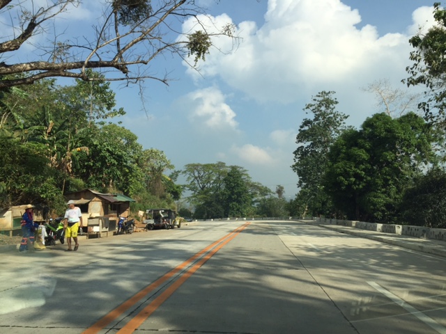 I think this part of the road is practically the highest in terms of elevation. There should be a good view of the surrounding areas including the city center and Hinulugang Taktak from this area.
 Another section of Pinagmisahan showing informal settlers
 Curved downward section towards Daang Bakal and Taktak Road – the fence on the left is for Fairmont Subdivision.
 Straight section approaching Daang Bakal
 Approach to intersection with Daang Bakal – the other lanes of the road is used as parking for visitors of Hinulugang Taktak
 Daang Bakal with Hinulugang Taktak on the left
I’m featuring Pinagmisahan here as I thought its timely given a lot of people will be using it this Holy Week to go to White Cross, which has life-size images for the Stations of the Cross.
–
