
Home » Motorcycles (Page 7)
Category Archives: Motorcycles
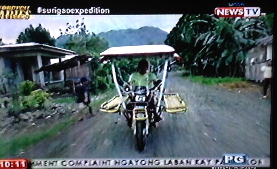
Habal-habal ambulance
I came across a documentary one late night after watching the news on GMA’s Channel 11. Motorcycle Diaries featured an episode on Surigao and a segment was devoted to habal-habal, those ubiquitous motorcycle taxis that are popular in the rural areas but are also found in many cities around the country. What caught my attention was not really the habal-habal itself (I’ve seen many other features in the past about these taxis.) but the use of the same for a purpose other than public transport. A habal-habal was fitted for use as an ambulance by a community in Surigao to transport people needing medical treatment to the nearest hospital. All photos below were taken from the television screen.
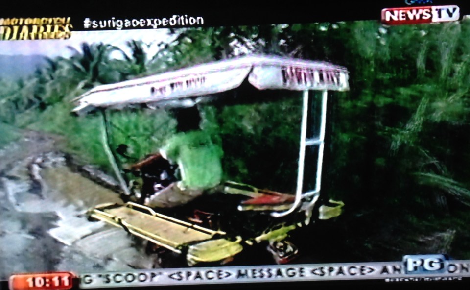
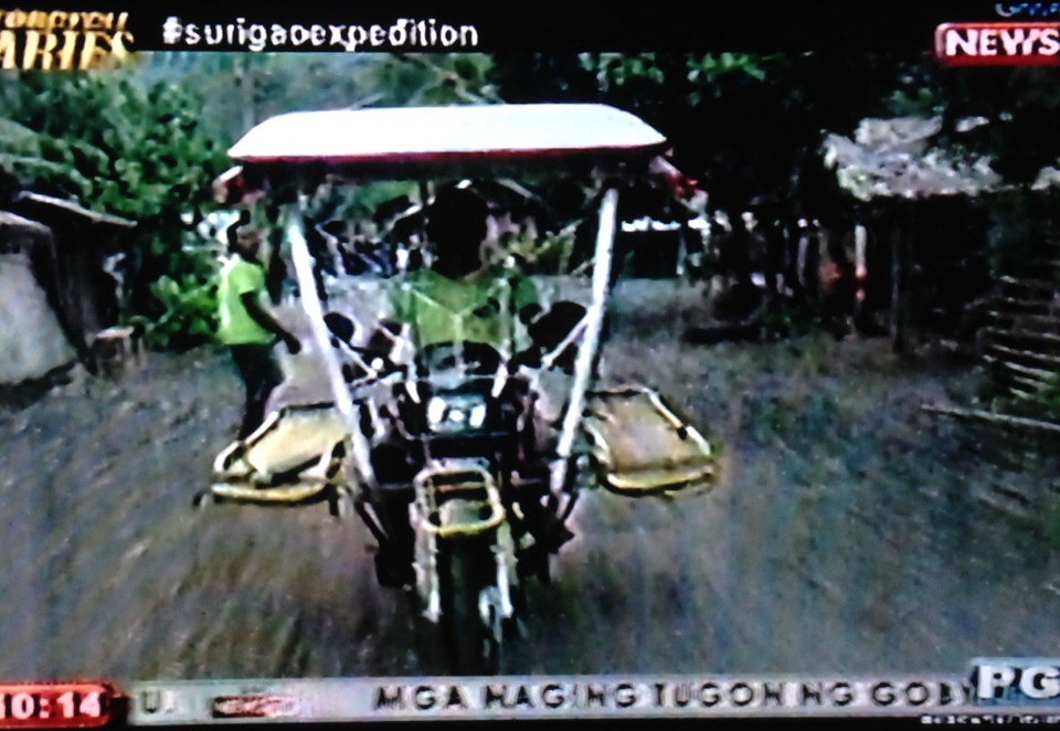 Unlike other habal-habal, this one has a roof and two planks on either side where patients lie down for transport. While I’ve seen habal-habals in Leyte and Samar that have roofs, the planks are more “skylab” than the typical habal-habal. “Skylab” is a term coined for the shape of motorcycle taxis with a plank installed perpendicular to its body. Passengers seated on the plank have to be balanced by the rider/driver.
 All terrain – the habal-habal is popular in rural areas as it can operate on bad roads, trails, no roads and even cross rivers and streams.
 The documentary also had interviews with the owner and driver of the motorcycle ambulance.
 Rough roads, typical of municipal and farm to market roads, do not deter haba-habal operations.
 Rural roads are a big challenge given the conditions like these huge holes filled with water. I’ve seen roads like this that are like rivers or streams during the rainy season.
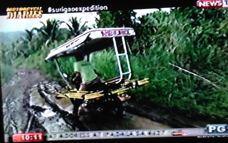 Travel is quite treacherous along these roads and I can only imagine how difficult it would be to transport a patient on a motorcycle ambulance. The risks are quite high that there can be a mishap along the way that could result in not only serious injuries but death.
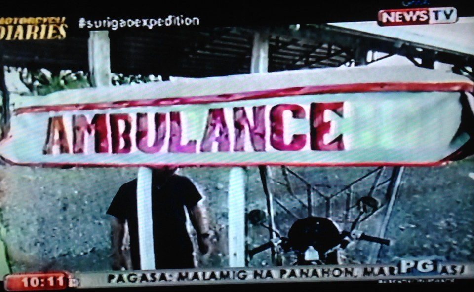 The sign makes it unmistakable for what the vehicle is for.
 The ride is a balancing act and the driver should be highly skilled for the task.
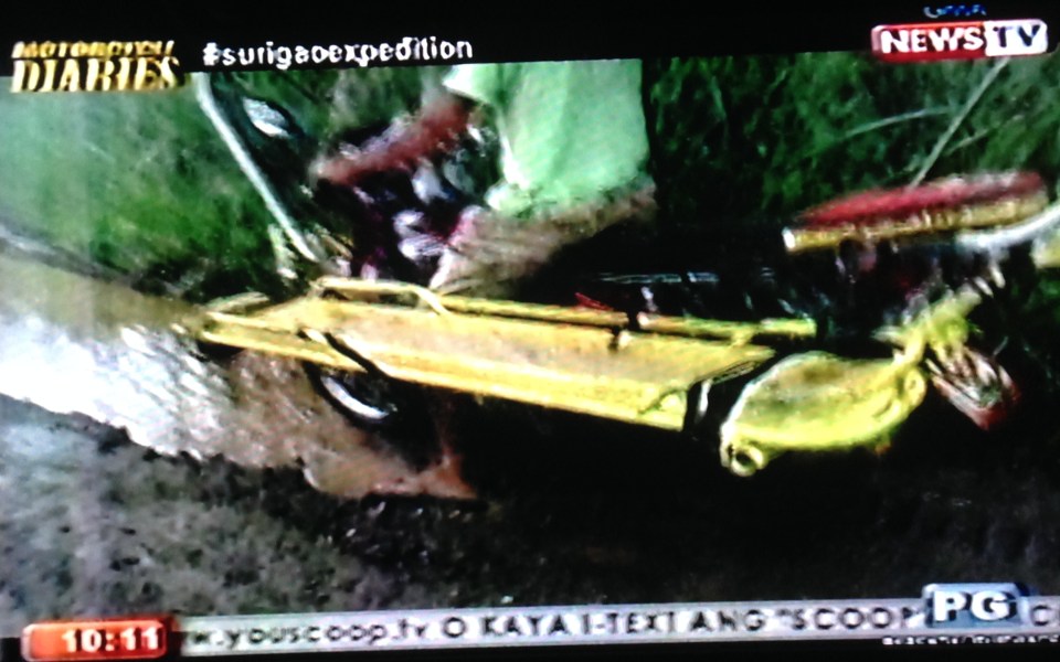 Patients or people needing medical attention are made to lie down on one of these cots on either side of the habal-habal. There are what looks like straps to secure the person. I assume that another person or weight should be placed on the other cot for balance. Likely, another person will ride behind the driver to care for the patient(s).
Such vehicles used for emergency are fitted out of necessity for these communities. As shown in the photos, the roads connecting these communities to the municipal or city centers are unpaved and conditions can be quite bad during the rainy season. It is clear that many such roads need to be paved so that they can be used under all weather conditions. Paving the roads also makes them usable by regular vehicles such as your typical ambulances. It makes me angry to see many such ambulances in Metro Manila being used for personal travel while communities in dire need of emergency vehicles can only improvise with the habal-habal to get people to hospitals.
It’s a shame that our government can spend a lot or engage the private sector in major projects while hundreds or even thousands of communities remain under-served for basic needs including access to schools, hospitals and workplaces. These are not even the typical farm-to-market roads but appears to be municipal, city or provincial roads. The fruits of economic development will not trickle down or cannot be felt in these areas if transport facilities cannot be upgraded. These are requirements for inclusive growth that government should address – and with urgency.
–
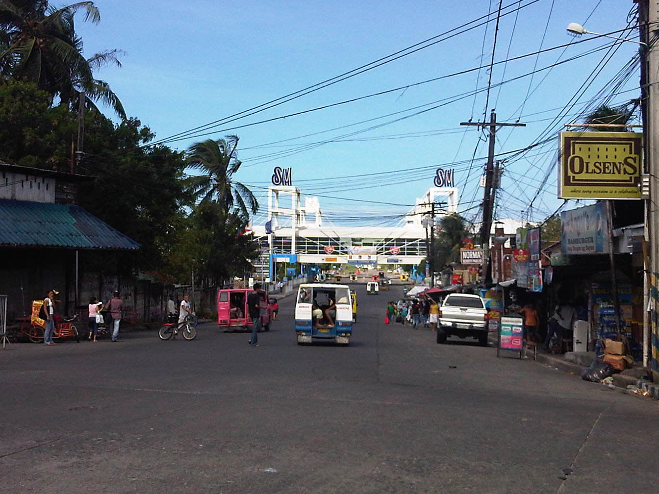
Tricycles in the Philippines – Part 2
In a previous post on tricycles, I featured some photos taken from various trips I’ve taken around the country. Closer to home are tricycles that provide some convenience to commuters along a stretch of C-5 that is more commonly known as Katipunan Avenue. The example below is of a typical tricycle traveling along a section that cuts through lands of the University of the Philippines Diliman.
 Tricycle along Katipunan Avenue
Tricycles do not necessarily just roam around to get passengers like what we usually see. They do have formal terminals though the informal ones outnumber these and typically cause problems due to the spaces they tend to occupy. These spaces include road space, the consequence of which is a reduction in road capacity, and sidewalks, which deny pedestrians space for walking. The first causes or exacerbates congestion while the second mainly puts people at higher risk as pedestrian safety is compromised. Following are photos of tricycle terminals taken from recent trips north of Manila in the provinces of Tarlac, Pangasinan and La Union.
 Tricycle terminal at the Moncada Public Market
 Tricycles still dominate traffic along the Manila North Road in Urdaneta, Pangasinan where they have terminals around the public market and at the intersections of side streets.
 Roadside tricycle terminal in La Union where the newly paved shoulders are occupied by tricycles waiting for passengers from a nearby public school.
 Tricycle terminal in front of the Civic Center in Agoo, La Union and just across the church.
More on tricycles and their terminals in succeeding posts!
–
Tricycles in the Philippines – Part 1
We start the “ber” months strong with an initial feature on an ubiquitous mode of transport in the Philippines. While the jeepney seems to have had most of the attention when the subject of public transport in the Philippines is discussed, the truth is that there is arguably another, more dominant mode of public transport in the country. These are the tricycles, a motorized three-wheeler consisting of a motorcycle and a sidecar. You see these everywhere around the country in most cities and municipalities where they thrive particularly in residential areas. They are usually the only mode of public transport for most people in rural areas where local roads are typically narrow. In many cases the only roads connecting communities may be national roads. And so, there is really no other choice for tricycles but to travel along national roads and against existing laws prohibiting tricycles from these roads.
 Tricycle along the motorcycle lane of Circumferential Road 5
 Tricycles racing along the Olongapo-Castillejos Road in Zambales
 Tricycle along Romulo Highway, Tarlac
 Tricycles along Catolico Avenue in Gen. Santos City
Unlike buses and jeepneys, tricycles are not regulated under the Land Transportation Franchising and Regulatory Board (LTFRB). Instead, they are under the local government units that through one office or another issue the equivalent of franchises for tricycles to operate legally. Fares are quite variable but are usually according to distance though there are special rates for when passengers want to have the vehicle for themselves much like a taxi.
Unfortunately, few LGUs have the capacity to determine the optimum number of tricycles for service areas under their jurisdictions. As tricycle operations are often the source of livelihood for many, the granting of franchises is often seen as a way for mayors to have influence over people who would have “utang na loob” (debt of gratitude) for being granted franchises. The tendency, therefore, is to have too many tricycles as mayors try to accommodate more applicants who seem to have no other options to earn income or to invest in. This poses a challenge to many who want to reform the system and modernize or upgrade public transport in cities around the country.
–
Swapang! or the perils of walking
Walking to the jeepney terminal for a ride to the university, I was irritated by the constant honking behind me as motorcycles rode up the sidewalk to avoid the weaving into congested traffic along Aurora Boulevard. And so I tried to stand my ground allowing only half the space of the sidewalk for these motorcycles to pass through. As far as I’m concerned, I was already too generous giving part of the space that is for pedestrians and not for motorized traffic. Still, there were a few motorcyclists who seem to think they had the right of way as they attempted to convince me give up more space so they could practically take over the sidewalk. I didn’t give way and assumed they were cursing me inside their helmets. Manigas sila! I thought that in the end, sila ang asar at talo in this situation, not me.
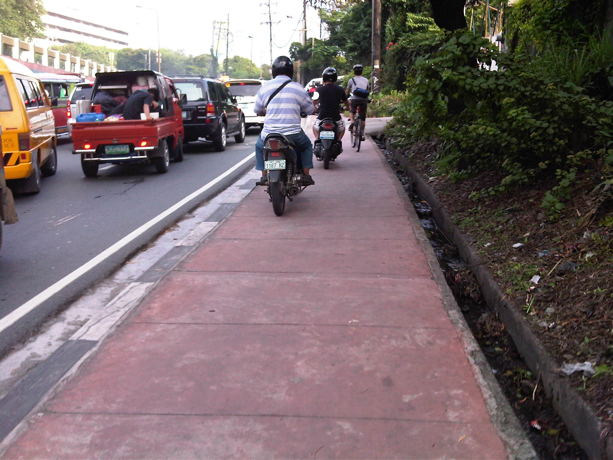 Motorcycles dominating space for pedestrians
At one point, I held my ground and didn’t give way to the motorcycles behind me [Advisory: This is not for everyone especially those who are “pikon” or who are looking for a fight.]. I knew my rights and I was walking on the pedestrian sidewalk. Unfortunately, a bicycle came along and I gave way only because I also appreciated cycling and understood that pedestrians and cyclists are sort of “kindred spirits” in a world dominated by motorized transport. The bicycle was immediately followed by two motorcycles including one that almost sideswiped the cyclist. I took the photo above to better show the situation.
The other day, I chanced upon a similar situation as I was driving in heavy traffic along Amang Rodriguez in Pasig City. What little space was available for pedestrians along a narrow sidewalk along this road connecting Marikina and Pasig cities.
 Motorcycles using a narrow pedestrian sidewalk to avoid traffic congestion along Amang Rodriguez
These cases are clear examples of swapang attitude or behavior that is prevalent among many road users. Unfortunately, these are not apprehended or accosted by traffic enforcers. The latter seem to be more engrossed with number coding and swerving violations, anyway, that they seem to have forgotten all the other traffic violations that included this brazen behavior of motorcyclists. Perhaps enforcers should go back to the basics and take more notice of all those other violations (e.g., speeding, counter flowing, beating the red light, beating the green light, etc.) to improve and promote discipline on our roads.
–
The Streets of Bacolod: Around the Public Plaza
The streets surrounding the Bacolod Public Plaza are one-way streets following a counter-clockwise circulation around the plaza. Typical of plazas of old, the latter has around it the church (in this case San Sebastian Cathedral), the old city hall, commercial establishments, the police headquarters, and a major school (La Consolacion College). The following photos were actually taken a year ago in February 2012. I doubt if much has changed since then but the circulation and traffic situation should practically be the same give and take the normal traffic growth due to progress for the capital city of Negros Occidental.
 Intersection of San Juan St. and Gonzaga St. (view along San Juan St. towards southwest)
 Intersection of San Juan St. and Luzuriaga St. (view from east corner of intersection towards Westown Hotel)
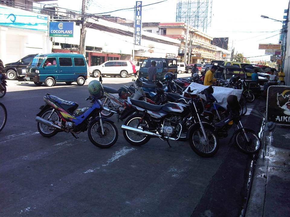 Roadside parking along San Juan St. Noticeable above are the motorcycle parked along the road, with some occupying pedestrian crossing space.
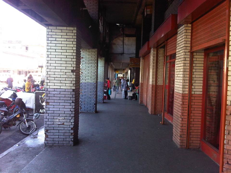 Old cities like Bacolod have buildings featuring arcades like this where pedestrians have the ROW and are sheltered from the elements. I was glad to see that the city basically cleared these facilities from obstacles. It is not entirely without impediments though as shown in the photo.
 Luzuriaga Street (view towards southeast)
 Arcade of Plaza Mart building along Gonzaga Street and across from the Bacolod Public Plaza (view towards Araneta Ave. and Gatuslao Street)
 Another view of the arcade of Plaza Mart, this time along San Juan Street (towards Luzuriaga St.)
 San Juan Street (view from the corner at Gonzaga Street) – at right is the Plaza
 Gonzaga Street (view at corner of the Plaza along San Juan Street) – vehicles downstream are at the intersection of Gonzaga St. and Araneta Ave. Further downstream is Gatuslao Street
 Rizal Street taken from the plaza side and featuring San Sebastian Cathedral
 Rizal Street leads to SM City Bacolod, which is found in the reclamation area. (View from the intersection of Rizal St. with San Juan Street)
 Steel barriers along Rizal Street prevent vehicles crossing the street from the northeast side of San Juan St. All traffic must turn right towards SM. (view from the corner of San Juan and Rizal along San Juan towards the southwest direction) The PNP headquarters is the building on the opposite corner with the blue roof.
 Intersection of San Juan Street and Luzuriaga Street (view along San Juan St. towards southwest)
 San Juan-Luzuriaga intersection (view from Westown Hotel corner)
 San Juan-Luzuriaga intersection (view along Luzuriaga St. towards southeast)
 Luzuriaga Street is also a one-way street and with significant roadside parking as shown in the left side of the photo. View of traffic coming from the intersection with San Juan St. Westown Hotel is the building at left.
The circulation scheme at the plaza seems to be working out well at the time. This is despite the proliferation of roadside parking along the streets and around the plaza. The streets are relatively wide and so a one-way scheme works well in terms of taking advantage of the capacities of the streets while allowing for curbside parking that typically occupies one lane of road space as shown in the photos above. We didn’t see anyone charging parking fees for the vehicles and so we assume that these are practically free though we did see some informal “watch-your-car” boys who rely on tips from those parking along the road. Ultimately, though, the city should look into the provision off-street parking facilities as I can imagine traffic congestion, for example, in the vicinity of San Sebastian Cathedral on Sundays. Traffic in the area should be expected to increase as the city continues to experience economic growth and more developments ultimately locate at the reclamation area.
–
Transport gaps
I first learned about the concept back in the 1990’s when I was a graduate student at UP majoring in transportation engineering. The concept on transport gaps was first mentioned in a lecture by a visiting Japanese professor as he was discussing about transport modes, particularly on which was suitable or preferable over certain travel distances and which could carry more passengers. Another time later and while in Japan, I heard about the concept during a presentation of a friend of his technical paper on public transport.
The figure below is one of many possible illustrations of the concept of transport gaps. In the figure, a distinction is made for mass transport and individual transport. As the original figure is likely taken from a textbook or a paper (probably from Japan), shown with a white background are the more conventional modes of transport including subways, urban and suburban railways, walking and a mention of the shinkansen (more popularly known as the bullet train). With a gray background in the original figure is a category on new urban transit systems that include monorails, AGTs and LRTs. If we attempt to qualify local transport modes such as jeepneys, UV Express, tricycles and pedicabs into the graph, the outcome can be like what is illustrated with different color backgrounds in the figure below.

The concept of transport gaps allow us to visualize which modes are suitable for certain conditions where other established modes of transport may not be available or viable. In the original figure, the gap in Japan is filled by new urban transit systems. In our case, gaps are filled by so-called indigenous transport modes such as jeepneys, multicabs, tricycles, pedicabs and even habal-habal (motorcycle taxis).
There are gaps in the Philippine case probably and partly because of the slow development of public transport systems such as the mass transport modes shown in the preceding figure. There was a significant gap right after World War 2 when the tranvia and other railways were destroyed during the war. That gap was filled by the jeepney. There was also a gap in the early 1990’s that was eventually filled by FX taxis. Such gaps can obviously be filled by more efficient modes of transport but intervention by regulating agencies would be required and rationalizing transport services can only be addressed with the provision of mass transport options complemented by facilities for walking and cycling that will complement these modes.
–
Some thoughts on transport and traffic while commuting between Cainta and Antipolo
Commuting from the Ortigas (Cainta) end of Imelda Ave. to its other end at Marcos Highway (near where Pasig, Marikina, Cainta and Antipolo meet), one should be able to observe and make a quick assessment of the positives and negatives of our local transport system. While there are more negatives at Cainta Junction and along Imelda Avenue, Marcos Highway definitely has improved particularly in terms of walkability. It is a commute that I have taken so many times since my childhood days and I can only now remember times when one could walk safely from one end to the other when there were far less vehicles than the volume that flows along Imelda Ave. these days.
Junction is still quite the mess despite some road widening at the intersection owing to various factors including the fact that the intersection simply cannot handle the volume of vehicles using it even after the elimination of some turning movements from Ortigas Ave. in favor of U-turns particularly for traffic coming from the eastbound side of Ortigas. It seems the traffic signal settings can no longer handle peak period traffic and manual traffic management probably aggravates the situation especially when enforcers employ the buhos technique of trying to dissipate as much of the queued vehicles per approach or movement. The latter technique does not take into consideration that the longer a movement or group of movements are allowed to move, there are corresponding build-ups in traffic along all other approaches. It is a vicious cycle (pun intended) that is supposed to be addressed by an optimally times signal system. Saturated conditions, though, are inevitable due to the sheer volume of vehicles using the intersection given that Junction is a catchment for vehicles from Rizal Province that ultimately uses Ortigas Ave. to head into Metro Manila in the mornings. The reverse is true in the afternoon to evening periods.
Imelda Avenue, which was also known for a time as Francisco Felix Ave., is plagued congestion due to notoriously bad pavement conditions, so many median openings, and high vehicle trip generation rates from the many residential subdivisions or village along the road. The pavement conditions are due mainly to damage brought about by trucks and, during the wet season, frequent flooding along many sections of the avenue. Bad pavement conditions and flooded streets significantly slow down traffic as Imelda Ave only has two lanes along each direction and is divided by a narrow median island that’s just enough for a few plant boxes and lamp posts.
There are mostly middle class subdivisions including the large Vista Verde, Village East, Karangalan, and Pasig and Cainta Green Parks along the road. There is also a DMCI medium rise development has its main access road also connecting to Imelda Ave. These villages generate much vehicle traffic and each have their own median openings that practically function as intersections along the entire stretch of the avenue. These openings create a lot of conflict between through traffic and vehicles entering and exiting the villages, especially those taking left turns to or from their gates.
While there are commercial establishments along the avenue, most were small and traffic generation characteristics were not so significant as to cause severe congestion. The first major generator in the middle of the avenue was a branch of the membership-concept Makro supermarket cum depot. Makro generated significant traffic but did not cause much congestion along the stretch in front of the Village East gate. It was eventually acquired by commercial giant SM and the branch is now an SM Supercenter that seems to be generating much more traffic than Makro did at its peak. While traffic studies are usually the norm before such developments are constructed given the trips attracted by SM, the congestion experienced along Imelda Ave has been reported to be generally un-managed despite the need for more disciplined loading and unloading by public transport, pedestrian movements and vehicle entries and exits.
Jeepneys are the main public transport mode along Imelda Ave. although there are tricycles serving the various subdivisions that often not only cross the road but also travel along Imelda Ave. for short distances. I remember in the 1970’s and early 80’s that the tricycles used to be the primary mode of transport from Junction and the Cainta Public Market as Imelda was not yet connected to the still to be completed and unpaved Marcos Highway. There was even a Metro Manila Transit Corp. bus service (probably missionary route and with low frequency of service) along Imelda Ave. that turned around near Kasibulan Village, one of the first subdivisions in the area. Many jeepneys are noticeably the patok or popular type known for their loud stereos and reckless driving. Still, there are the smaller, older jeepneys whose route connects either ends of Imelda Avenue. Most patok jeepneys are from the many longer routes between Rizal towns and Cubao overlapping along Imelda Ave (e.g., Angono-Cubao, Antipolo-Cubao, Binangonan-Cubao, Taytay-Cubao, etc.).
–
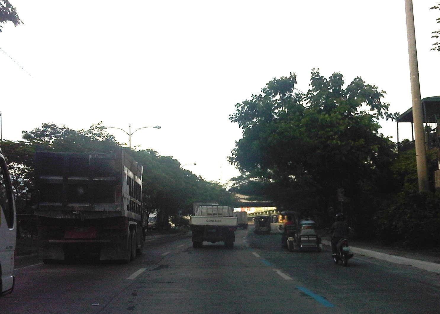
Sumulong Highway: Marikina to Masinag
Sumulong Highway stretches from its intersection with A. Tuazon Ave. and A. Bonifacio Ave. in Marikina City, Metro Manila to the intersection with the Taktak Road or M.L. Quezon Ave. in Antipolo City in the Province of Rizal. It serves both as an arterial (for Marikina and Antipolo) and a feeder (with respect to Marcos Highway).
The following photos show the stretch from Marikina to Masinag that shows typical conditions along the highway. These conditions are quite different from those along the stretch from Masinag to Taktak Road in upper Antipolo City.
 Sumulong Highway has a total of 4 lanes (2 per direction) but a lack of pavement markings make it difficult to ascertain the center of the road and the space allocation for traffic. This makes travel less safe as motorists assume they are traveling along the correct space on the road.
 The asphalt-surfaced road has no lane markings but has very good pavement conditions. There is also significant on-street parking as most establishments along the highway have no adequate off-street parking spaces. The section shown above is right in front of a sabungan or coliseum for cockfights.
 There are pedestrian crossings though, near intersections and where there are schools along the highway.
 Only the traffic lanes have asphalt overlay, the shoulders have the concrete surface exposed thereby distinguishing them from the traveled way.
 The shoulders are used as parking spaces for establishments along the highway as shown in the photo. Such practices are also common along national highways around the country.
 Even the barangay hall of Bgy. Mayamot utilizes road space for parking as shown in the left. The Mayamot Barangay Hall is see on the left in the photo. This effectively reduces road capacity leading to traffic slowing down at such sections.
 Another pedestrian crossing, this time in front of a public school right after the barangay hall.
 Some sections have sidewalks for people to walk along but these are also usually blocked or occupied by stuff from the establishments along the street.
 Waiting shed along the highway. I could not say its typical because the more recent ones usually have names or initials of politicians on them. This shed is likely to be old and uses clay tiles for roofing.
 There are also tricycles along the road due to the sidestreets and subdivision entrances connecting to the highway. Public utility tricycles are supposed to be prohibited from using national roads but are common in most provincial areas and CBDs where they are the main mode of transport. In this case, tricycles should be prohibited from using the highway as they are already competing with jeepneys, serving larger areas aside from what should be individual subdivisions or residential districts.
 There are many auto repair and supply shops along this stretch of Sumulong Highway. Such shops typically have many customers who also park along the highway, often occupying road space and causing congestion.
 Approaching the Masinag junction, which is the intersection of Marcos and Sumulong Highways, one sees more commercial establishments on either side, mostly small stores or shops. At the junction is the Masinag Wet Market, which is now in decline after major commercial developments have been constructed in the area including the most recent SM City Masinag.
 Steel barriers placed along the center of the highway to discourage jaywalking – some barriers have been moved by pedestrians to create space for illegal (and risky) crossings such as what is seen just downstream in the middle of the photo (notice the person with the red umbrella?).
 Barriers forcing all traffic to turn right to Marcos Highway – seen across is the approach of Sumulong Highway from Antipolo
Portions of this section of Sumulong Highway are prone to flooding including the intersection with V.V. Soliven Avenue, which leads to SSS Village and other subdivisions. The more recent floodings were due to the heavy monsoon rains from a couple of weeks ago that effectively isolated residential areas in Marikina and Antipolo as vehicles could not exit the subdivisions to major roads like Sumulong and Marcos Highways. It’s quite interesting to note that the drainage systems along these roads including Sumulong have not been upgraded to be able to accommodate run-off from what is turning to be heavier rains due to climate change. Thus, it may be expected that the same sections will be flooded should there be heavy rains particularly due to typhoons and other major weather systems affecting Metro Manila and its environs.
–
San Fernando, Pampanga Poblacion
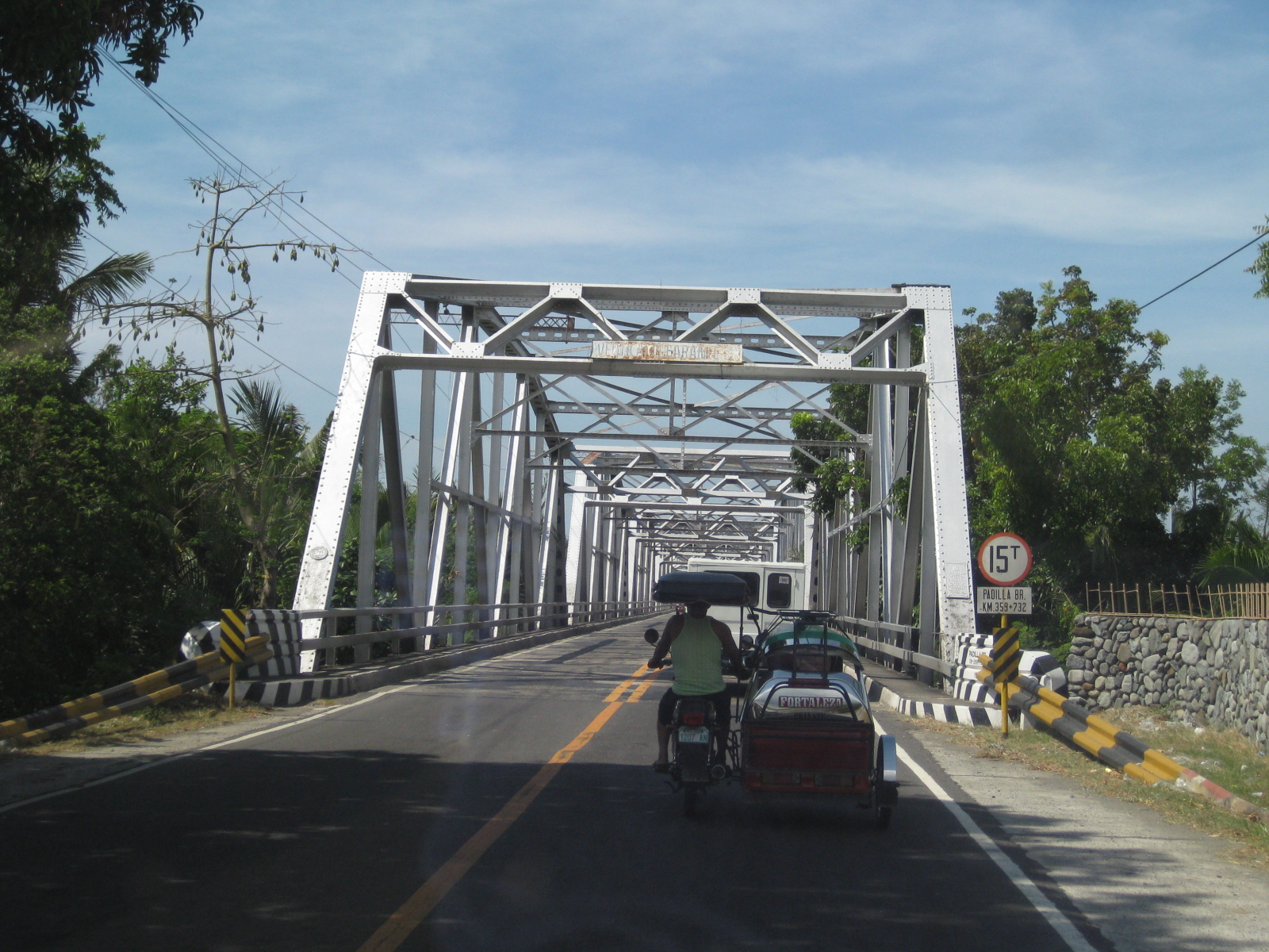
I had the opportunity to do a project in San Fernando, Pampanga and went around the poblacion taking photos showing transport and traffic conditions in the old city center. To many travelers, perhaps the San Fernando they know is associated with what they see along the Gapan-San Fernando-Olongapo Road (also known as Jose Abad Santos Ave along this stretch in the city) after exiting the NLEX. There is much commercial development along the stretch of the highway between NLEX and McArthur Highway and of course, around the exit itself as mall giants SM and Robinsons have branches there. The “real” San Fernando is located only a few kilometers south from GSO via McArthur and the poblacion reveals a lot about the heritage or old character of the city and perhaps its potential for restoration as an example of urban development during the Spanish times.
Following are a collection of photographs from field work that we did in the city. We took a walk around the principal roads including McArthur, Tiomico, Consunji, Gen. Hizon., Abad Santos and Limjoco. Tiomico eventually becomes the Capitol Blvd. as it leads to the provincial capitol complex while Consunji becomes Sto. Nino Viejo when traversed westbound. The latter becomes Lazatin Blvd, which crosses GSO towards the north. Gen. Hizon appears to be the original alignment of the Manila North Road (McArthur), which passed through the heart of the city. Sometime in the not so distant past, a bypass road was constructed as traffic became constricted in the poblacion and many travelers not bound for San Fernando were inconvenienced by the congestion. This is clear from the maps of the area.
 Poblacion preview – The San Fernando cathedral as seen from the approach of the bridge along Gen. Hizon Ave. The bridge itself appears to be an old one. It is a two-lane structure and its lamp posts reminded me of a similar bridge in Melaka, Malaysia I saw only this year.
 The cathedral as seen from the bridge – the junction immediately after the bridge is Gen. Hizon’s intersection with Consunji Ave. The latter is one way eastbound so left turns are prohibited at the junction. Vehicles may go through towards Tiomico (the next junction right after the cathedral) or right where travelers will immediately see city hall on the right side of the road and just across from the cathedral; the typical set-up of most old towns in the Philippines.
 Gen. Hizon Ave. towards Tiomico – the commercial establishments around the cathedral are very similar to those you would in many other old cities and towns around the country. Pedestrians are supposed to take the arcade sidewalks just in front of the ground floors of the buildings on the left and underneath their second floors. These seem to be blocked by merchandise or stalls so some pedestrians take the street instead. The photo also shows typical on-street parking in the poblacion.
 Pedestrian flow – the photo shows pedestrians crossing Gen. Hizon from the commercial establishments on the left towards the cathedral. The photo also shows people using the walkways integrated with the buildings (arcade), providing shelters against the elements, in this case the scorching sun.
 Rotonda? – at what seems to be the end of Gen. Hizon is a curious set-up which functions as a rotonda. Tiomico is also a one way street (westbound) and there is another intersection just ahead in the photo after turning right from Gen. Hizon.
 Off-set intersection – Gen. Hizon actually continues as B. Mendoza Ave. (which eventually leads to a junction with McArthur to the north) from the junction that is identified by the 7-Eleven on one of its corners that is visible in the photo. The public market is just across from the building housing the convenience store.
 City hall – the building is just across from the cathedral and the parking problems in the city are clear from this photo alone. City halls generate a lot of traffic due to the transactions, meetings and other activities associated with the institution. On weekdays, most parking in front of the building and across at the cathedral are probably by people with business at city hall. During Sundays, parking would be for church-goers.
 Walkways – the arcade/pedestrian walkways I were referring to earlier are much like the one shown in the left of the photo in front of a shoe store. The set-up allows for pedestrians to be shielded from the elements as they should be able to walk comfortably without getting wet during the rainy season or exposed directly to the sun during the summer. The street on the right is Consunji and leads to the public market, part of which is just behind the yellow building.
 Jose Abad Santos Street – the stretch was closed to motor vehicles at the time we walked around the poblacion. There was a sports event at the time and the street was being used for races – note the writing along the zebra crossing indicating the starting line for the race.
 Consunji by the market – the one-way street is lined with commercial establishments and part of the street is used as parking, a common problem in other poblacions in similar cities.
 Prohibition? – this is Tiomico Street in the public market area. The sign on the lower left says 3-wheelers are not allowed along this stretch of the street and yet we found most of the vehicles to be exactly what is supposed to be prohibited – tricycles and pedicabs. The stretch could have been nice if it were developed into a pedestrian street instead with limited access to motor vehicles (perhaps for deliveries only?) much like those market streets in Japan.
 Typical mayhem – further down the street is a mix of people, bicycles, pedicabs, tricycles, and other motor vehicles. There’s potential here for re-development or transformation that would enable the revival of this commercial district that includes the public market.
 Blast from the past – aside from the typical tricycles and pedicabs providing for local public transport, we were a bit surprised that there were still calesas, or two-wheelers pulled by horses. At the time (2010), the kutseros or drivers charged PhP 10 to 20 (about 20 to 50 US cents) per passenger depending on the destination. These calesas are all registered with the local government, and they have license plates indicating their registration.
 Queue – most of the horses pulling the calesas looked healthy enough and well-cared for. The kutseros were kind enough to answer our inquiries about their operations. I think the city should carefully consider how to take advantage of its heritage/character to promote sustainable transport including walking, NMT and the calesas for moving around the poblacion and its immediate environs.
 Two-seaters – the passenger capacity for the calesas is two. To address the poop issue, there is a contraption just behind the horse and hanging under the carriage that catches dung and prevents it from being spilled unto the roads. I assume these are disposed of properly.
 Alternative design – the pedicabs in San Fernando are different from the conventional ones we see in other cities or towns. Noticeable from the photo is that this is not your regular bicycle with a sidecar set-up. These are fabricated 3-wheelers that seem to be sleeker if not more stable than the usual pedicabs we’ve seen.
 Tiomico Street – just after Gen. Hizon, one gets an idea of the challenges for transport and traffic in San Fernando. The one-way street has no pavement markings, obstructed signs (if any at all), no pedestrian sidewalks and vehicles each doing their own thing along the road (e.g., motorcycle zigzagging through traffic, jeepneys stopping anywhere, etc.).
 Walkability – people generally walk along the carriageway, as shown in the photo, due to a lack of proper facilities like sidewalks. Though there are remnants of zebra crossings, people also generally cross anywhere and so contribute to the mayhem along the streets. There was a proposal for a pedestrian overpass but such is so inappropriate given the narrow streets. No one will use such an overpass as it would be more an inconvenience to pedestrians. A more appropriate treatment would probably be traffic calming or other approaches that would prioritize pedestrians over motor vehicles in the poblacion area. The lot where jeepney terminal mentioned on the left side of the photo is now an SM mall.
 Hazards – the relocation of electric poles seem to have been an afterthought when they re-paved Tiomico. These are not easily seen at night and could lead to crashes should vehicles miscalculate their locations. The road drainage may be found beneath concrete covers on either side of the road such as those along which the people in the photo are walking over. These are supposed to be easier to maintain as crews can just lift the covers to remove blocks such as garbage.
 Traffic mix – I like this photo because it shows almost all modes of transport operating in the poblacion: calesas, pedicabs, bicycles, motorcycles, and jeepneys. Its a good thing trucks are banned from using these roads. Otherwise, traffic would be worse.
 Junction – approach to the junction of Tiomico, Lazatin Street (left) and Capitol Boulevard (right). There were no signs to indicate the approach to the intersection as well as for traffic control (e.g., stop or yield signs). There are also no pavement markings.
 Capitol – the photo shows vehicles approaching from Capitol Boulevard, which comprise generous (wide) two lanes. Sidewalks were on either side of the boulevard except where there were driveways and parking spaces.
 Junction – approach to the junction of Lazatin St., Consunji Street (left) and Sto. Nino Viejo Road (right). Again, there are no signs and pavement markings are already weathered.
 Old bridge – there is a short, old bridge just after the junction. The bridge is over a creek connecting to the main river and has 4 lamp posts that are similar to the main bridge along Gen. Hizon, and perhaps the inspiration for the lamp posts along Consunji Street.
 Consunji Street – is also a two-lane, one way street. Some sections have pedestrian facilities like the sidewalk on the left. The pavement markings were already weathered but still visible during the daytime. There are also less electric poles along this street and the lamp posts are appropriate in design.
 Heritage House – the structure on the left is an ancestral house, of which there are many in the province of Pampanga and especially around San Fernando, which is one of the oldest towns in the province.
 Recognition – the marker by the National Historical Institute recognizes the structure as a Heritage House. The smaller plaque provides a description of the house and those who lived or used it, highlighting its significance. There are other heritage houses as well as old houses that have not been given such a distinction (family not prominent enough?) but which deserve preservation.
 Future and present site – this lot was being used by jeepneys as their terminal at the time of our field work. The lot is bounded by Tiomico St. in the northwest and Consunji St. in the southeast, and is where the recently opened SM City San Fernando is situated.
 Approach from Consunji – there are no pavement markings (yellow box) defining the intersection and no signs to help in traffic control.
–
North EDSA
Heading to Tutuban for our technical visit of the Philippine National Railways, we passed along the north segment of EDSA from its junction with North Avenue in Quezon City to 8th Street in Caloocan City. Following are photos showing the overhead LRT 1, the motorcycle lane, U-turn slots and various buildings adjacent to EDSA.
 EDSA – North Avenue junction – the blue lane markings designate the motorcycle lane along EDSA. SMDI’s Grass Residences can be seen behind the mall.
 Section in front of SM North EDSA – the bus stop beneath the SM Sky Garden is on the right of the photo
 Section after SM North – the green building is Quezon City Academy
 Section in the vicinity of Roosevelt Ave./Congressional Ave.
 Section between Corregidor St. and Roosevelt Ave./Congressional Ave.
 LRT 1 Extension Roosevelt Station
 Section after Roosevelt Ave./Congressional Ave. before Fema Road
 Section approaching Home Depot and Kaingin Road junction
 Section across from Shell Station right after Wilcon Builders Depot
 Section across from Hyundai dealer right after Shell station
 Section approaching Balintawak LRT Station
 Section along Munoz Market (note the cart full of vegetables on the right in the photo)
 Exit ramp to NLEX at the Balintawak interchange (cloverleaf)
 Section of EDSA on top of NLEX (Balintawak interchange)
 Section right right after the interchange – vehicles on the rightmost lane are those coming from NLEX southbound and coming on to EDSA northbound
 Section after Toyota Balintawak and Gen. Evangelista, and approaching Gen. Mascardo
 Section approaching 8th Street U-turn slot after Mariano Ponce
 Vehicles stopped at intersection/U-turn slot to allow vehicles turning left from EDSA northbound to 8th Street
–
