
Home » Motorcycles (Page 8)
Category Archives: Motorcycles
San Fernando, Pampanga Poblacion
I had the opportunity to do a project in San Fernando, Pampanga and went around the poblacion taking photos showing transport and traffic conditions in the old city center. To many travelers, perhaps the San Fernando they know is associated with what they see along the Gapan-San Fernando-Olongapo Road (also known as Jose Abad Santos Ave along this stretch in the city) after exiting the NLEX. There is much commercial development along the stretch of the highway between NLEX and McArthur Highway and of course, around the exit itself as mall giants SM and Robinsons have branches there. The “real” San Fernando is located only a few kilometers south from GSO via McArthur and the poblacion reveals a lot about the heritage or old character of the city and perhaps its potential for restoration as an example of urban development during the Spanish times.
Following are a collection of photographs from field work that we did in the city. We took a walk around the principal roads including McArthur, Tiomico, Consunji, Gen. Hizon., Abad Santos and Limjoco. Tiomico eventually becomes the Capitol Blvd. as it leads to the provincial capitol complex while Consunji becomes Sto. Nino Viejo when traversed westbound. The latter becomes Lazatin Blvd, which crosses GSO towards the north. Gen. Hizon appears to be the original alignment of the Manila North Road (McArthur), which passed through the heart of the city. Sometime in the not so distant past, a bypass road was constructed as traffic became constricted in the poblacion and many travelers not bound for San Fernando were inconvenienced by the congestion. This is clear from the maps of the area.
 Poblacion preview – The San Fernando cathedral as seen from the approach of the bridge along Gen. Hizon Ave. The bridge itself appears to be an old one. It is a two-lane structure and its lamp posts reminded me of a similar bridge in Melaka, Malaysia I saw only this year.
 The cathedral as seen from the bridge – the junction immediately after the bridge is Gen. Hizon’s intersection with Consunji Ave. The latter is one way eastbound so left turns are prohibited at the junction. Vehicles may go through towards Tiomico (the next junction right after the cathedral) or right where travelers will immediately see city hall on the right side of the road and just across from the cathedral; the typical set-up of most old towns in the Philippines.
 Gen. Hizon Ave. towards Tiomico – the commercial establishments around the cathedral are very similar to those you would in many other old cities and towns around the country. Pedestrians are supposed to take the arcade sidewalks just in front of the ground floors of the buildings on the left and underneath their second floors. These seem to be blocked by merchandise or stalls so some pedestrians take the street instead. The photo also shows typical on-street parking in the poblacion.
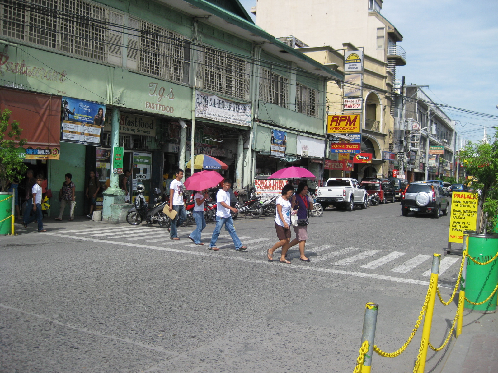 Pedestrian flow – the photo shows pedestrians crossing Gen. Hizon from the commercial establishments on the left towards the cathedral. The photo also shows people using the walkways integrated with the buildings (arcade), providing shelters against the elements, in this case the scorching sun.
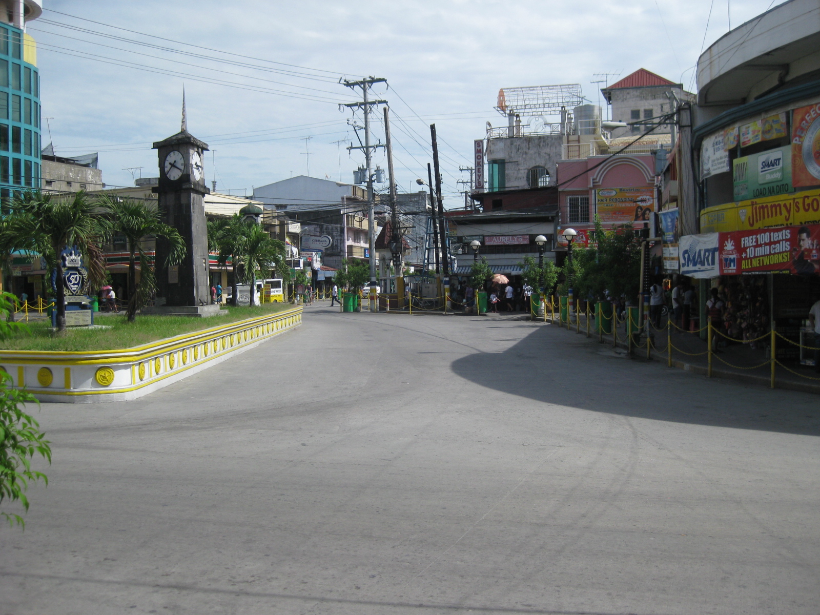 Rotonda? – at what seems to be the end of Gen. Hizon is a curious set-up which functions as a rotonda. Tiomico is also a one way street (westbound) and there is another intersection just ahead in the photo after turning right from Gen. Hizon.
 Off-set intersection – Gen. Hizon actually continues as B. Mendoza Ave. (which eventually leads to a junction with McArthur to the north) from the junction that is identified by the 7-Eleven on one of its corners that is visible in the photo. The public market is just across from the building housing the convenience store.
 City hall – the building is just across from the cathedral and the parking problems in the city are clear from this photo alone. City halls generate a lot of traffic due to the transactions, meetings and other activities associated with the institution. On weekdays, most parking in front of the building and across at the cathedral are probably by people with business at city hall. During Sundays, parking would be for church-goers.
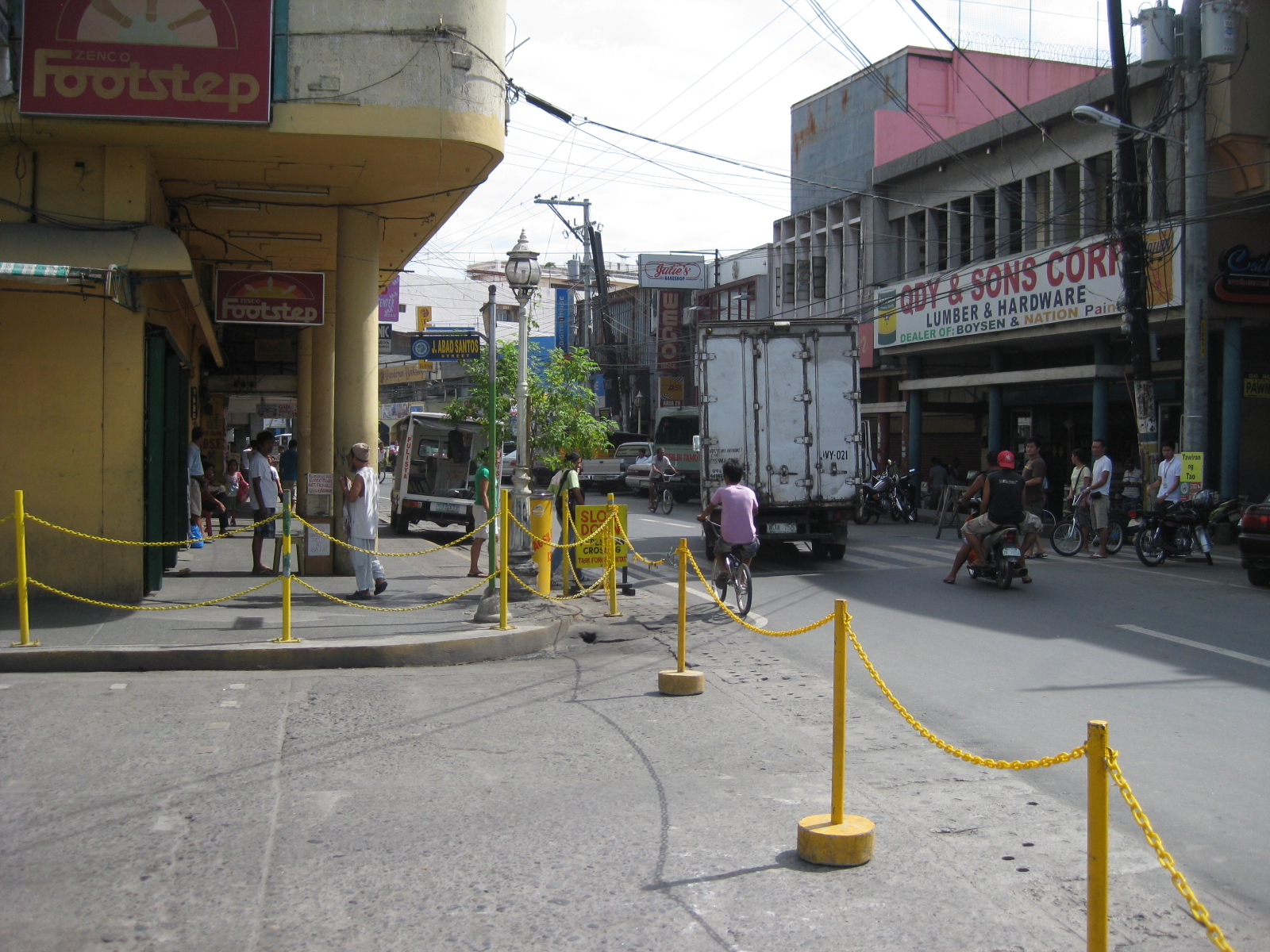 Walkways – the arcade/pedestrian walkways I were referring to earlier are much like the one shown in the left of the photo in front of a shoe store. The set-up allows for pedestrians to be shielded from the elements as they should be able to walk comfortably without getting wet during the rainy season or exposed directly to the sun during the summer. The street on the right is Consunji and leads to the public market, part of which is just behind the yellow building.
 Jose Abad Santos Street – the stretch was closed to motor vehicles at the time we walked around the poblacion. There was a sports event at the time and the street was being used for races – note the writing along the zebra crossing indicating the starting line for the race.
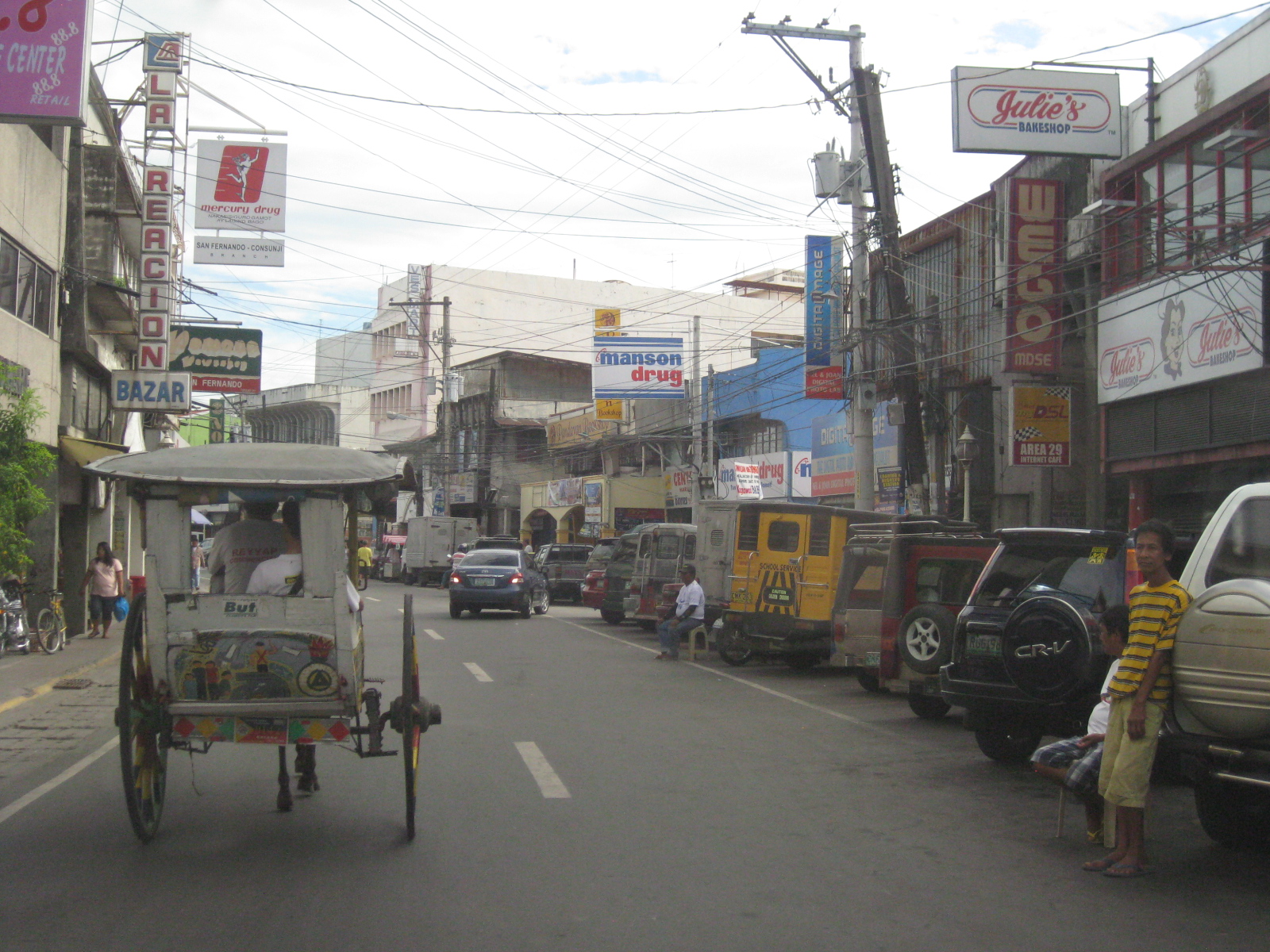 Consunji by the market – the one-way street is lined with commercial establishments and part of the street is used as parking, a common problem in other poblacions in similar cities.
 Prohibition? – this is Tiomico Street in the public market area. The sign on the lower left says 3-wheelers are not allowed along this stretch of the street and yet we found most of the vehicles to be exactly what is supposed to be prohibited – tricycles and pedicabs. The stretch could have been nice if it were developed into a pedestrian street instead with limited access to motor vehicles (perhaps for deliveries only?) much like those market streets in Japan.
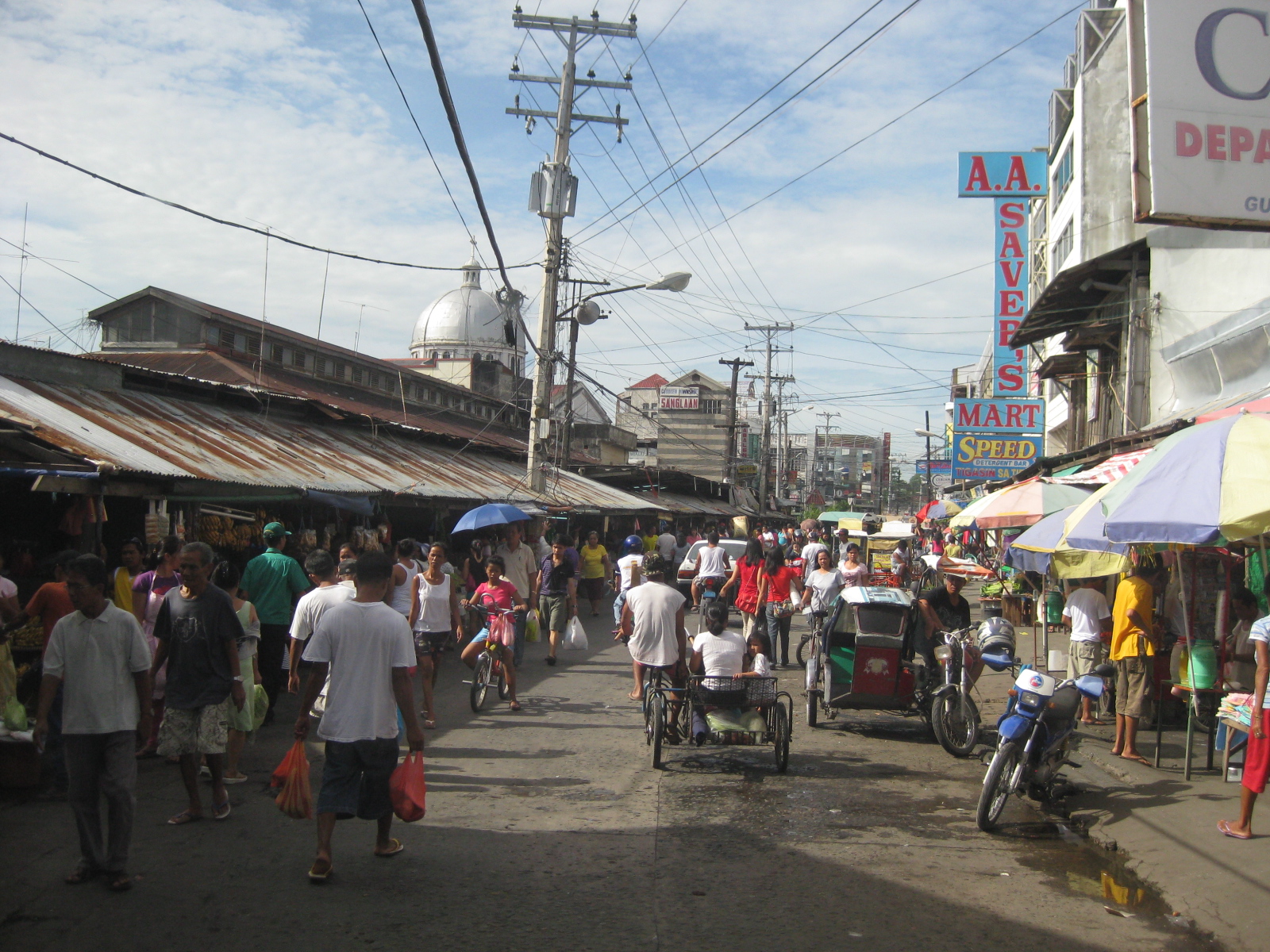 Typical mayhem – further down the street is a mix of people, bicycles, pedicabs, tricycles, and other motor vehicles. There’s potential here for re-development or transformation that would enable the revival of this commercial district that includes the public market.
 Blast from the past – aside from the typical tricycles and pedicabs providing for local public transport, we were a bit surprised that there were still calesas, or two-wheelers pulled by horses. At the time (2010), the kutseros or drivers charged PhP 10 to 20 (about 20 to 50 US cents) per passenger depending on the destination. These calesas are all registered with the local government, and they have license plates indicating their registration.
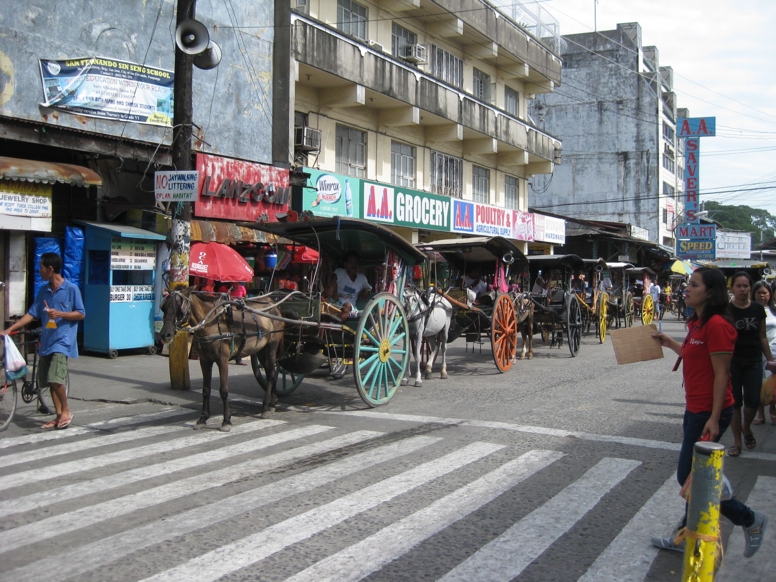 Queue – most of the horses pulling the calesas looked healthy enough and well-cared for. The kutseros were kind enough to answer our inquiries about their operations. I think the city should carefully consider how to take advantage of its heritage/character to promote sustainable transport including walking, NMT and the calesas for moving around the poblacion and its immediate environs.
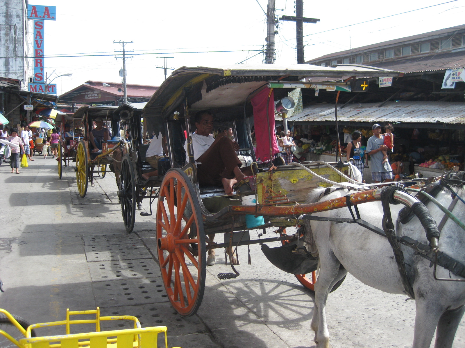 Two-seaters – the passenger capacity for the calesas is two. To address the poop issue, there is a contraption just behind the horse and hanging under the carriage that catches dung and prevents it from being spilled unto the roads. I assume these are disposed of properly.
 Alternative design – the pedicabs in San Fernando are different from the conventional ones we see in other cities or towns. Noticeable from the photo is that this is not your regular bicycle with a sidecar set-up. These are fabricated 3-wheelers that seem to be sleeker if not more stable than the usual pedicabs we’ve seen.
 Tiomico Street – just after Gen. Hizon, one gets an idea of the challenges for transport and traffic in San Fernando. The one-way street has no pavement markings, obstructed signs (if any at all), no pedestrian sidewalks and vehicles each doing their own thing along the road (e.g., motorcycle zigzagging through traffic, jeepneys stopping anywhere, etc.).
 Walkability – people generally walk along the carriageway, as shown in the photo, due to a lack of proper facilities like sidewalks. Though there are remnants of zebra crossings, people also generally cross anywhere and so contribute to the mayhem along the streets. There was a proposal for a pedestrian overpass but such is so inappropriate given the narrow streets. No one will use such an overpass as it would be more an inconvenience to pedestrians. A more appropriate treatment would probably be traffic calming or other approaches that would prioritize pedestrians over motor vehicles in the poblacion area. The lot where jeepney terminal mentioned on the left side of the photo is now an SM mall.
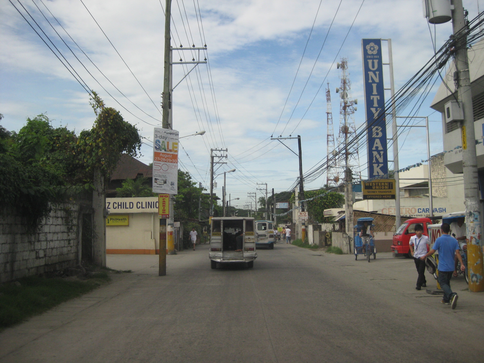 Hazards – the relocation of electric poles seem to have been an afterthought when they re-paved Tiomico. These are not easily seen at night and could lead to crashes should vehicles miscalculate their locations. The road drainage may be found beneath concrete covers on either side of the road such as those along which the people in the photo are walking over. These are supposed to be easier to maintain as crews can just lift the covers to remove blocks such as garbage.
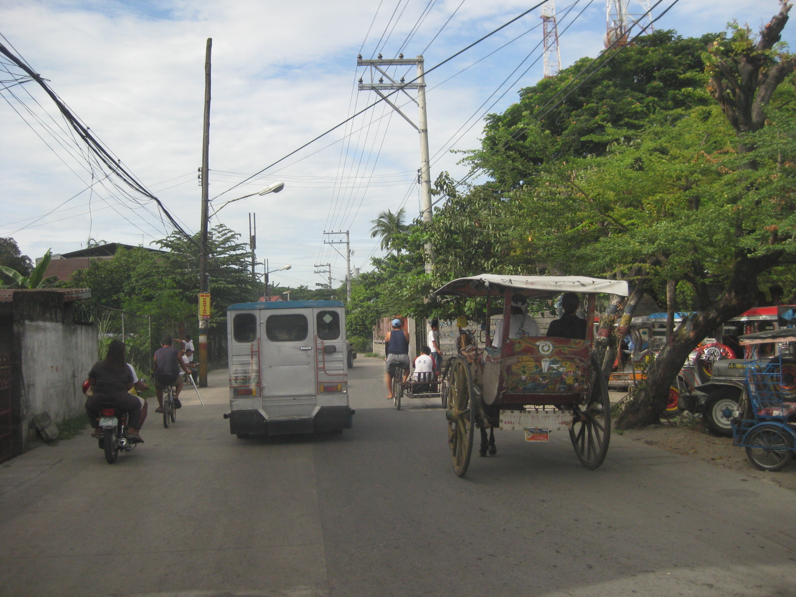 Traffic mix – I like this photo because it shows almost all modes of transport operating in the poblacion: calesas, pedicabs, bicycles, motorcycles, and jeepneys. Its a good thing trucks are banned from using these roads. Otherwise, traffic would be worse.
 Junction – approach to the junction of Tiomico, Lazatin Street (left) and Capitol Boulevard (right). There were no signs to indicate the approach to the intersection as well as for traffic control (e.g., stop or yield signs). There are also no pavement markings.
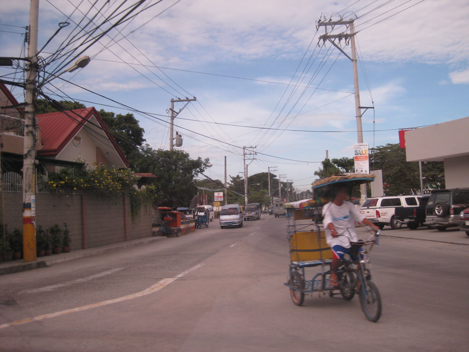 Capitol – the photo shows vehicles approaching from Capitol Boulevard, which comprise generous (wide) two lanes. Sidewalks were on either side of the boulevard except where there were driveways and parking spaces.
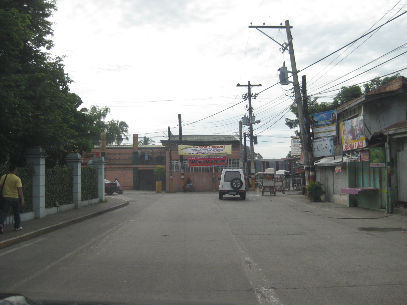 Junction – approach to the junction of Lazatin St., Consunji Street (left) and Sto. Nino Viejo Road (right). Again, there are no signs and pavement markings are already weathered.
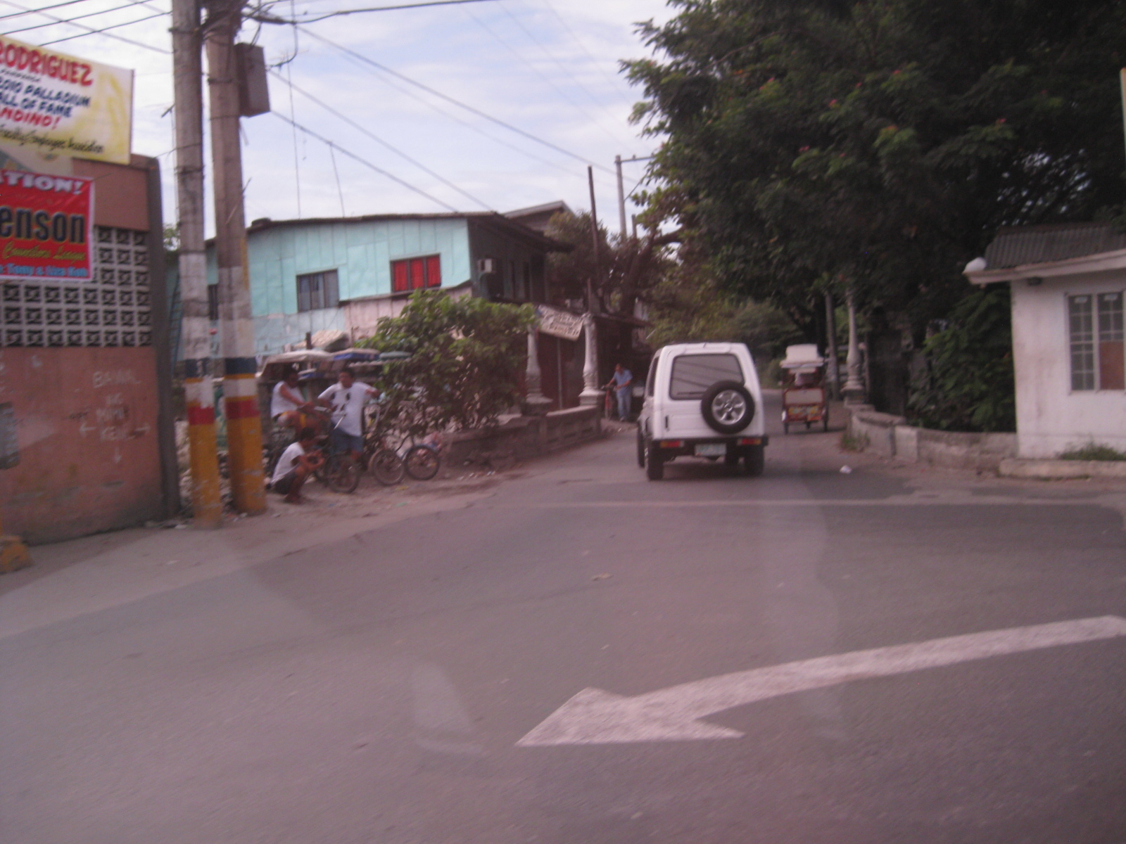 Old bridge – there is a short, old bridge just after the junction. The bridge is over a creek connecting to the main river and has 4 lamp posts that are similar to the main bridge along Gen. Hizon, and perhaps the inspiration for the lamp posts along Consunji Street.
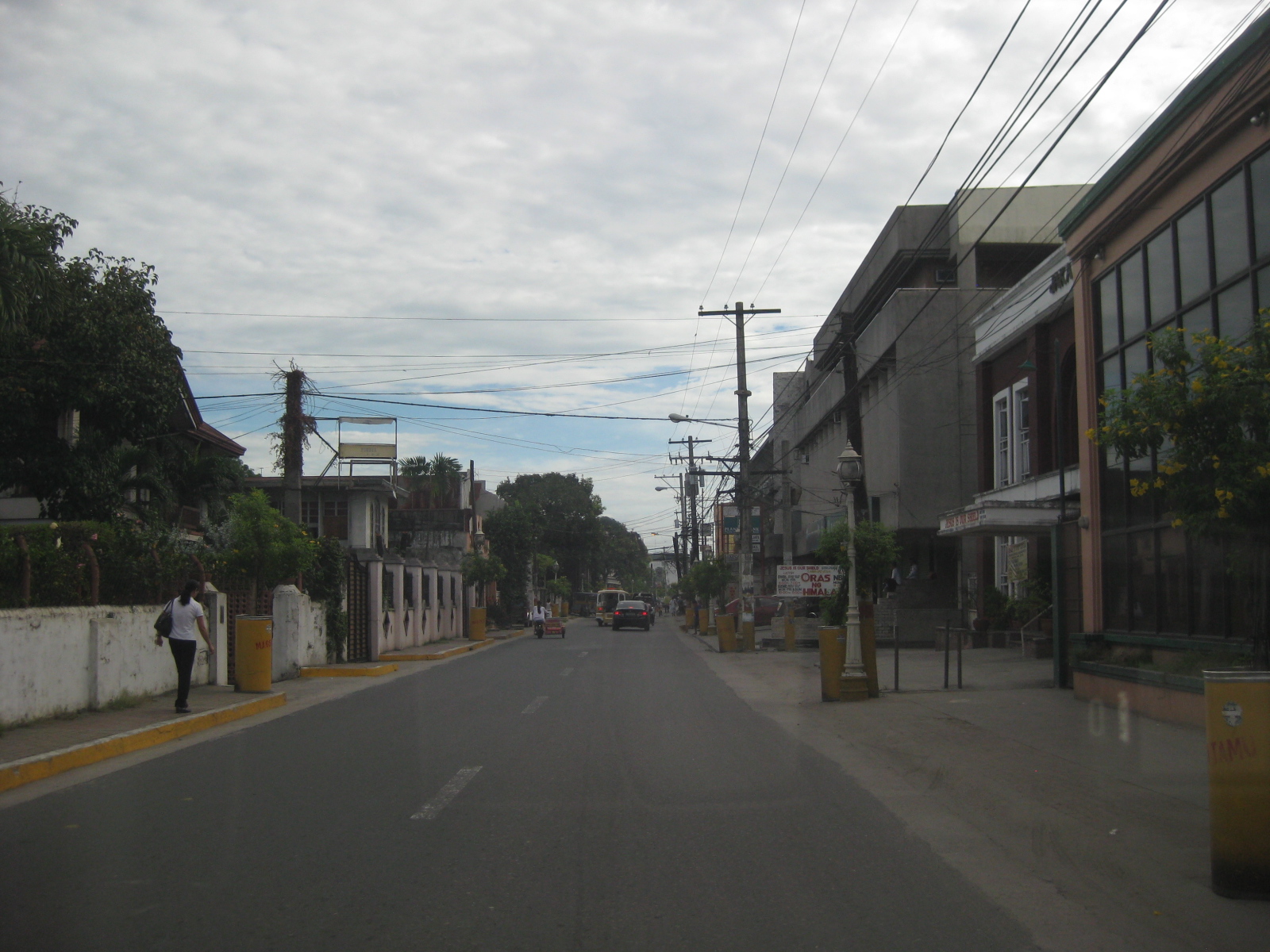 Consunji Street – is also a two-lane, one way street. Some sections have pedestrian facilities like the sidewalk on the left. The pavement markings were already weathered but still visible during the daytime. There are also less electric poles along this street and the lamp posts are appropriate in design.
 Heritage House – the structure on the left is an ancestral house, of which there are many in the province of Pampanga and especially around San Fernando, which is one of the oldest towns in the province.
 Recognition – the marker by the National Historical Institute recognizes the structure as a Heritage House. The smaller plaque provides a description of the house and those who lived or used it, highlighting its significance. There are other heritage houses as well as old houses that have not been given such a distinction (family not prominent enough?) but which deserve preservation.
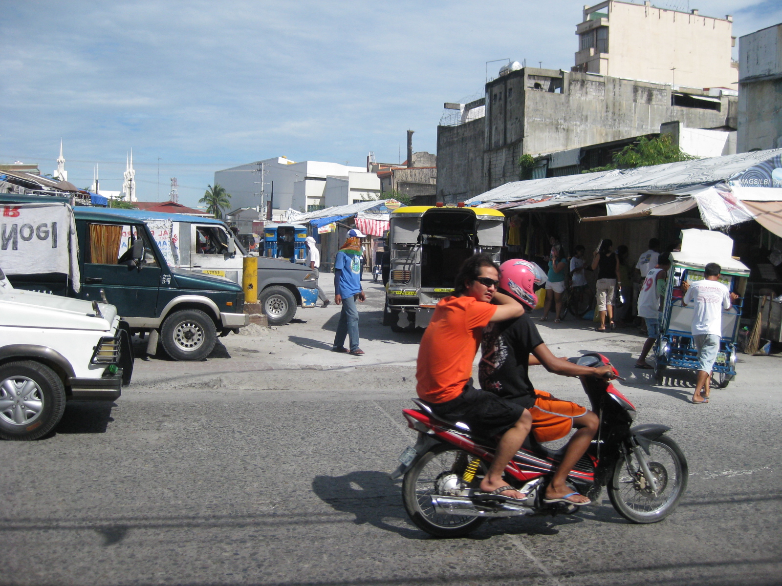 Future and present site – this lot was being used by jeepneys as their terminal at the time of our field work. The lot is bounded by Tiomico St. in the northwest and Consunji St. in the southeast, and is where the recently opened SM City San Fernando is situated.
 Approach from Consunji – there are no pavement markings (yellow box) defining the intersection and no signs to help in traffic control.
–
North EDSA
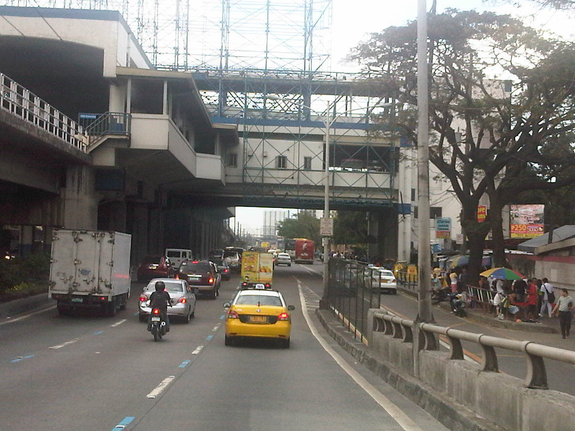
Heading to Tutuban for our technical visit of the Philippine National Railways, we passed along the north segment of EDSA from its junction with North Avenue in Quezon City to 8th Street in Caloocan City. Following are photos showing the overhead LRT 1, the motorcycle lane, U-turn slots and various buildings adjacent to EDSA.
 EDSA – North Avenue junction – the blue lane markings designate the motorcycle lane along EDSA. SMDI’s Grass Residences can be seen behind the mall.
 Section in front of SM North EDSA – the bus stop beneath the SM Sky Garden is on the right of the photo
 Section after SM North – the green building is Quezon City Academy
 Section in the vicinity of Roosevelt Ave./Congressional Ave.
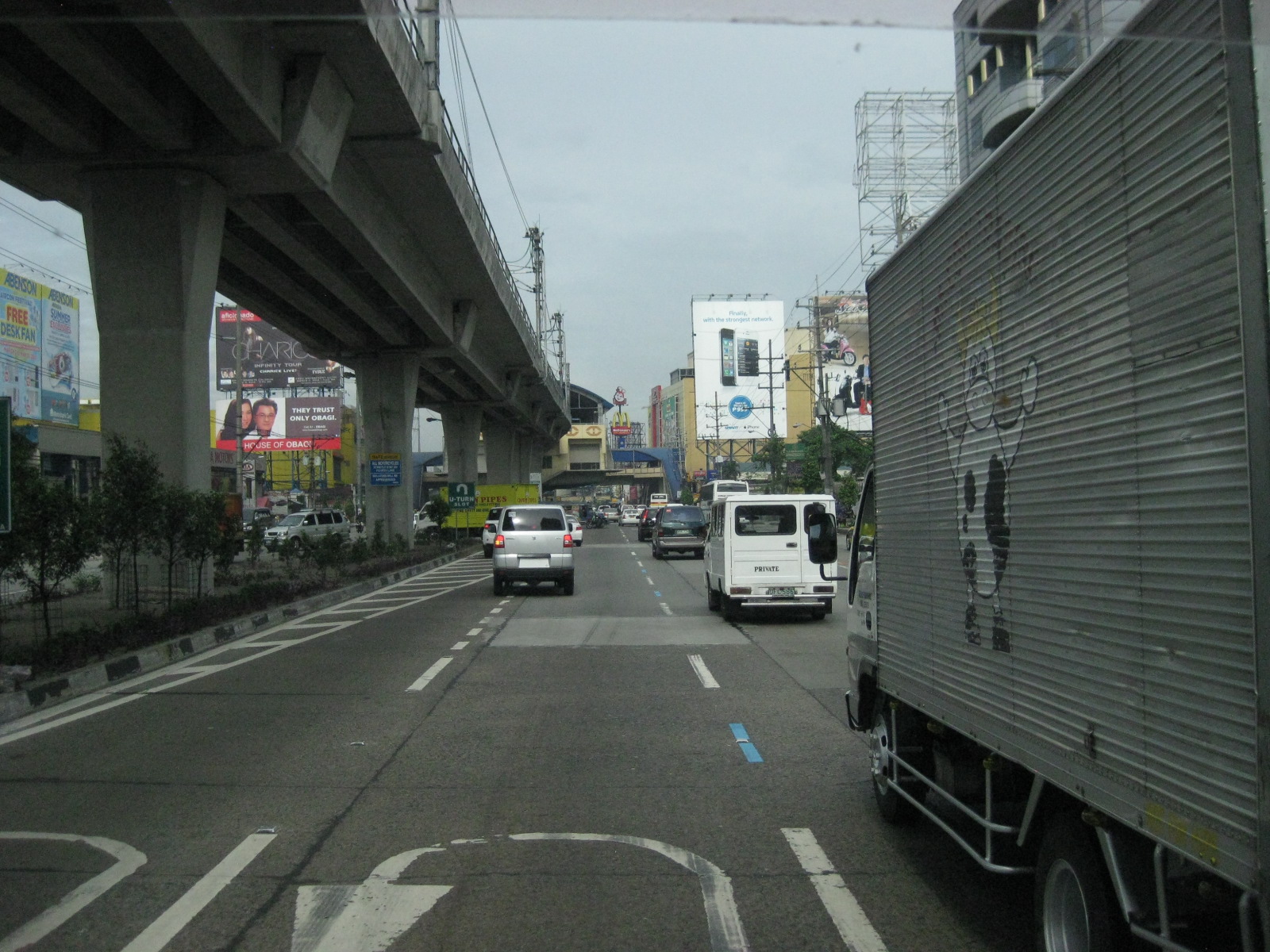 Section between Corregidor St. and Roosevelt Ave./Congressional Ave.
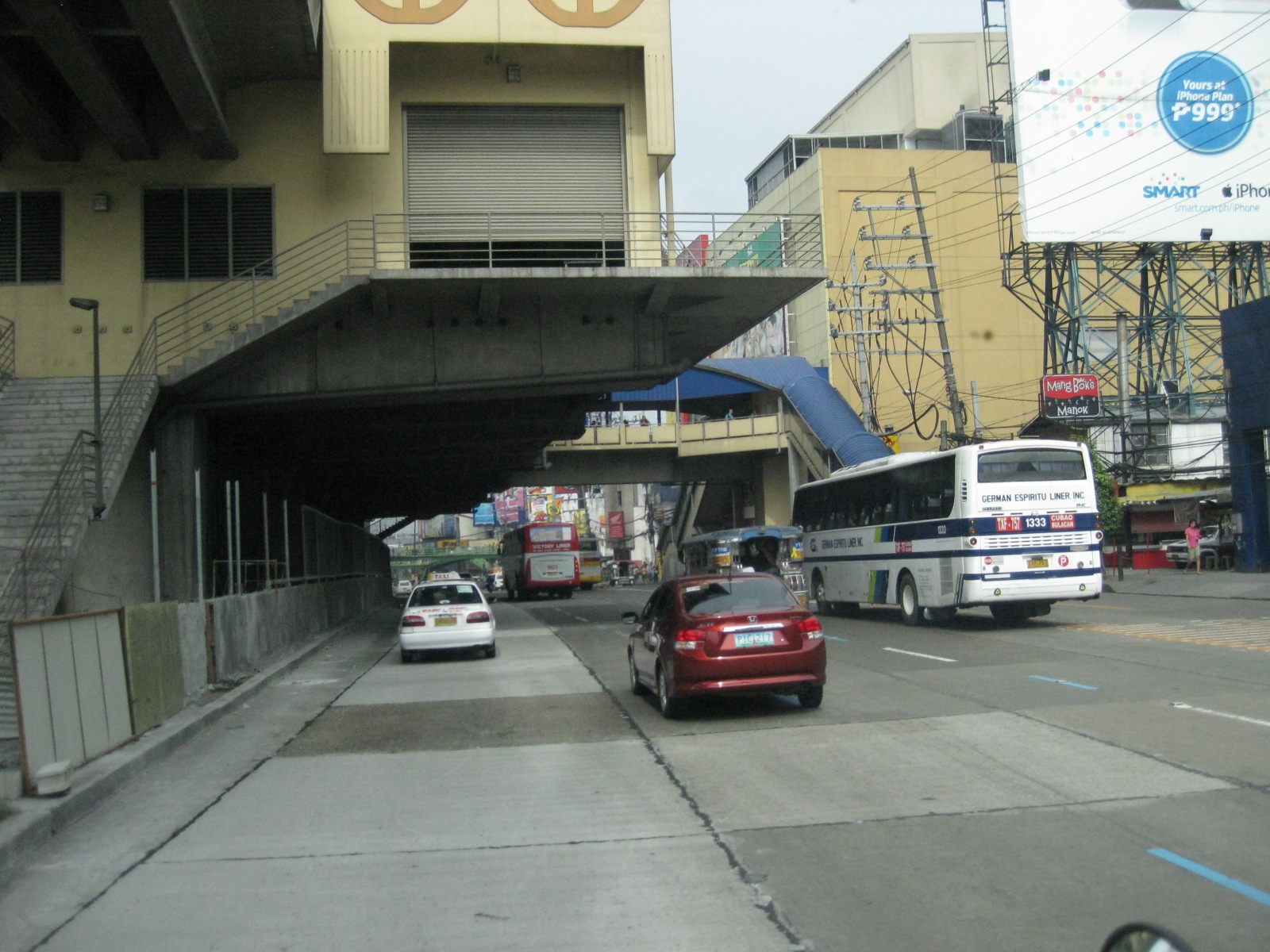 LRT 1 Extension Roosevelt Station
 Section after Roosevelt Ave./Congressional Ave. before Fema Road
 Section approaching Home Depot and Kaingin Road junction
 Section across from Shell Station right after Wilcon Builders Depot
 Section across from Hyundai dealer right after Shell station
 Section approaching Balintawak LRT Station
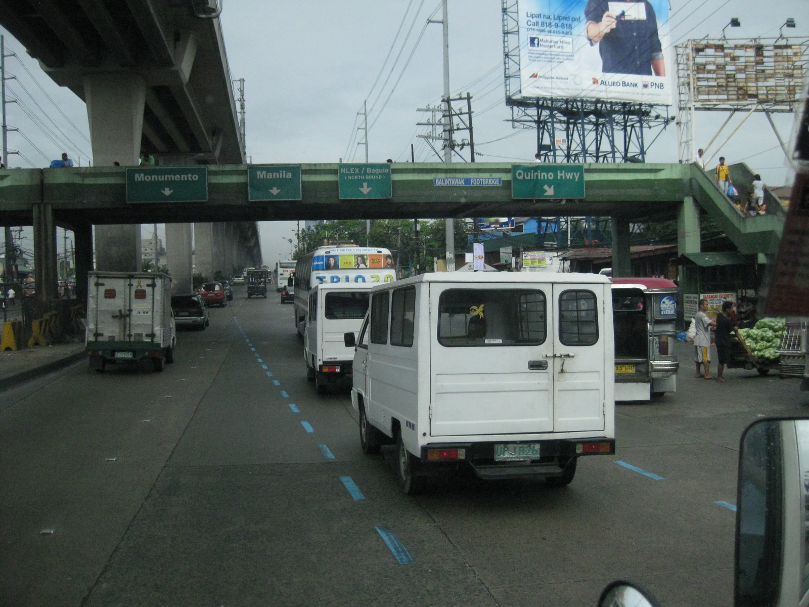 Section along Munoz Market (note the cart full of vegetables on the right in the photo)
 Exit ramp to NLEX at the Balintawak interchange (cloverleaf)
 Section of EDSA on top of NLEX (Balintawak interchange)
 Section right right after the interchange – vehicles on the rightmost lane are those coming from NLEX southbound and coming on to EDSA northbound
 Section after Toyota Balintawak and Gen. Evangelista, and approaching Gen. Mascardo
 Section approaching 8th Street U-turn slot after Mariano Ponce
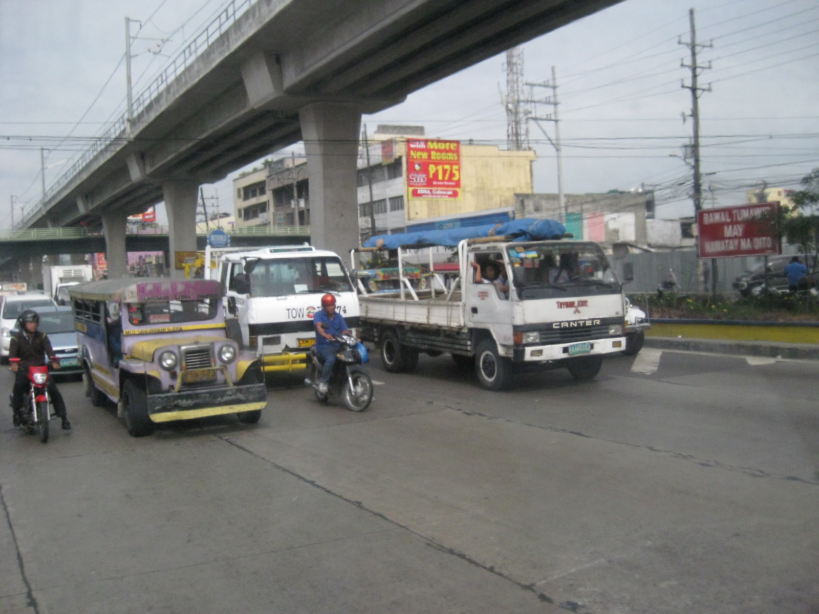 Vehicles stopped at intersection/U-turn slot to allow vehicles turning left from EDSA northbound to 8th Street
–
Scenes along EDSA
The following photos are just takes on EDSA during one of those trips from a meeting to go back to the university. The pictures show what we encounter everyday along what may be the busiest thoroughfare in the country. Of course, it goes without saying that similar scenes are also observed along other roads including expressways.
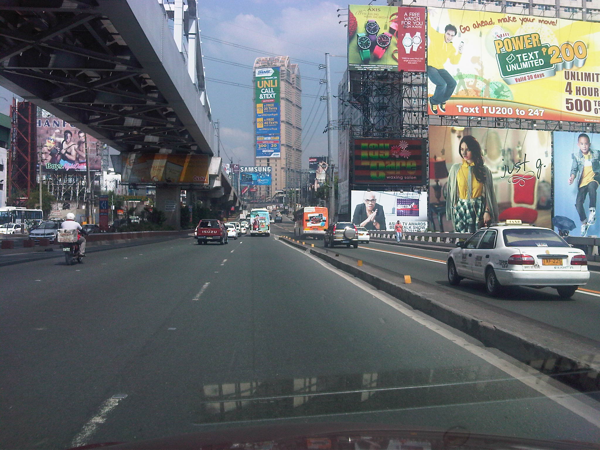
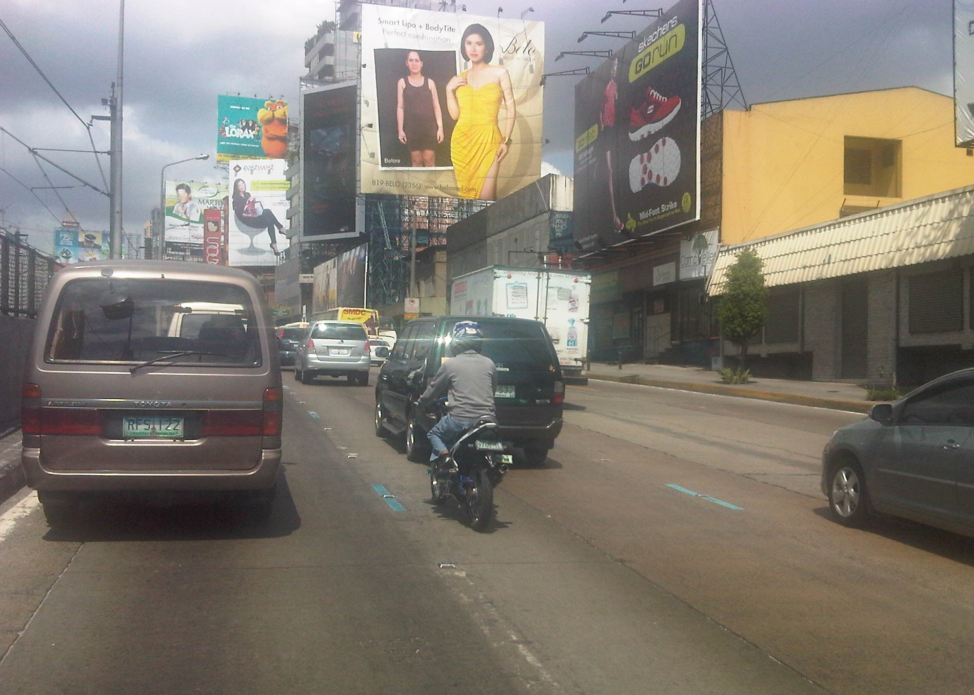 Visual noise – the billboards along EDSA remain to be a source of “visual noise” as some architects and planners refer to their proliferation. There are a huge concentration of these billboards in the Guadalupe area including LED screens that literally light up the road. Not a few people including MMDA Chairs have called for the removal of the billboards or at least regulating their content. With summer approaching fast, the models might have lesser clothing on them and become more of distractions for motorists and riders.
 Motorcycle lane – the imposition/implementation of motorcycle lanes along EDSA has received mixed feedback from various sectors. Unlike Commonwealth, EDSA’s traffic is significantly higher and the latter has less lanes and so during peak periods, there is no choice for motorists but to use the motorcycle AND bus lanes. The result is a chaotic mix of vehicles jostling for road space especially along areas where bus stops are located.
 NMT lane-splitting – I was fortunate to be able to capture this scene where a man on bicycle splits the lane along EDSA. The lane here is actually part of the 2 outermost lanes designated for buses (yellow lanes). However, in the vicinity of intersections, private vehicles are tolerated to use the lanes as the turn into or off from EDSA. I don’t think there is good data on how many bicycles travel along EDSA (or sections of the highway) everyday. This would be an interesting statistic that could enable us to determine the demand for cycling along this highway.
–
Another quick look at the EDSA motorcycle lanes
There was a story appearing in the news recently about motorcycle riders staging a motorcade rally to bring attention to their plight in relation to the motorcycle lane along Epifanio Delos Santos Avenue (EDSA) or Circumferential Road 4 (C-4). The Metropolitan Manila Development Authority (MMDA) implemented the scheme along EDSA after getting generally positive results along Commonwealth Avenue in Quezon City and Diosdado Macapagal Boulevard in Pasay City. Perhaps the thinking here was that if such a scheme succeeded in other roads, it would also succeed elsewhere. Right? – Wrong!
EDSA is always so different from may other Metro Manila roads, most definitely from Commonwealth Ave. and Macapagal Blvd. For one, EDSA carries more traffic than these two roads (combined?) and the sheer volume of private vehicles during busy times of the day cannot be handled by the lanes designated for them. The two outermost lanes of EDSA are supposed to be for the exclusive use of buses but private vehicles frequently encroach on these lanes due to the inevitable spillover from congestion. Fortunately, there is a truck ban along the highway (these generally use Circumferential Road 5) but this does not translate to less congestion as the following photos show. Commonwealth is wider than EDSA while carrying less traffic. As such, vehicles can speed up along many sections of that highway. In fact, the main problems along Commonwealth happen to be related to speeding and weaving. Macapagal has even less traffic and generally does not carry public transport. Perhaps it will carry more traffic in the future once the reclamation areas are fully developed.
 Heavy traffic along EDSA at mid-afternoon – many cars encroach upon the two outermost lanes that are supposed to be for buses. The same vehicles practically occupy the lanes designated for motorcycles.
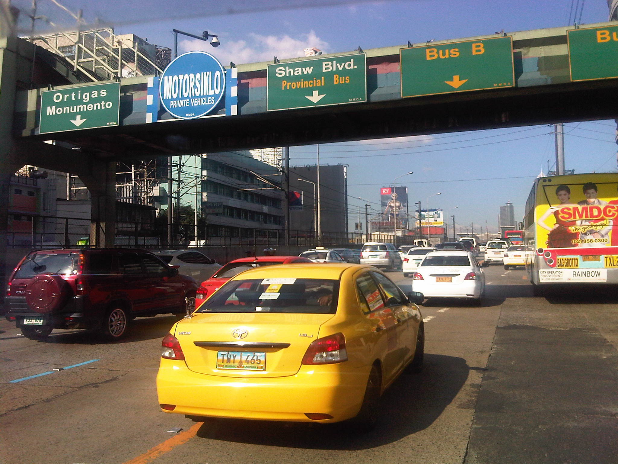 Vehicles occupying the lane designated for use by motorcycle along EDSA – note the “fine print” on the sign on the pedestrian overpass stating the lane is also for use by private vehicles. Riders are lobbying for the lane to be for their exclusive use.
 No motorcycles in sight – there were few motorcycles along EDSA at the time the photos appearing here were taken. Their numbers are more significant during the morning and afternoon peak periods.
 The motorcycle lane proceeds through EDSA along its underpasses and overpasses – EDSA’s capacity during peak periods is not enough for cars and so they usually spill over to the bus lanes. It’s also status quo for them in as far as using the motorcycle lane is concerned, unlike in the case of Commonwealth Ave. where the wider carriageway allows for private vehicles to avoid taking the motorcycle lane.
The initial assessment we made for the motorcycle lanes along EDSA was positive and hopeful for the behavior change that it is supposed to bring about both with drivers and riders. I believe that despite the dry run and the aggressive enforcement that followed, the scheme as applied along EDSA is still very much in the “honeymoon” stage and there’s room for some adjustments here and there including some flexibility on motorcycle riders who are often forced out of the designated lane by cars. It is clear from the photos above that private cars really cannot be given too much freedom to use the motorcycle lane. Perhaps by prohibiting cars from generally using the motorcycle lane, we’ll eventually have a safer EDSA. This comes at a steep price, however, as that will be one less lane for private cars. But then again, if the objective is to discourage car use (especially the low occupancy kind) then it should be good but with the caveat that public transport services along EDSA, including the MRT running along the center of the highway, should have improved quality of service.
–
Learning from motorcycling in South East Asia
The scenes are very similar to what you would see along roads in many parts of the Philippines. Motorcycles and scooters zipping here and there, often with more than one rider. If one were not aware of the fact that the motorcycles and other vehicles were along the left side of the road. Motorcycles are very popular in most of Southeast Asia and is in fact the dominant mode in cities in countries like Vietnam, Cambodia and Thailand. It is also very popular in Indonesia and is rapidly on the rise in the Philippines. Despite the mayhem associated with motorcycles based on the various stories or anecdotes that eventually came with photo evidence, motorcycles are here to stay and there is a lot to learn from the experiences in our South East Asian neighbors for us to improve safety concerning motorcycles.
 Riders along a street in Bali – the scene is so familiar as if we were just traveling along a Philippine street
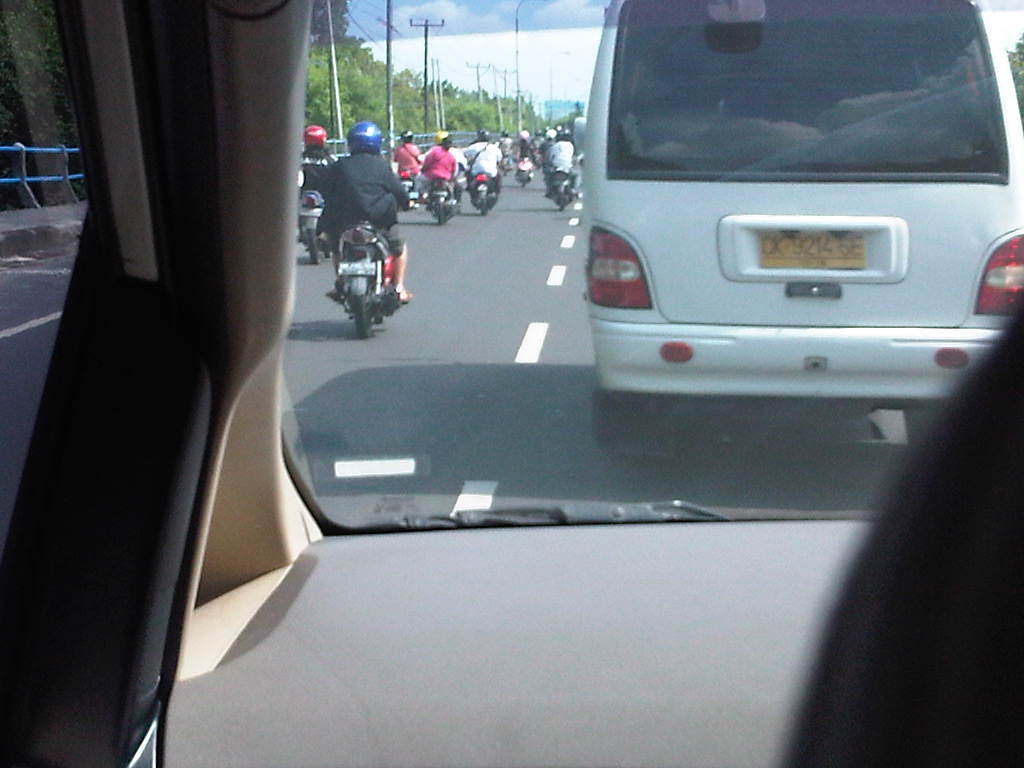 Motorcycles traveling along the left-most lane (the equivalent of our right-most or curbside lane) – that lane is also assigned to public transport. Along this road, the public transport happens to be a BRT variant.
The difference in motorcycling between Bali and Manila (or any Philippine city for that matter) seems to be that drivers of other motor vehicles in Bali are more respectful of the rights of motorcycle riders to road space. While lane splitting is also a common occurrence as well as riding along other motorcycles in the same lanes, the impression is that in the Philippines, riders have higher risks considering the likelihood that they will be sideswiped by other vehicles particularly public transport (buses, jeepneys and AUVs) and trucks. Philippine drivers have a tendency to assert their positions along the road often tailgating or shifting lanes (cutting) at the last moment, and often with the smallest of gaps available for such maneuvers. Such behaviors often have them in conflict with motorcycle riders who are brushed off as minor elements in traffic.
From a driver’s perspective, motorcycle riders in Bali seem to be more disciplined when in flowing traffic, seldom weaving when not required to do so, even while traveling at 2 or 3 motorcycle beside each other along a lane. This is not the case in the Philippines where riders tend to speed even when unnecessary and employ risky maneuvers while doing so. Such behavior increases the likelihood of crashes involving motorcycles, as there are increased interactions among vehicles.
With or without motorcycle lanes, riders (and their passengers) should be safer if other motorists would just respect their rights to the road. This works the other way around where motorcycle riders should, on their part practice lane discipline and refrain from unnecessary maneuvers like lane splitting and weaving in flowing traffic. Mutual respect and discipline, while perhaps difficult to achieve in the immediate term are something that should be encouraged with firm and fair enforcement of traffic rules and regulations. Otherwise, mayhem in our roads will continue and will exact more lives and limbs from motorists and pedestrians alike.
–
Motorcycle lanes along EDSA?
The MMDA is implementing a one-week dry run of its motorcycle lane scheme along EDSA starting today, February 14. The scheme is the same as that implemented along Commonwealth Avenue where motorcycles are assigned to use only one lane of a road – in the case of EDSA the 4th lane from the curbside. To guide riders and drivers of other motor vehicles, the MMDA used alternating white and line blue pavement markings for the motorcycle lane similar to what was done along Commonwealth.
Following are photos taken last week along EDSA and a few observations on the traffic conditions with respect to the motorcycle lane scheme.
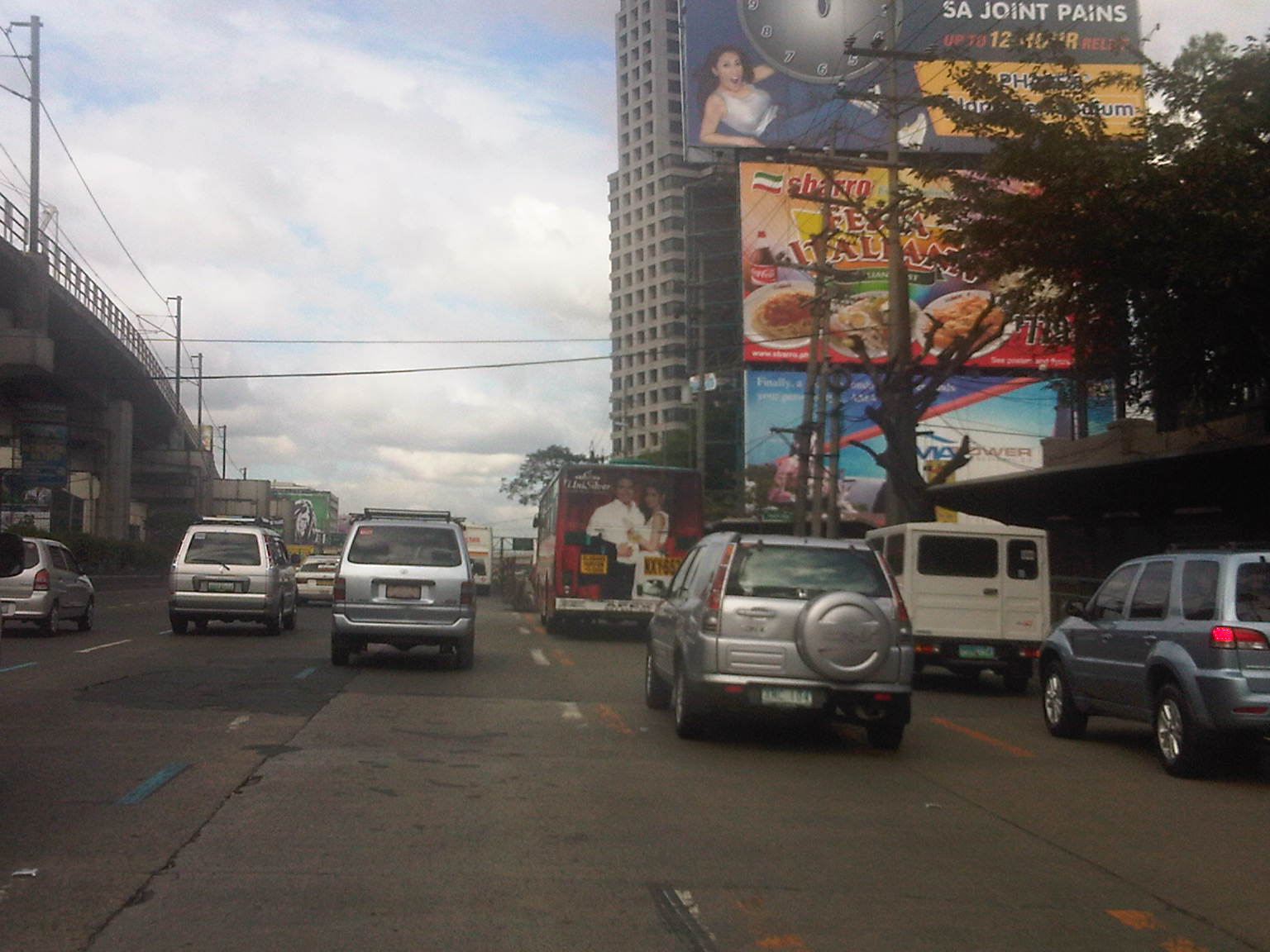 Light blue lane markings can be seen designating the 4th lane from the curbside for motorcycles. The yellow markings are for the two outermost lanes that are designated as bus lanes. While bus lanes are supposed to be for the exclusive use of buses, many private vehicles use the lanes throughout the day and are not apprehended by traffic enforcers for this encroachment.
 Sign for the motorcycle lane already installed along EDSA before the MRT Santolan Station as of February 9 – this photo was taken around 3 PM (not yet the afternoon peak period).
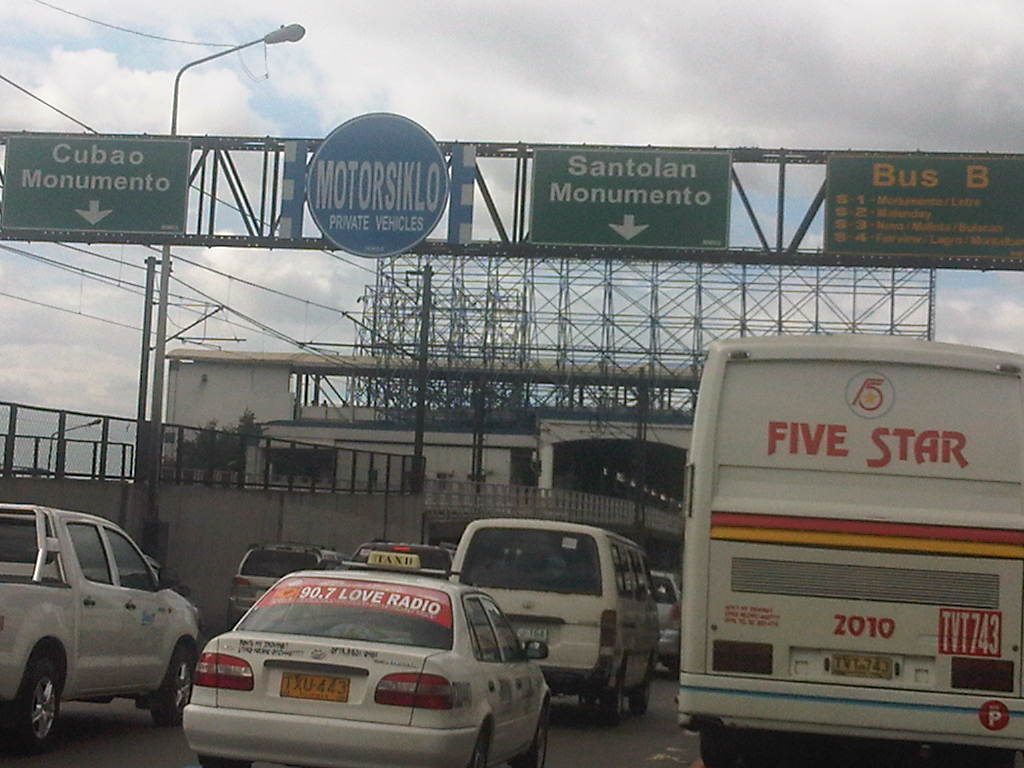 Close-up of sign for the motorcycle lane but with “fine print” indicating that the same lane may be used by private vehicles – herein lies the problem as private vehicles are sure to mix it up with motorcycles, with the high likelihood that riders will revert to lane splitting or using other lanes. This will be an enforcement nightmare.
 Motorcycle lane sign installed on pedestrian overpass between Aurora Blvd. and Kamias. Notice the provincial bus encroaching upon the adjacent lane designated for private vehicles.
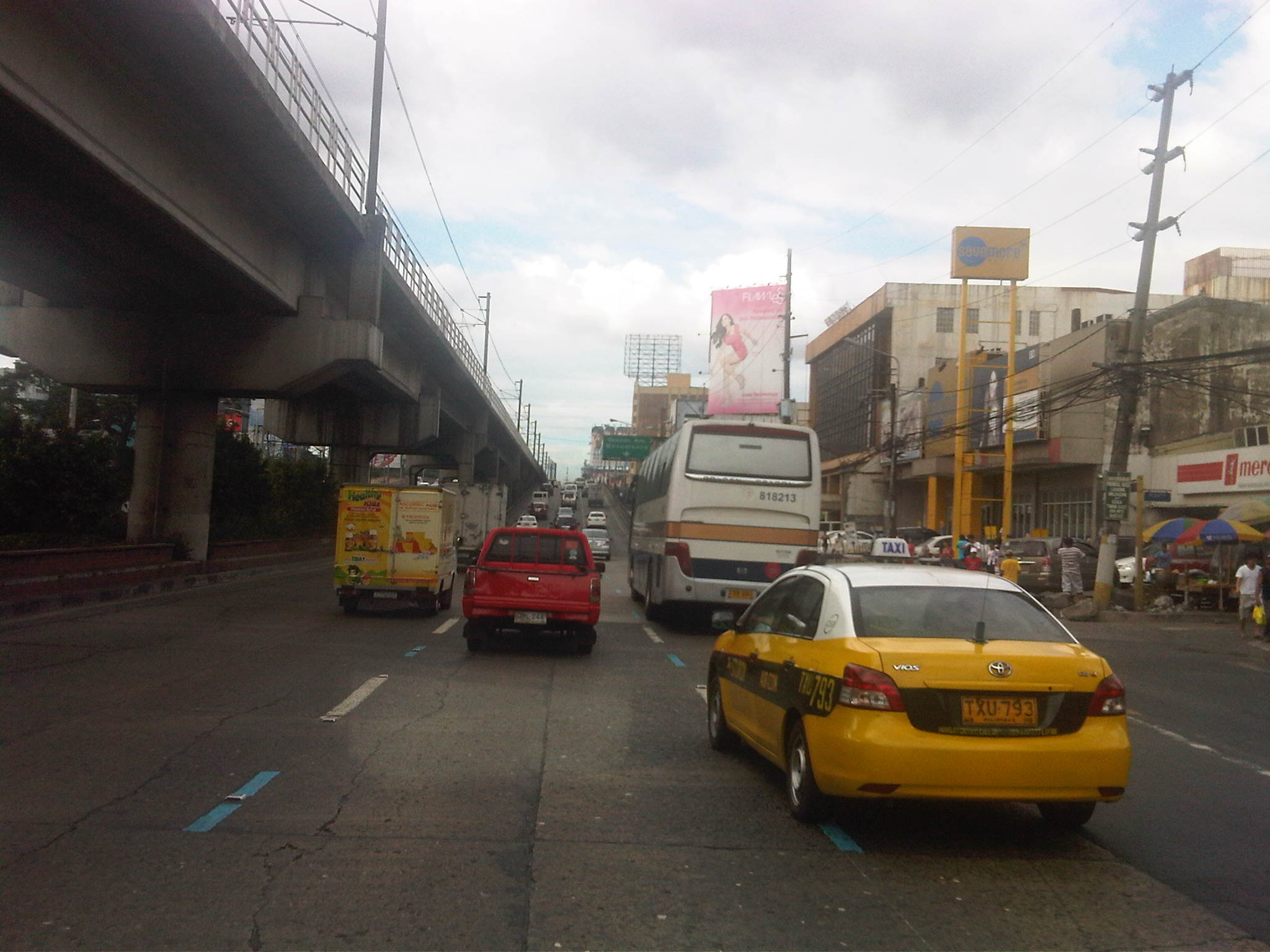 Motorcycle lane prior to the Kamias-East Avenue overpass along EDSA.
 The middle lane is designated as the motorcycle lane along the overpass
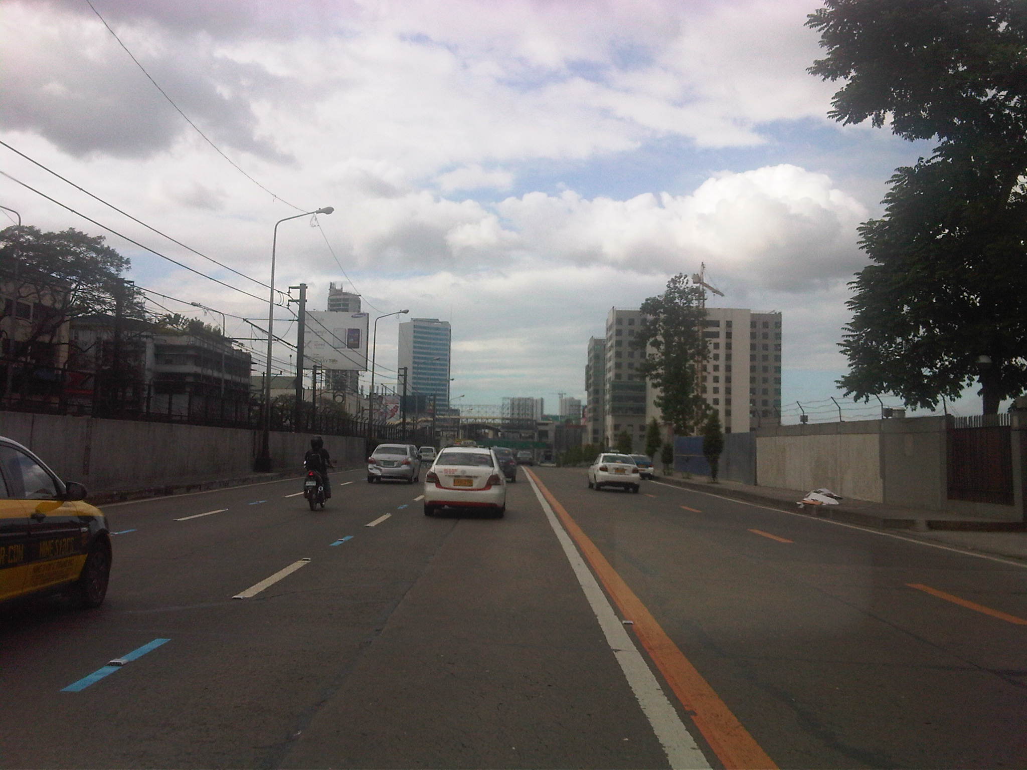
 Motorcycle lane along EDSA beneath the EDSA-MRT GMA Station
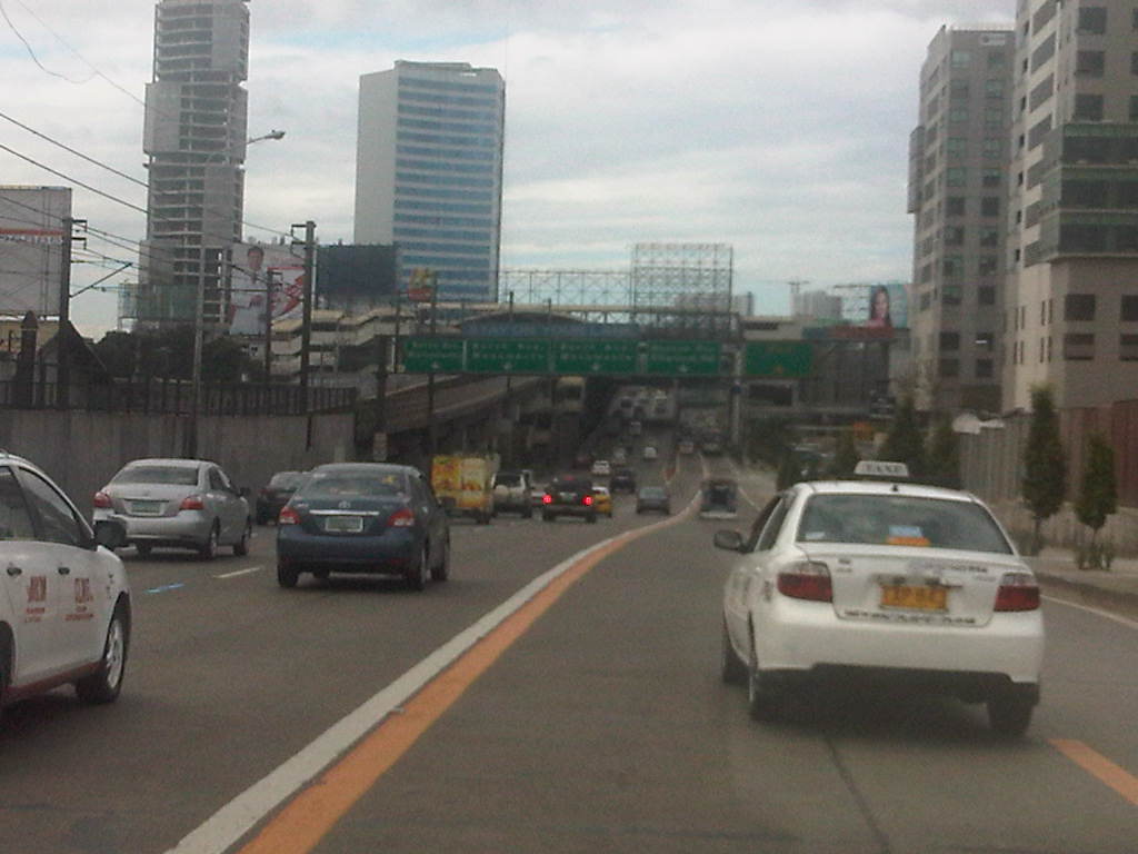
 Bus and motorcycle lanes along EDSA past the the MRT GMA Station. Traffic is typically light along this stretch as many vehicles turn towards East Avenue or Timog Avenue.
 Typical light traffic between East Ave. and Quezon Ave. along EDSA northbound
 Motorcycle lane ascends the flyover crossing the junction with Quezon Avenue – the lane is again the middle of three lanes. That’s the EDSA-MRT Quezon Avenue station on the left and downstream in the photo and the Centris mall on the right.
If the implementation of the motorcycle lane scheme along Commonwealth is to be the basis for assessing the likelihood for success along EDSA, I believe that we can be expect significant behavioral changes along EDSA. For one, motorcycle riders along Commonwealth have been generally diligent in following the scheme. This can also be expected for most riders using EDSA should the MMDA be strict, firm and fair with their enforcement duties. Meanwhile, drivers of private vehicles have been becoming more aware and respectful of motorcyclists rights of way along Commonwealth and we are hopeful that such will eventually be the case along EDSA, although both enforcement and management will be much more challenging due to the sheer volume of vehicles involved and the more restricted space for traffic flow. It is to be expected that there will be many stubborn private vehicle drivers who even without the motorcycle lane are already encroaching on the bus lanes. Even more challenging will be the behavioral change required of buses given their propensity for reckless driving. I wanted to emphasize behavioral change here because I strongly believe that this is a critical factor for the improvement of traffic and transport in Metro Manila where many issues have roots on driver, rider and pedestrian behavior.
–
Weekday EDSA
I chanced upon an uncongested EDSA one day during noontime along the northbound direction. I was traveling from the airport and saw that my usual route along C5 was very congested. I decided to take EDSA instead considering it was noontime and there would probably be less vehicles along the highway during that time of day. I was right and the following photos speak for themselves in as far as describing traffic between 12:00 NN and 1:00 PM.
 Section past Orense Street and the MMDA headquarters
 Section approaching Guadalupe
 Guadalupe Bridge, crossing the Pasig River, the MRT 3 runs along the steel bridge above
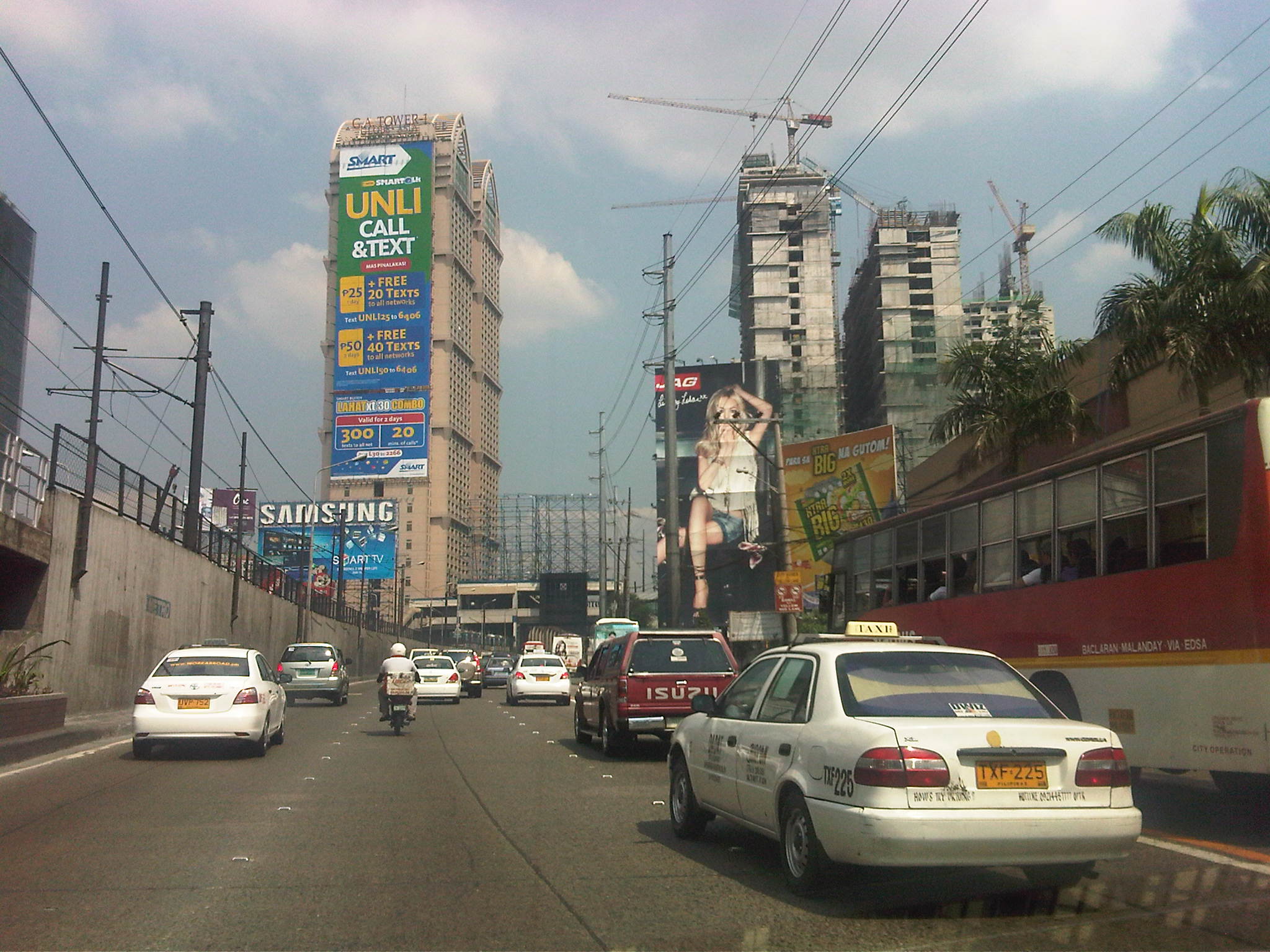 Approaching A. Bonifacio/Renaissance, in the background is the G.A. Tower, the Boni MRT Station and condos under construction including SMDC’s Jazz
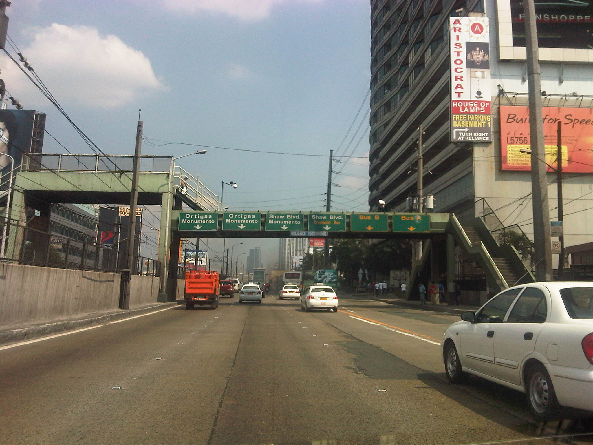 Section across the Renaissance Tower where many FM radio stations are based
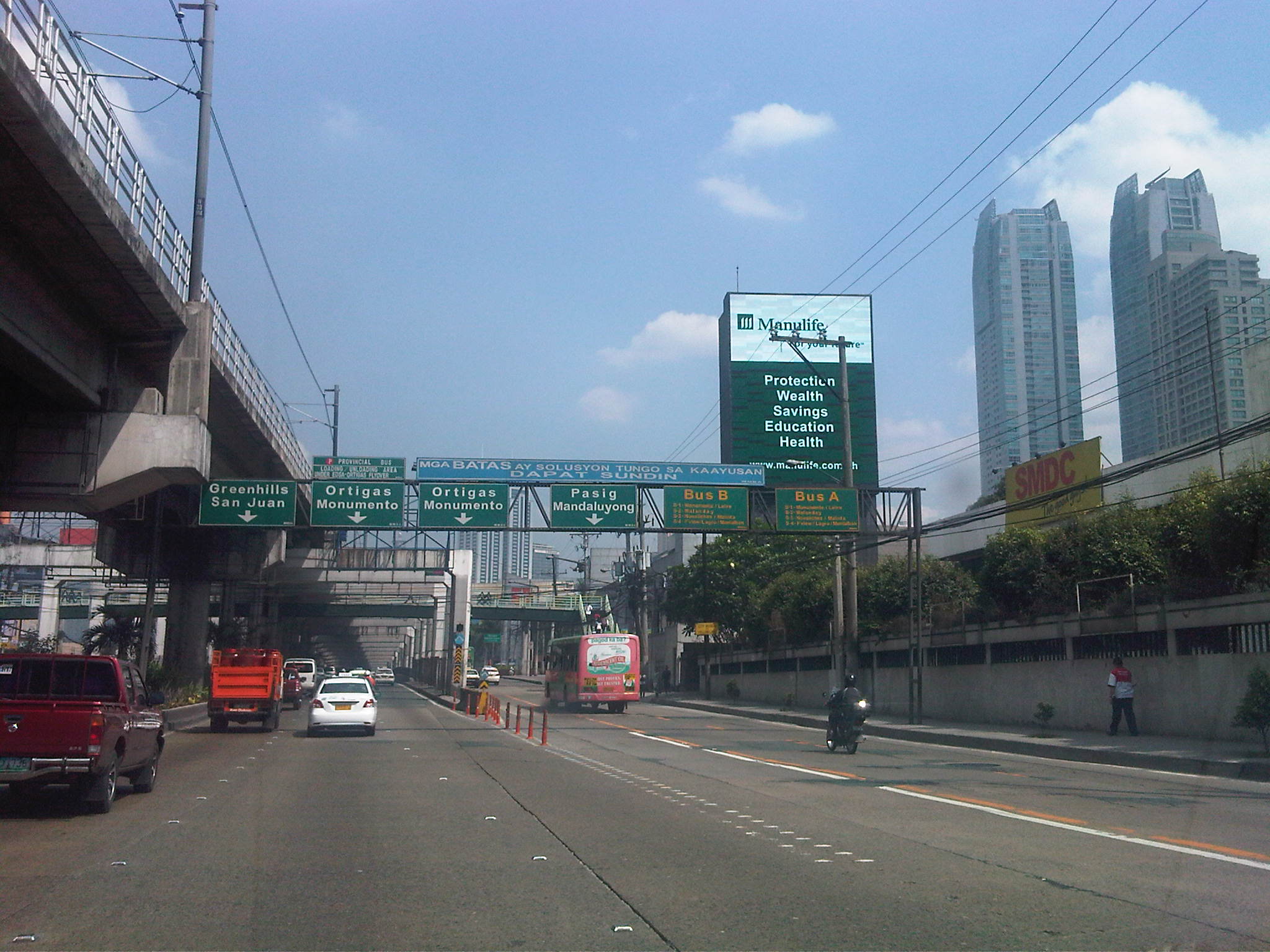 Section past Robinsons Cybergate Mall
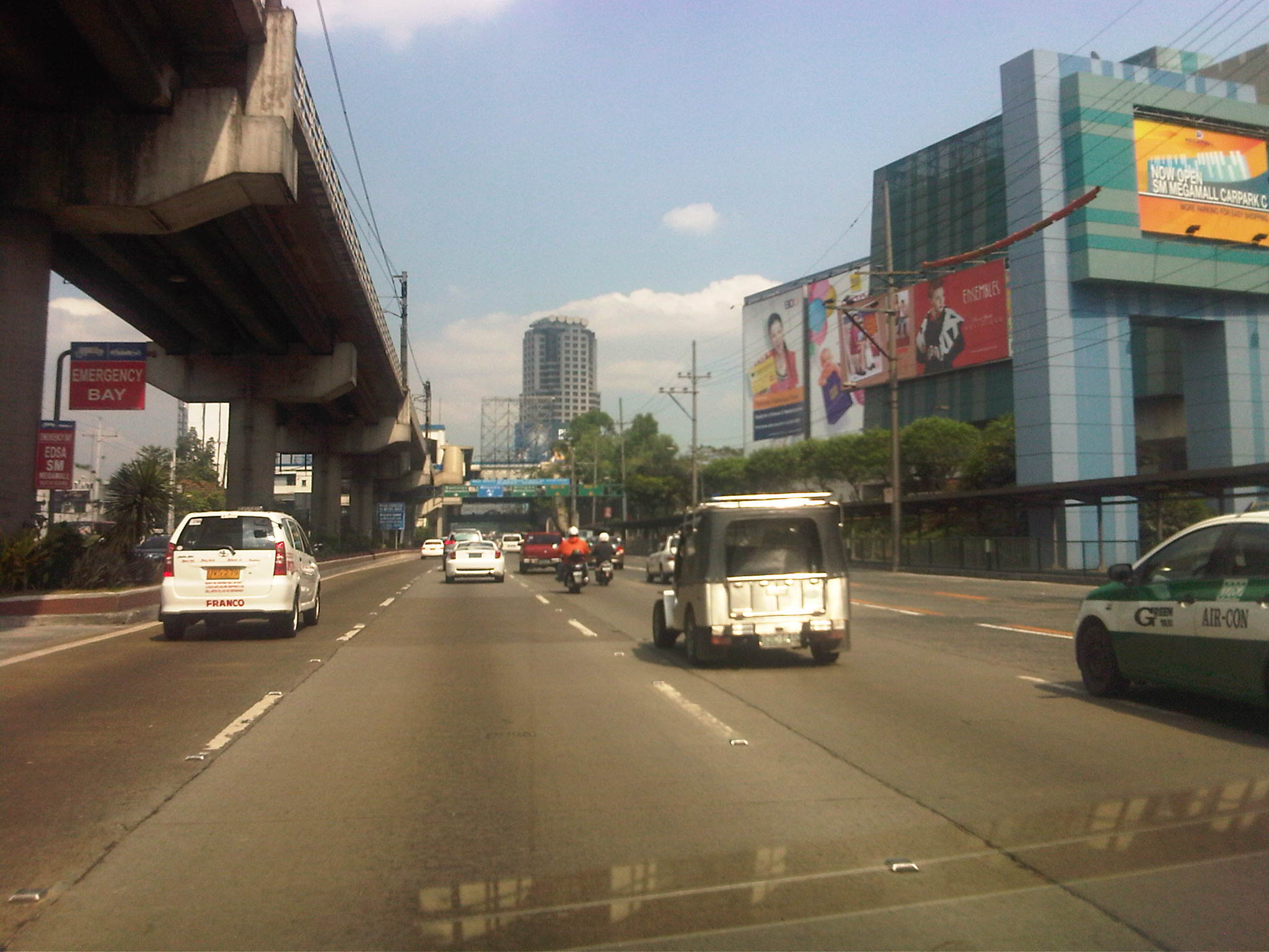 Section across the SM Megamall and approaching the ADB
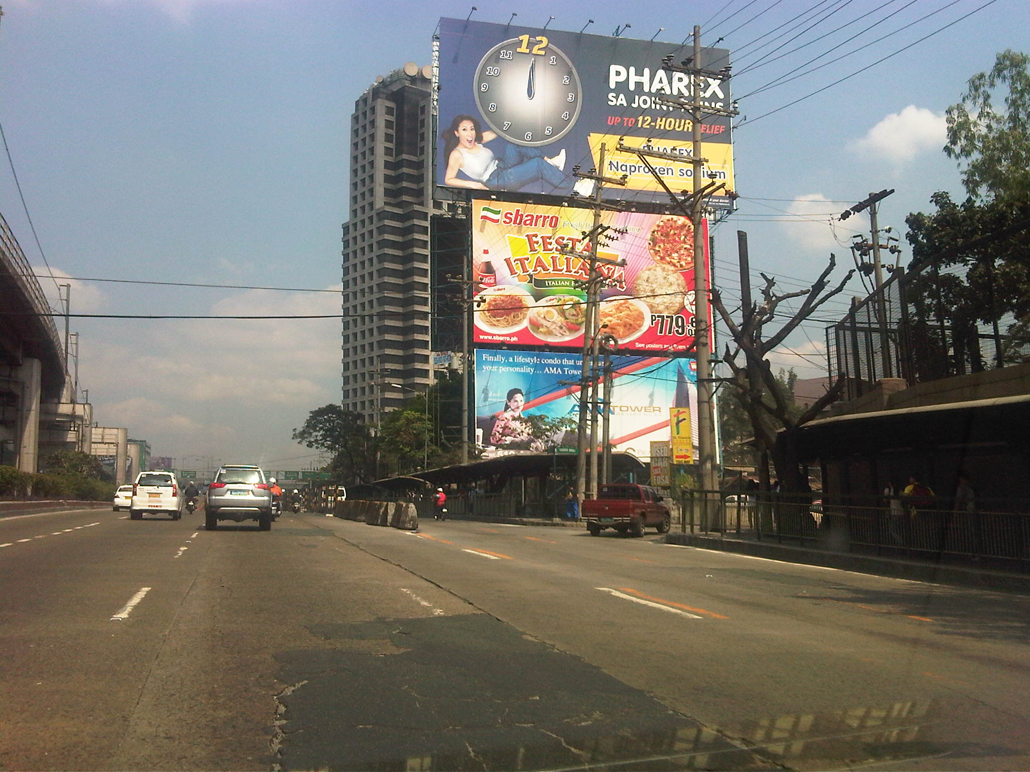 Section across the ADB and approaching Ortigas Ave. One of Galleria’s buildings is seen behind the giant billboards. The MRT
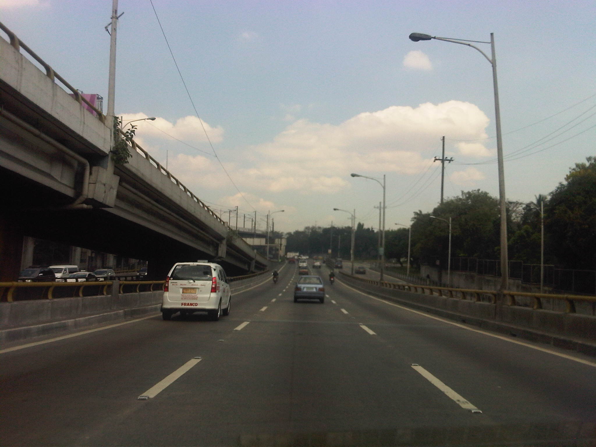 Section descending the Ortigas Flyover and across from Corinthian Gardens
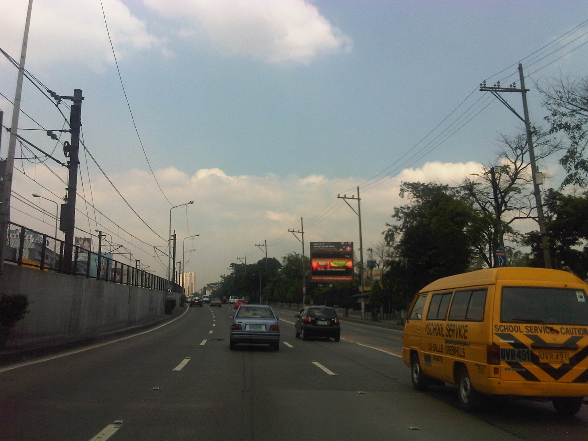 Section across Camp Aguinaldo (between the Aguinaldo and Crame) and approaching the Camp’s EDSA gate
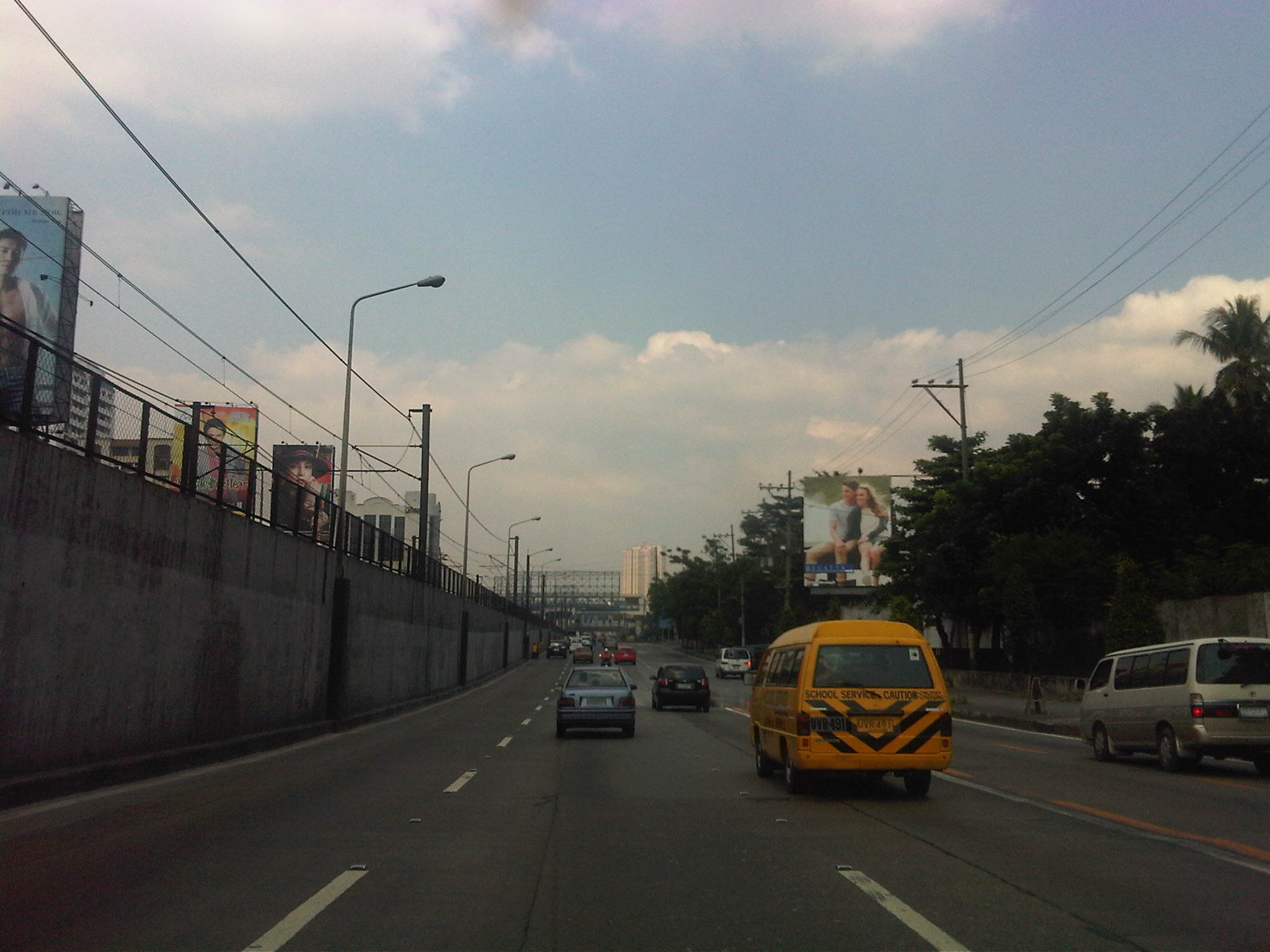 Section approaching Boni Serrano Avenue
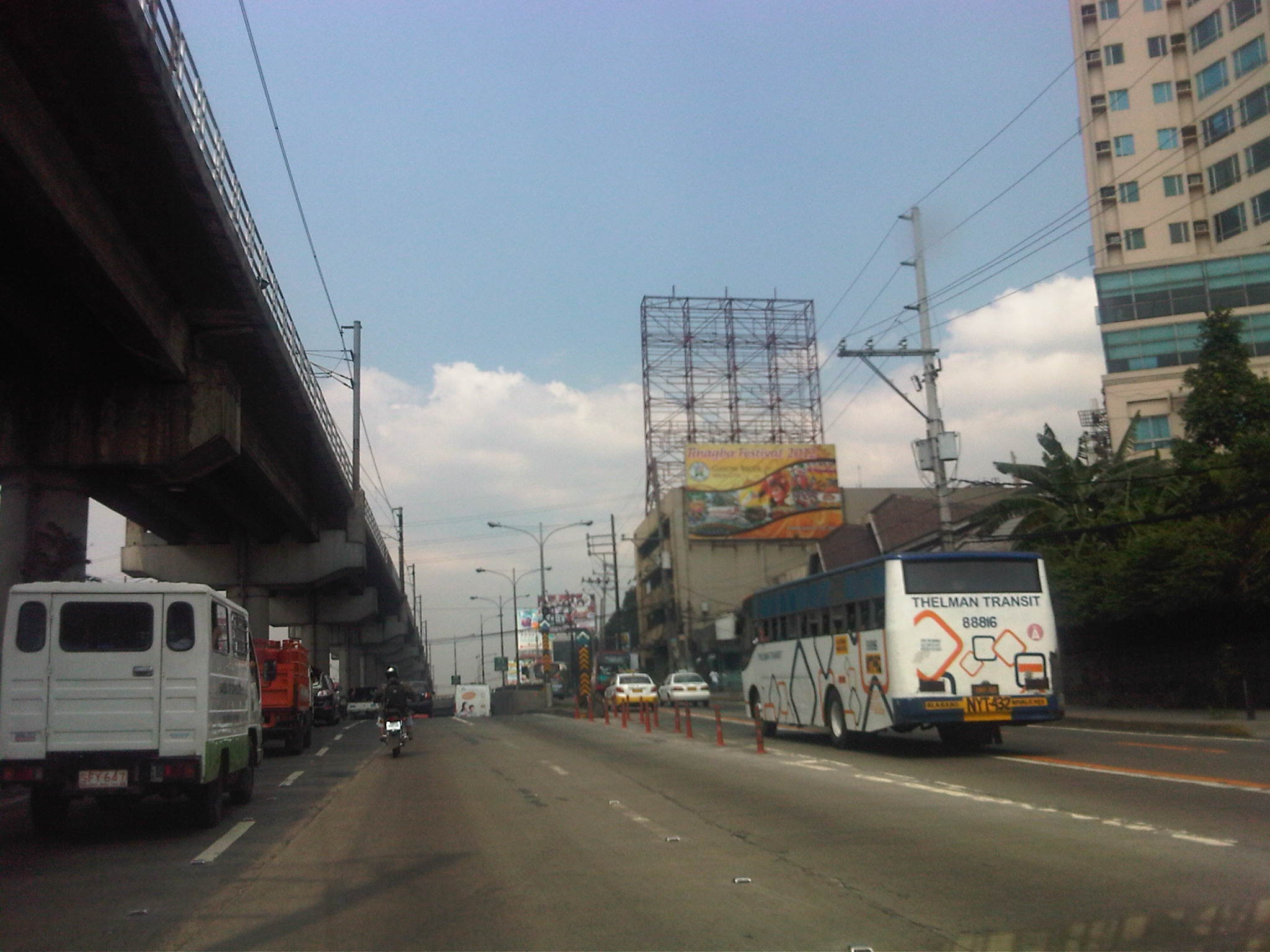 Section approaching the EDSA underpass crossing P. Tuazon and approaching the Cubao commercial center
 Section past the Cubao commercial center and across from several provincial bus terminals lined up along EDSA northbound
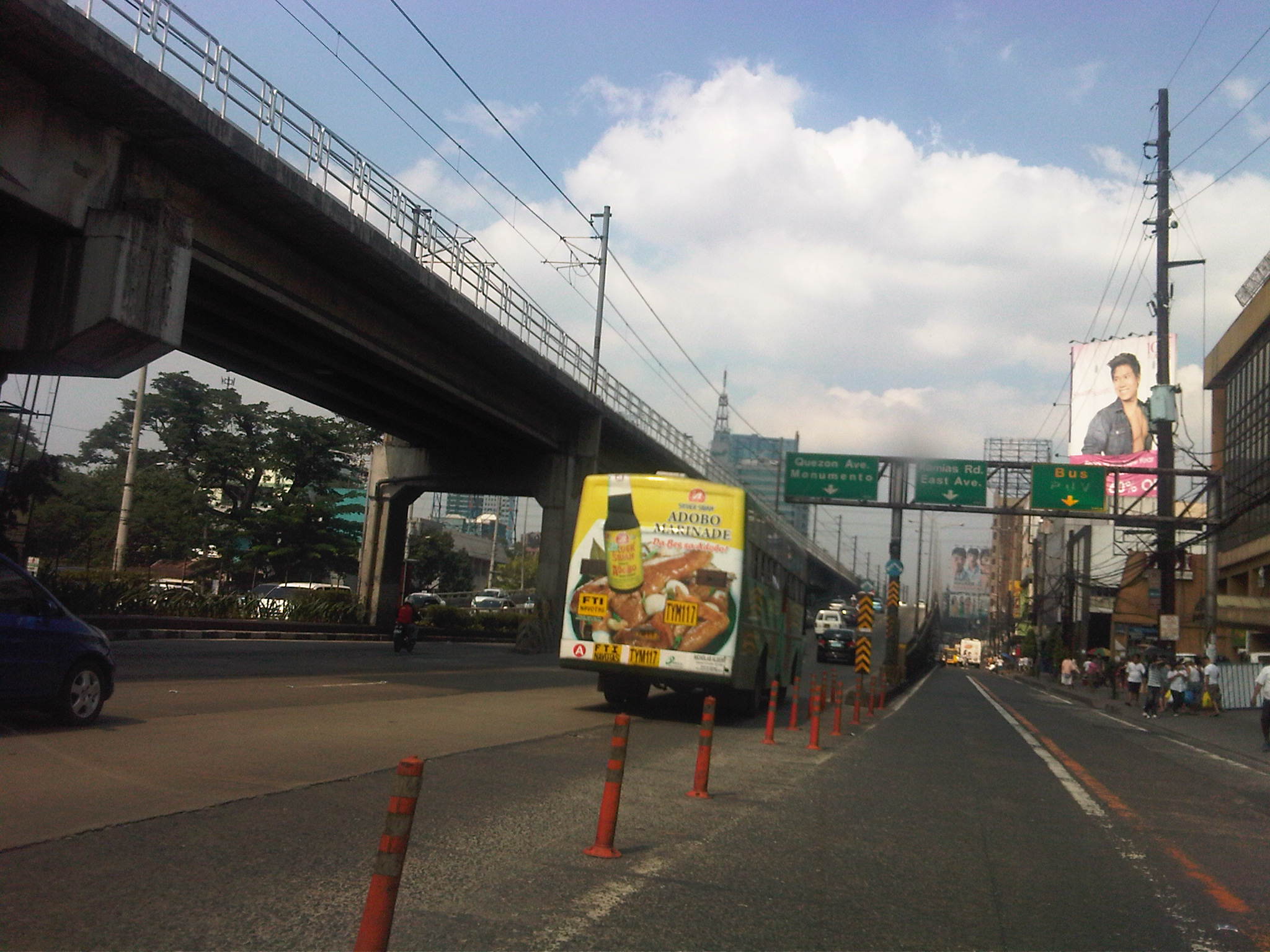 Section approaching Kamias – taking the flyover means I won’t be able to turn towards East Avenue so we shifted towards the outer lanes
Now, if only EDSA and the other main arteries of Metro Manila could be like this more frequently…
–
Fine-tuning the motorcycle lanes
I tried following the motorcycle lanes along Commonwealth Avenue one weekend to see if the MMDA has been able to mark the designated lane (4th lane from the roadside) throughout the entire stretch of the highway. I was optimistic considering all the hype about the lanes but still crossed my fingers given past experiences on such schemes’ implementation in Metro Manila and other Philippine cities. I wasn’t happy with what I saw while traveling along Commonwealth, particularly at points where public utility vehicles stop to drop-off or pick-up passengers. In a previous post, I already explained that where buses, jeepneys and AUVs tend to congregate, they occupy several lanes and effectively block through traffic. Among the lanes occupied are the ones designated for motorcycles. In all my observations, traffic enforcers seem always helpless and inutile against errant motorists occupying the motorcycle lane and posing danger through their maneuvers.
Following are a few photos I took along Commonwealth to “survey” the motorcycle lanes.
 Motorcycle lane along section past Toyota Commonwealth – note the “Motorsiklo” sign on the overpass indicating the lane designated for motorcycles
 Motorcycle lane along section in vicinity of Diliman Prep School – the lane is identifiable by the alternating blue and white lines, as well as the sign (“Motorsiklo”) on the overpass. While motorcycles are required to use only this lane while traversing the highway, other vehicles like the taxi shown in the photo are allowed use of the lane. I believe this is something that should be discouraged as they create situations where there is a high probability of crashes occurring.
The lane disappears after the St. Peter church and there are no markings or signs that would help guide motorcyclists to stay on the lane and perhaps also guide other motorists as well against using the lane. Many motorists, especially private vehicles, seem to respect the “blue lane,” usually and consciously leaving this lane for motorcyclists. We need more of that respect and much of courtesy in our streets and highways!
 Section past Sandiganbayan and approaching the Commonwealth and Fairview Markets – while some motorcycle riders can be observed as trying hard to follow the scheme, there are no markings to help guide them nor are there signs on the overpasses along the rest of the way. Perhaps the MMDA and the DPWH have not yet painted the markings or installed the signs along these sections? But then perhaps the implementation of the scheme is premature considering the lack of pertinent signs and markings?
 A bit of mayhem along Commonwealth and Fairview Markets – buses and jeepneys are practically everywhere here and occupy around 4 lanes as they load/unload passengers at this very crowded area. Motorcycle riders understandably veer away from the outer lanes of Commonwealth
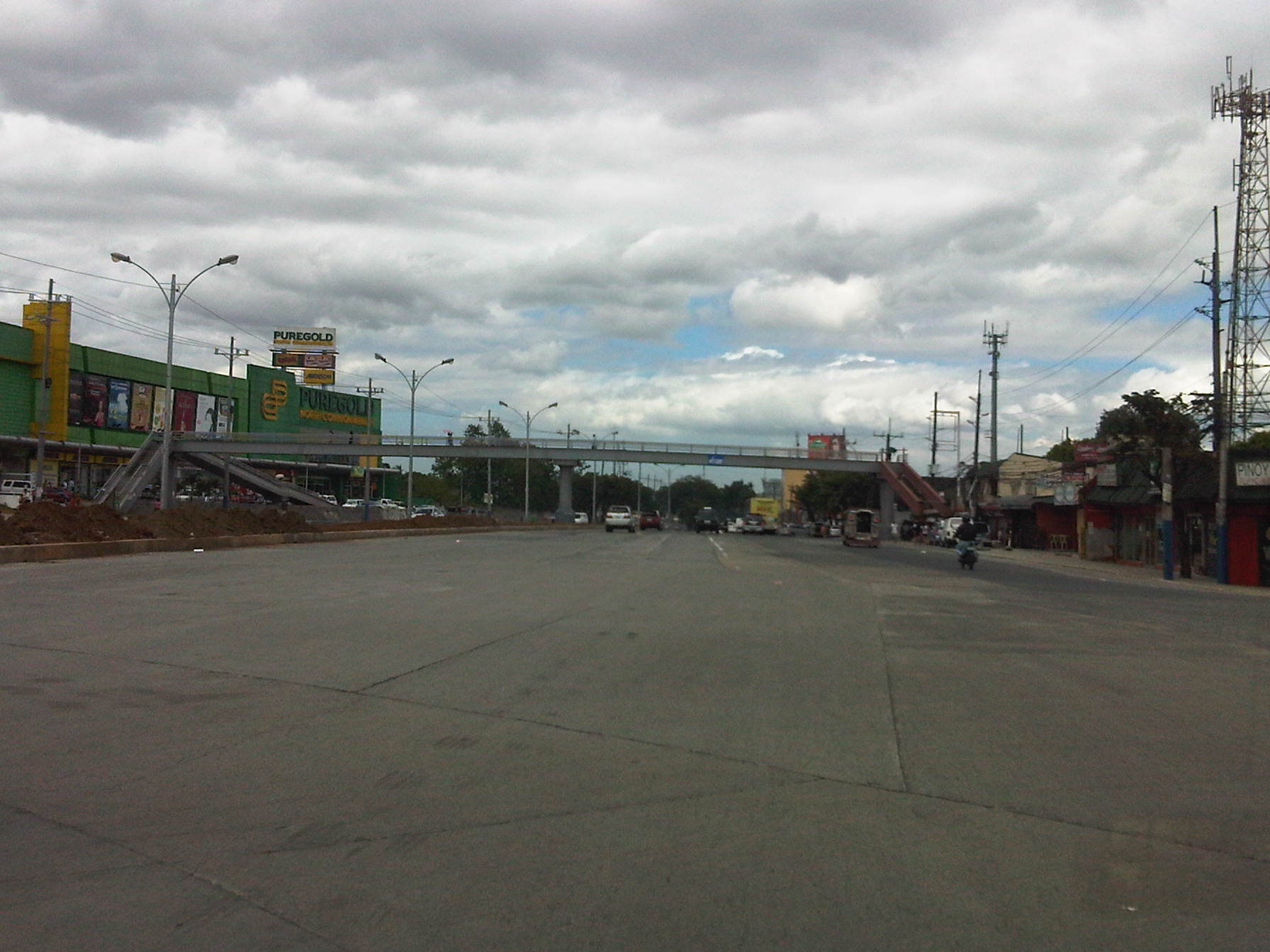 Section past the new rotonda along Commonwealth just before the overpass across the new Puregold branch – the highway was widened along this stretch and narrows to 3 lanes per direction after the overpass. There are no pavement markings yet for the newly added lanes and most of those for the previous lanes are already faded.
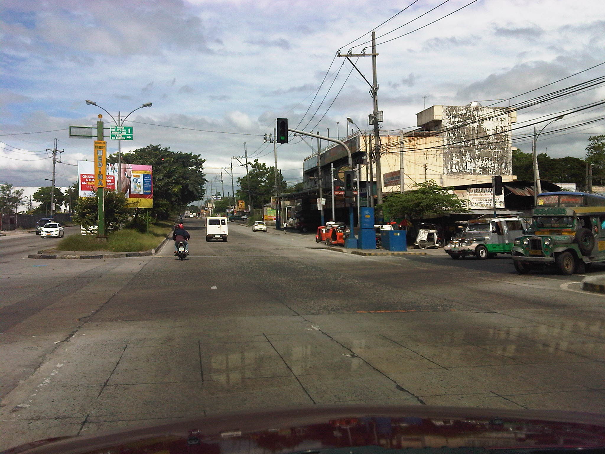 Junction of Commonwealth and Regalado – pavement markings are practically weathered and there are no indications of motorcycle lanes along these sections of Commonwealth
The formulation and implementation of motorcycle lanes along Commonwealth (and Macapagal Boulevard) are based on very good intentions (i.e., to reduce the incidence of road crashes involving motorcycles). However, the absence of pavement markings and signs to guide motorists and especially motorcyclists send the wrong signals in as far as enforcement is concerned. Add to this the serious matter of traffic management along PUV loading/unloading areas that is required to ensure that PUVs will not occupy motorcycle lanes and forcing riders to take to other lanes, thereby coming into conflict with private vehicle traveling along the inner lanes. These two issues clearly need to be addressed and fast so that the scheme can be effectively implemented throughout the entire length of Commonwealth Avenue.
The current situation pertaining to the implementation of motorcycle lanes in Metro Manila is perhaps another case where the agency implementing the scheme again “bit off more than it could chew.” As in the case of the 60 kph speed limit, effective enforcement throughout Commonwealth is limited by the availability and deployment of speed measurement equipment. As such, many vehicle still exceed 60 kph at sections where there obviously are no speed guns or radars. These situations and conditions are highly likely to lead ultimately to a ningas cogon outcome for such traffic management schemes. Such is undesirable since motorists will only become jaded (if they are not yet at this point) about traffic management in Metro Manila and elsewhere. And yet there are already indications that, like the PUV lanes, the MMDA would eventually slack on the enforcement side after realizing it needs to employ and deploy much more trained/skilled enforcers to implement all these schemes at the same time.
Conflicting flows – driver and rider behavior in the vicinity of flyovers
Typical issues concerning traffic flow along sections approaching or departing from the ramps of vehicular overpasses or flyovers include weaving. Simple observations will reveal that a significant number of vehicles, regardless of whether private or public, passenger or freight, big or small, have a propensity to change lanes before and after a flyover. Such weaving behavior is a consequence of driving behavior in this country where many drivers and riders often are unmindful of planning their trips as well as the proper positioning of their vehicles while using the road. Many drivers and riders seem intent only in bypassing points of congestion and do not have any respect at all for the rights of other road users as well as for the rule of law along highways and streets.
I took the opportunity of taking a few photos after an interview conducted atop the pedestrian overpass along Commonwealth across from Puregold and near the Tandang Sora flyover. Below are a few photos taken during nightfall on Monday showing typical behavior of drivers and riders in the vicinity of the foot of the Tandang Sora flyover.
 Jeepneys occupying five (5) northbound lanes of Commonwealth Avenue, including the lane designated for motorcycles (delineated by the blue lines) – Most public utility vehicle drivers in the Philippines seem to abhor queuing and the prevailing practice is for most of them to try to bypass others by encroaching along the middle lanes. Instead of a First In First Out (FIFO) discipline that is desirable for conventional public transport operations, its more like a Last In First Out (LIFO) state along loading/unloading areas.
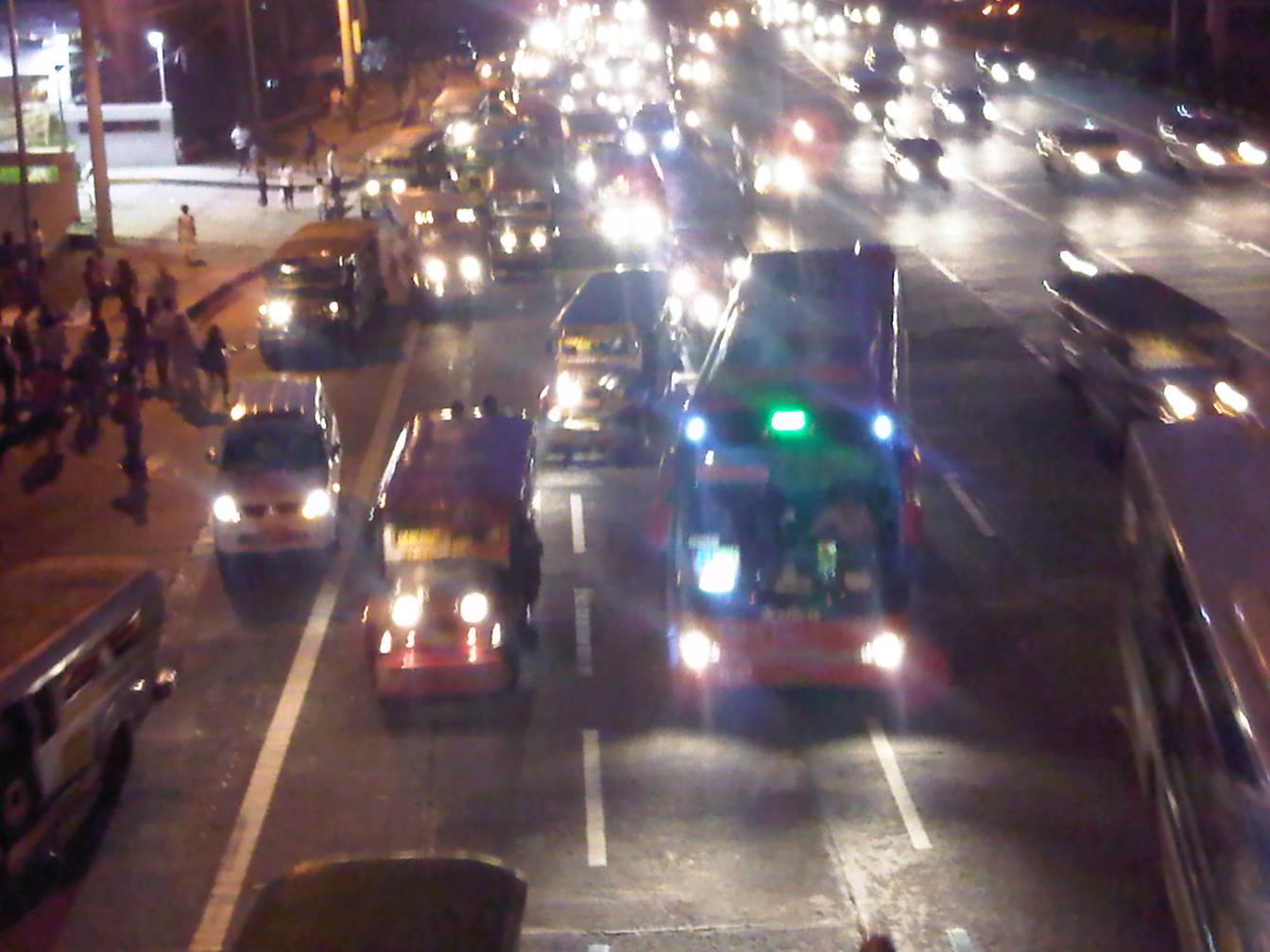 Buses joining the fray of vehicles in the same area – Note that practically 4 to 5 lanes of Commonwealth are occupied by buses, jeepneys and AUVs, effectively blocking motorcycles from using the lane designated for them. Such behavior in the vicinity of the foot of the Tandang Sora flyover also influences private vehicles to shift towards the inner lanes of the highway and unto the path of vehicles descending the flyover.
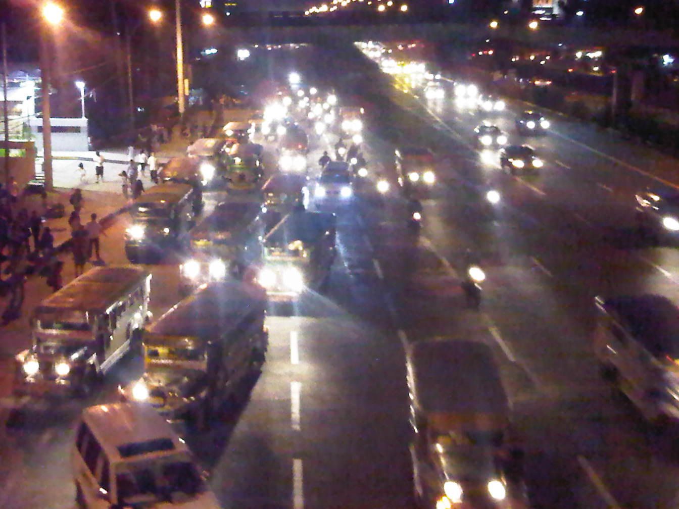 Motorcycles (they with the single headlights) using the 5th and 6th lanes of Commonwealth – riders have no choice in this situation where PUVs have occupied the motorcycle lane and behave as if they are the the only road users in the area. PUVs are observed as generally oblivious of the fact that road space is to be shared and basic courtesy is a requirement for smooth and safe flow to occur.
 As the traffic flow decreases, partly due to the control imposed by the traffic signal upstream at the Tandang Sora intersection, lanes become less congested – motorcycles are then able to return to their designated lane.
The chaotic situation shown in the photos could have been prevented or corrected if enforcers were in the area to manage traffic. There were none in the area, and I only found a few of them a couple of hundred meters downstream apprehending riders where traffic is already free-flowing. I thought perhaps that instead of focusing on apprehending riders, these enforcers were better off trying to address the mess upstream of their position. It is always both frustrating and disappointing to see enforcers diligently doing their jobs in the wrong locations along our highways. And all too often, the drivers and riders they apprehend are not the ones guilty of constricting traffic or posing dangers upon other motorists.
Motorcycle lanes – a few comments
The Metropolitan Manila Development Authority (MMDA) recently established motorcycle lanes along Commonwealth Avenue in Quezon City and Macapagal Boulevard in Pasay City. The main intention is to reduce crashes involving motorcycles by attempting to segregate them from other vehicles in traffic. Following are a few photos I took this afternoon along Commonwealth where I observed the MMDA painting blue lines to mark the motorcycle lane. In this case, the lane is the 4th from the outer edge (shoulder) of the highway.
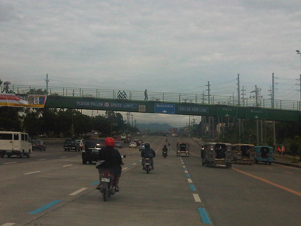 Newly painted blue lines mark the motorcycle lanes. Photo shows riders following the new policy, probably knowing that getting apprehended will lead to a 15-minute lecture on motorcycle safety. Such a penalty will only be applicable this week when the MMDA is implementing a dry-run of the policy. From Monday next week, the penalty would be a 500-peso fine for every apprehension.
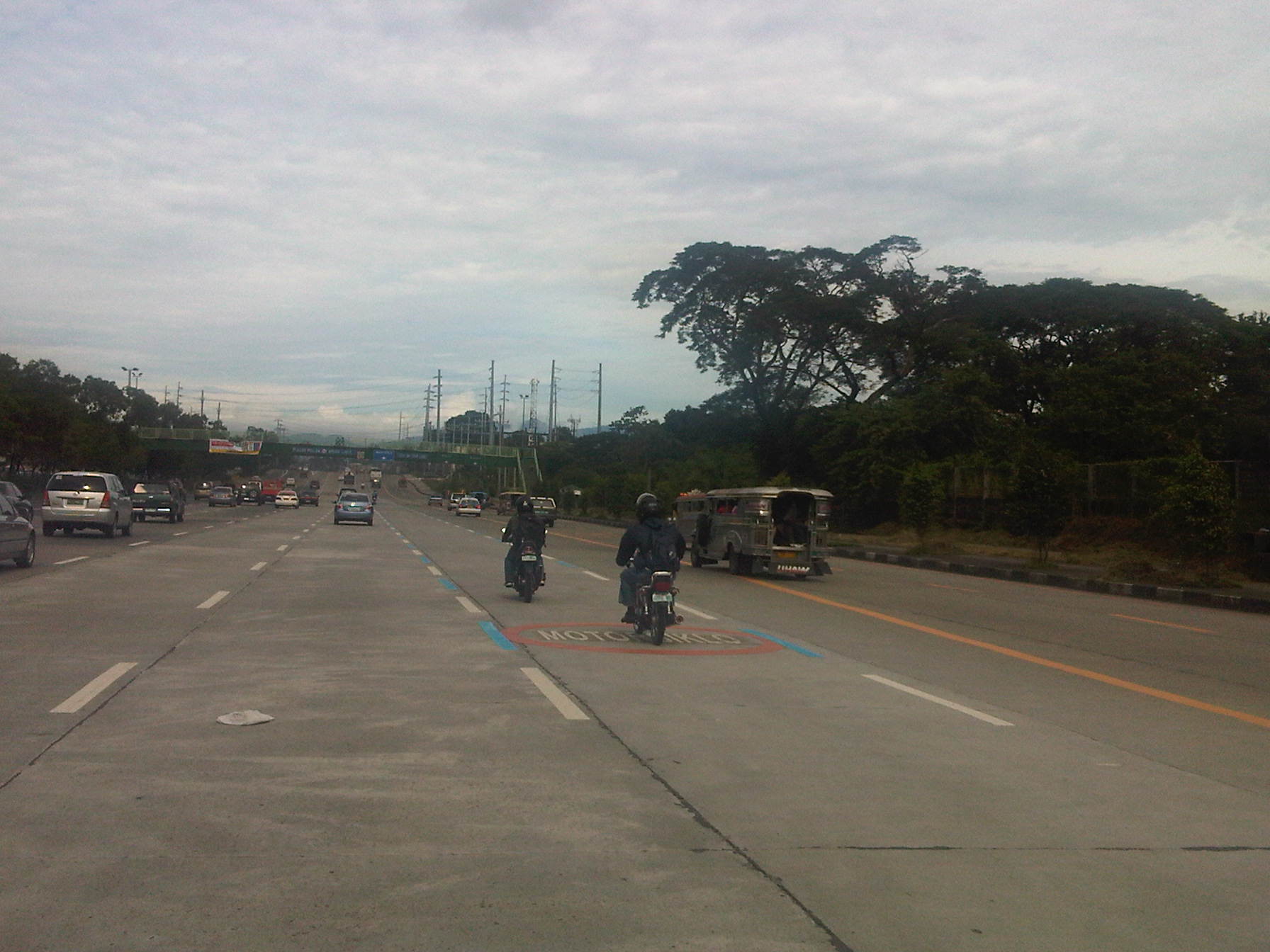 Pavement markings for the motorcycle lane along Commonwealth. Note that the lane is quite close to the lanes designated for public utility vehicles like jeepneys and buses. This situation creates a high potential for the occurrence of crashes involving motorcycles and PUVs. Of particular concern is the behavior of PUVs, especially buses that tend to encroach upon the lanes to the left of the PUV lanes including the motorcycle lane. Another issue is the fact that private vehicles are allowed along the motorcycle lanes and not just for maneuvering. I share the opinion of riders that motorcycle lanes should be for motorcycles only.

