
Home » Pedestrian (Page 18)
Category Archives: Pedestrian
“Pwede na yan” bikeways?
The recent clamor for bicycle facilities have led to several initiatives in Metro Manila and other Philippines cities (most notable recently is Iloilo) to support the demand for cycling facilities. While Marikina City already has a network of off-street bikeways segregated from motorised traffic, there are few other examples of such facilities elsewhere. The more recent initiatives in Metro Manila involved the Metropolitan Manila Development Authority (MMDA) establishing bikeways in several areas along major roads in the metropolis. I say establish because the MMDA did not construct new bikeways like the ones in Marikina or Iloilo. What the agency did was to designate sidewalks and other existing paths for cycling by painting these over. Unfortunately, these so-called bikeways did not take into consideration the needs of pedestrians with whom cyclists must share this limited space. And so few people use them despite a high profile launch that brought together government officials and NGOs including cycling and mobility advocates and enthusiasts. I guess the big test was really not whether advocates and enthusiasts would really use the bikeways (Don’t count on the officials to use them. They have chauffeur-driven vehicles.). Would the regular commuter use them instead of the roads, despite the risk or dangers posed by motor vehicles?
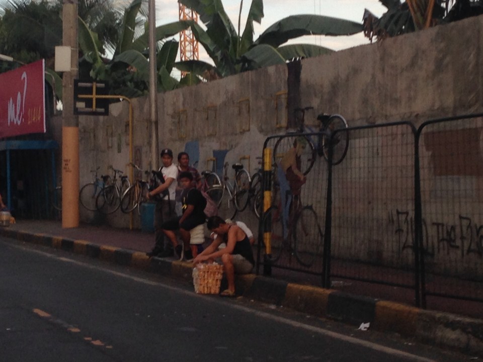 Commuters waiting for a bus ride along EDSA with suspended bicycle racks behind them. The sidewalks along EDSA have been painted red, designating them for bicycle use. The big question now is how cyclists will interact with pedestrians given the very limited space they should be sharing.
 Bicycles hanging on racks attached to the perimeter wall of an exclusive subdivision along EDSA.
 Cyclist using the curb side lane of EDSA – these people run the risk of being sideswiped by buses operating along the yellow (bus) lanes of this busy thoroughfare. It is quite obvious in the photo that there is no space on the sidewalks to accommodate cyclists and even pedestrians. Column for the MRT-3 stations are right on the sidewalks and makes one wonder how this flawed design was approved in the first place. MMDA enforcers usually appear as if they are only bystanders and seem to be generally helpless when it comes to managing traffic.
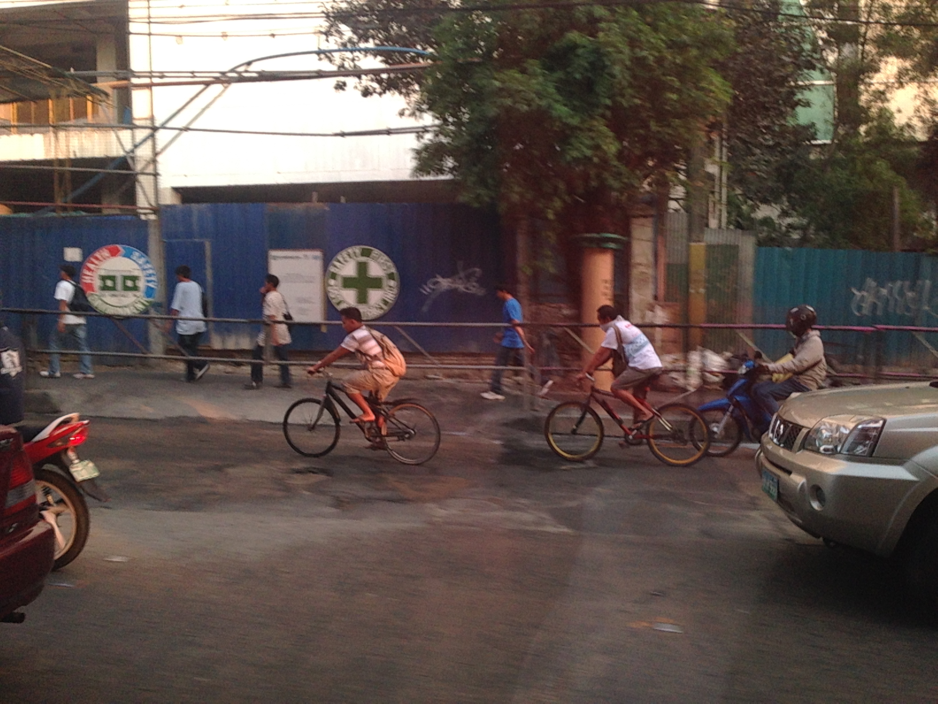 Workers cycling back to their homes after a day’s work. Many people have opted to take bicycles for their daily commutes even if they have to travel long distances in order to save money that would otherwise be paid as fares for buses, jeepneys, UV Express or tricycles. Note that the cyclists use the outermost lane of the road as the sidewalks pose many obstacles including pedestrians as shown in the photo. Some cyclists though want more than a share of the sidewalk or a lane of the road for their use regarding pedestrians and motor vehicles as nuisance for them. Surely, some pedestrians also regard cyclists as nuisance to walking and would prefer to have the sidewalks for themselves.
Cycling is in a way an emancipation from motorized transport commutes, and savings translate to money they could allocate for other needs of their families. While there are raw data for family expenditures from census surveys, there are few studies and publications focused on transport. It would be interesting to see how much a typical Filipino family spends for transport in absolute terms as well as a percentage of their total incomes. Such information would be essential for understanding the needs of travelers, especially for daily commutes for work and school (other trips include those for purposes of shopping, recreational, social and others). Long commutes are associated with higher expenses (e.g., in terms of fares or fuel costs) and reducing such costs through shorter commutes should free up money for necessities like food, housing and clothing. Ultimately, this would help solve issues relating to poverty and health, which can easily be related to commuting behavior and characteristics.
It is in that context that transport systems should be planned and implemented carefully along with the housing developments. This underlines the essence of the relationship between transport and land use that has been the topic of discussions for quite some time now that apparently, a lot of people in this country, especially officials and the private sector have chosen to ignore or apply selectively (i.e., according to their own advantage and not really for the general welfare of the public). A transport system is not cycling alone, or roads or railways alone. It is, by definition, a network, a set of interacting, integrated elements and each of these components of the system are essential for it to function well. It is the interaction and integration that are the key elements that we often forget as we advocate one transport mode over others as if they are independent from each other. They are not and we should complement rather than compete in our advocacies for transport so we can finally achieve an efficient, effective system for everyone.
–
“Sharing the road” – bandwagons and fads? Let’s hope not!
There seems to be a lot of talk about “sharing the road” and the initiatives to have more bikeways. I hope I am proven wrong but it seems to me as if these current programs and projects are more of a fad. A lot of people (and local governments) join the bandwagon with little understanding of what needs to be done. It’s usually because of the good PR they get out of these that they agree to coming up with the token carless street or the haphazardly implemented bicycle lanes. More than PR, some cities are aware of the opportunities that come with such initiatives as international agencies and groups are willing to spend money to support such programs and projects. The question really is on sustainability and doing the right thing not only on initiating things or coming up with programs but on the substance itself. And by substance I mean that programs should also go into the details of designs. Too often, the “pwede na yan” approach is taken and this just won’t do.
 The MMDA painted the sidewalks in White Plains and designated them as bikeways, in a way alienating pedestrians.
A vision for what people want to have is there but it is ultimately how the achieve the vision that needs a lot of work. For example, bills are being filed in congress to force the creation of bicycle lanes along major highways. (And mind you there are a lot of similar bills filed in congress that upon closer inspection actually have little substance.) The premise here seems to be that if you build them then people will start cycling. That was not the experience in Marikina, which boasts of the country’s only bikeways network that includes many off-street sections. These bikeways were built at a time when the perception and analysis pointed to a critical mass of cyclists in that city that was thought to be surely the tipping point in terms of non-motorised transport. Nowadays, the same bikeways are used by motorcycles and tricycles and most cyclists we see are not commuters (e.g., cycling between home and work/school) but recreational cyclists. It would take Marikina some effort to promote commuting by bicycles and much effort in enforcement to correct the misuse of the bikeways. The “new” bikeways in Quezon City appear to be poorly conceptualised as the MMDA decided to paint the sidewalks along EDSA northbound without addressing the obstacles like electric posts. Still, it is an effort to put NMT in the consciousness or awareness of the general public (thanks in part to media’s making these news worthy items).
Cities like Pasig and Taguig like to show-off Ortigas Center and Bonifacio Global City, respectively, as their faces when in fact the cities have not done much in their original cores. The running joke is that the real Taguig is not the areas to the west of C-5 but the old Taguig, which is to the east. This Taguig is the one plagued by narrow streets and the proliferation of tricycles. It was not so long ago that a former mayor imposed e-tricycles on BGC (where they were not suitable) while not doing much to lift a finger in the mayhem of tricycles in old Taguig (e.g., along Gen. Luna). As for Pasig, you just have go along the Pasig River and the Manggahan Floodway to see what it has accomplished so far in those areas.
There are no quick fixes to the transport and traffic problems our cities are facing. In the case of Metro Manila, much is at stake for the long-delayed mass transit projects. And the DOTC’s announcements of projects being formulated or proposed are no longer taken seriously as they have not delivered on any of these despite 4 years of this current administration. For other cities, it is important to learn the hard lessons from the experience of Metro Manila. There is also a need for a drastic change in transport and traffic policies in our cities. Iloilo, for example, has built an expensive bike lane along Ninoy Aquino Avenue (Diversion Road) and has marketed its Esplanade as a haven for pedestrians and cyclists. Yet the city has not acted on the clamour to revisit the overpasses along Gen. Luna (Infante and Jalandoni flyovers). The latest information I got from the city is that there are issues in the design of the bikeway along the Diversion Road as the surface (they used pavers) is not suitable for cycling. It seems, also, that the city and cyclists were not consulted by the DPWH when the bikeway was designed and constructed resulting in many cyclists using the Diversion Road itself for traveling. This last example is a lesson for our local governments and national agencies that they need to cooperate with each other and turfing has no place in transport and traffic if we are really serious about bringing solutions to problems we encounter everyday.
–
Snippets of Manila streets and traffic
Coming from a forum held at a hotel in Manila, I took a few photos of scenes along our route back to the university. These are snippets of everyday scenes in the Philippines capital city, which now has for its mayor the former President of the country who was ousted back in 2001 for allegations of plunder. He has been on the news quite frequently as his administration has introduced traffic schemes intended to address traffic congestion in that city. These include going after buses without terminals in Manila last year and quite recently an expanded truck ban that renewed discussions about logistics and the Port of Manila (i.e., decongesting the port in favor of Subic and Batangas ports).
 Traffic at the intersection of Bonifacio Drive, Roxas Boulevard and Padre Burgos Avenue. The trucks in the photo are coming from the Port of Manila and at the time this was taken, the window of the extended truck ban in Manila allowed these trucks to travel.
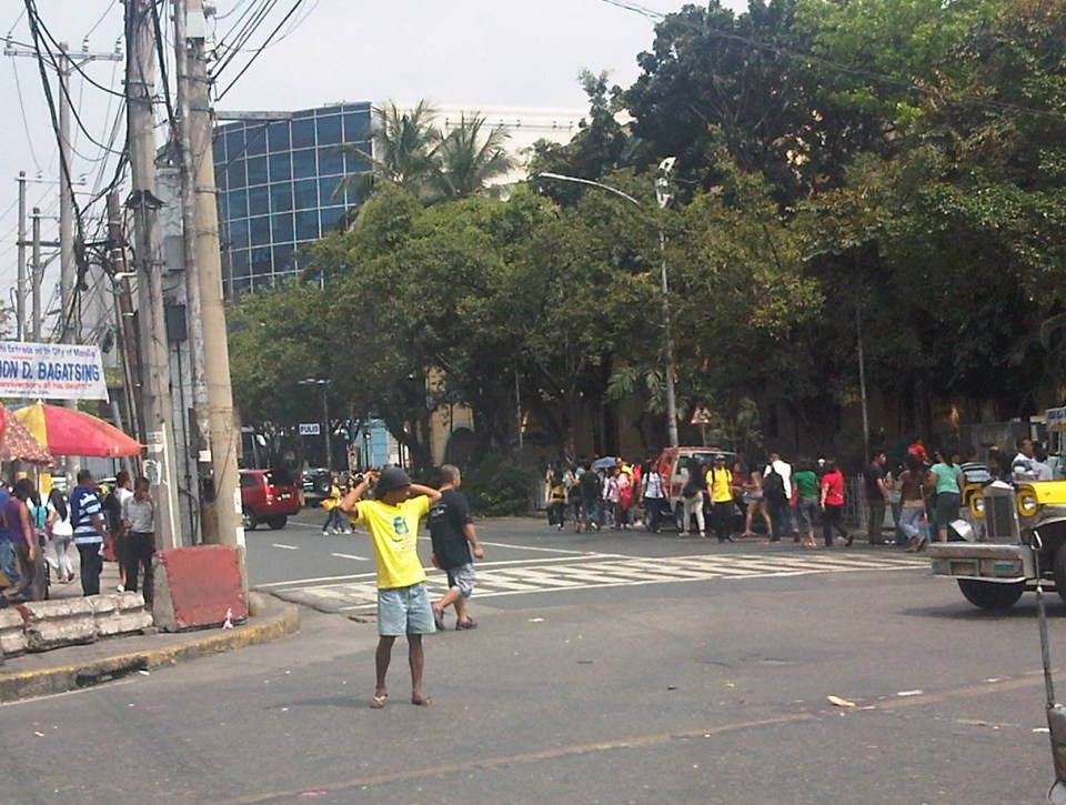 Barkers meet jeepneys head-on in the middle of the street just past Manila City Hall. A friend posted sometime ago that in Philippine streets, the uneducated dominate the educated and this seems so true in the case of public transport where barkers, paratransit drivers and their lot control how people should get a ride and how vehicles should operate.
 Organized mayhem – pedicabs run along most of Manila’s streets with many even traveling counter-flow. This photo was taken just across from the old, decrepit Metropolitan Theater just before the Quezon Bridge towards Quiapo.
 More pedicabs (also called padyak or trisikad), non-motorized 3-wheelers that notoriously violate traffic rules and regulations as they proliferate in many parts of the city.
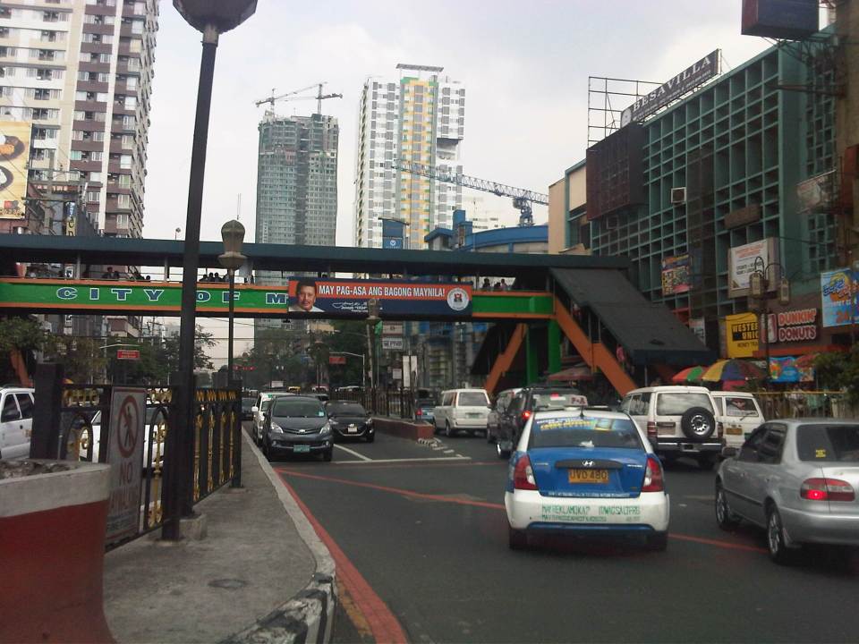 A sign stating “There’s hope for a new Manila.” with the face of former Philippines President Estrada, who was elected Manila Mayor last year.
 A modern public transport stop along the eastbound side of Espana Avenue shows a guide map and electronic message board that informs people who was responsible for the project.
 Another modern bus stop, this time just in front of the University of Sto. Tomas campus, which is along Espana Avenue.
 A side street to Espana Avenue reveals an on-street motorized tricycle terminal. There is a sign at the entrance to the street saying buses are not allowed along the road.
More on Manila in the next posts…
–
Designing for walking and cycling
There are current discussions regarding the highway and street designs mostly from the perspective of safety. These discussions include those hosted by the academe and those posed as challenges by practitioners, mainly architects with experience designing similar facilities abroad and who are advocating for more people-friendly designs. Such discussions are slowly but steadily gaining traction in the Philippines but has met with some resistance in the form of key persons and agencies not giving due attention to the design challenges being posed that would have implications on planning and design guidelines. That is, the implications of promoting people-friendly designs in our roads will require changes in the National Building Code as well as the Highway Planning Manual of the Department of Public Works and Highways (DPWH). These changes will include standards and specifications for the geometric design of walkways and bikeways integrated into our roads and a departure from the current approach that basically treats pedestrian and cycle facilities as an afterthought to motorways.
I’m posting a few photos I took from a recent visit to Yokohama, Japan, which was my home for 3 years back in the 1990s. Much has changed in Yokohama since I last visited in 2008 but notable are the people friendly transport infrastructure including pedestrian and cycling facilities. Following are photos taken in the Minato Mirai district of the city.
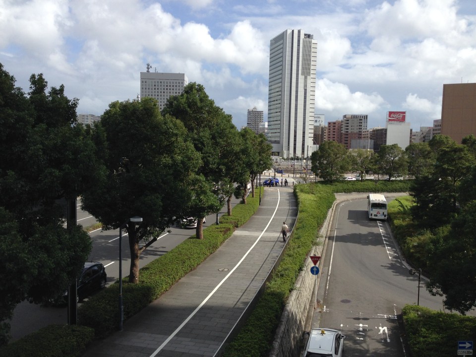 Pedestrian and cycling lanes along the main road of Yokohama’s Minato Mirai district. The tree-lined street provides a conducive environment for walking and cycling.
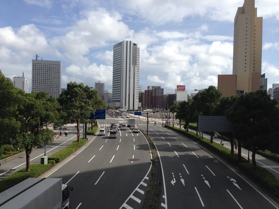 Depending on how one sees it, Minato Mirai Odori is a 10-lane road with 4 lanes allocated for walking and cycling (i.e., 1 lane each on either side of the lanes for motor vehicles).
 Pedestrian bridge connecting Minato Mirai Odori with the World Porters commercial development
 A 10-lane bridge with 2 of 5 lanes per direction devoted for walking and cycling. That’s a full lane of at least 3.2 meters allocated for pedestrians and another full lane for cyclists. While it is not shown in the photo, the pedestrian and cycling lanes are efficiently utilized during the peak periods.
–
Motomachi
It’s December again and during this month I like to reminisce about favorite places I went to or still go to here and abroad. One of my favorite haunts during the time I called Yokohama my home city was the Yamate area. I went to Mass every Sunday at Yamate Catholic Church. After church, friends and I descend towards the Motomachi shopping street to take strolls, window shop or have lunch in one of the many restaurants along the street. I think it is a good example of a shopping street that’s also found in many other places particularly in Europe and the US. It provides a better environment compared to the large malls we often find in many cities including Metro Manila.
 On-street parking spaces are provided along one side of several sections of along the street. There are parking meters at these spaces.
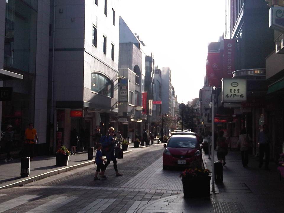 It is a nice place to take a walk whether doing actual shopping, window shopping or just a simple stroll to while away the time.
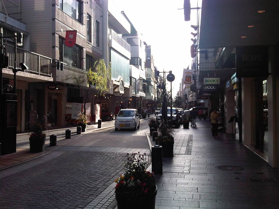 I like the brick road of Motomachi and the restaurants and shops lining the street.
 Benches where people can sit down, take a short rest or wait for their companions who are shopping at a nearby store.
 Motomachi Union where I used to do some groceries whenever I’m in the area (usually Sundays after Mass at Yamate Church).
 A look back to Motomachi as I approached the JR Ishikawacho Station.
There used to be a Indian restaurant at one of the side streets of Motomachi. The chef of the restaurant was a Sri Lankan Catholic who was a church mate at Yamate. We often went to eat there after Mass or on occasion. He would usually adjust the ingredients of our favorite curry and tandoori dishes so they weren’t too hot or spicy for our palates. I wonder where he is now with his family and hope they are doing very well.
There also used to be some clubs or pubs at the end of Motomachi. These included one that was operated by Filipinos that had the Philippine flag displayed. Those establishments are long gone, replaced by newer restaurants and shops as well as a building leading to the underground station of the Tokyu Minato Mirai Line. I know there are also a lot of new, still undiscovered shops and restaurants in the side streets to Motomachi. I look forward to going around the area again soon to check out these places.
–
Scenes at Aurora-Katipunan
My commute between my workplace and home includes a stop at the junction of Aurora Boulevard and Katipunan Avenue (C-5) to transfer from one jeepney to another. This is very similar to my commute when I was a university student a couple of decades ago. At the time, there was no flyover in the area and the Katipunan jeepney terminal was located at what was called K-Mart, a wet market set-up on privately owned land that was tolerated for quite some time before the market and terminal were eventually evicted from the area. The transfers when coming to the university were smoother. It involved shorter walks then and now. Meanwhile, the Katipunan jeepneys had orderly queues for passengers. There were two types of jeepneys – those that terminate at Balara and those that are allowed to travel inside the UP Diliman campus.
The transfers going home were and are still more challenging as it required longer walks and crossing Aurora Boulevard to get to the informal terminal or the loading/unloading areas for jeepneys. Back in the day, there was no terminal and the loading/unloading zone was a stretch in front of the old Sta. Clara church in what is now the LRT 2 Katipunan Station. Now, there is an informal terminal also beneath the Aurora-Katipunan flyover.
 Walking and falling in line – commuters walking past the queue for Katipunan jeepneys at the terminal beneath the Katipunan-Aurora flyover.
 A view of the Katipunan jeepney terminal from the pedestrian overpass crossing Aurora Boulevard. Aside from the terminal, there are also parking spaces for bicycles and motorcycles as well as a police assistance center. There are also many vendors in the area selling items like fruit, peanuts, cigarettes and even sandals and used clothes.
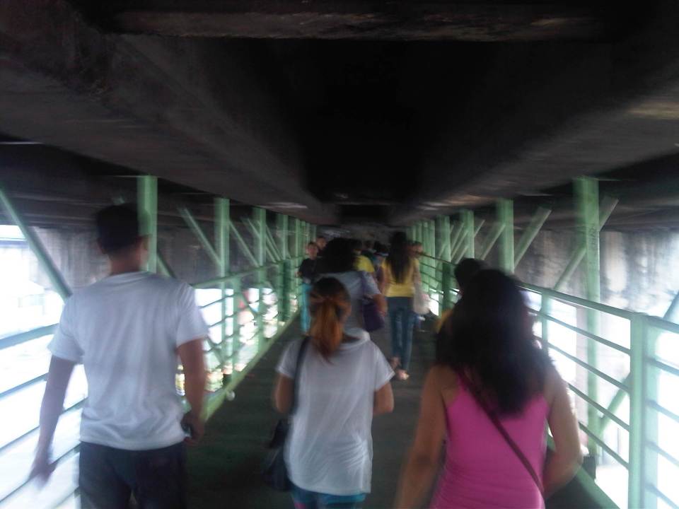 Pedestrians along the walkway hanging from under the Aurora-Katipunan flyover. The walkway is quite stable and there are no noticeable movements in the structure even with significant pedestrian traffic.
 Pedestrians descending the stairs towards the informal terminal for Rizal and Marikina-bound jeepneys.
 Informal terminal for Rizal and Marikina-bound jeepneys.
This could have been a different commute if the LRT 2 terminated in Masinag instead of at Santolan. I could have been taking the trains instead of the jeepneys for one leg of my commute. I still look forward to the day I would be taking the trains and am constantly frustrated by the inaction of those responsible for public transport in Metro Manila and this particular corridor.
–
Some thoughts on the issues on bus bans and terminals in Metro Manila
I had originally wanted to use “Clarifying issues on bus bans and terminals in Metro Manila” as the title for this post. However, I felt it was too strong a title, and one that would be more appropriate for a government agency like the MMDA or DOTC, or an LGU like Manila. More than fault-finding and criticizing government agencies and local governments, I believe we should take a closer and more objective look at the issues (or non issues?) pertaining to the Manila bus ban and the opening of the southwest provincial bus terminal for Cavite-bound buses. Following are my comments on issues raised the past weeks about the two initiatives.
Issue 1: There were no or few announcements about the implementation of the bus ban in Manila and the southwest terminal in Cavite.
Comments: While the bus ban in Manila came as a surprise to many, the move was actually a consequence of a Manila City Council resolution. Normally, such resolutions would take time to implement and would entail announcements for stakeholders. Though we will probably never know the truth or who is saying the truth about the resolution and its implementation, it is likely that bus operators already knew about the implications but decided to call Manila’s bluff and play the media and public appeal cards rather than comply with Manila’s requirements for franchised buses and terminals as they have done before in other issues like fuel prices and fare hikes.
I find it difficult to believe that the MMDA did not do its part in announcing the opening of the southwest terminal. Perhaps people thought the announcement was over a very short period? Or maybe people didn’t mind the announcement and are also at fault for paying no or little attention to the announcement? If so, then the public is also partly to blame for disregarding the announcement from the MMDA, assuming the agency won’t push through with its initiatives to implement central terminals for buses. Next up will be another southern terminal at Alabang and a northern one near Trinoma.
Issue 2: Poor transfer facilities and services including a lack of pedestrian facilities between the bus terminal and transfer point, and lack of public transport like jeepneys to ferry passengers to their destinations.
Comments: I think it’s quite clear that the MMDA and LGUs are at fault here. Despite the construction and scheduled opening of the southwest terminal, there have been limited effort in improving pedestrian facilities. Such facilities needed to be in place prior to or upon the opening of the southwest terminal and requiring all provincial buses to terminate at the facility instead of continuing to Metro Manila. People-friendly facilities could have helped people in adjusting to the new policy though walking from 100 to 200 meters is certainly not for all, especially during this rainy season. Senior citizens and persons with disabilities (PWDs) would have specific needs that could have been addressed from day one of operation of the terminal. One approach to “bridge the gap” between the terminal and where people could take city bus and jeepney rides could have been to modify some city bus and jeepney routes to make these closer to the terminal. Ideally, the terminal could have been an intermodal facility providing efficient, seamless transfers between modes of transport.
In the case of Manila, the jeepneys were already there with routes overlapping with buses but their numbers and capacity could not cope with the demand from the buses. Since the main objective of Manila was to weed out colorum buses, it could have coordinated with the LTFRB to check the registration and franchises of buses rather than generalizing among all buses. Perhaps Manila just wanted to make a big statement? But then this was at the expense of the riding public, which obviously got the attention of many including the media. Coordination among agencies and LGUs, however, has not been a strong suit for these agencies, and this thought leads us to the next issue.
Issue 3: Lack of coordination among LGUs and agencies in implementing transport schemes.
Comments: This issue is an enduring one and has been the topic of discussions, arguments and various fora for as long as we can remember. On one hand, the DOTC and the LTFRB should provide guidelines and guidance to local governments on transport planning and services. The agencies should be proactive in their engagement of LGUs in order to optimize transport services under the jurisdiction of national agencies and local governments. On the other hand, LGUs must accept the fact that most if not all of them are ill equipped or do not have the capacity nor capability to do transport planning much less addressing issues regarding public transport. Citing the Local Government Code and its devolution of local transport to LGUs everytime there’s a transport issue certainly won’t help LGUs solve their problems.
Issue 4: Terminals required for city buses in Manila.
Comments: There should be a terminal for city buses in Manila but not a terminal for each company. There should only be one or maybe two terminals where buses can make stops prior to making the turnaround for the return trip. There is actually a terminal in Manila, which the city can start with for city buses. This is the one just beside the Metropolitan Theater and near City Hall, which can be utilized by city buses. It is also close to the LRT Line 1 Central Station so the facility can be developed as a good intermodal terminal for land transport.
Issue 5: Colorum or illegal public transport vehicles in Manila
Comments: This is actually a problem not just for Manila but for the rest of Metropolitan Manila and the rest of the country. The colorum problem is there for both conventional and paratransit services as there are illegal buses, jeepneys, UV express, multicabs, taxis, tricycles and pedicabs everywhere. Many of these are allegedly being tolerated by national agencies and local governments with many allegedly being fielded or owned by public transport operators themselves.
–
In most cases, the best time to evaluate a traffic policy or scheme is NOT during its first days or weeks of implementation but after a significant time, say at least a month, after it was implemented. This is because the stakeholders, the people involved would take some time to adjust to any scheme or policy being implemented. This adjustment period will vary according to the magnitude or scope of the scheme/policy and can be quite “painful” to many who have gotten used to the old ways. Usually, a lot of comments and criticisms are quite emotional but it is clear that the collective sentiment is the result years or decades of poor transport services and fumbling by government agencies. Transport in Metro Manila is already quite complicated with routes overlapping and services competing with each other for the same passengers. Perhaps it is time to simplify transport while also in the process of optimizing and rationalizing services. I have written about this in this previous post.
More transport issues in Manila will come about should the city train its attention on other modes of transport including jeepneys, UV express vehicles, tricycles, pedicabs and kuligligs. If the city is really intent on reforming transport services within its jurisdiction, it should consider the needs of all stakeholders and especially and particularly the riding public. Transport should be inclusive, people-friendly as well as environment-friendly and there are many good practices in other cities that Manila could refer to and study for adaption and adoption for the city. If it is successful in improving transport, then perhaps Manila could be the country’s model for transformation from being the “Gates of Hell” to being a “Portal to Heaven” to residents and visitors alike.
–
More pedestrian facilities please!
I took a couple of photos one late afternoon on a weekday on my way home. I wanted to have a picture of typical jeepney overloading during the afternoon peak. Typically, jeepneys would allow “sabit” or passengers hanging from behind the jeepney. This practice is actually prohibited and carries a fine if jeepney drivers are apprehended. And that is usually a big “if” considering enforcers turn a blind eye to the practice especially during peak periods when it is difficult to get a ride.
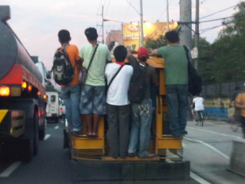 Jeepney full of sabit or hangers-on in heavy traffic along the eastbound side of a major highway
I also happened upon an opportunity to take a photo of the overloaded jeepney together with pedestrians walking along the walkway at the roadside. Though the photo was not so clear, it captured the image I wanted with people opting to walk while others took a risky ride on a jeepney. The cyclists in the photos were just bonuses and added to the visual of alternatives for mobility.
 Pedestrians and a cyclist along the widened walkway/bikeway along Marcos Highway
Walking remains as the mode of transport with the highest share when all modes, motorized or non-motorized, are compared. While there is a strong clamor from cyclists for bikeways and for cycling to be taken up by more people as an option for commuting, the reality is that cycling is not really for everyone. It is a viable and healthy mode but should also fit in a hierarchy of modes. Most people walk and walking should be encouraged over distances where it is most suitable. Facilities for walking need to be provided and properly designed so that people can walk safely and most efficiently like the example in the following photo taken during another weekday late afternoon.
 People walking along Marcos Highway
Local governments help promote walking by making sure sidewalks are provided and clear of obstructions. Perhaps walkability can be used as an indicator or parameter for a city to be qualified as livable and true to the advocacy of sustainable transport. Walking should be encouraged to promote healthy living as it incorporates exercise in our daily routines. More people walking should also increase awareness for the advocacy for clean air and help initiatives to improve air quality, particularly efforts to reduce harmful emissions by motorized vehicles. Thus, it is not difficult to understand how investing in pedestrian facilities and promoting walking is not a smart move and a beneficial one for any politician’s constituency.
–
Swapang! or the perils of walking
Walking to the jeepney terminal for a ride to the university, I was irritated by the constant honking behind me as motorcycles rode up the sidewalk to avoid the weaving into congested traffic along Aurora Boulevard. And so I tried to stand my ground allowing only half the space of the sidewalk for these motorcycles to pass through. As far as I’m concerned, I was already too generous giving part of the space that is for pedestrians and not for motorized traffic. Still, there were a few motorcyclists who seem to think they had the right of way as they attempted to convince me give up more space so they could practically take over the sidewalk. I didn’t give way and assumed they were cursing me inside their helmets. Manigas sila! I thought that in the end, sila ang asar at talo in this situation, not me.
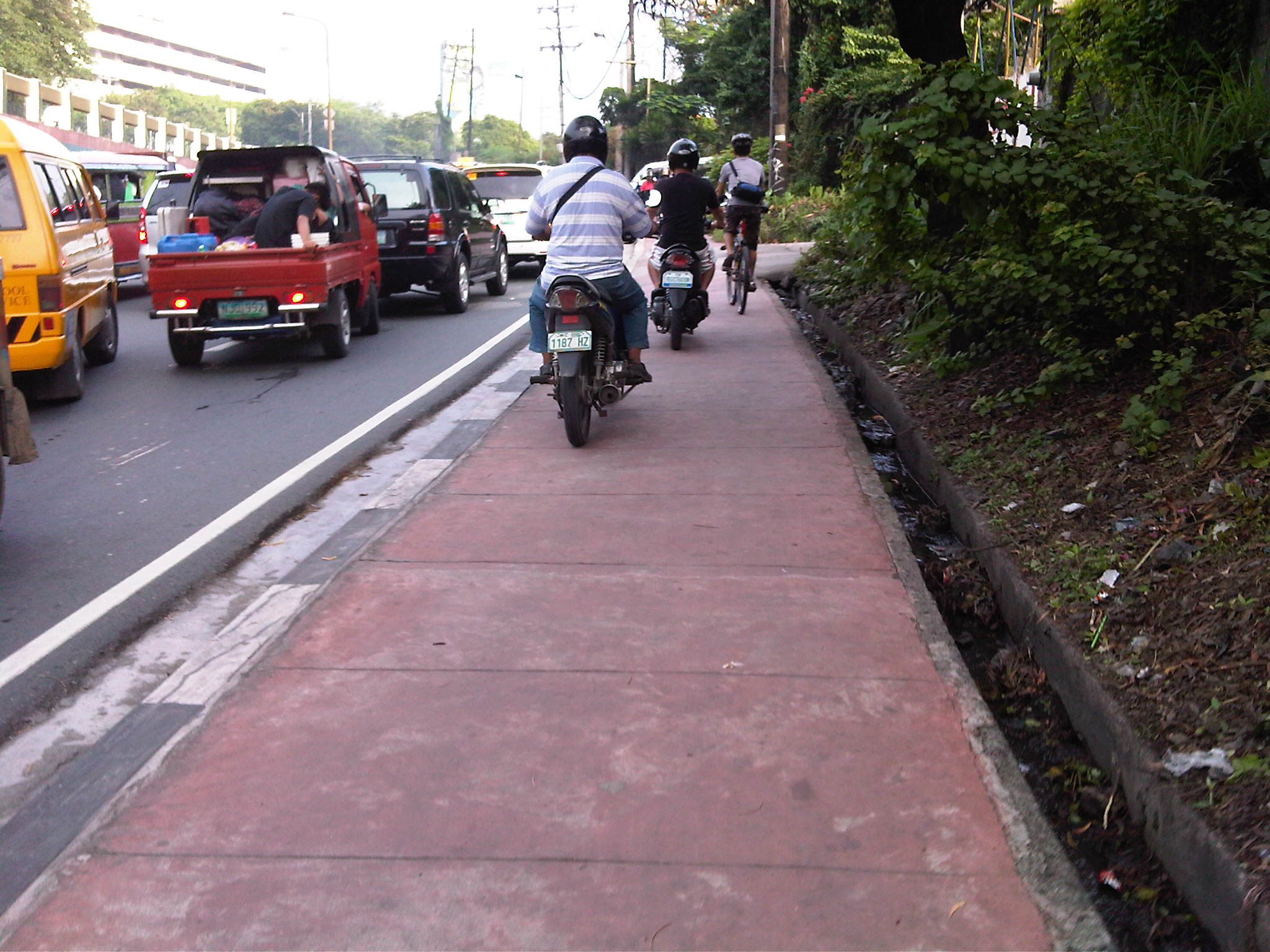 Motorcycles dominating space for pedestrians
At one point, I held my ground and didn’t give way to the motorcycles behind me [Advisory: This is not for everyone especially those who are “pikon” or who are looking for a fight.]. I knew my rights and I was walking on the pedestrian sidewalk. Unfortunately, a bicycle came along and I gave way only because I also appreciated cycling and understood that pedestrians and cyclists are sort of “kindred spirits” in a world dominated by motorized transport. The bicycle was immediately followed by two motorcycles including one that almost sideswiped the cyclist. I took the photo above to better show the situation.
The other day, I chanced upon a similar situation as I was driving in heavy traffic along Amang Rodriguez in Pasig City. What little space was available for pedestrians along a narrow sidewalk along this road connecting Marikina and Pasig cities.
 Motorcycles using a narrow pedestrian sidewalk to avoid traffic congestion along Amang Rodriguez
These cases are clear examples of swapang attitude or behavior that is prevalent among many road users. Unfortunately, these are not apprehended or accosted by traffic enforcers. The latter seem to be more engrossed with number coding and swerving violations, anyway, that they seem to have forgotten all the other traffic violations that included this brazen behavior of motorcyclists. Perhaps enforcers should go back to the basics and take more notice of all those other violations (e.g., speeding, counter flowing, beating the red light, beating the green light, etc.) to improve and promote discipline on our roads.
–
Some issues on pedestrian crossings at signalized intersections at BGC
I had heard from friends working at Bonifacio Global City in Taguig that it is difficult for pedestrians to cross at intersections at BGC. For one, the cycle settings (i.e., movements allowed for every green signal) for the intersections, at least those I’ve seen, often had turning traffic in direct conflict with pedestrian crossings. This meant that while given the green light to cross the street, for example, pedestrians had to contend with left turning as well as right turning vehicles who are also allowed movement for particular green phases. The phasing and the cycle settings are definitely more favorable to motor vehicles and assume that motorists will give way to pedestrians already on the carriageway and crossing the street. This is not the case and motorists tend to assert their way against pedestrians. These pedestrians are not jaywalkers but actually have the right of way by virtue of them getting the green light to cross. There is also that frequently violated rule of vehicles having to give way to legitimate crossings when people are already on the road. This is practiced in many other countries including the US, Japan and Singapore but is lost upon our motorists who seem to believe they own the road.
Another situation I’ve observed and personally experienced is the insufficient amount of time allocated for pedestrians to cross streets. This is particularly true for the wider streets of the Fort where it seems the people who set the signal cycles failed to estimate how much time it requires for people to cover the distance from one side of the roa to the other. What’s more is that the pedestrian settings allow only one or two people to cross at a comfortable pace. That is, other people will have to rush or run to be able to cross. Of course, the pedestrians would have to contend with the
 Intersection of 26th Street and 5th Avenue (view along 26th and towards 4th) – notice the green light given to through and left turning traffic as well as the signals for pedestrians, which include countdown timers.
 26th and 5th (view at the corner facing the Net Lima building)
 26th and 7th (view from the corner towards The Fort)
The solution to this issue about pedestrian crossings is a little bit more tricky that what seems like something that can be addressed by a simple adjustment of signal settings to provide more time for pedestrians. There is a need to revisit the phasing scheme for vehicle movements allowed at the intersections. Then there is also a need to find the optimum cycle and green time allocations considering the requirements for pedestrians and not just for vehicles. I believe whoever is in charge of the signal settings at BGC should look into this and if they are not capable of adjusting the settings then they should require the provider of the signals to make the necessary adjustments if not show them how to do this considering that traffic is quite dynamic and settings would need to be programmed to be responsive to demand not just for vehicles but pedestrians as well. BGC has great potential to be a pedestrian friendly CBD but whoever is in charge of transport planning and development should step up and level up, so to speak, in providing an environment that will encourage people to walk rather than take their cars. High Street is already there and is an important element in that mix of development but then the cluster of offices and residential condos aren’t exactly designed for efficient walking, and the settings for the intersection signals, as we pointed out, need to be adjusted for pedestrians.
–

