
Home » Public Transport (Page 55)
Category Archives: Public Transport
More pedestrian facilities please!
I took a couple of photos one late afternoon on a weekday on my way home. I wanted to have a picture of typical jeepney overloading during the afternoon peak. Typically, jeepneys would allow “sabit” or passengers hanging from behind the jeepney. This practice is actually prohibited and carries a fine if jeepney drivers are apprehended. And that is usually a big “if” considering enforcers turn a blind eye to the practice especially during peak periods when it is difficult to get a ride.
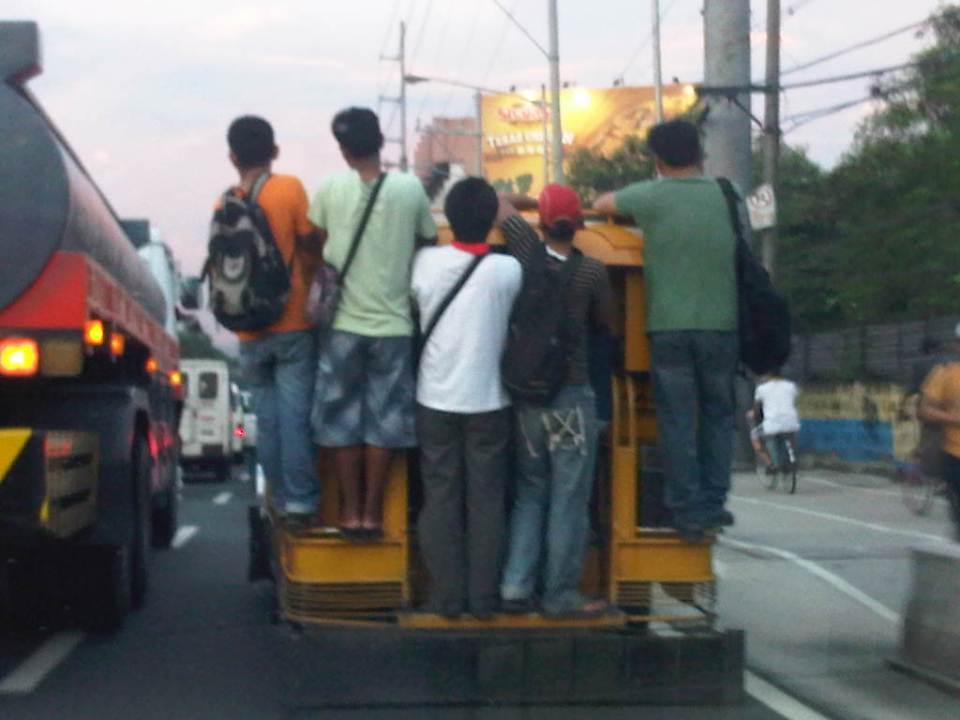 Jeepney full of sabit or hangers-on in heavy traffic along the eastbound side of a major highway
I also happened upon an opportunity to take a photo of the overloaded jeepney together with pedestrians walking along the walkway at the roadside. Though the photo was not so clear, it captured the image I wanted with people opting to walk while others took a risky ride on a jeepney. The cyclists in the photos were just bonuses and added to the visual of alternatives for mobility.
 Pedestrians and a cyclist along the widened walkway/bikeway along Marcos Highway
Walking remains as the mode of transport with the highest share when all modes, motorized or non-motorized, are compared. While there is a strong clamor from cyclists for bikeways and for cycling to be taken up by more people as an option for commuting, the reality is that cycling is not really for everyone. It is a viable and healthy mode but should also fit in a hierarchy of modes. Most people walk and walking should be encouraged over distances where it is most suitable. Facilities for walking need to be provided and properly designed so that people can walk safely and most efficiently like the example in the following photo taken during another weekday late afternoon.
 People walking along Marcos Highway
Local governments help promote walking by making sure sidewalks are provided and clear of obstructions. Perhaps walkability can be used as an indicator or parameter for a city to be qualified as livable and true to the advocacy of sustainable transport. Walking should be encouraged to promote healthy living as it incorporates exercise in our daily routines. More people walking should also increase awareness for the advocacy for clean air and help initiatives to improve air quality, particularly efforts to reduce harmful emissions by motorized vehicles. Thus, it is not difficult to understand how investing in pedestrian facilities and promoting walking is not a smart move and a beneficial one for any politician’s constituency.
–
Getting reacquainted with the Tokyo Metro
After almost 5 years since my previous trip to Japan, I was excited to go around Tokyo during our free time after our meetings. With all the information available online now, it is quite easy to do a desk review of public transportation in Tokyo. Since our hotel and meeting venue were near subway stations, it was practical to know about the metro lines near us. Whenever I was in Tokyo, I always took the trains whether it was by subway or by Japan Railways (JR) lines. There are two companies operating the subways in Tokyo. One is Toei and the other is Tokyo Metro. I seldom, if ever, used the bus or taxi preferring to walk between train stations to/from my meetings or appointments.
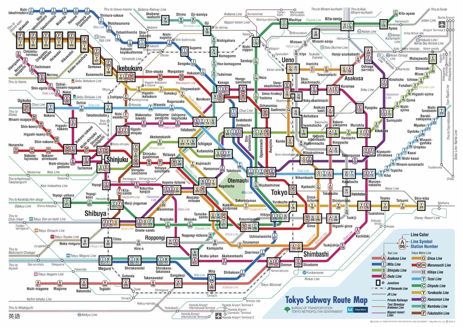 Tokyo subway map downloadable from the internet
 One can purchase tickets at the station using these machines. These have bilingual features so you only need to press the button to have the interface in English. Maps overhead provide guidance about stations and fares.
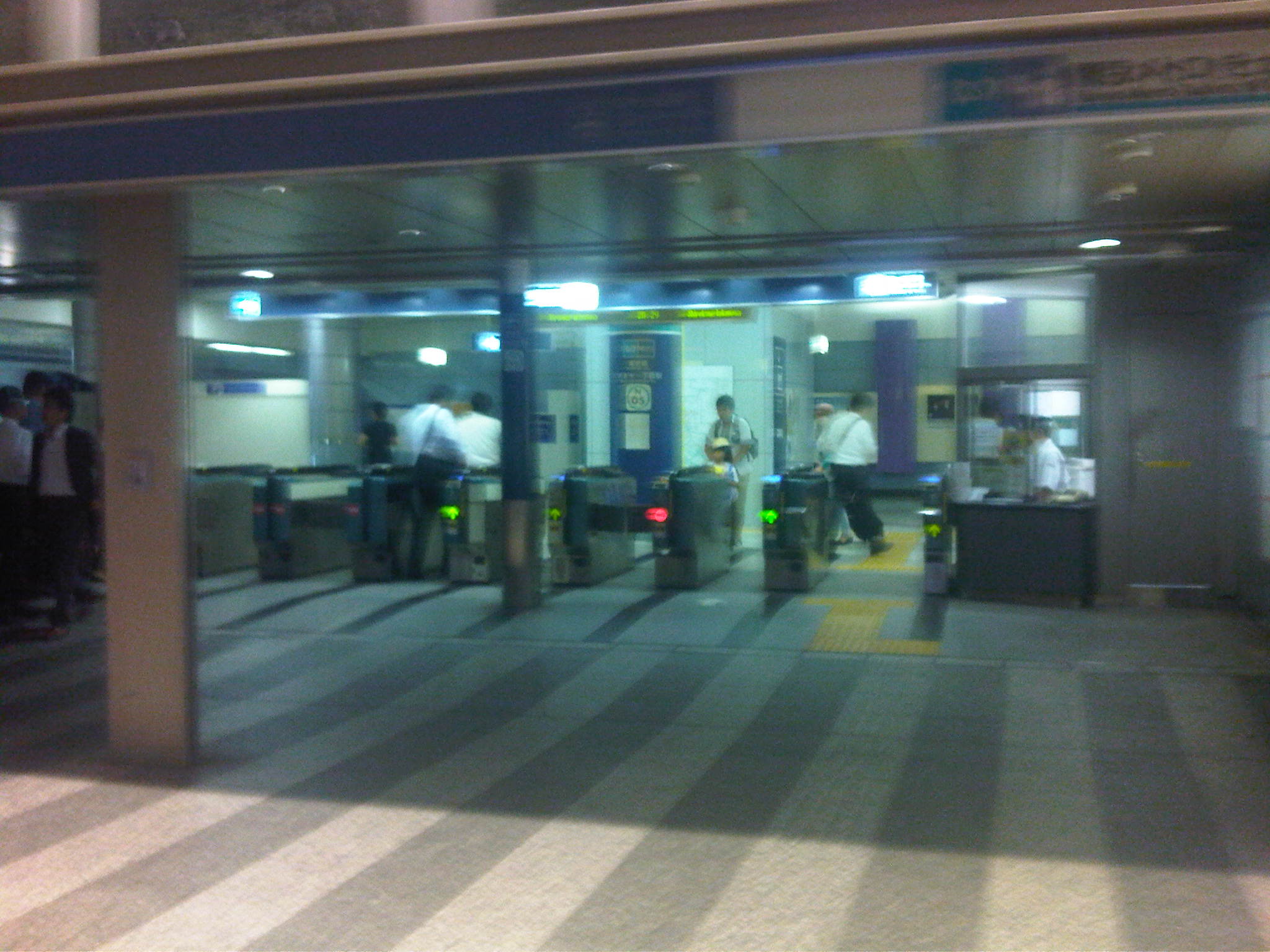 Subway turnstiles where passengers enter and exit for the platforms
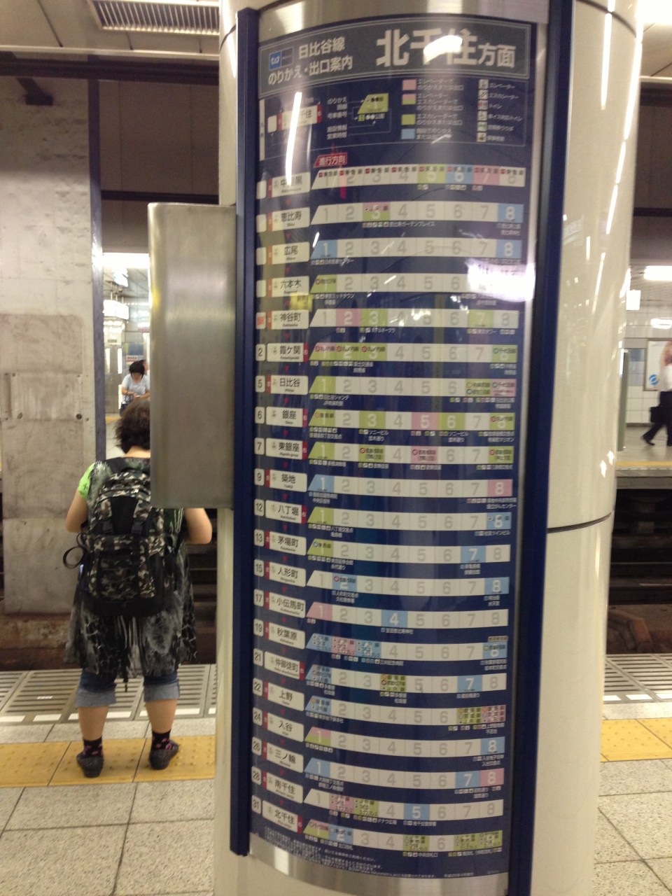 Information on transfer stations and the cars nearest the stairs. This information is helpful so passengers can easily position themselves in the car to minimize transfer time from one train to another.
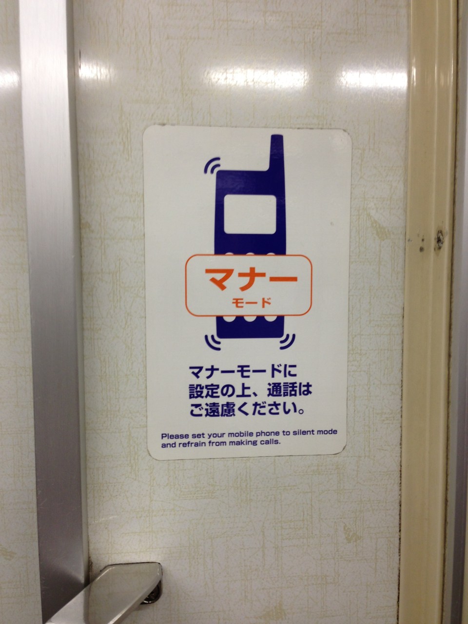 “Manner mode” sticker on the subway train near the door advises passengers to refrain from making calls while on the train. This is considered rude and annoying to fellow passengers.
 Metro line information overhead at the train doors include a line map and a message board announcing the next station in Japanese and English.
One can also purchase special tickets or passes from the stations. Ticket vending machines may also have the capability to issue the popular Pasmo or Suica IC cards that can be used in almost all transport modes in Tokyo and other cities. Information on these cards are easily found in the internet. There are also online route or travel planners that people can use to plan their trips. One such tool, which I recommend, is Hyperdia, which provides information on lines, transfers, travel time and fares.-
Manila’s bus experiment
Manila recently banned provincial and city buses from entering the city stating this is because many of them do not have franchises and/or terminals in the city. Those without franchises are the ones labeled as “colorum” or illegally operating public transport vehicles, which really don’t have a right to convey people in the first place. It’s become difficult to catch them because many carry well-made falsified documents. But it’s not really an issue if the LTFRB, LTO and LGUs would just cooperate to apprehend these colorum drivers. The LTFRB and LTO are under the DOTC, and so the agency is also responsible for policies and guidelines to be followed by the two under it. LGUs (and the MMDA in the case of MM) are tasked with traffic enforcement and so they can apprehend vehicles and act on traffic violations including operating without a franchise.
Those without terminals are both city and provincial buses. For city buses, this can be because they “turnaround” in Manila and operators do not feel the need to have a formal terminal. For example, G-Liner buses plying the Cainta-Quiapo route will stop at Quiapo only to unload Quiapo-bound passengers, and then switch signboards and proceed to load Cainta-bound passengers as they head back to Rizal. There is very little time spent as the bus makes the turnaround. It’s a different case for provincial buses, whose drivers should have the benefit of rest (same as their vehicles, which also need regularly maintenance checks) after driving long hours. Thus, if only for this reason they need to have formal, off-street terminals in the city. Following are photos I took near the Welcome Rotunda en route to a forum last Friday.
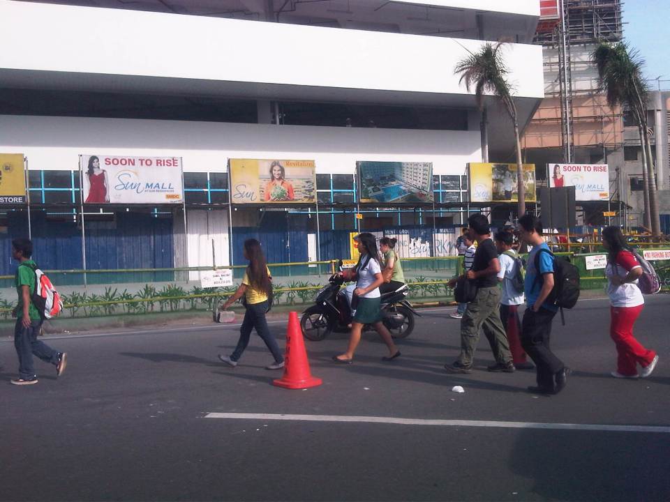 Commuters walking to cross the street at the Welcome Rotunda to transfer to jeepneys waiting for passengers to ferry to Manila.
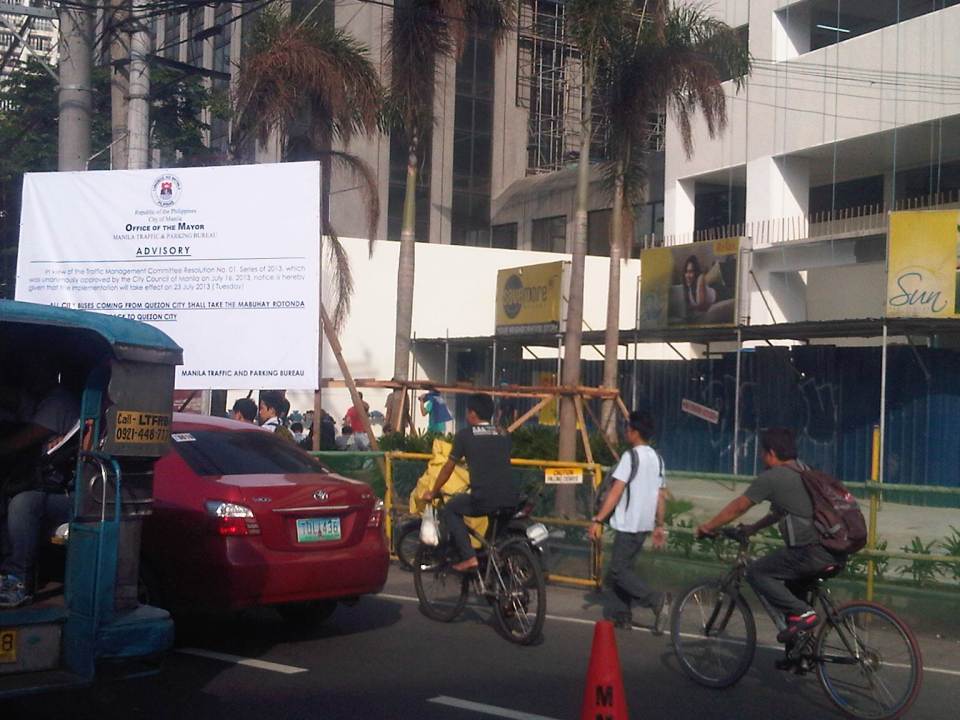 Commuters and cyclists moving along the carriageway as there are no pedestrian or cycling facilities in front of a construction site at the corner of Espana and Mayon Ave.
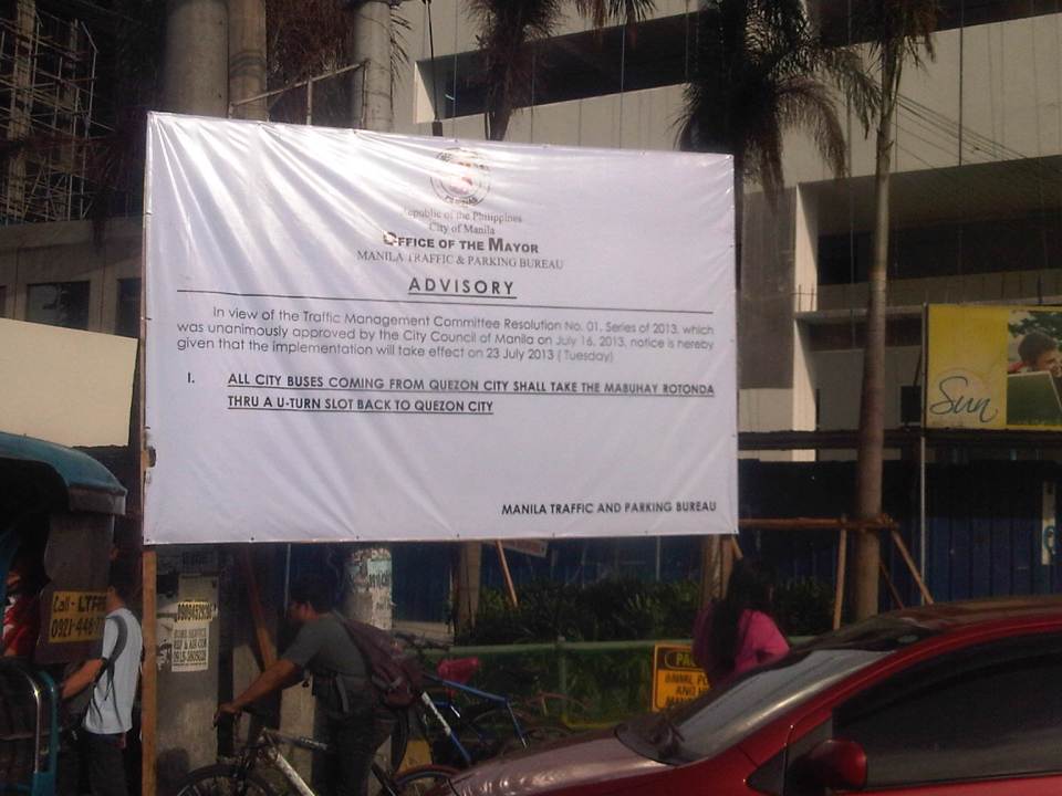 Advisory for buses coming from Quezon City
 Commuters waiting for a jeepney ride along Espana just after the Welcome Rotunda
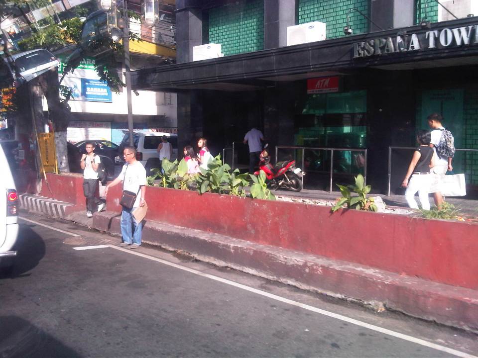 Some pedestrians opt to walk on instead of waiting for a ride. Manila used to be a walkable city but it is not one at present. Many streets have narrow sidewalks and many pedestrian facilities are obstructed by vendors and other obstacles.
So, is it really a move towards better transport systems and services in Manila or is it just a publicity stunt? If it is to send a message to public transport (not just bus) operators and drivers that they should clean up their acts and improve the services including practicing safe driving, then I’m all for it and I believe Manila should be supported and lauded for its efforts. Unfortunately, it is unclear if this is really the objective behind the resolution. Also, whether it is a resolution or an ordinance, it is a fact that the move violates the franchises granted to the buses. These franchises define their routes and specify the streets to be plied by buses. Many LGUs in the past have executed their traffic schemes and other measures intended to address traffic congestion, without engaging the LTFRB or at least ask for the agency’s guidance in re-routing public transport. Of course, the LTFRB is also partly to blame as they have not been pro-active in reviewing and optimizing PT routes.
One opinion made by a former government transport official is that this is just a ploy by the city to force bus companies to establish formal terminals in the city. This will require operators to secure permits, purchase or lease land and build terminals. And so that means revenues for the city and perhaps more traffic problems in the vicinity of the terminals just like what’s happening in Quezon City (Cubao) and Pasay City (Tramo).
Transport planning is a big part of the DOTC’s mandate and both the LTO (in charge of vehicle registration and driver’s licenses) and LTFRB (in charge of franchising of buses, jeepneys and taxis) look to the agency for guidelines and policy statements they are to implement. Meanwhile, LGUs have jurisdiction over paratransit like tricycles and pedicabs. In the case of Manila, these paratransit also include the “kuligligs,” 3-wheeler pedicabs that were fitted with engines and have been allowed (franchised?) by the city to provide transport services in many streets. Unfortunately, most LGUs do not have capacity nor capability for transport planning and so are limited or handicapped in the way they deal with transport (and traffic) issues in their jurisdictions. We have always maintained and promoted the stand that the DOTC should extend assistance and expertise to LGUs and the LGUs should also actively seek DOTC’s guidance in matters pertaining to transport. There needs to be constant communication between the national and local entities with cooperation leading to better, more suitable policies being formulated and implemented at the local level.
–
Pedicabs at your service
Pedicabs are among the most common modes of public transport around the country. These are usually found in residential areas including subdivisions or villages where they provide services to people who find it far to walk between their homes and the village gate. However, in many other places, particularly in the rural areas, pedicabs along with tricycles represent the main public transport mode for short trips. And because the main roads connecting barangays or barrios may be national roads, one will find these non-motorized transport traveling along national roads and clearly violating a law prohibiting such transport from using the national highways.
Pedicabs serving rural areas are often tolerated because of a lack of convenient public transport services in barangays. Many communities that happen to be located along national highways are often served by pedicabs (and/or motor tricycles) since jeepneys or buses come along quite sporadically, especially during the off-peak hours. Their drivers and passengers though are often at risk from motor vehicles, especially buses and trucks, that travel at higher speeds and with which crashes are highly likely to result in fatalities.
 This guy earns 10 pesos for a special (single passenger only) ride from the national highway to the Leyte Landings monument in Palo. Normal fare is 6 pesos per passenger if you share the ride with others. It’s a decent job and the man earns an honest living pedaling his pedicab to ferry people to and from government offices around the area.
 Pedicab queue at the junction of national roads are quite common in the rural areas.
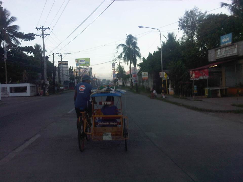 Pedicab traveling along a national highway in Leyte.
In the urban setting, pedicabs operate in many streets and in many cases travel along major roads. Many are considered nuisances in traffic as they are slow moving and do risky maneuvers. In certain cases, like Intramuros and Pasay, they are just too many and may cause congestion simply by their numbers in general traffic. One can also wonder why they are necessary in many places if the walking environment can be improved for pedestrians so that they would not need to take short rides via pedicabs. While we are aware of the social dimensions of pedicab services (i.e., mainly their being the source of income or livelihood for a lot of people), there is the view that many of these same people are misguided in their being allowed to operate so many pedicabs and thereby making many believe it is the “only” livelihood they can depend on. The local governments should be made answerable to these questions regarding pedicab proliferation where they are not suitable.
 Pedicabs along a Manila street near Tutuban and the PNR station.
 Pedicabs in Intramuros, Manila near Mapua Institute of Technology.
 Pedicabs operating along a section of EDSA in Pasay City near the provincial bus terminals.
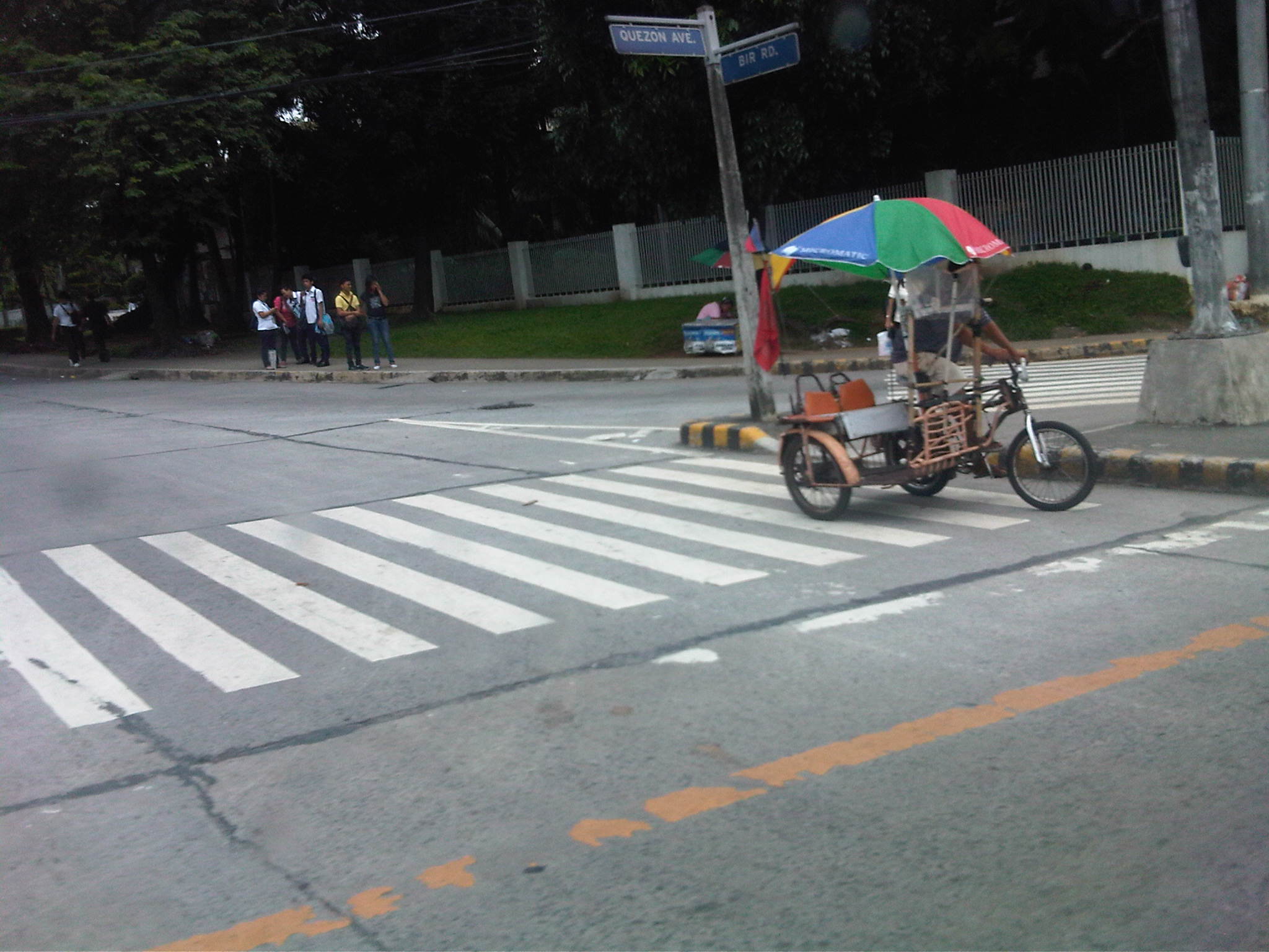 Pedicab along Quezon Avenue in Quezon City near the BIR Road and Agham Road, ferrying people from the EDSA MRT station to offices along the said roads.
Then, of course, there are the pedicabs serving the private or gated residential subdivisions. While tricycles have been the ones to first establish services for these villages, pedicabs have become the choice for many where noise and emissions from tricycles have become irritants and serious issues to residents. The slower-moving pedicabs pose less risks to children playing on the streets or pedestrians walking on village carriageways.
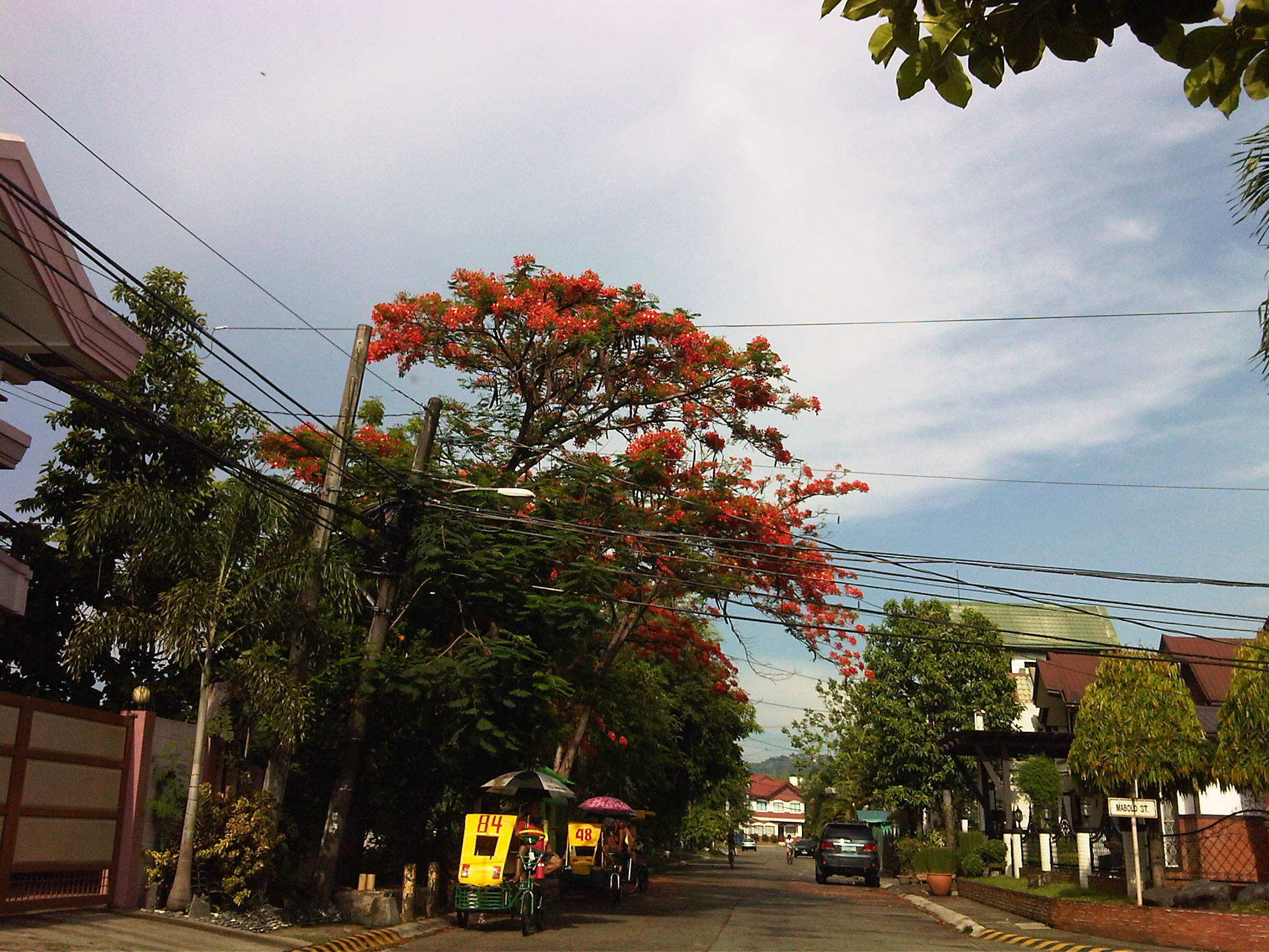 Pedicabs at an exclusive residential subdivision – depending on the fare policies set by local governments, barangays or village associations, pedicabs may charge somewhere between 5 to 10 pesos per passenger depending on the distance traveled, and in some cases the weather conditions (i.e., in many areas, pedicabs charge more when its rainy and especially when streets are flooded).
–
What is the context for electric tricycles in the Philippines?
The NEDA Board recently approved six projects that included one that will be promoting electric vehicles throughout the country. Entitled “Market Transformation through Introduction of Energy Efficient Electric Vehicles Project” (formerly Market Transformation through Introduction of Energy Efficient Electric Tricycle (E-Trike) Project), the endeavor seeks to replace thousands of existing conventional motorized 3-wheelers (tricycles) with e-trikes and to develop and deploy charging stations for these vehicles. While I have nothing against electric vehicles and have supported their promotion for use in public transport, I am a bit worried about the context by which electric tricycles are being peddled especially the part about equating “transformation” with “replacement.”
First, it is a technology push for an innovation that has not been fully and satisfactorily tested in Philippine conditions. The deployment of e-trikes in Bonifacio Global City is practically a failure and a mode that was not suitable from the start for the area it was supposed to serve (i.e., while there were already jeepneys serving the area, there were also the Fort Bus services and plans for a BRT linking the Ayala CBD and BGC. There are now few (rare sightings) of these e-trikes remaining at the Fort, as most of these vehicles are no longer functioning due to problems regarding the batteries, motors, and issues regarding maintenance. Meanwhile, the e-trikes in Mandaluyong, a more recent model, have also been difficult to maintain with one case reportedly needing the unit to be sent back to China for repairs.
Second, the e-trikes are a whole new animal (or mode of transport). I have pointed out in the past including in one ADB forum that the 6 to 8 seater e-trike model is basically a new type of paratransit. Their larger capacities mean one unit is not equivalent to one of the current models of conventional tricycles (i.e., the ones you find in most city and municipality around the country). Thus, replacement should not be “1 e-trike : 1 tricycle” but perhaps “1:2” (or even “1:3” in some cases). This issue has not been resolved as the e-trike units continue to be marketed as a one to one replacement for conventional trikes. There should be guidelines on this that local government units can use, particularly for adjusting the number of franchises or authorized tricycles in their respective jurisdictions. Will such come from the Department of Energy (DOE)? Or is this something that should emanate from Department of Transportation and Communications (DOTC)? Obviously, the last thing we like to see would be cities like Cabanatuan, Tarlac or Dagupan having so many e-trikes running around after they have replaced the conventional ones, and causing congestion in the cities. Emissions from the tricycle may have been reduced but emissions from other vehicles should be significant due to the congestion.
Third, the proliferation of e-trikes will tie our cities and municipalities to tricycles. Many cities already and definitely need to upgrade their public transport systems (e.g., tricycles to jeepneys or jeepneys to buses, and so on). Simply replacing tricycles with electric powered ones does not effect “true” transformation from the transport perspective. Is the objective of transformation mainly from the standpoint of energy? If so, then there is something amiss with the project as it does not and cannot address the transport, traffic and social aspects of the service provided by tricycles (and other modes of transport).
So what is the context for the e-trikes or conventional tricycles? They are not even under the purview of the Land Transportation Franchising and Regulatory Board (LTFRB) as they are regulated by LGUs. Shouldn’t the DOTC or the LTFRB be involved in this endeavor? Shouldn’t these agencies be consulted with the formulation of a framework or guidelines for rationalizing and optimizing transport in our cities? These are questions that should be answered by the proponents of this project and questions that should not be left to chance or uncertainty in so far as the ultimate objective is supposed to be to improve transport in the country. I have no doubt that the e-trikes have the potential to improve air quality and perhaps the also the commuting experience for many people. I have worries, however, that its promise will not be kept especially in light of energy supply issues that our country is still struggling with and deserves the attention of the DOE more than the e-trikes they are peddling.
–
Flash floods and traffic congestion
Traffic last night along most of Metro Manila’s roads were a nightmare. It took many people hours before they could reach their homes from their offices and schools. The main reason cited for the horrendous traffic jams was the weather. It has been raining almost every afternoon in Metro Manila and its surrounding areas due to the combination of a tropical depression east of the island of Luzon and the intensified monsoon rains (Habagat). Rainfall intensity combined with a high percentage of the water translating into runoff contributed to flash floods all around Metro Manila including some that were waist-high, rendering the road impassable to most vehicles. However, while a lot of motorists and commuters were simmering along many roads last night, I couldn’t help but notice that most vehicles in the photos circulating in social media sites and news footage are private vehicles. Buses along EDSA occupied only the outermost lane for most stretches of the road. Meanwhile, conspicuous is the space in the middle of EDSA, which is the ROW for the MRT-3 tracks.
One lesson we learned last night was something we already knew all along and have failed miserably to address – we need better public transport in Metro Manila. Could there have been less cars on the roads affected by flash floods brought about by the heavy rains yesterday? Could commuters have had an easier way of traveling between their offices or schools and their homes? The answer is yes, that is, we could have built the necessary public transport infrastructure years ago. While there is a need to be transparent and have a corruption-free (is there such a thing?) process for planning, funding, designing, and constructing public transport infrastructure, we must realize that these are all systems that we should have had long ago, and further delay only dooms mobility and accessibility in our cities. Our leaders seem to be too engrossed with processes and making sure they won’t get entangled in controversies or lawsuits that they forget that time is ticking and all other people are caught in the mess that is the traffic congestion we experience every day. I wonder if at least some of our decision-makers for transport and traffic were caught in the monstrous jams last night? Maybe getting caught in one would change their perspectives and give them a sense of urgency for the task at hand? Or maybe, and likely, they were sitting behind their cars and burning time on their notebooks or tablets while their drivers were trying to maneuver in traffic? Frankly, we deserve better transport than what we have but then we don’t get to decide what gets built and when such infrastructure will be built, if at all. We could, however, do our part in lobbying (or demanding) for better transport.
Taken by a good friend commuting to his home last night:

From the GMA News website:
–
Traffic congestion and the limits of quick fixes
One time last summer night, it took me 2.5 hours to get to the airport from where I reside when it should only be an hour or 1.5 hours (on a typical bad day). Very early mornings (between 2 to 4 AM), it only takes me 40 minutes between my home an the airport. The route I usually take is mainly along Circumferential Road 5 (C-5); a route that basically has sparse public transport (mostly jeepneys along different sections) but is a truck route. It was summer though and one would have thought that there would be less vehicles along the road with school still out. I was wrong in that assumption and that cost me both time and fuel that night.
Traffic congestion in Metro Manila and other Philippine cities have been issues for such a long time that one tends to assume there’s nothing being done to fix the problem. In Metro Manila, the Metropolitan Manila Development Authority (MMDA), in cooperation with the various local governments and national agencies, has implemented various schemes including the number coding, truck ban and a bus dispatch system along EDSA. Yet, congestion persists and only last week, the President got caught in traffic as he traveled from Malacanang Palace in Manila to the DOST Compound in Taguig. The news was filled with a comment that he supposedly made to the MMDA Chair about the delay he and his entourage experienced. The bad news is that this congestion will not go away and will only worsen if there are no steps taken to address the problem. And this happens not only in Metro Manila but in other highly urbanized cities in the country. Quite obviously, quick fixes are no longer enough and we have reached the limits of their applicability.
 EDSA during the morning rush hours
 EDSA during the afternoon peak, which actually extends to an evening and even nighttime traffic jam
So how do we alleviate traffic congestion? Here’s three things that come to mind as they seem to be quite logical and very obvious:
1. Build the mass transit infrastructure required – these infra include rail and bus rapid transit systems and are urgently needed in Metro Manila, Metro Cebu, Davao and other highly urbanized cities. A shift from private vehicle use to public transport will not happen if people have no attractive options for commuting. In Metro Manila, there is a backlog of mass transit projects with lines that should have been constructed and operational years or even decades ago.
2. Rationalize transport services – the long standing practice is to increase the number of existing modes of transport as the demand increases. This logic is one that is most abused as a doubling of demand is conveniently but incorrectly interpreted as requiring a corresponding doubling of the number of tricycles or jeepneys, for example. What is required is for our cities to “graduate” from low capacity and less efficient modes to higher capacity and more efficient ones. Many cities seem plagued with tricycles as their main modes of transport within their CBDs when these should have been restricted to residential areas and mainly in the periphery rather than allowed to dominate (and clog) urban streets.
3. Build more walkways and cycling facilities – its difficult to encourage people to walk and cycle if there are no space for pedestrians and cyclists to travel safely and efficiently. Most trips are actually short ones and do not require motor vehicles so it makes sense to invest in pedestrian and cycling facilities so people get the clear message of support for such options for travel. Such investment is also one for healthy living as walking and cycling are forms of exercise and it is well established that these modes of transport promote healthier lifestyles and therefore, healthier people in cities.
–
What Public Transit Data Teaches Us About How People Use a City
I’m sharing an interesting article featured on The Atlantic Cities, one of our favorite sites on the internet. Enjoy!
What Public Transit Data Teaches Us About How People Use a City.
Level up on buses in the Philippines
I chanced upon the demonstration run of an articulated bus for the Department of Transportation and Communications (DOTC) and participants of a workshop on crowd-sourcing that was being conducted that day. After seeing the interiors of the bus, I decided to ride in a vehicle following the bus to take a few photos of the vehicle and also catch the reactions of people along the street who might be seeing an articulated bus for the first time. The demo run (and others in the future) should give people an idea of what road transport still has to offer in terms of vehicles that could carry more people.
 Articulated bus approaching the EDSA-Ortigas intersection
 Articulated bus manufactured by MAN
 Inside the bus, there is space for more passengers than 2 regular buses can accommodate
 I like the look on people along the streets that the bus passed along. Some were scratching their heads and others had to have a second look (double take) at the long vehicle.
Articulated buses are not new to public transport operations. Singapore’s SMRT operates many of these buses along busy routes. Below is a photo of an articulated bus passing in front of the Central Fire Station across the Funan IT Mall.
 SMRT articulated bus passing in front of the Central Fire Station in Singapore
There are other types of buses in service in cities in other countries such as double deckers, and bi-articulated buses (equivalent of about 2.5 regular buses). These buses require skilled driving to ensure safe operations including maneuvering at intersections and terminals. The buses should be suitable for routes with passenger demands between those requiring regular buses and rail transit like routes that can be designated for bus rapid transit (BRT), and with scheduled stops. I am quite optimistic about the future of public transport in Metro Manila and other cities where buses should play a significant role for mass transport.
–
Rizal Avenue – Part 2: Tayuman to Pampanga Street
In the last post on Rizal Avenue, the featured photos show conditions under the LRT Line 1, which included visual evidence of certain issues like on-street parking, poor lighting and even sanitation (i.e., garbage) along the corridor. This post features more of the same and perhaps worse in some cases that are used as proof of the blight caused in part by the LRT superstructure. I say in part because LRT Line 1 is not wholly to blame for problems under and around it. Local governments and the private sector share responsibility for the decline of the areas within the direct influence of the rail line. Napabayaan. But of course, this does not absolve proponents of the LRT Line 1 for poor station design.
 Approach to Tayuman Station along the northbound side of Rizal Avenue.
 Tayuman Station – shown in the upper part of the photo is one end of the northbound platform.
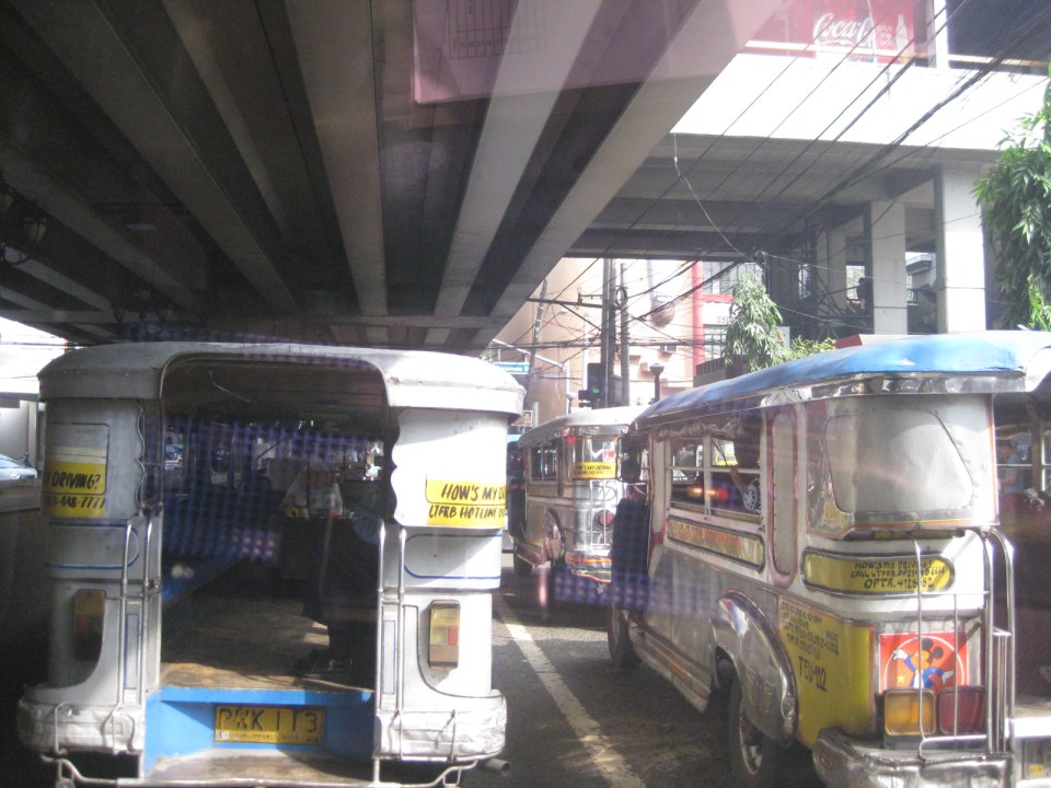 Underneath the station, jeepneys clog the lanes as they load/unload passengers. LRT Line 1 stations are poorly designed for intermodal transfers (e.g., LRT to jeepney, LRT to bus, etc.).
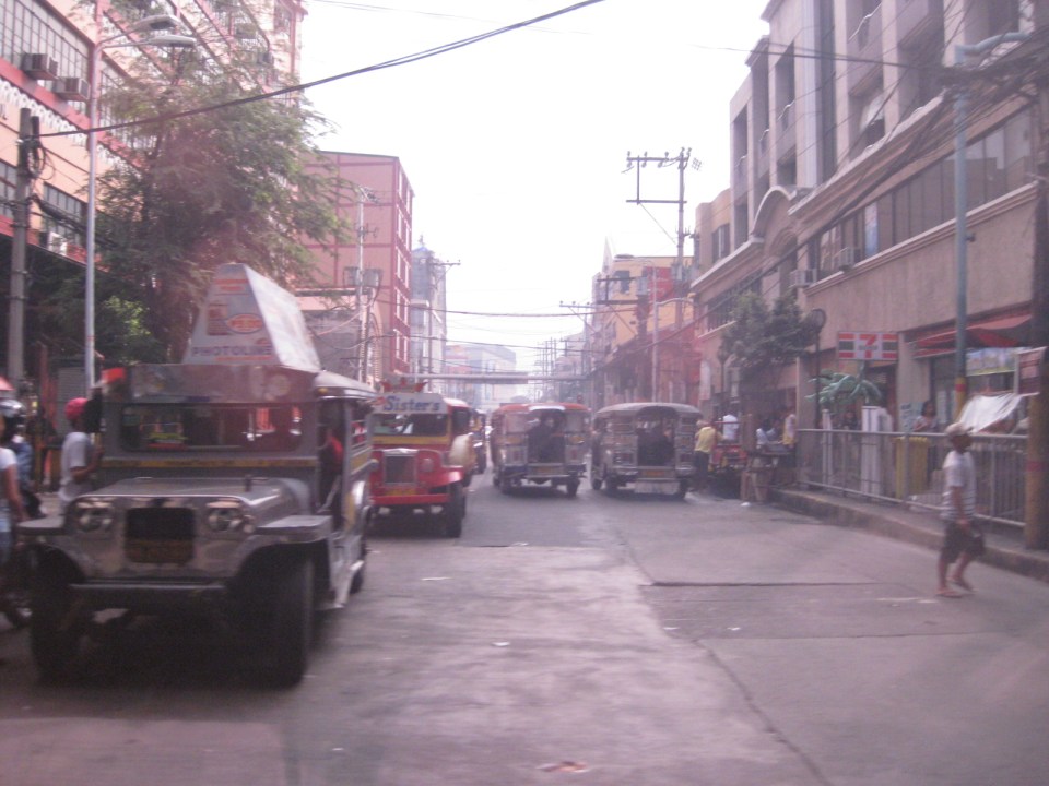 Tayuman Road is a busy street in Manila that’s served by jeepneys connecting to major streets like Lacson Avenue to the east and Abad Santos and Juan Luna to the west. The photo shows a view to the east of the LRT Tayuman Station.
 Approach to the junction with Herrera Street
 Approach to Blumentritt Station – the station is named after Ferdinand Blumentritt, an Austrian who was a close friend of the national hero Jose Rizal. The street leads to a large public market close to the station (near the intersection) that is also named after the fellow and one of the more crowded markets in the metropolis. There are many jeepney lines with Blumentritt as part of their routes.
 Birds and other creatures being sold as pets around Blumentritt – many have been painted to attract children and other buyers curious at the colored birds.
 Vendors line the Rizal Avenue, Blumentritt and the other side streets in the area, which is usually crowded no matter what day of the week it is.
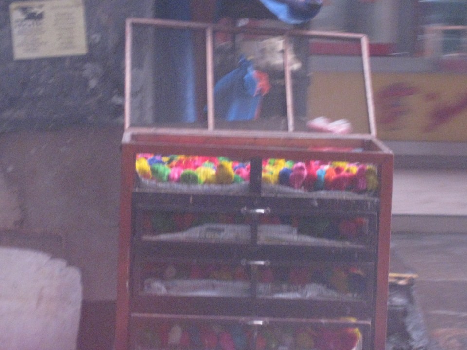 Angry birds? A closer look reveals the birds as chicken chicks colored by the vendors to attract interest. Sadly, many of these do not survive to become full grown chickens and children (and adults) will be disappointed to discover later that the color comes off pretty quick when the chicks come in contact with water.
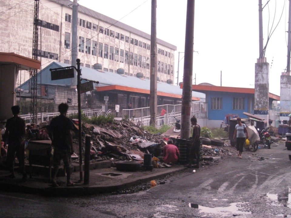 There is a PNR Blumentritt Station and unless there’s been some radical clean-up of the area, this is pretty much what you’d see around the station – garbage, dirt, informal settlers and other characters. The building behind the station is a public school.
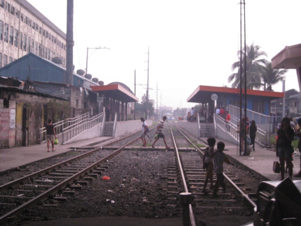 The PNR Blumentritt Station has two platforms on either side of the double track. Security is quite lax and people, including children, cross the tracks freely. Fortunately, train service frequencies are quite low (about 1 per hour) so the risk of getting hit by a train is also low. The photo shows the view to the east of Rizal Avenue.
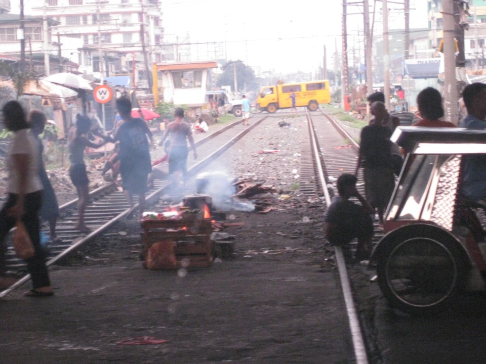 On the left side of Rizal Avenue is a scene where people are oblivious to the railways with some even doing their cooking between the tracks.
 Blumentritt Avenue is a very crowded street with a public school (building at right) just across the public market (at left). There are many vendors lined along the street and people as just about everywhere and without regard to vehicular traffic.
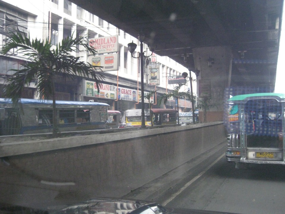 Traffic congestion along Rizal Avenue is attributed mainly to the market and median barriers were constructed to reduce pedestrian crossings anywhere along the road. Commercial establishments line either side of Rizal Avenue, basically contributing to congestion in the area.
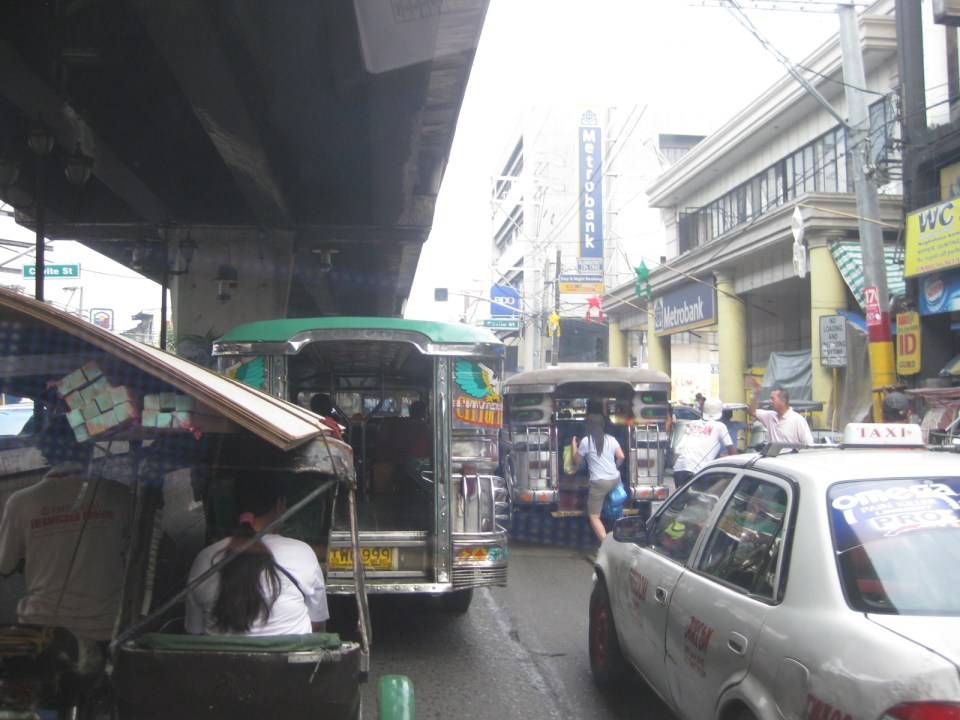 Commercial establishments plus customers plus paratransit equal to traffic congestion
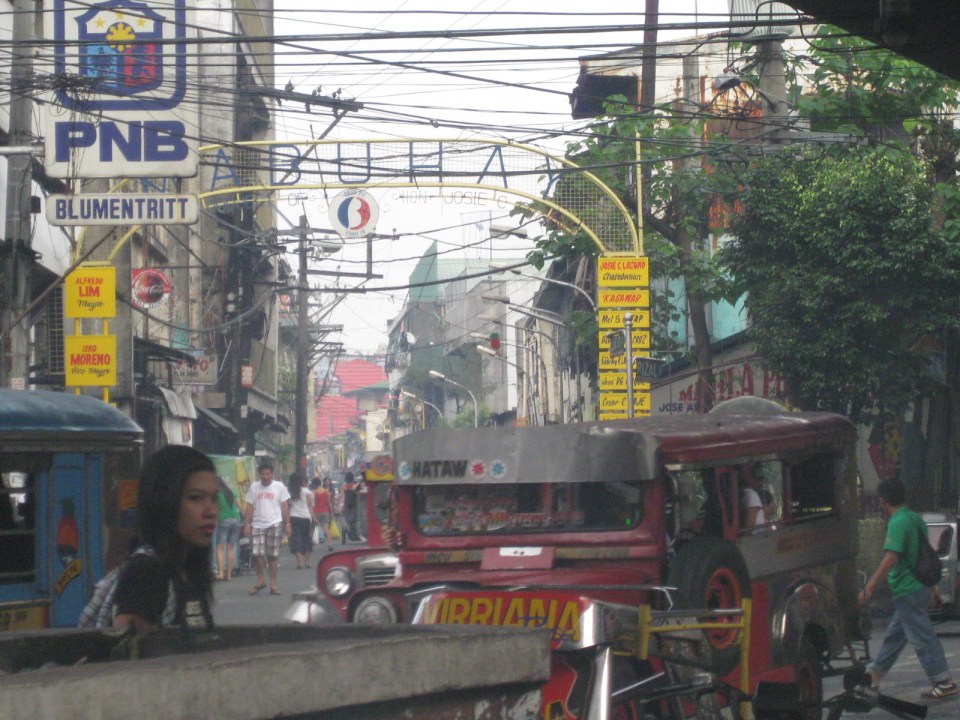 16A busy side street in the Blumentritt area – there are no sidewalks so pedestrians and motor vehicles mix it up along the road.
 Bulacan Street serves as an informal terminal for jeepneys. The road appears to be newly paved but there are no sidewalks and tents are found along the road often bearing the names of politicians sponsoring the tents for various purposes such as wakes and parties.
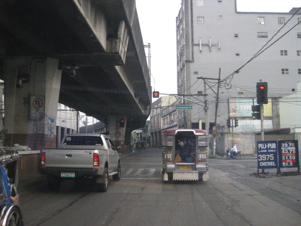 Intersection with Pampanga Street, just before Rizal Avenue and the LRT line turns towards Aurora Boulevard and proceed to Caloocan City and Monumento.
More on Rizal Avenue in future post…
–

