
Home » Public Transport (Page 56)
Category Archives: Public Transport
Streets of Olongapo: Rizal Avenue
Olongapo City is located in the Province of Zambales, the only city in that province, and beside the Subic Freeport. It is a pioneer in public transport service innovations in the form of the first initiative on the color-coding of jeepneys according to their routes. Despite what seemed to be forever being linked to the Freeport in terms of economic development, the city has enjoyed continued growth and is currently experiencing more challenges attributed to this growth. Among these challenges are those pertaining to traffic congestion and public transport services for the city. A Transportation and Traffic Management Plan Study was conducted by UP Diliman through the National Center for Transportation Studies and is up for formal adoption of the city.
Following are photos taken along the city’s main street, Rizal Avenue, where many of the city’s transport and traffic problems are manifested.
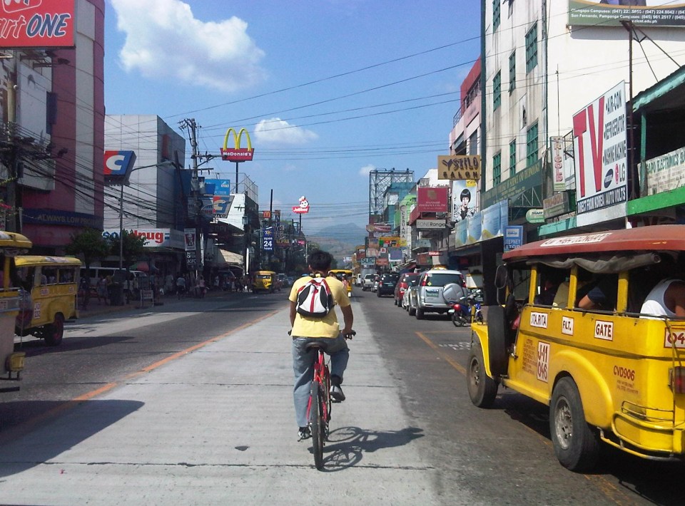 Cyclist pedaling along Rizal Avenue beside a yellow jeepney taking passengers at the designated stop at curbside. Downstream are parked vehicles along the road.
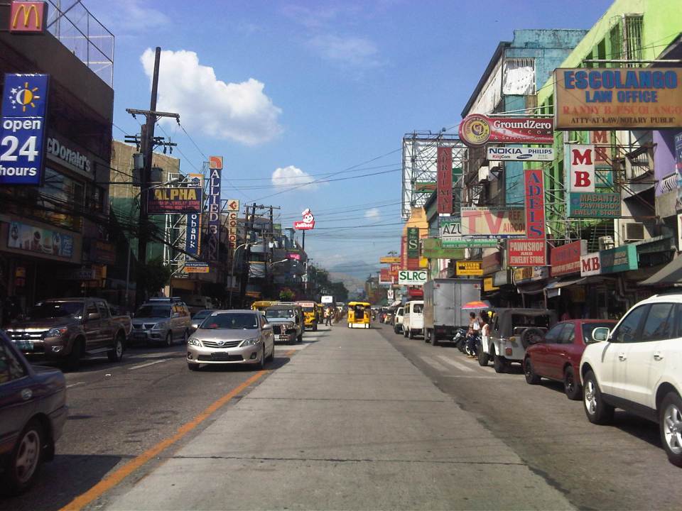 More parked vehicles at either side of Rizal Avenue effectively reducing road capacity for the 4-lane street.
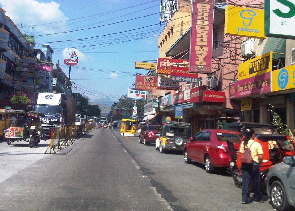 On-street parking is a problem for the city as there are few, if any, off-street parking facilities in the city. On-street parking turnover is quite low since many of the parked vehicles are not clients or customers but establishment owners or managers.
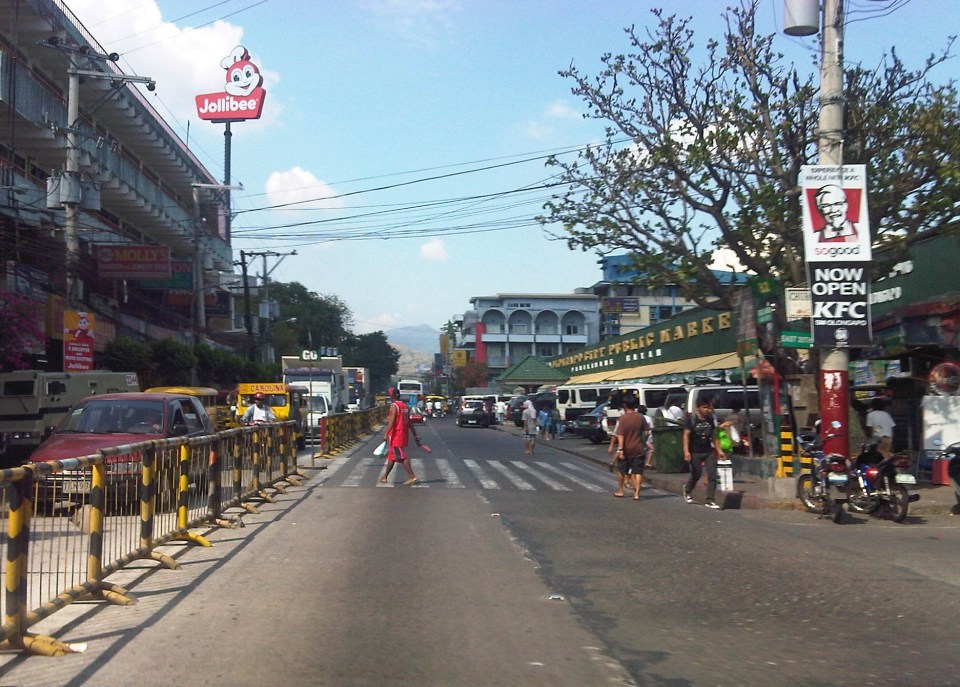 Most of Rizal Avenue is undivided but there are median barriers along the section in front of the public market to reduce jaywalking among pedestrians.
 The section in front of city hall – just across are many commercial establishments and on-street parking.
 Another view of the Rizal Avenue, this time along the westbound side, with the the market on the left side. The yellow jeepneys are quite conspicuous and remind me of the UP Ikot jeepneys.
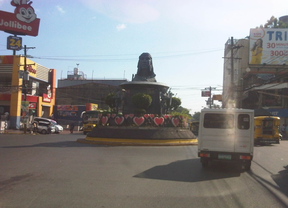 A monument to the Ulo ng Apo, from which the name of the city is said to be derived from, is right in the middle of a rotunda at a major intersection along Rizal Avenue. Around the rotunda are commercial establishments and a major provincial bus terminal.
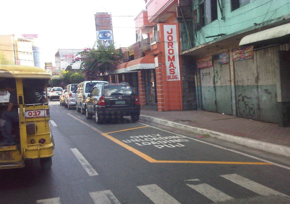 There are designated stops for jeepneys along the avenue but these are often crowded out by parked vehicles. As a result, jeepneys could not maneuver properly and end up unloading/loading passengers in the middle of the road.
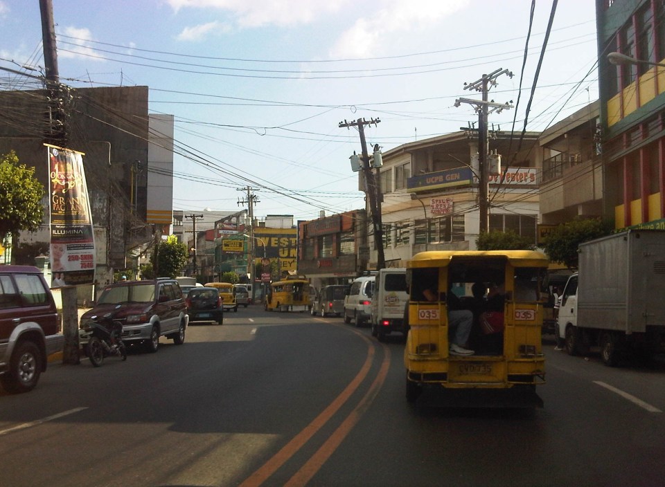 On-street parking along curves tend to impede the flow of traffic. There are also issues where electric posts like the one shown in the photo have not been transferred, posing risks to vehicular traffic.
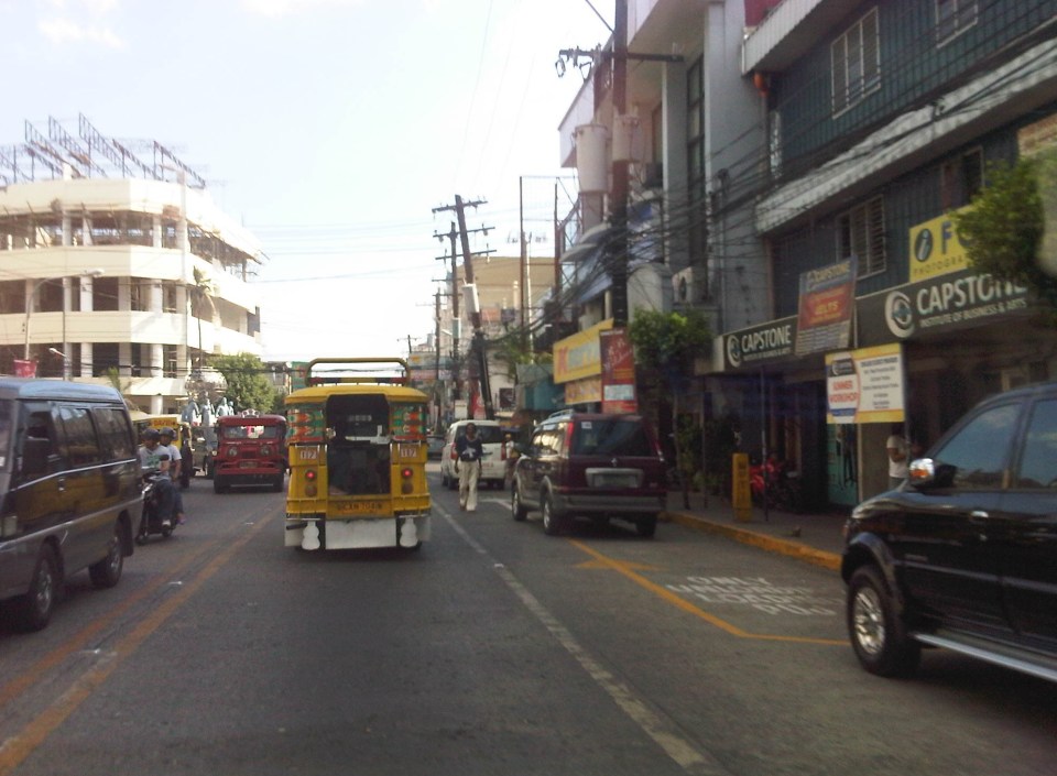 Another example of a designated jeepney stop along the avenue where parked vehicles constrict maneuvering space for jeepneys.
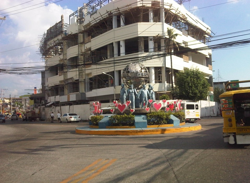 A monument to the volunteers of Olongapo during the Mt. Pinatubo episode after the closure of the U.S. Naval Base in what is now a Freeport. I wonder if the building under construction in the photo has enough parking spaces for the traffic it generates.
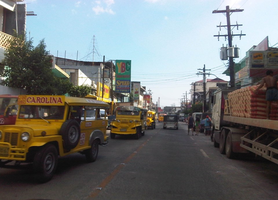 More jeepneys and more on-street parking – there is a perception that there are too many (oversupply) of jeepneys. Note though that most PUJs in Olongapo are not the bigger 20 to 24 seater jeepneys we see in Metro Manila but the older, 16 to 18 seaters like the ones shown in the photo.
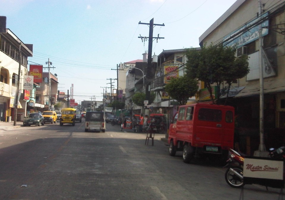 Some on-street parking spaces are “reserved” by establishments. I didn’t mention that on-street parking is free of charge and such situation probably encourages longer parking durations. Perhaps the city should seriously consider parking fees to reduce long-term parking and ensure smoother flow of traffic along its streets. There are examples of these parking schemes in other cities including Makati City that Olongapo can adopt and adjust.
–
The commute to the airport
Traveling from our home in Antipolo to the airport in Clark, I decided to take the MRT to the Quezon City Air Terminal (QCAT) from where I would be taking the Clark Airport Rail Express (CARE) to the sparkling new terminal at what is a fast growing aerotropolis north of Metro Manila. It was an easy commute from the station near my home and a convenient one considering the e-Pasahe integrated commute card that I could also use for the C5 subway line or the Quezon Avenue BRT. Soon, all the jeepneys and buses would be accepting the card for fares. 100% of taxis were already accepting the card for payments and the electric tricycles were surprisingly ahead with 90% accepting the e-Pasahe card. I made sure my card was topped up when I left the university yesterday so I could also use it to buy a drink or a meal while at the airport. The convenience of the card reminded me of the Suica and Pasmo cards I used while traveling in Japan.
Upon arriving at the QCAT, I proceeded to the check-in counters to drop-off my luggage. I had already checked-in online so I just had to leave my bag at the express lane. I was already excited about the direct trip to New York, on board Cebu Pacific’s newly delivered A380, where I would be meeting up with the wife who’s already there for a conference. Unfortunately, we won’t be on the same flight home as she was taking the PAL’s non-stop Dreamliner service to NAIA.
On-board the CARE train to the airport, I had a quick but good view of Metro Manila as the train emerged from the underground tunnel for its surface run from Bocaue, Bulacan. It was still early in the morning and the sun was just rising. It felt good to see that there was much less smog covering the metropolis. All those electric and hybrid vehicles have made a significant impact on reducing air pollution and improving air quality. I decided to have a power nap for the rest of the trip and awoke minutes later to find out everything was just a dream.
🙂
Happy April Fool’s Day!
Buses speeding along Commonwealth Avenue
Traveling along Commonwealth Avenue last Holy Thursday, we couldn’t help but notice the buses racing against each other along the wide highway. One bus speeding along the motorcycle lane almost hit a motorcycle along that lane. Traffic was free flowing and speed limits obviously were not being enforced or followed. Running at 60 kph, our vehicle was always passed by buses and cars alike, their drivers probably enjoying the wide space and the knowledge that there will be few if any traffic enforcers along Commonwealth. We saw a few underneath the Tandang Sora flyover but they were relaxed and seem to turn a blind eye over speeding violations along the highway. The video below was taken last Thursday and showed three buses speeding along Commonwealth, occupying lanes that they are not supposed to be using (Note: Public transport are supposed to run along the two outermost lanes of the highway marked with yellow lines.)
–
Rizal Avenue – Part 1: Carriedo – Bambang
Rizal Avenue stretches from Manila northward to Caloocan city from Carriedo to Monumento. What used to be one of the more cosmopolitan streets in Manila was transformed (some say blighted) by the construction of the elevated LRT Line in the early 1980’s. Carriedo, for example, used to be a popular shopping street along with Escolta. Those were times when there were none of the huge shopping malls now scattered in Metro Manila and people came to Manila to shop.
The following photos were taken while we traversed Rizal Avenue as part of a recon we were conducting for a project with the Department of Transportation and Communications (DOTC) back in 2011. I’m not sure if there have been any significant changes along Rizal Avenue and I am not aware of any recent programs to improve conditions under the LRT Line 1.
 Approaching the LRT Line 1 Carriedo Station from the McArthur Bridge
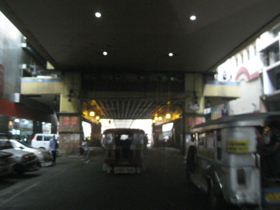 Under Carriedo Station, one experiences first-hand what people have been saying about the area being blighted by the LRT 1 structure
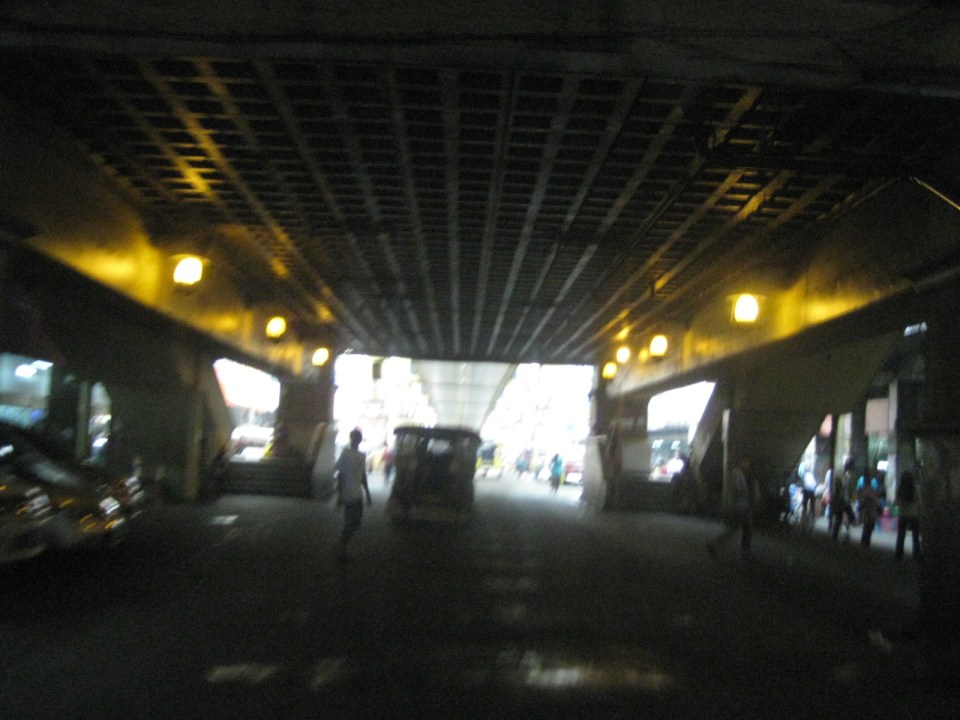 Poorly lighted? It was broad daylight outdoors when we conducted the recon but underneath an LRT 1 Station it can get quite dark. Of course, aside from the need to improve illumination, perhaps authorities can also improve the environment including the cleanliness of the area under the station. A common complaint is garbage and there are those saying the area smells of piss (i.e., mapanghi).
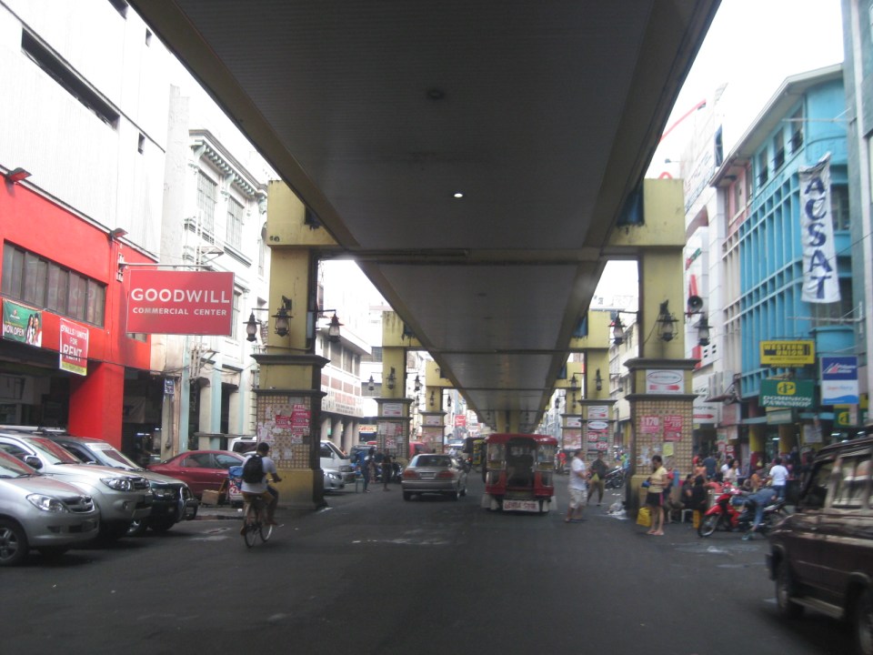 Past Carriedo Station, it was brighter and perhaps the area can be developed so that stretches can be pedestrian friendly. Maybe there should also be restrictions on vehicle parking, which tends to make the area look congested. It would be good to have a strategically located multilevel facility in the area where most vehicles can park instead of along the streets as shown in the photo.
 5More roadside parking plus the presence of tricycles contribute to traffic congestion in the area. People are everywhere walking and crossing anywhere. The arcades where they are supposed to walk along are mainly occupied by vendors or merchandise of stores/shops occupying the ground floors of the buildings along the street.
 Each side of Rizal Avenue is surprisingly wide with 3 lanes per direction. One lane is effectively used for on-street parking while the other two are for general traffic. There are no lane markings at the time we passed by the area so there can be confusion as to lane assignments.
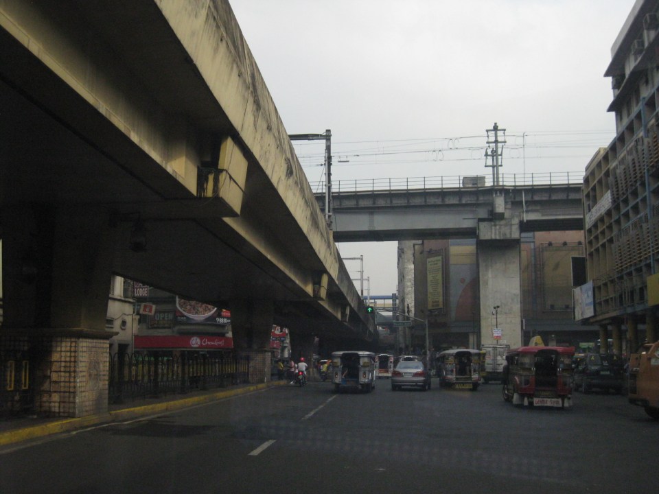 Approach to the junction with Recto Ave. and the LRT Line 2, which is also elevated and at the 3rd level as shown in the photo.
 Rizal Ave.-Recto Ave. intersection – visible downstream in the photo is Doroteo Jose Station
 Provincial bus terminal between Doroteo Jose and Bambang Stations
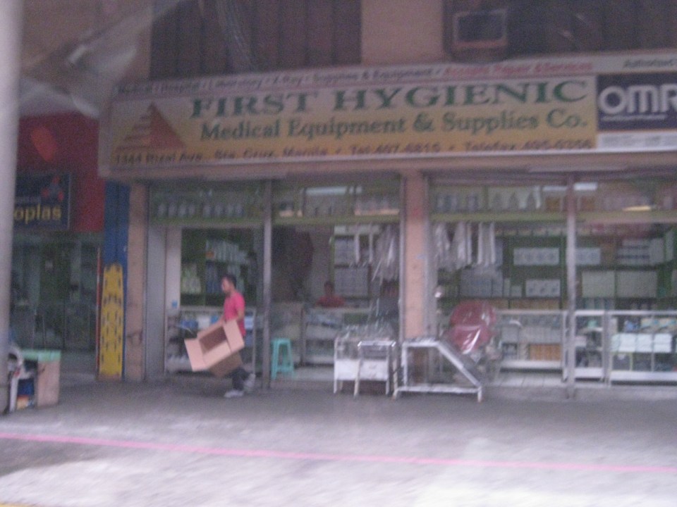 The Sta. Cruz district and particularly the Bambang area is well-known for shops selling medical equipment and supplies. Medical, nursing and other students of allied medical professions as well as professionals come to Bambang to purchase equipment and supplies from these shops, which offer items at lower prices.
 LRT 1 Bambang Station
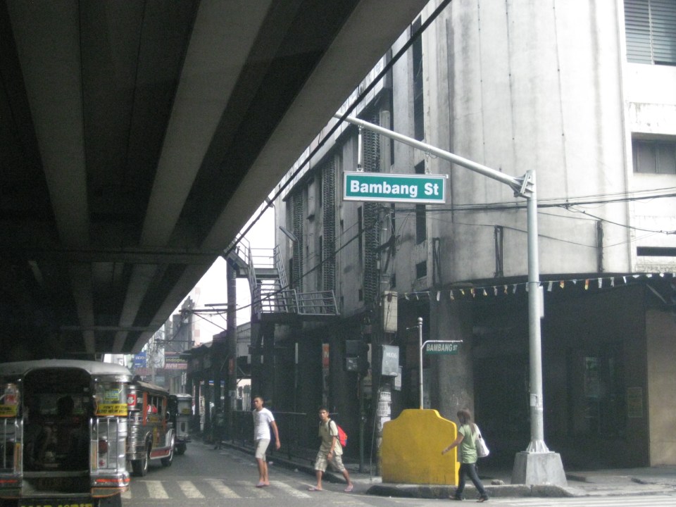 Rizal Ave.-Bambang St. intersection beneath the station
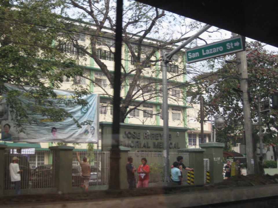 Two large government hospitals are located in the area between Bambang Station and Tayuman Station – San Lazaro Hospital and Jose Reyes Memorial Medical Center. Both are run by the Department of Health (DOH), which is located beside Jose Reyes.
–
Informal transport at PNR Bicutan Station
On our way to a meeting at the Department of Science and Technology (DOST) in Bicutan, Taguig City, we crossed the PNR line running parallel to the SLEX. I quickly took a photo of the scene to the right of our vehicle that showed an informal market and terminal. The informal market or talipapa is one you would usually finally elsewhere in many other places in the city and likely caters to mostly informal settlers residing along the PNR ROW. On our return trip from the DOST, we took the same route and again I quickly took a photo of what was on the other side of the road along the same PNR line. On the other side was the PNR Bicutan Station and what appears to be a clear ROW northbound towards Manila. Much has been accomplished in the clearing of the PNR’s ROW over the past years and the efforts included the relocation of many informal settlers in coordination with the local governments along the PNR line.
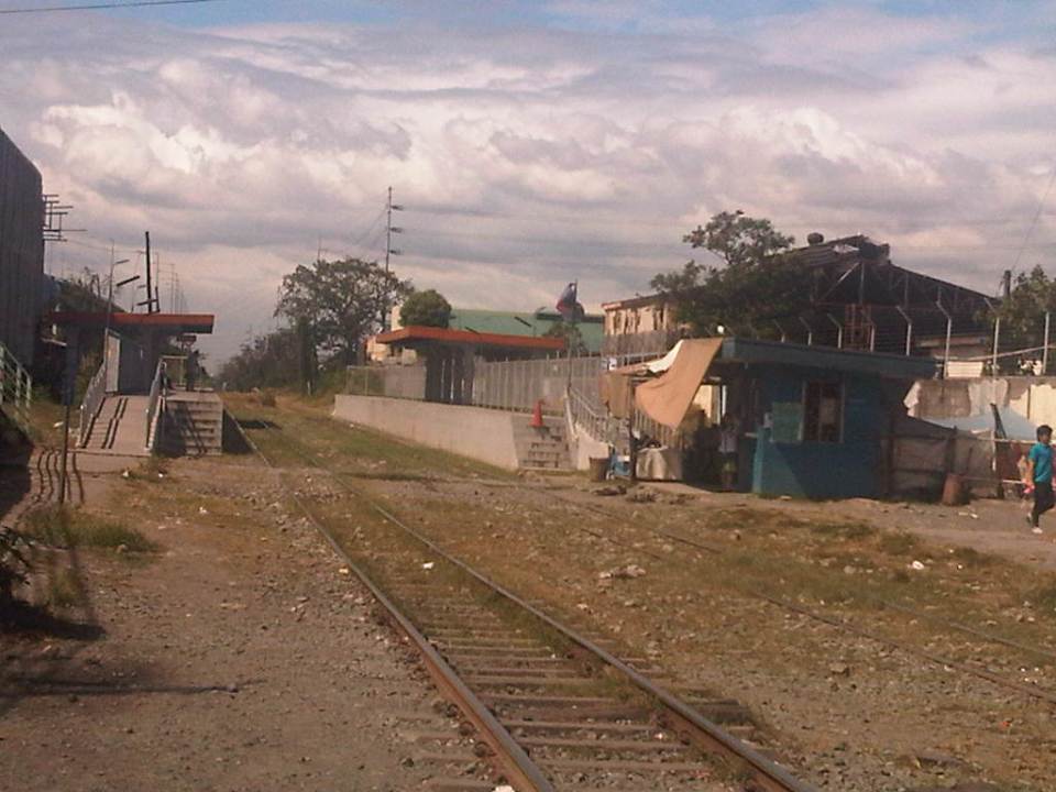 The PNR Bicutan Station on the north side of Gen. Santos Ave. near the SLEX Bicutan interchange
 Non-motorized trolleys on the south side of Gen. Santos Ave. near the SLEX Bicutan Exit
The trolleys are informal transport vehicles serve people living along the PNR ROW including many informal settlements within and without the PNR property. Some of the buildings or structures of these informal settlers are visible in the photo downstream of the railroad crossing. There are similar cases in Manila and elsewhere along the PNR ROW including motorized trolley services in the provinces of Quezon and Camarines Sur, where trolleys are also utilized for public transport and are the means for livelihood by some of the same informal settlers.
There are increasing safety concerns for these vehicles, their operators and their passengers. The trolleys are lifted from the tracks an people clear the way once a train approaches. They return after the train has passed. With the PNR currently experiencing a revival of sorts, and if resources continue along with an increase in ridership, train frequencies should also be expected to increase. As such, there should come a time when trolleys would have to be banned along the entire line in order to minimize the chances for crashes involving trains and trolleys that will surely lead to fatal consequences. Perhaps the local governments along the PNR line should already look into this eventuality and initiate programs to address this issue, which can be associated with livelihood and residential concerns.
–
The Economic Case for Rail Subsidies
Today, I’m sharing a nice article on rail subsidies from The Atlantic Cities:
Namumulaklak
The Filipino term “namumulaklak” usually refers to flowering plants when blossoms appear around the equivalent of springtime. This term has also been used to describe passenger behavior, sabit or to hang, particularly when public transport vehicles are already full and the more daring people hang at the door of the vehicle. When one says namumulaklak yung jeepney (the jeepney is like a flowering plant), this refers to a several passengers dangling from the rear door of the vehicle such as what is shown in the photos below. Perhaps the one who coined the phrase sees the jeepney as a bouquet with the people hanging behind as the flower buds?
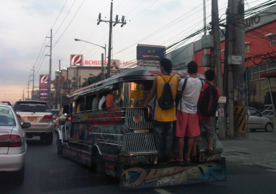 Jeepney along Marcos Highway in Pasig City
I took the preceding photo while traveling along Marcos Highway en route to Antipolo, Rizal. The corridor has been served by jeepneys as far as I can remember. The scene is one you’d see every time during peak periods despite prohibition of this practice by authorities. Jeepneys easily evade being apprehended as the driver or conductor of the vehicle usually accepts only a few hangers-on and asks the latter to dip their heads so police or traffic enforcers cannot easily see the violation as the jeepney approaches. One or two people hanging behind the jeepney is quite common and generally tolerated along many roads. Enforcers says they are usually against excessive sabit when the risks are higher that one would fall off the jeepney.
This behavior is not exclusive to Metro Manila jeepneys but may be observed in other cities and towns as well. In certain cases such as Baguio City in the north, there are even passengers on the roof of the vehicle. While more unsafe, the behavior is tolerated and, surprisingly, there are minimal incidents of people falling off. Some foreign tourists are even offered rides on the roof and those seeking some thrill often oblige and just try to keep a tight hold on whatever that will keep them from falling off the vehicle.
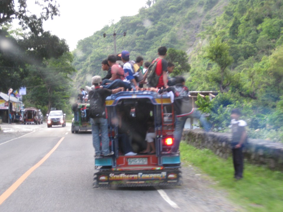 Jeepney along Kennon Road heading up to Baguio City
 Another jeepney along Kennon Road
 Jeepney along National Road in Bondoc Peninsula, Quezon
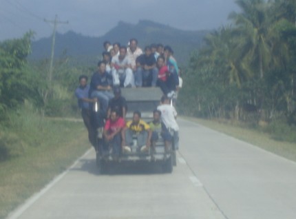 Another jeepney along the national highway in Quezon
I used to hang behind jeepneys when I was commuting back during my college days. I had to take 2 jeepney rides between our home and UP Diliman. Those times it was quite difficult to get my first ride to or from the old jeepney terminal near Katipunan Avenue. To get a seat will take you a lot of time or would require one to go to Cubao where there are queues for jeepneys passing our village. Going to Cubao meant spending more for fares and so we would usually try to chance upon jeepneys with none or few sabit so we could be relatively safe under the rear roof of the jeepney rather than dangling outside. Many jeepney drivers seem to revel in trying to shake off people as they drive recklessly along the spacious Marcos Highway. Among the most notorious are jeepneys plying the Antipolo-Cubao via Sumulong Highway, Cubao-Montalban, Angono-Cubao (Double Highway) routes, particularly those which as regarded as patok (popular) jeepneys with their signature loud stereos blaring rock or hip hop music.
There are calls for enforcers to apprehend more violators and be firm with the law against such risky behavior on public transport vehicles. These calls are correct and there should be a strong campaign to reduce sabit. But what is usually lost in the road safety discussion is the reality that such behavior stems from the fact that there is unserved transport demand along the routes served by the jeepneys. This unserved demand means the supply side needs to be addressed first by determining why people are having difficulties getting seats when these are needed. It is not simply a coincidence that the time when it’s most difficult to get a ride is during the peak period. But this does not mean we have to provide all the vehicles with the equivalent number of seats during this time. Note that the resulting number of public utility vehicles will be excessive as they are not required during the rest of the day. The key is to understand that the travel speeds and turnaround times of public transport needs to be improved, and that means addressing congestion and not just increasing seating capacities for passengers by increasing vehicles. This is actually a daunting job and one that requires some clever analysis considering the overlapping routes in many Philippine cities. Perhaps one approach is really to simplify route structures and this can only be done if there are mass transit systems that can provide backbone services for most commuters.
–
The Streets of Bacolod: Around the Public Plaza
The streets surrounding the Bacolod Public Plaza are one-way streets following a counter-clockwise circulation around the plaza. Typical of plazas of old, the latter has around it the church (in this case San Sebastian Cathedral), the old city hall, commercial establishments, the police headquarters, and a major school (La Consolacion College). The following photos were actually taken a year ago in February 2012. I doubt if much has changed since then but the circulation and traffic situation should practically be the same give and take the normal traffic growth due to progress for the capital city of Negros Occidental.
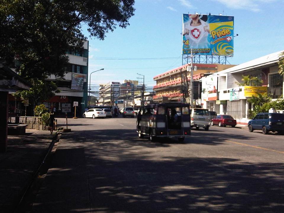 Intersection of San Juan St. and Gonzaga St. (view along San Juan St. towards southwest)
 Intersection of San Juan St. and Luzuriaga St. (view from east corner of intersection towards Westown Hotel)
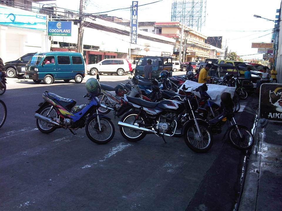 Roadside parking along San Juan St. Noticeable above are the motorcycle parked along the road, with some occupying pedestrian crossing space.
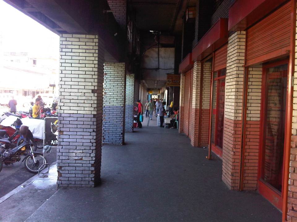 Old cities like Bacolod have buildings featuring arcades like this where pedestrians have the ROW and are sheltered from the elements. I was glad to see that the city basically cleared these facilities from obstacles. It is not entirely without impediments though as shown in the photo.
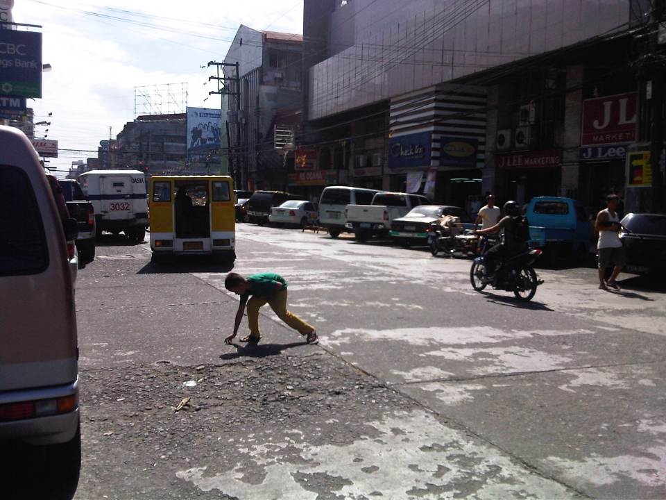 Luzuriaga Street (view towards southeast)
 Arcade of Plaza Mart building along Gonzaga Street and across from the Bacolod Public Plaza (view towards Araneta Ave. and Gatuslao Street)
 Another view of the arcade of Plaza Mart, this time along San Juan Street (towards Luzuriaga St.)
 San Juan Street (view from the corner at Gonzaga Street) – at right is the Plaza
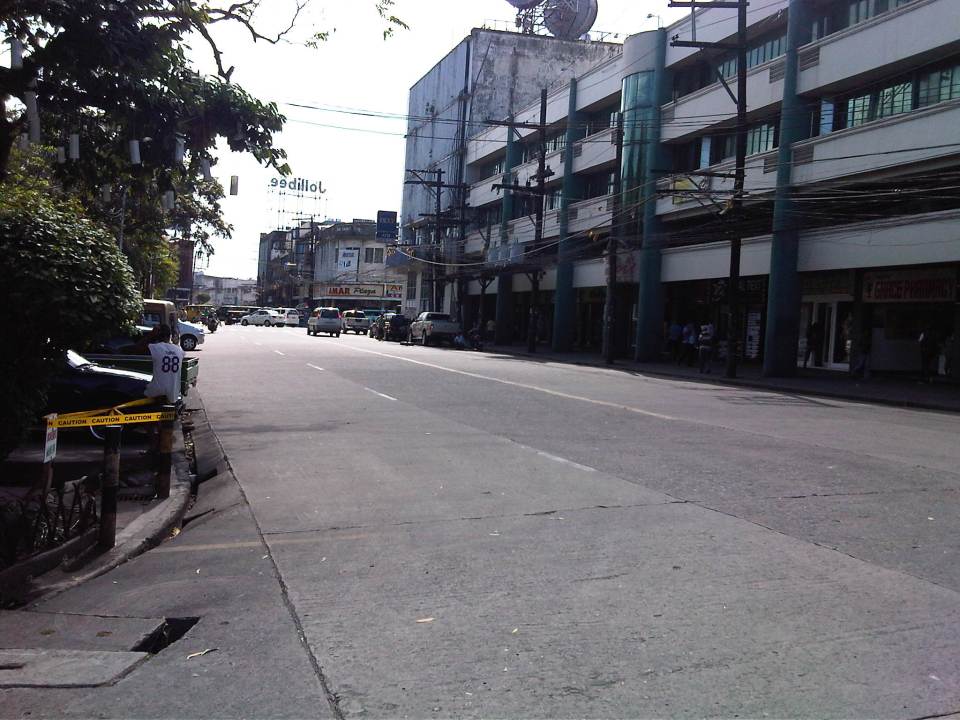 Gonzaga Street (view at corner of the Plaza along San Juan Street) – vehicles downstream are at the intersection of Gonzaga St. and Araneta Ave. Further downstream is Gatuslao Street
 Rizal Street taken from the plaza side and featuring San Sebastian Cathedral
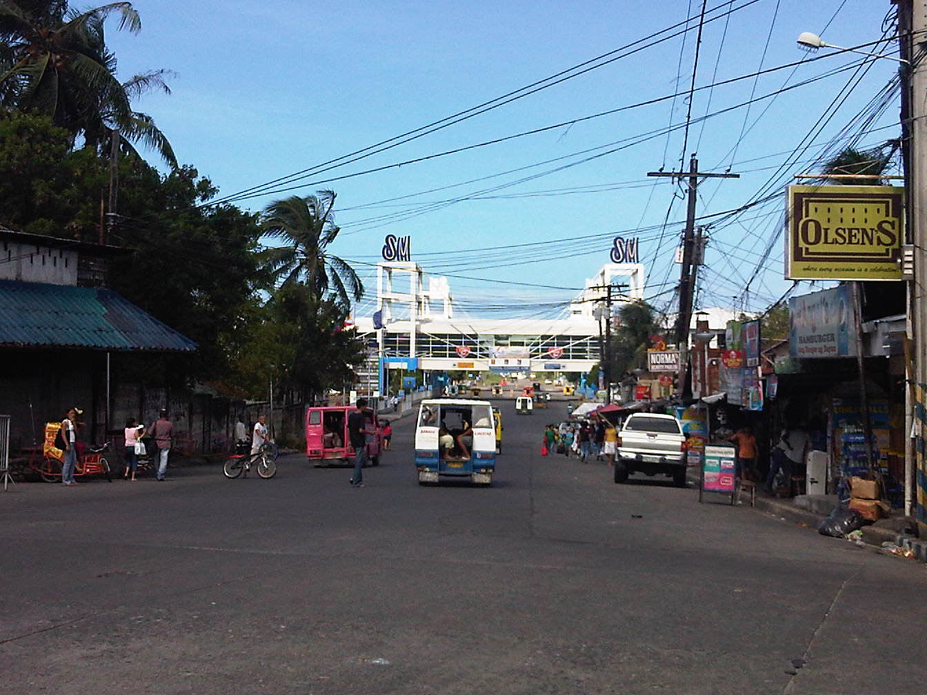 Rizal Street leads to SM City Bacolod, which is found in the reclamation area. (View from the intersection of Rizal St. with San Juan Street)
 Steel barriers along Rizal Street prevent vehicles crossing the street from the northeast side of San Juan St. All traffic must turn right towards SM. (view from the corner of San Juan and Rizal along San Juan towards the southwest direction) The PNP headquarters is the building on the opposite corner with the blue roof.
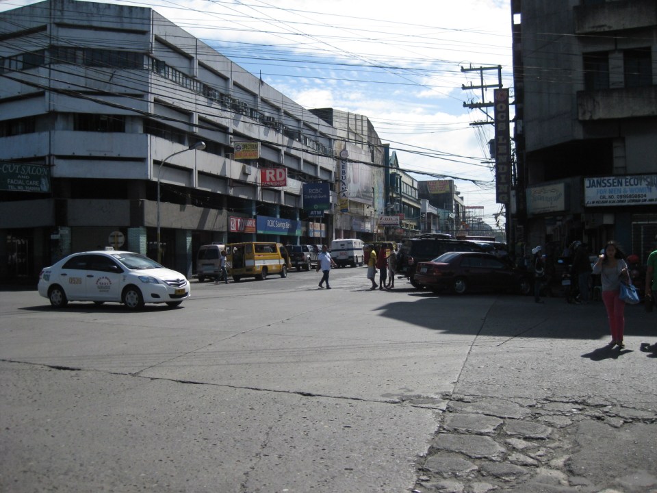
 Intersection of San Juan Street and Luzuriaga Street (view along San Juan St. towards southwest)
 San Juan-Luzuriaga intersection (view from Westown Hotel corner)
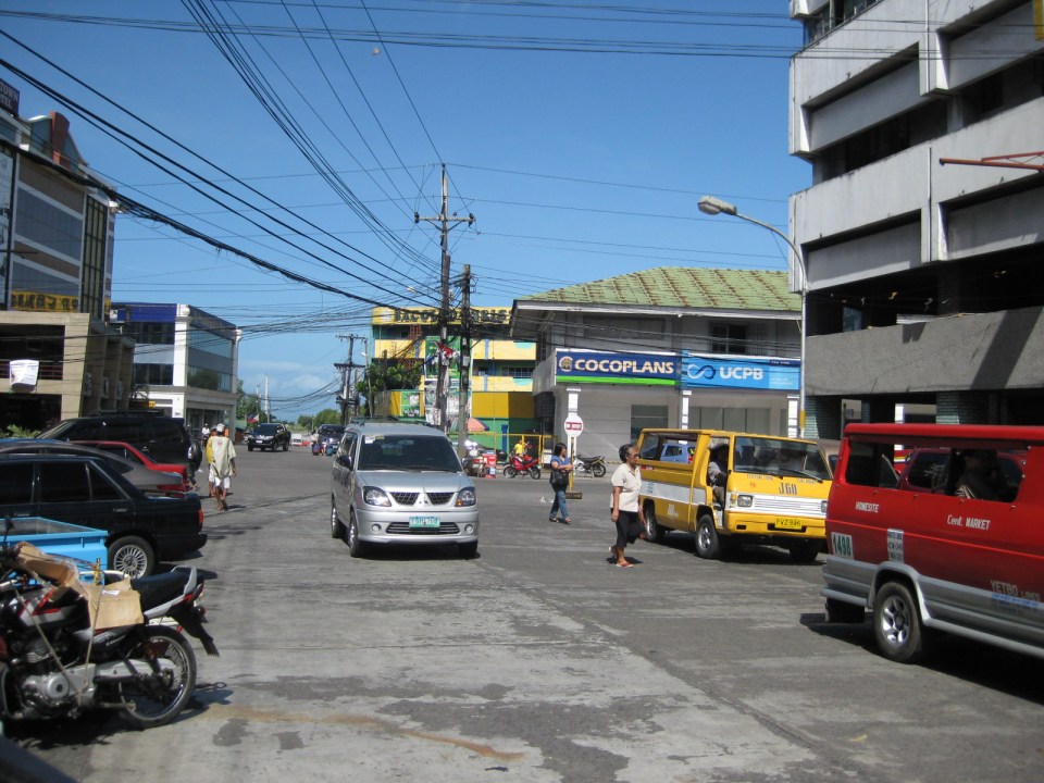
 San Juan-Luzuriaga intersection (view along Luzuriaga St. towards southeast)
 Luzuriaga Street is also a one-way street and with significant roadside parking as shown in the left side of the photo. View of traffic coming from the intersection with San Juan St. Westown Hotel is the building at left.
The circulation scheme at the plaza seems to be working out well at the time. This is despite the proliferation of roadside parking along the streets and around the plaza. The streets are relatively wide and so a one-way scheme works well in terms of taking advantage of the capacities of the streets while allowing for curbside parking that typically occupies one lane of road space as shown in the photos above. We didn’t see anyone charging parking fees for the vehicles and so we assume that these are practically free though we did see some informal “watch-your-car” boys who rely on tips from those parking along the road. Ultimately, though, the city should look into the provision off-street parking facilities as I can imagine traffic congestion, for example, in the vicinity of San Sebastian Cathedral on Sundays. Traffic in the area should be expected to increase as the city continues to experience economic growth and more developments ultimately locate at the reclamation area.
–
Antipolo Simbahan
“All roads lead to Antipolo” is a saying that is especially true for devotees to Our Lady of Peace and Good Voyage for whom the shrine in Antipolo is dedicated. Indeed, major transport routes lead to Antipolo City and signboards on jeepneys (and buses of old) state “Antipolo Simbahan” as their destination. In much older days, the Manila Railroad Company used to have trains directly serving this route. The remnants of its right-of-way is still there but in the form of roads. These are the Daang Bakal, which stretches from Valley Golf in Cainta, Rizal until its junction with Taktak Road and Ninoy Aquino Blvd., where it becomes the Lorenzo Sumulong Memorial Circle, Antipolo’s circumferential road. A trace of this old railway line may be found in this previous post.
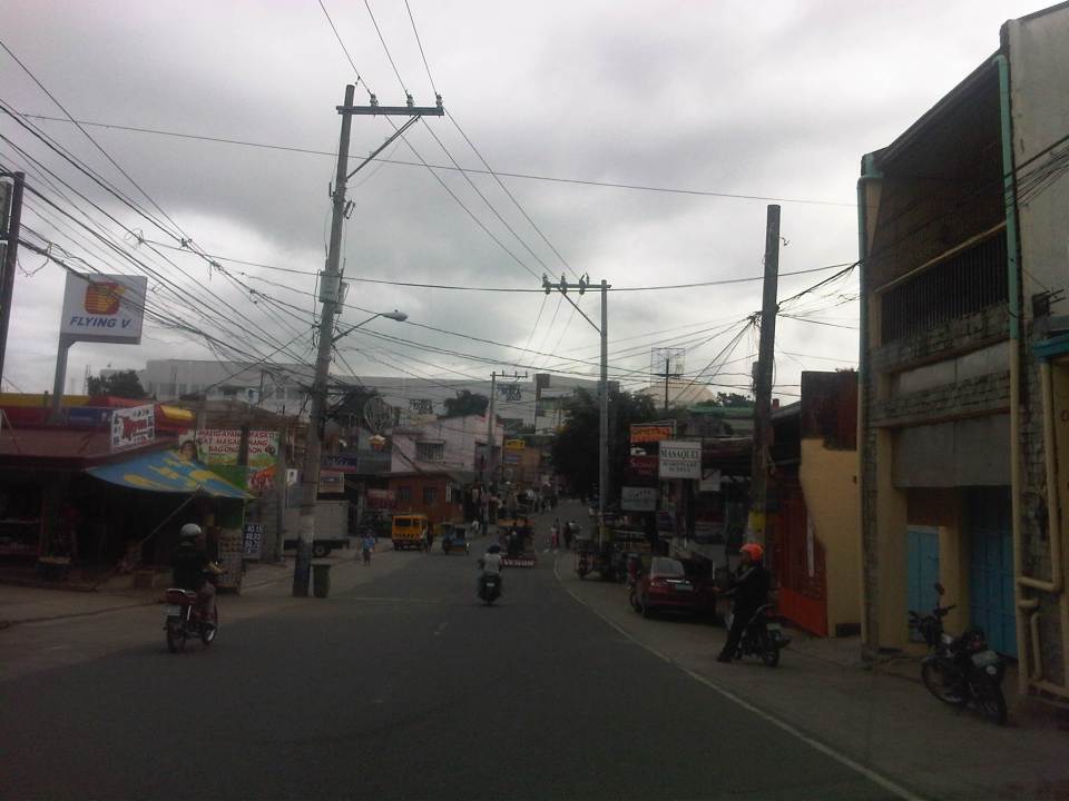 From J.P. Rizal Street, which extends from Sumulong Highway, one turns left to head straight towards the Antipolo church along P. Oliveros Street. The street is a two-lane, one-way road that has been widened at some sections. The shoulders, however, are mostly used for parking as shown in the photo.
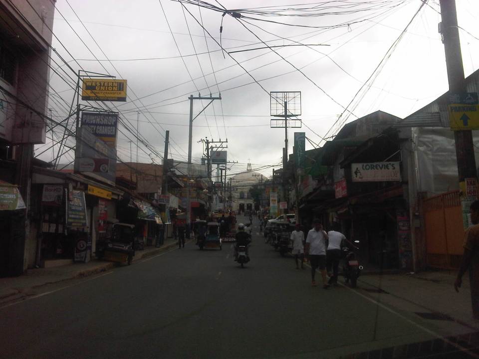 The dome of the church becomes visible to the traveler as one comes closer. P. Oliveros St. is closed to traffic during the feast day in May. It is usually open during Lent even during the Holy Week when there are lots of people coming to Antipolo for the Visita Iglesia. Traffic during those times can be quite slow because there are also lots of people walking along the streets, many of whom are devotees who are namamanata, or have promises of sacrifice and prayers to the patron of the shrine.
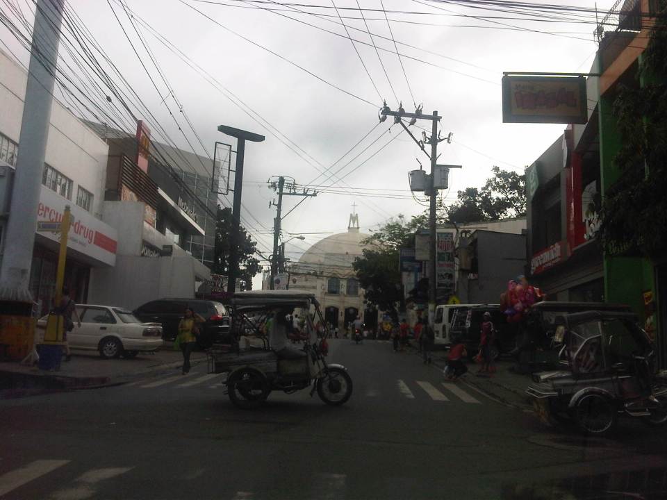 Similar to other poblacions around the country, commerce surrounds the church. Antipolo receives thousands of visitors daily and its being a natural traffic generator provides opportunities for businesses to thrive around it. Establishments around the church are proof of this and one will find most major fast food chains within a stone’s throw away from the shrine. In the photo are major chains Jollibee, Mang Inasal, Greenwich along the right and Mercury Drug(not fast food but the largest drug store chain in the Philippines) and McDonald’s on the left. There are more including banks and food stalls along M.L. Quezon Street, which is the main street of the poblacion.
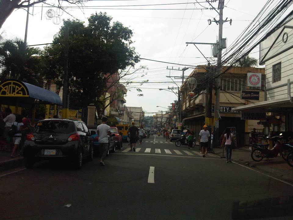 M.L. Quezon Street in front of the shrine and the main street of the poblacion, is also a two-lane, one-way street (southbound flow). There are many one-way streets here as it is no longer possible to widen streets. One side of M.L. Quezon is used for parking and a short walk from the church is Antipolo City Hall, which is the red building barely visible (obscured by the tree on the left) downstream in the photo.
 The Antipolo City Hall building is seen here at the left in this photo.
There is a proliferation of tricycles operating in the poblacion. I don’t know how many there are but they seem to be from different tricycle operators and drivers associations (TODA) that all converge at the shrine. This overlap of service areas (tricycles do not have fixed routes) suggest everyone is taking advantage of the shrine and city hall being major traffic generators. The problem is that the city has not been able to control their numbers and regulation is probably limited to registration, which brings some revenues to the city. This is certainly not sustainable from the perspective of transport
It would be nice to see the poblacion re-planned, designed and managed so that walking may be given primacy over other modes, particularly motorized ones. Antipolo should be walkable and it was in the past considering there were no tricycles and automobiles during the Spanish and early American periods. One took an animal-drawn vehicle, road a horse, or walked even when there was a train service in the early part of the last century. If parking is an issue, then perhaps the city, with the cooperation of the private sector, could find ways of building multi-storey parking facilities in the periphery and within comfortable walking distance from the shrine and city hall. There’s much potential here that is steadily being wasted due to traffic and with no design theme even for buildings surrounding the shrine. The shrine represents heritage and to preserve and enhance it, Antipolo City should find ways to introduce sustainable transport as well as applying architectural principles for the poblacion.
–
Another what if: Rapid Transit Railway for Metro Manila
I posted a map on my FaceBook page showing the lines of a railway network for Metro Manila proposed about 40 years ago. The map, which I reproduce below, was produced from the original featured in the Final Report of the Urban Transport Study in Manila Metropolitan Area (UTSMMA) that was completed in September 1973. To enhance the image, I traced the lines and provided some color. I also indicated the intersections among the lines that are potentially common stations for the network. The study was funded by what was then the Overseas Technical Cooperation Agency of Japan, the predecessor of the Japan International Cooperation Agency (JICA). The study recommended for a Rapid Transit Railway (RTR) system for Manila.

The main routes of a mass transit system was recommended by UTSMMA to be restricted to railways in the form of subways in the inner area bound by what was then called Highway 54 (C-4 or EDSA) and elevated trains outside in the suburban areas. The study recognized the important roles of buses and jeepneys while recommending that these serve feeder routes once the railways were completed. Following are descriptions of the Lines including their lengths:
- Line 1 (27.1 km) – from Construction Hill to Talon via central Quezon Boulevard, Manila downtown and the International Airport
- Line 2 (36.0 km) – from Novaliches to Cainta via Manila downtown and Pasig
- Line 3 (24.3 km) – Along Highway 54 (C-4): half a circle route about 12 km from Manila downtown
- Line 4 (30.1 km) – From Marikina to Zapote via Cubao, Manila downtown and the Manila Bay area
- Line 5 (17.6 km) – From Meycauayan to Manila downtown running between Line No. 2 and PNR
- PNR improvement (56.4 km) – From Bocaue to Muntinglupa via Tutuban Station
Curiously, a Feasibility Study for Line 1 was completed in June 1976 but unfortunately (or tragically) plans for the implementation of the network were apparently scuttled after a subsequent study that included a land use component. This was the Metro Manila Transport, Land Use and Development Study (MMETROPLAN) that was completed in February 1977, which came up with the following assessment:
“Heavy Rapid Transit (HRT) would provide public transport passengers with much faster journey, but by 1990 would attract only 2.5% of motorists and would have negligible impact on traffic congestion. Partly because of this and partly because of its very high capital cost, it would be hopelessly uneconomic: the annualized capital costs would be higher than the estimated benefits in 1990…passenger flows are not high enough to exploit its full capacity…and the large savings in time for public transport passengers are not given a high value in Manila, and are not high enough to persuade motorists to change mode.
These results are conclusive , and are unlikely to be changed by any circumstances or reasonable assumptions…it is clear that any other fully segregated public transport system, whether light rail or busway, would also be uneconomic. As such systems would require the appropriation of most, if not all, of the available funds for all transport (including highways) in Metro Manila for the foreseeable future, and as there is not other rationale for their implementation, they have been rejected from further consideration.” (MMETROPLAN, Final Report, 1977)
Looking back and then making a rapid assessment of what is now Mega Manila, we now know that this conclusion in 1977 was so off the mark. Further, the assumptions then that included restricted development in areas such as the Marikina Valley were not realized; resulting in a sprawl and population distribution that pretty much requires the RTR system recommended in 1973. We also now know that such a system could have been a game changer in terms of how we commute and how lands were developed along those transit corridors. I would even be brave enough to state that a subway system could have forced us to invest in a comprehensive drainage system to prevent flooding that could also have had tremendous benefits now in these times of Ondoy and Habagat with heavy rains often wreaking havoc on Metro Manila.
–


