
Home » Traffic Congestion (Page 15)
Category Archives: Traffic Congestion
Causes of congestion along Ortigas Ave. Extension
I have written about the common causes of congestion along Ortigas Avenue. The past articles mentioned the undisciplined loading and unloading along the entire stretch of the road and particularly at either ends of the Manggahan Floodway bridge in Pasig City. I have also written about the congestion caused by private vehicles generated by a private school just a stone’ throw away from DOTC headquarters. This time, I focus on Ortigas Avenue Extension, particularly the stretch from Cainta Junction to Valley Golf.
The current and more critical choke points along Ortigas Ave. Ext. are along the stretch of the road between Cainta Junction and Valley Golf. These are due to the road and drainage works along that section that effectively made the westbound side of Ortigas a single lane road between Brookside and Park Place. There are also road and drainage works along the eastbound side between Brookside and Valley Golf where the entire road section is being elevated. This section is flood prone and has been problematic during the wet season when heavy rains often result in flash floods.
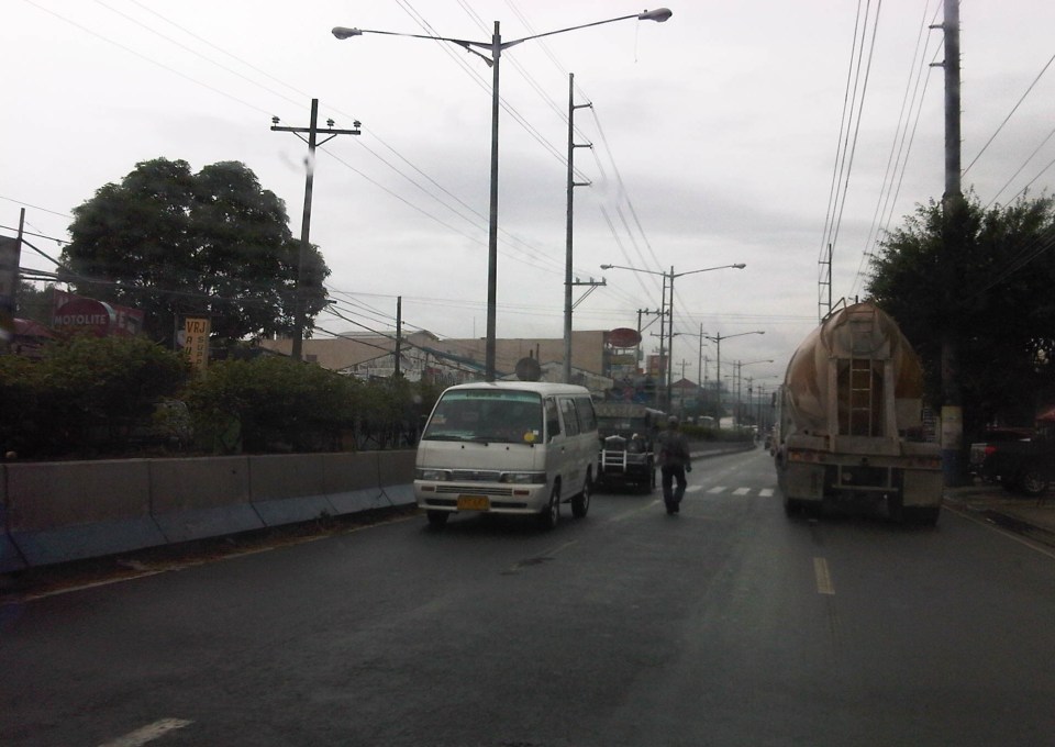 Counter flow along Ortigas Avenue Extension – this scheme has been the only option for the section between Valley Golf and Park Place Subdivision as the work proceeds one lane at a time. At the time, I took this photo, the counter flow lanes allowed for 2 lanes each for both the eastbound and westbound directions of this corridor. The past week, however, I noticed that during the afternoons and evenings, I noticed that two lanes were allocated for westbound traffic while only one was for the eastbound direction. This should not be the case as the peak direction in the afternoon to the evening is eastbound when people are home bound mainly from work and school.
 The section across from STI is another choke point as the area is one of the ends of the project raising the elevation of the avenue as well as improving the drainage along the road. The traffic along this area has improved much though vehicles still have to slow down to transition between the old pavement and new pavement sections, as well as vehicles turning towards Hunters ROTC Road.
 Unfinished sections – at the time this photo was taken, work along the site was intermittent. Commuters making the observation are often frustrated and much disappointed when they see none working along the construction site. The Mayor of Cainta did very well by talking to the contractor and apparently discussing with the latter how to improve traffic conditions as well as how to expedite the implementation of the project. My own observation was that conditions did indeed improve after that meeting (which was related by the Mayor in his Facebook page) and people could see workers busy with the project even at night time.
Traffic will continue to be bad along Ortigas Avenue Extension until this project is completed. While there should be some significant improvement in traffic flow after completion, congestion will again steadily worsen for this corridor whose private vehicle traffic continues to grow. Public transport is provided by buses, jeepneys and UV Express (whose numbers have ballooned during the last 5 years) and these have contributed a lot to congestion because of their drivers’ behavior particularly when they stop for passengers at areas like Valley Golf, Brookside, Cainta Junction, Ever, Countryside, Manggahan and Rosario.
There is hope though as news proclaim that the NEDA Board has approved the LRT 4 project along this corridor. A mass transit system is indeed necessary and this was required perhaps over a decade ago already. I do hope that this ‘LRT’ is more like the current Line 2 trains and stations than the Line 3 kind. Line 2 is a heavy rail system while Line 3 is light rail. The Ortigas corridor requires a heavy rail system considering the passenger demand in the areas that will be served by the transit system. I also hope that Line 4 is implemented like Line 2 with the government taking responsibility for constructing the system. I have maintained my view that the current administration is too fixated with Public Private Partnerships (PPP) that it had practically given up its responsibility to the general public to provide an efficient and equitable means of public transport for commuting. I just now wonder what became of the proposed BRT line along this same corridor. Perhaps the BRT option has already been abandoned by the DOTC in favor of rail?
–
Running out of answers? How about congestion pricing?
A lot of people ask me about solutions to transport and traffic problems. Some are very general like the question “How do we solve traffic congestion in Metro Manila?” and others are more specific like “How do we solve congestion along EDSA?” These questions are becoming quite tricky because, for one, we are running out of answers of the ‘short term’ kind. All these ‘stop-gap’ or ‘band aid’ measures will only provide short-term relief and we have used many of them already including vehicle restraint measures we are very familiar with like the number coding and truck ban schemes currently implemented in the metropolis.
The general answer and likely an inconvenient truth is that we can’t solve congestion. It is here to stay and is a given considering the continued growth experienced throughout the country. Accepting this phenomenon of congestion, we can proceed towards managing it and work towards alleviating it. Denying that there is a problem or dismissing such as an issue requiring urgent action sets a dangerous course towards unsuitable responses or worse, inaction on the part of the government.
Like cholesterol, there is good congestion and bad congestion. Good traffic congestion is when it is predictable in occurrence and period. For example, the morning rush hour is termed so because it used to last only about an hour or so. Congestion occurring between 7:30 – 8:30 AM is okay but between 6:30 – 11:30 AM is undesirable. The cases between those two vary in acceptability based on the tolerance levels of commuters. In Metro Manila, for example, many people probably have been conditioned to think that 2-hour congestion is okay but more than that is severe. This is actually related to travel times or the time it takes to travel between, say, one’s home and workplace.
And so, are there better options other than a return to the “Odd-Even” scheme? There are actually many other options but they are more complicated to the point that many are unpalatable to people who are in a hurry to get a solution our traffic mess. Note that this is to get out of a hole that’s deep enough already but they still managed to dig deeper the last 5 years. Among these solutions would be congestion pricing.
Singapore offers a successful model for this where tolls vary according to the levels of congestion for these roads. There is a base rate for peak periods when congestion is most likely or expected. The government determines the desirable speed ranges along roads as a basis for congestion charges. Along urban streets, that range may be between 20 – 30 km/h. If speeds reduce to below 20 km/h (i.e., congested) then charges or tolls increase. If speeds increased to above 30 km/h, the rates decrease. The image below is screen capture from a presentation made by an official of Singapore’s Land Transportation Authority (LTA).

Note the item on the scheme being ‘equitable’ that is very essential in understanding how road space must be shared among users and that there is an option to use public transport instead. This scheme, of course, will require a lot of consultations but the technical part should not be worrisome given the wealth of talent at universities, private sector and government agencies who can be involved in the analysis and simulations. Important here also is to determine or institute where the money collected from congestion pricing will go. Logic tells us that this should go to public transportation infrastructure and services. In Singapore, a big part of the funds collected from ERP goes to mass transit including their SMRT trains and buses. Funds help build, operate and maintain their trains and buses. The city-state already has a good public transport system that is subsidized by congestion charges and this system is able to attract people from using their cars especially during the weekdays when transport is used for work and school trips. That way, people who don’t really need to own and use their cars are discouraged from doing so (Note: This works together with Singapore’s restrictive car ownership policies.).
Would it be possible to have congestion pricing for Metro Manila or other cities in the Philippines? Yes, it is and but entails a lot of serious effort for it to work the right way. We can probably start by identifying major roads whose volumes we want regulated, installing sensors for monitoring traffic conditions and tagging vehicles and requiring most if not all vehicles to have transponders for motorists to be charges accordingly. However, there should be an attractive and efficient public transport option for this program to work. Unfortunately, we don’t have such along most roads. Perhaps an experiment or simulation can be undertaken once the LRT 2 extension is completed and operational? That corridor of Marcos Highway and Aurora Boulevard, I believe is a good candidate for congestion pricing.
With the sophisticated software that are now available, it is possible to conduct studies that would employ modelling and simulation to determine the potential impacts of congestion pricing on traffic. It should have a significant impact on congestion reduction even without mass transit systems such as Singapore’s. However, without good public transport, it would be punishing for people who are currently using their own vehicles to avoid taking public transport. I used the term ‘punishing’ because congestion pricing will be a back breaker for people who purchased vehicles to improve their commutes (i.e., they likely were not satisfied with taking public transportation). These are the working people and part of the small middle class whose transport needs should be addressed with urgency.
–
Rains, floods and traffic
The wet season is here and with it the now typically heavy rains in the afternoons. Last week, the heavy rains brought upon flash floods in Metro Manila and adjacent towns. There have been no typhoons yet so these are mainly monsoon rains (Habagat), which we expect to be daily occurrences. Many of these floods are along major roads including EDSA, C5, Espana, and Quezon Ave. that transformed these roads into parking lots as most light vehicles are unable to traverse flooded streets.
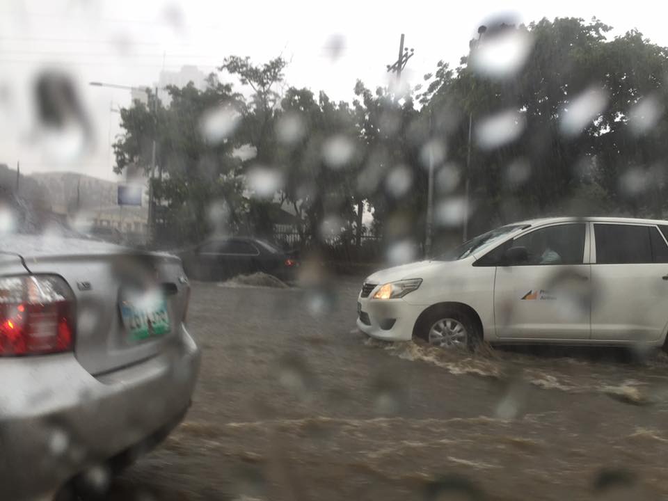 Vehicles run along the flooded Elliptical Road in Quezon City
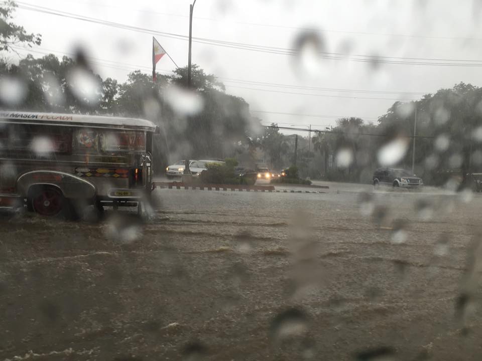 Jeepneys and SUVs (at right in the photo) take on the flooded Elliptical Road-Quezon Avenue intersection
Due to the traffic congestion resulting from the floods, many public utility vehicles especially jeepneys and UV Express vehicles were not able to go back and make their round trips.
 Cars risk the floods along Elliptical Road – the deepest waters are, ironically and curiously, along the section fronting Quezon City Hall where there is a pedestrian underpass connecting city hall with the Quezon Memorial Circle. Since the underpass is not flooded then it can be concluded that there’s something wrong with the drainage for Elliptical Road.
The weather is a very significant consideration for transport planning for cities in the Philippines. For Metro Manila it is almost everyone’s concern about how they can travel between their homes, offices, schools and other destinations without them and their things getting wet. This is what a lot of people advocating for road sharing seem to forget or choose to forget in their arguments for walking and cycling. A person residing in Fairview in Quezon City and working in Makati City will most likely not walk or cycle between his home and office because of the weather. This is a reality that could be solved by good public transportation, which, unfortunately, we also don’t have (yet) so people are ‘forced’ to do what they can to improve their plight. Unfortunately, too, what they are forced to do is purchase a car (or more). The proposal to build infrastructure to enable walking and cycling especially over medium to long distance is in the same dilemma as those for mass transit. And the latter is the more urgent matter needing action for the sheer volume of people they can carry and therefore benefit.
–
Ortigas Ave. Extension choke points
One alternative route for my daily commute is Ortigas Avenue. While there are several choke points along this road, I will focus on those between the Ever mall and Cainta Junction. Congestion is also usually experienced between the Manggahan Bridge and Ever but these are mostly due to traffic interruptions because of vehicles turning to and from the many subdivisions whose access/egress line up along Ortigas Ave.
The Ever mall is already a given as a significant traffic generator in the area. However, there is something about its circulation particularly the flow of vehicles in and out of the complex that detrimentally affects Ortigas Ave. traffic. While through traffic along the eastbound direction should use Ortigas Ave., many opt to go through the wide driveway of Ever in order to bypass the choke point that is the exit driveway of the mall. Many of these exiting vehicles are jeepneys turning left into Ortigas westbound (their routes terminate here and make their turnaround via Ever’s driveway). These effectively block the flow of traffic along Ortigas eastbound especially in cases when the westbound direction is also congested (i.e., due to sheer volume as well as stopping vehicles across the mall).
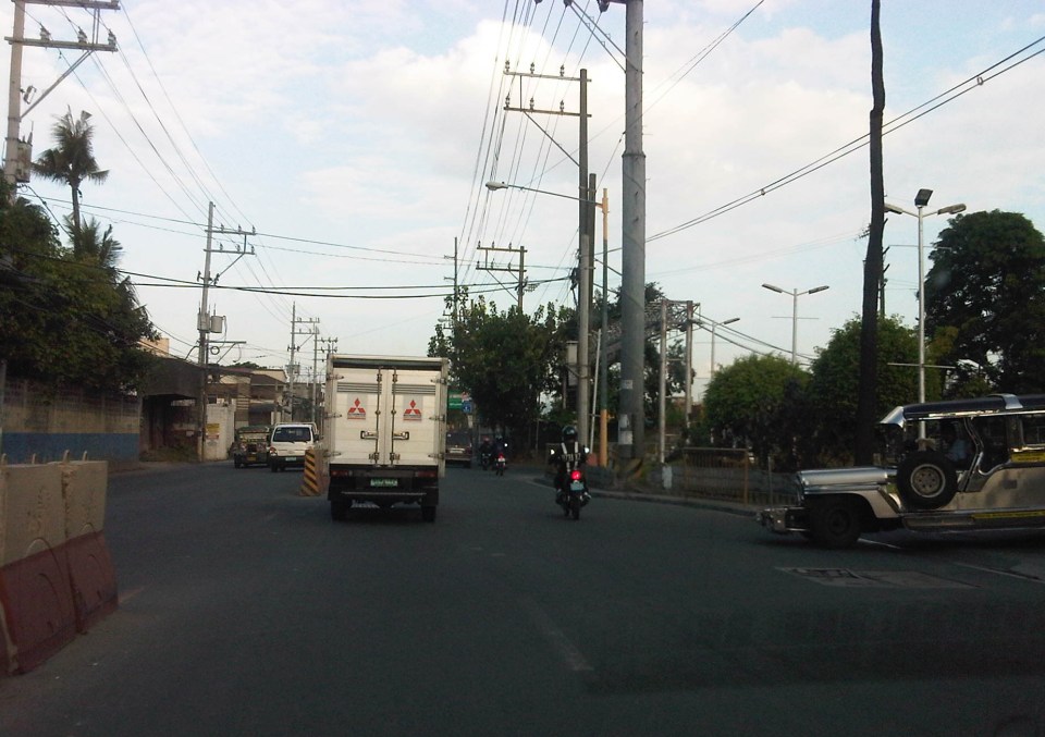 Vehicles exiting from Ever and turning left to Ortigas westbound
Once eastbound vehicles are freed from the blockage of left-turning vehicles, they have to merge with significant right-turning traffic from Ever that includes buses and mostly through traffic vehicles whose drivers were ‘wise’ to have taken the driveway instead of Ortigas to get through the choke point. The situation results in another choke point right after the first one as the traffic along two lanes of Ortigas eastbound merge with the traffic equivalent to 2-3 lanes turning right from Ever. The total of 5 lanes of traffic squeezing into 2 lanes immediately after is a prime example of a bottleneck.
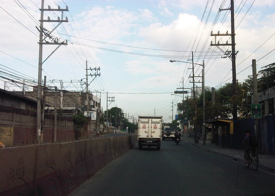 Narrow eastbound two-lane section – additional space should be expropriated to widen Ortigas at this section
Right after the short 2-lane section is a sudden widening of Ortigas Ave. in front of BF Metals. I have heard it said that this is the ideal road width for Ortigas Ave. considering the volume of traffic passing through this major corridor connecting Rizal province with Metro Manila. There are practically 4 lanes for each direction at this short section so its easy to project these lanes on maps to see what properties would need to be expropriated if the objective is road widening. (Of course, the best option should still be to pursue a mass transit system along this corridor.)
 Ideal road width – Ortigas Avenue at its widest is the section across BF Metals. Vehicles here spread out along the many lanes suddenly available. But then people will eventually and immediately realize this is the mouth of a funnel. Note the sign indicating that vehicles are entering the Province of Rizal from this point.
 The eastbound section in front of BF Metals is usually parking lot in the evenings. This is due mainly to the 4 lanes almost abruptly constricting into 2 lanes just past BF Metals. Compounding things is the U-turn slot located here where many jeepneys whose routes end at Cainta Junction make their turnaround. Turning vehicles are assisted by “tambays” earning their money by blocking eastbound vehicles to make way for U-turning vehicles.
Finally, there is Cainta Junction itself, which is a signalized 4-leg intersection that handles a tremendous volume of traffic all-day. I am sure that there are efforts for the traffic signal settings to be optimized but more often there is human intervention for traffic management at the intersection. Whether this causes more severe congestion is quite obvious to many travelers going through this intersection. Queues along Imelda Ave./Felix Ave., for example, can reach way past Village East even reaching Vista Verde on a bad day. This only shows that the intersection is already severely saturated and conventional traffic management or signal settings can no longer handle the traffic. Perhaps the next stage of engineering intervention for this intersection is grade separation or the construction of a flyover or two at the intersection. Notably, such a project should including strategic widening along Ortigas Ave in order to balance the number of lanes feeding into and receiving traffic from the intersection.
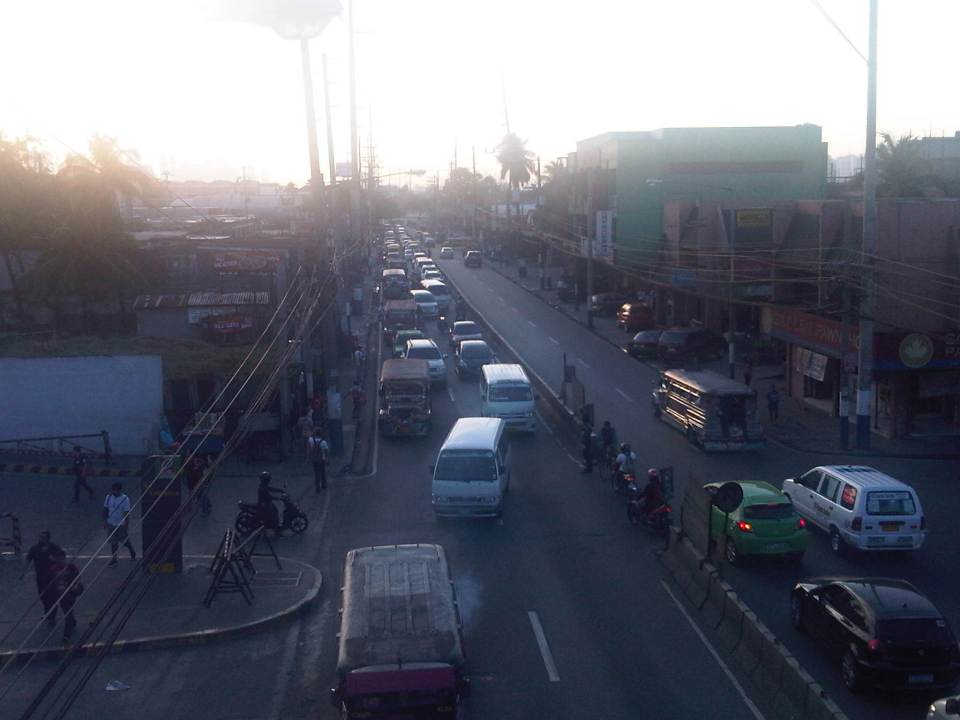 A view of the traffic approaching Cainta junction – there are only 2 lanes along the eastbound side of Ortigas and public utility vehicles stopping here only exacerbates the congestion along the road.
Is road widening the ultimate solution to Ortigas Ave congestion? I personally don’t think so. As I have mentioned earlier in this post and in previous posts the key is still to come up with a mass transit system to serve this eastern corridor. Yes, there will eventually be a Line 2 along Marcos Highway, the main alternate (or competing?) route to Ortigas but is is obvious that even with a railway line along Marcos Highway and connecting to Aurora Blvd., there will still be an urgent need for a similar capacity line along Ortigas. The buses and jeepneys can no longer handle the demand and their poor levels and qualities of service have given rise to a proliferation of UV Express and pushed people to purchase cars and motorcycles. Congestion can be reduced significantly with a mass transit system along Ortigas. Without this transit system, Ortigas will just continue to be congested even if the entire corridor is widened; except perhaps if it is widened like Commonwealth Ave. in Quezon City. I don’t think that is possible and practical.
–
Conditioning
Was traffic really bad yesterday, Dec. 21, or was it typical Friday traffic? A lot of people have been talking or posting about how traffic last Friday was expected to be the worst of the year. Apparently, it was not.
Based on posts on my social media accounts yesterday, it seems that traffic was not at all that bad in many parts of Metro Manila, especially along roads that were expected to be hellish in terms of congestion. One post stated that it him only an hour to travel from Ayala to Trinoma by bus. People usually post about really bad experiences about traffic congestion and this crowd-sourcing approach is usually very reliable. I went home early yesterday and it didn’t take me long to travel between stops for errands I had to do along the way home. Media also would have reported about terrible congestion along major roads including EDSA, C5 and the expressways.
Statements like what the MMDA made prior to Dec. 21 are typical of a psychological approach that some agencies seem to have been resorting to in order to manage people’s expectations and perceptions. Conditioning people’s minds is not a new strategy or tactic. The MMDA has been doing this a lot for as long as I can remember, including during the stint of its former chair Bayani Fernando. Many if not most of these “conditioning” activities are done through media with the agency making statements through its officials about issues such as traffic, garbage and flooding. This is no different to the perception of one agency making frequent “power point presentations” (a reference to projects involving the private sector) to announce much delayed projects supposedly for immediate implementation.
One opinion is that this is a form of damage control. People will usually have strong opinions about what government is doing to address issues like congestion. For people not react too strongly against agencies that are supposed to be responsible for the problem, the same agencies have anticipated and preempted the manifestation of their ineptness by stating the obvious ahead of its occurrence. This would not have been necessary if the agencies did what they were supposed to do in the first place. Hopefully, in the near future such conditioning and other psychological tactics will indeed not be necessary once programs and projects are finally implemented and help alleviate or solve problems.
–
What’s wrong with Marcos Highway?
Traffic along the eastbound direction of Marcos Highway in the late afternoons to evenings have worsened particularly for the section stretching from Aurora Boulevard in Quezon City to Imelda Avenue in Cainta. It takes me at least 45 minutes just to traverse that section and then just under 30 minutes the rest of the way to my home in Antipolo. In addition, there is the traffic along Katipunan, which can be quite unpredictable despite the traffic signals now installed at two major intersections near Ateneo and Miriam. The congestion along Marcos Highway is usually due to several factors:
- Rush hour(s) traffic – the sheer number of vehicles during the afternoon/evening peak is enough to cause traffic congestion along Marcos Highway. This is no longer for an hour but for a period usually spanning about 4 hours (5 to 9 PM). It’s become so bad that I am no longer surprised when I go home late some nights to find out it’s still congested at certain points (usually Santolan and Ligaya) past 9 PM.
- People occupying the road – commuters waiting for a ride along Santolan, Ligaya and Metro East/Sta.Lucia often occupy not just one but 2 to 3 lanes of Marcos Highway. This drastically reduces road capacity. For some reason, the MMDA and LGU traffic enforcers could not persuade them to clear the carriageway or at least encroach only on the outermost lane.
- Errant road public transport – loading and unloading operations of jeepneys and UV express happen in the middle of the road. This is partly due to the fact that people already occupy 1 to 3 of the outermost lanes of the road. It is also partly due to driver behaviour as many PUV drivers are unruly. These are also maybe because the enforcers are not doing their jobs managing traffic and apprehending those violating rules and regulations whether driver or pedestrian.
- Major trip generators – there are already 4 malls along Marcos Highway (SM Marikina, Robinsons Metro East, Sta. Lucia East Grand Mall, and SM Masinag) and a 5th is already under way with Ayala constructing a mall at Ligaya. These will attract and produce significant traffic with vehicles generally contributing to congestion in the direct vicinity of the malls but spreading along all major roads. Unfortunately, Marcos Highway is one if not the only access road that these malls have.
A lot of people using their own vehicles live in areas served by Marcos Highway including those beyond Masinag and Cogeo. There are so many subdivisions and other residential areas in these parts east of Metro Manila that vehicles from these residential areas alone can cause sever congestion at Masinag Junction. But this should not come as a surprise given that there is no efficient mass transport system in these areas, which are served primarily by jeepneys and tricycles. Obviously, the quality of service of existing road public transport encourages people to get their own vehicle. And obviously, too, the solution is in a project that is considered “bitin” – LRT Line 2, which currently terminates at Santolan. The extension project has long been delayed and could have a significant impact on transport and traffic once it is constructed and becomes operational.
The past two weeks, I have proceeded to take C-5 and turned to Ortigas Avenue Extension on my way home. Surprisingly, traffic has not been bad at Cainta junction and I have only occasionally encountered congestion at the section in front of the BF Metals plant where jeepneys turning around tend to block traffic during their maneuvers. I estimate that I average just under an hour on this route, a savings of 30+ minutes from my original home-bound route via Marcos Highway and Sumulong Highway. I figure that I will most likely keep using this route as traffic will continue to worsen along Marcos Highway in the run-up to Christmas.
–
Undergraduate research topics on transportation for AY2014-2015
The Transportation Engineering Group (TEG) of the Institute of Civil Engineering (ICE) recently finalised the researches to be implemented by undergraduate students assigned to the group.
- Calibrating car-following and lane-changing models for local traffic micro-simulators
- Effects of clear yielding rules at weaving sections
- Evaluation of re-opening of traffic signals along Katipunan Avenue
- Shuttle service for University of the Philippines Diliman employees
- Analysing trip-cutting behaviour of jeepneys and UV express with respect tot he LRT Line 2 Santolan and Katipunan Stations
- Assessment of pedestrian facilities along Ortigas Avenue Extension and Marcos Highway
- Study on satellite parking system for UP Diliman
- Road safety audit checklist for expressways
- Study on Philippine National Railways (PNR) station congestion
- Using drones for analysis of weaving sections, and traffic circulation in roundabouts
- Air quality assessment at the Centennial Dormitory along C.P. Garcia Avenue
- Estimating bus passenger demand between UP Diliman and UP Los Banos
- Mode choice modelling of new transport systems
- On-road energy efficiency of alternative fuel vehicles
Note that several topics in the list are focused on issues concerning the UP Diliman campus. These are a continuation of studies geared at providing solutions to transport or traffic problems at UP’s flagship campus sprawled over an area of 493 hectares. The above are working titles at best as students taking up the topics are supposed to develop their research proposals (complete with literature review, methodology and budget) this semester and then implement these in the next semester. Since UP has already adjusted its academic calendar, research implementation will be undertaken from January to May 2015.
–
Interesting articles on traffic congestion
Here are a few good reads on traffic congestion and its measurement or quantification:
- How Not To Measure Traffic Congestion—Hold the Hyperbole, Please! which appears on Planetizen today, October 15, 2014.
- Rethinking the economics of traffic congestion which appeared on June 1, 2012.
Reading these articles will probably make you think that traffic is good or that congestion is good. While congestion is indeed indicative of economic vibrance as movement of people and goods are a good measure for economic activity, excessive congestion results in many other problems that need to be addressed and which can also be quantified in economic terms. Note, too, that one author mentions “peak traffic” that is now becoming common in developed countries as motorization has plateaued and transport systems have become developed to provide people and goods with a variety of modes to choose from including walking and cycling. In our case, traffic has not yet “peaked” in the sense that motorization continues for many of our cities including Metro Manila. There is also a lag in the provision of transport infrastructure including mass transit systems that should have been constructed decades if not years ago. Perhaps we need to be clear about the context by which congestion costs are estimated and presented.
The somewhat dramatic presentations like the manner shown in the first article above reminds us of similar estimates of congestion costs in the Philippines, particularly for Metro Manila. The latest of these come from a JICA project that had as an objective the drafting of a roadmap for transport in the expanded region that is dubbed as Mega Manila (Region 3, National Capital Region and Region 4A). The end product has been billed as a “Dream Plan for Mega Manila” and draws on congestion cost estimates that would definitely be regarded as exaggerated if seen in the context of the two articles we mentioned above. Perhaps it is the important message (i.e., we need to build transport infrastructure) of such exaggerated presentations that we should focus on an not really the specific numbers being quoted by news organizations and circulated in social media.
We have to caution the reader that congestion is here to stay and cannot be totally eliminated, especially with economically vibrant or growing cities. What we probably would like to address, however, is excessive congestion. Yes, there is such a thing as excessive congestion. I would like to describe this as something that is “unreasonable” along the lines of say instead of your regular 1 hour commute, it took you 2 hours or more. For some, this can be due to horrendous traffic jams due to flooded streets. Or perhaps someone who takes public transport waiting for hours just to get a ride. And so people are forced to cope and in a way, their minds have been conditioned to tolerate (accept?) the levels of congestion they experience on a daily basis. Congestion is good but it does not have to be hellish.
–
The return of traffic signals at Katipunan
It’s been more than a decade since the MMDA implemented what was formally called the Grand Rotunda Scheme. To most, it will always be the U-turn scheme that was implemented all around Metro Manila. After seeing what seemed like success along roads like Commonwealth and Quezon Avenue, it was concluded that the U-turns were the answer to Metro Manila’s traffic woes or at least the part that’s blamed on signalized intersections. The perception by many at the time was that traffic signals were not working and caused so much congestion as evidenced by the long queues at intersections. This is not entirely false as intersections with in-optimal settings would definitely bring about congestion especially along corridors or networks where signals are not coordinated. It was, however, a generalization at a large scale and led to more experiments of opening and closing slots in order to determine which would be the most effective combinations. These experiments and their outcomes include drivers becoming more aggressive in order to maneuver ahead of others at the U-turn slots. Weaving has become the norm and in many cases have increased the risk of road crashes.
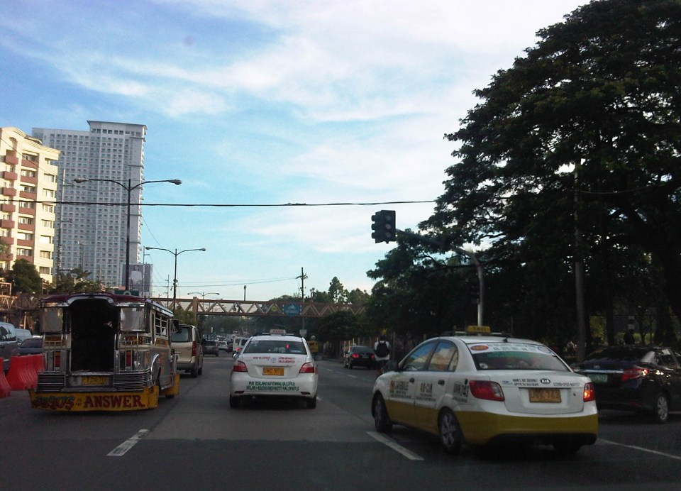 Traffic signals have been installed and the section of the median island has been removed across Ateneo’s Gate 3. This will become a three-leg intersections once again but I hope the signals will not favor Ateneo over through traffic along C5.
 Traffic lights are already installed along the southbound side of Katipunan at the approach to the junction with Miriam College’s Main Gate. This will be a four-leg intersection as across Miriam is B. Gonzales Street that connects to Esteban Abada.
The signals are supposed to be operational starting September 13, which is a Saturday. Perhaps this is to try it out first during that weekend and for the MMDA to do some tweaks before the real deal that is traffic on Monday. But then how can you simulate traffic generated by the two schools in the area except maybe if there is significant enough traffic on Saturday? Did the MMDA or its consultants do some simulation using their computers and the VISSIM software they acquired many years ago? Or will we see more of the experiments as signals are fine-tuned according to the conditions along Katipunan?
We are hopeful that the signals along Katipunan will help improve the traffic along this very busy corridor. The results for sections of C5 from Libis (QC) to Ugong (Pasig) are promising and many people I know have told me that traffic has improved. Of course, this may also be partly due to the one-lane policy the MMDA has implemented for trucks. It’s never just one scheme or measure that will work wonders for Metro Manila traffic. It will always be a combination that will alleviate traffic woes in the metropolis. We’ll soon know what will become of traffic along Katipunan. We should, however, temper expectations at least for the 6:30 – 7:30 AM period during weekdays when traffic peaks in the vicinity of Ateneo and Miriam. The sheer volume of vehicles generated by the schools will overwhelm any system that is put up in the area. Nevertheless, for the rest of the day at least traffic flow should improve when signals are operational once again for Katipunan.
–
EDSA: Taft to Tramo
The EDSA-Taft Ave. intersection was in the news a few weeks ago due to the MRT3 train that derailed and overshot the end of the line along EDSA. Being a major intersection for roads as well as for rail (MRT3 and LRT1), it is a very crowded area. Nearby, too, is the Redemptorist church in Baclaran that attracts a lot of people especially during Wednesdays. Following are a few photos of the area showing the conditions on the pedestrian overpasses and at street level.
 The pedestrian overpass at EDSA-Taft is also a mall of sorts given the merchandise being sold at informal shops at the overpass.
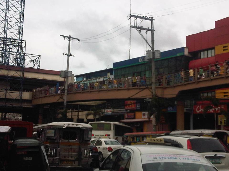 The overpass connects to the EDSA-MRT 3 Taft Ave. Station. This is the MRT 3’s end station and the overpass system connects the MRT 3 Taft Ave. Station with the LRT Line 1 EDSA Station. The connection was not and is still not a smooth one, which has been the subject of criticism from a lot of people.
 The overpass allows people to walk around this large intersection
 Pedicabs freely travel along this stretch of EDSA between Taft and Tramo on lanes designated for public utility buses and clearly violating regulations regarding what vehicles are allowed on EDSA. You can also see in the photo a cart full of merchandise being pushed along the curbside lane.
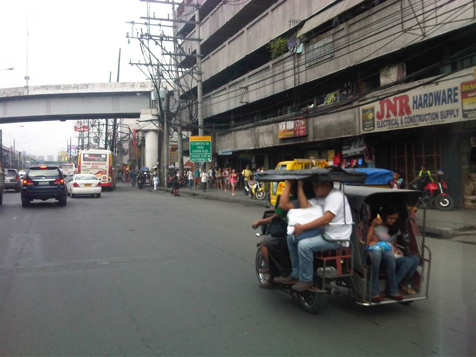 A motor tricycle ferrying passengers along EDSA just before Tramo (that’s the street above which is an overpass from EDSA southbound).
–

