
Home » Traffic Congestion (Page 16)
Category Archives: Traffic Congestion
2014 Professorial Chair lectures on transport topics
The 2014 Professorial Chair Colloquium of UP Diliman’s College of Engineering was held from yesterday until today. Most of the lectures concerning transport were presented today. Here are some of the highlights of the lectures delivered this morning:
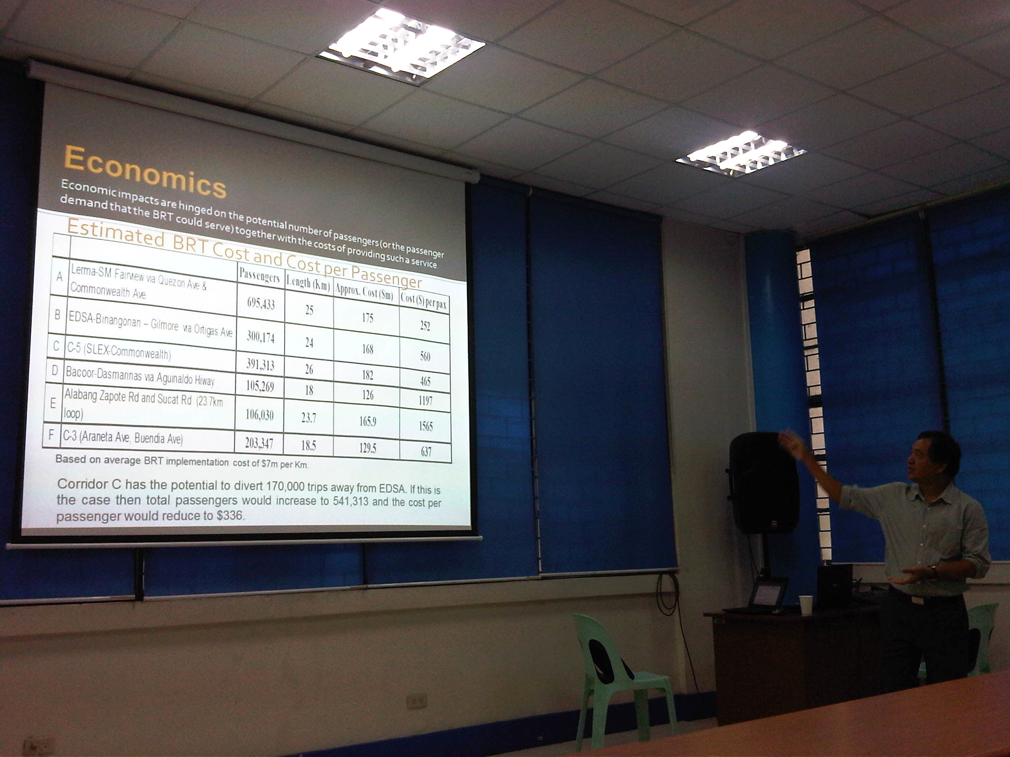 Dr. Ric Sigua, Director of the Institute of Civil Engineering, making a point about the economics of Bus Rapid Transit (BRT).
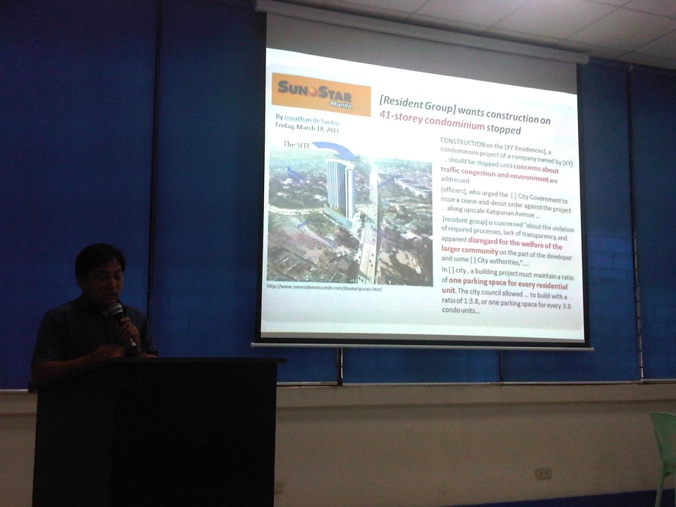 Dr. Sean Palmiano, Director of the National Center for Transportation Studies, explaining the finer points of traffic impact assessment for high density residential developments.
 Prof. Happy Denoga of the Department of Mechanical Engineering explaining on the advantages of hybrid systems for vehicles.
 Dr. Karl Vergel of the Institute of Civil Engineering talking about the on-road tests for jeepneys using B5 or 5% CME-blended fuels in a project commissioned by the Philippine Coconut Authority.
 Comparison of jeepney mileage using 2% and 5% blended fuels.
 Dr. Edwin Quiros of the Department of Mechanical Engineering’s Vehicle Research and Testing Laboratory (VRTL) discussing the dynamometer tests conducted for jeepneys using B5 fuel.
There were other presentations but unfortunately, I wasn’t able to attend these as lectures were spread among various venues at the college. That’s often the hang-up of having parallel sessions during these colloquiums. Nevertheless, it is nice to know that transport remains a popular subject for these lectures.
–
Re: traffic congestion along Katipunan
Yesterday was a holiday in Quezon City so most offices and schools were closed. It was not a holiday elsewhere so through traffic along Katipunan Avenue would have been “normal.” This is assumed especially for trucks that have been blamed as the cause of the severe congestion. I was curious about how traffic would be with the holiday in QC and through traffic could practically be “isolated.” There still was significant traffic generated by establishments like restaurants and cafes along Katipunan. It was a regular weekday and not like it was a Sunday. Following are photos that were taken around 2:00 PM when the truck ban is not enforced in the area.
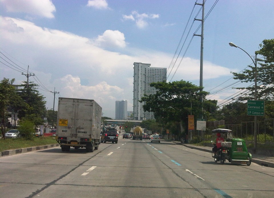 Free-flowing traffic along the section across from the UP Town Center – There were no long queues at the approach to the Katipunan-C.P. Garcia intersection.
 Free-flowing traffic along Katipunan across from Ateneo – the two universities generated few private car traffic yesterday during a period when there’s usually a lot coming in and out of the campuses due to the dismissals in the early afternoon.
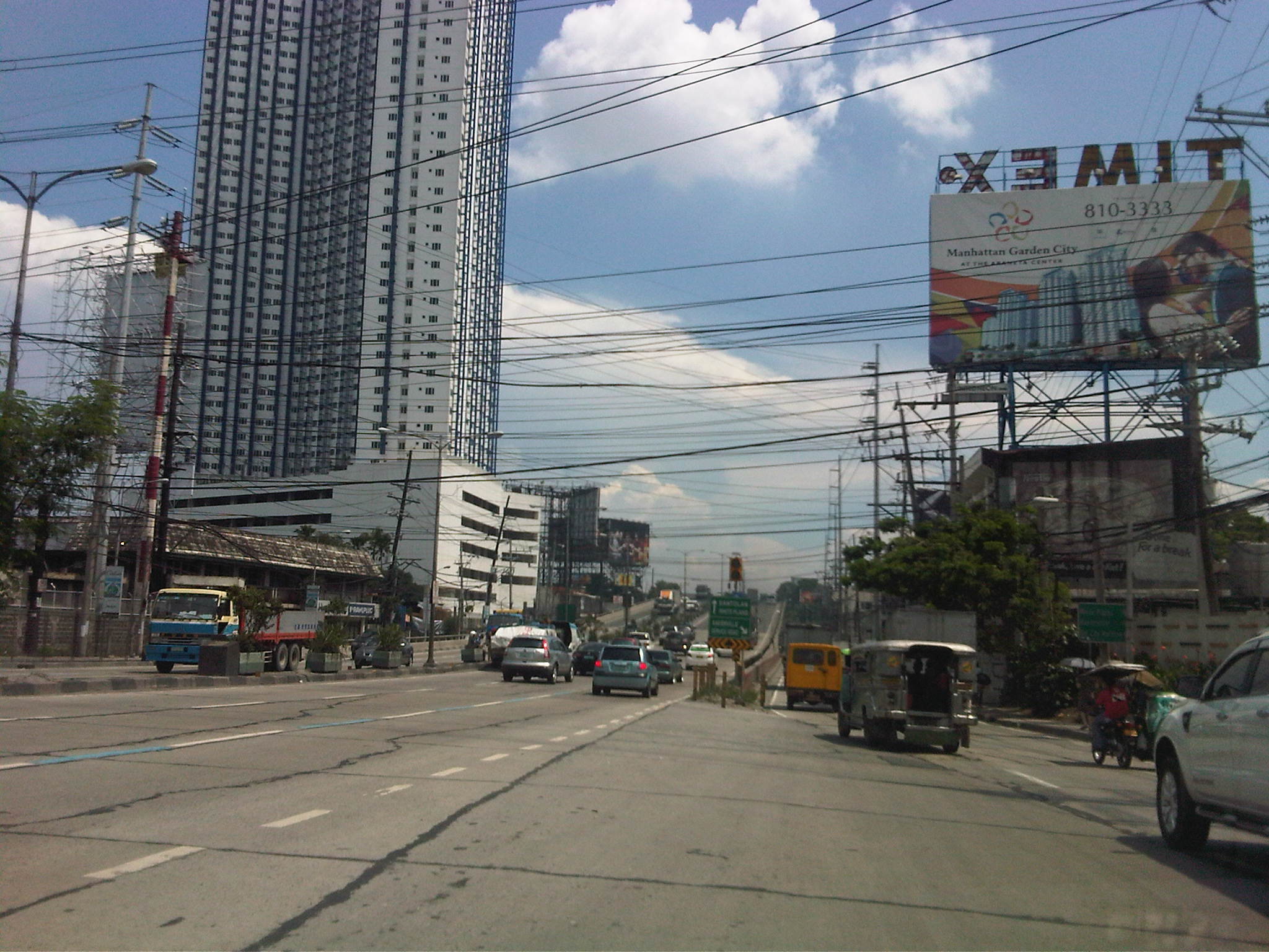 Free-flowing traffic along the Katipunan-Aurora overpass – in the early afternoons, the northbound side of Katipunan is usually full of vehicles mainly private cars and trucks. While there were many trucks yesterday, their numbers were not enough to cause traffic jams.
I think the traffic situation yesterday provided a clear picture that the major traffic generators along Katipunan are mainly the reason for traffic congestion along the stretch from Blue Ridge to Balara. These are mostly the schools (Ateneo, Miriam and UP) that generate so much private vehicle traffic on weekdays and Saturdays. Sundays are different because there’s no school nor work at offices on this day. With the QC holiday, the through traffic was still there owing to work and school in other cities (e.g., Residents of QC would still have to travel to Makati or Ortigas if their workplaces are located there. Similarly, students residing in QC whose schools are in the University Belt in Manila would have to travel.). This means there is really a need to understand why there is congestion and what causes it. A lot more effort is needed for this understanding and to ultimately reduce traffic congestion along this stretch of C5. Pointing fingers among agencies and simply putting the blame on one sector of traffic (e.g., trucks) will not get us anywhere. The solution will require strong cooperation among stakeholders and will definitely be not a painless undertaking for many.
–
What’s causing traffic congestion along Katipunan?
An article came out today on a popular online news site stating that the Metropolitan Manila Development Authority (MMDA) blames the Land Transportation Franchising and Regulatory Board (LTFRB) for the severe traffic congestion that is experienced daily along Katipunan Avenue (part of Circumferential Road 5). The article may be found in the following link:
MMDA: LTFRB to blame for Katipunan traffic
Reading the article, I would like to think that the MMDA likely misunderstood the advisory from the LTFRB extending the “non-apprehension policy” for trucks that have not renewed their franchises. This policy is not the same as the truck ban scheme being implemented in Metro Manila by the MMDA and LGUs. The trucks using Katipunan Avenue during the prescribed period that they are allowed travel along this and other roads are not violating any laws or regulations. Meanwhile, the increase in the volume of trucks can only be attributed to an increasing demand for goods that translate into freight movement. There are very limited alternatives to Katipunan Ave., which is a truck route (note: most of EDSA is not a truck route), and there are few wide roads that can accommodate the volume of trucks carried by C5.
I use Katipunan everyday as it is the main road between my home and my office. I can say that traffic has worsened along this stretch of C5 and one can always see the long queue of vehicles caught in traffic along the northbound side of Katipunan especially from the afternoon to night periods. There are many causes of traffic congestion along Katipunan Ave. and during times when trucks are banned from traveling, it is still congested due to the sheer number of private vehicles using the road. C5, after all, is a major road connecting Quezon City with Pasig, Makati and Taguig, which host major CBDs (Ortigas, Makati and Bonifacio Global City).
In the mornings, much private vehicle traffic is generated by the exclusive schools along Katipunan and the northbound side of the road is usually congested from C.P. Garcia all the way to Blue Ridge. Meanwhile the southbound side is full of vehicles from B. Gonzales (across Miriam College’s main gate) to Tandang Sora. In the afternoons and evenings, traffic congestion is caused mainly by traffic returning from Ortigas, Makati, BGC, etc. to Quezon City and elsewhere where their passengers reside. Road capacity is usually reduced by the parked and standing vehicles that usually occupy a couple or more lanes along Katipunan southbound.
I guess the MMDA would just have to do a better job of managing traffic along this corridor. However, they can only do so much given the sheer volume of private and freight traffic using Katipunan and the limited options for reducing traffic over the immediate to short terms. Only an efficient mass transit system (including walking and cycling for short trips) and a significant mode shift from private to public transport can provide a long term solution to traffic congestion along Katipunan. Until then, congestion along Katipunan will continue to worsen and this will further be exacerbated by the full development and operation of the U.P. Town Center and other high rise developments along the road. Good luck to all of us using Katipunan Ave.!
–
How to get rid of traffic jams using intelligent transport
I came across a few more online articles recently and this time one article featured mostly intelligent transport systems (ITS). ITS has been around for quite some time now and the big difference between now and a couple of decades ago is the cost for these systems. I would not delve into the details of ITS, and leave it up to the reader to perhaps google about this and all the different types of ITS.
The article “Here’s How to Get Rid of Traffic Jams” presents the various systems that have been implemented in other countries. Some have been implemented one way or the other in some parts of the Philippines, particularly the coordination of traffic signals (Manila, Cebu, Davao) but most have not even been attempted so there’s a lot of room for the improvement especially where congestion is becoming more serious and unmanageable due in part to limitations among agencies and the people themselves who are involved in transport and traffic management.
It also refers to a study on traffic congestion that was conducted for Los Angeles, CA. Reading through the document I couldn’t help but note that much of what LA has experienced and is still experiencing describes what we also try to deal with in Metro Manila and other major Philippine cities. Be sure to browse for the full document and not just the summary for the study. There are also a lot more materials on transport that you can find this website so be sure to bookmark Rand’s website.
–
Bottlenecks and other traffic issues in Antipolo
Commuting between our home in Antipolo and my work place in Quezon City, I have noted a lot of issues on transport and traffic that needs to be attended to by the local government in coordination with other entities like the DPWH and Meralco. Here are some photos with my notes and comments.
 Much of Sumulong Highway have been widened to 4 lanes but many electric posts remain in the middle of the additional lanes and pose hazards to motorists and cyclists. These posts seem to have been here for quite some time now and the paint on them gives the message that they will be here for the foreseeable future. Paint or no paint, they are road hazards and have the potential to kill people on vehicles crashing into the poles. I think this is supposed to be the responsibility of the power company (Meralco) but there needs to be a firm request and coordination coming from Antipolo City Government to finally relocate these poles.
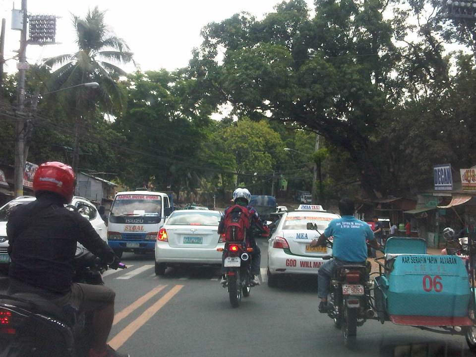 Congestion is often caused by counter-flowing vehicles forcing their way back into the right lane (like the car in the middle of the photo) upon encountering opposing traffic. It doesn’t help that there are motorcycles splitting the lanes to make for a very crowded road.
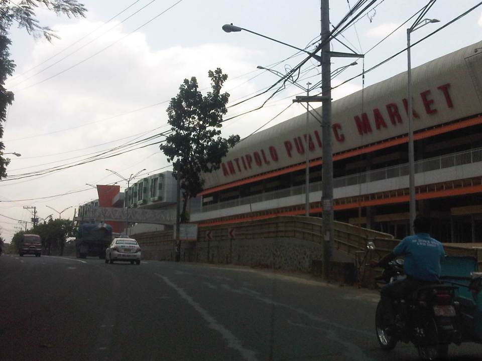 The new but still closed Antipolo Public Market along Sumulong Highway and near the intersection with Daang Bakal (the old railroad line that’s now a road). I wonder about the trip generation potential of this complex as it is not yet operational. Meanwhile, a huge Robinsons mall (looks larger than their Magnolia property) is currently under construction just across from it and will definitely be a major traffic generator in that area. The combined traffic to be attributed to these commercial complexes will surely have a tremendous impact on Sumulong Highway and other roads in the vicinity.
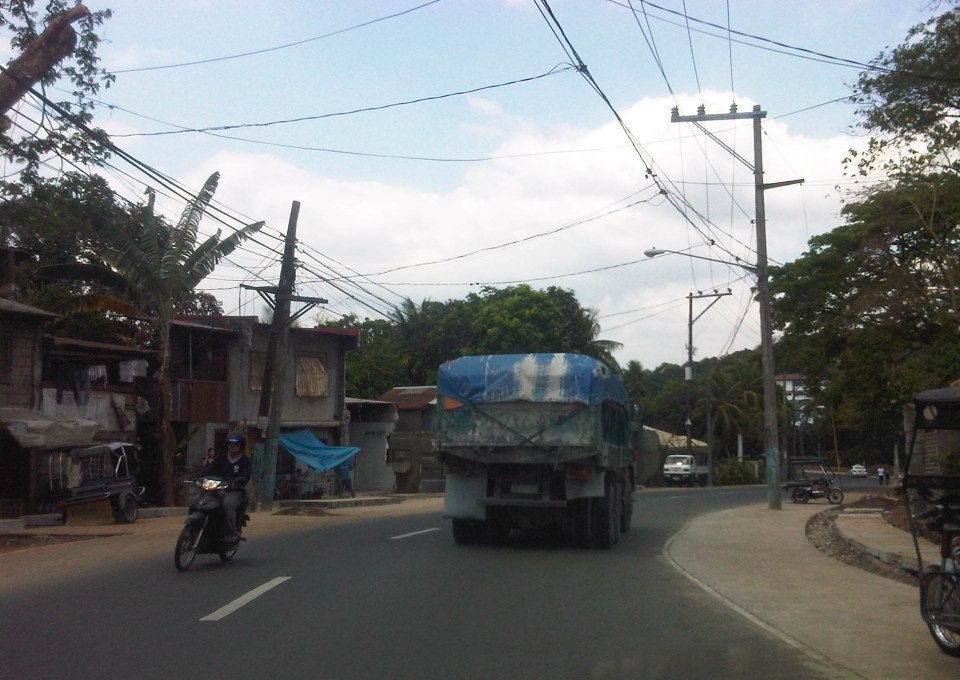 Both Sumulong Highway and Ortigas Avenue Extension carry significant truck traffic. These often cause congestion as they are slow going up to Antipolo and can block the entire road as Sumulong Highway and Ortigas Extension have some narrow sections where the shoulders could not provide enough space for other vehicles to pass the slower moving ones. In certain cases like the one in the photo above, there are electric posts in the middle of the shoulder lane.
 Tricycles occupy the outer lane of Ortigas Ave. Ext./Olivares Street. Such informal and on-street terminals are illegal along national roads and yet the city tolerates them. One explanation for this is that there are informal communities along the highway on shanties built along what is supposed to be a ledge along the mountainside (shown at right in the photo). These are where tricycle drivers and their families reside.
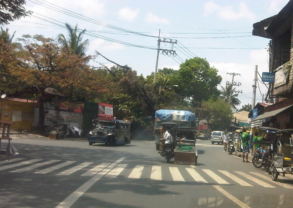 Tricycles from different tricycle operators and drivers associations (TODAs) seem to roam the entire city. This is contrary to the common practice in other cities and municipalities where tricycles are limited within a certain area or district that in many cases just overlap with others (e.g., UP Teachers Village-Philcoa-Krus na Ligas).
 Many tricycles serve as school service. However, the observation is that most tricycles tend to be overloaded with passengers. These are usually small children so the driver probably figured that they could cram more passengers than what is legally allowed.
 Sharing the road? Antipolo is very popular with cyclists and weekends bring a lot of them to the city as they come from all over via the main routes along Sumulong Highway and Ortigas Avenue (there should also be those coming from the east via the Antipolo-Teresa Road and Antipolo-Tanay Road). Most motorists are aware of these cyclists and give way to them. Most experienced cyclists are also aware of the ROW of other vehicles and so keep to the inner lanes. This mutual awareness and respect are vital to make roads safe for all. I think the only thing needed is to provide space for pedestrians as there are significant numbers of people walking, hiking or jogging along these roads.
–
Transport and traffic purgatory, paradise and inferno
A lot of people have been referring to the traffic congestion and other derivative issues that will be the result of the construction of several transport projects around Metro Manila as “traffic armageddon.” Some friend have appropriately (I think) referred to it more as “car-mageddon.” This seems to be the case since it is perceived to have the most impact on car users than public transport users, cyclists or pedestrians. This is far from the truth as there are more people taking public transport, cycling or walking than those driving their own cars. In fact, estimates for Metro Manila indicate that 70-80% of travelers take public transport while 20-30% take private vehicles. These mode splits do not include bicycles or walking, which obviously will further decrease private car shares.
I would rather refer to this period of construction as a sort of “purgatory” though it has nothing to do with the cleansing that’s associated with it. There is still the suffering involved while improvements are being implemented. But, most importantly, there is hope at the end of this process. This “hope” is not necessarily the “light at the end of a dark tunnel” kind of thing as surely population and the number of vehicles will surely increase over time even as the transport projects are being implemented. By the time these are completed, there are sure to be more people, more vehicles, as well as more of other developments that will put our transport system to a stress test. We can only hope that the designs of these infrastructure we are building now are based on honest to goodness trip or traffic forecasts. Otherwise, we’ll end up with congested or saturated systems by the time they start operating.
Unfortunately, most projects mentioned and those we know have the green light and would likely be proceeding with construction in the near future are basically road projects. It’s ironic considering that what Metro Manila urgently, and maybe desperately, needs now are public transport systems including the much delayed MRT 7, LRT 2 Extension and LRT 1 Extension. The proposals for Bus Rapid Transit (BRT) seem to be in a limbo, too, despite extensive studies and surveys to support BRT along corridors such as Ortigas Avenue and Circumferential Road 5. These are blamed on institutional and legal impediments including allegations of shortcomings among officials of agencies responsible for these infrastructure.
I am aware of an initiative led by an environmental lawyer seeking to effect the redistribution of road space in favor of public transport users, cyclists and pedestrians. I think such actions are useful from the perspective of getting the attention necessary to push government and private sector players to have a sense of urgency not just in words but also in actions in as far as transport infrastructure programs and projects are concerned. We are already lagging behind our ASEAN neighbors with regards to infrastructure and at this pace, it is likely that less developed countries like Cambodia and Myanmar might just overtake us in the foreseeable future. From another perspective, it is hard to push for sharing the road when people really don’t have better options for commuting. Walking and cycling are not for everyone and many people have turned to the motorcycle to solve their transport woes. In the latter case, motorcycles are perceived as a vehicle that’s fuel efficient and allows the users to zip through congested streets often at high risks of being involved in a crash or spill.
We can only achieve “paradise” in our highly urbanized cities if we build these mass transit systems along with the pedestrian and cycling facilities that will complement each other. Those for whom car travel is a necessity would also benefit from reduced road congestion so it will eventually (hopefully) play out well for most people. Meanwhile, we would have to endure transport and traffic hell (some more and longer than others) as the government and private sector embark on this round of infrastructure projects implementation. It helps to look back at our experiences with the last major batch of projects in the latter part of the 1990’s when the number coding scheme was first implemented. At the time, it was implemented as a temporary measure to alleviate congestion while projects where being implemented. What was a temporary measure is now still being implemented along with a truck ban that has also been evolving the past years with the latest being the one implemented by the City of Manila starting last February 24. Will these vehicle restraint schemes be modified to cope with the traffic congestion expected from projects like the Skyway connector? Will these be relaxed or removed after all these projects have been completed? Your guess is as good as mine.
–
Christmas season traffic jams
Traffic jams are a common occurrence in most cities. In some they are predictable, usually during peak hours in the morning and the afternoon or evening. These peak periods may range from less than an hour or stretch to a couple or even longer hours depending on the characteristics of the area. In many cases, congested are main corridors (Commonwealth, Ortigas, Marcos Highway, McArthur Highway, SLEX, etc.) leading to or from the city center or central business district (e.g., Makati, Ortigas, Cubao, etc.). In Metro Manila, it can be a corridor connecting CBDs like EDSA or C-5.
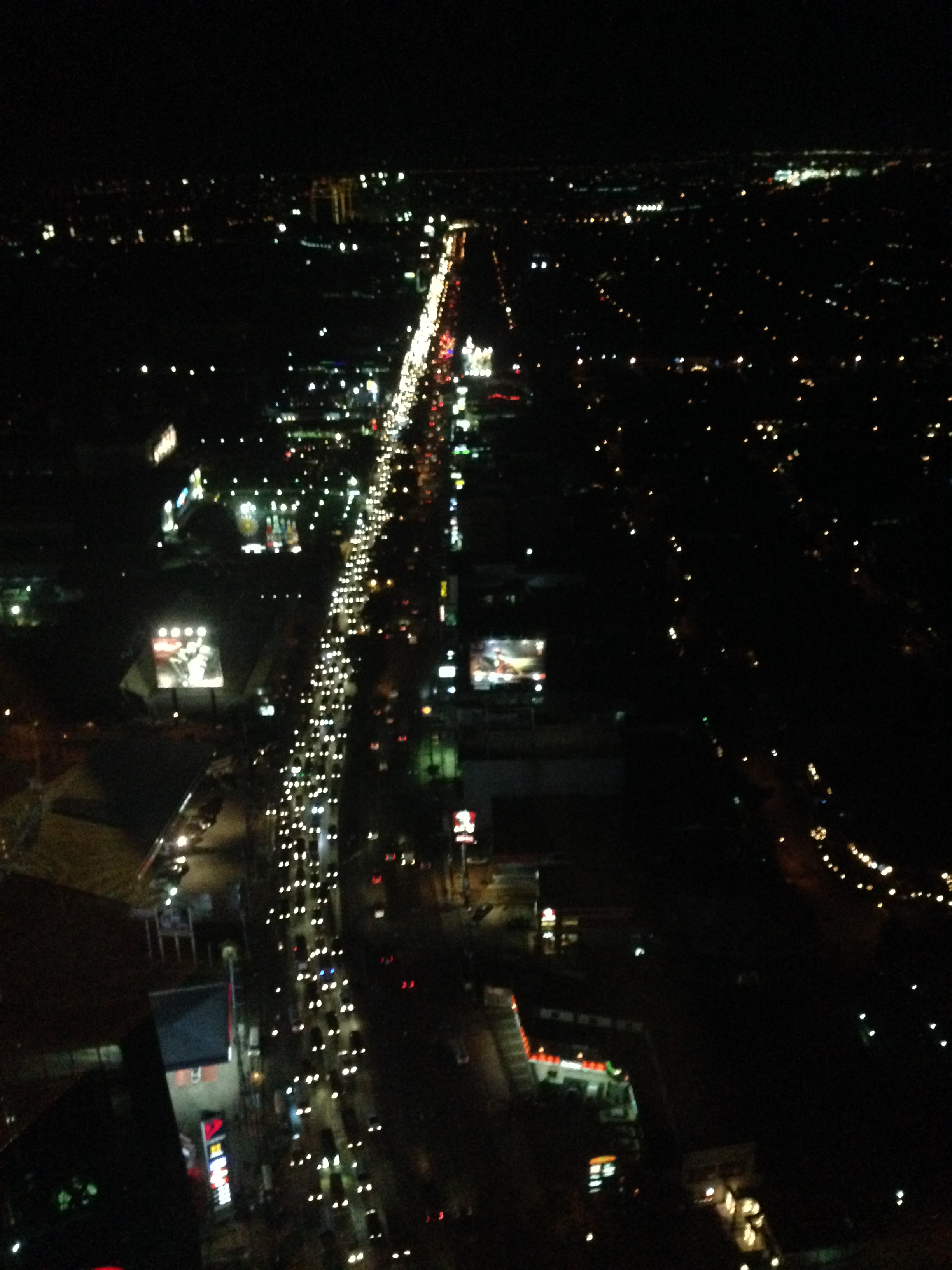 Traffic congestion along the northbound side of Circumferential Road 5 seems much worse this December though it is always bad from the late afternoon to late night on weekdays. Congestion is usually worst along the stretch between Bonifacio Global City and Pasig River though it is also usually bad along the stretch from Ortigas Ave. to Eastwood in Quezon City. Traffic along the southbound side is usually bad in the mornings especially in the Pasig area.
 Traffic congestion along Tramo on the way to the airport – traffic can really be bad in the vicinity of airports during this season but then the way the terminals of NAIA are situated and the conditions along airport roads also contribute to the congestion. For example, along Tramo in Pasay City you will find a lot of bus terminals and informal settlements. There are tricycles and pedicabs operating in the area, and parked vehicles along the road that reduce capacity. I always wonder what local authorities are doing to address these issues considering NAIA is our prime gateway to the world.
Unfortunately, the Christmas season in the Philippines is perhaps the longest in the world so Christmas traffic starts to build up in September (the first of the ‘ber’ months). Worst are days in December when everyone seems to be at their busiest. Aside from the work being done due to deadlines at the end of the year, there are shopping mall sales and Christmas parties.
So how do we know if December is indeed the busiest month of the year in terms of traffic? What evidence can we show as proof to this long-standing perception that is accepted as fact by many? I was asked these questions in a recent interview but unfortunately, I didn’t have the figures to show that December indeed is the busiest month in terms of traffic. Unfortunately, too, our government agencies do not conduct data collection to determine traffic volumes throughout the year so what you can get from the DPWH is Annual Average Daily Traffic (AADT). Perhaps the evidence is with our toll operators, which conduct daily counts through their detectors and their toll booths. The cumulative volume of vehicles per month can be derived from data on tolls collected to validate the notion that December is highest in terms of traffic volumes.
Meanwhile, there might also be video evidence from the cameras installed by the MMDA and other local governments monitoring traffic. Footage taken from January to December can be compared to show which months are the busiest. Taking this to another level, image processing software for traffic are now available or can be developed to determine vehicle volumes from video.
It is reasonable to argue that indeed December is the busiest and we experience more traffic congestion during this month as there are more activities, especially those related to shopping, during this month. Ask anyone on the street and surely they will say that traffic and commuting is worst this time of year but many will also say they aren’t really complaining given the situation of other people (e.g., those affected by the earthquakes in Bohol and Cebu, and those affected by Typhoon Yolanda/Haiyan in the Visayas). For many, this is still a season for joy and we generally don’t let traffic get in the way of happiness.
Merry Christmas to all!
–
Some thoughts on the issues on bus bans and terminals in Metro Manila
I had originally wanted to use “Clarifying issues on bus bans and terminals in Metro Manila” as the title for this post. However, I felt it was too strong a title, and one that would be more appropriate for a government agency like the MMDA or DOTC, or an LGU like Manila. More than fault-finding and criticizing government agencies and local governments, I believe we should take a closer and more objective look at the issues (or non issues?) pertaining to the Manila bus ban and the opening of the southwest provincial bus terminal for Cavite-bound buses. Following are my comments on issues raised the past weeks about the two initiatives.
Issue 1: There were no or few announcements about the implementation of the bus ban in Manila and the southwest terminal in Cavite.
Comments: While the bus ban in Manila came as a surprise to many, the move was actually a consequence of a Manila City Council resolution. Normally, such resolutions would take time to implement and would entail announcements for stakeholders. Though we will probably never know the truth or who is saying the truth about the resolution and its implementation, it is likely that bus operators already knew about the implications but decided to call Manila’s bluff and play the media and public appeal cards rather than comply with Manila’s requirements for franchised buses and terminals as they have done before in other issues like fuel prices and fare hikes.
I find it difficult to believe that the MMDA did not do its part in announcing the opening of the southwest terminal. Perhaps people thought the announcement was over a very short period? Or maybe people didn’t mind the announcement and are also at fault for paying no or little attention to the announcement? If so, then the public is also partly to blame for disregarding the announcement from the MMDA, assuming the agency won’t push through with its initiatives to implement central terminals for buses. Next up will be another southern terminal at Alabang and a northern one near Trinoma.
Issue 2: Poor transfer facilities and services including a lack of pedestrian facilities between the bus terminal and transfer point, and lack of public transport like jeepneys to ferry passengers to their destinations.
Comments: I think it’s quite clear that the MMDA and LGUs are at fault here. Despite the construction and scheduled opening of the southwest terminal, there have been limited effort in improving pedestrian facilities. Such facilities needed to be in place prior to or upon the opening of the southwest terminal and requiring all provincial buses to terminate at the facility instead of continuing to Metro Manila. People-friendly facilities could have helped people in adjusting to the new policy though walking from 100 to 200 meters is certainly not for all, especially during this rainy season. Senior citizens and persons with disabilities (PWDs) would have specific needs that could have been addressed from day one of operation of the terminal. One approach to “bridge the gap” between the terminal and where people could take city bus and jeepney rides could have been to modify some city bus and jeepney routes to make these closer to the terminal. Ideally, the terminal could have been an intermodal facility providing efficient, seamless transfers between modes of transport.
In the case of Manila, the jeepneys were already there with routes overlapping with buses but their numbers and capacity could not cope with the demand from the buses. Since the main objective of Manila was to weed out colorum buses, it could have coordinated with the LTFRB to check the registration and franchises of buses rather than generalizing among all buses. Perhaps Manila just wanted to make a big statement? But then this was at the expense of the riding public, which obviously got the attention of many including the media. Coordination among agencies and LGUs, however, has not been a strong suit for these agencies, and this thought leads us to the next issue.
Issue 3: Lack of coordination among LGUs and agencies in implementing transport schemes.
Comments: This issue is an enduring one and has been the topic of discussions, arguments and various fora for as long as we can remember. On one hand, the DOTC and the LTFRB should provide guidelines and guidance to local governments on transport planning and services. The agencies should be proactive in their engagement of LGUs in order to optimize transport services under the jurisdiction of national agencies and local governments. On the other hand, LGUs must accept the fact that most if not all of them are ill equipped or do not have the capacity nor capability to do transport planning much less addressing issues regarding public transport. Citing the Local Government Code and its devolution of local transport to LGUs everytime there’s a transport issue certainly won’t help LGUs solve their problems.
Issue 4: Terminals required for city buses in Manila.
Comments: There should be a terminal for city buses in Manila but not a terminal for each company. There should only be one or maybe two terminals where buses can make stops prior to making the turnaround for the return trip. There is actually a terminal in Manila, which the city can start with for city buses. This is the one just beside the Metropolitan Theater and near City Hall, which can be utilized by city buses. It is also close to the LRT Line 1 Central Station so the facility can be developed as a good intermodal terminal for land transport.
Issue 5: Colorum or illegal public transport vehicles in Manila
Comments: This is actually a problem not just for Manila but for the rest of Metropolitan Manila and the rest of the country. The colorum problem is there for both conventional and paratransit services as there are illegal buses, jeepneys, UV express, multicabs, taxis, tricycles and pedicabs everywhere. Many of these are allegedly being tolerated by national agencies and local governments with many allegedly being fielded or owned by public transport operators themselves.
–
In most cases, the best time to evaluate a traffic policy or scheme is NOT during its first days or weeks of implementation but after a significant time, say at least a month, after it was implemented. This is because the stakeholders, the people involved would take some time to adjust to any scheme or policy being implemented. This adjustment period will vary according to the magnitude or scope of the scheme/policy and can be quite “painful” to many who have gotten used to the old ways. Usually, a lot of comments and criticisms are quite emotional but it is clear that the collective sentiment is the result years or decades of poor transport services and fumbling by government agencies. Transport in Metro Manila is already quite complicated with routes overlapping and services competing with each other for the same passengers. Perhaps it is time to simplify transport while also in the process of optimizing and rationalizing services. I have written about this in this previous post.
More transport issues in Manila will come about should the city train its attention on other modes of transport including jeepneys, UV express vehicles, tricycles, pedicabs and kuligligs. If the city is really intent on reforming transport services within its jurisdiction, it should consider the needs of all stakeholders and especially and particularly the riding public. Transport should be inclusive, people-friendly as well as environment-friendly and there are many good practices in other cities that Manila could refer to and study for adaption and adoption for the city. If it is successful in improving transport, then perhaps Manila could be the country’s model for transformation from being the “Gates of Hell” to being a “Portal to Heaven” to residents and visitors alike.
–
More pedestrian facilities please!
I took a couple of photos one late afternoon on a weekday on my way home. I wanted to have a picture of typical jeepney overloading during the afternoon peak. Typically, jeepneys would allow “sabit” or passengers hanging from behind the jeepney. This practice is actually prohibited and carries a fine if jeepney drivers are apprehended. And that is usually a big “if” considering enforcers turn a blind eye to the practice especially during peak periods when it is difficult to get a ride.
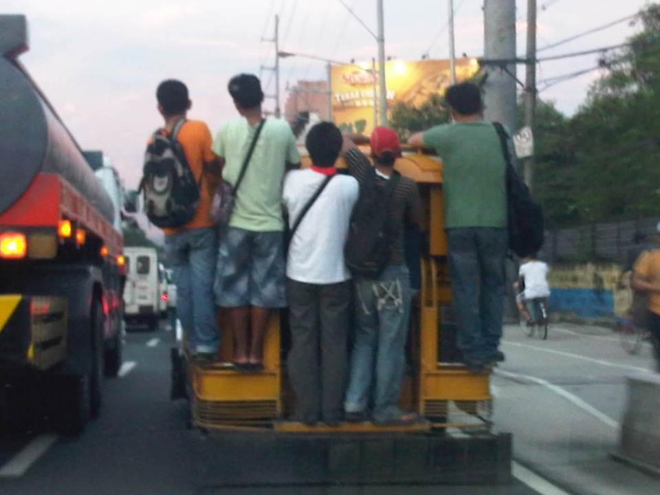 Jeepney full of sabit or hangers-on in heavy traffic along the eastbound side of a major highway
I also happened upon an opportunity to take a photo of the overloaded jeepney together with pedestrians walking along the walkway at the roadside. Though the photo was not so clear, it captured the image I wanted with people opting to walk while others took a risky ride on a jeepney. The cyclists in the photos were just bonuses and added to the visual of alternatives for mobility.
 Pedestrians and a cyclist along the widened walkway/bikeway along Marcos Highway
Walking remains as the mode of transport with the highest share when all modes, motorized or non-motorized, are compared. While there is a strong clamor from cyclists for bikeways and for cycling to be taken up by more people as an option for commuting, the reality is that cycling is not really for everyone. It is a viable and healthy mode but should also fit in a hierarchy of modes. Most people walk and walking should be encouraged over distances where it is most suitable. Facilities for walking need to be provided and properly designed so that people can walk safely and most efficiently like the example in the following photo taken during another weekday late afternoon.
 People walking along Marcos Highway
Local governments help promote walking by making sure sidewalks are provided and clear of obstructions. Perhaps walkability can be used as an indicator or parameter for a city to be qualified as livable and true to the advocacy of sustainable transport. Walking should be encouraged to promote healthy living as it incorporates exercise in our daily routines. More people walking should also increase awareness for the advocacy for clean air and help initiatives to improve air quality, particularly efforts to reduce harmful emissions by motorized vehicles. Thus, it is not difficult to understand how investing in pedestrian facilities and promoting walking is not a smart move and a beneficial one for any politician’s constituency.
–
Construction and congestion along the Manggahan East Bank Road
The East Bank Road along the Manggahan Floodway stretches from Pasig City through Cainta and Taytay in Rizal Province. It provides an alternate route for people traveling to/from the Rizal towns of Cainta, Taytay, Binangonan and the City of Antipolo from/to Metro Manila. The East Bank Road is directly connected to Amang Rodriguez Ave. and Ortigas Ave. while local roads connect it with C-6 and the Manila East Road. It is also an alternate route for people living in the residential areas of Pasig, Cainta and Taytay that are accessible via the many local streets connecting to the East Bank Road. After the Manggahan Bridge along Ortigas Ave Extension, there are two more bridges that travelers can use to cross the floodway. These are the Javier Bridge, which people can use to get to Raymundo Ave. or Sixto Antonio Ave. to eventually get to C-5, and the Barkadahan Bridge, which connects Highway 2000 in Taytay to Ejercito Ave. in Pasig in an area that’s contested by 3 LGUS (Pasig, Taytay and Cainta).
Sections of the East Bank Road are currently being rehabilitated. However, the contractors have started by working on the middle lane of a carriageway that’s 3 to 4 lanes wide with significant on-street parking on both sides of the road. There were minimal or no semblance at all of any traffic management on the side of the contractor, the MMDA or the LGUs involved in the project and so congestion occurs as it’s practically every driver/rider for him/herself along the road. I managed to take a few photos of the road and traffic conditions as we traveled towards Taytay and the Barkadahan Bridge from Ortigas Ave. and I can’t imagine how traffic is during the peak periods. I leave that up to the imagination of my readers.
 Middle lane undergoing pavement rehabilitation
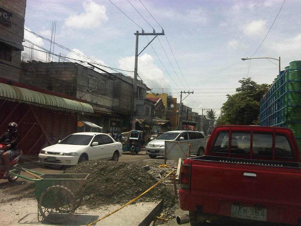 Construction and waste materials and equipment

–


