
Home » Traffic Congestion (Page 17)
Category Archives: Traffic Congestion
Flash floods and traffic congestion
Traffic last night along most of Metro Manila’s roads were a nightmare. It took many people hours before they could reach their homes from their offices and schools. The main reason cited for the horrendous traffic jams was the weather. It has been raining almost every afternoon in Metro Manila and its surrounding areas due to the combination of a tropical depression east of the island of Luzon and the intensified monsoon rains (Habagat). Rainfall intensity combined with a high percentage of the water translating into runoff contributed to flash floods all around Metro Manila including some that were waist-high, rendering the road impassable to most vehicles. However, while a lot of motorists and commuters were simmering along many roads last night, I couldn’t help but notice that most vehicles in the photos circulating in social media sites and news footage are private vehicles. Buses along EDSA occupied only the outermost lane for most stretches of the road. Meanwhile, conspicuous is the space in the middle of EDSA, which is the ROW for the MRT-3 tracks.
One lesson we learned last night was something we already knew all along and have failed miserably to address – we need better public transport in Metro Manila. Could there have been less cars on the roads affected by flash floods brought about by the heavy rains yesterday? Could commuters have had an easier way of traveling between their offices or schools and their homes? The answer is yes, that is, we could have built the necessary public transport infrastructure years ago. While there is a need to be transparent and have a corruption-free (is there such a thing?) process for planning, funding, designing, and constructing public transport infrastructure, we must realize that these are all systems that we should have had long ago, and further delay only dooms mobility and accessibility in our cities. Our leaders seem to be too engrossed with processes and making sure they won’t get entangled in controversies or lawsuits that they forget that time is ticking and all other people are caught in the mess that is the traffic congestion we experience every day. I wonder if at least some of our decision-makers for transport and traffic were caught in the monstrous jams last night? Maybe getting caught in one would change their perspectives and give them a sense of urgency for the task at hand? Or maybe, and likely, they were sitting behind their cars and burning time on their notebooks or tablets while their drivers were trying to maneuver in traffic? Frankly, we deserve better transport than what we have but then we don’t get to decide what gets built and when such infrastructure will be built, if at all. We could, however, do our part in lobbying (or demanding) for better transport.
Taken by a good friend commuting to his home last night:

From the GMA News website:
–
Traffic congestion and the limits of quick fixes
One time last summer night, it took me 2.5 hours to get to the airport from where I reside when it should only be an hour or 1.5 hours (on a typical bad day). Very early mornings (between 2 to 4 AM), it only takes me 40 minutes between my home an the airport. The route I usually take is mainly along Circumferential Road 5 (C-5); a route that basically has sparse public transport (mostly jeepneys along different sections) but is a truck route. It was summer though and one would have thought that there would be less vehicles along the road with school still out. I was wrong in that assumption and that cost me both time and fuel that night.
Traffic congestion in Metro Manila and other Philippine cities have been issues for such a long time that one tends to assume there’s nothing being done to fix the problem. In Metro Manila, the Metropolitan Manila Development Authority (MMDA), in cooperation with the various local governments and national agencies, has implemented various schemes including the number coding, truck ban and a bus dispatch system along EDSA. Yet, congestion persists and only last week, the President got caught in traffic as he traveled from Malacanang Palace in Manila to the DOST Compound in Taguig. The news was filled with a comment that he supposedly made to the MMDA Chair about the delay he and his entourage experienced. The bad news is that this congestion will not go away and will only worsen if there are no steps taken to address the problem. And this happens not only in Metro Manila but in other highly urbanized cities in the country. Quite obviously, quick fixes are no longer enough and we have reached the limits of their applicability.
 EDSA during the morning rush hours
 EDSA during the afternoon peak, which actually extends to an evening and even nighttime traffic jam
So how do we alleviate traffic congestion? Here’s three things that come to mind as they seem to be quite logical and very obvious:
1. Build the mass transit infrastructure required – these infra include rail and bus rapid transit systems and are urgently needed in Metro Manila, Metro Cebu, Davao and other highly urbanized cities. A shift from private vehicle use to public transport will not happen if people have no attractive options for commuting. In Metro Manila, there is a backlog of mass transit projects with lines that should have been constructed and operational years or even decades ago.
2. Rationalize transport services – the long standing practice is to increase the number of existing modes of transport as the demand increases. This logic is one that is most abused as a doubling of demand is conveniently but incorrectly interpreted as requiring a corresponding doubling of the number of tricycles or jeepneys, for example. What is required is for our cities to “graduate” from low capacity and less efficient modes to higher capacity and more efficient ones. Many cities seem plagued with tricycles as their main modes of transport within their CBDs when these should have been restricted to residential areas and mainly in the periphery rather than allowed to dominate (and clog) urban streets.
3. Build more walkways and cycling facilities – its difficult to encourage people to walk and cycle if there are no space for pedestrians and cyclists to travel safely and efficiently. Most trips are actually short ones and do not require motor vehicles so it makes sense to invest in pedestrian and cycling facilities so people get the clear message of support for such options for travel. Such investment is also one for healthy living as walking and cycling are forms of exercise and it is well established that these modes of transport promote healthier lifestyles and therefore, healthier people in cities.
–
Common causes of traffic congestion along Philippine roads
As a follow-up to a previous post on traffic congestion, I am writing on some of the most basic causes of congestion along Philippine roads. I say most basic because these are the usual situations we see along the road as we commute. And these are also supposed to be easily solved or addressed by the most basic approaches – enforcement. Here are a couple of photos and commentaries on this matter.
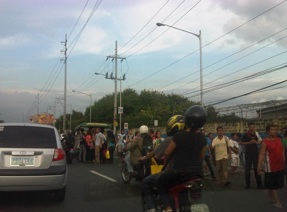 Commuters occupying two lanes of the road as they wait for public transport along Marcos Highway in Pasig – PUVs like the jeepney in the photo stop in the middle of the road to load/unload passengers. Were there traffic enforcers/aides in the area? Sometimes. Were they doing their jobs? Definitely not. In many cases, I’ve seen enforcers using the congestion (i.e., slowed traffic) to apprehend number coding violators. Now, number coding is premised on motorists being discouraged from traveling during certain times of the day to reduce congestion from vehicle volume. In the photo above, it’s pretty clear that the problem isn’t number coding violators but the mayhem caused by public transport and commuters. Something that traffic enforcers/aides could have acted on and with regularity and persistence so that they can positively influence jeepney driver and commuters towards orderly conduct.
 On-street parking and pedestrian activity along Manila roads – many cities such as Manila are guilty of not having any serious initiatives to address on-street parking. In many cases, its tolerated particularly in commercial areas as local governments don’t like to engage business in what they assume to be the small issue (or non-issue) of parking. In the case of pedestrians, it is a behavioral thing that requires a bit more effort than police or enforcer visibility (or the occasional apprehension). As a result, people will generally cross wherever they want and walk along the carriageway, not minding their safety. Of course, such behavior is encouraged by the absence of space for walking as vehicles, merchandise and other stuff occupy space that’s supposed to be for pedestrians.
–
Traffic congestion along Buendia (Gil Puyat Ave.)
The Makati CBD generates a very high number of trips owing to it being arguably the largest CBD in Metro Manila in terms of offices and workers. There are several other CBDs like Manila, Ortigas, Cubao, Eastwood, Filinvest City, and Bonifacio but they generate less traffic compared to Makati. There are several major roads in the area including four intersecting roads that practically define the CBD. These are Ayala Avenue, Gil Puyat Avenue (formerly but still popularly known as Buendia Avenue), Makati Avenue and Paseo de Roxas. Both Gil Puyat and Ayala Avenue are lined with offices along either side and are often congested due to the vehicle traffic generated by the CBD. Following are a few photos of Buendia Ave.
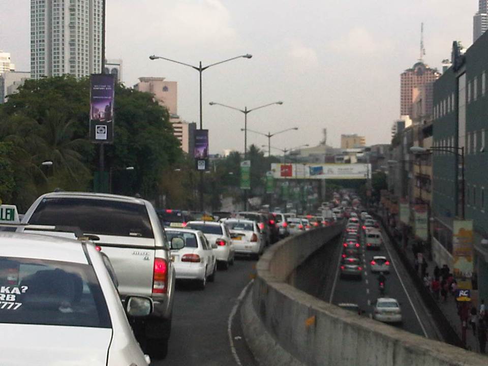 Traffic congestion along Gil Puyat Ave. as seen from the overpass from Kalayaan Ave. Even the sidewalk on the right side of the road is filled with pedestrians.
 One can see many people walking along the narrow sidewalk along Buendia. Some buildings have been renovated and refitted but many remain as they were in the last decade or more. The building in the center of the photo has so many air-conditioning units jutting outside the windows that it is quite obvious the units were an afterthought. Other buildings would likely have centralized or more strategically positioned air-conditioning units.
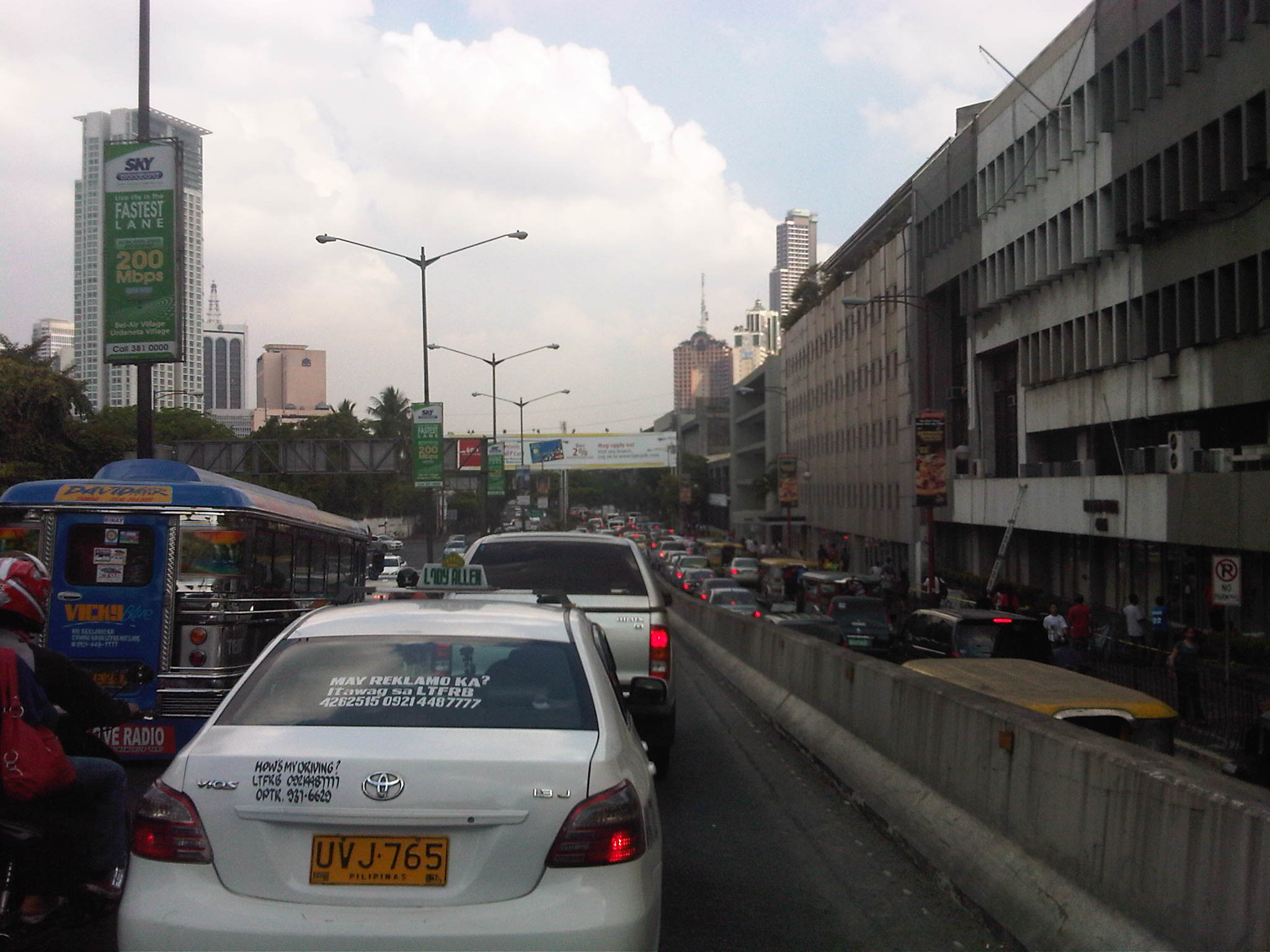 Another look at the traffic jam along one of Makati’s main roads indicate a lengthy queue from the Buendia Ave.-Paseo De Roxas intersection. The junction is signalized but saturated during peak periods. I am not sure about the optimization of the signal settings but it should be synchronized with at least two other intersections: Buendia Ave.-Makati Ave. and Paseo de Roxas-Makati Ave.
The DPWH is proposing a grade separation project along Buendia that is supposed to alleviate congestion at the intersections with Paseo de Roxas and Makati Avenue. The plan is to have an underpass along the avenue that would allow vehicles to flow through and bypassing the two major intersections. At-grade would still be signalized intersections but minus substantial through traffic along Buendia. The downside of such a project, of course, would be the expected traffic congestion during the construction phase. With very limited alternate routes and restricted space (i.e., unlike the case of the Quezon Ave. underpass at Araneta Ave.), traffic management in the area will surely be a challenge for the combined forces of Makati and MMDA traffic enforcers.
–
Night time congestion along C-5
Traffic congestion along Circumferential Road 5 is experienced practically throughout the day with the worst congestion along the southbound direction during the mornings between the Riverbanks Road in Quezon City and Kalayaan Avenue in Makati City, and the northbound direction between Bonifacio Global City and Eastwood from noon to nighttime. The following photos taken by my wife as I fetched her one night from her office shows the traffic jam along C-5 as we turned from the flyover past Market! Market! towards the highway.
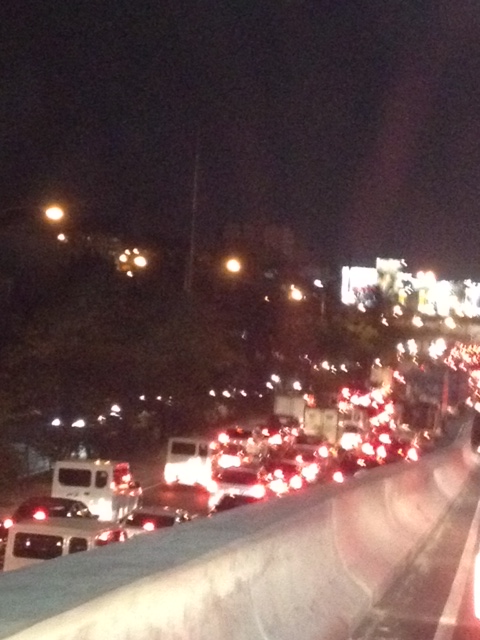 Congestion along the C-5 northbound is a regular thing during the weekdays from the afternoon to late at night. While apps like the MMDA’s Traffic Navigator and Waze allow us to have an idea of how congested C-5 is during such periods, the actual experience is much worse than what many of us can just imagine from the apps.
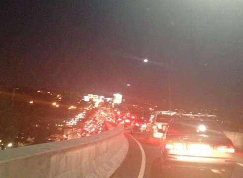 As far as the eye could see – congestion in the form of the taillights of vehicles along the northbound side of C-5 indicate just how many people are caught in traffic from Taguig all the way to Pasig and beyond. The giant billboards from Kalayaan Avenue to Pasig Boulevard including those seen along the bridge crossing the Pasig River. Most of these people are office workers coming from Makati and Global City and heading home to Quezon City, Pasig, and the towns of Rizal. After 7 PM, trucks add to the traffic
Many people are asking if there is a solution in sight for congestion along C-5. To be frank, there is none in the immediate future. There are proposals to introduce a public transport system along the corridor with one option being a Bus Rapid Transit (BRT) and another an elevated rail transit line. The BRT line is a recommendation of a Pre-FS for Metro Manila BRT conducted around 6 years ago though there was a proposal for a bus system (Philtrak) along the same corridor back in the late 80’s and pursued for some time during the 90’s. Not much have been done towards realizing any of these proposals. An efficient mass transit system along the corridor could encourage people to shift from private to public transport and help reduce vehicular traffic along C-5 considering that even as I write this post, vehicle ownership is increasing in Metro Manila and its environs and this could only mean more congestion along C-5 and other roads.
–
Daily penance: traffic congestion along C-5
People have been telling me about the traffic congestion along Circumferential Road 5 (C-5) and I am quick to reply that I know the feeling as I’m one of those who have driven or traveled along C-5 and experienced first hand the traffic congestion, which is worst during the mornings (southbound) and late afternoons and evenings (northbound). Midday traffic jams are not uncommon as C-5 is a truck route and large vehicles contribute to clogging especially at bottlenecks like the U-turns slots along the highway and bridge crossing the Pasig River. C-5 has been this way since its opening (or more appropriately the completion of missing links along the main alignment).
It will not get better. It will only get worse. I say so because of the annual increase in vehicle ownership, including motorcycles, in what is now termed as Mega Manila. I dare say so because of the backlog of public transport infrastructure in the metropolis (or megalopolis?). It is well established that efficient public transport infra and services are good incentives for people to commute rather than drive. This means there will be less vehicles on the road and therefore there will be less congestion as basically only those who really need to drive would be using their cars on a regular basis. Of course, it is not as easy at it seems considering trip making and mode choices are in reality complicated matters. But then the availability of viable, acceptable choices for travel, especially in the urban setting allows for people to have better mobility and more equitable use of the transport system than a car-oriented city. Until then, when we do have the public transport system that our cities require, it will be a daily penitensya for many of us traveling and not just along C-5.
 Congestion along the southbound side of C-5 approaching the flyover crossing Ortigas Ave. The flyover can be seen in the horizon.
 Congestion along C-5 southbound in the Bo. Ugong area approaching the junction with Lanuza Avenue. An overpass was proposed for construction along this section but now it doesn’t look like it will do any good considering the bottleneck is the Pasig Flyover and the bridge across Pasig River.
 Congestion along C-5 southbound at the Pasig flyover. The flyover has 2 lanes per direction and vehicle breakdowns or road crashes have resulted in terrible traffic jams.
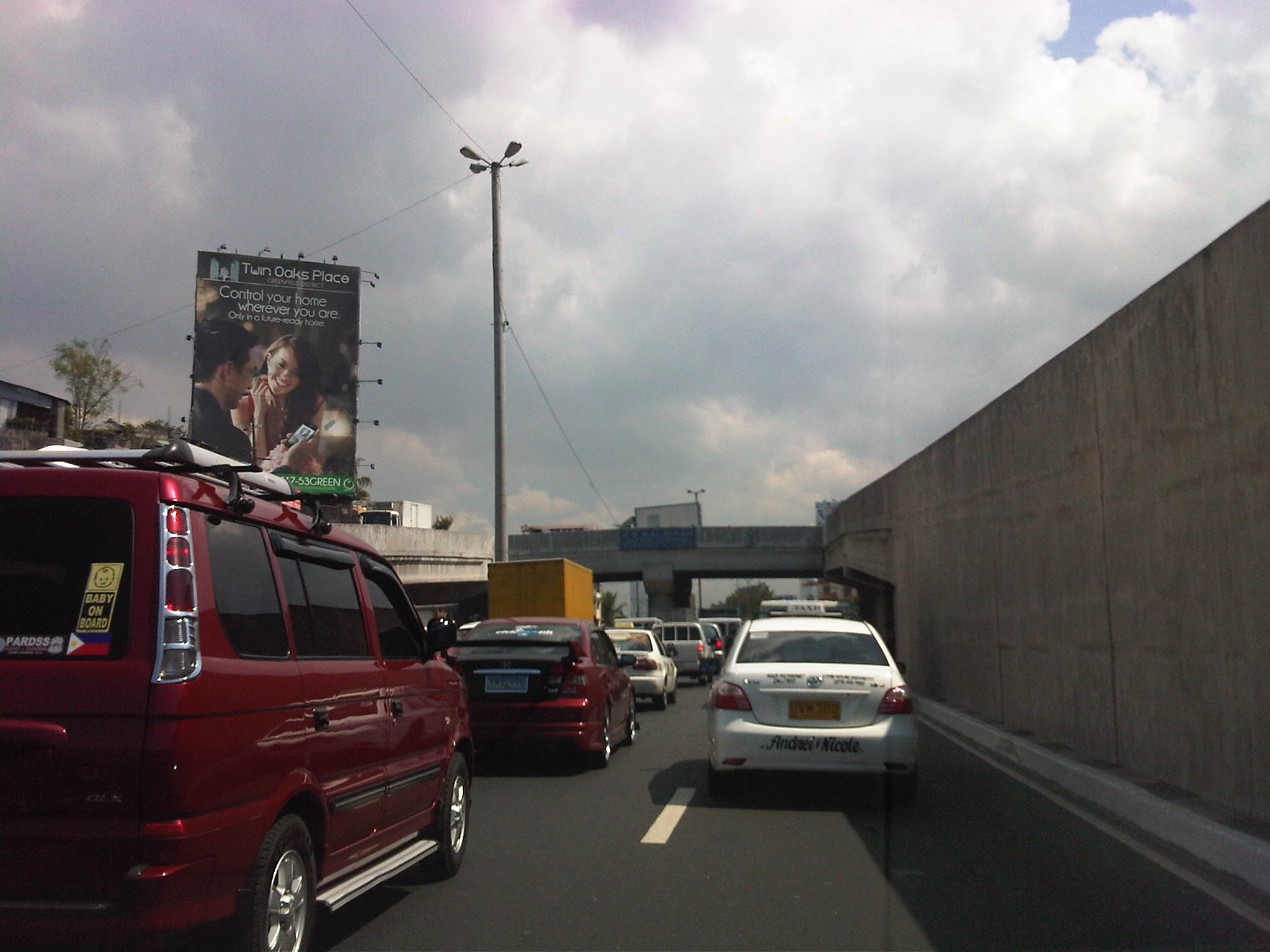 Congestion along C-5 northbound at the C-5/Kalayaan junction. The north U-turn flyover, one of two in the area, is shown in the photo. An underpass was initially proposed, designed and approved (with budget from a JBIC loan) at the junction. A previous MMDA Chair, however, didn’t agree and successfully maneuvered for the twin U-turn flyovers to be constructed instead.
–
The rains and traffic
Last Friday, the midday downpours resulted in flash floods around Metro Manila. The rains were not really a surprise given that PAGASA and other weather reports already stated the high probability of rain that day. It was the volume of rains that day in most parts of Metro Manila and the surrounding areas that caught a lot of people unprepared as many areas including streets experienced flash floods. Most cases were due to drainage systems unable to take in the rainwater because many were ill-designed or were clogged by debris (e.g., garbage, leaves, soil/dirt, etc.). The rains caused or worsened traffic congestion along many roads including C-5, Quezon Ave., and other flood prone streets in the metropolis. It was reported that some areas had zero visibility and so a lot of motorists were forced to slow down in order to avoid being involved in a road crash. It is good practice for all to turn on their headlights or hazard lights during times of heavy rains. If a driver has difficulty driving under such conditions, it is recommended that the driver pull off from the road and wait until the rains have weakened for safer driving.
 Atop the C-5 flyover from the Blue Ridge area and moving towards Eastwood, we couldn’t help but quip about the overpass being transformed into an elevated waterway (aqueduct?) as the drainage couldn’t handle the amount of water pouring in from the skies.
 Caught this scene of a boat on a trailer apparently en route for delivery. I thought is was at the same time humorous and ironic as rain was pouring around us and some parts of C-5 was already flooded. Perhaps we’ll need these boats to go around Metro Manila in the future during the wet seasons when heavy rains cause deluges in many areas. My colleague noted that the trailer didn’t have a license plate (Note: Trailers are required to have their own registration with the LTO.) and so wasn’t supposed to be on the road.
–
Another revolution needed along EDSA?
One of the most powerful images of EDSA that sticks to anyone’s mind is one where you see hundreds of thousands of people occupying the sections near what is now a shrine dedicated to the People Power Revolution that led to the ouster of Ferdinand Marcos in 1986. Perhaps a more recent version of this image is another associated with a People Power 2 that ended the term of another Philippine President, Erap Estrada, in 2001. The latter had in the background the newly operational MRT-3 as well as the overpasses at the intersection of EDSA-Ortigas that were built after 1986. These images are now mostly replaced by those depicting EDSA as one huge parking lot for cars during peak periods that seem to stretch beyond the typical morning and afternoon hours. A couple of photos are reproduced below showing day time and night time traffic congestion along the stretch of EDSA from Ortigas to Camp Aguinaldo.
 Afternoon congestion along the section of EDSA between Ortigas and Santolan. Note that even the overpasses are full of vehicles. Camp Aguinaldo is the green area on the top right.
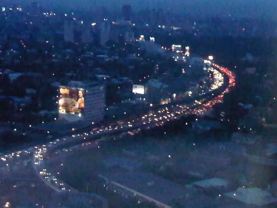 Traffic congestion along the same section of EDSA at night. The head and tail lights represent the motor vehicles crawling along the highway.
Already the Metropolitan Manila Development Authority (MMDA) has tried so many schemes along EDSA but mostly to regulate bus traffic. These have included various versions of dispatching schemes including a failed foray into the use of RFIDs. The current system that was launched in January is another attempt that we hope to be more successful than the previous ones. Already, the system has been able to weed out drivers with multiple traffic violations. There are many more of these drivers behind the wheels of public transport vehicles who probably shouldn’t be driving such vehicles as they put their passengers at risk of being involved in road crashes. Incidentally, such traffic violations associated with the different private bus companies operating in Metro Manila have been the subject of an interesting discussion during one congressional inquiry on public transport franchises where the MMDA reported hundreds if not thousands of traffic violations attributed to various bus companies.
The MMDA is limited by its mandate in so far as buses are concerned. It is the Land Transportation Franchising and Regulatory Board (LTFRB), which has the responsibility to address franchise violations and enforce rules in such a way that the agency could influence bus companies to improve their services. However, the MMDA is not at all helpless here as they are in the best position to petition for sanctions against erring bus companies based on their data on traffic violations. Such obviously constitute a violation in the franchise particularly where reckless or irresponsible driving exposes their passengers and the general public to risks in the form of road crashes. Such crashes can translate into losses of lives, injuries or significant damages to property.
The Department of Public Works and Highways (DPWH) has proposed an elevated highway on top of EDSA. This is supposed to have been inspired by similar elevated expressways found in other principal metropolitan areas including those in Tokyo. Would it solve the problem of traffic along EDSA? Probably in the short run after its opening but likely not in the long run as the elevated highway will rapidly become congested much like the experience with C-5. An elevated highway will also require ramps at many of EDSA’s intersections with other major highways and congested on the ground will lead to the condition spreading to the elevated sections.
The planned rehabilitation of EDSA is overdue. However, it has met a lot of opposition and mixed signals from various sectors including the MMDA itself, which is supposed to work with the DPWH in finding a solution for Metro Manila’s busiest thoroughfare. It seems that the MMDA is perhaps more interested in pursuing another elevated highway project, the Skybridge, which would be along a corridor on top of the San Juan River. Curiously, the objective of this other proposal is to have another alternate route to EDSA or simply “to decongest EDSA.” While well meaning, I have the gut feeling it won’t have a tremendous impact as it will still cater mainly to private cars. How about the commuters who comprise 70 to 80 percent of travelers along EDSA but only have about 30 percent of the road? We have to realize that only by keeping people, who do not need to drive, on public transport can we effectively decongest our roads. It is when they start using cars or motorcycles that our road space become all the more limited.
Meanwhile, the Department of Transportation and Communications (DOTC), the agency which is supposed to come up with the solutions to our transport problems has not been as active as it should be on the topic of EDSA. To be fair, the agency seems to be working on the acquisition of additional coaches to address the also overdue capacity expansion for the MRT Line 3. However, it also seems that now worries that the line was poorly planned in the sense that it failed to anticipate the present transport demand, has been validated. MRT Line 3 is really a light rail transit line that was built along EDSA despite the need for a higher capacity system. But is it too late to upgrade this system? Or do we need another to supplement or complement the MRT 3?
Perhaps what is needed along EDSA is another revolution but one of the sustainable transport kind. “Sobra na! Tama na! Palitan na!” were cries in 1986 that are now very much applicable to the transport system we have along EDSA. It will not be an easy nor an inexpensive task to upgrade the MRT-3 into a higher capacity system required along this corridor. But opportunities are now available to ease the burden along the line. The emergence of bus rapid transit (BRT) as a viable option along EDSA would have to be explored. But a BRT cannot be simply installed along the corridor. The government would also have to be firm with the conventional buses plying routes that all seem to be overlapping along EDSA. These routes would have to be simplified along with the numerous companies that would have to be encouraged to form consortia (or cooperatives?) that can participate in a MRT-BRT-bus integrated network. The question now is who will champion or lead such a revolution for transport? Who will be progressive enough to lead us into an era of modern transport that should be inclusive, environment-friendly, and promotes “dignity of travel” for all?
–
Antipolo Simbahan
“All roads lead to Antipolo” is a saying that is especially true for devotees to Our Lady of Peace and Good Voyage for whom the shrine in Antipolo is dedicated. Indeed, major transport routes lead to Antipolo City and signboards on jeepneys (and buses of old) state “Antipolo Simbahan” as their destination. In much older days, the Manila Railroad Company used to have trains directly serving this route. The remnants of its right-of-way is still there but in the form of roads. These are the Daang Bakal, which stretches from Valley Golf in Cainta, Rizal until its junction with Taktak Road and Ninoy Aquino Blvd., where it becomes the Lorenzo Sumulong Memorial Circle, Antipolo’s circumferential road. A trace of this old railway line may be found in this previous post.
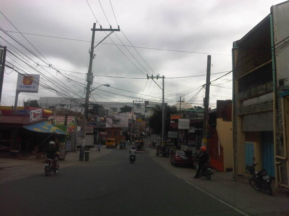 From J.P. Rizal Street, which extends from Sumulong Highway, one turns left to head straight towards the Antipolo church along P. Oliveros Street. The street is a two-lane, one-way road that has been widened at some sections. The shoulders, however, are mostly used for parking as shown in the photo.
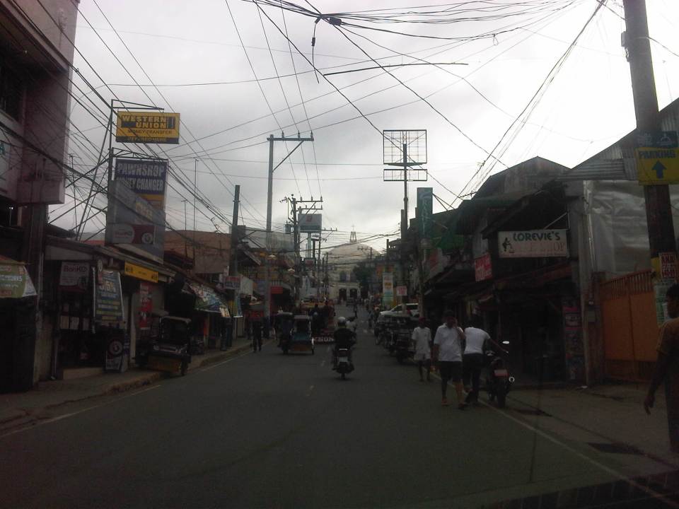 The dome of the church becomes visible to the traveler as one comes closer. P. Oliveros St. is closed to traffic during the feast day in May. It is usually open during Lent even during the Holy Week when there are lots of people coming to Antipolo for the Visita Iglesia. Traffic during those times can be quite slow because there are also lots of people walking along the streets, many of whom are devotees who are namamanata, or have promises of sacrifice and prayers to the patron of the shrine.
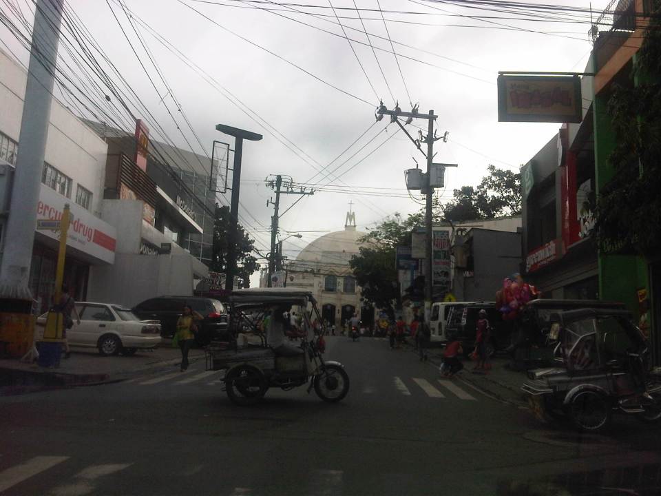 Similar to other poblacions around the country, commerce surrounds the church. Antipolo receives thousands of visitors daily and its being a natural traffic generator provides opportunities for businesses to thrive around it. Establishments around the church are proof of this and one will find most major fast food chains within a stone’s throw away from the shrine. In the photo are major chains Jollibee, Mang Inasal, Greenwich along the right and Mercury Drug(not fast food but the largest drug store chain in the Philippines) and McDonald’s on the left. There are more including banks and food stalls along M.L. Quezon Street, which is the main street of the poblacion.
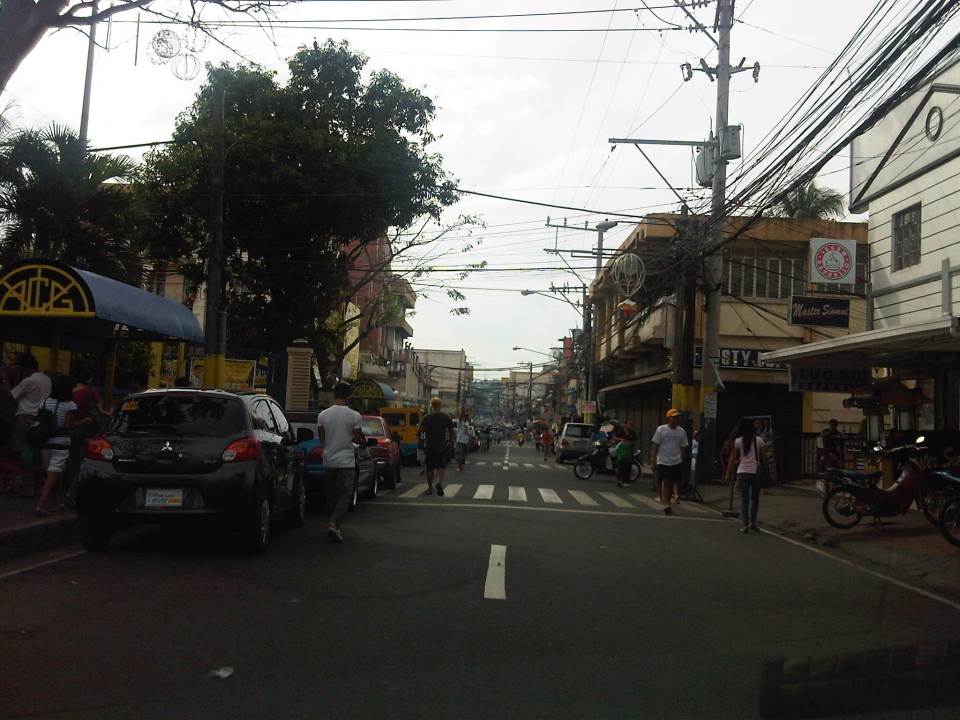 M.L. Quezon Street in front of the shrine and the main street of the poblacion, is also a two-lane, one-way street (southbound flow). There are many one-way streets here as it is no longer possible to widen streets. One side of M.L. Quezon is used for parking and a short walk from the church is Antipolo City Hall, which is the red building barely visible (obscured by the tree on the left) downstream in the photo.
 The Antipolo City Hall building is seen here at the left in this photo.
There is a proliferation of tricycles operating in the poblacion. I don’t know how many there are but they seem to be from different tricycle operators and drivers associations (TODA) that all converge at the shrine. This overlap of service areas (tricycles do not have fixed routes) suggest everyone is taking advantage of the shrine and city hall being major traffic generators. The problem is that the city has not been able to control their numbers and regulation is probably limited to registration, which brings some revenues to the city. This is certainly not sustainable from the perspective of transport
It would be nice to see the poblacion re-planned, designed and managed so that walking may be given primacy over other modes, particularly motorized ones. Antipolo should be walkable and it was in the past considering there were no tricycles and automobiles during the Spanish and early American periods. One took an animal-drawn vehicle, road a horse, or walked even when there was a train service in the early part of the last century. If parking is an issue, then perhaps the city, with the cooperation of the private sector, could find ways of building multi-storey parking facilities in the periphery and within comfortable walking distance from the shrine and city hall. There’s much potential here that is steadily being wasted due to traffic and with no design theme even for buildings surrounding the shrine. The shrine represents heritage and to preserve and enhance it, Antipolo City should find ways to introduce sustainable transport as well as applying architectural principles for the poblacion.
–
Link: Measuring Transport Efficiency
I’m sharing a recent article from Todd Litman of the Victoria Transport Policy Institute. The article is entitled Measuring Transport System Efficiency that appears in the Planetizen online journal. It’s a very good read for all, even those without planning or engineering backgrounds, who want to have an understanding of how to evaluate or assess transport systems according to the various aspects of a system (e.g., there’s a difference between conventional road planning and accessibility-based transport planning). Todd is as usual very good in discussing these topics given his experience and expertise, and is able to present it in a manner that is easily understood by any reader (well, except maybe the trolls we find anywhere online these days).
Happy reading!
–

