
Home » Traffic Congestion (Page 20)
Category Archives: Traffic Congestion
On high density development along Katipunan
I saw the tarp below posted along Katipunan Avenue as we drove to UP one Saturday morning. There are actually two signs: one in front of Ateneo Gate 1 and the one below just after Ateneo Gate 2. Both speak out to the Quezon City Council for issuing an exemption to SM Development Corporation (SMDC), part of the SM group of shopping mall fame, for its high-rise condominium development near the corner of Aurora Boulevard and Katipunan Avenue (C5). The development, known as Blue Residences, will not only have residential units but commercial establishments as well. By the name of the project, it is obviously a play on the nearby Ateneo De Manila University, which has blue for its standard color (e.g., Blue Eagles). [Note: For whatever its worth, there is also a Green Residences being developed by SMDC near De La Salle University, which adopts green as its banner color – e.g., Green Archers.]

The questions going in my mind after seeing the signs include the following:
1) Isn’t it too late for this, a campaign against a development that is already under construction and months after a decision has been made to approve the project?
2) What is Ateneo’s and its allies success rate for such? [The high density developments just across the university seem to be concrete evidence and reminders of such actions falling on deaf ears.]
3) Given this seemingly renewed (not new-found, I hope) interest in urban development in the area, wouldn’t it make more sense to also campaign against another development, this time by another real estate giant in Camella/Vista Land that already has set up shop across Ateneo?
4) And, as a follow-up perhaps, has that strip along Katipunan already been ceded to high density development and Ateneo and its allies have already conceded that a long time ago? [There’s SMDC’s Berkeley Residences, Prince David, Burgundy, etc.]
A colleague put forward an opinion that such developments are actually beneficial to Ateneo and its allies. In fact, many of the residents of the high rise condominiums in Katipunan have children studying at Ateneo and Miriam, their addresses being conveniently located minutes away from school. In other cases, units are rented by university students who similarly take advantage of the building’s proximity to their schools. I wouldn’t be surprised if enterprising people have purchased units not for them to reside in but to rent/lease out to students or other wishing to live near the universities or the nearby LRT 2 station (Katipunan Station).
From the traffic perspective, such developments definitely require full-blown transport or traffic impact studies due primarily to their trip generation characteristics. Such studies should clearly show how to address potential transport and traffic problems including who will be responsible (hint: the proponent should not pass on responsibility to the MMDA or local traffic enforcement) for traffic management. I reproduce below excerpts from a report submitted by a stakeholder community in opposition to a proposed high-rise, high density mixed-use (commercial, office, hotel and residential) development at the corner of EDSA and Ortigas Ave. where a huge excavation is still present and can be clearly seen when riding a Makati-bound MRT train:
“The EIS Report failed to consider the traffic impact once the project starts to operate hence necessary measures were likewise not discussed. Many projects will, at first glance, give an impression that a traffic impact study would not be required. The Skycity development, however, immediately gives the layman an impression that it would indeed have a significant and long-term impact on traffic in its direct vicinity. While its influence area can only be clarified via a thorough study of the characteristics of the development, the description and hype alone by the project proponents give us an idea that Skycity will impact people from as far as Rizal province.
In the process of attaining these objectives, this paper will identify the deficiencies and weaknesses pertaining to transportation and traffic and establish the need for detailed traffic studies, specifically the requirement of a Traffic Impact Study (TIS). The TIS will entail traffic impact analysis (TIA) to satisfy the questions or concerns regarding the traffic generated/attracted by the Skycity project and the consequent problems that will be caused by the project from its construction to eventual operation.
A traffic impact assessment (TIA) would be imperative, if truly the effects of the development would be quantified. The TIA would be able to answer the following questions, among others that would crop up in the minds of stakeholders:
- What are the transportation improvements needed to serve the traffic generated by the new development?
- How much will the improvement cost be and who will pay for them?
- Will the new project impact traffic on any existing residential streets and how will those impacts be mitigated?
- Will the new development aggravate any existing safety hazards or create new ones and, if so, how can those hazards be corrected?
- Can the proposed development be served by public transportation and does the design encourage ridesharing?
- Is the design of the development friendly towards bicyclists and pedestrians who need to access the development or who need to pass through or by the development?
- Is the on-site parking sufficient or is there an opportunity to share parking with other adjacent uses?
- How many driveways are needed, what design should each driveway have and is there a long enough throat for each driveway that is clear of parking spaces and other cross aisle traffic?
- If any driveway is proposed to be signalized, is the traffic signal really needed and can on-site circulation handle the traffic that will be queuing to wait for a green light? (
Conduct of TIA will deal with deficiencies in traffic analysis as well as provide a platform for a package of measures to deal with issues: what measures? who will pay? what level of development? Until then, it’s not possible to concretely evaluate the EIS.
Concerning traffic, the GEA letter raised the following points:
- That traffic congestion at EDSA-Ortigas intersection is already a nightmare even without the Skycity on that particular corner;
- That the traffic congestion problem can be attested by key agencies such as the Mandaluyong City Mayor’s Office, the MMDA Traffic Management Group, the Barangay 27 Wack Wack Greenhills East and the nearby DOTC, all of which are helpless in providing solution to the problem;
- That the already grave traffic congestion will even worsen due to obstructions and additional traffic during construction and operation of Skycity;
- That Ortigas Avenue is too narrow to accommodate the high volume of traffic; and
- That provision of several parking floors as presented in the EIS cannot be a solution.
“Manpower requirement will be high during the operations phase. It is estimated that about 12,000 persons will be required to for the operations and maintenance of the Skycity Project. These would include the general administration, manpower for the utilities and security, and employees for the hotel. Man power for the commercial, office establishments and other development use of the project will add a few thousand more jobs.”
The above quotation is from a report submitted as part of the response of stakeholders that scrutinized the Environmental Impact Assessment (EIA) report submitted by the proponents of the project to the DENR-EMB. The latter was presented at a stakeholder conference held as a prerequisite to the approval of the project (i.e., prior to granting an ECC). There are other aspects of the project including drainage, water supply, structure, foundation, environmental, etc. that were discussed with proponents and stakeholders arguing about the pros and cons of the project. However, the most important element here is timing since the discussions occurred prior to the granting of an ECC to the project and after the stakeholders have presented their case before the DENR-EMB’s EIA Review Committee assigned to the project. I am not aware of how SM Blue went about securing the approval for their project including the ECC and if the process was followed according to the guidelines. I am also not aware of whether there was a stakeholder conference held and if Ateneo and its allies were invited and participated in that meeting. Was this organized by the EIA RevCom or was this hosted by the QC Council (because of the zoning issue)? Such matters are important since it would help in establishing whether certain people are at fault and whether certain processes and requirements were indeed followed with regards to the project being questioned.
–
Passing the blame for our traffic mess
We like to bash and criticize public transport drivers for their behavior when we only need to look in the mirror to see who is part of the traffic problem in this country. A lot of private car drivers here and elsewhere in the country tend to attribute traffic congestion to buses, jeepneys, AUVs and taxis while practically washing their hands off the congestion and reckless driving habits that we see everyday along Philippine highways and streets. Many tend to think that only PUV drivers are to blame for our traffic mess when in reality and data-wise there are surely more private traffic on our roads compared with public. Such statistics including mode shares for both vehicular and person trips along major corridors in Metro Manila I will share in another post.
I drive from my home to the office and back almost everyday and I have observed driving behavior for much of my life including the times when I’m in cities in other countries. PUV drivers to me are more predictable than private car drivers in this country. In fact, we can know for sure that PUV drivers will weave their vehicles in traffic and we will always brace ourselves for the aggressive driving every time we encounter PUVs. Such errant behavior, of course, could have been addressed by a stricter and more reliable licensing system for drivers. But that’s another story altogether that’s worth an entire article.
Meanwhile, I share the observation of one friend that many SUV or high-end vehicle drivers “tend to drive like outlaws.” I had articulated in an interview before that many young drivers (and older ones as well) tend to imagine themselves as race car drivers – and proceed by trying to out-speed and/or out-maneuver other drivers the way stuntmen do in the movies. This you can observe whether along a congested street or a free flowing expressway. Evidence to this includes all the road crashes involving private vehicles (including motorcycles) that would certainly out-number those involving PUVs. One thing not going for the PUVsm, however, is that they happen to carry more passengers and therefore more responsibility as a requirement of their being issued franchises. Another proof to irresponsible behavior are postings of claims and photos on social media showing speedometers exceeding speed limits. And yes, there are those who routinely and consciously violate speed limits along expressways for them to be captured by speed cameras. The shots are then used as bragging rights attesting to the driver reaching a certain speed with his/her vehicle.
This morning, I almost got sideswiped by a car who cut my path to make an abrupt right turn to enter the gate of a major private university. I thought I had a clear path to change lanes as I estimated a good distance from the same vehicle who was trailing me on the other lane. Instead, the vehicle accelerated and with horns blaring asserted his right to the lane. I had to use my defensive driving skills to avert a collision. Seconds later, he was blocking my path as he made a right turn at the university’s gate. I could only shake my head in frustration with what happened while an MMDA enforcer looked helplessly as a witness to the incident. A few minutes later, a couple of SUVs coming from a posh subdivision along Katipunan cut our path to make an illegal left turn at a U-turn slot. Vehicles from this subdivision do so regularly and with impunity as if their passengers were more blessed and more important persons than the rest using this major highway.
The examples above are just some of what we usually encounter everyday while traveling or during our regular commutes. These are certainly being caught on video by the MMDA cameras spread out and observing traffic along major roads in Metro Manila. These same drivers might be the first to throw the proverbial stone to their fellow drivers whom they have judged to have committed sins of recklessness when the truth is that they themselves are guilty and only have to look in the mirror to see for themselves who are really to blame for our dangerous and congested roads. Truly, what’s wrong with traffic in this country may not necessarily be with the way we manage traffic or enforce rules and regulations. It might just be the nut behind the wheel that’s defective, after all.
–
More congestion due to Imelda Ave. water and road works
Days before the long weekend break for the days commemorating All Saints and All Souls (Undas), I was surprised to experience severe congestion during the evenings that I drive to my home in Antipolo. To me it was quite unusual knowing from experience that traffic should be lighter considering most schools were already on semestral break and, closer to the weekend, many people would have already gone on vacation leave to return to their hometowns. I took a couple of photos of the progress of civil works as I drove, quite slowly, to my parents’ home at a subdivision along Imelda Ave. I wanted to take more photos but there was a sudden rainfall that obscured vision over my windshield and it became dangerous to take chance photos while driving in the rain.
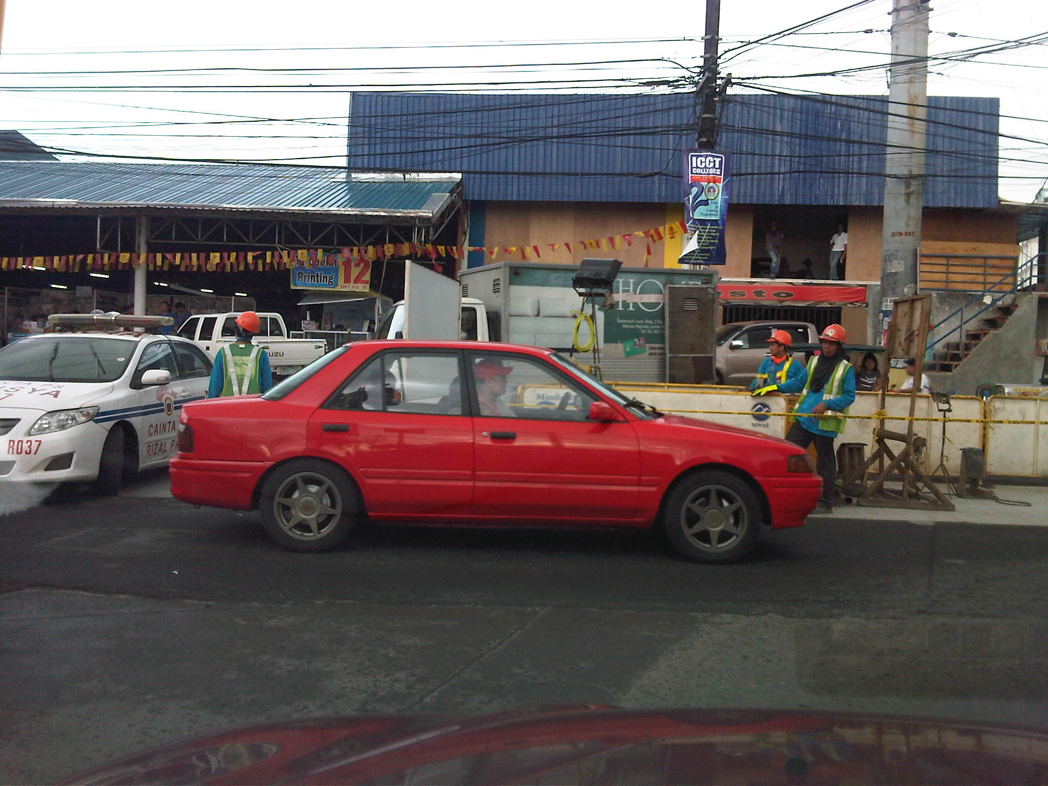 Water and road works at the junction of Imelda Ave. with the Sta. Lucia access road – the activity area effectively occupies a full lane of southbound direction of Imelda Ave. This has resulted in significant reduction in the capacity of the highway, and leads to sever congestion during the afternoon to evening peak periods. During these times, a very high volume of traffic including large trucks pass through the avenue from Marcos Highway and the resulting queues spill over and block traffic at the junction with Marco Highway. At its worst, the congestion extends towards Amang Rodriguez (Ligaya).
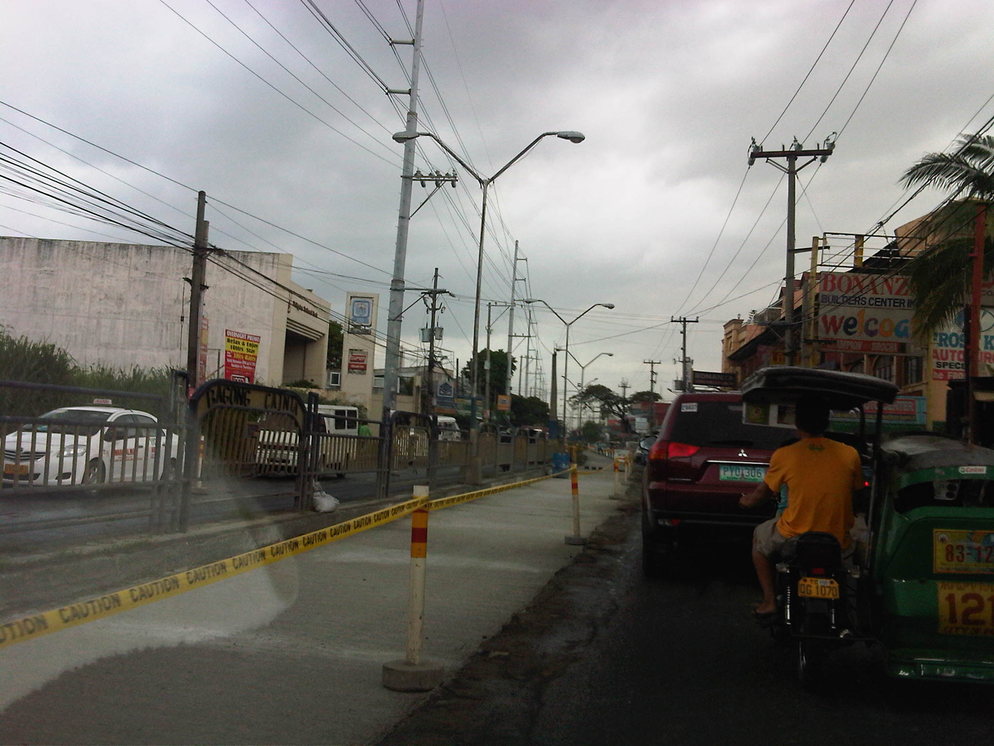 Single lane available to southbound (to Cainta Junction) traffic – all vehicles had to use one lane due to civil works being undertaken along the lane shown in the photo. New water pipes were laid down under the lane to increase capacity for the increasingly growing populations of the progressive towns of Rizal Province.
From the looks of the progress of work I’ve seen personally this weekend, I guess we can expect the congestion to start easing from the latter part of this week. The contractor tried to ease southbound traffic by employing a counter-flow scheme using one lane on the northbound side but the result was not as successful as the contractors desired as congestion quickly set in along this direction causing more misery to travelers along Imelda Ave. Apparently, the contractor underestimated the traffic along the avenue.
Congestion along Ortigas Ave. Extension
The severe traffic congestion experienced along Ortigas Avenue Extension these days are due partly to civil works related to a water project. This is similar to works that were implemented along Marcos Highway that coincided with the road widening and drainage project along that Highway. Ortigas Ext. traffic is always bad during the weekdays due to the limited capacity of the road combined with the sheer volume of traffic it has to carry. The highway still serves as the primary artery connecting the populous and progressive towns of Rizal Province to Metro Manila. These include Antipolo City and the towns of Cainta, Taytay, Binangonan and Angono. I’ve written a piece about traffic along Ortigas Ext. as well as the management schemes that have been employed to address peak period congestion including allowing counterflow traffic on weekday mornings. Following are a few more observations and assessments

Civil works in the middle of Ortigas Ave. Ext. in the De Castro Subdivision area – road capacity is substantially reduced along significant sections of the road due to waterworks project. Both eastbound and westbound traffic are affected as one lane each are taken up by the project. Traffic flow will surely improve once the project is completed, automatically adding two lanes (one for either direction) to increase capacity.

Sunday jam – I can only imagine how bad traffic congestion can be during the weekdays. The photo above is one I took on a Sunday afternoon showing congestion along the westbound direction typically associated with peak period traffic on weekdays. Meanwhile, traffic is practically free flowing on the eastbound side once you get past the work area across De Castro. I was a little surprised about the discipline of drivers considering only few (mostly motorcycles) dared to counterflow.

More diggings – this time 2 lanes are taken away from the wide section of Ortigas stretching from across the former Riverside Mills to the BF Metal Corp. This is where vehicles usually make U-turns because of the space available for vehicles making such maneuvers that are no longer allowed during most periods past the vicinity of Cainta Junction.

Approach to Cainta Junction – this is probably one of the most congestion or saturated intersections outside Metro Manila. Most traffic though can be attributed to Metro Manila as most vehicles are either bound for MM or are coming from it. At this Junction, Ortigas Ext. meets Imelda Ave. (formerly known also as Francisco Felix Ave.), which continues as A. Bonifacio Ave. as it extends to towards Cainta town proper. Ortigas Ext. from the eastbound approach has only 2 lanes (another 2 on the opposing direction) widening to 5 (additional lane for right turning traffic to Cainta) at the entry. Meanwhile the westbound approach from Antipolo/Taytay also has 3 lanes with one dedicated to right turning traffic, which is significant due to left turns being disallowed from the eastbound approach towards Imelda Ave. Vehicles now go through Ortigas and take a U-turn after the junction and then turn right to Imelda. At the median opening, Ortigas has been widened to allow for such maneuvers.
Cainta traffic and the MMDA has been experimenting on a number of schemes for the signalized junction. One proposal that has been on the shelf for quite some time now is for an overpass to be constructed along Ortigas to allow for continuous traffic flow along the highway. So far, there just seems to be not enough space for an overpass to be constructed and some quarters are saying that the only way to improve traffic really is to widen Ortigas to something like Marcos Highway on the other end of Imelda Ave. Such propositions could have been averted if a mass transit system was constructed along this corridor when congestion was just starting to set-in. Actually, history tells us that there was a mass transit system before with trains running regularly between Manila and Antipolo. But that is a topic we’ll reserve for another post. Abangan!
Road and drainage improvements along Marcos Highway – Part 2
Previous posts on Marcos Highway road works and the resulting congestion did not include photos and discussions on a significant section of the highway. This is the stretch that runs from P. Tuazon/Imelda Ave. to Masinag Junction, where Marcos Highway intersects with Sumulong Highway. Some friends have pointed out the bottlenecks that include Masinag Junction itself and the uncompleted work in the vicinity of the newly opened SM City Masinag. Following are a few photos I took on a Saturday morning while traveling along that stretch of road and a few observations pertaining to some causes of congestion.
 Unfinished drainage and roadworks along eastbound direction of Marcos Highway approaching Golden Meadows gate – note that materials occupy practically 2 lanes of the highway.
 Construction along Marcos Highway eastbound in front of AMA Computer College just after Filinvest East Gate – only 3 lanes available to traffic, sometimes 2 due to heavy equipment maneuvers.
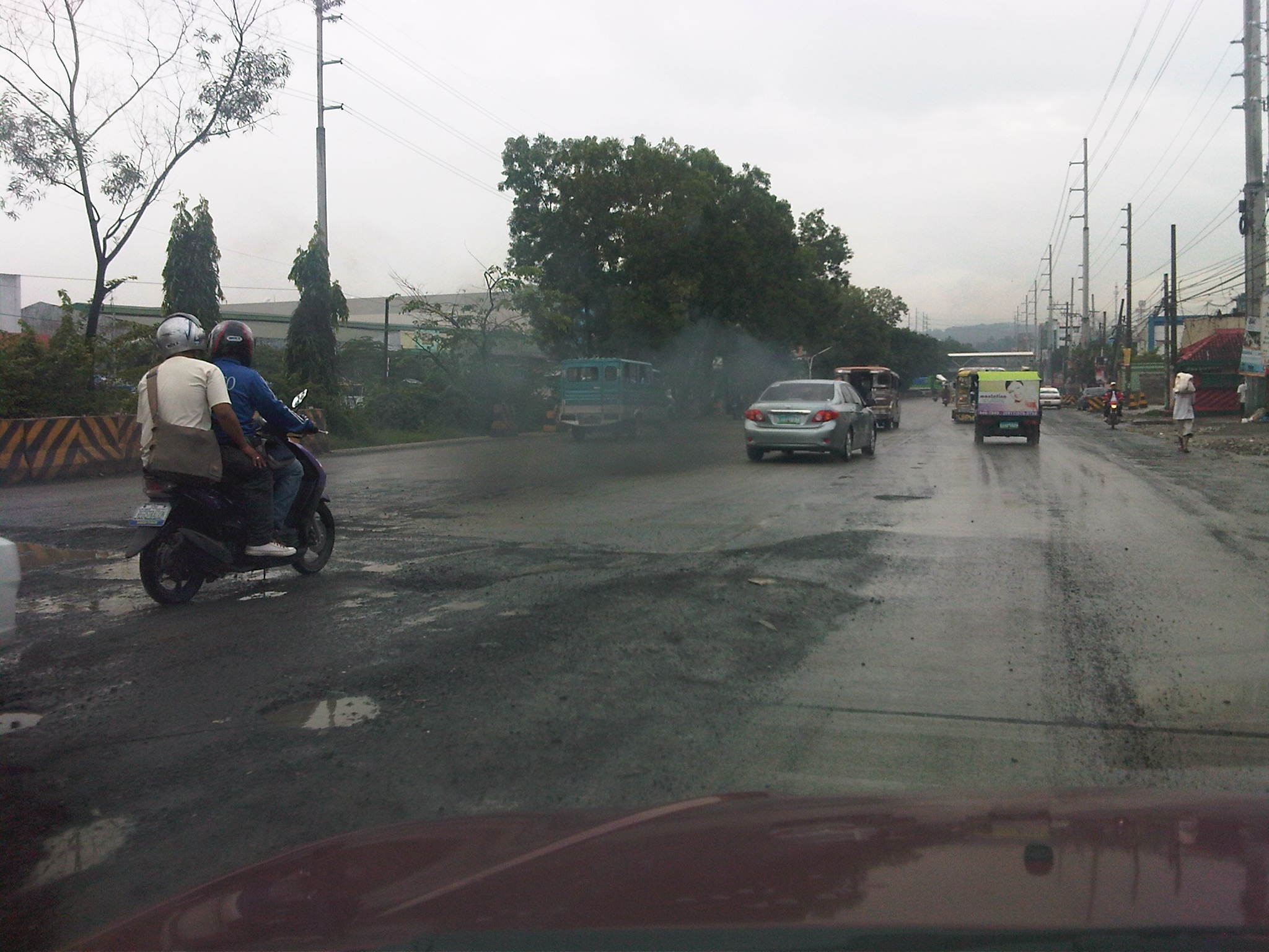 Unfinished road works near Kingsville Gate along Marcos Highway eastbound – bad road conditions lead to congestion as vehicles are forced to slow down due to the potholes and uneven pavement surface.
 Completed PCC pavement sections along Marcos Highway eastbound approaching SM City Masinag area – note that standard signs and pavement markings are still lacking along completed sections. Perhaps there is also a plan to have asphalt overlay as a protective or weathering layer for the concrete slabs?
 Completed section and newly constructed pedestrian overpass across SM Masinag – despite the overpass, many people still brave crossing the wide highway and risk getting run over by speeding vehicles.
 Jaywalking and risky crossing at Masinag Junction – I think traffic enforcers usually fail in managing pedestrians and cyclists crossing at the intersection resulting in the decrease in the throughput of the intersection. In any case, poor control may just lead to a road crash involving pedestrians and/or cyclists.
 More pedestrians crossing at Masinag junction – in this case, the only conflict is with vehicles turning right from Sumulong Highway.
 Another look at the new pedestrian overpass across SM Masinag along Marcos Highway westbound – this was a necessary facility for the safety of people (likely shoppers) crossing the 8-lane highway. The overpass would probably have to be modified later should LRT Line 2 be extended towards Antipolo City.
 Concrete barriers delineating lanes intended for vehicles making a U-turn along Marcos Highway just after SM Masinag – the barriers are also meant to reduce weaving caused by vehicles generated by the mall and intending to make the U-turn. These barriers, however, are also hazards as vehicles accelerating after Masinag will suddenly encounter these without adequate warnings. At present the lane is blocked right after the median opening due to uncompleted roadworks. Thus, erroneously entering the leftmost lanes will require a U-turn. Such barriers would have to be removed so traffic can still opt to pass through the section.
 Unfinished section along Marcos Highway westbound – the number of lanes are reduced from 5 to 2, drastically reducing capacity and causing serious queuing due to the shockwave resulting from the bottleneck.
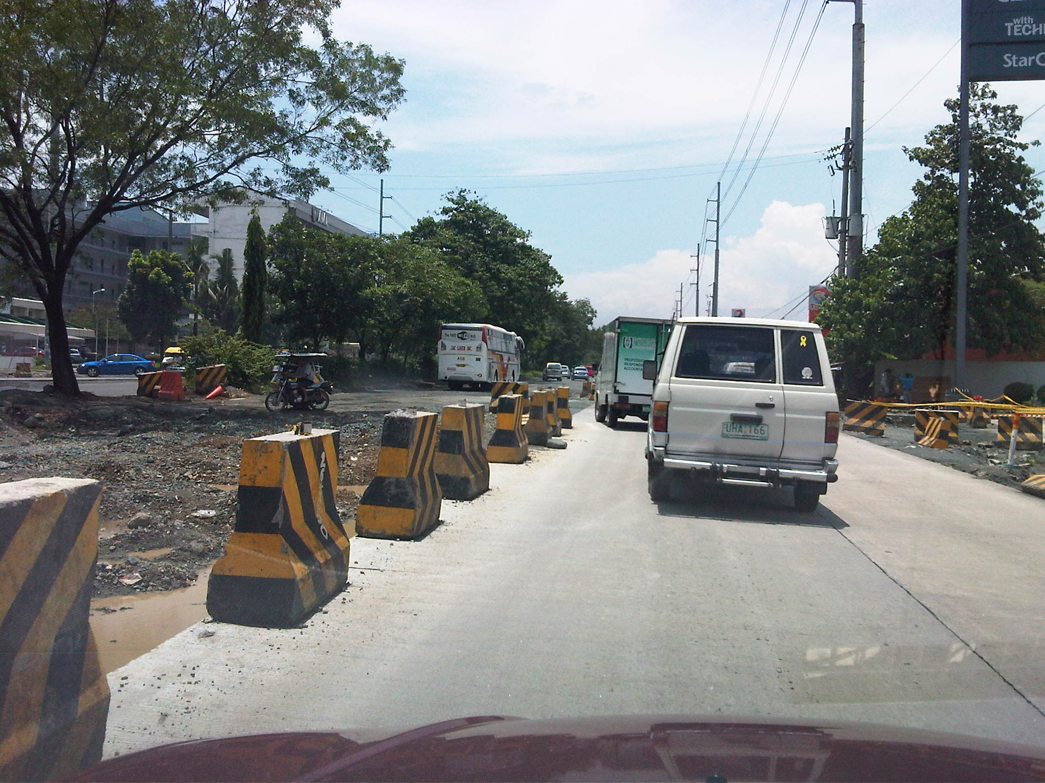 Unfinished drainage and roadworks along Marcos Highway westbound across the Caltex service station approaching the Filinvest East and Vermont Park gates – the section widens just before the subdivision gates and median opening but the inner lanes have not been paved at the time the photo was taken.
 Median opening (U-turn slot) for westbound traffic coming from Imelda Avenue – the old median opening across Burger King was closed and traffic was diverted to this slot located between the Shell and Phoenix service stations right after the Town & Country gate and CVC grocery. The result was less congestion due to weaving traffic between Imelda and this slot. This, however, came with a price – a longer trip for vehicles coming from Imelda Avenue.
With the completion of road and drainage works along Marcos Highway, it is expected that congestion will eventually be eased and the inherent costs will be reduced. Perhaps there will also be an opportunity to revisit traffic management and traffic control at critical junctions including Masinag, Imelda Ave./A. Tuazon, and A. Rodriguez/J.P. Rizal. So far, the perception of continuous movement due to the U-turn schemes along Marcos Highway have resulted in many adjustments to the locations of the slots while only producing congestion and perhaps encouraging aggressive driving behavior. Traffic signals should again be considered though traffic and travel behavior will surely be affected by a proposed extension of LRT Line 2.
Bottlenecks along Marcos Highway
Motorists and commuters using Marcos Highway which connects towns in the Province of Rizal to Metro Manila (particularly Marikina, Pasig and Quezon City) typically experience severe congestion due to two bottlenecks. These are at Santolan in the general area of the LRT 2 Station and near the junction with Evangelista Street, and at Ligaya near the junction with Amang Rodriguez/J.P. Rizal Avenues (note that the road intersecting with Marcos Highway is known as Amang Rodriguez on the Pasig side and J.P. Rizal in Marikina). Even without the current road and drainage projects being implemented on both sides of the highway, severe congestion is experienced in these areas.
There are mainly two reasons for congestion. The first is the operation of public utility vehicles, particularly jeepneys, in these areas. The second is the traffic flow characteristics, particularly merging and weaving activities, along Marcos Highway. Undisciplined operations of jeepneys in both areas have always led to congestion as they have tended to occupy significant road space (say 2 or 3 lanes) as they compete among themselves for space and for passengers. This generally results in the reduction of road capacity as there are less lanes available for all other vehicles traversing the highway. Chaotic loading and unloading have also influenced commuters to also compete for their rides with people often found advancing to meet up with the approaching jeepneys, and occupying road space in the process.
In the case of Santolan, people occupy 2 lanes just after the junction with Evangelista street right after the bridge. Such results in usually 2 to 3 lanes available to motor vehicles. Combined with jeepneys stopped across the LRT2 station, only 2 to 3 lanes are effectively available to traffic along a stretch of the highway. I always wonder why the MMDA and Pasig City enforcers are always appear to be helpless against these people when the former should be preventing the latter from occupying road space and causing congestion that can reach as far as Aurora Boulevard along and also fill up the bridge from C5. The situation is very similar for Ligaya where Pasig-Marikina jeepneys tend to establish informal, on-road terminals at the intersection itself and clogging both sides of Marcos Highway. Again, people are everywhere and occupy road space, ensuring that only a couple of lanes are usable for general through traffic. Here also, there seems to be enough enforcers from the MMDA and Pasig City but I always observe them not doing their jobs of managing the traffic and preventing mayhem in the area.
From the perspective of traffic flow, these two areas also have weaknesses. Santolan is already located in the vicinity of an LRT2 station so it is a natural stop for both public and private vehicles. Complicating its situation is the fact that for the eastbound side of the highway, two major streams merge. One comes from the highway bridge fed by both Aurora Boulevard and Maj. Dizon (Industrial Valley), and another comes the Macapagal Bridge that connects to C5. Since the general direction of most vehicles are towards Rizal, there is tremendous weaving activity in the area causing much friction among motor vehicles. On the westbound side of Marcos Highway, there is the tendency for divergence of traffic flow again due to the two bridges plus the presence of an SM Mall whose access road is to the right of the ramp leading to Macapagal Bridge. Again there is weaving activity here that has caused not a few road crashes.
The Ligaya junction used to be a signalized intersection that was closed and replaced by a pair of U-turn slots sometime during the past dispensation at MMDA. Thus, vehicles that used to go through Rodriguez/J.P. Rizal are now required to take a right turn and weave towards the U-turn slots a few meters downstream and weave again to take a right to Rodriguez or J.P. Rizal. Many of these are public utility jeepneys, the same ones that have informal terminals at the intersection itself. Vehicles negotiating the U-turn slots tend to block through traffic as they maneuver towards the outer lanes of the highway and head for the intersection, resulting in daily congestion at the already widened section of the highway in the vicinity of the U-turn slots. The morning case is usually the more severe one and there are usually no traffic enforcers in the area between 5:30 and 6:30 AM. If there happens to be a few early birds from the MMDA and Pasig, these seem to be more concerned with setting up the barriers for the counterflow scheme they implement in relation to the road and drainage project along the highway. Pasig enforcers do not manage the traffic but seem to be engrossed in apprehending those violating the number coding scheme. During the evenings, they are unmindful of the congestion and the people spilled out and occupying the traffic lanes seemingly content on watching vehicles crawling by.
These bottlenecks along Marcos Highway are examples of situations where simple traffic management in the form of active enforcement would be enough to alleviate congestion and perhaps help reduce the potential for road crashes (that may also result in more congestion). The enforcers’ presence and absence in these cases seem to add insult to the injury that is already caused by congestion that can be solved if the enforcers were doing their jobs in the first place. I would not even consider the relocation of the U-turn slots or the criticize the flaws of the design of the bridges’ ramps because the weaving behavior of vehicles may be effectively addressed by proper traffic management. And there are many similar cases throughout Metro Manila and other Philippine cities where this is happening. Hopefully, the agencies or local governments can address such concerns and with urgency considering the time and fuel wasted due to such bottlenecks.
Congestion along Imelda (Felix) Avenue
Imelda Avenue was its original name and is taken from the first name of a former First Lady of the Republic. It was appropriate at the time considering it intersected with Marcos Highway, which was being developed as a main thoroughfare to the east and alternate to the older and established corridor of Ortigas Avenue. Imelda Avenue extends from the Cainta Junction where the road continues towards the town center of Cainta as A. Bonifacio Ave., up to Marcos Highway, across which, the road continues towards the Marikina City center as A. Tuazon Ave.
Imelda Avenue is basically a 4-lane, divided road with the division pertaining to the narrow island in the middle of the avenue than separates opposing flows of traffic. At some point in the middle of the avenue, from the Vista Verde subdvision main gate, two 2-lane undivided service roads appear on either side of the highway and continue until Karangalan Village, which has phases on each side of Imelda Avenue. Sometime in the 1990s, the avenue’s name was changed to Francisco Felix Avenue, in honor apparently of a former mayor of Cainta who was the first of a dynasty of three Felixes who became Mayor of the town. The current mayor is a former media personality on his third term and, who seems to be on the way to establishing his own dynasty by already advertising projects and accomplishments of his better half. But that’s politics and definitely another story that we will steer away from. Anyhow, the original name of the avenue was restored sometime ago as most people still referred to it as Imelda rather than Felix.
Adding insult to the injury that is congestion along Marcos Highway are the severe jams experienced by motorists and commuters passing through Imelda Avenue. The congestion is primarily attributed to the civil works related to projects of the Manila Water concessionaire whose pipes happen to be located in the middle of the road and not conveniently under one lane of the highway. Manila Water is not to blame as this was something they inherited from the MWSS who laid down the pipes, apparently without the benefit of foresight. The result of the project is severe congestion as only one lane has been practically available for Cainta-bound traffic.
But even without the project, congestion has been an issue due to the continuously increasing volume of through traffic plus the contributions in vehicle generation of the residential areas on either side of Imelda. These generators include the sprawling Vista Verde, Village East and Green Park subdivisions that have relatively high car ownership due to their mainly middle class residents. Jeepney operations along the highway where loading and unloading operations are indiscriminate and undisciplined. The two service roads offer minor comfort considering these are usually clogged by on-street parking due to commercial establishments. Tricycles operating along these service roads also contribute to slow traffic if one opts to bypass the sections affected by the water project.
The following photos were taken during a weekend trip where I had to pass through Imelda Avenue. Many areas along the highway are flood-prone (much of Imelda was submerged during Ketsana/Ondoy) so this eventuality is partly to blame for what seems to be a slowly progressing project that has already wasted a lot of valuable time and fuel. Hopefully, the project will be completed before the “ber” months arrive when traffic naturally starts to increase due to the anticipation for the Christmas season.
 Cordoned section showing only one lane of Imelda Ave southbound available to traffic. Other vehicles brave the west service road on the right.
 Pavement subgrade prepared for subsequent pouring for concrete at section approaching Vista Verde main gate. The pedestrian overpass downstream serves a national high school along the northbound side of Imelda Avenue and beside the Vista Verde gate. Notice the island on the right occupying space equivalent to 1 lane.
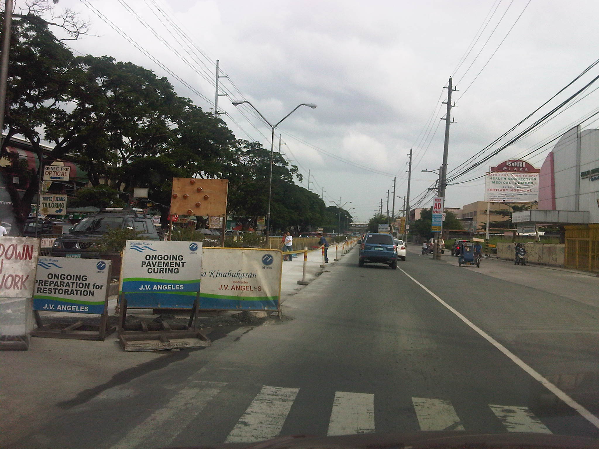 Newly paved lane along Imelda Avenue fronting the Karangalan market. The island separating Imelda from the west service road has been removed along this section to alleviate congestion and permit vehicle maneuvers in the vicinity of the market.
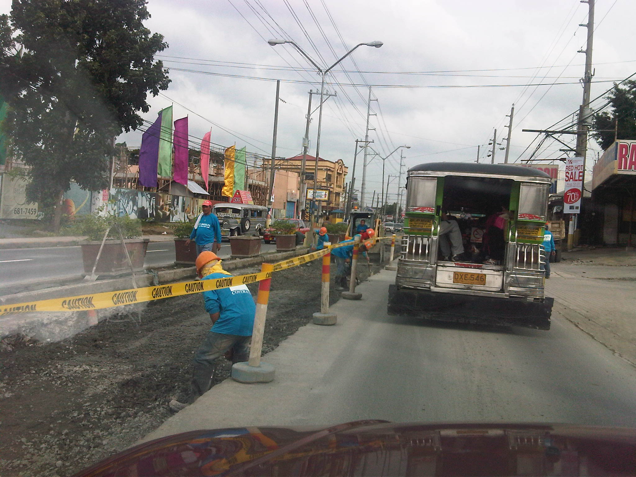 Manila Water contractor working on lane past Vista Verde main gate . Notice that there are no service roads along either side of Imelda from this point.
Road and drainage improvements along Marcos Highway
People driving or commuting from the eastern part of Metro Manila and the towns of Rizal Province have been experiencing traffic congestion for quite some time now due to the civil works associated with the improvement of Marcos Highway. The project is part of the Metro Manila Urban Transportation Integration Project (MMURTRIP) that finally pushed through after failed bids that caused significant delay to its implementation. The major components of the project include road widening and pavement rehabilitation, and the improvement of drainage along the highway. The latter component is quite important as the drainage system is supposed to contribute to the alleviation of flooding in areas along the highway. Who knows if the system could have prevented or at least mitigated the floods brought about by Ketsana (Ondoy) in 2009 if the project had been implemented according to its original schedule?
The photos below were taken during a regular commute along the highway and shows civil works in various stages of completion.
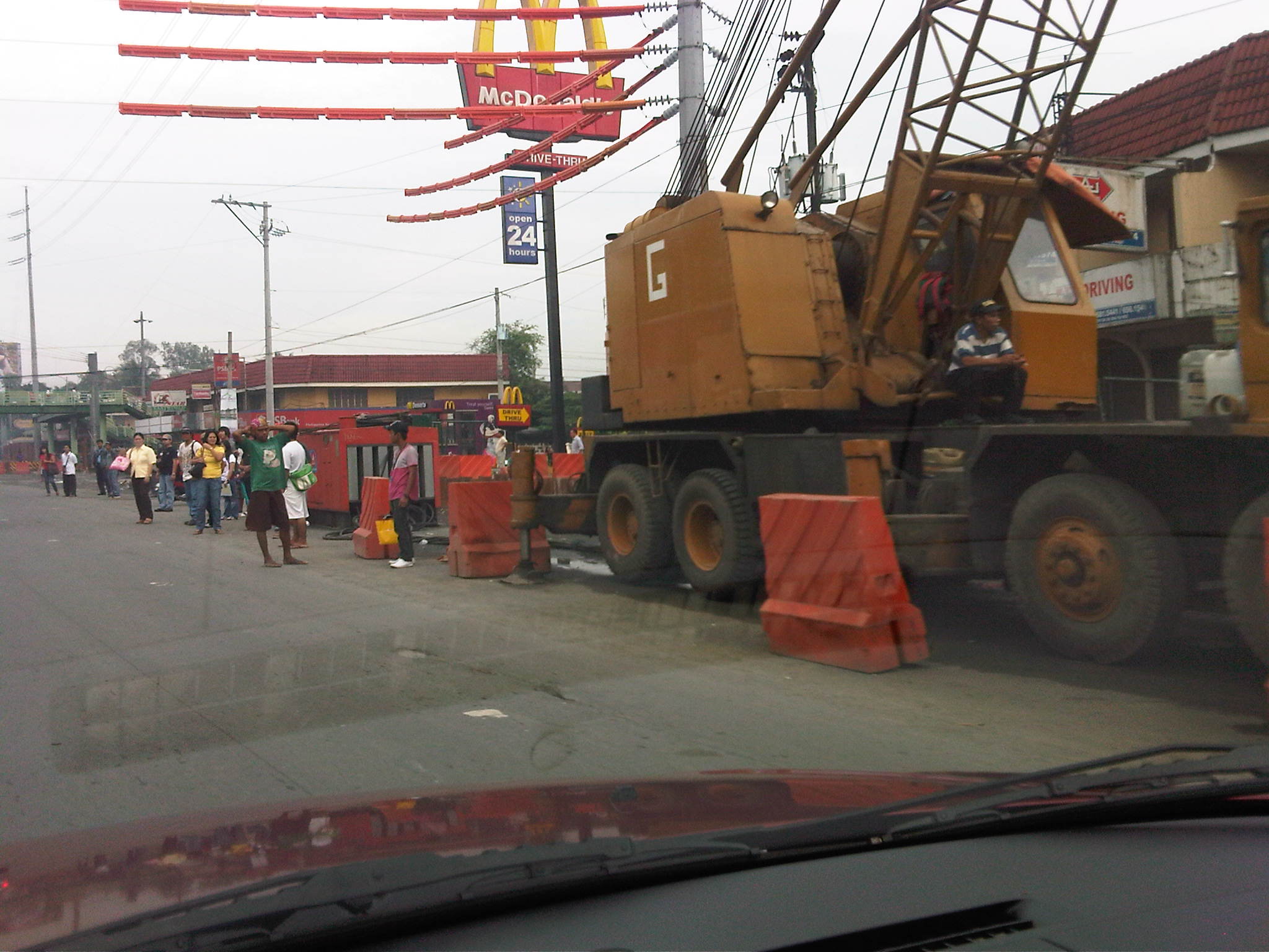 Crane deployed along westbound lane of Marcos Highway – Note the barriers and other equipment that effectively occupy about 2 lanes of the highway and the passengers waiting along the highway.
 Partly completed works along Marcos Highway westbound just after the junction with Felix Ave./A. Tuazon Ave. and across from Sta. Lucia Grand Mall
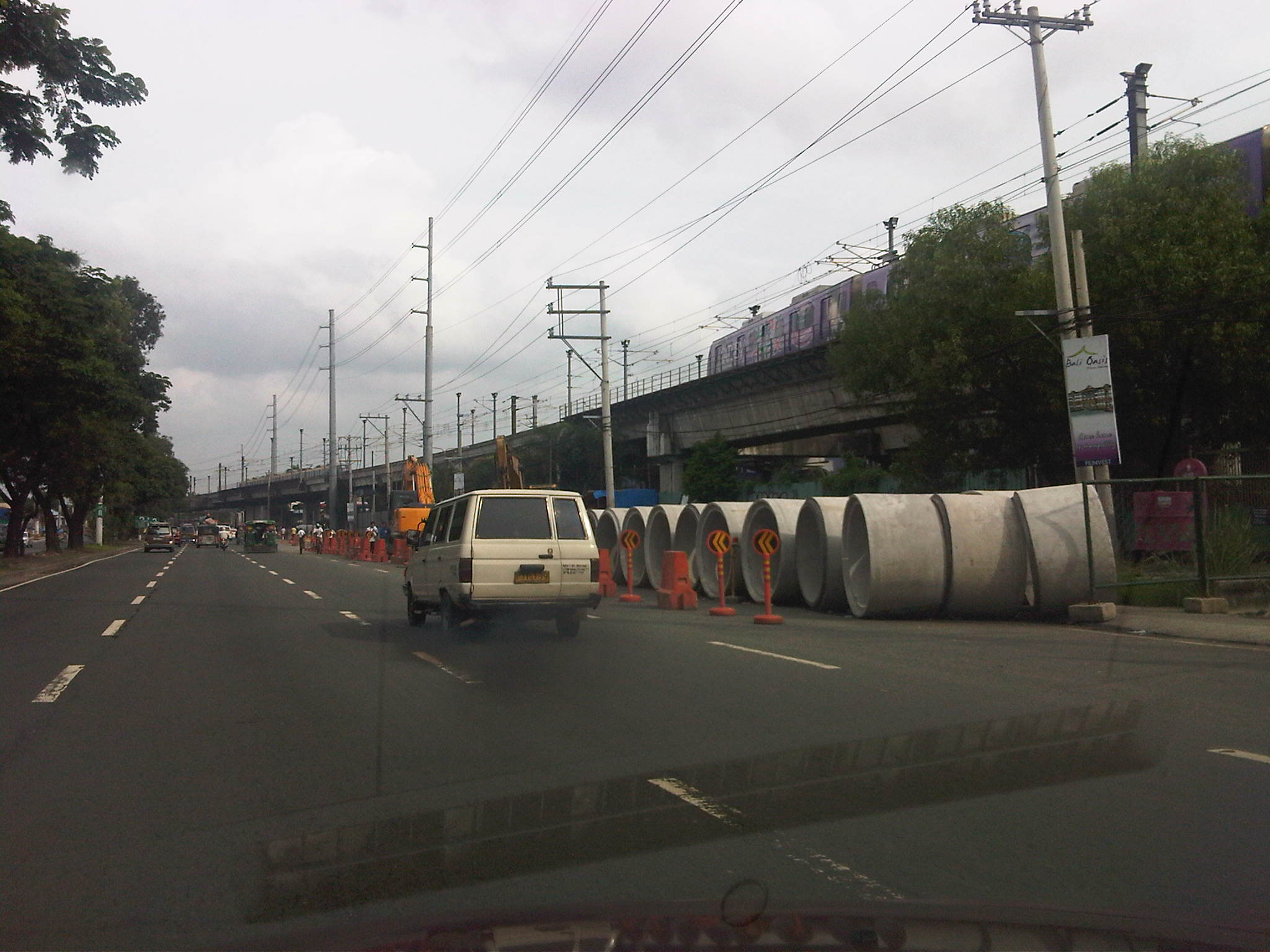 Civil works along Marcos Highway eastbound in front of the LRT2 Depot in Santolan
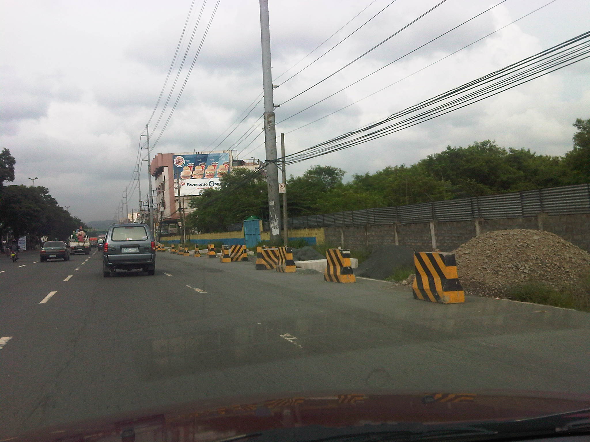 Partially completed works along Marcos Highway eastbound just after junction with A. Rodriguez Ave. (Ligaya)
 Project equipment and materials and informal barracks along Marcos Highway eastbound near the Barrio Fiesta/Slimmer’s World
 Excavations along Marcos Highway eastbound
Due perhaps to the magnitude of the project, traffic congestion along many if not most sections of the highway have been inevitable though prolonged. But partly responsible for the congestion is the Manila Water concessionaire that also did their own civil works at the same time as the DPWH project. As such, the capacity of the highway was significantly reduced with the outer lanes affected by the DPWH project and the inner lanes impacted by Manila Water works.
We should be hopeful though that once the project is completed, traffic flow will greatly improve and flooding may be alleviated along the highway and its catchment area. Works seems to be continuing although there seems to be less people working on the project these days compared to when the project started. Maybe they are just spread out along the highway? The following photos show examples of progress in the civil works.
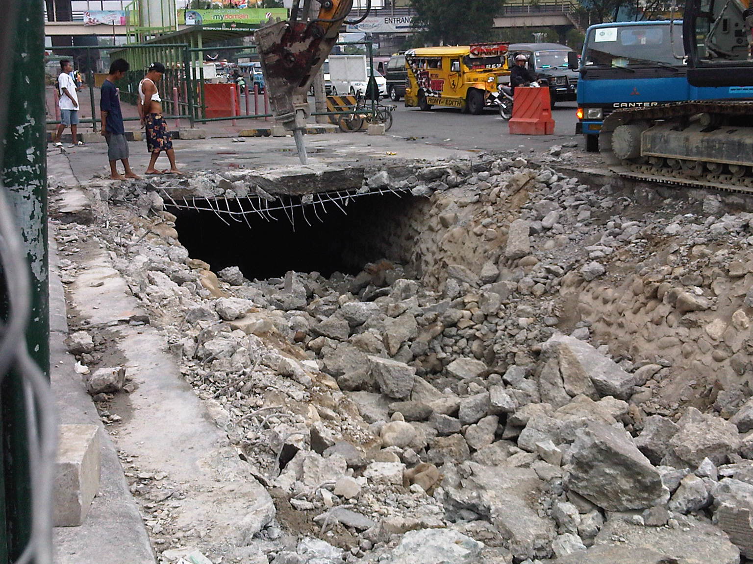 Demolition work of slab covering drainage along Marcos Highway westbound (before)
 Drainage canal covered and pavement engineering works (progress/after)
While it is expected that vehicle flow will be facilitated by the project, it can be said also that this may only encourage more vehicular traffic. As such, perhaps the next project that could be considered for this corridor is the also much-delayed extension of LRT2 towards Masinag.
Still on Katipunan
Katipunan is again the subject of attention thanks to the Sunday newspaper article by Prof. Randy David in his column at the Inquirer. The problem is not really new and I have been familiar with the congestion and its derivatives from the time I first studied in UP Diliman in 1988 and up to now when I continue to pass through the avenue between home and workplace.
I was able to dig up a 2003 study on Katipunan conducted by the National Center for Transportation Studies (NCTS) of UP for a consortium chaired by then DENR Secretary Bebet Gozun. The study was the group’s response to the MMDA’s effort to install their U-turn scheme along Katipunan, encouraged at the time by the scheme’s apparent success along Commonwealth and EDSA while not acknowledging the problems experienced along Quezon Avenue. The photos below were taken during the time when the study was being undertaken and are very much the same picture of Katipunan today during the peak periods.
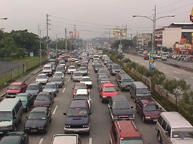 Figure 1: Morning traffic congestion in 2003 along the northbound direction of Katipunan Avenue in front of the Ateneo De Manila University (notice that there was no U-turn slot near Gate 2 at the time)
 Figure 2: Ateneo-bound vehicles blocking through traffic along the service road and the Aurora flyover
The study involved contributions from most if not all stakeholders including Ateneo and Miriam, the private sector and civil society groups, the Transportation Science Society of the Philippines (TSSP), and some government agencies particularly the DENR, who convened the group to formulate an alternative to the MMDA’s initiative that was personally being pushed by its then Chair Bayani Fernando. I reproduce below, word for word, the conclusions and recommendations from that 2003 study:
{Conclusion}
“After a thorough evaluation of the traffic problems along Katipunan as well as the solicited and unsolicited solutions from stakeholders, it becomes clear that the answer to the Katipunan traffic question is not the introduction of the U-turn scheme into the system. Indeed, while the U-turn scheme has met with relative success along major thoroughfares including Marcos Highway and Commonwealth Avenue, it has also contributed if not created congestion along Quezon Avenue. The notion that “success in EDSA and Commonwealth means there is no reason why the scheme won’t work in Katipunan” would not hold water in the light of the requirements for effective implementation of U-turns. Simply said, the traffic volume along Katipunan during the peak periods alone will assure that the U-turn scheme will cause more congestion rather than mitigate it.
{Recommendations}
- Optimization of traffic signals – coordination of signals need to be implemented particularly for the intersection pairs identified in this report. The Traffic Engineering Center (TEC) must be consulted with respect to the operation of the traffic signals along Katipunan.
- Restriction of roadside parking – parking restrictions must be strictly enforced and establishments along Katipunan should adhere to the required parking slots corresponding to the traffic they generate.
- Removal of parts of the islands to improve flow – geometric improvements to ease flow (i.e., increase road capacity) may be explored. Note that this report is not entirely opposed to removal of parts of the islands. However, their outright removal with the trees for the sole purpose of the U-turn scheme is not acceptable to most stakeholders. This must be carefully evaluated.
- Construction of an internal road between Ateneo and Miriam – the internal road will allow common vehicles to circulate within the campuses thereby eliminating traffic that would otherwise make several entries and exits to the campuses via Katipunan.
- Open additional gate at Ateneo – the possibility of opening another gate at Ateneo between the existing Gates 2 and 3 must be explored.
- Encourage carpooling or car-sharing – it is strongly recommended that Ateneo and Miriam consider carpooling or car-sharing schemes. It has been found that traffic along Katipunan is primarily composed of private vehicles will low occupancies bound for the two schools. While the surveys showed high return rates from grade school and high school students, very low returns came from college students. It is these people who account for a majority of the vehicles that clog Katipunan and they should take part in the formulation and implementation of such schemes that would lead to a significant improvement to traffic along Katipunan.
- Strict implementation of the zoning laws – this last recommendation points to the inconsistency in the granting of building permits to developers of high-rise condominiums along Katipunan. This is a constant issue and a controversial one since residents in the area and the two major schools (Ateneo and Miriam) have always opposed the “spot zoning” practice along Katipunan.” (NCTS, Study on the Traffic Management of Katipunan Avenue, 2003)
The study recommended alternative solutions in lieu of the U-turn scheme for Katipunan Avenue that was at the time being pushed by the MMDA as the solution for traffic congestion in the area. The recommended measures considered different aspects: traffic management per se, geometric improvements or road construction, travel demand management, land use, and other measures. However, it seems that 8 years after there has been practically no change in conditions along Katipunan Avenue.
The support and commitments of the different stakeholders (academic institutions, residents, business establishments, professional organizations, government agencies, and concerned citizens) are essential for the successful implementation of the recommendations contained herein. It is only through a strong partnership that sustainable and long-term solutions to the traffic problems in Katipunan Avenue can be achieved.
However, it is realized that there should be some sacrifices involved including a dramatic or drastic change in the travel behavior of those mainly responsible for the congestion. The vehicle trip generation of both Ateneo and Miriam are the roots of the problem and their continuing resistance to proposed solutions while not offering any viable countermeasures or proposals will only serve to perpetuate congestion in the area even as the external costs associated with the traffic they generate spread to a larger area. Recent studies at the UP Diliman, which is an open campus, has shown that private vehicle through traffic (i.e., traffic that has nothing to do with UP) has also grown and most of these are Ateneo and Miriam-bound trips.
It seems awkward and even confusing to see that 8 years after what was perhaps the last (maybe even the first?) serious look into Katipunan traffic, conditions have only worsened. This is due to additional developments in the area including high density residential projects that also tend to generate a lot of traffic, and commercial establishments that do not provide sufficient parking spaces. But although these contribute to congestion, their vehicle generation pale in comparison to that of the schools in the area. This is perhaps a case where one is able to see the flaws of others and yet refuses to look in the mirror to see for oneself something that needs critical attention.
School traffic generation – Part 1
One thing I will miss about summers is the relatively light traffic along Katipunan Avenue, which is where I pass through almost everyday between my home and workplace. There is still some congestion during the mid-day and the afternoons but these are typically due to truck traffic as Circumferential Road 5 (C5) is a truck route. During the rest of the year, however, with the exception of most weekends and holidays, severe congestion is experienced along Katipunan during the peak periods, particularly in the mornings between 6:30 AM and 7:30 AM. This is due primarily to the traffic generated by schools along Katipunan Avenue, most notably the Ateneo De Manila University and Miriam College. The following photos show typical traffic conditions along C5 during the peak periods.
 Slow-moving vehicles along the northbound side of Katipunan Avenue
 Congestion along the northbound direction of Katipunan atop the Aurora Blvd. overpass
 Congestion along the Katipunan southbound service road leading to the U-turn slot underneath the Aurora Blvd. overpass
Traffic along the southbound service road leads to a U-turn slot under the overpass where many vehicles turn, heading in the general direction of Ateneo. Most turn here in order to enter the university via its Gate 1, which is the main access to the Grade School. On most times, congestion is caused by these vehicles turning right at Gate 1 as they effectively occupy the two lanes of the northbound service road and block all other traffic. This is shown in the following photo where it is clear that vehicles bound for Ateneo and turning at Gate 1 are the main cause of congestion. Beyond Gate 1, the traffic lanes are practically free of congestion.
 Vehicles turning right to Ateneo’s Gate 1 blocking traffic along the Katipunan northbound service road
The afternoon peak is exacerbated by traffic generated by these schools that lead to longer periods of congestion as the number of private vehicle traffic dramatically increases when there are classes between June and April. Meanwhile, there is a noticeable decrease in traffic during the weekends and holidays. Such phenomenon is mostly attributable to the trip generation characteristics of schools, and especially those that tend towards the generation of much private vehicles. Ateneo and Miriam along Katipunan are just two examples. The traffic they generate and the consequential congestion is replicated in other places as well, giving headaches to motorists and commuters passing along major roads affected by these schools. Ortigas Avenue, for example, is usually congested during the weekdays because of traffic generated by LaSalle Greenhills, and ADB Avenue at the Ortigas Center is usually congested due to traffic attributed to Poveda.


