
Home » Traffic flow (Page 7)
Category Archives: Traffic flow
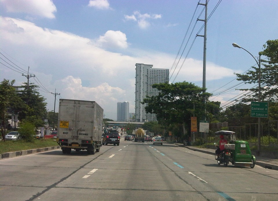
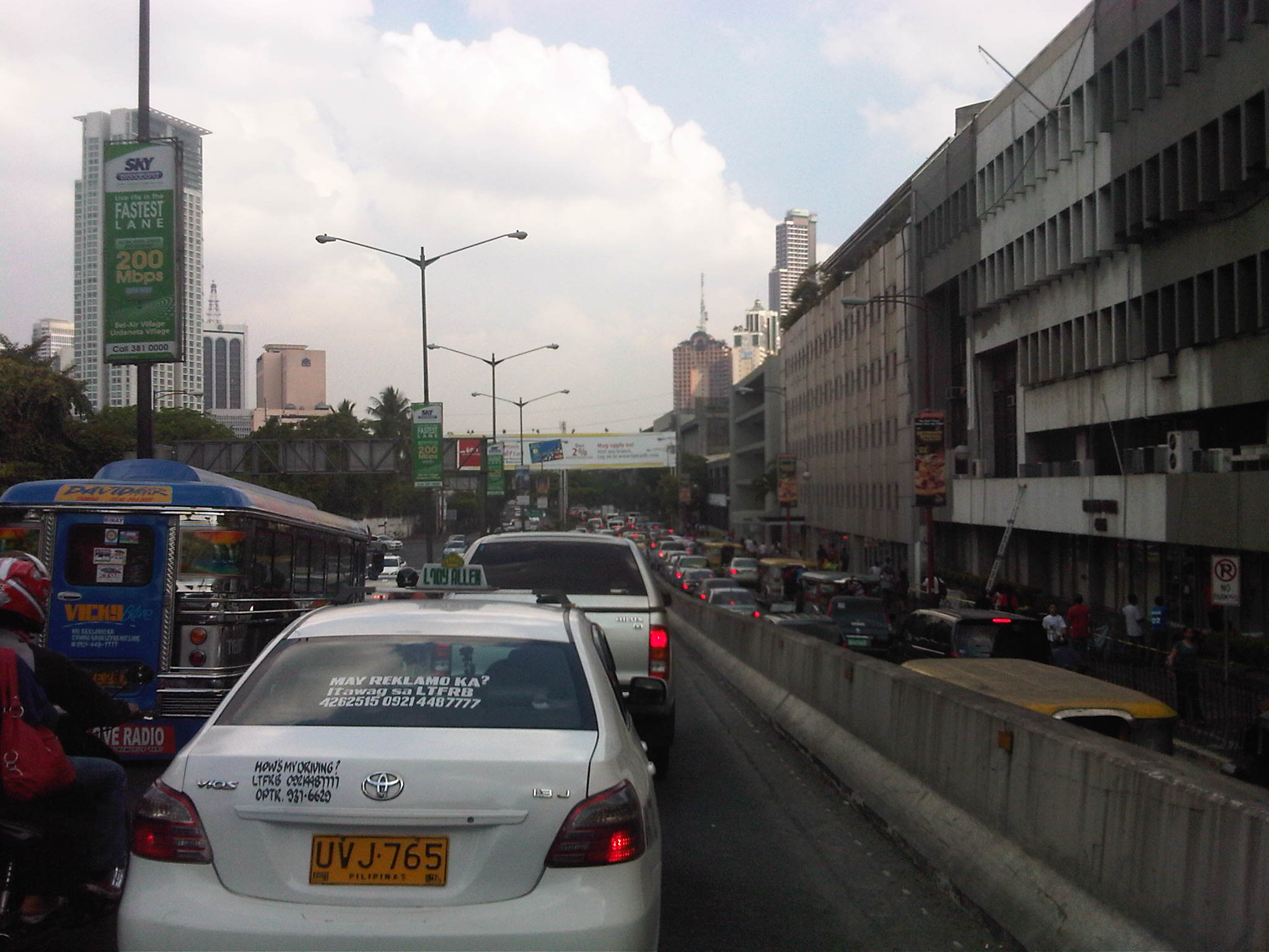
What’s wrong with Marcos Highway?
Traffic along the eastbound direction of Marcos Highway in the late afternoons to evenings have worsened particularly for the section stretching from Aurora Boulevard in Quezon City to Imelda Avenue in Cainta. It takes me at least 45 minutes just to traverse that section and then just under 30 minutes the rest of the way to my home in Antipolo. In addition, there is the traffic along Katipunan, which can be quite unpredictable despite the traffic signals now installed at two major intersections near Ateneo and Miriam. The congestion along Marcos Highway is usually due to several factors:
- Rush hour(s) traffic – the sheer number of vehicles during the afternoon/evening peak is enough to cause traffic congestion along Marcos Highway. This is no longer for an hour but for a period usually spanning about 4 hours (5 to 9 PM). It’s become so bad that I am no longer surprised when I go home late some nights to find out it’s still congested at certain points (usually Santolan and Ligaya) past 9 PM.
- People occupying the road – commuters waiting for a ride along Santolan, Ligaya and Metro East/Sta.Lucia often occupy not just one but 2 to 3 lanes of Marcos Highway. This drastically reduces road capacity. For some reason, the MMDA and LGU traffic enforcers could not persuade them to clear the carriageway or at least encroach only on the outermost lane.
- Errant road public transport – loading and unloading operations of jeepneys and UV express happen in the middle of the road. This is partly due to the fact that people already occupy 1 to 3 of the outermost lanes of the road. It is also partly due to driver behaviour as many PUV drivers are unruly. These are also maybe because the enforcers are not doing their jobs managing traffic and apprehending those violating rules and regulations whether driver or pedestrian.
- Major trip generators – there are already 4 malls along Marcos Highway (SM Marikina, Robinsons Metro East, Sta. Lucia East Grand Mall, and SM Masinag) and a 5th is already under way with Ayala constructing a mall at Ligaya. These will attract and produce significant traffic with vehicles generally contributing to congestion in the direct vicinity of the malls but spreading along all major roads. Unfortunately, Marcos Highway is one if not the only access road that these malls have.
A lot of people using their own vehicles live in areas served by Marcos Highway including those beyond Masinag and Cogeo. There are so many subdivisions and other residential areas in these parts east of Metro Manila that vehicles from these residential areas alone can cause sever congestion at Masinag Junction. But this should not come as a surprise given that there is no efficient mass transport system in these areas, which are served primarily by jeepneys and tricycles. Obviously, the quality of service of existing road public transport encourages people to get their own vehicle. And obviously, too, the solution is in a project that is considered “bitin” – LRT Line 2, which currently terminates at Santolan. The extension project has long been delayed and could have a significant impact on transport and traffic once it is constructed and becomes operational.
The past two weeks, I have proceeded to take C-5 and turned to Ortigas Avenue Extension on my way home. Surprisingly, traffic has not been bad at Cainta junction and I have only occasionally encountered congestion at the section in front of the BF Metals plant where jeepneys turning around tend to block traffic during their maneuvers. I estimate that I average just under an hour on this route, a savings of 30+ minutes from my original home-bound route via Marcos Highway and Sumulong Highway. I figure that I will most likely keep using this route as traffic will continue to worsen along Marcos Highway in the run-up to Christmas.
–
Re: traffic congestion along Katipunan
Yesterday was a holiday in Quezon City so most offices and schools were closed. It was not a holiday elsewhere so through traffic along Katipunan Avenue would have been “normal.” This is assumed especially for trucks that have been blamed as the cause of the severe congestion. I was curious about how traffic would be with the holiday in QC and through traffic could practically be “isolated.” There still was significant traffic generated by establishments like restaurants and cafes along Katipunan. It was a regular weekday and not like it was a Sunday. Following are photos that were taken around 2:00 PM when the truck ban is not enforced in the area.
 Free-flowing traffic along the section across from the UP Town Center – There were no long queues at the approach to the Katipunan-C.P. Garcia intersection.
 Free-flowing traffic along Katipunan across from Ateneo – the two universities generated few private car traffic yesterday during a period when there’s usually a lot coming in and out of the campuses due to the dismissals in the early afternoon.
 Free-flowing traffic along the Katipunan-Aurora overpass – in the early afternoons, the northbound side of Katipunan is usually full of vehicles mainly private cars and trucks. While there were many trucks yesterday, their numbers were not enough to cause traffic jams.
I think the traffic situation yesterday provided a clear picture that the major traffic generators along Katipunan are mainly the reason for traffic congestion along the stretch from Blue Ridge to Balara. These are mostly the schools (Ateneo, Miriam and UP) that generate so much private vehicle traffic on weekdays and Saturdays. Sundays are different because there’s no school nor work at offices on this day. With the QC holiday, the through traffic was still there owing to work and school in other cities (e.g., Residents of QC would still have to travel to Makati or Ortigas if their workplaces are located there. Similarly, students residing in QC whose schools are in the University Belt in Manila would have to travel.). This means there is really a need to understand why there is congestion and what causes it. A lot more effort is needed for this understanding and to ultimately reduce traffic congestion along this stretch of C5. Pointing fingers among agencies and simply putting the blame on one sector of traffic (e.g., trucks) will not get us anywhere. The solution will require strong cooperation among stakeholders and will definitely be not a painless undertaking for many.
–
Practicable road sharing in Antipolo
As there are increased calls for more bikeways, we try to look at some good examples of what I’d call “practicable” road sharing. I term it “practicable” because it is something doable or is already being done or practiced. I tried to find a few good examples of practicable road sharing to show that it can be done and usually if all road users respect each others’ right to use the road. This respect can be developed over time and requires some familiarity for each users behaviors. Of course, there will always be abusive or disrespectful people on the road including drivers of different types of vehicles. Reckless or unsafe driving is not limited to public transport or truck drivers. There are also many unruly private vehicle drivers who endanger the lives of others whenever they are on the road. Then there are the motorcyclists, cyclists and pedestrians – all road users and also with bad apples or “pasaway” among them.
Road sharing happens everyday in Antipolo City in the Province of Rizal. Along Ortigas Avenue and Sumulong Highway – the two main routes to and from Antipolo, you will see motor vehicles, bicycles and pedestrians sharing what are mostly 4 lane, undivided sections of the two major roads. Antipolo is a very popular destination for cyclists so even during weekdays you will find a lot of people cycling up and down the mountain roads even during the night time and very early mornings. While many are recreational riders, many, too, are doing this for health. I would bet that a good percentage might be biking to work or school but there are no hard statistics to show this (topic for research?).
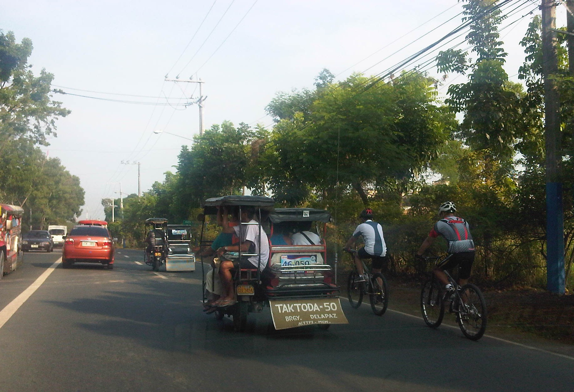 Motorists and cyclists “sharing the road” along Sumulong Highway
Sharing the road shouldn’t be too difficult. However, road users need to have respect for each other’s right to use the road. I have observed many instances where one or more road user types are guilty of “disrespect” and tend to hog the road as if making a statement that “i am king of the road” rather than “i have the right to use the road.” Here are among my pet peeves:
1. Slow moving trucks or jeepneys hogging two lanes and not giving way to other vehicles to pass them.
2. Jeepneys and private vehicles racing up or down the mountain roads and overtaking even in perilous sections (i.e., those already identified as prone to crashes).
3. Tricycles taking up the middle lanes and maneuvering anywhere.
4. Cyclists taking up the middle lanes or sometimes the entire two lanes of any direction preventing other road users to pass them.
5. People crossing anywhere along the road especially at blind sections (curves) where sight distance is limited.
There are practically no pedestrian sidewalks along most of Ortigas Extension and Sumulong Highway so pedestrians would have use the carriageway. As there are a significant number of people walking (e.g., students, workers, and even joggers or walkers), motorists and cyclists need to be careful not to hit these people. The same people, however, need to be aware of these vehicles and should exercise caution, always being alert as they use the road properly. Ultimately though, I would like to see walkways built along Ortigas and Sumulong especially since there is already an increasing demand for walking especially during the summer months when Antipolo holds its fiesta and a lot of people go on pilgrimages on foot to the Shrine of Our Lady of Peace and Good Voyage.
There is practicable road sharing in Antipolo because most road users are already familiar with each others’ behavior and accept each others’ presence and rights on the road. These road users are likely residents of Antipolo or nearby towns or regular visitors to the city. They are “nagbibigayan sa daan.” The “pasaway” people are likely the newer ones who seem to think that the way they drive or ride (i.e., unsafe) elsewhere is the norm. Of course, that goes without saying that familiarity with the roads and its users also breed risk takers who think they already know the road and have the skill and experience to drive like crazy. Here is where effective enforcement (e.g., timely apprehensions and reminders) and engineering (e.g., traffic signs and pavement markings) comes in to address the gaps in safety in order to reduce if not totally eliminate crash incidence along these roads.
–
Dissertation defense
After a series of posts on my recent travels, here’s something on the serious side:
The oral defense of the dissertations of Ph.D. in Civil Engineering (Major in Transportation Engineering) Program doctoral candidates, Mr. Ernesto B. Abaya (staff/affiliate student/ERDT scholar) and Mr. Alex S. Ladaga (affiliate student/CHED scholar) with topics on transportation & environment and traffic flow theory, respectively, will be on October 21, 2013 (Monday) from 9:00 AM and from 1:00 PM at the National Center for Transportation Studies. Details are shown below:
ERNESTO B. ABAYA
“DEVELOPMENT OF DRIVE CYCLES & ESTIMATION OF FUEL CONSUMPTION FACTORS OF LIGHT DUTY VEHICLES IN METRO MANILA”
21 October, 2013, Monday, 9:00 AM at the Toyota Training Room, NCTS, UP Diliman
Dr. Edwin N. Quiros (UPD-DME), Panel Chair
Dr. Hilario Sean O. Palmiano (UPD-ICE), Panel Member
Dr. J. B. Manuel M. Biona (DLSU-COE), Panel Member
Dr. Karl B. N. Vergel (UPD-ICE), Panel Member (Adviser)
Dr. Ricardo G. Sigua (UPD-ICE), Panel Member (Co-adviser)
Abstract: The urban drive cycles for five different light duty vehicles (LDV) are developed in this study. Furthermore, the fuel consumption factors for each of the type of LDV are estimated. The study presents the methodology in the development of the drive cycles in which the speed profile of the specific type of vehicle is surveyed, downloaded and processed. In the survey of speed data, a Global Positioning System (GPS) device is used as an on-board instrument. The GPS device is placed on the dashboard of every surveyed vehicle and it recorded instantaneous speed in its memory. The speed data is downloaded from the device using software provided by the maker of the device (Garmin) called Mapsource. The speed data is processed using a program to execute the methodology in generating candidate drive cycles. The program creates drive cycles by randomly appending microtrips to form a minimum of twenty minute speed time profile. Furthermore, along with the generated drive cycle, the program also indicated how it compared with the target drive cycle by computing their individual absolute value difference of their joint speed-acceleration probability distribution. Ten drive cycles for each type of LDV are developed which have absolute value differences less than 20%. The final drive cycle is selected from the ten (10) candidate drive cycle developed from each type of LDV. The selected drive cycles are then used in the Vehicle Research and Testing Laboratory at UP College of Engineering, Mechanical Engineering Department, to estimate the fuel consumption factors of each type of light duty vehicle considered. The developed drive cycles for the different types of light duty vehicles, namely (1) private cars, (2) taxicabs, (3) public utility jeepneys, (4) asian utility vehicles express, and (5) light cargo vehicles have average speeds of 17.97 kph, 13.57 kph, 10.87 kph, 14.69kph and 8.43 kph respectively. The fuel consumption factors estimated for all the light duty vehicles tested in the chassis dynamometer laboratory ranges from 9 to 12 km/liter.
Keywords: light duty vehicles, drive cycles, chassis dynamometer laboratory
—
ALEX S. LADAGA
“EFFECTS OF GAP FORCING ON THE CAPACITY OF TWO LANE ROUNDABOUTS IN THE PHILIPPINES”
21 October, 2013, Monday, 1:00 PM at the Toyota Training Room, NCTS, UP Diliman
Dr. Karl B. N. Vergel (UPD-ICE), Panel Chair
Dr. Jose Regin F. Regidor (UPD-ICE), Panel Member
Dr. Hilario Sean O. Palmiano (UPD-ICE), Panel Member
Dr. Ma. Sheilah G. Napalang (UPD-SURP), Panel Member
Dr. Ricardo G. Sigua (UPD-ICE), Panel Member (Adviser)
Abstract: Traditional method in estimating roundabout capacities using gap acceptance theory involves the assumption that vehicles entering the roundabouts give way to vehicles running along the circulatory road. Parameters usually used include the critical gap and the follow up times used by the entry vehicles. Gap forcing persists in local roundabouts and this common Filipino driver behaviour renders the existing models derived from traditional assumptions unsuitable for local applications. The study embarks on the development of the simulation model which takes into account gap forcing in the estimation of capacity of roundabouts in the Philippines. It explores the feasibility of introducing more realistic driver behaviour assumptions and the inclusion of additional parameters to come up with a model suitable for local use.
Keywords: roundabouts, gap forcing, capacity
—
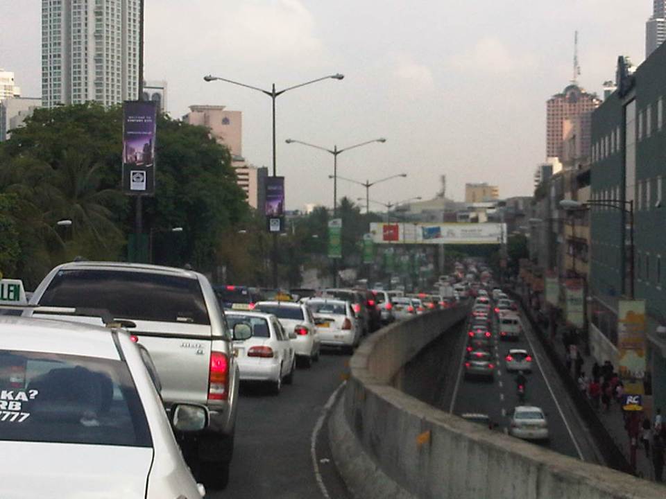
Traffic congestion and the limits of quick fixes
One time last summer night, it took me 2.5 hours to get to the airport from where I reside when it should only be an hour or 1.5 hours (on a typical bad day). Very early mornings (between 2 to 4 AM), it only takes me 40 minutes between my home an the airport. The route I usually take is mainly along Circumferential Road 5 (C-5); a route that basically has sparse public transport (mostly jeepneys along different sections) but is a truck route. It was summer though and one would have thought that there would be less vehicles along the road with school still out. I was wrong in that assumption and that cost me both time and fuel that night.
Traffic congestion in Metro Manila and other Philippine cities have been issues for such a long time that one tends to assume there’s nothing being done to fix the problem. In Metro Manila, the Metropolitan Manila Development Authority (MMDA), in cooperation with the various local governments and national agencies, has implemented various schemes including the number coding, truck ban and a bus dispatch system along EDSA. Yet, congestion persists and only last week, the President got caught in traffic as he traveled from Malacanang Palace in Manila to the DOST Compound in Taguig. The news was filled with a comment that he supposedly made to the MMDA Chair about the delay he and his entourage experienced. The bad news is that this congestion will not go away and will only worsen if there are no steps taken to address the problem. And this happens not only in Metro Manila but in other highly urbanized cities in the country. Quite obviously, quick fixes are no longer enough and we have reached the limits of their applicability.
 EDSA during the morning rush hours
 EDSA during the afternoon peak, which actually extends to an evening and even nighttime traffic jam
So how do we alleviate traffic congestion? Here’s three things that come to mind as they seem to be quite logical and very obvious:
1. Build the mass transit infrastructure required – these infra include rail and bus rapid transit systems and are urgently needed in Metro Manila, Metro Cebu, Davao and other highly urbanized cities. A shift from private vehicle use to public transport will not happen if people have no attractive options for commuting. In Metro Manila, there is a backlog of mass transit projects with lines that should have been constructed and operational years or even decades ago.
2. Rationalize transport services – the long standing practice is to increase the number of existing modes of transport as the demand increases. This logic is one that is most abused as a doubling of demand is conveniently but incorrectly interpreted as requiring a corresponding doubling of the number of tricycles or jeepneys, for example. What is required is for our cities to “graduate” from low capacity and less efficient modes to higher capacity and more efficient ones. Many cities seem plagued with tricycles as their main modes of transport within their CBDs when these should have been restricted to residential areas and mainly in the periphery rather than allowed to dominate (and clog) urban streets.
3. Build more walkways and cycling facilities – its difficult to encourage people to walk and cycle if there are no space for pedestrians and cyclists to travel safely and efficiently. Most trips are actually short ones and do not require motor vehicles so it makes sense to invest in pedestrian and cycling facilities so people get the clear message of support for such options for travel. Such investment is also one for healthy living as walking and cycling are forms of exercise and it is well established that these modes of transport promote healthier lifestyles and therefore, healthier people in cities.
–
Traffic congestion along Buendia (Gil Puyat Ave.)
The Makati CBD generates a very high number of trips owing to it being arguably the largest CBD in Metro Manila in terms of offices and workers. There are several other CBDs like Manila, Ortigas, Cubao, Eastwood, Filinvest City, and Bonifacio but they generate less traffic compared to Makati. There are several major roads in the area including four intersecting roads that practically define the CBD. These are Ayala Avenue, Gil Puyat Avenue (formerly but still popularly known as Buendia Avenue), Makati Avenue and Paseo de Roxas. Both Gil Puyat and Ayala Avenue are lined with offices along either side and are often congested due to the vehicle traffic generated by the CBD. Following are a few photos of Buendia Ave.
 Traffic congestion along Gil Puyat Ave. as seen from the overpass from Kalayaan Ave. Even the sidewalk on the right side of the road is filled with pedestrians.
 One can see many people walking along the narrow sidewalk along Buendia. Some buildings have been renovated and refitted but many remain as they were in the last decade or more. The building in the center of the photo has so many air-conditioning units jutting outside the windows that it is quite obvious the units were an afterthought. Other buildings would likely have centralized or more strategically positioned air-conditioning units.
 Another look at the traffic jam along one of Makati’s main roads indicate a lengthy queue from the Buendia Ave.-Paseo De Roxas intersection. The junction is signalized but saturated during peak periods. I am not sure about the optimization of the signal settings but it should be synchronized with at least two other intersections: Buendia Ave.-Makati Ave. and Paseo de Roxas-Makati Ave.
The DPWH is proposing a grade separation project along Buendia that is supposed to alleviate congestion at the intersections with Paseo de Roxas and Makati Avenue. The plan is to have an underpass along the avenue that would allow vehicles to flow through and bypassing the two major intersections. At-grade would still be signalized intersections but minus substantial through traffic along Buendia. The downside of such a project, of course, would be the expected traffic congestion during the construction phase. With very limited alternate routes and restricted space (i.e., unlike the case of the Quezon Ave. underpass at Araneta Ave.), traffic management in the area will surely be a challenge for the combined forces of Makati and MMDA traffic enforcers.
–
Signaling
I recently read an article about signaling in the United States. It states that about 25% of turns are not signaled. That is, drivers do not signal prior to turning left or right at an intersection. This comes as somewhat a surprise for me as I thought this statistic should be lower in the US considering their stricter procedures for getting a license. I don’t really observe signaling behavior in the US when I am there also because maybe I assume that traffic enforcement is also stricter and errant behavior would usually be caught and the driver cited by the police.
In the Philippines, it’s a lot worse with many if not most drivers of all types of vehicles including motorcycles not indicating their intention to turn for other motorists. Drivers of public utility vehicles like buses, jeepneys and taxis are perceived to be the ones with the highest likelihood of not signaling prior to turning at an intersection or to change lanes. The results, of course, are chaotic driving conditions along Philippine roads and especially in urban streets where motorcycles add to the complexity as riders zip in and out of every conceivable space between vehicles.
I am not aware of any formal studies on signaling and related driver behavior in the Philippines. Perhaps there is one somewhere and not necessarily on traffic engineering but on psychology or other behavioral studies. Such researches, while appearing to be simple and somewhat trivial to some, can be quite helpful in understanding driver behavior and how these can influence the road environment. Abrupt or poor anticipation of turning or lane changing may lead to road crashes and motorists in the country are not the easiest to educate after getting their licenses. Of course, nothing can replace consistent, strict enforcement of traffic rules and regulations to encourage good behavior along our roads but this would just be a reinforcement of what was supposed to have been taught at driving school in the first place.
Here’s the link to the article appearing on the website Atlantic Cities:
DIY Urbanism of the Day: How Many Drivers in Your Nabe Aren’t Signaling?
–
Night time congestion along C-5
Traffic congestion along Circumferential Road 5 is experienced practically throughout the day with the worst congestion along the southbound direction during the mornings between the Riverbanks Road in Quezon City and Kalayaan Avenue in Makati City, and the northbound direction between Bonifacio Global City and Eastwood from noon to nighttime. The following photos taken by my wife as I fetched her one night from her office shows the traffic jam along C-5 as we turned from the flyover past Market! Market! towards the highway.
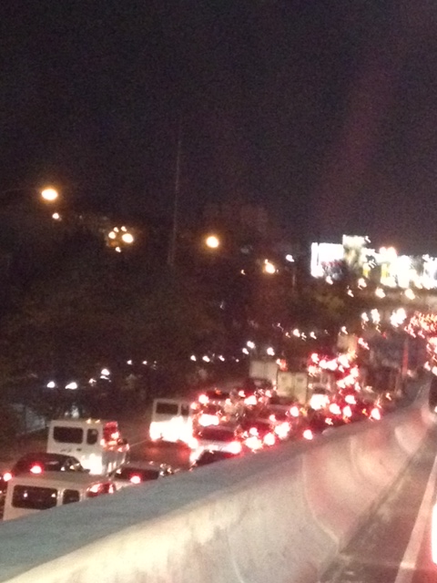 Congestion along the C-5 northbound is a regular thing during the weekdays from the afternoon to late at night. While apps like the MMDA’s Traffic Navigator and Waze allow us to have an idea of how congested C-5 is during such periods, the actual experience is much worse than what many of us can just imagine from the apps.
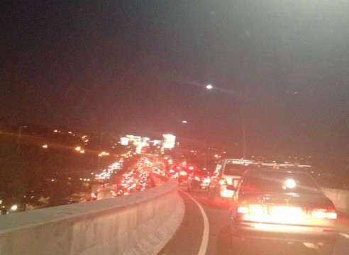 As far as the eye could see – congestion in the form of the taillights of vehicles along the northbound side of C-5 indicate just how many people are caught in traffic from Taguig all the way to Pasig and beyond. The giant billboards from Kalayaan Avenue to Pasig Boulevard including those seen along the bridge crossing the Pasig River. Most of these people are office workers coming from Makati and Global City and heading home to Quezon City, Pasig, and the towns of Rizal. After 7 PM, trucks add to the traffic
Many people are asking if there is a solution in sight for congestion along C-5. To be frank, there is none in the immediate future. There are proposals to introduce a public transport system along the corridor with one option being a Bus Rapid Transit (BRT) and another an elevated rail transit line. The BRT line is a recommendation of a Pre-FS for Metro Manila BRT conducted around 6 years ago though there was a proposal for a bus system (Philtrak) along the same corridor back in the late 80’s and pursued for some time during the 90’s. Not much have been done towards realizing any of these proposals. An efficient mass transit system along the corridor could encourage people to shift from private to public transport and help reduce vehicular traffic along C-5 considering that even as I write this post, vehicle ownership is increasing in Metro Manila and its environs and this could only mean more congestion along C-5 and other roads.
–
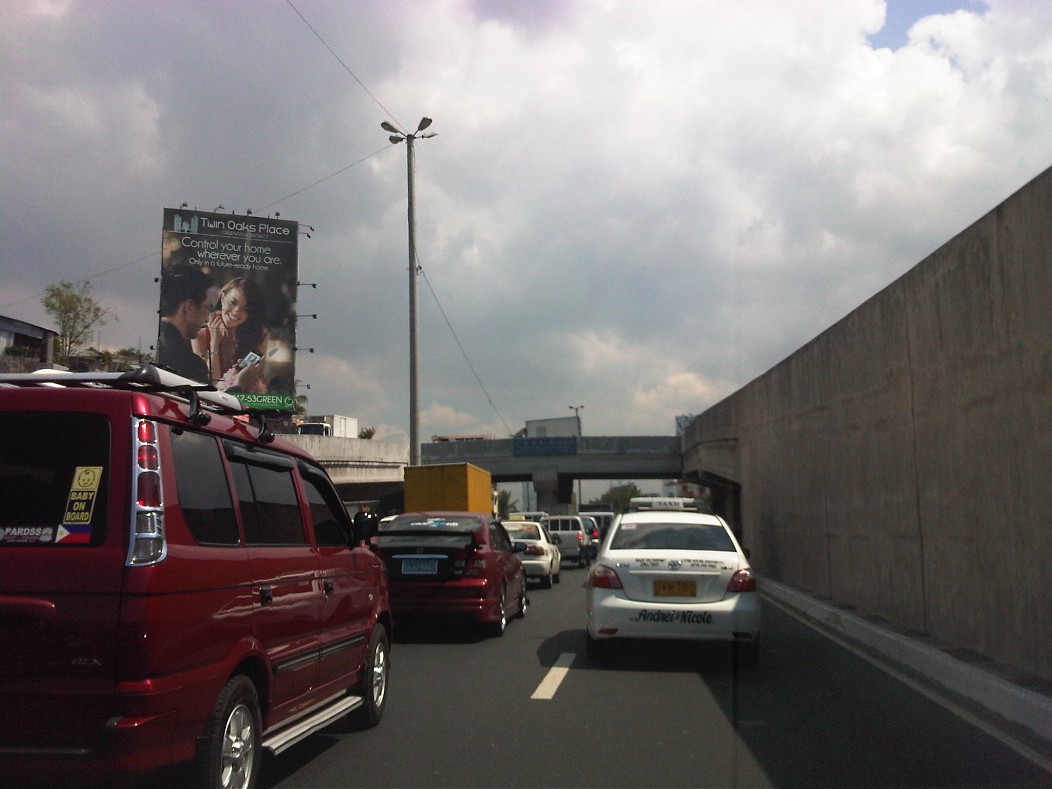
Daily penance: traffic congestion along C-5
People have been telling me about the traffic congestion along Circumferential Road 5 (C-5) and I am quick to reply that I know the feeling as I’m one of those who have driven or traveled along C-5 and experienced first hand the traffic congestion, which is worst during the mornings (southbound) and late afternoons and evenings (northbound). Midday traffic jams are not uncommon as C-5 is a truck route and large vehicles contribute to clogging especially at bottlenecks like the U-turns slots along the highway and bridge crossing the Pasig River. C-5 has been this way since its opening (or more appropriately the completion of missing links along the main alignment).
It will not get better. It will only get worse. I say so because of the annual increase in vehicle ownership, including motorcycles, in what is now termed as Mega Manila. I dare say so because of the backlog of public transport infrastructure in the metropolis (or megalopolis?). It is well established that efficient public transport infra and services are good incentives for people to commute rather than drive. This means there will be less vehicles on the road and therefore there will be less congestion as basically only those who really need to drive would be using their cars on a regular basis. Of course, it is not as easy at it seems considering trip making and mode choices are in reality complicated matters. But then the availability of viable, acceptable choices for travel, especially in the urban setting allows for people to have better mobility and more equitable use of the transport system than a car-oriented city. Until then, when we do have the public transport system that our cities require, it will be a daily penitensya for many of us traveling and not just along C-5.
 Congestion along the southbound side of C-5 approaching the flyover crossing Ortigas Ave. The flyover can be seen in the horizon.
 Congestion along C-5 southbound in the Bo. Ugong area approaching the junction with Lanuza Avenue. An overpass was proposed for construction along this section but now it doesn’t look like it will do any good considering the bottleneck is the Pasig Flyover and the bridge across Pasig River.
 Congestion along C-5 southbound at the Pasig flyover. The flyover has 2 lanes per direction and vehicle breakdowns or road crashes have resulted in terrible traffic jams.
 Congestion along C-5 northbound at the C-5/Kalayaan junction. The north U-turn flyover, one of two in the area, is shown in the photo. An underpass was initially proposed, designed and approved (with budget from a JBIC loan) at the junction. A previous MMDA Chair, however, didn’t agree and successfully maneuvered for the twin U-turn flyovers to be constructed instead.
–
Quezon Ave. underpass at Araneta Ave.: some expectations and issues
The underpass along Quezon Ave. at its junction with Araneta Ave. is set to open to general traffic this coming week. I got this from a reliable source who was involved in the project as well as friends from the DPWH and the MMDA. If the opening pushes through, the underpass is expected, based on analysis, to ease traffic along both major roads with Quezon Avenue’s through traffic having the most benefit from the uninterrupted flow provided by the underpass. At-grade traffic management at the intersection will still be provided mainly by traffic signals but the substantial reduction of traffic attributed to the through movements along Quezon Ave. The reduction of congestion comes as a relief to a lot of travelers as well as businesses affected by the construction of the underpass in the last year. Fortunately, there has been little delay in the construction and so it seems that lost times due to construction-related congestion (translated here as sacrifices for those who had to endure daily traffic congestion and had to adapt to the situation) will finally be compensated for. Many, indeed, have been anticipating the eventual opening of the underpass, expecting the facility to solve congestion in the area.
The area has been subject to flooding considering its proximity to the San Juan River. Official data for flood occurrences in the area can be accessed through the Department of Science and Technnology’s (DOST’s) Nationwide Operational Assessment of Hazards website where it is clear that flooding will be an enduring problem for the underpass and surrounding areas. Recent reports (from last week until today) indicate that there is still the specter of flooding that will have to be addressed given that prior to the construction of the overpass, this issue had already been flagged by various stakeholders including the Quezon City Government. It is for this reason that the underpass will have pumps to ensure that water will not accumulate and lead to the closure of the facility in times of heavy rains resulting in flash or regular flooding.
–
