
Home » Traffic Management (Page 12)
Category Archives: Traffic Management
“New phenomenon” in traffic?
I read in the news recently that the government official currently acting as traffic czar for Metro Manila. The news item may be found at the following link:
http://www.gmanetwork.com/news/story/536851/news/nation/almendras-cites-new-phenomenon-in-edsa
Apparently, the government official found what he claimed as a “new phenomenon” along EDSA. To quote from the article:
“Sa gabi, your honor, may bagong phenomenon na we’re still trying to understand: Bakit ang daming naghihintay ng bus pauwi?” Almendras told senators during the Senate Committee on Economic Affairs’ hearing on the traffic in Metro Manila.
The secretary added that while commuters are having a hard time getting a bus ride in the afternoon, EDSA is packed with passenger buses in the morning.
Almendras has been personally monitoring EDSA since the police’s Highway Patrol Group took over traffic management on the main thoroughfare.
He said somebody told him that passenger buses are no longer going out in the afternoon or in the evening because they have already hit their quota during daytime.
“This is not fact yet… Somebody told me that when the buses hit their minimum targets, the drivers decide, ‘Bakit pa ako magpapakahirap magbiyahe?'” he said.
“I have that question. Why do I see a lot of people on the streets waiting to go home in the afternoon than in the morning?” he added.
It boggles the mind on how our officials are making assessments of the transport and traffic situation around Metro Manila and particularly along EDSA. The statements taken directly shows how detached our officials are from the realities of commuting that most people face on a daily basis in the metropolis. Such statements reinforce calls for public officials to take public transportation themselves in order for them to experience first-hand and understand how most people feel during their daily travels between homes, workplaces and schools. But while people do not deserve such hardships of commuting, there is the lingering (philosophical) question of whether the same commuters deserve the leaders they elected who appointed these same officials who have been and continue to be inutile and insensitive to the plight of the commuting public. Hopefully, the coming 2016 elections will yield officials who will be more sensitive and responsive to the plight of commuters in this country.
–
EASTS 2015 – Cebu City, September 11-13, 2015
The 11th International Conference of the Eastern Asia Society for Transportation Studies (EASTS 2015) will be held in Cebu City this September 11-13, 2015. For information on the conference and program, check out their website here:
You can also download a brochure about EASTS here:
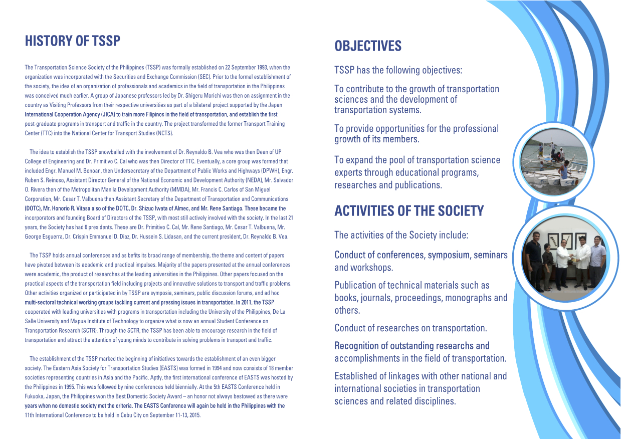
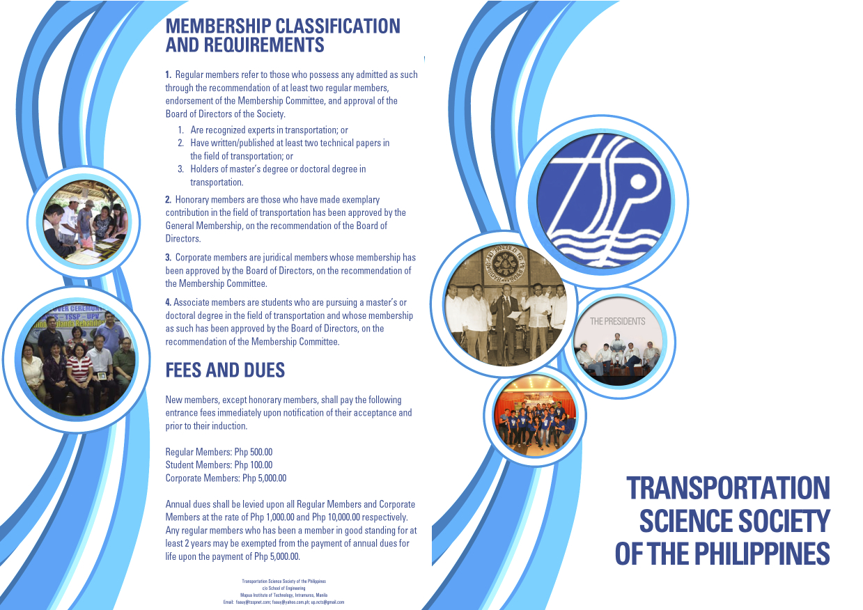
The conference is hosted by the Transportation Science Society of the Philippines (TSSP), which is the local affiliate of the EASTS. More information on the TSSP are found below:
–
Capability building for traffic management in Metro Manila
The Metropolitan Manila Development Authority (MMDA) has been on the news lately due to the perceived shortcomings of the agency on traffic management in the metropolis. The current administration has designated the Philippine National Police – Highway Patrol Group (PNP-HPG) to take charge of traffic management/enforcement at six identified choke points along EDSA. EDSA or Circumferential Road 4 has been a battleground of sorts for Metro Manila, representing the capital’s transport and traffic woes with just about all the conceivable problems including severe traffic congestion, high incidence of road crashes and a malfunctioning rail line (MRT Line 3) along the corridor.
The agency was criticized when its head went to Cebu City with a team of enforcement personnel in an apparent effort to augment that city’s traffic personnel. Cebu City has its own traffic management unit in the Cebu City Traffic Operations Management (CITOM), which has been managing traffic in that city for quite some time now. They have been actually ahead of Metro Manila with their own traffic engineering center already integrated with CITOM way back in the late 1980s. The traffic signals around the city were already under CITOM when Metro Manila’s Traffic Engineering Center (TEC) was still under the DPWH. It was only in the last decade that the TEC was formally transferred to MMDA and modernised to the current modern facility beside the MMDA headquarters at EDSA-Orense St. in Makati City. People observed that Cebu was already ahead of Metro Manila on this part and that the MMDA already had their hands full with Metro Manila’s traffic woes. The joke among major cities is that they were learning about traffic management and enforcement from Metro Manila by checking what the MMDA was doing. They will do the opposite. These cities in on the joke include Cebu, Davao and Iloilo, which are all highly urbanized cities looking to alleviate their own transport and traffic problems before these become the level of Metro Manila’s.
The MMDA has the capacity for traffic management as it has the resources including staff to manage traffic around Metro Manila. It even has people to spare that the agency can deploy to assist or supplement traffic personnel in adjacent local governments (e.g., in Rizal, Cavite, Laguna and Bulacan). However, capacity does not mean capability. And MMDA clearly has limited capabilities despite the resources at its disposal. In fact, their traffic management group should be integrated if not closely working with their planning group. Transport engineering, planning and enforcement should go together, working cooperatively in order to come up with comprehensive schemes and solutions that address problems that are progressive in nature.
The old Transport Training Center (TTC) of the University of the Philippines was established to build both capacity and capability for government agencies that included the then Constabulary Highway Patrol Group (CHPG) that was under the then Philippine Constabulary/Integrated National Police (PC/INP) headed by the then Gen. Fidel V. Ramos. The PC/INP became the PNP and the CHPG became the Traffic Management Group (TMG) (later becoming the current HPG) but they all trained under the TTC, which became the National Center for Transportation Studies (NCTS).
The MMDA trained under the NCTS since the 1990s but most of those who did so over the years are now out of the agency and working elsewhere (including those who have migrated to other countries). The remaining training graduates have limited capability and some have quite a bit of overconfidence (this probably is a by-product of the BF era when the agency and its staff were basically taught that they were better than their DPWH and DOTC counterparts and everything they did was right). Mix this with what seems to be confusion about what they need to do and the result is quite amusing.
The MMDA recently established an Institute for Traffic Management (ITM) with the intent of providing training for their own staff and those from local government units. This is apparently with the instigation of their consultants who include a few academics without transport planning and engineering expertise and experience yet dabble in it anyway. I think the ITM is not necessary at this point and it is actually not in the agency’s mandate to provide training programs other than to their own staff. MMDA should focus instead on capability building. If not under NCTS or other local entities they can probably get the knowledge and skills required to manage Metro Manila traffic elsewhere and abroad. In fact, I would recommend that they explore programs offered by the Land Transportation Authority Academy (LTA Academy) of Singapore. These are professional programs that have been developed in cooperation with leading institutions in Singapore like the National University of Singapore (NUS) that can provide a fresh infusion of knowledge to the MMDA. But attendance in such programs is not an assurance that the agency can be better afterwards. The key ingredient would still have to be an effective and progressive leadership that is not under the influence of politics and is committed to no-nonsense traffic management even without the media covering these activities.
–
Causes of congestion along Ortigas Ave. Extension
I have written about the common causes of congestion along Ortigas Avenue. The past articles mentioned the undisciplined loading and unloading along the entire stretch of the road and particularly at either ends of the Manggahan Floodway bridge in Pasig City. I have also written about the congestion caused by private vehicles generated by a private school just a stone’ throw away from DOTC headquarters. This time, I focus on Ortigas Avenue Extension, particularly the stretch from Cainta Junction to Valley Golf.
The current and more critical choke points along Ortigas Ave. Ext. are along the stretch of the road between Cainta Junction and Valley Golf. These are due to the road and drainage works along that section that effectively made the westbound side of Ortigas a single lane road between Brookside and Park Place. There are also road and drainage works along the eastbound side between Brookside and Valley Golf where the entire road section is being elevated. This section is flood prone and has been problematic during the wet season when heavy rains often result in flash floods.
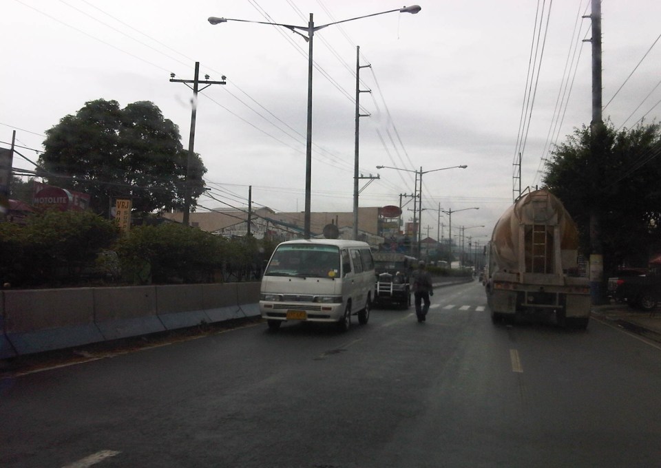 Counter flow along Ortigas Avenue Extension – this scheme has been the only option for the section between Valley Golf and Park Place Subdivision as the work proceeds one lane at a time. At the time, I took this photo, the counter flow lanes allowed for 2 lanes each for both the eastbound and westbound directions of this corridor. The past week, however, I noticed that during the afternoons and evenings, I noticed that two lanes were allocated for westbound traffic while only one was for the eastbound direction. This should not be the case as the peak direction in the afternoon to the evening is eastbound when people are home bound mainly from work and school.
 The section across from STI is another choke point as the area is one of the ends of the project raising the elevation of the avenue as well as improving the drainage along the road. The traffic along this area has improved much though vehicles still have to slow down to transition between the old pavement and new pavement sections, as well as vehicles turning towards Hunters ROTC Road.
 Unfinished sections – at the time this photo was taken, work along the site was intermittent. Commuters making the observation are often frustrated and much disappointed when they see none working along the construction site. The Mayor of Cainta did very well by talking to the contractor and apparently discussing with the latter how to improve traffic conditions as well as how to expedite the implementation of the project. My own observation was that conditions did indeed improve after that meeting (which was related by the Mayor in his Facebook page) and people could see workers busy with the project even at night time.
Traffic will continue to be bad along Ortigas Avenue Extension until this project is completed. While there should be some significant improvement in traffic flow after completion, congestion will again steadily worsen for this corridor whose private vehicle traffic continues to grow. Public transport is provided by buses, jeepneys and UV Express (whose numbers have ballooned during the last 5 years) and these have contributed a lot to congestion because of their drivers’ behavior particularly when they stop for passengers at areas like Valley Golf, Brookside, Cainta Junction, Ever, Countryside, Manggahan and Rosario.
There is hope though as news proclaim that the NEDA Board has approved the LRT 4 project along this corridor. A mass transit system is indeed necessary and this was required perhaps over a decade ago already. I do hope that this ‘LRT’ is more like the current Line 2 trains and stations than the Line 3 kind. Line 2 is a heavy rail system while Line 3 is light rail. The Ortigas corridor requires a heavy rail system considering the passenger demand in the areas that will be served by the transit system. I also hope that Line 4 is implemented like Line 2 with the government taking responsibility for constructing the system. I have maintained my view that the current administration is too fixated with Public Private Partnerships (PPP) that it had practically given up its responsibility to the general public to provide an efficient and equitable means of public transport for commuting. I just now wonder what became of the proposed BRT line along this same corridor. Perhaps the BRT option has already been abandoned by the DOTC in favor of rail?
–
Running out of answers? How about congestion pricing?
A lot of people ask me about solutions to transport and traffic problems. Some are very general like the question “How do we solve traffic congestion in Metro Manila?” and others are more specific like “How do we solve congestion along EDSA?” These questions are becoming quite tricky because, for one, we are running out of answers of the ‘short term’ kind. All these ‘stop-gap’ or ‘band aid’ measures will only provide short-term relief and we have used many of them already including vehicle restraint measures we are very familiar with like the number coding and truck ban schemes currently implemented in the metropolis.
The general answer and likely an inconvenient truth is that we can’t solve congestion. It is here to stay and is a given considering the continued growth experienced throughout the country. Accepting this phenomenon of congestion, we can proceed towards managing it and work towards alleviating it. Denying that there is a problem or dismissing such as an issue requiring urgent action sets a dangerous course towards unsuitable responses or worse, inaction on the part of the government.
Like cholesterol, there is good congestion and bad congestion. Good traffic congestion is when it is predictable in occurrence and period. For example, the morning rush hour is termed so because it used to last only about an hour or so. Congestion occurring between 7:30 – 8:30 AM is okay but between 6:30 – 11:30 AM is undesirable. The cases between those two vary in acceptability based on the tolerance levels of commuters. In Metro Manila, for example, many people probably have been conditioned to think that 2-hour congestion is okay but more than that is severe. This is actually related to travel times or the time it takes to travel between, say, one’s home and workplace.
And so, are there better options other than a return to the “Odd-Even” scheme? There are actually many other options but they are more complicated to the point that many are unpalatable to people who are in a hurry to get a solution our traffic mess. Note that this is to get out of a hole that’s deep enough already but they still managed to dig deeper the last 5 years. Among these solutions would be congestion pricing.
Singapore offers a successful model for this where tolls vary according to the levels of congestion for these roads. There is a base rate for peak periods when congestion is most likely or expected. The government determines the desirable speed ranges along roads as a basis for congestion charges. Along urban streets, that range may be between 20 – 30 km/h. If speeds reduce to below 20 km/h (i.e., congested) then charges or tolls increase. If speeds increased to above 30 km/h, the rates decrease. The image below is screen capture from a presentation made by an official of Singapore’s Land Transportation Authority (LTA).

Note the item on the scheme being ‘equitable’ that is very essential in understanding how road space must be shared among users and that there is an option to use public transport instead. This scheme, of course, will require a lot of consultations but the technical part should not be worrisome given the wealth of talent at universities, private sector and government agencies who can be involved in the analysis and simulations. Important here also is to determine or institute where the money collected from congestion pricing will go. Logic tells us that this should go to public transportation infrastructure and services. In Singapore, a big part of the funds collected from ERP goes to mass transit including their SMRT trains and buses. Funds help build, operate and maintain their trains and buses. The city-state already has a good public transport system that is subsidized by congestion charges and this system is able to attract people from using their cars especially during the weekdays when transport is used for work and school trips. That way, people who don’t really need to own and use their cars are discouraged from doing so (Note: This works together with Singapore’s restrictive car ownership policies.).
Would it be possible to have congestion pricing for Metro Manila or other cities in the Philippines? Yes, it is and but entails a lot of serious effort for it to work the right way. We can probably start by identifying major roads whose volumes we want regulated, installing sensors for monitoring traffic conditions and tagging vehicles and requiring most if not all vehicles to have transponders for motorists to be charges accordingly. However, there should be an attractive and efficient public transport option for this program to work. Unfortunately, we don’t have such along most roads. Perhaps an experiment or simulation can be undertaken once the LRT 2 extension is completed and operational? That corridor of Marcos Highway and Aurora Boulevard, I believe is a good candidate for congestion pricing.
With the sophisticated software that are now available, it is possible to conduct studies that would employ modelling and simulation to determine the potential impacts of congestion pricing on traffic. It should have a significant impact on congestion reduction even without mass transit systems such as Singapore’s. However, without good public transport, it would be punishing for people who are currently using their own vehicles to avoid taking public transport. I used the term ‘punishing’ because congestion pricing will be a back breaker for people who purchased vehicles to improve their commutes (i.e., they likely were not satisfied with taking public transportation). These are the working people and part of the small middle class whose transport needs should be addressed with urgency.
–
Construction of pedestrian overpass at Masinag
What’s been causing a lot of traffic jams the past week emanating from the Masinag area is the installation of the pedestrian overpasses (or footbridges, if you prefer the term) at the junction. Components of the overpasses were constructed and installed intermittently over several months already. Last Sunday, major works were undertaken including the raising of the main girders that are also to be the walkways for pedestrians. The work entailed closing sections or parts of the intersection and resulted in monstrous traffic jams along both Marcos Highway and Sumulong Highway. The congestion spread to local roads that were used to divert traffic as work was underway during the daytime. Yes, daytime! I found it unusual that such works would be undertaken when traffic was already significant for the two major roads here even if it were a Sunday. Most people had little or no information about this including residents of Antipolo and Marikina who were the most affected by partial closures.
 The still unfinished pedestrian facility at Masinag Junction
The pedestrian facility at Masinag junction has four spans that are supposed to cover crossings across all four legs of the intersection. Thus, theoretically, pedestrians may cross any time despite the busy traffic at ground level. I haven’t seen the stairs yet but if they are much like other footbridges including recent ones of similar design, then I would say that they are not that friendly to senior citizens, persons with disabilities and those who want to cross with their bicycles. Then there are those who are just too lazy to use the overpass and instead would just risk it by braving traffic as they cross at ground level. Already, many pedestrians choose to cross the roads a few meters from the intersection (it used to be that they crossed at the intersection) and it will take a lot of education and enforcement to make most people use the footbridges. Meanwhile, Antipolo should ensure that vendors do not set up shop at the overpasses. This facility is for walking and not shopping.
Among the implications of the four overpasses is the need to re-install traffic signals at the intersection as the current set-up is already obscured by the pedestrian structure. Incidentally, that it also why Antipolo City had to assign personnel to manage traffic at the intersection for much of the day. It is expected that the signals will be installed where motorists can easily see them. The pedestrian facility is also expected to enhance safety at the intersection especially for pedestrians as well as ease congestion for vehicular traffic. Call it car-oriented but it is a necessity given the steadily increasing volume of traffic at the junction. Until there is a good public transport system to help reduce the number of motor vehicles on roads such as Sumulong and Marcos Highways, cars and the like will continue to rule our road space. Ultimately, the provision of pedestrian facilities (hopefully, appropriately designed) is a people-oriented endeavor that should be promoted.
–
Ortigas Avenue Extension Roadworks
Causing much traffic congestion the past weeks and especially these days are sections of Ortigas Avenue Extension. This is basically caused by roadworks between Cainta Junction and Valley Golf. The section between Brookside and Valley Golf is being raised. The section is a low portion of the road and is almost always flooded whenever there are heavy rains due also in part to the creek in the area. The westbound side of that section is completed and the contractor is now working on the eastbound side. The section is a wider segment of Ortigas and it’s possible to close one lane at a time while having 2 lanes usable for traffic along either side of the road.
The more severe congestion is along the westbound side where another contractor is working on drainage between Junction and Brookside. The section in front of the RRCG bus depot only has one lane usable by traffic and so westbound traffic is regularly backed up for hundreds of meters. How bad is it on a weekday? It took me 30 minutes to pass the area between 5:15 and 6:00 AM last Monday.
 Eastbound traffic splits into two lanes separated by roadworks
 The left lane is part of an already elevated westbound side of Ortigas Ave. Ext. The inner eastbound land has already been graded and ready for concrete pouring. The base course layer is visible in the photo.
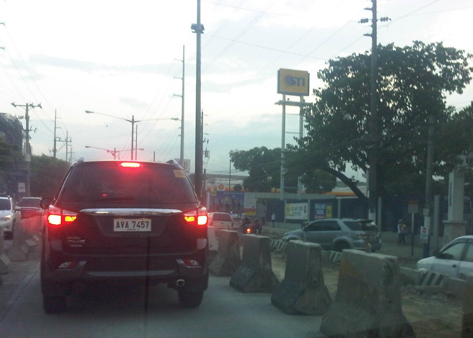 Section near Hunters ROTC Road (right where the grey SUV is coming from) and STI, and approaching Valley Golf.
 Past STI, the traffic lanes go back to normal just before the intersection at Valley Golf.
Traffic is so severe along Ortigas Ave. Ext. that I am sure a lot of people are looking for alternate routes. Those from Antipolo, Taytay and towns along the Manila East Road would likely take the routes utilizing the floodway including Highway 2000 and C-6. Others would find the longer route via Sumulong Highway and/or Marcos Highway to be worth the time and fuel. Hopefully, work will be continuous along Ortigas and roadworks will be completed before we are deep into the typhoon season this year.
–
Ortigas Ave. Extension choke points
One alternative route for my daily commute is Ortigas Avenue. While there are several choke points along this road, I will focus on those between the Ever mall and Cainta Junction. Congestion is also usually experienced between the Manggahan Bridge and Ever but these are mostly due to traffic interruptions because of vehicles turning to and from the many subdivisions whose access/egress line up along Ortigas Ave.
The Ever mall is already a given as a significant traffic generator in the area. However, there is something about its circulation particularly the flow of vehicles in and out of the complex that detrimentally affects Ortigas Ave. traffic. While through traffic along the eastbound direction should use Ortigas Ave., many opt to go through the wide driveway of Ever in order to bypass the choke point that is the exit driveway of the mall. Many of these exiting vehicles are jeepneys turning left into Ortigas westbound (their routes terminate here and make their turnaround via Ever’s driveway). These effectively block the flow of traffic along Ortigas eastbound especially in cases when the westbound direction is also congested (i.e., due to sheer volume as well as stopping vehicles across the mall).
 Vehicles exiting from Ever and turning left to Ortigas westbound
Once eastbound vehicles are freed from the blockage of left-turning vehicles, they have to merge with significant right-turning traffic from Ever that includes buses and mostly through traffic vehicles whose drivers were ‘wise’ to have taken the driveway instead of Ortigas to get through the choke point. The situation results in another choke point right after the first one as the traffic along two lanes of Ortigas eastbound merge with the traffic equivalent to 2-3 lanes turning right from Ever. The total of 5 lanes of traffic squeezing into 2 lanes immediately after is a prime example of a bottleneck.
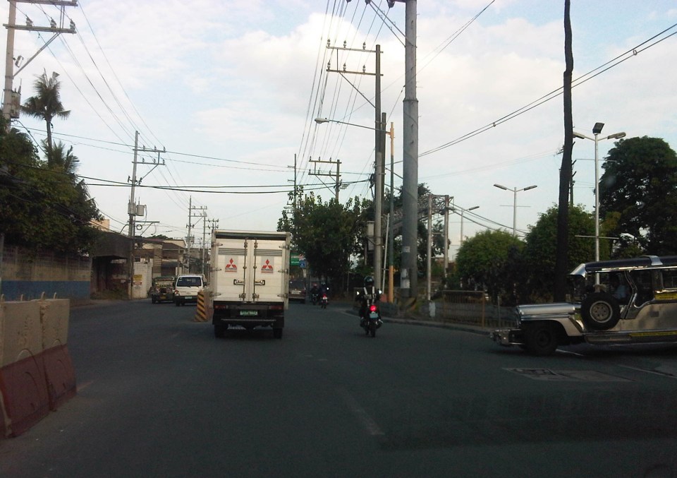
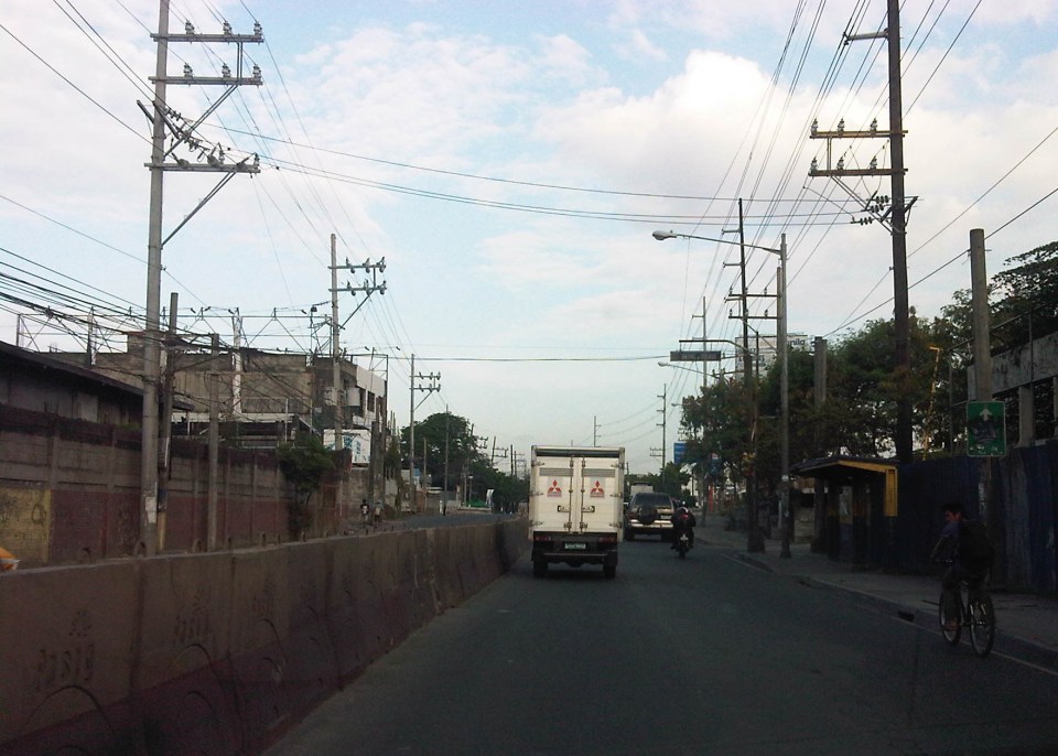 Narrow eastbound two-lane section – additional space should be expropriated to widen Ortigas at this section
Right after the short 2-lane section is a sudden widening of Ortigas Ave. in front of BF Metals. I have heard it said that this is the ideal road width for Ortigas Ave. considering the volume of traffic passing through this major corridor connecting Rizal province with Metro Manila. There are practically 4 lanes for each direction at this short section so its easy to project these lanes on maps to see what properties would need to be expropriated if the objective is road widening. (Of course, the best option should still be to pursue a mass transit system along this corridor.)
 Ideal road width – Ortigas Avenue at its widest is the section across BF Metals. Vehicles here spread out along the many lanes suddenly available. But then people will eventually and immediately realize this is the mouth of a funnel. Note the sign indicating that vehicles are entering the Province of Rizal from this point.
 The eastbound section in front of BF Metals is usually parking lot in the evenings. This is due mainly to the 4 lanes almost abruptly constricting into 2 lanes just past BF Metals. Compounding things is the U-turn slot located here where many jeepneys whose routes end at Cainta Junction make their turnaround. Turning vehicles are assisted by “tambays” earning their money by blocking eastbound vehicles to make way for U-turning vehicles.
Finally, there is Cainta Junction itself, which is a signalized 4-leg intersection that handles a tremendous volume of traffic all-day. I am sure that there are efforts for the traffic signal settings to be optimized but more often there is human intervention for traffic management at the intersection. Whether this causes more severe congestion is quite obvious to many travelers going through this intersection. Queues along Imelda Ave./Felix Ave., for example, can reach way past Village East even reaching Vista Verde on a bad day. This only shows that the intersection is already severely saturated and conventional traffic management or signal settings can no longer handle the traffic. Perhaps the next stage of engineering intervention for this intersection is grade separation or the construction of a flyover or two at the intersection. Notably, such a project should including strategic widening along Ortigas Ave in order to balance the number of lanes feeding into and receiving traffic from the intersection.
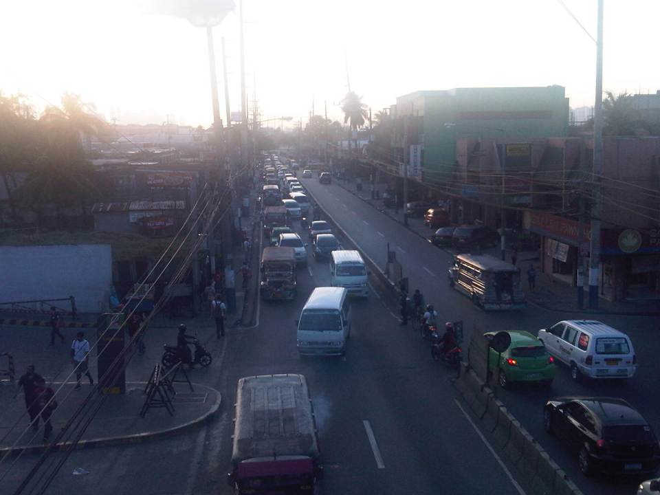 A view of the traffic approaching Cainta junction – there are only 2 lanes along the eastbound side of Ortigas and public utility vehicles stopping here only exacerbates the congestion along the road.
Is road widening the ultimate solution to Ortigas Ave congestion? I personally don’t think so. As I have mentioned earlier in this post and in previous posts the key is still to come up with a mass transit system to serve this eastern corridor. Yes, there will eventually be a Line 2 along Marcos Highway, the main alternate (or competing?) route to Ortigas but is is obvious that even with a railway line along Marcos Highway and connecting to Aurora Blvd., there will still be an urgent need for a similar capacity line along Ortigas. The buses and jeepneys can no longer handle the demand and their poor levels and qualities of service have given rise to a proliferation of UV Express and pushed people to purchase cars and motorcycles. Congestion can be reduced significantly with a mass transit system along Ortigas. Without this transit system, Ortigas will just continue to be congested even if the entire corridor is widened; except perhaps if it is widened like Commonwealth Ave. in Quezon City. I don’t think that is possible and practical.
–
On the uncommon sense on license plates
The issuance of new license plates has been a very “painful” process and experience to a lot of people and it is not without serious issues. For one, there is still a backlog in license plates as evident from Strictly speaking, these vehicles shouldn’t be operating or not allowed to be driven even considering they are technically registered with the Land Transportation Office (LTO). The proliferation of vehicles without license plates allows for the abuse of such by owners of relatively new vehicles who can remove their plates in order to be able to take their cars on their coding days. It is also possible to be involved in a road crash or incident where the driver of a vehicle without a license plate can make an escape (the details on the conduction sticker are not easy to spot and memorize) or evade apprehension.
Among the most problematic is the issuance of plates of the same design as that used by private vehicles to public utility vehicles like UV Express and taxis. This creates a lot of opportunities for abuse especially private vehicles masquerading as PUVs. These are without the proper franchises and are illegal (i.e., colorum). What the LTO claims as security features on the plate are meaningless as the uniform color of the plates defy the simple logic behind the old policy of having a specific color to quickly distinguish among vehicles bearing different color plates. This makes it easier for traffic officers including the Philippine National Police (PNP) to spot vehicles with mismatched or inappropriate license plates.
 Taxi cab bearing plate with the same design as that used by private vehicles.
 UV Express van bearing license plate for private vehicles
The purpose of having plates with different colors is for quick identification and distinction of vehicles. A plate with yellow background has always been associated with public utility vehicles. Those with blue lettering or background are those for diplomatic plates. Those with red lettering or background are for government plates. Fortunately, the LTO has reverted to the original policy pertaining to the license plate colors and new plates to be issued to PUVs will once again be a distinctive yellow. Perhaps corrections are due for those legitimate PUVs that were issued inappropriate design (i.e., color) plates.
–
All roads lead to Antipolo: rerouting for the Alay Lakad
The Rizal Provincial Government and the Antipolo City Government recently posted traffic rerouting schemes on their Facebook pages. Lalawigan ng Rizal was the first to post schemes that affect traffic in at least 3 major local government jurisdictions – Antipolo, Cainta and Taytay. The schemes affect the two major corridors that basically lead to Antipolo’s National Shrine of Our Lady of Peace and Good Voyage (or Antipolo Cathedral to many) – the Ortigas Avenue corridor and the Marcos Highway-Sumulong Highway corridor. There are many major and minor routes connecting to these corridors and are clearly seen in the maps.
Within Antipolo, there are also re-routing schemes, which the Antipolo City Government posted along with a “clearer” re-posting of the maps from the Rizal FB page. The Antipolo FB page includes information/maps on the rerouting within the city center. These schemes will affect traffic circulation including public transport routes. Critical would be the permanent and temporary terminals and parking areas set-up around the city that should be able to accommodate the thousands of vehicles that are also expected to be used by people who won’t be walking or cycling.
What the maps basically say is that from 4:00 PM today, Maundy Thursday, to 6:00 AM tomorrow, Good Friday, the stretch from Cainta Junction to the Shrine will be closed to traffic. This is to allow the hundreds of thousands expected to make the trek to Antipolo to have the road for themselves. What the maps don’t say is that motorcycles and tricycles would likely be allowed, too. I can understand that motorcycles could easily squeeze into the throngs of people but then allowing tricycles to operate among the walkers and bikers would be risky given their drivers’ behavior. Add to this that they would be making a killing out of charging opportunistic fares.
Technically, the rerouting schemes don’t appear to be as well thought of as can be expected from the LGUs. Baka ito lang nakayanan ng staff o ng consultants nila, and surrender na agad ang Rizal and Antipolo with regards to the coming up with more options for people to travel to the Antipolo Shrine? Not all people can walk or cycle but are willing to an could take public transport for their pilgrimage. The maps themselves are a bit crude and the Province of Rizal and City of Antipolo could have done much better maps given the resources of these LGUs. There are open source tools now available as well as your basic software like PowerPoint or Photoshop (even Word!) that can be used to render good quality images to guide people making the Alay Lakad. This is a regular event and though it happens once a year then perhaps the LGUs could have better plans especially to transport people who cannot make the walk to Antipolo. The objective after all is to convey the masses to and from the shrine safely and efficiently – something a mass transport system can do whether via Marcos/Sumulong or Ortigas corridors.
One reminder to all doing the Alay Lakad: keep your garbage to yourselves if you cannot find a proper waste bin. Do not dispose of your waste along the route and make a dumpsite out of Ortigas Avenue, Marcos Highway, Sumulong Highway or whatever roads you are taking! Kasalanan din po ang irresponsableng pagtatapon ng basura. While you might be forgiven for these “sins” through the Sacrament of Reconciliation (which many will likely take at the Cathedral), nature will have a way of getting back at you for your environmental travesty. –
 Caught (up) in traffic